![]()
![]()
![]()

Trip 082 - June 4-6, 2015 (Thursday - Saturday)
Bullmoose Mine Road & Windfall Creek FSR
Near Tumbler Ridge BC
Location: Northeastern British Columbia. Bullmoose Mine Road starts approximately 20 kilometers North of Tumbler Ridge off BC Highway 29, while Windfall Creek Forest Service Road branches off Bullmoose Mine Road at km 17.2, and goes for approximately 60 kilometers.
Liked: Several natural views, meeting a porcupine, access to four trails.
Of note: Remote area, no cell phone signal. Potholes are rare, but they sneak up on you. There are several trouble spots on Windfall Creek FSR, where the road may soon be eroded. Also, several short stretches of potential rockfall on Windfall Creek FSR.
July 2016 Update: Windfall Creek FSR at least to the 24.3 km mark now has numerous deep potholes, including a suspension-busting cross-ditch at the 22.0 km mark.
Northern BC Backroad Mapbook (3rd edition) Coordinates for the Beginning of the Road: Page 44 (Tumbler Ridge) A1. Coordinates for the Beginning of the FSR: Page 43 (Mount Crum) F2.
Trips Off Bullmoose Mine Road: Cowmoose Mountain Trail Hike, Windfall Lake Trail Hike, Holzworth Meadows Hiking Route, Pinnacle Peak Route Hike.
Other Forest Service Roads Trips: Chehalis (by Harrison Mills), Chilliwack Bench, Chilliwack Foley, Chilliwack Lake, Chuchinka-Colbourne (North of Prince George), Clear Creek (off Harrison East), Florence Lake (access to Stave Lake by Mission), Harrison East, Harrison East Second Trip, Harrison West, Jones Lake (near Hope), Lost Creek (by Mission), Mamquam River (by Squamish), Nahatlatch (near Boston Bar), Parsnip West (by Mackenzie), Scuzzy (by Boston Bar), Shovel Creek (off Harrison East), Sowaqua Creek (by Hope), Squamish River Main, Squamish River Ashlu, Squamish River E-Main, Squamish River FSR Washout.
Bullmoose Mine Road and Windfall Creek Forest Service Road (which branches off Bullmoose) lead to four trails. Along Bullmoose Mine Road, there are several camping areas, and we have seen a large group occupying one of the spots. Since this part of British Columbia is away from major roads or populated places, even on a weekend we have encountered very few people.
Follow @ihikebc Tweet
Points of Interest for Bullmoose Mine Road and its offshoot, D33H Road:
| KM | Feature | Side |
| 13.5 | Good Mountain View | Left |
| 15.5 | Cowmoose Trail Turnoff | R |
| 17.2 | Windfall Creek FSR Start | L |
| 18.5 | No Further Access on Bullmoose Mine Road (Gate) | S |
| 18.5 | D33H Road | R |
| 18.8 | Small Lake | L |
| 19.2 | Small Lake | L |
| 22.4 | D33H Rd Ends (chiselled rock view) | S |
Points of Interest for Windfall
Creek Forest Service Road:
| KM | Feature | Side |
| 0.4 | Talisman FSR | L |
| 14.1 | Holzworth Meadows Trailhead | L |
| 16.6 | First Good Mountain View | R |
| 17.5 | Shelter Bus | R |
| 17.6 | Big Pothole Before a Bridge | S |
| 24.3 | Windfall Lake Trail & Pinnacle Peak Route Turnoff | L |
| 28.6 | Impending Washout | L |
| 37.6 | Deep Pothole After a Bridge | S |
| 54.0 | End of our forward progress - good turnaround area | S |
1. We are Southbound on BC Highway 29, between Chetwynd and Tumbler Ridge, approximately 20 kilometers North of Tumbler Ridge. The sign with an arrow on the right side of the photo states "Bullmoose Gas Plant 15 km".
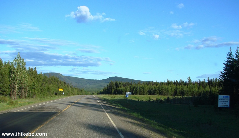
BC Highway 29 near Bullmoose Mine Road
2. The turnoff just down the road.
BC Highway 29 South Turnoff to Bullmoose Mine Road
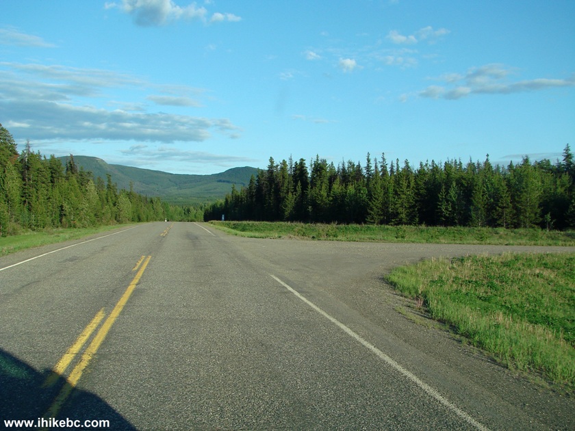
3. Bullmoose Mine Road immediately after the turnoff. Zero your odometer here, if you want to follow the first table above. There are mileage markers on the road too, and they mostly (but not quite) reflect the mileage for landmarks in the table.
Bullmoose Mine Road Near Tumbler Ridge British Columbia Canada
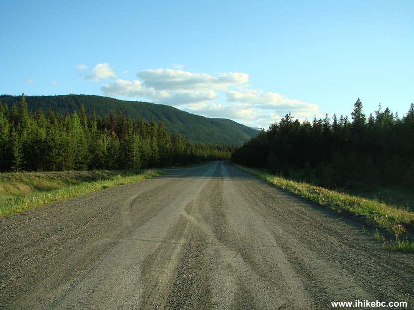
4. Bullmoose Mine Road is paved and is fairly smooth. We have spotted three mountain goats in the distance on the left side of the road, but they ran too fast for us to take a photo. Backroad Mapbook indicates that there is a goat viewing area not far from the Bullmoose Plant (but you would need to get through a gate, so the viewing area may or may not be accessible - no idea how it works down there).
Bullmoose Mine Road BC Canada
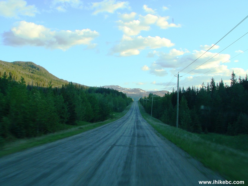
5. There are not too many great views on this road, but, at km 13.5, there is a good mountain view on the left (slightly zoomed).
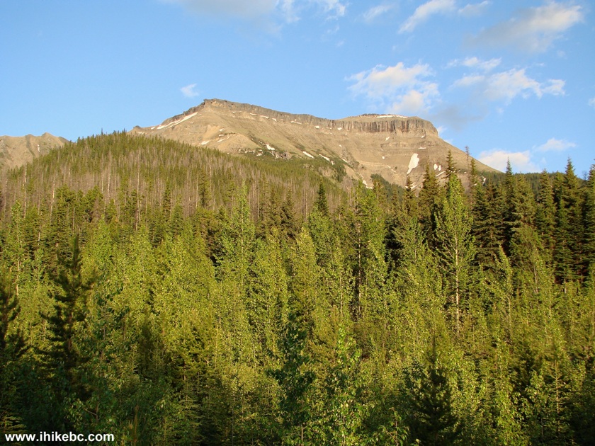
Mountain View off Bullmoose Mine Road
6. Cowmoose Mountain Trail access road turnoff (on the right side) arrives at km 15.5. A blue sign indicates 4 km to the trail (though it's actually 5.1 km).
Bullmoose Mine Road Turnoff to Cowmoose Mine Trail
7. At km 17.2 of Bullmoose Mine Road, Windfall Creek Forest Service Road begins on the left side. Coordinates: N 55⁰08.396' W 121⁰28.109'. Elevation: 1,060 meters. A blue sign indicates 13 km to Holzworth Meadows Trail, and 25 km to Windfall Lake Trail and Pinnacle Peak Route.
Bullmoose Mine Road Turnoff to Windfall Creek Forest Service Road
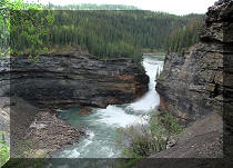
8. We will cover Windfall Creek FSR shortly, but, for the time being, we are still on Bullmoose Mine Road, which soon ends for unauthorized people at this gate. Bullmoose Mine Falls can be seen behind the gate. A sign on the gate warns against trespassing.
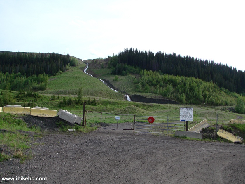
Bullmoose Mine Falls
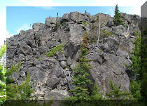
9. It is possible to drive further for a few minutes along D33H road, which starts immediately to the right of the closed gate. You would drive by a few small lakes, and then see this.
D33H Road by Bullmoose Mine Road near Tumbler Ridge British Columbia
Canada
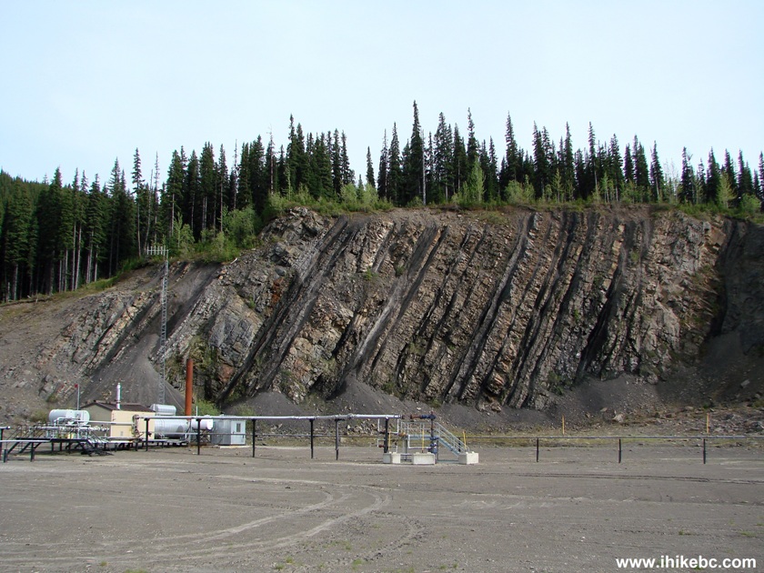
10. There is at least one more side road there too, but this one ends on top of the hill seen in the photo above. There is a gas industry installation with a backdrop of a neat chiselled rock. Coordinates: N 55⁰06.859' W 121⁰31.699'. Elevation: 1,310 meters.
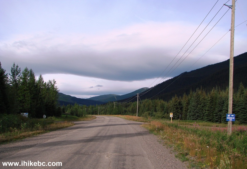
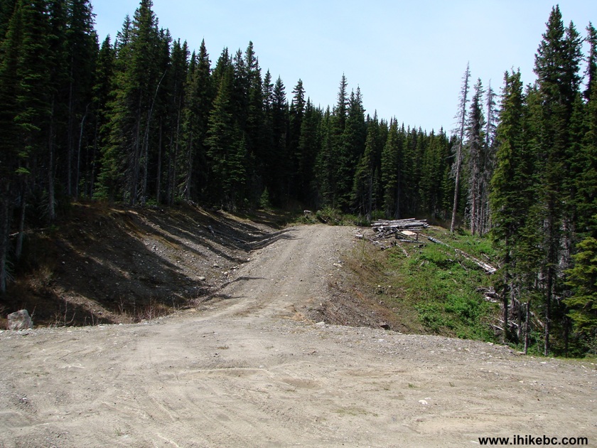
11. The rest of the trip report will cover Windfall Creek FSR. As mentioned in the photo #7 caption, this forest service road begins at km 17.2 of Bullmoose Mine Road. Windfall Creek FSR leads to three trails, and also has a former school bus converted into a shelter. The decent views are few while you are driving, though. Hiking the trails is a different matter. The good news is that low-clearance vehicles at present would certainly make it to Holzworth Meadows trailhead (km 13 of the FSR) at the very least. The bad news is that there are a few problematic spots, which might soon make Windfall Creek FSR impassable for all but very capable 4WD vehicles. But, the start of the road is promising.
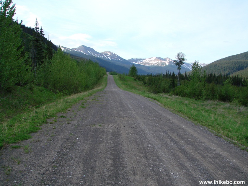
Windfall Creek FSR British Columbia Canada
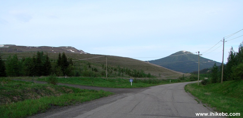
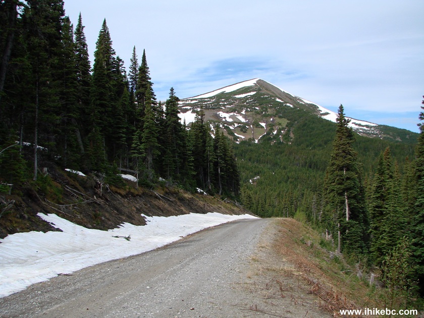
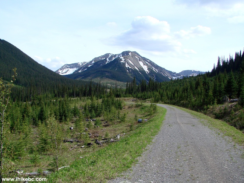
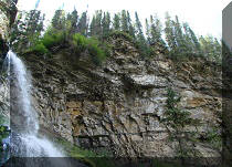
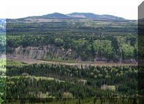
12. There are good mountain views here and there.
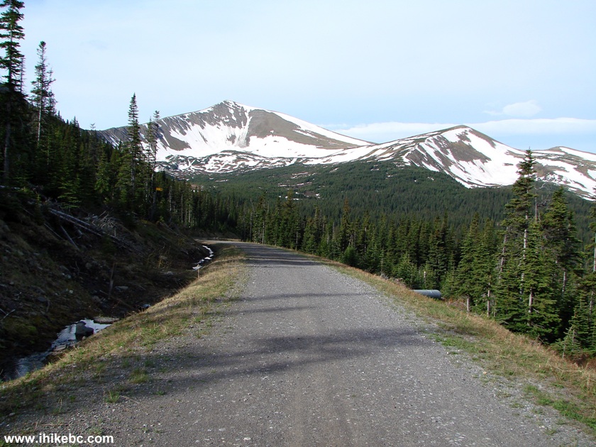
Windfall Creek Forest Service Road British Columbia Canada
13. Then, at km 17.5, there is this "day use and emergency" shelter, placed by snowmobilers.
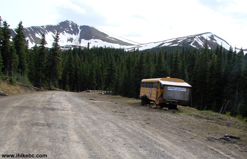
Windfall Creek FSR Shelter
14. Inside the shelter. Note the stove.
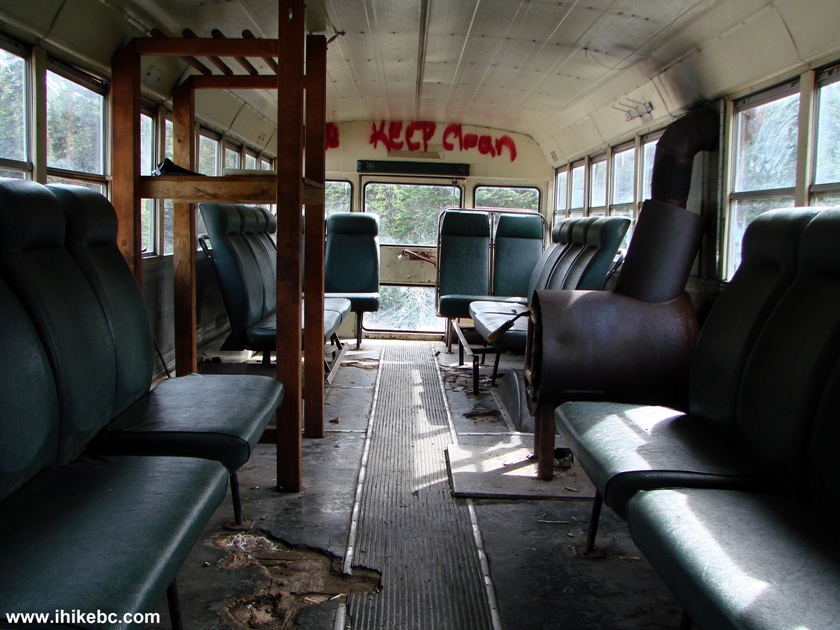
Inside the Windfall Creek Forest Service Road Shelter BC Canada
15. As we were approaching the shelter bus, some animal started making moves under the shelter. Turned out to be a porcupine.
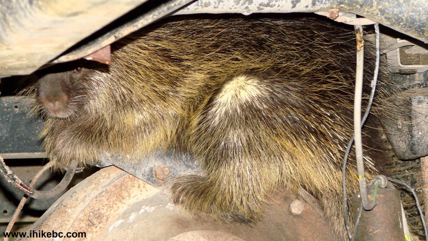
Porcupine on Windfall Creek FSR British Columbia Canada
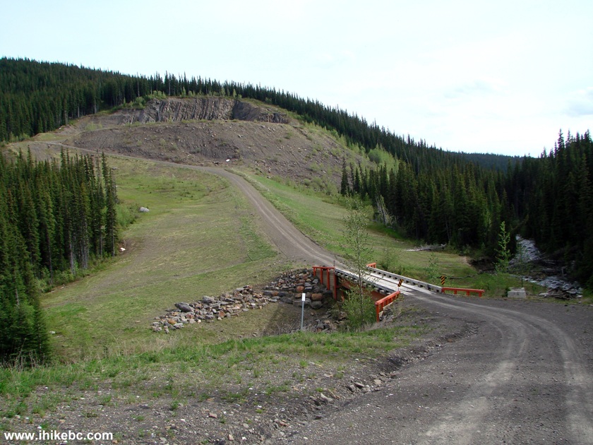
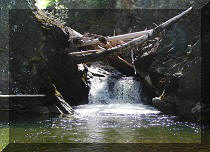
16. Immediately after the shelter, there is a small bridge, of which there are quite a few on Windfall Creek FSR. Deep potholes are developing before the bridge. For now, large pieces of wood are used to make a small "bridge" before the bridge, but the situation does not look promising for low-clearance vehicles.
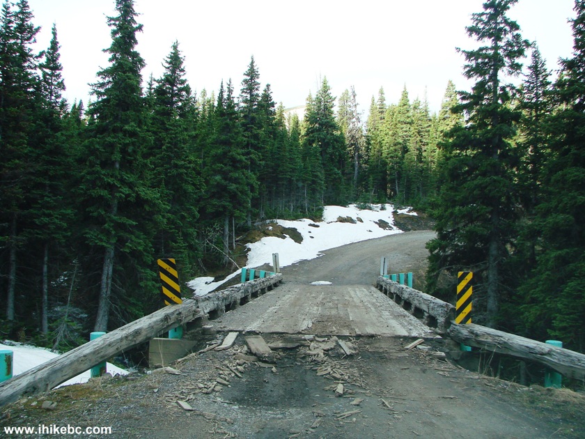
Bridge on Windfall Creek FSR
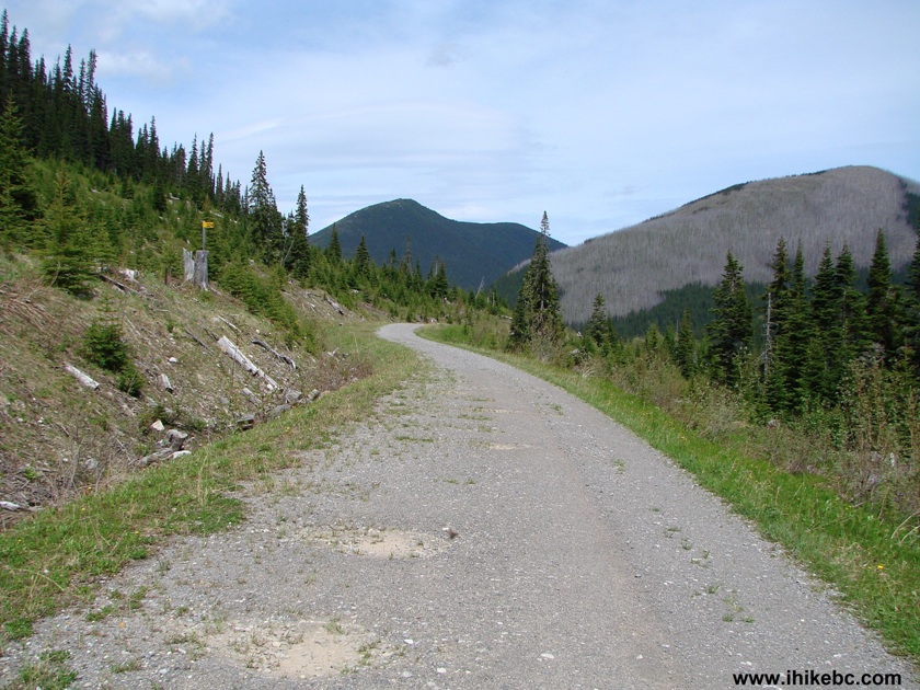
17. A fine mountain view further down the road.
Mountain View Windfall Creek Forest Service Road BC Canada
18. And, at km 24.3, a turnoff to Windfall Lake Trail and Pinnacle Peak Route.
Windfall Creek FSR Turnoff to Windfall Lake Trail and Pinnacle Peak
Route
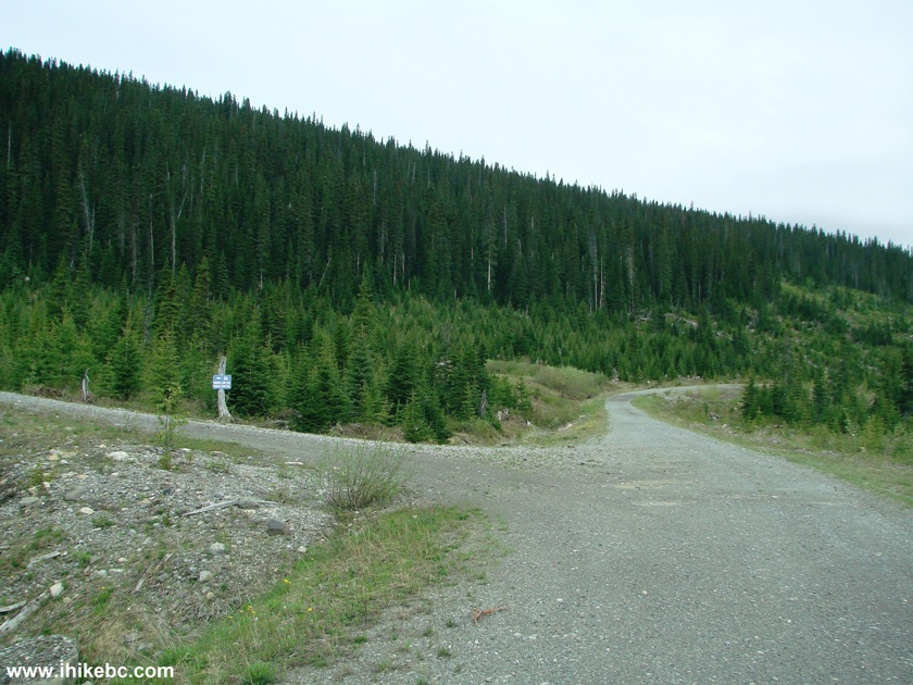
19. Continuing further down Windfall Creek Forest Service Road. Not much to see, really, as you drive between logged out areas on a rather smooth road, and occasionally slam on the brakes to avoid hitting an unexpected pothole.
Picture of Windfall Creek FSR British Columbia Canada
20. A good example of two common things on this FSR: a small bridge and a logged out area.
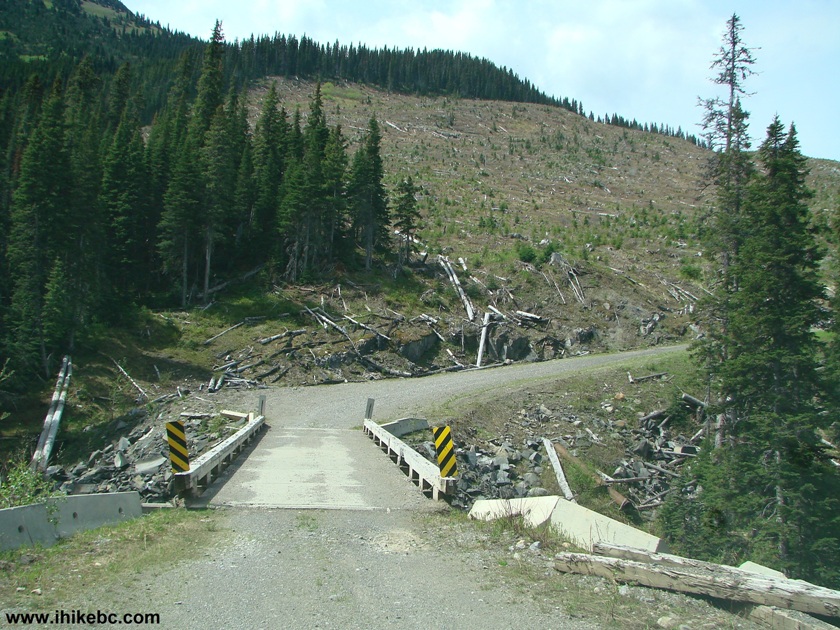
Logged Out Area Windfall Creek Forest Service Road British Columbia
Canada
21. We stopped our forward progress at the 54 km mark of Windfall Creek FSR, soon before the apparent end of the road (judging by the map in Backroad Mapbook). This is a good place for a turnaround. Coordinates: N 55⁰07.539' W 121⁰45.174'.
Windfall Creek FSR BC Canada
22. On our way back, we took a photo of another problem area: just beyond the bridge at km 28.6 of Windfall Creek FSR (or just before the bridge, when you are driving up the road into the wilderness) there is a washout in progress, and the water was still flowing despite a sunny day, and it being generally dry in the area. Coordinates: N 55⁰03.845' W 121⁰38.686'.
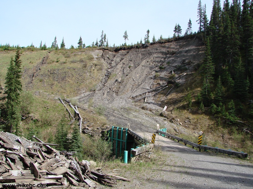
Potential Washout Area Windfall Creek FSR
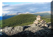
23. A good view.
Windfall Creek Forest Service Road Tumbler Ridge Area British Columbia
Canada
24. And we are back at Bullmoose Mine Road.
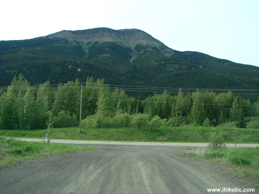
Windfall Creek FSR at Bullmoose Mine Road
Bullmoose Mine Road and Windfall Creek FSR lead to four very fine trails, and have a few good views of their own, as well as several wilderness camping areas.


|
 |
Other Trips in Tumbler Ridge BC Area:
|
|
|
|
|
|
|
|
|
|
|
|
|
|
|
|
|
Monkman
Falls Hike
|
|
Windfall Lake Trail  |
|
Cowmoose Mtn Trail
|
|
Bootski Lake Trail  |
|
Murray Canyon
Overlook
|
|
Quality Canyon Trail  |


Other Trips:


![]()


![]()
![]()
![]()
Follow @ihikebc Tweet
ihikebc.com Trip 082 - Bullmoose Mine Rd & Windfall Creek FSR (near Tumbler Ridge BC)