![]()
![]()
![]()

Trip 101 - May 14, 2016 (Saturday)
Teapot Mountain Trail Hike
Near Prince George BC
Location: Approximately 50 kilometers North of Prince George, off
Highway 97.
Liked: Several fine views, shade, the last part of the trail is a loop.
Of note: Steep unbarricaded drop-offs, numerous mosquitoes, the trail is popular, hiking poles and boots are highly recommended.
Northern BC Backroad Mapbook (3rd edition) Coordinates: Page 27 (Bear Lake) B5.
This particular Teapot Mountain is located North of Prince George, and should not be confused with Teapot Hill by Cultus Lake near Chilliwack in the Lower Mainland of British Columbia. Just like its southern namesake, this hike features several teapots placed here and there along the trail. This is a short hike, taking all of 90 minutes round trip. It's a popular trail too, so you are likely to meet quite a few people, especially on a weekend.
1. To get to Teapot Mountain, take Highway 97. Here we are Northbound, with Prince George about 45 kilometers behind us, and see a sign indicating that Tallus Road is approaching on the left side.
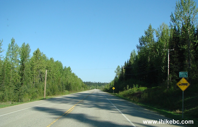
BC Highway 97 Near Tallus Road
2. Soon, there is the turnoff to Tallus Road. Coordinates: N 54⁰19.051' W 122⁰38.060'.
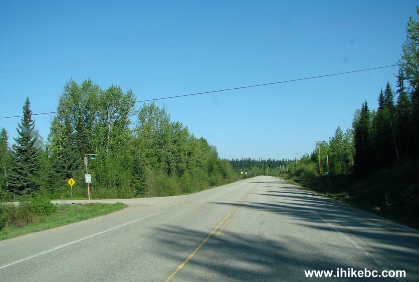
Photo of BC Highway 97 Tallus Road Turnoff
3. Upon turning onto Tallus Road, there is a railroad to be crossed.
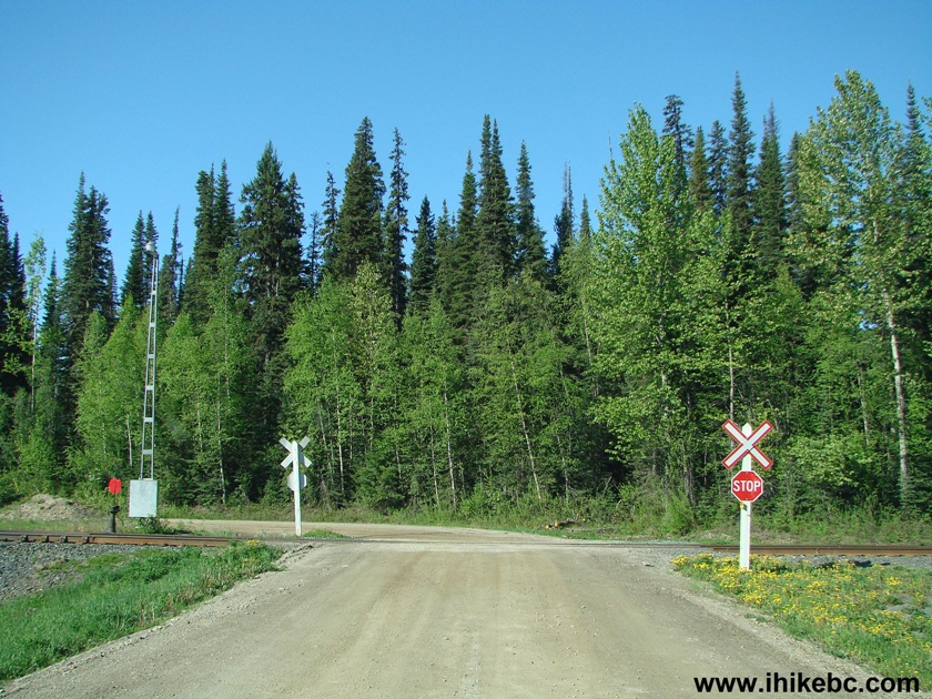
Railroad Crossing Tallus Road North of Prince George British Columbia
Canada
4. Nine hundred meters after turning from Highway 97, turn right from Tallus Road unto Caine Creek Forest Service Road.
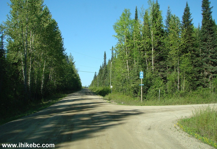
Tallus Road at Caine Creek Forest Service Road British Columbia Canada
5. It's a smooth ride all the way to the trailhead, 3.4 km after turning onto Caine Creek FSR (4.3 km after turning onto Tallus Road from Highway 97). Here we are on Caine Creek Forest Service Road with Teapot Mountain looming in the distance.
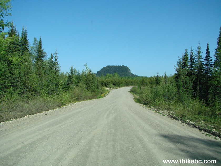
Teapot Mountain Seen From Caine Creek FSR BC Canada
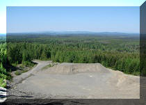
6. Several hundred meters before the trailhead, there is a bridge with this fine view on the right side.
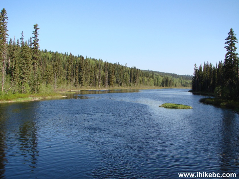
View from the Bridge on Caine Creek Forest Service Road Province of
British Columbia
7. Two hundred meters after the bridge, there is a turnoff on the right side - the trailhead is within a minute after the turn. However, many folks parked right here, as parking space by the trailhead is limited to just a few vehicles, and the trail is quite popular by Northern standards (i.e. the MOST popular Northern trail we have seen so far). Coordinates for the turnoff seen below: N 54⁰19.624' W 122⁰40.244'.
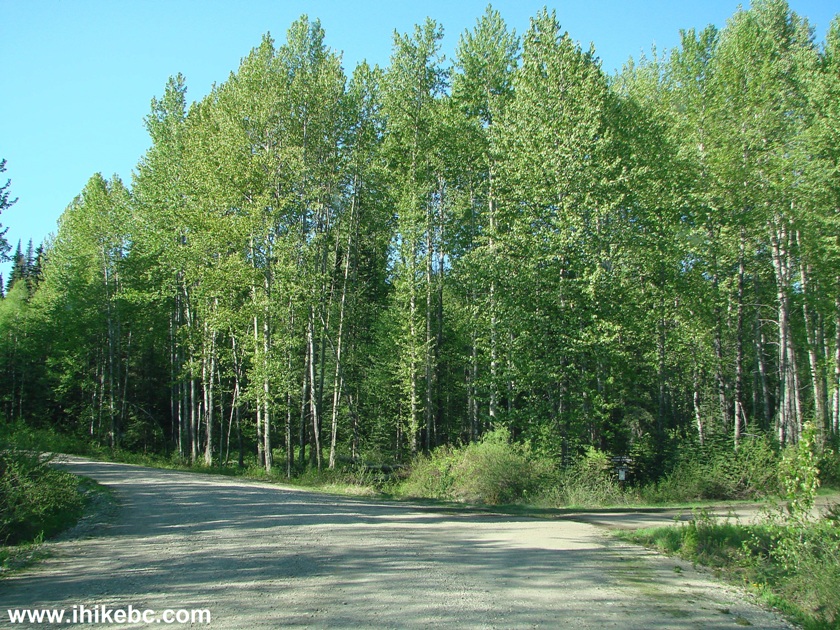
Caine Creek FSR Turnoff to Teapot Mountain Trailhead
8. Here is that parking area by the trailhead, which is located on the left side of the photo. A pit toilet is on the right side.
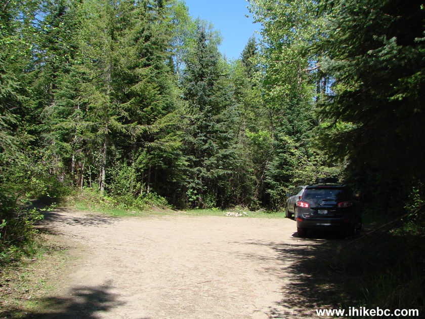
Parking at Teapot Mountain Trailhead North of Prince George British
Columbia
9. Off we go. Teapot Mountain Trail starts benignly enough. The biggest concern was aggressive mosquitoes, spoiled by two-legged meals coming to their 'hood with regular frequency.
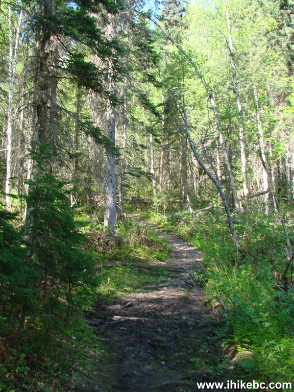
Prince George Hiking -
Teapot Mountain Trail Hike Northern BC Canada
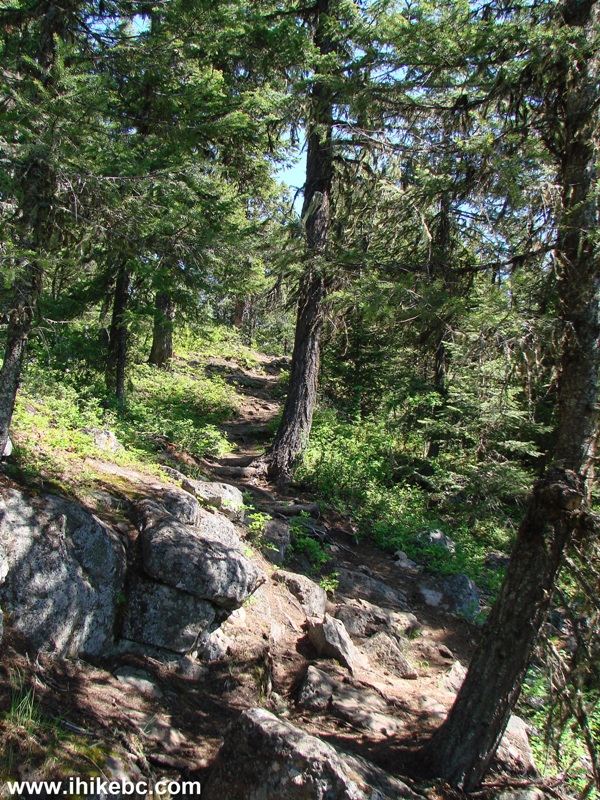
10. Within a few minutes, we got a feeling that this could be the Northern BC's version of Grouse Grind - just look at those natural stairs.
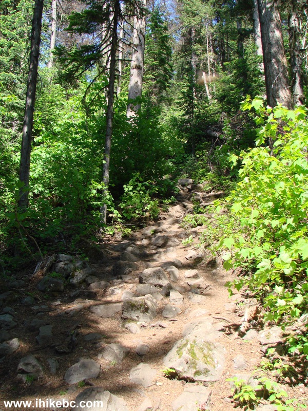
Teapot Mountain Trail - Hiking in Prince George Area Canada
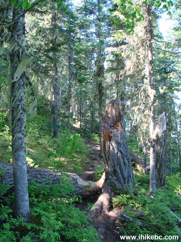
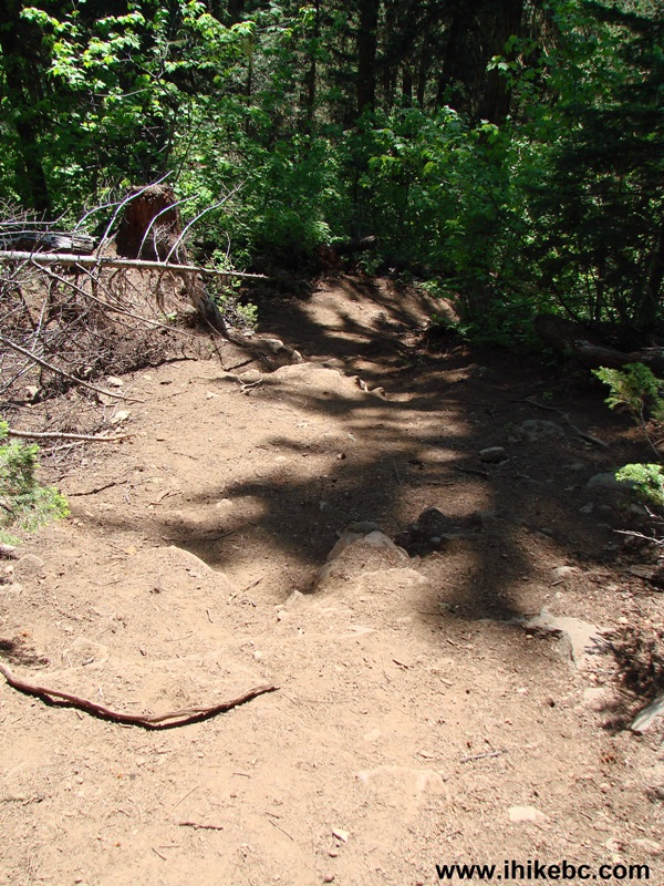
11. That feeling ended soon, as the "stairs" mostly disappeared, but what appeared is this treacherously smooth stretch, which would be quite a challenge to tackle on the way down without hiking boots and, especially, poles.
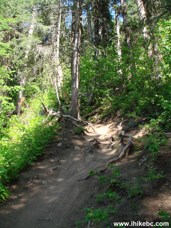
Prince George Hike -
Teapot Mountain Trail Northern British Columbia Canada
12. Twenty minutes after the trail starts, there is this split, allowing to hike the second half of the trail in a loop.
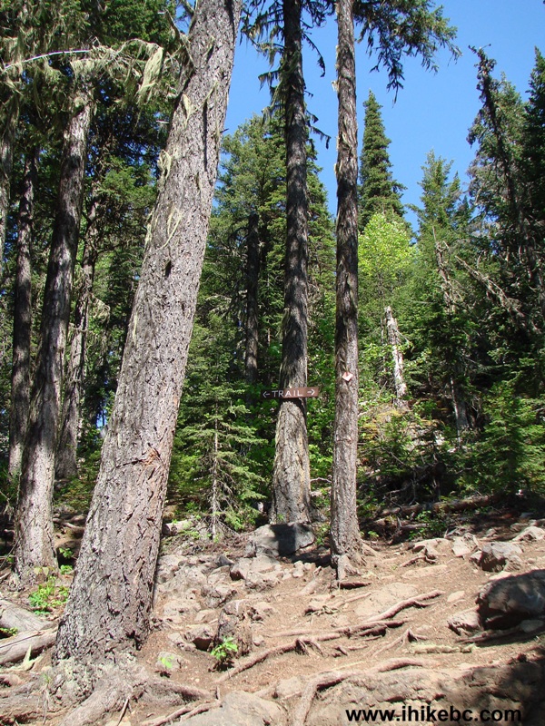
Hike in Prince George Area -
Teapot Mountain Trail Split
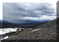
13. We went counterclockwise, and the first view arrived in four minutes.
View From Teapot Mountain Trail Northern BC Hiking Canada
14. Moving on.
Teapot Mountain Trail Near Prince George BC Hike
15. Here is a leaning tree of Teapot Mountain.
Leaning Tree on Teapot Mountain - Trail near Prince George British
Columbia Canada
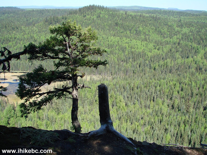
16. And another view.
View from Teapot Mountain Northern British Columbia - Canada Hiking
17. Fifteen minutes after the trail split, we are at the main viewpoint at the 1 km mark, at the elevation of 900 meters (a gain of a few hundred meters or so from the start of the trail).
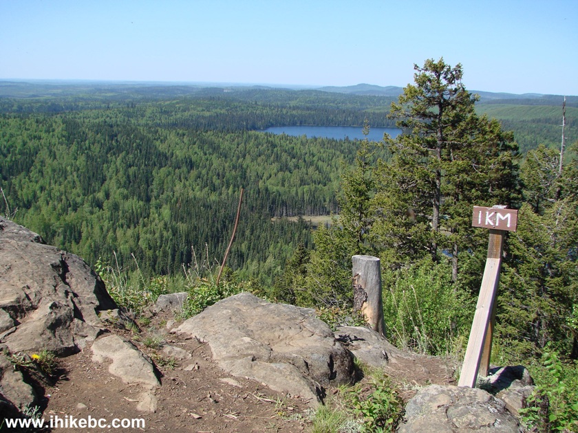
Teapot Mountain Main Viewpoint - Northern British Columbia Hiking Canada
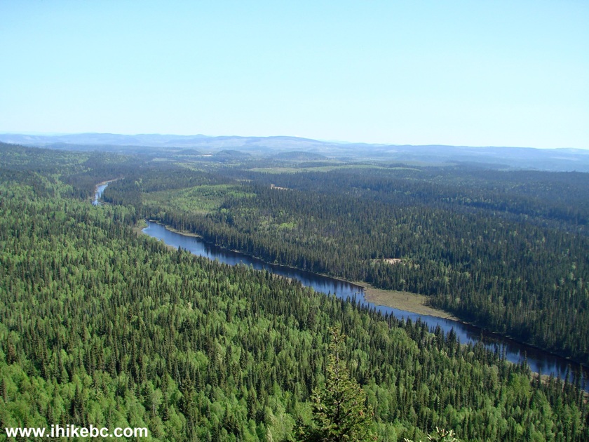
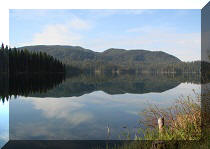
18. A good view of Summit Lake from the 1 km mark viewpoint. This photo also features a steep unbarricaded drop-off, which are in abundance on top of this mountain. The sun was shining at us, making the view a bit hazy.
Summit Lake View from Teapot Mountain Near Prince George BC
Here is Our Video from the 1 Km Mark Viewpoint:
More ihikebc videos are on our YouTube Channel.
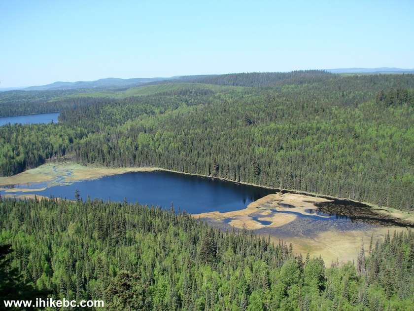
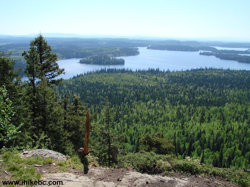
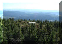
19. Hike a bit more, and see views here and there, prior to completing the loop.
Teapot Mountain Trail Northern BC - Prince George Hiking
20. When descending, beware of the "smooth" trail spots, akin to the one in photo #11. Here is this (or a similar) spot going down.
Teapot Mountain Trail Near Prince George British Columbia
Teapot Mountain Trail is quite short, and rewards with several fine views. Just be ready for the mosquitoes, the drop-offs, and a few steep and tricky parts of the trail.


|
 |
Other Trips in Prince George BC Area:
|
|
|
|
|
|
|
|
|
|
|
|

Other Trips:


![]()


![]()
![]()
![]()
ihikebc.com Trip 101 - Teapot Mountain Trail Hike (near Prince George BC)