![]()
![]()
![]()

Trip 098 - September 26, 2015 (Saturday)
Kimta Creek Trail Hike
Near Mackenzie BC
Location: Northeastern British Columbia, West of the town of
Mackenzie, off Parsnip West Forest Service Road.
Liked: Views of the mountains and Williston Lake.
Of note: Many fallen trees on the trail, several very muddy spots, strong wind in the sub-alpine. Hiking boots and poles are recommended.
Northern BC Backroad Mapbook (3rd edition) Coordinates: Page 55 (Mackenzie) B2.
Kimta Creek Trail starts off Parsnip West Forest Service Road, and goes for about 6 km, first through a forest, then through the sub-alpine. The trail is moderately difficult, and there are good views of mountains and Williston Lake to be had along the way.
1. This photo shows a turnoff from Parsnip West FSR onto Kimta Creek Recreation Site. For directions on how to get to this point from BC Highway 97, check out our Parsnip West FSR trip report. The photo below is the same as photo #33 of that report.
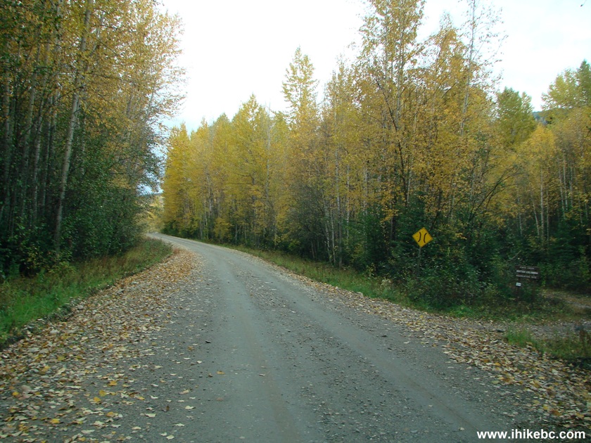
Parsnip West FSR at Kimta Creek Recreation Site
2. Kimta Creek Recreation Site, located right by Parsnip West FSR, features a table, two benches, and a pit toilet. Coordinates: N 55⁰40.359'. W 123⁰26.725'. Elevation: 815 meters.
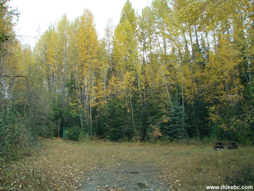
Kimta Creek Recreation Site British Columbia Canada
3. To the right of the table is Kimta Creek trailhead.
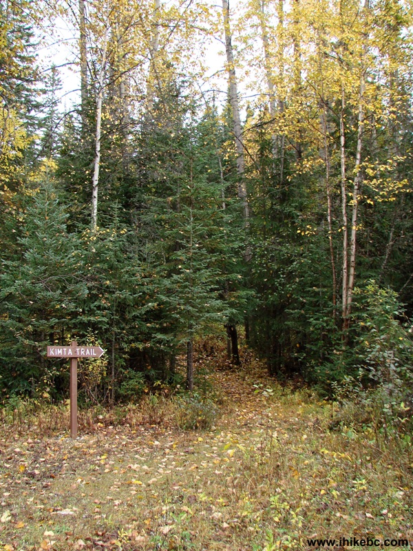
Kimta Creek Trailhead
4. At first, the trail goes through a forest which features numerous fallen trees.
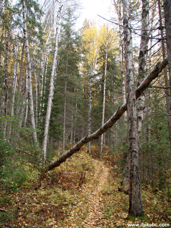
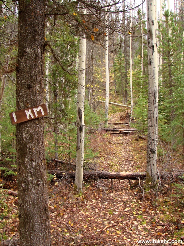
Kimta Creek Trail Near Mackenzie BC Canada
5. The real obstacle course begins after the 1 km mark.
Mackenzie Hike -
Kimta Creek Trail BC Canada
6. There are about a hundred fallen trees for you to conquer on this trail.
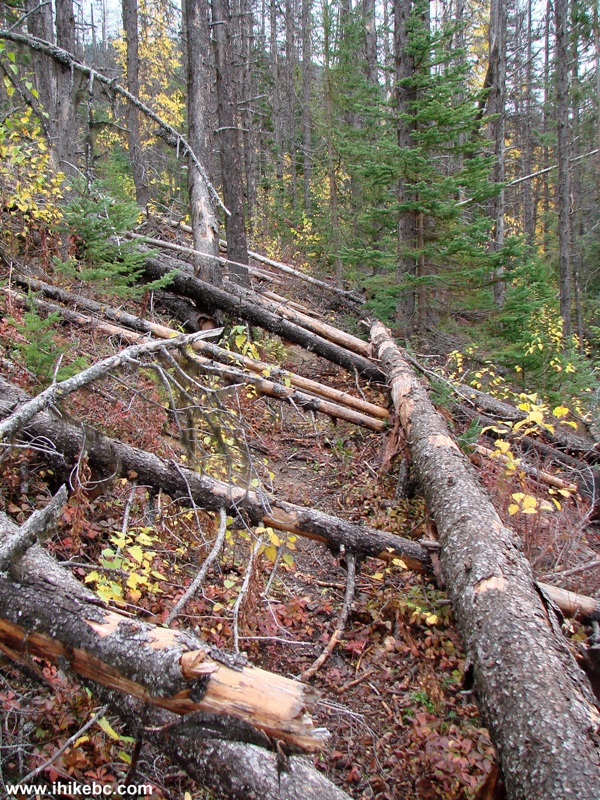
Photo of Fallen Trees Kimta Creek Trail BC Canada
7. Something like that.
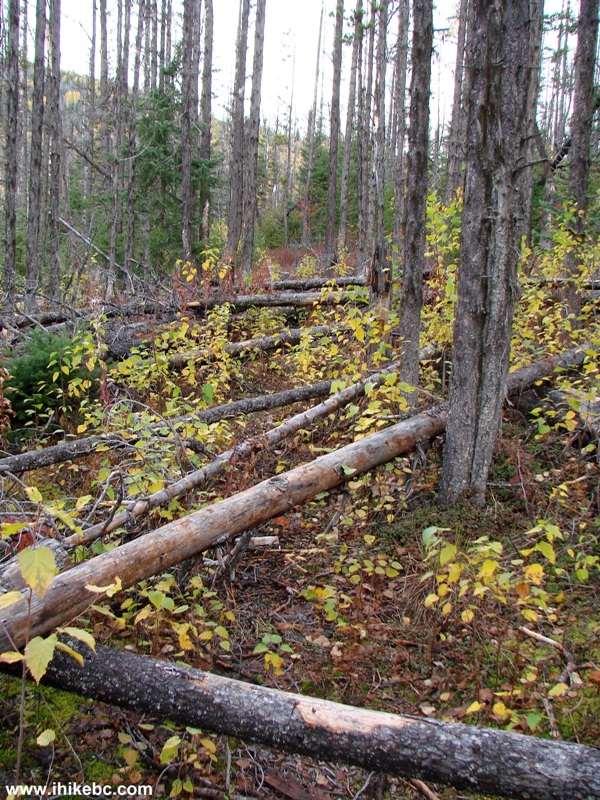
Mackenzie Hiking -
Kimta Creek Trail BC Canada
8. By the 2 km mark things get better, and, after the 2.5 km mark, this colourful spot appears on the trail.
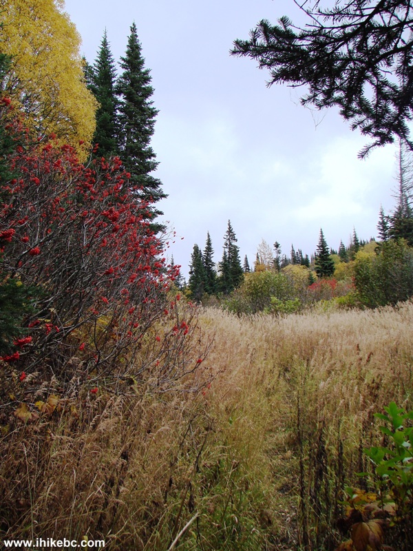
Photo of Kimta Creek Trail - Hike British Columbia
9. Things get really muddy for a bit at around the 3 km mark. If you would hike soon after the rain, this trail could be quite a swamp at some point.
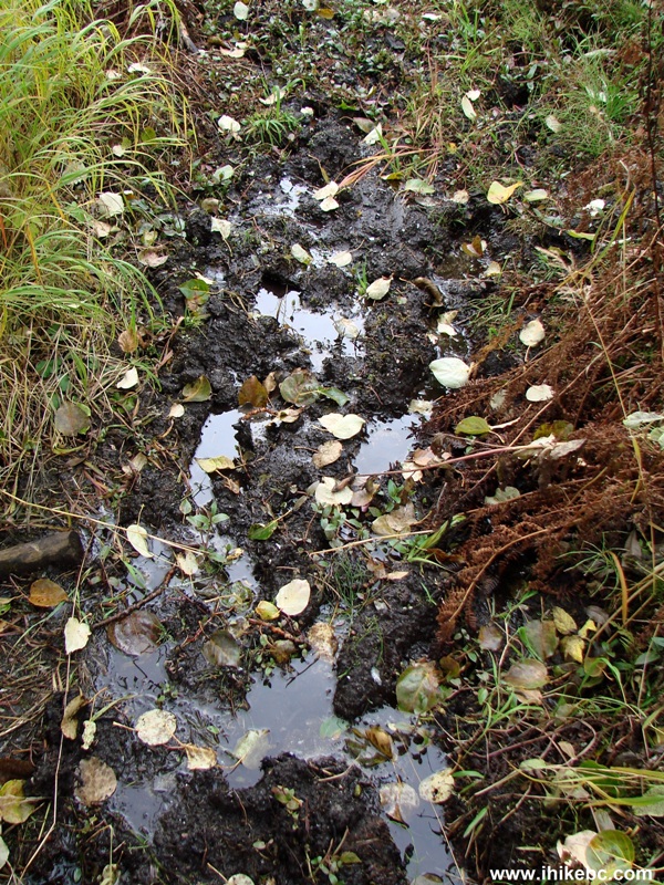
Muddy Spot Kimta Creek Trail - BC Hiking Canada
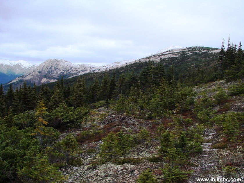
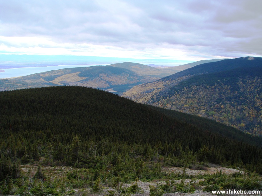
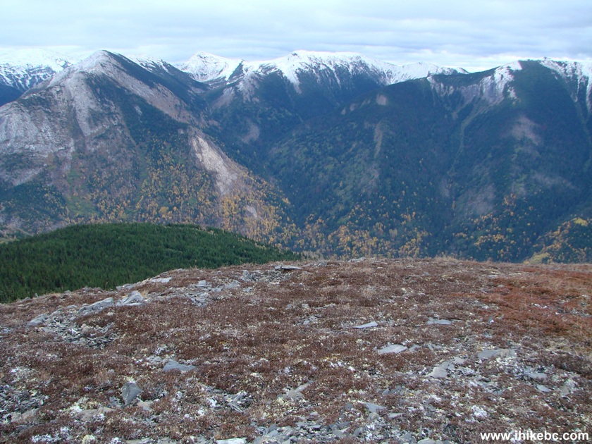
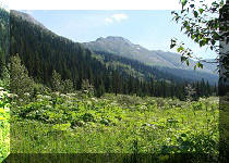
10. The good news is that the mountain views arrive around here as well. Even on an overcast day, the views were impressive.
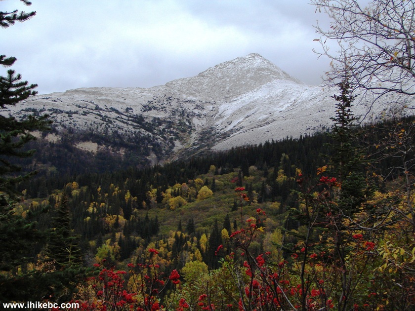
Mountain View Kimta Creek Trail - Hiking in Mackenzie Area British Columbia Canada
11. Not bad at all.
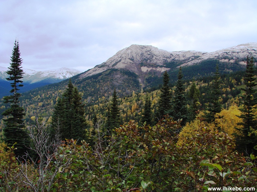
View from Kimta Creek Trail off Parsnip West FSR British Columbia Canada
12. The forest ends shortly after the 4.5 mark.
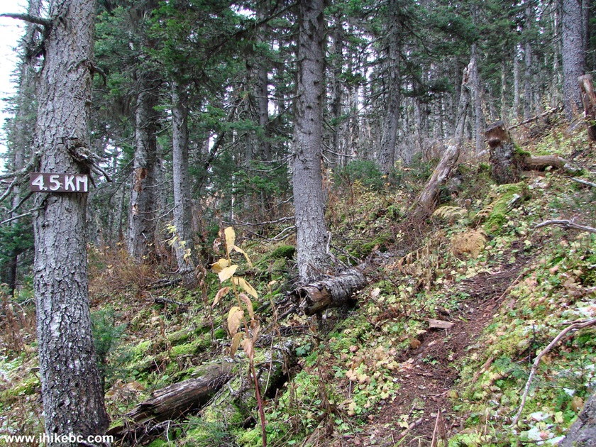
Kimta Creek Trail British Columbia Hike Canada
13. The sub-alpine begins shortly thereafter, and the trail could be a bit more difficult to follow than before, as now you are relying on flagging tape, which is not overly abundant.
Hike in Mackenzie Area -
Kimta Creek Trail BC Canada
14. However, the general direction of travel is obvious, as you keep Williston Lake on the right and continue hiking. The photo below shows the most flagging tape you would see from this point forward. Also in this photo you can see, far ahead, an inukshuk.
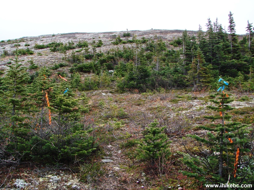
Photo of Kimta Creek Trail BC Canada
15. Here is this inukshuk up close. Coordinates: N 55⁰39.978' W 123⁰24.108'. Elevation: 1,561 m.
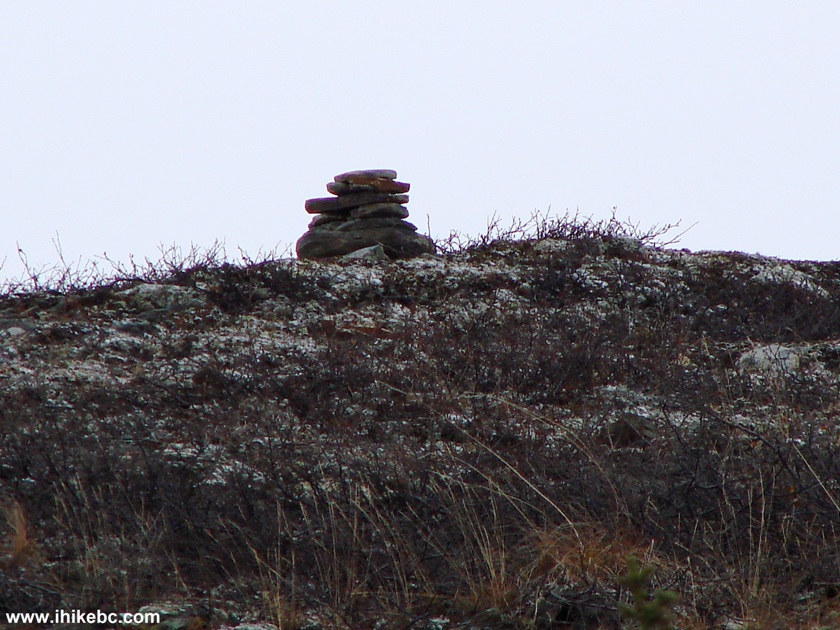
Inukshuk on Kimta Creek Trail BC Canada
16. Williston Lake on the right side.
Williston Lake seen from Kimta Creek trail British Columbia Canada
17. Looking back, we see a bunch of hills.
View from Kimta Creek Trail BC Canada
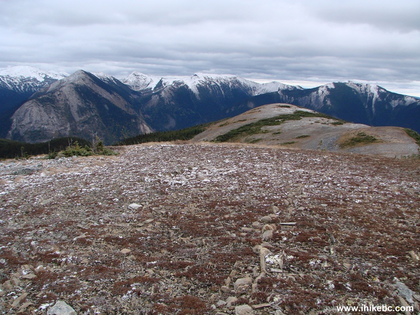
18. Now at the 5.5 km mark. It's wide-open sub-alpine from here, and you can walk to the left or straight to continue your hike.
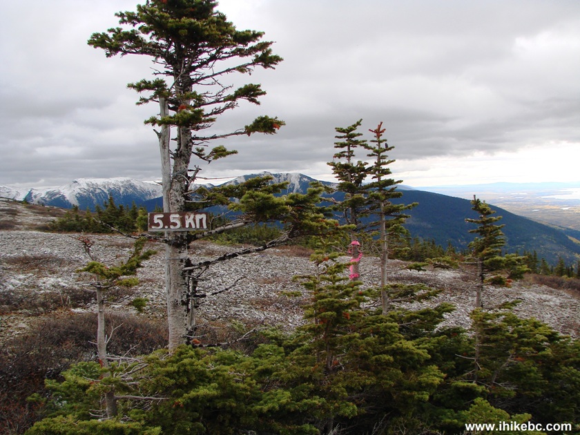
Mackenzie Trail -
Kimta Creek Hike 5.5 km Mark
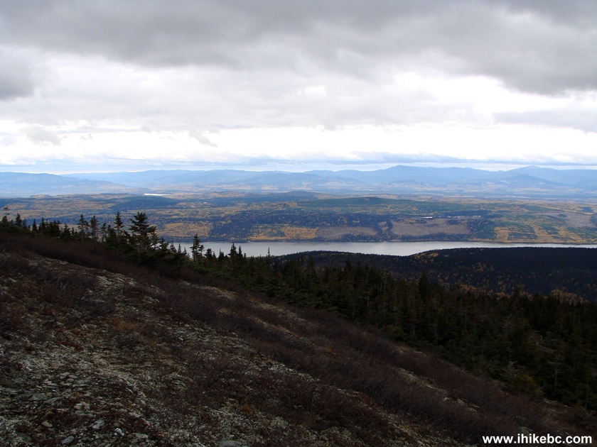
19. A good view of Williston Lake from around the 5.5 km mark.
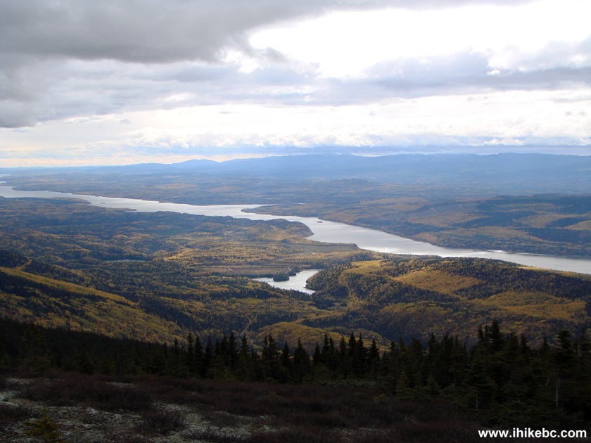
Williston Lake BC Canada
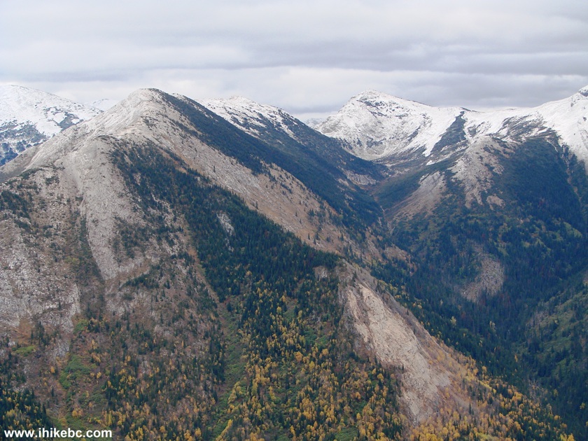
20. If you would go left, this mountain would be waiting.
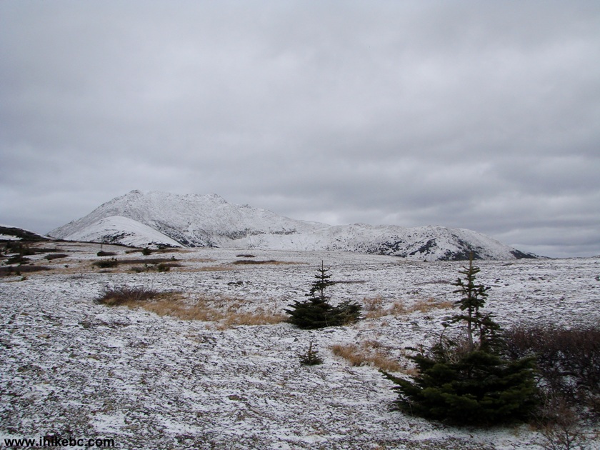
Mountain view from Kimta Creek Trail British Columbia Canada Hiking
21. But we decided to go straight. It's about 500 more meters from the 5.5 km mark to the end of our hike, seen ahead.
Kimta Creek Trail Hike BC Canada
22. Getting closer.
Kimta Creek Trail - Hike in the Province of British Columbia Canada
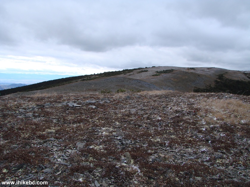
23. And we are there. Coordinates: N 55'39'771 W 123'23'063. Elevation: 1,580 m (765 meters elevation gain from the start of the trail, for an average grade of about 13%).
End of Kimta Creek Trail - Mackenzie Hike
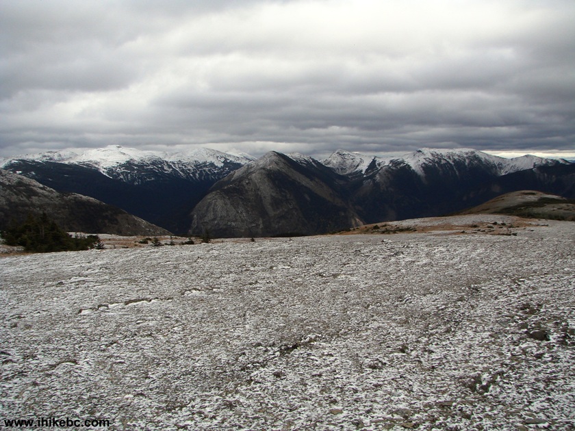
24. Good mountain views.
Kimta Creek Trail Mountain View
Here is Our Video of the Surrounding Area:
More ihikebc videos are on our YouTube Channel.
25. It was +10 degrees and very windy and cold. Made for an interesting hike back to the forest, where the wind calmed down. Looking back from our final destination.
Kimta Creek Trail British Columbia Canada
It was good to hike Kimta Creek Trail, though hiking in the Summer, when the colours should be more vibrant, would likely be even better.


|
 |
Other Trips in Mackenzie BC Area:
|
|
|
|
|
|
|
Other Trips:


![]()


![]()
![]()
![]()
ihikebc.com Trip 098 - Kimta Creek Trail Hike (near Mackenzie BC)