![]()
![]()
![]()

Trip 166 - July 29, 2019 (Monday)
Yak Peak Trail Hike
Off Highway 5 (Coquihalla) near
Hope BC
Liked: Excellent panoramic mountain views, no bugs.
Of Note: Very steep and challenging high altitude trail, suitable for experienced, well-equipped hikers only. Hiking poles and boots are essential. Constant noise from Highway 5.
Vancouver, Coast & Mountains BC Backroad Mapbook (2nd edition) Coordinates: Page 16 (Coquihalla Summit) E2.
A hike across the highway: Needle Peak Trail.
Another good hike nearby: Zoa Peak Trail.
Other Trips in Hope BC Area: Thacker Mountain Trail, Flat Iron Peak Trail, Sowerby Creek FSR Hike, Dog Mountain Trail, Jones Lake FSR Trip to Jones Lake, Yak Peak Trail, HBC Heritage Trail, Sowaqua Creek FSR, Skagit River Trail, Skyline II Trail Hike, Silver Skagit Road, Mount Outram Trail, Othello Tunnels, Eaton Lake Trail, Mount Hope Lookout Trail, Town of Hope BC.
Yak Peak is, arguably, the most recognizable mountain on the side of BC Highway 5 (Coquihalla) North of Hope and South of Merritt. It is a very steep trail, with some sections requiring scrambling more than hiking, and one has to hike up (and then down) a boulder field of several hundred meters long. This is definitely not a trail for novice hikers, and may not be a good trail to hike at all, if the ground is wet or icy. The noise from Highway 5, with numerous large trucks using engine brakes, makes it for a much less serene hike than desirable. That said, the views from this trail are great, and get better and better the higher you climb. Another point to note is that this is a high altitude trail, and oxygen shortage is quite obvious, so the going does get tough as the altitude increases, especially when you tackle the steepest parts of the trail.
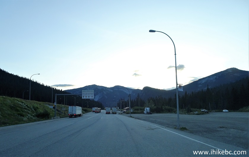
1. To get to Yak Peak Trail from Vancouver, take Highway 1 East, and then Highway 5 North (Coquihalla), which starts near Hope. Here is the view of Yak Peak from Highway 5 while driving North.
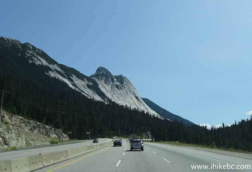
Yak Peak view from Coquihalla Highway 5 near Hope BC
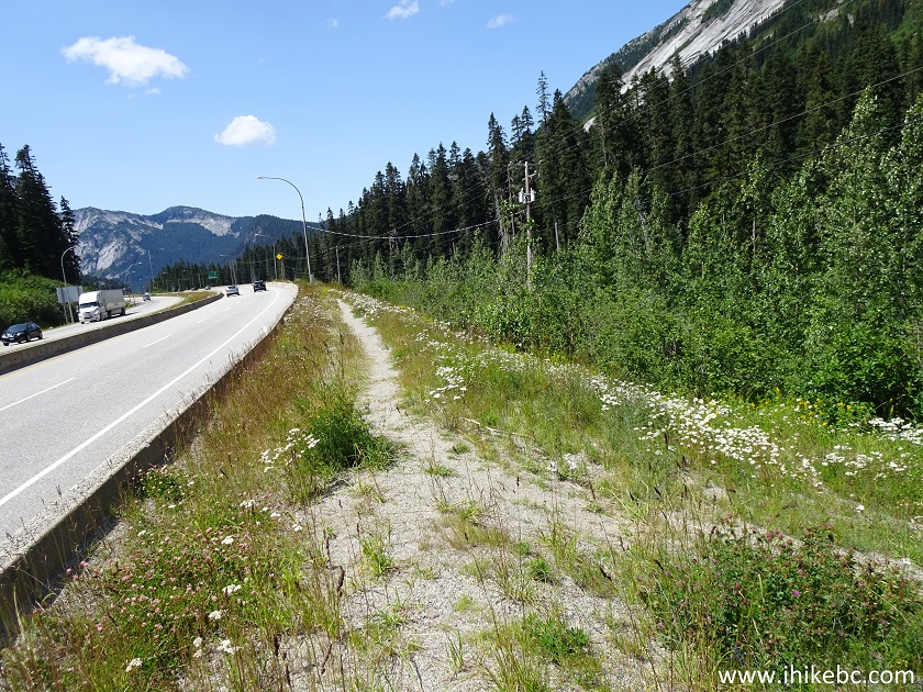
2. We are now approaching the snowshed on Highway 5. It's 3 kilometers from the snowshed to the unmarked highway exit leading to the trail.
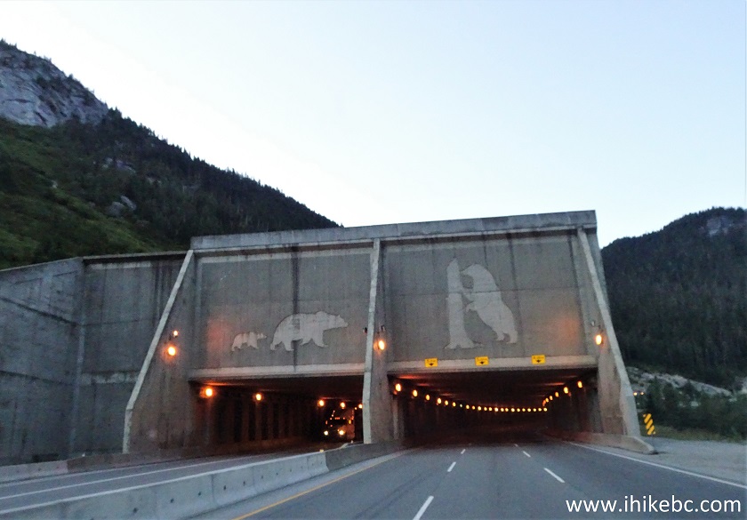
Coquihalla snowshed
3. And here is that unmarked exit. On the other side is Zopkios brake check, very prominently marked for Southbound traffic. You would need to use a tunnel to cross under Highway 5 and get to Zopkios brake check / rest area. It's about 400 meters to the trailhead from there. If you miss this unmarked exit, proceed to the next marked exit (Falls Lake, Exit 221), turn around, and drive to Zopkios brake check.
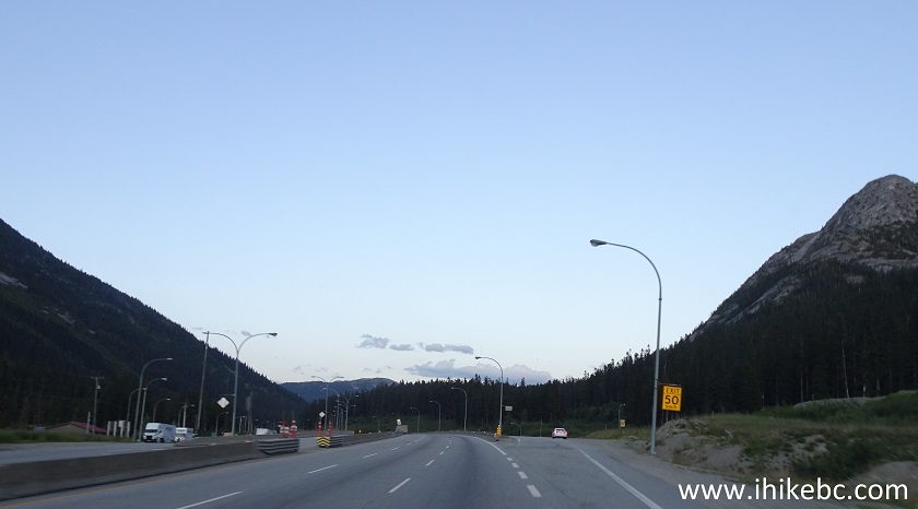
Coquihalla Highway 5 North across from Zopkios Brake Check and Rest Area
4. Here is a sign for Zopkios brake check for Southbound traffic.
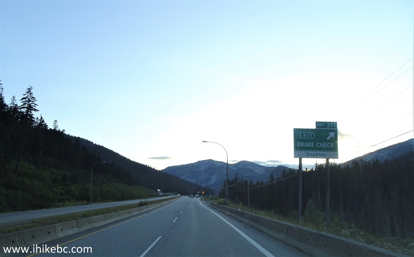
BC Highway 5 (Coquihalla) Zopkios Brake Check Sign
5. And this is Zopkios brake check / rest area. Coordinates: N 49⁰35.776' W 121⁰07.246'. Elevation: 1,189 meters.
Zopkios Brake Check and Rest Area near Hope British Columbia Canada
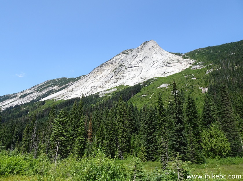
6. Yak Peak view from Zopkios brake check / rest area. It's very popular with tourists, who stop by and take pictures.
Yak Peak seen from Zopkios Rest Area / Brake Check
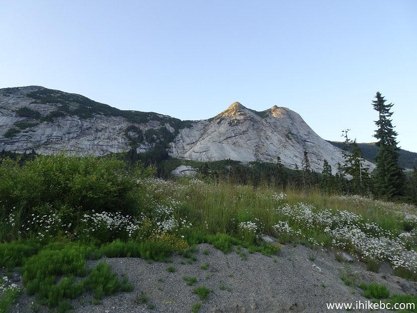
7. And now a better view with the sun out - 600 meters South of the brake check.
Yak Peak near Hope BC Canada
8. To get to the trailhead, walk North (towards Merritt) on the Zopkios brake check side of the highway. There is an obvious path by the highway, and then an obvious trailhead. Here we are looking back (South) towards Zopkios brake check, and the trailhead is seen branching off on the right side.
Path near towards Yak Peak trail near Zopkios Brake Check / Rest Area
9. Now facing the trailhead, with Highway 5 several meters behind us. Coordinates: N 49⁰35.714' W 121⁰06.411'. Elevation: 1,215 meters. There are no signs pointing to the trail, but some flagging tape is present by the trailhead.
Yak Peak trailhead
10. After a brief stretch of dense forest, this creek crossing would be the first and last stream on this trail.
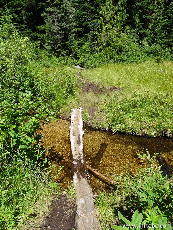
BC Hiking - Yak Peak Trail near Hope
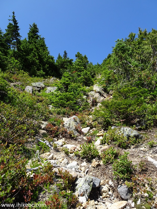
11. Then, the trail goes up quite gently, if for a very short period of time.
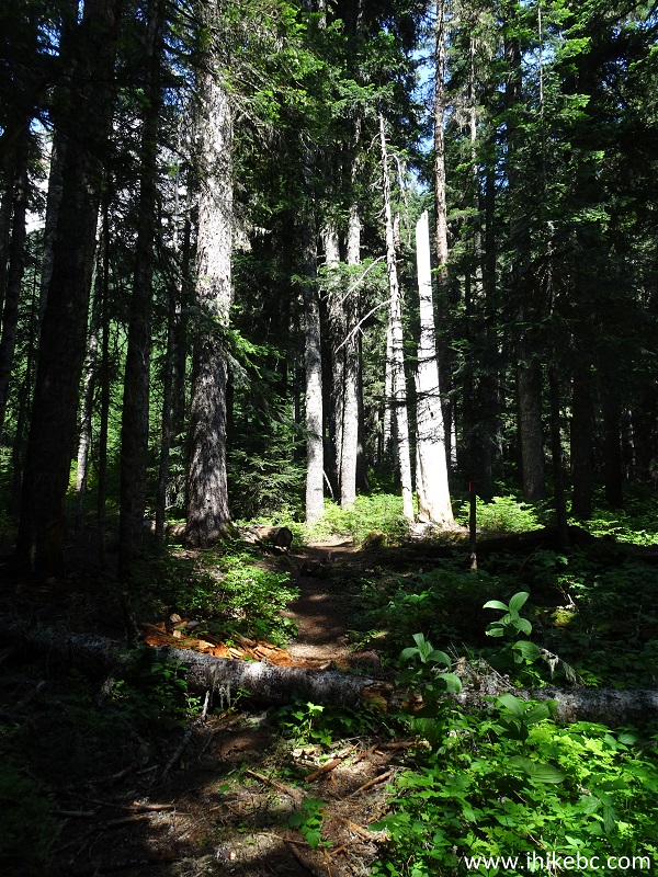
Hiking in British Columbia - Yak Peak Trail near Hope
12. Steep grade arrives after that, and is all but relentless until the end of Yak Peak Trail.
Hope Hiking - Yak Peak trail
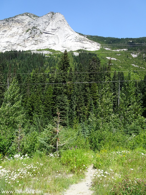
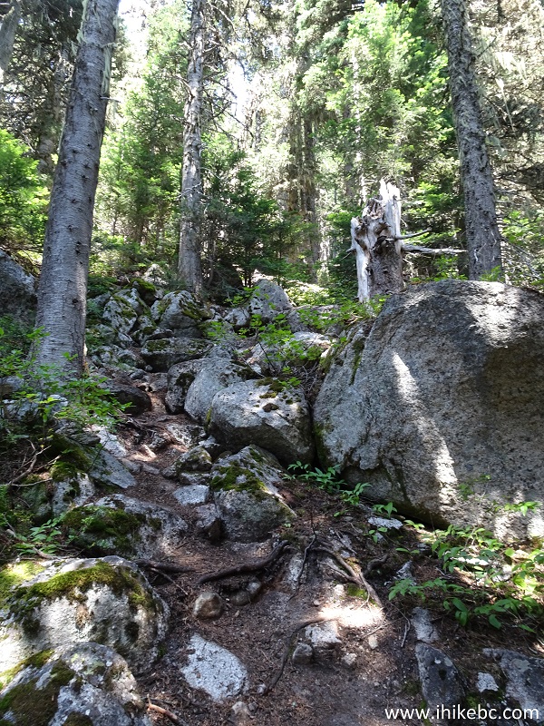
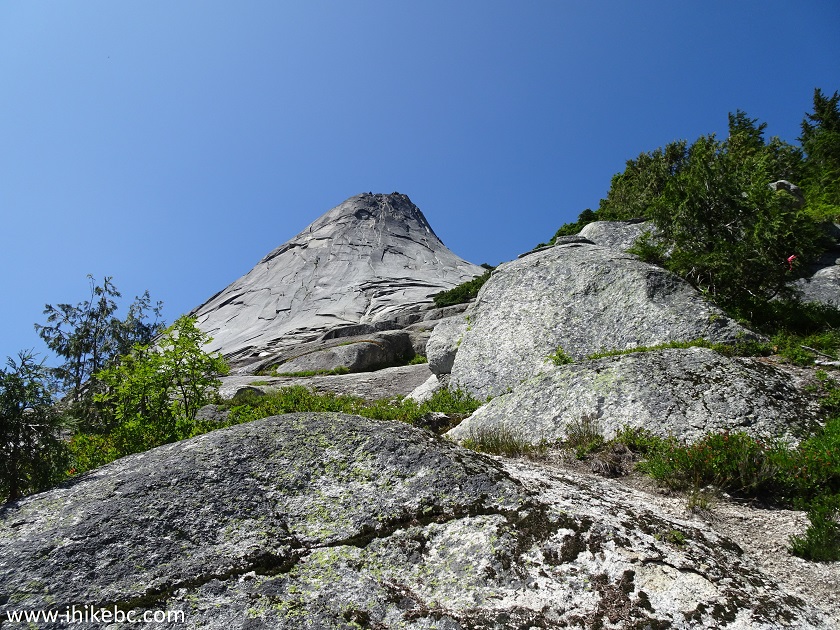
13. After 1.2 kilometers of hiking, you are out of the woods. Yak Peak is right above. Coordinates: N 49⁰36.008' W 121⁰06.222'. Elevation: 1,422 meters. The next challenge is climbing up a field of boulders for about 250 meters.
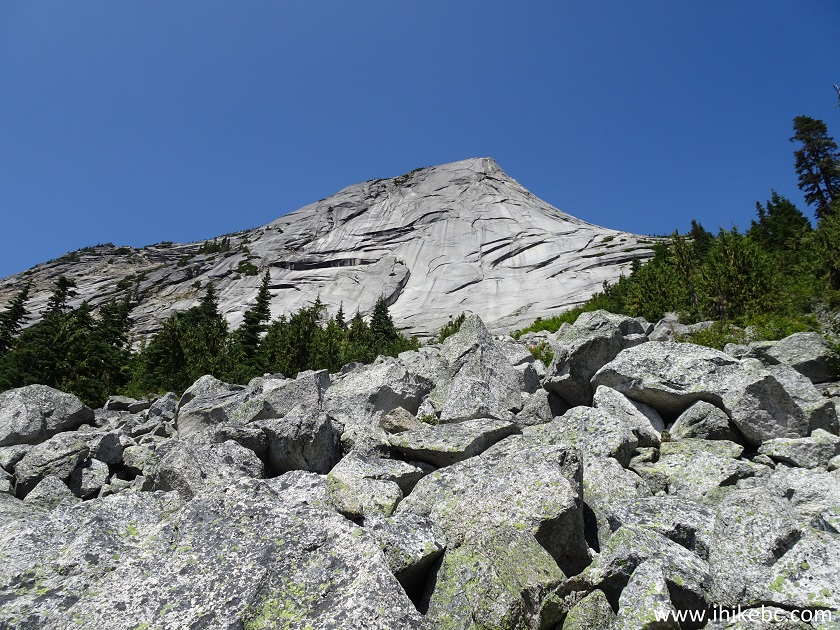
Yak Pea Trail Boulder Field - Hiking in British Columbia
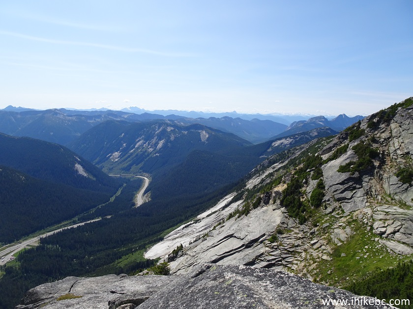
14. Also at this point, the views start appearing behind you as well. Straight across from Yak Peak is Needle Peak, and Highway 5 (Coquihalla) runs at the bottom.
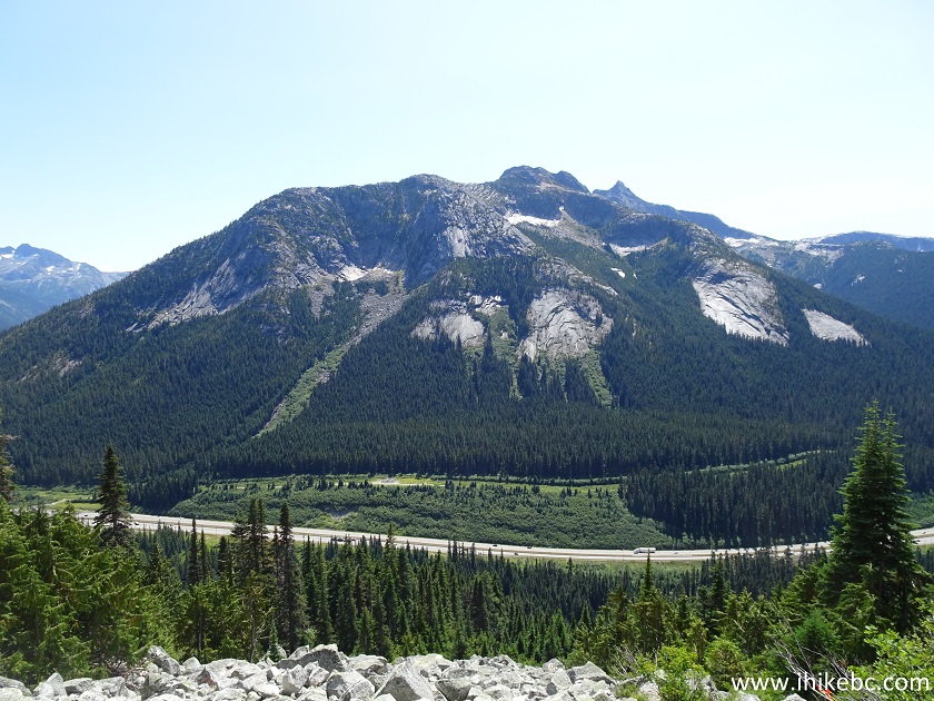
Needle Peak and BC Highway 5 (Coquihalla) seen from Yak Peak trail near
Hope
15. The trail continues on the right side.
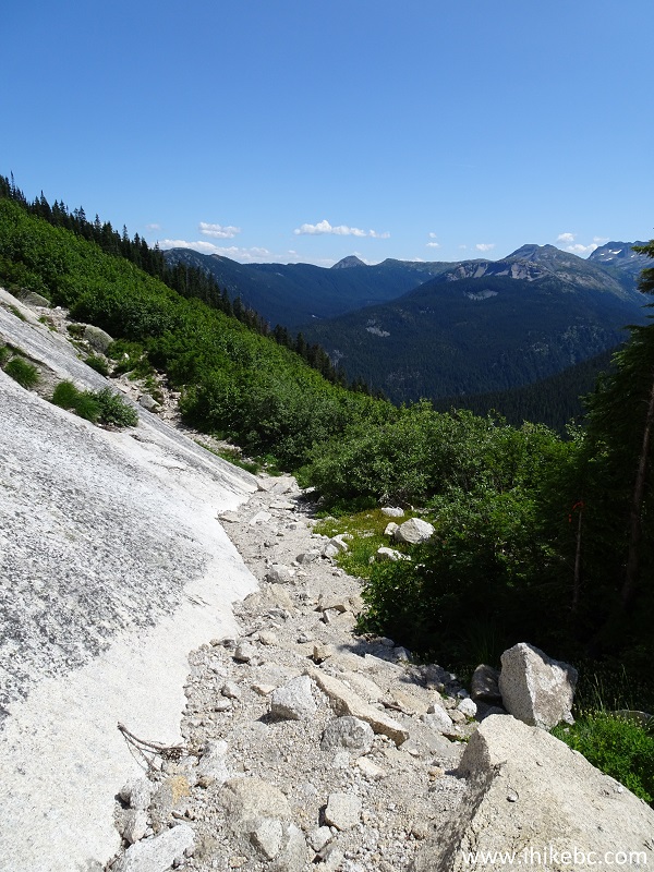
Yak Peak Trail - Hike in Hope Area of British Columbia Canada
16. The face of Yak Peak constantly changes the further you go.
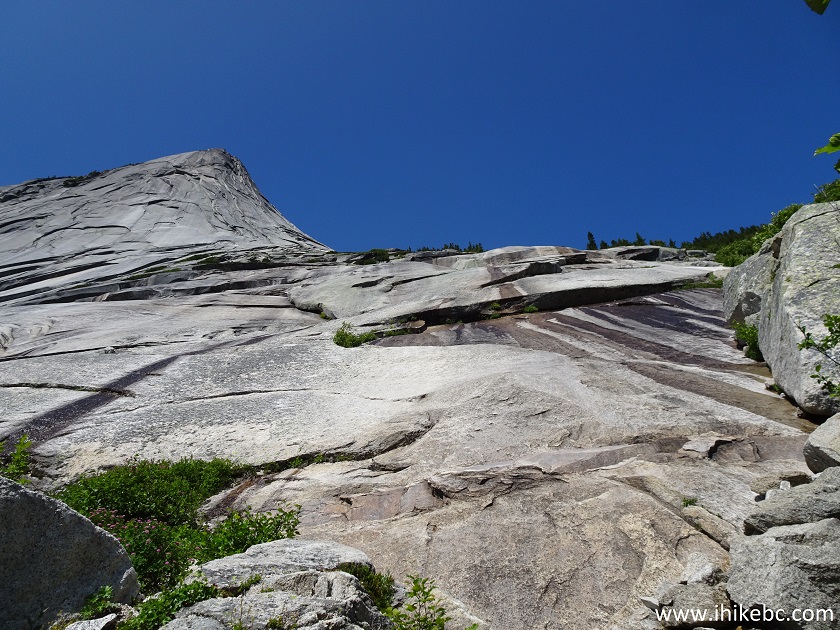
Yak Peak - Trail in Hope BC Area
17. At one point it gets so steep, that a rope is needed to assist in ascending and descending.
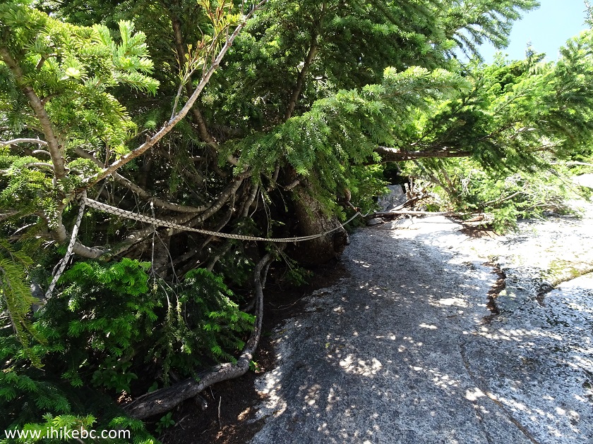
Rope on Yak Peak trail near Hope British Columbia Canada
18. There is lots of time to enjoy the scenery, as the steepness of the trail and high altitude / reduced oxygen ensure that breaks to catch breath happen one after another.
Yak Peak - Hope Hiking British Columbia
19. There are a few stretches where one has to scramble for some time.
Yak Peak Trail - Hiking in Hope BC Area
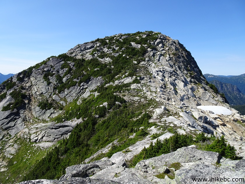
20. Finally, the trail becomes a bit less steep, and the second (main) Yak Peak becomes visible as well.
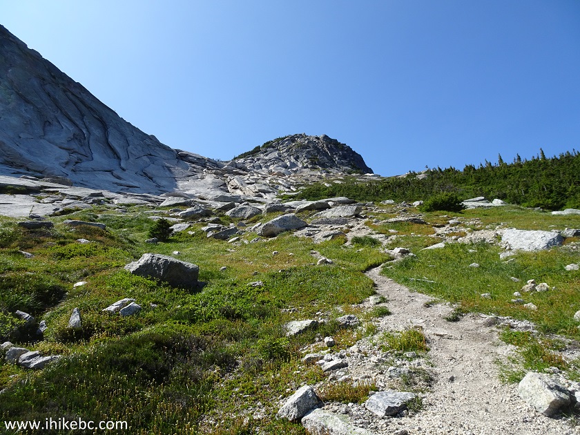
Yak Peak Hike near Hope BC Canada
21. The false peak is to the left, and ridge hiking is required to reach the end of that peak.
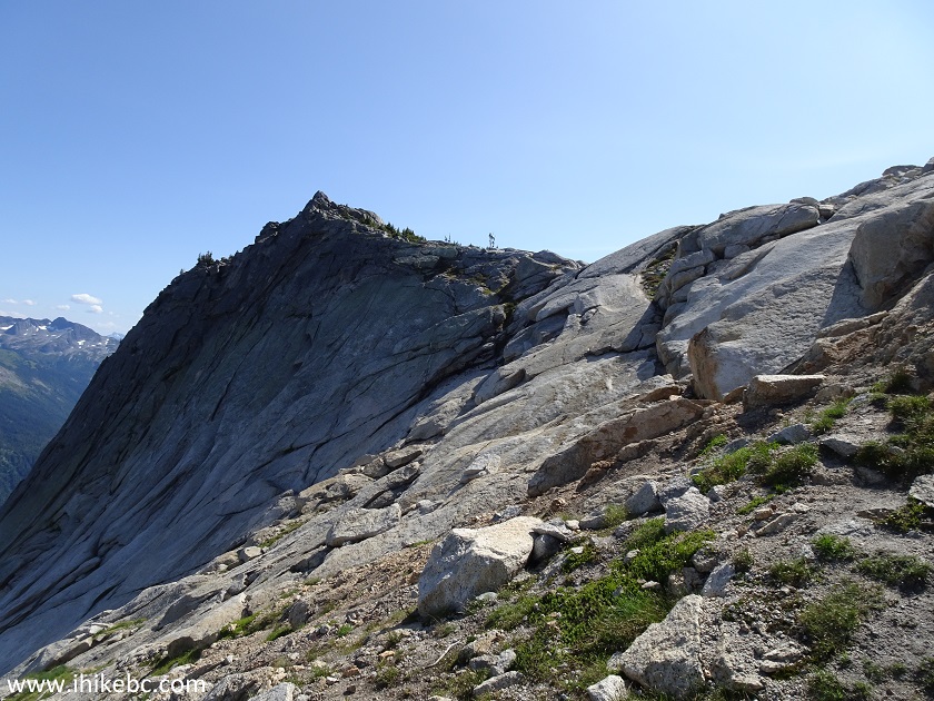
Coquihalla Hiking - Yak Peak Trail near Hope BC
22. Approaching the end of Yak Peak Trail, if the false summit is your final destination.
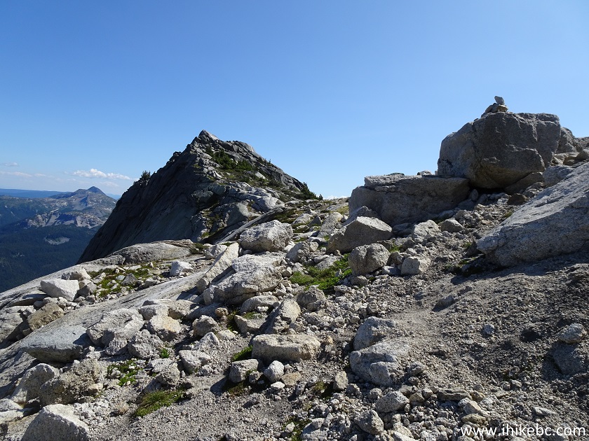
Hiking in Coquihalla Area - Yak Peak Trail
23. And here is Yak Peak (false summit). Coordinates: N 49⁰36.306' W 121⁰06.219'. Elevation: 1,989 meters (774 meters elevation gain from the trailhead). The trail is slightly over 3 km long, so the average grade is about 25%. It took us 2.5 hours to get to the top.
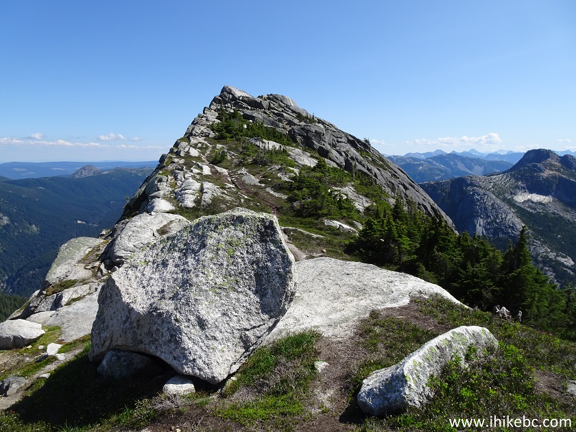
Yak Peak British Columbia
24. The false peak itself is very narrow, so be careful, as there are steep drop-offs. To make things complicated, climbing the peak looks easy, but the approach is angled, so one needs to slightly accelerate to avoid sliding back (it's about 5-6 meters above the trail), so take care not to overshoot the narrow ridge of the peak while doing so. Here we are looking back from the peak, and you can see how narrow and angled it is (bottom of the photograph). It's also quite windy on the top, making for yet another challenge.
Hope Hiking - Yak Peak Trail by BC Highway 5 Coquihalla
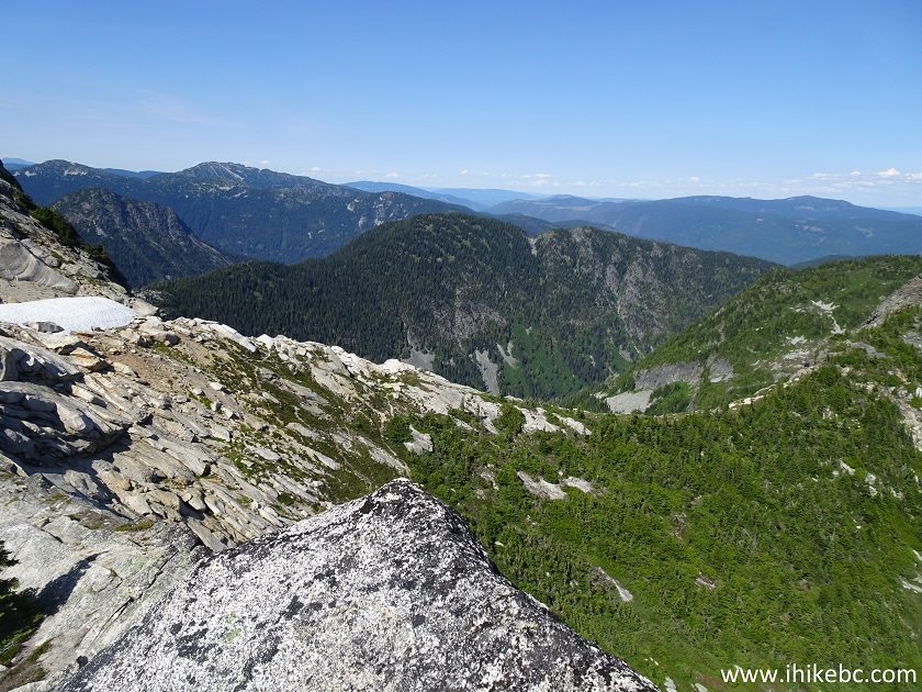
25. If you do not feel comfortable climbing the peak itself, the landing just beyond it offers views which are nearly just as good, and it is easy to get there from the trail. We took this photo from the false peak, looking the other way compared to the photo above, and the narrow ridge of the peak can be seen at the bottom left of the photograph.
View from Yak Peak - BC Hike
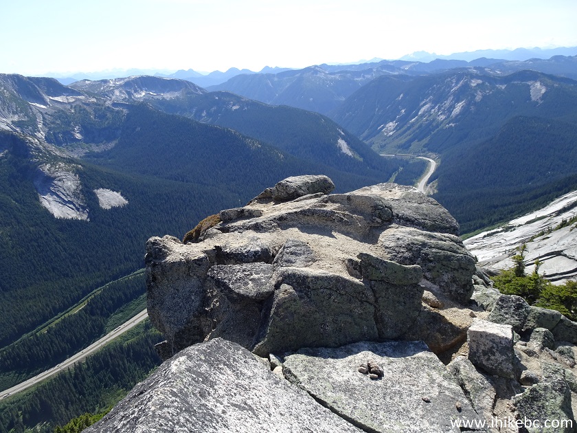
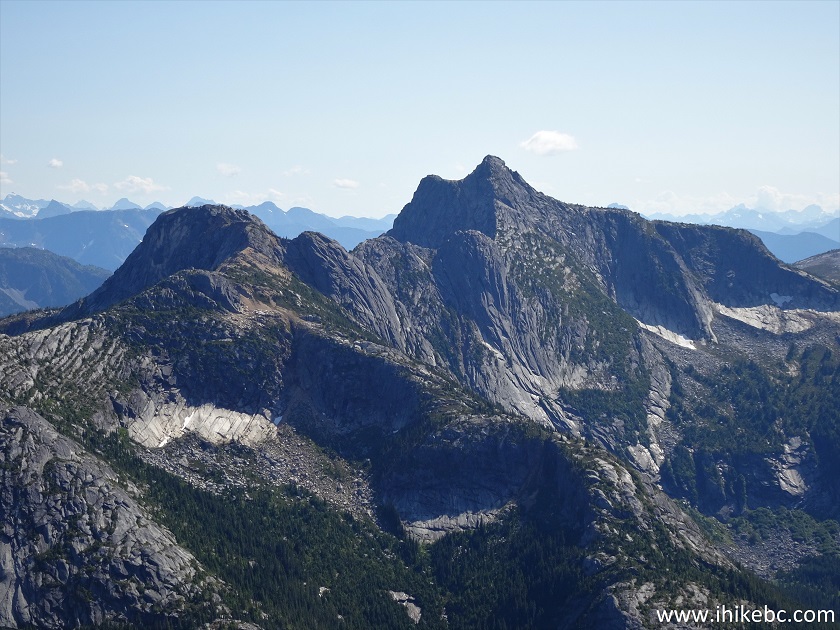
26-30. The views from the top are great indeed. Looking left to right, with the last photograph showing the main peak.
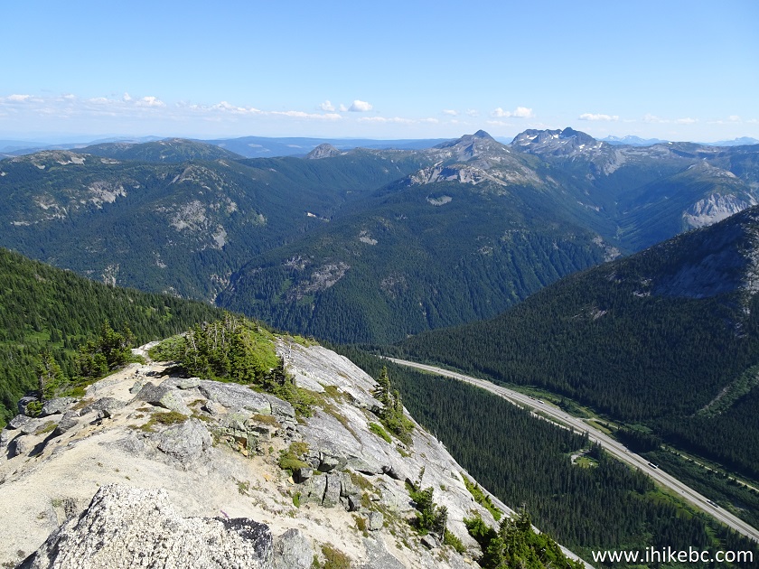
Needle Peak near Hope British Columbia
Yak Peak - Hope BC Hiking
Here is our video of the views from the top.
More ihikebc videos are on our YouTube Channel.
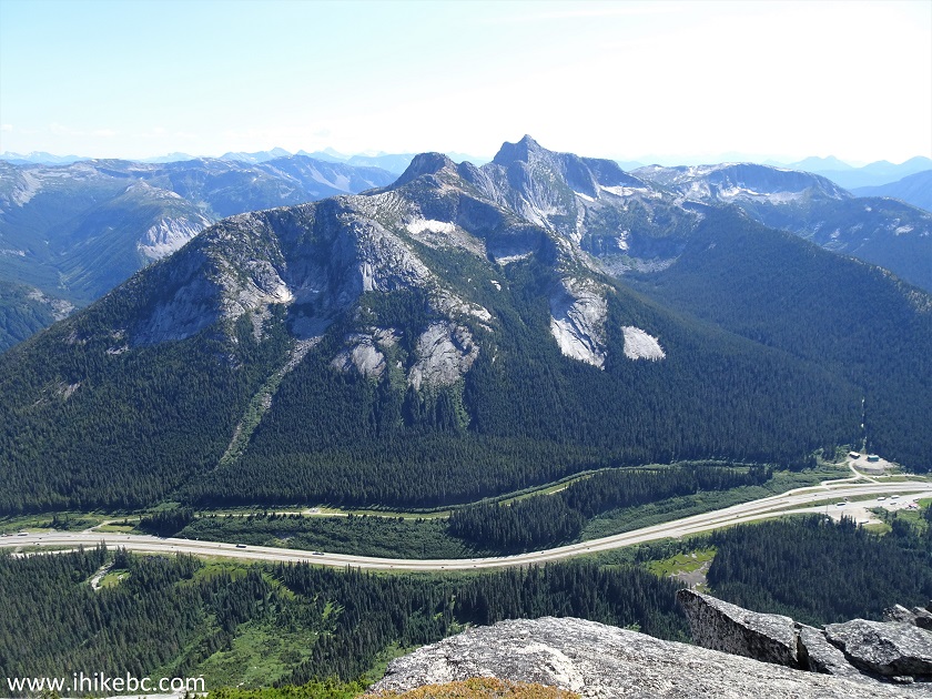
31. Needle Peak close-up.
Needle Peak near Hope BC Canada
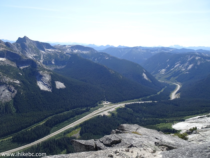
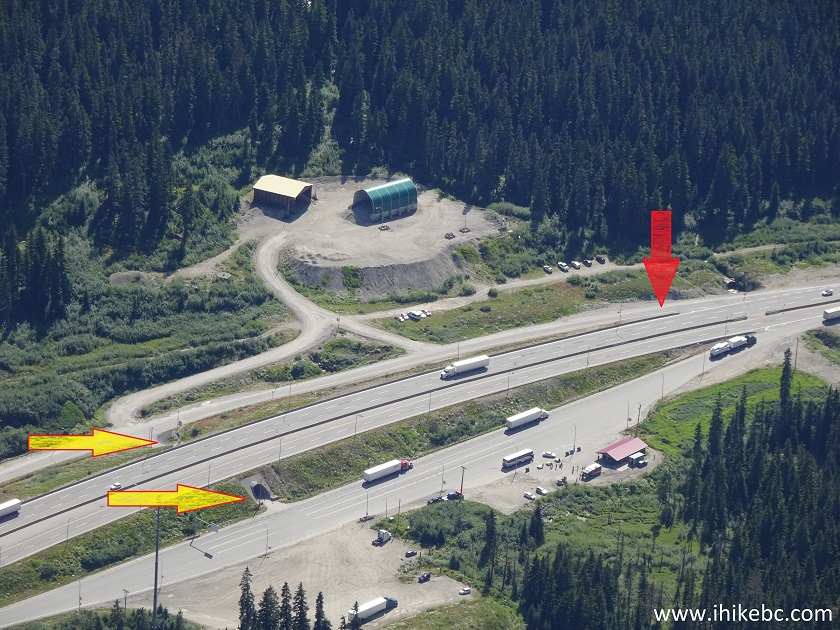
32. With lots of zoom, we see BC Highway 5 (Coquihalla) and Zopkios brake check / rest area. The red arrow points at the unmarked exit for Northbound traffic, and the yellow arrows show the tunnel to be used by Northbound traffic for getting to the brake check / trail parking area on the other side of the highway.
Zopkios Brake Check and Rest Area seen from Yak Peak
33. And here is a closer zoomed photo of the brake check / rest area. This is the best spot to take a photo of Yak Peak in that location.
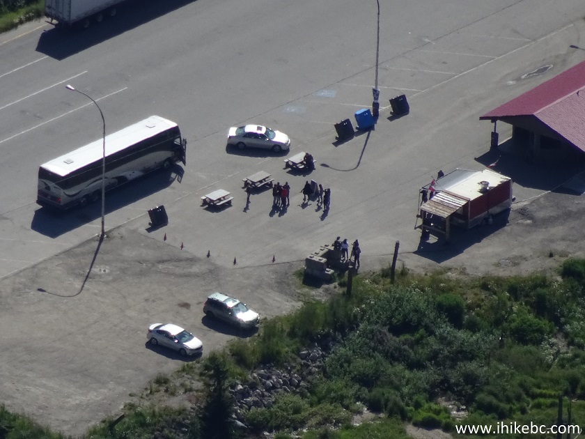
Zopkios Brake Check and Rest Area
If you know what you are doing and are properly equipped, Yak Peak trail will offer some very fine views. Highly recommended.


|
 |
Other Trips in Hope BC Area:
|
|
|
|
|
|
|
|
|
|
|
|
|
|
|
|
|
|
|
 |
|
|
|
|
|
Eaton
Peak Route
|
Skyline II West Trail
|
Eaton
Lake Hike 2
|
|
|


Other Trips:


![]()


![]()
![]()
![]()
ihikebc.com Trip 166 - Yak Peak Trail Hike (Near Hope BC)