![]()
![]()
![]()

Trip 023 - April 29-30, 2010 (Thursday - Friday)
Squamish River Forest Service Road
S-Main Branch
Liked: Tranquility, natural beauty, friendliness of fellow backcountry travelers.
Of note: Very rough road with numerous potholes. Remote wilderness area with few people around and no cell phone coverage. Possible logging in the area. Road subject to washout. Large stones fall onto the road.
Vancouver, Coast & Mountains Backroad Mapbook (2010 edition) Coordinates for the Beginning of the FSR: Page 22 (Squamish) A3.
Related Website: District of Squamish FSR Conditions.
Nearby FSR Trips: Squamish River Ashlu, Squamish River Ashlu Second Trip, Squamish River E-Main, Squamish River FSR Washout.
Other Forest Service Roads Trips: Chehalis (by Harrison Mills), Chilliwack Bench, Chilliwack Foley, Chilliwack Lake, Chuchinka-Colbourne (North of Prince George), Clear Creek (off Harrison East), Florence Lake (access to Stave Lake by Mission), Harrison East, Harrison East Second Trip, Harrison West, Jones Lake (near Hope), Lost Creek (by Mission), Mamquam River (by Squamish), Nahatlatch (near Boston Bar), Parsnip West (by Mackenzie), Scuzzy (by Boston Bar), Shovel Creek (off Harrison East), Sowaqua Creek (by Hope), Windfall Creek (by Tumbler Ridge).
Follow @ihikebc Tweet
Squamish Valley Road suddenly ended and a rough road began. It was the beginning of Squamish River Forest Service Road. It is marked in miles from Squamish (thank you, "103 Hikes in Southwestern British Columbia"), unusual for our province (2014 update - Squamish River FSR is now marked in kilometers from the beginning of the FSR seen in photo #1). BC Hydro power generating station followed shortly, with a nicely paved stretch of the road to match, and then the potholes and simply very rough surface returned. We drove past the 25 mile sign and parked in one of the many side pockets next to Squamish River. As you are driving, there are numerous side roads to explore, preferably in a 4x4 or, better yet, an ATV. There are a few large information stands along the road with the area map, but they are virtually useless due to very unclear road markings and the lack of the "you are here" indicators.
That day we walked for a few kilometers ahead, then came back and decided to hike forward the next day. From about 3 PM on the day of arrival (Thursday) until the end of the day on Friday, we saw at most ten people driving by, as well as two fishermen with an inflatable boat. When the night came, there was almost total darkness, the noise of the flowing river, and probably no one around for miles and miles.
The next day, we drove a bit forward until around the 29 mile sign, and then walked to the 40 mile sign and back, for a total of 22 miles (35 kilometers). Saw a few people camping, and met with several armed men on ATVs. Squamish River Forest Service Road offers many great views, which could be missed, if driving in a vehicle. To avoid driving on such a rough surface, you can park at the beginning of the road by the Squamish River FSR sign, and bike for about 65-70 kilometers until it apparently ends.
0. Here is a Google Maps location where Squamish Valley Road ends and Squamish River FSR begins.
1. The entrance to Squamish River Forest Service Road. There is a good parking area next to this sign, where you can sleep overnight, and then bike on the road, if you don't feel like driving.
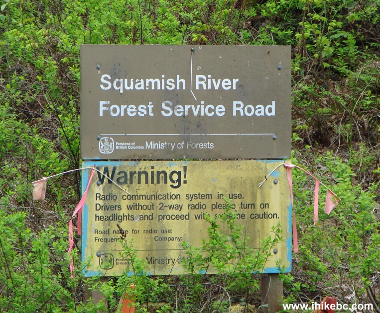
Squamish River Forest Service Road entrance near Squamish BC Canada
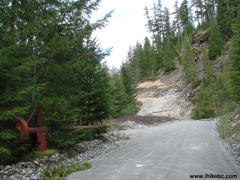
2. The road is rough, with many potholes.
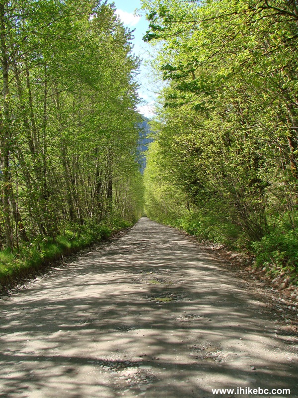
Squamish River Forest Service Road near Squamish BC Canada
3. It is Friday now, and we are beginning our hike with a look at this very interesting tree.
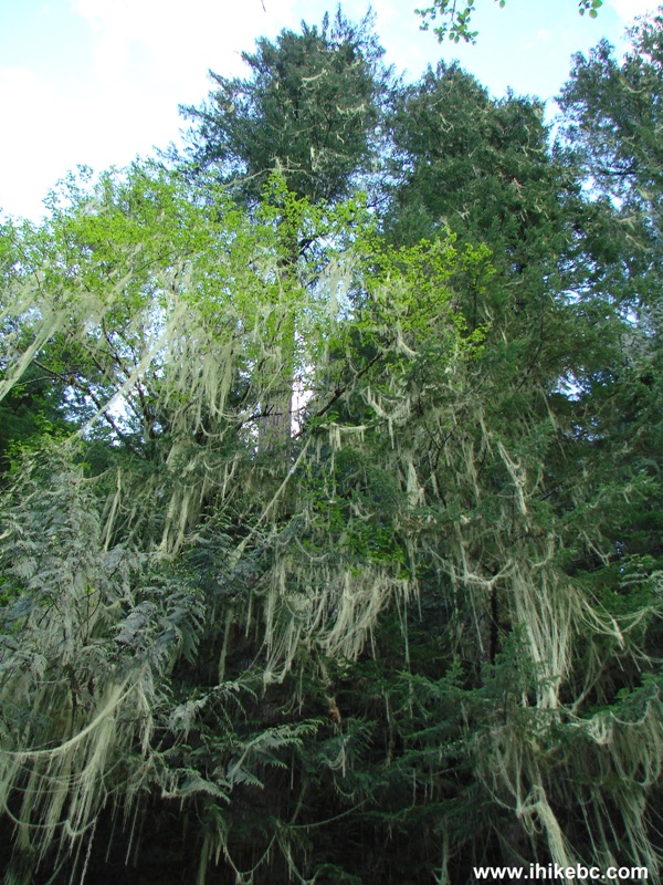
Tree seen from Squamish River Forest Service Road near Squamish BC
Canada
4. It sure is better to walk or bike on this road than drive.
Squamish River FSR
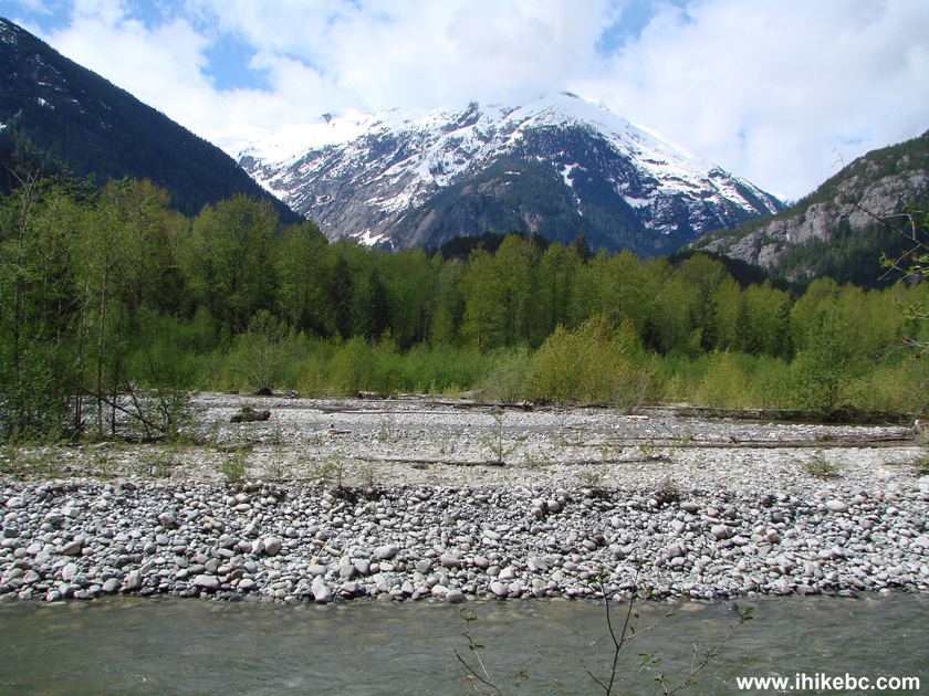
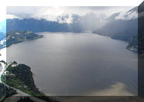
5. The arrival of natural beauty.
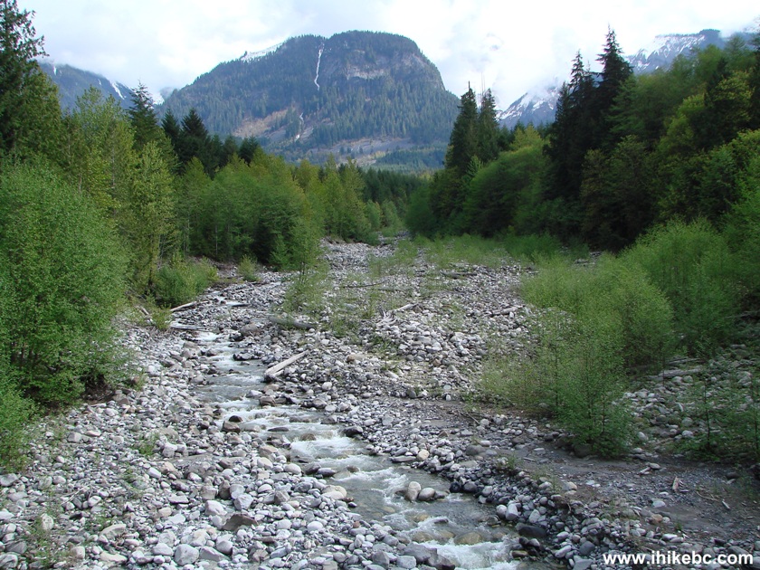
View from Squamish River Forest Service Road near Squamish British
Columbia Canada
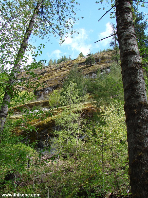
6. And, then, there was this small piece of exposed granite, which is hard to notice, as it is fairly high. Substantial zoom.
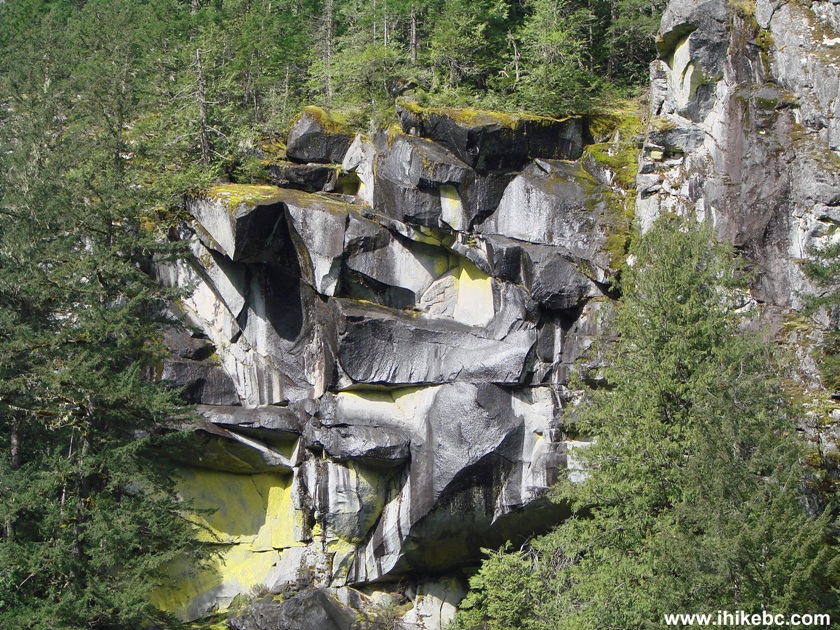
View from Squamish River FSR near Squamish British Columbia Canada
7. We took the photo above while standing next to this river turn. The road here (between km 21 and 22) is subject to washout (and, in 2014, it did wash out, stranding us for a day).
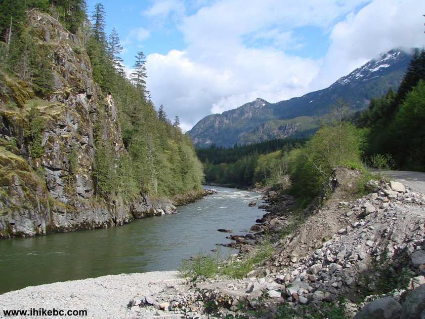
Squamish River seen from Squamish River Forest Service Road near
Squamish British Columbia Canada
8. A zigzagging creek flowing into the river.
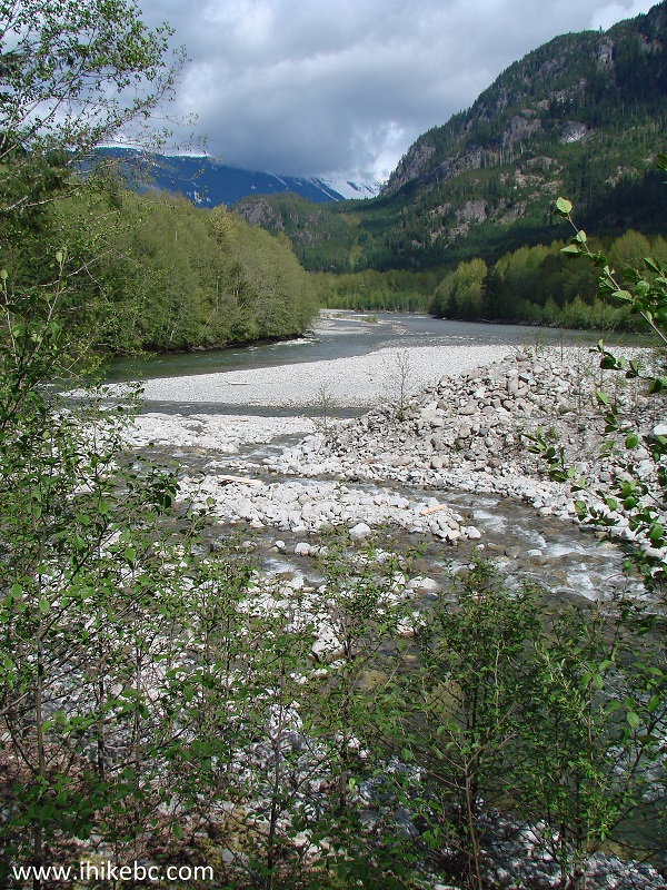
View from Squamish River FSR by Squamish BC
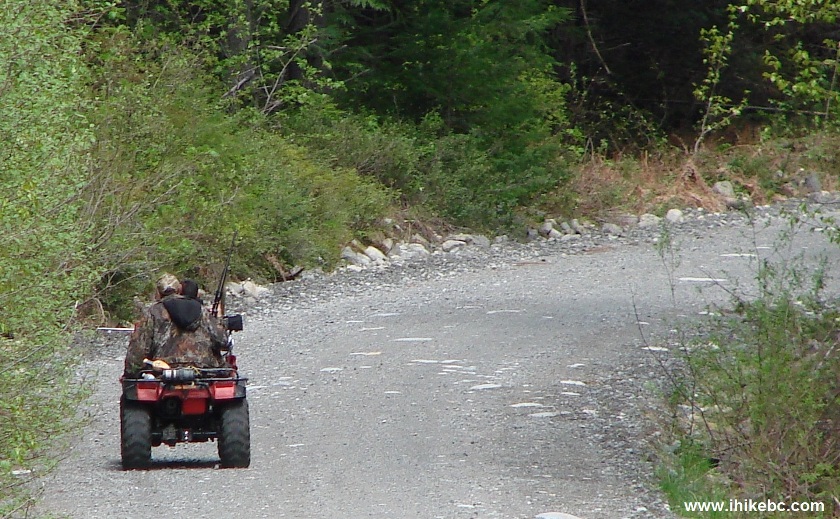
9. As we were walking through a forest, this guy was driving by. He slowed down and asked if we needed a lift. Politely declined, and off he went, with a gun firmly attached to the front of his ATV.
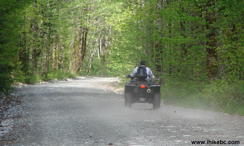
Armed man on ATV on Squamish River FSR near Squamish BC Canada
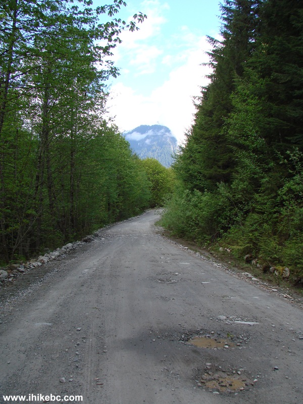
10. Sometimes, the road comes very close to the mountains.
View from Squamish River FSR
11. 27.9 km after the beginning of the FSR, there is a split. Squamish River FSR goes straight ahead, and Elaho River Road (Squamish River FSR E-Main) is to the left across this bridge.
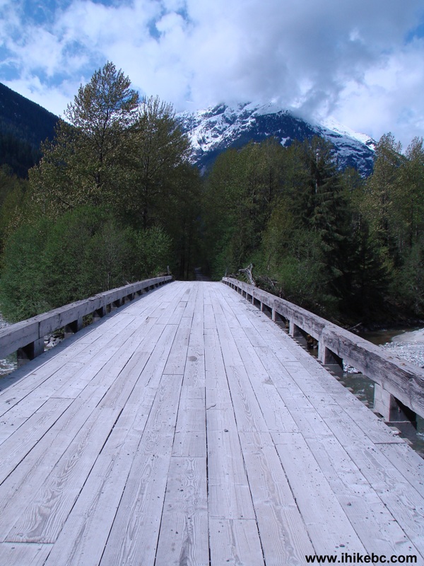
Bridge across Squamish River near the Elaho River Road Split
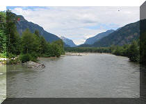
12. Nice view from the bridge.
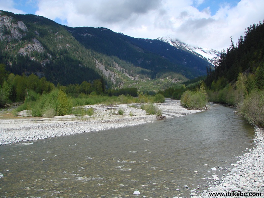
Photo of Squamish River seen from the bridge to Elaho River Road
13. We stayed on Squamish River FSR, with this view to the left being our reward shortly after the split.
View from Squamish River Forest Service Road near Squamish British
Columbia Canada
14. Soon, we came to an ancient open gate. A weather-beaten note on the gate advised that the road was closed due to the extreme fire danger. BC Forest Service probably closes this gate when the conditions warrant such a closure.
Fire danger gate Squamish River FSR near Squamish BC Canada
15. Then, we went through an area of a minor slide, with some stones sitting close to the middle of the road.
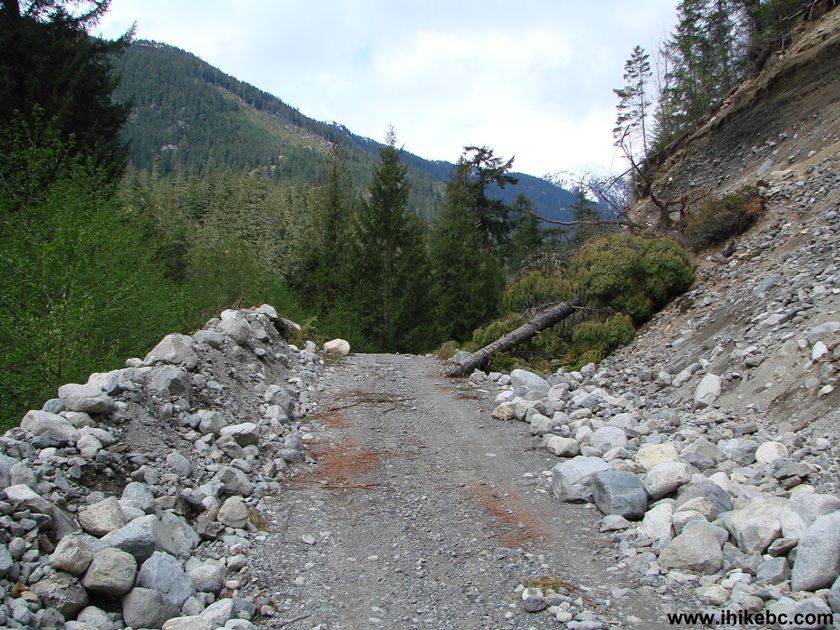
Cleared slide on Squamish River Forest Service Road near Squamish
British Columbia Canada
16. This was a fun encounter. As these guys were passing us by earlier in the day, the driver yelled: "You must love walking!" They were both armed, and the passenger had a gun with an optical scope.
Armed ATV riders with rifles Squamish River FSR
17. A very neat area to our right, and the photo shows only about half of it.
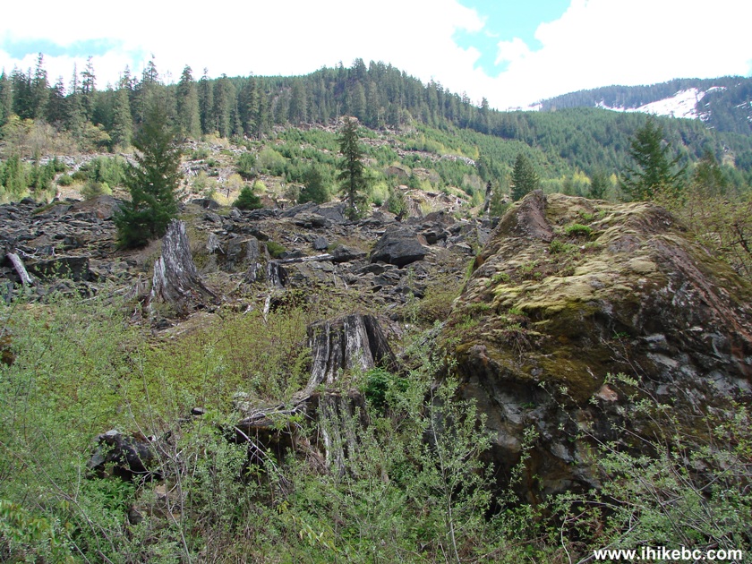
View from Squamish River Forest Service Road near Squamish British
Columbia Canada
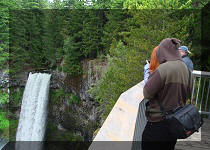
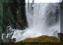
18. Shortly before the 40 mile marker, a truck drove by, slowed down, and the driver asked if everything was ok. We said yes, and asked how long was this road. The driver replied that it was about 60 miles long. As we had been hiking for more than three hours at that point, the further 20 miles would have to wait until another day. We had a break near a nice little waterfall shortly after the 40 mile marker, and then headed back.
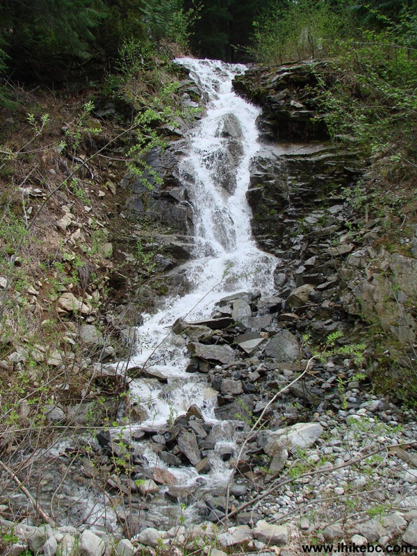
Waterfall near 40 mile marker of Squamish River FSR by Squamish BC
Canada
Overall, it was an excellent 7+ hours hike. Highly recommended, though biking would allow you to see three times as much in about the same amount of time. As we were walking back, about 10-15 vehicles drove by into the wilderness. That being Friday, people were heading into the bush for the weekend. But, still, it was a peaceful, deserted area.


|
 |
Other Trips in Squamish Area:
|
|
|
|
|
|
|
|
|
|
|
|
|
|
|
|
|
|
|
|
|
|
|


![]()
![]()
![]()
ihikebc.com Trip 023 - Squamish River Forest Service Road