![]()
![]()
![]()

Trip 209 - May 20, 2021 (Thursday) & September 12, 2024 (Thursday)
BC Highway 40 Trip
Lillooet to Gold Bridge
Page 1 of 2
Liked: Fine views of Carpenter Lake, Bridge River Canyon, and Marshall Creek Falls. Access to Gun Creek Recreation Site, many trails and several FSRs.
Of Note: Frequently narrow and winding road with steep unbarricaded drop-offs. Much of the road is gravel. Dust from passing vehicles on gravel surface, especially along Carpenter Lake. Rockfall hazard. Numerous large and small rocks on the road. Avalanche hazard in the winter season. No cell phone signal for most of the road.
Vancouver, Coast & Mountains Backroad Mapbook (5th edition) Coordinates: Page 53 (Lillooet) C6-B5-A4, Page 52 (Seton Portage) G4-F3-E3-E4-D5-C5-B4-A4, Page 51 (Gold Bridge) G4-F3-E3-D3-C3-B3.
Related Website:
DriveBC (road
conditions).
Other Road Trip Reports:
TransCanada Highway 1 and BC Highway 99 Loop,
BC
Highway 20 (Williams Lake to Bella Coola).
BC Highway 40 runs for just over 100 kilometers from the town of
Lillooet to a tiny community of
Gold Bridge. Along the way, this
semi-dangerous, partially unpaved road passes by some very impressive
views. Interestingly, this highway does not appear to be officially
numbered. Aside from ONE mentioning on a sign in Lillooet (indicated with
a red arrow in photo #6), there isn't a single sign along this highway
showing its number. The number 40, however, does appear in maps, and
many folks in BC do know what "Highway 40" refers to. There are three
roads which compose Highway 40: it starts in Lillooet where Moha Road
begins off Main Street. Shortly, Moha Road turns into Bridge River Road
(also known as Lillooet-Pioneer Road). Finally, at Terzaghi Dam,
Carpenter Lake Road along Carpenter Lake takes over as Highway 40 all
the way to Gold Bridge.
The main difficulty while driving on Highway 40 is watching the road while checking out all the
great views around you. Considering the number of blind corners, the
need to dodge numerous small and large rocks littering the highway, and
steep unbarricaded drop-offs, it's much safer to pull over for a
particularly good view.
Also, Highway 40 does get used by logging trucks and other industrial
traffic, so watch out for that too, especially on particularly narrow
stretches of the road.
BC Highway 40 starts in the town of Lillooet, and there are two ways to get there from Vancouver: first is Highway 1 East to Lytton via Fraser Valley-Hope-Yale-Boston Bar, then take Highway 12 from Lytton to Lillooet. Or, like we did this time, Highway 1 West to Horseshoe Bay, then Highway 99 (Sea-to-Sky) via Squamish-Whistler-Pemberton to Lillooet. The latter is a more scenic, albeit a more challenging drive, with steep grades past Pemberton. If driving on Highway 97 South towards Cache Creek, turn right onto Highway 99 a few kilometers before Cache Creek, and you'll get to Lillooet that way too.
September 2024 Update: We drove the entire length of BC Highway 40 again, and there are a few additional photos in this trip report (marked as such), as as well as a video of the entire road trip. Mileage markers have been changed from "Welcome to Lillooet" sign to the start of BC Highway 40 where Moha Road begins off Main Street in Lillooet.
0. Here are Google Maps directions from Lillooet to Gold Bridge via Hwy 40.
And here is our video of driving the entire Highway 40 from Lillooet to Gold Bridge.
1-2. Here we are on Highway 99, driving North from Pemberton and approaching an intersection where turning right would shortly lead to the beginning of Highway 12 (to Lytton) and continuation of Highway 99 (to Cache Creek). But, driving straight, would lead to Lillooet and (over 100 kilometers later) Gold Bridge via Highway 40. The red arrow points to a "Welcome to Lillooet" sign. All the mileage in this trip report is based on this sign as a starting point, so zero your odometer at that sign if you want to follow our mileage markers.
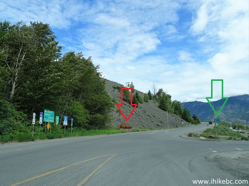
BC Highway 99 near Lillooet
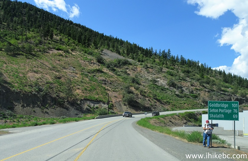
3. We went straight at the intersection shown above, and here is a distance info sign (shown with a green arrow in photo #2). Shalalth and Seton Portage can be reached via Highway 40 and Mission Mountain Road - the turnoff is at Terzaghi Dam 51 km later.
Seton Lake Road Lillooet BC Canada
4. Just around the corner, another sign indicates that a right turn is required to reach Gold Bridge and Seton Portage. This short stretch between the intersection seen in photos #1 & 2, and Main Street seen straight ahead, is called Seton Lake Road.
Seton Lake Road - Lillooet BC
5. Now on Main Street in downtown Lillooet. To hike a very fine Red Rock Trail, turn left at 6th Avenue.
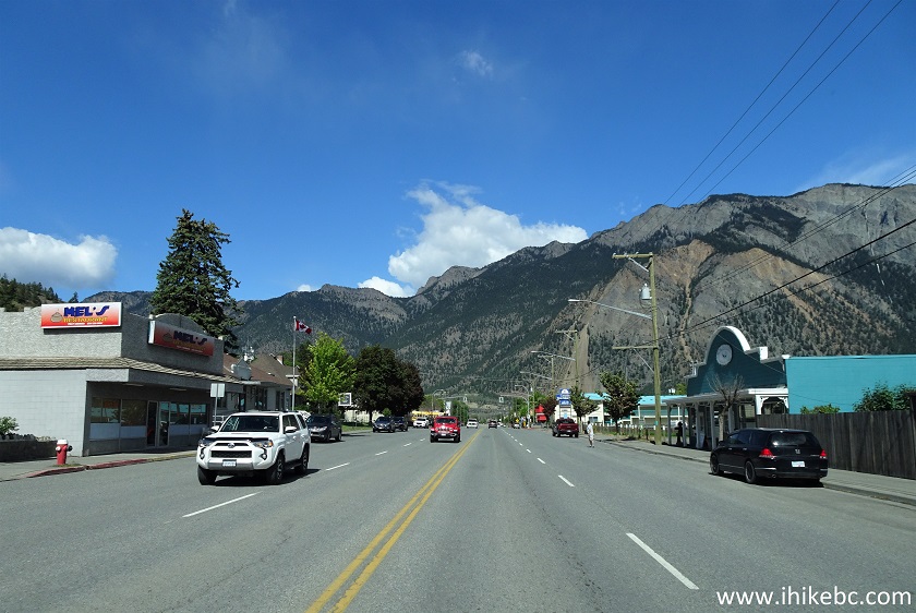
Main Street Lillooet BC
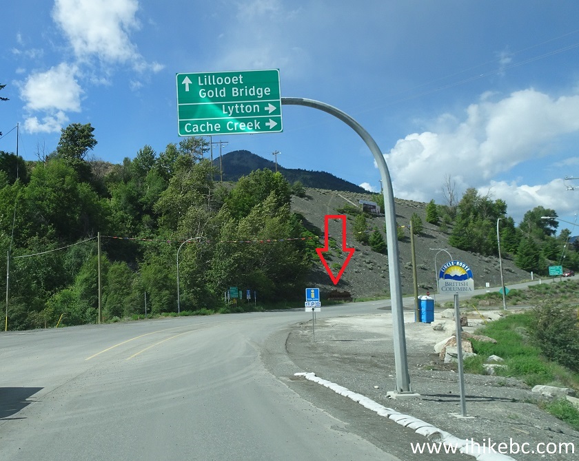
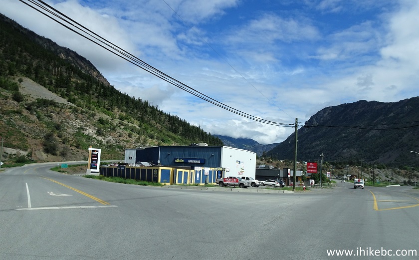
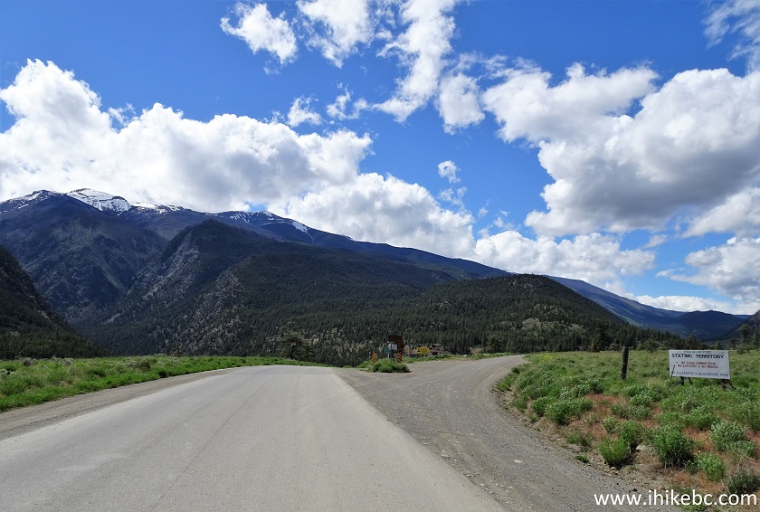
6a. Highway 40 starts where Moha Road begins off Main Street, 3.3 kilometers from Welcome to Lillooet sign. We are approaching that left turn. Canco gas station (located adjacent to KalTire) serves only 87 grade gasoline, as well as diesel, and it's your last chance to fuel up before Gold Bridge. This gas station usually has a MUCH better price than Chevron station just a few hundred meters earlier on Main Street. Note the red arrow in the photo below - it points to the only Highway 40 sign reference that we saw on this trip.
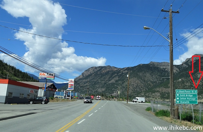
Main Street Lillooet
6b. Here is that sign in 2024.
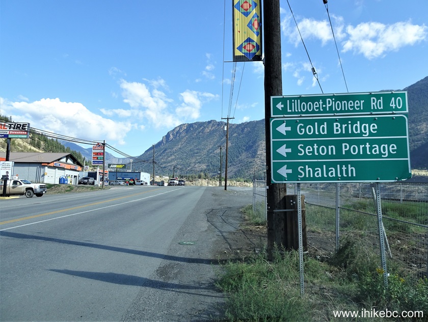
Lillooet, British Columbia, Canada
7-8. Turning left from Main Street onto Moha Road. BC Highway 40 begins here. There is a Buy-Low food store immediately to the right after you make that left turn, and it's the last substantial food store on this trip.
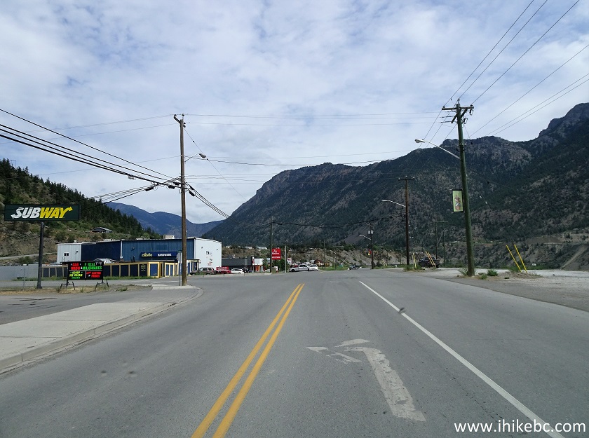
Main Street at Moha Road Lillooet British Columbia
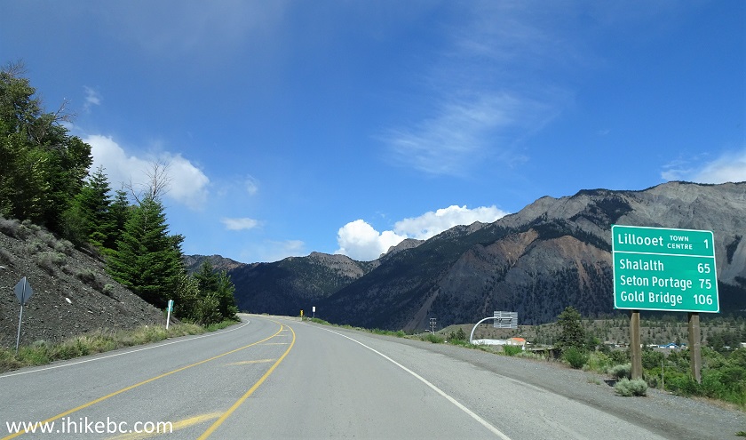
9. Having turned onto BC Highway 40 / Moha Road, we see a sign with distances to various destinations. We are going to zero our odometer here, so all subsequent mileage markers are going to be in reference to this starting point.
Moha Road Lillooet
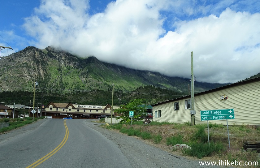
10. Moha Road passes by some residences.
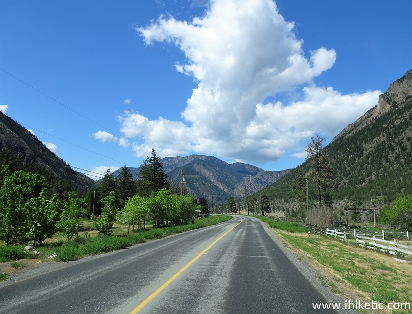
Moha Road Lillooet
11. Approaching a bridge across Bridge River.
BC Highway 40 near Lillooet
12-13. Here it is, 6.0 km from the start of BC Highway 40.
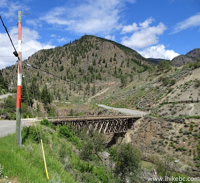
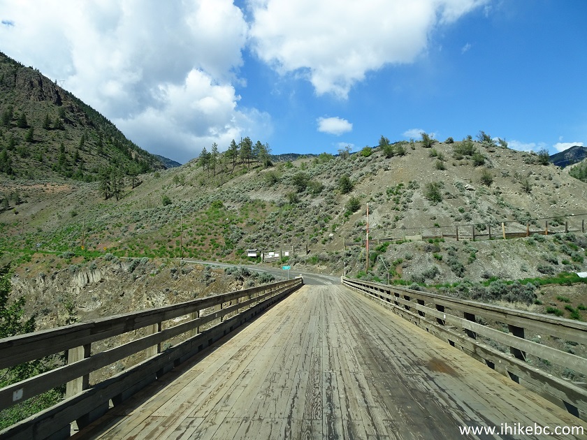
Bridge Across Bridge River near Lillooet BC
14. Bridge River view from the bridge.
Bridge River British Columbia
15. Just a few hundred meters later, at 6.4 km, West Pavilion FSR starts on the right side. It leads in just under 12 km to Camelsfoot Peak Trail, which we hiked a few days later.
BC Highway 40 at West Pavilion FSR
16. BC Highway 40 at 15.3 km after the Welcome to Lillooet sign. By this time it is probably already called Bridge River Road / Lillooet-Pioneer Road.
BC Highway 40
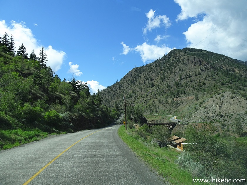
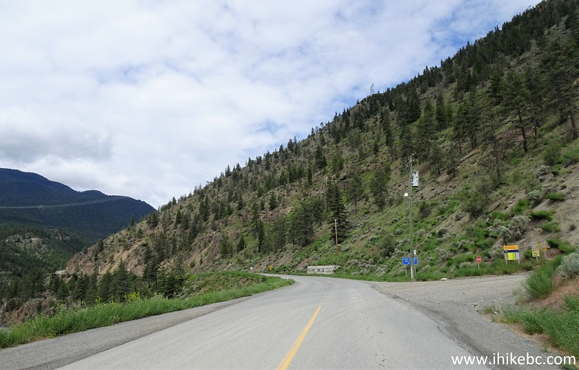
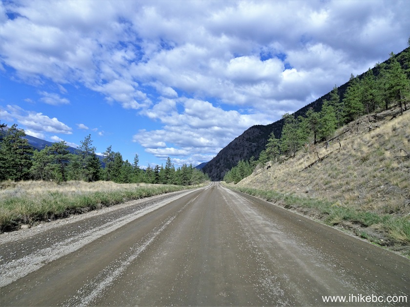
17. At 18.0 km, asphalt turns into gravel. The road then switches between gravel and asphalt several times.

Highway 40 British Columbia Canada
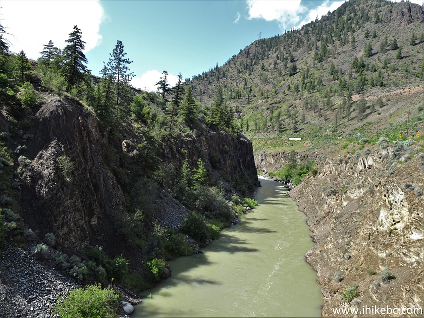
18a. A fine view of Bridge River and canyon at 18.1 km.
Bridge River seen from BC Highway 40
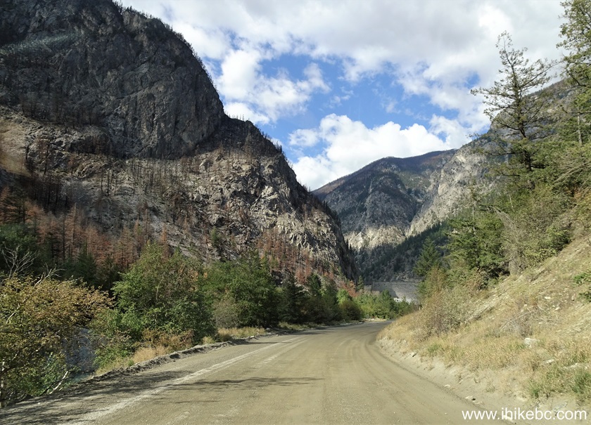
18b. BC Highway 40 at 19.8 km. September 2024 photo.
Highway 40 between Lillooet and Gold Bridge BC
And here is our 2021 video of driving on Hwy 40 near the spot seen in the photo above.
More ihikebc videos are on our YouTube Channel.
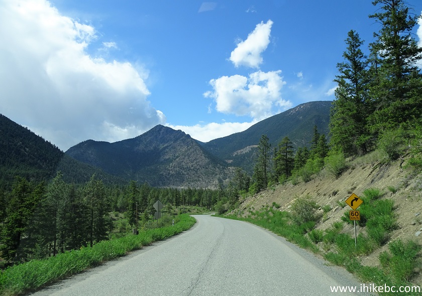
19a. The good views keep coming one after another. At 20.5 km here.
BC Highway 40 between Lillooet and Gold Bridge
19b. BC Highway 40 at 24.7 km. September 2024 photo.
20. Now at 26.7 km.
BC Highway 40
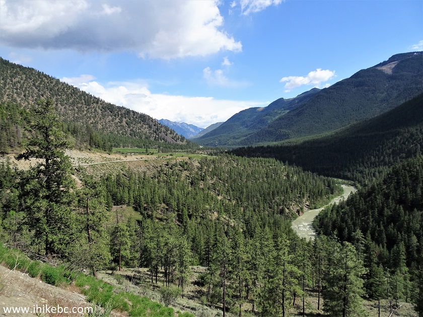
21. At 28.4 km, there is a large pullout on the left side. There is a great Bridge River and canyon view here, as well as Horseshoe Bend Trail which gets down to the river, and which we hiked a few days later.
BC Highway 40 at the Horseshoe Bend Pullout
22. The view from the pullout.
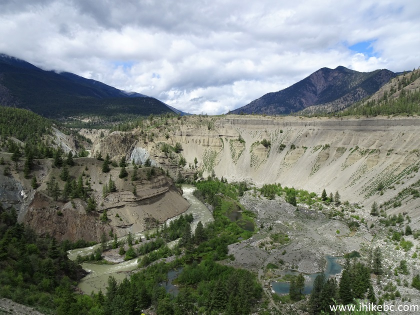
Horseshoe Bend Canyon View from BC Highway 40 Pullout
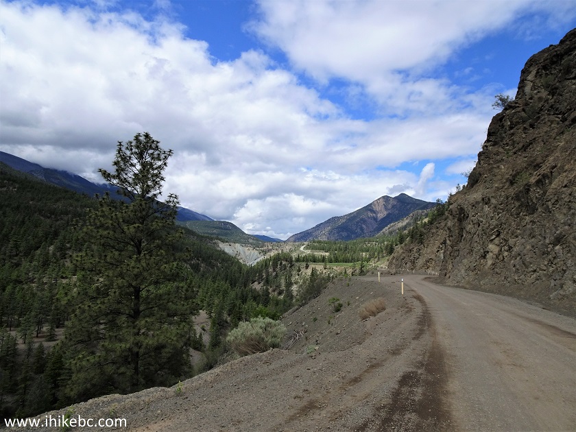
23. Moving on, at 30.4 km Yalakom FSR starts on the right side.
BC Highway 40 at Yalakom FSR Turnoff
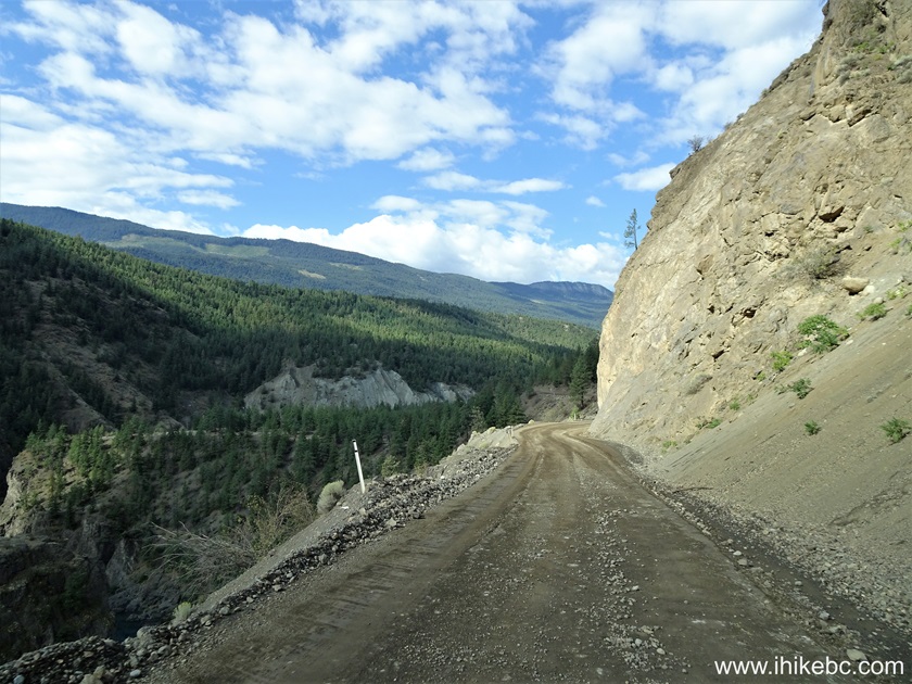
24. There is a series of tight switchbacks shortly thereafter, and here is a view of Highway 40, Bridge River and the Canyon from around that area.
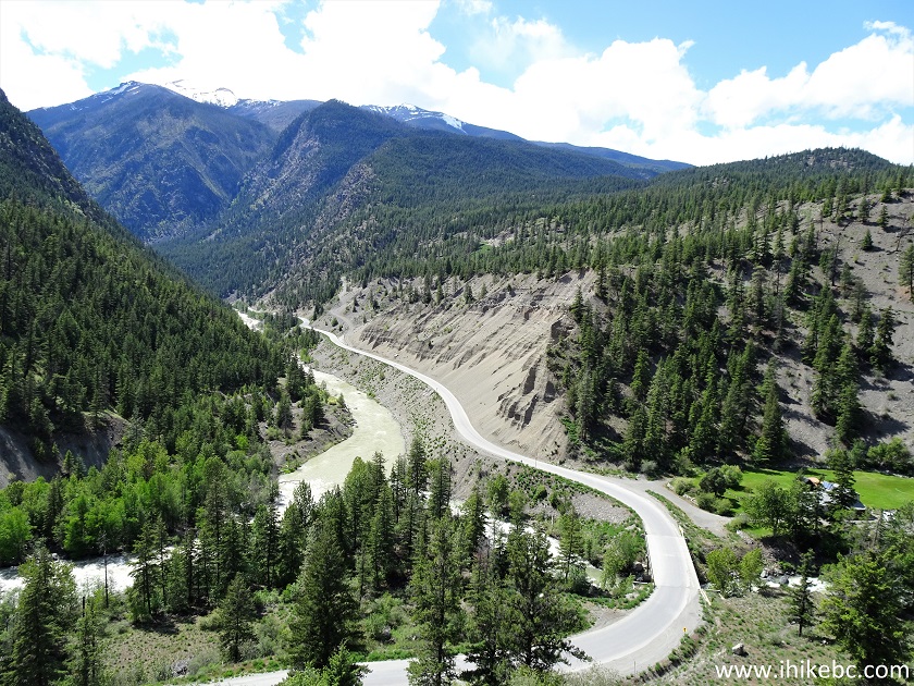
British Columbia Highway 40
25. At 36.7 km, a big rock is hanging right above the highway, and there are some large cracks there, so avoid stopping under that rock, as it might not stay there for much longer.
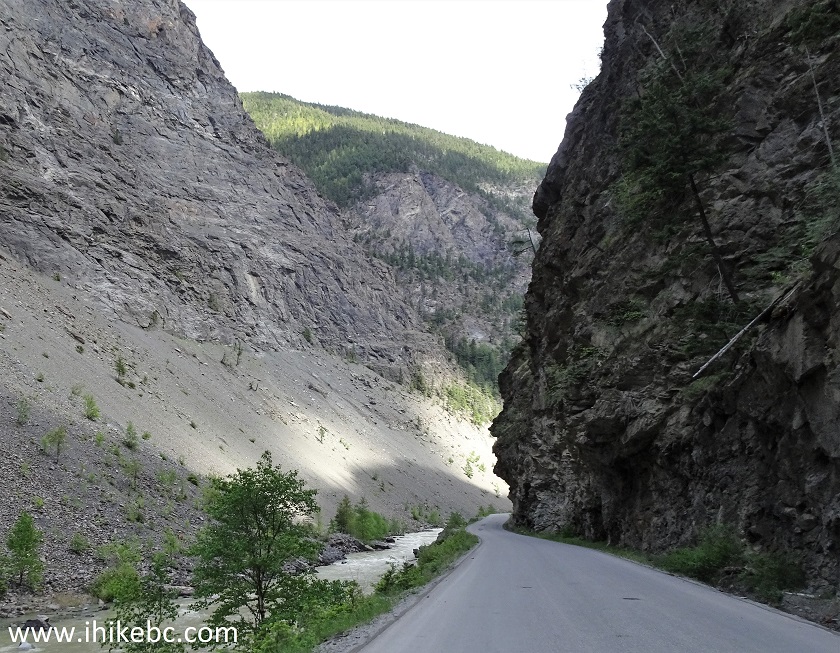
Highway 40 British Columbia
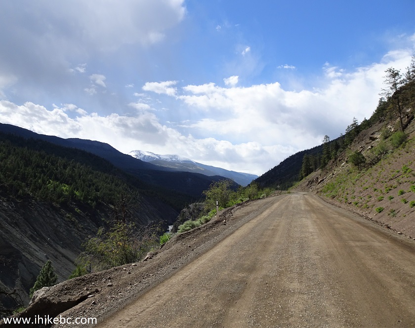
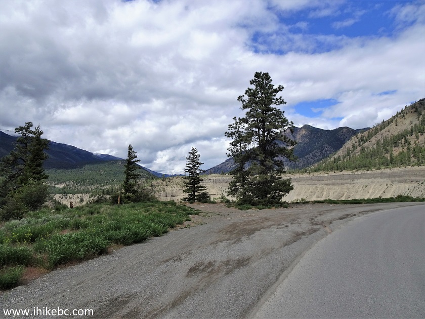
26a. BC Highway 40 (Bridge River Road / Lillooet-Pioneer Road) at 41.8 km.
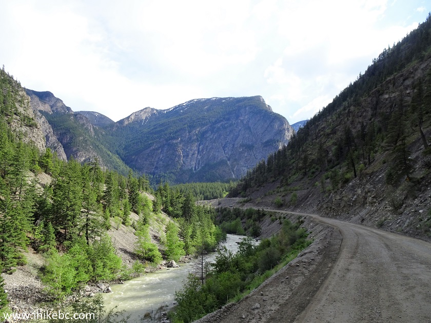
BC Highway 40
26b. BC Highway 40 at 44.7 km. September 2024 photo.

Scenic Highway 40 - British Columbia Canada
26c. BC Highway 40 at 46.2 km. September 2024 photo.
British Columbia Scenic Highway 40 between Lillooet and Gold Bridge
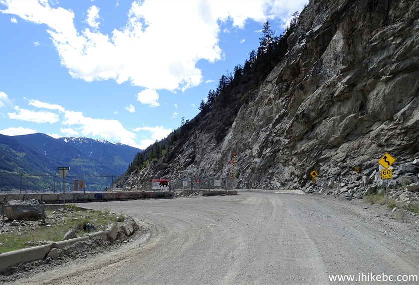
27. At 46.9 km, we are approaching Terzaghi Dam (formerly called Mission Dam) and a major intersection, where a left turn would lead to Seton Portage and Shalalth, while going straight (this would now be Carpenter Lake Road) would be the continuation of BC Highway 40, and would lead to Gold Bridge and Bralorne.
BC Highway 40 near Terzaghi Dam
28. Here is that intersection, at 47.2 km. Coordinates: N 50⁰47.393' W 122⁰13.486'. Elevation: 643 meters.
BC Highway 40 at Mission Mountain Road
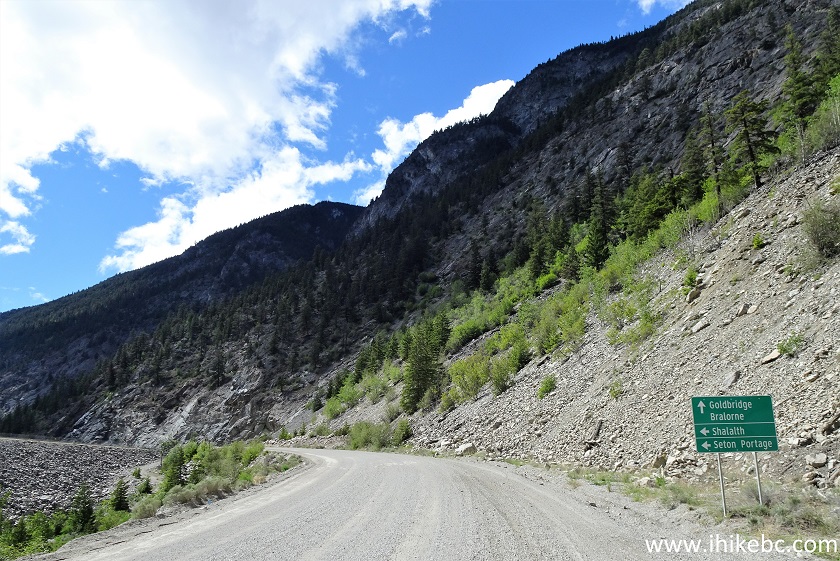
29. Looking left, this is Mission Mountain Road to Shalalth and Seton Portage.
Mission Mountain Road at BC Highway 40
30. Except today wasn't a good day to visit.
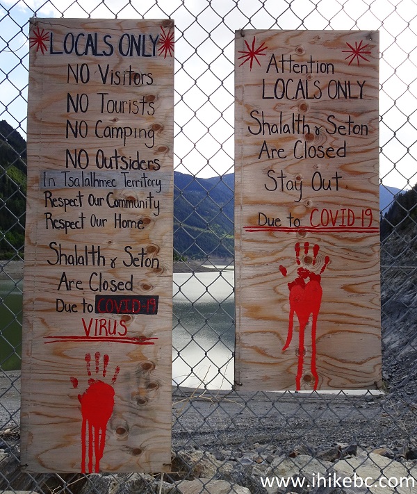
Shalalth and Seton Portage Closed due to Covid
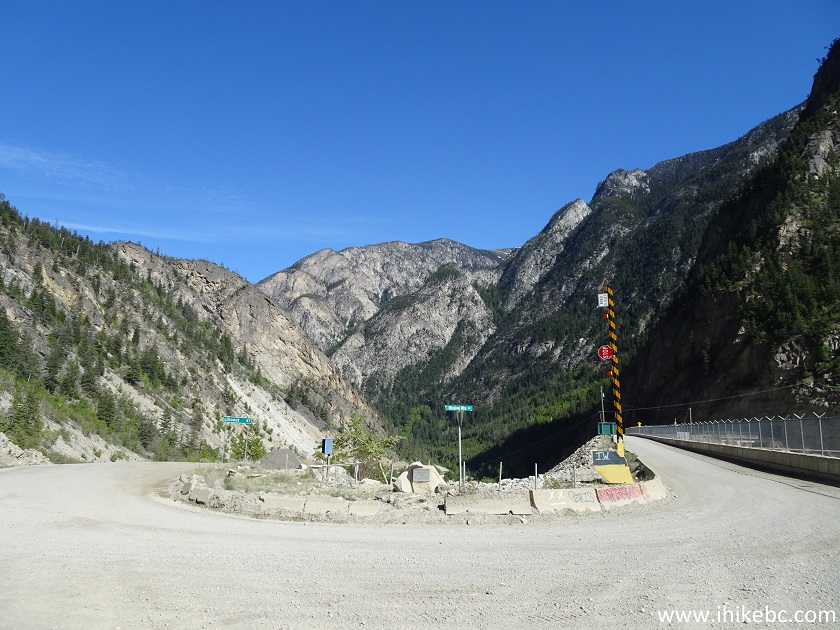
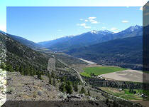
31. Here is a view of Carpenter Lake (a hydroelectric reservoir), which begins at this intersection. The great views are about to start arriving in abundance.
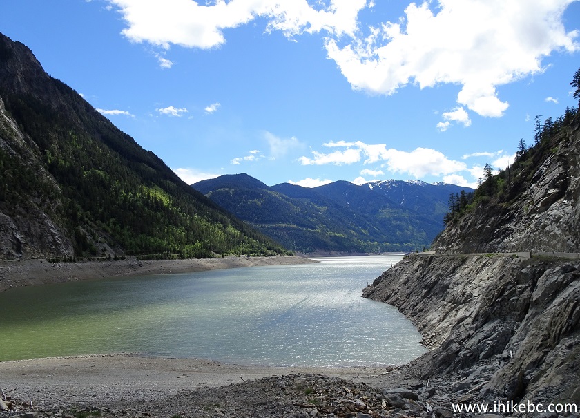
Carpenter Lake British Columbia Canada
Our BC Highway 40 Trip Report Continues on Page 2.


|
 |
Other Trips in Lillooet Area:
|
|
|
|
|
McGillivray
Creek Trail |
|
Other Trips:


![]()


![]()
![]()
![]()
ihikebc.com Trip 209 - BC Highway 40 Trip (Lillooet to Gold Bridge) Page 1 of 2