![]()
![]()
![]()

Trip 212 - May 25, 2021 (Tuesday)
Horseshoe Bend Trail Hike
Off BC Highway 40 Near Lillooet
Liked: Canyon and river views. A big rock with a tree on the side. A small pond with beautiful blue-coloured water. A busted old suspension bridge.
Of Note: Loose rocks and stones, uneven ground. Proceeding to the end of the trail requires navigating a short tricky stretch by the river. Hiking poles and boots are highly recommended (to the busted suspension bridge) and are essential (beyond the bridge).
Vancouver, Coast & Mountains Backroad Mapbook (5th edition) Trailhead Coordinates: Page 52 (Seton Portage) F3.
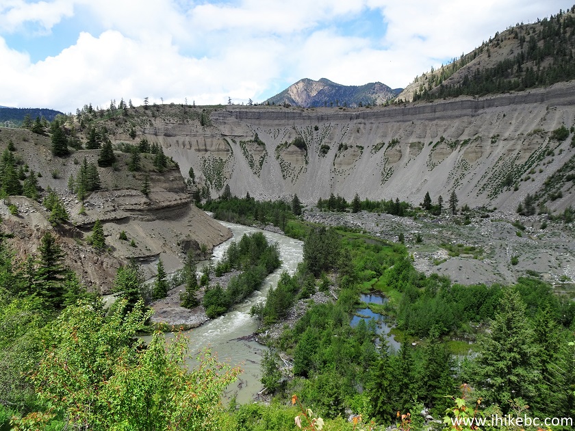
As you are driving on BC Highway 40 between Lillooet and Gold Bridge, at the 32.1 km mark from the Welcome to Lillooet sign there is a substantial pullout on the left side. It's a good place to stretch your legs and check out a very impressive canyon view. Also, there is a short (less than 2 km one way) trail going down to the bottom of the canyon, and then heading past a small blue-coloured pond, along Bridge River, past a very impressive large rock with a tree on its side, and then to a point where the canyon walls become too steep and you have to stop, which signals the end of the trail. That's the Horseshoe Bend Trail, so named because Bridge River makes a horseshoe-shaped turn at this point.
Overall, this trail is easy-to-moderately challenging, but is full of large loose stones. Plus, if you would want to proceed past a busted suspension bridge (and see that cool rock with a tree by its side), you would need to negotiate about 20 meters of very steep terrain consisting of loose sand and small rocks. As this spot is within several meters of fast-flowing Bridge River, hiking poles and boots would be essential to navigate it safely.
1. We are at a large pullout on the side of BC Highway 40, at the 32.1 km mark from the Welcome to Lillooet sign. That's where the Horseshoe Bend trailhead is located. This is the same spot as seen in photo #21 of our BC Highway 40 trip report. Check out that trip report for directions on getting to the trailhead from Lillooet.
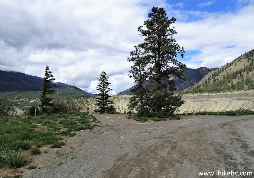
BC Highway 40 at Horseshoe Bend Trail Parking Area
And here is our video of driving the entire Highway 40 from Lillooet to Gold Bridge.
We arrive to Horseshoe Bend at the 37:10 mark of the video.
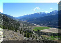
2. Even if you don't plan on hiking the Horseshoe Bend Trail, the canyon view from the pullout is well worth making a stop at this location.
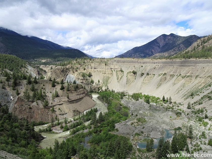
Horseshoe Bend Canyon off BC Highway 40 near Lillooet BC Canada
3. The trailhead is located at the beginning of the pullout (closer to Lillooet than Gold Bridge). Coordinates: N 50⁰51.463' W 121⁰09.151'. Elevation: 518 meters.
Horseshoe Bend Trailhead - Hike in Lillooet Area
4. A note on the chain preventing vehicular access to avoid spreading invasive species, invites you to walk down at your own risk.
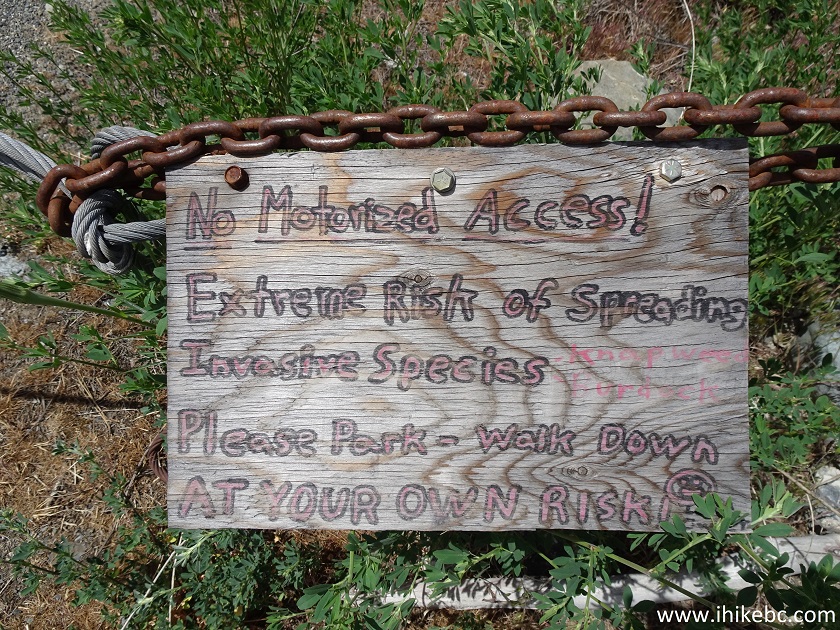
No Motorized Access Note for Horseshoe Bend Hike
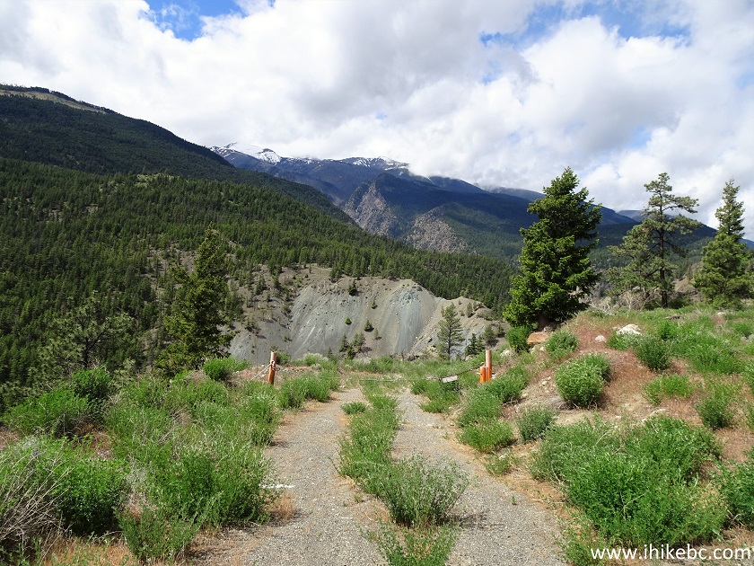
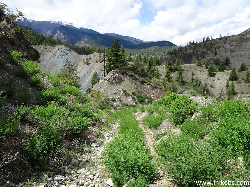
5. The Horseshoe Bend Trail 100 meters after the start (all distances are based on a GPS odometer and are approximate).
Hiking in Lillooet Area - Horseshoe Bend Trail
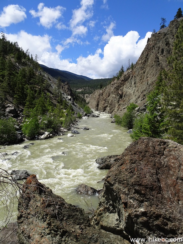
6. A neat view of Bridge River on the left side.
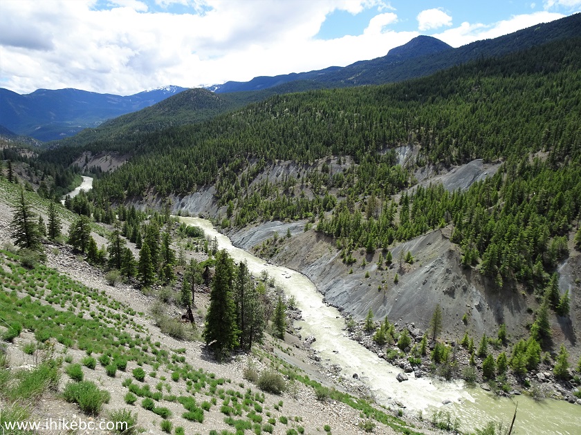
Bridge River British Columbia
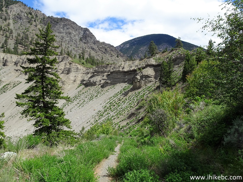
7. Horseshoe Bend Trail at 215 meters.
Horseshoe Bend Trail in Lillooet Area
8. The trail makes a 180-degree turn shortly thereafter, and here is a view after that turn.
Horseshoe Bend Trail - Hike in Lillooet BC Area
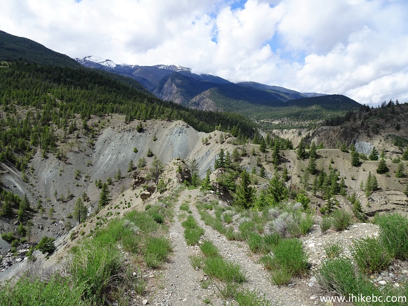
9. At 315 meters, a view of the canyon on the left side.
Canyon View from Horseshoe Bend Trail - Hiking in Lillooet Area
10. At 570 meters, a small neat pond on the right side, with beautiful blue water and even some small fish swimming in there.
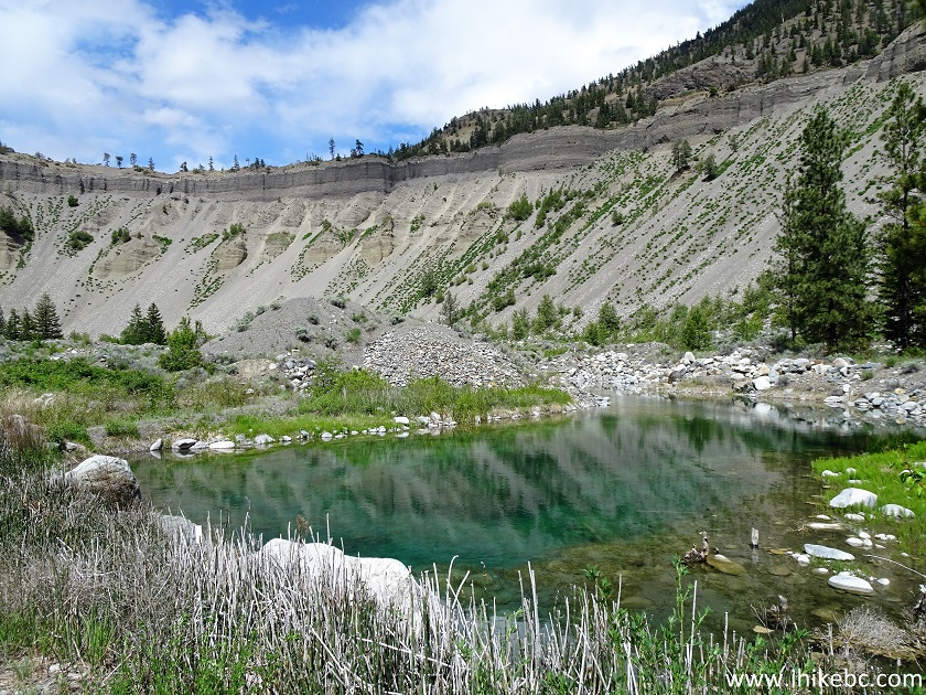
Horseshoe Bend Trail View
11. Cool.
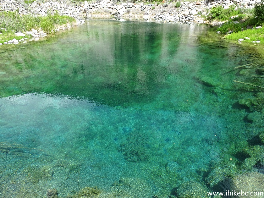
Horseshoe Bend Trail Pond
12. After you get through some bushes...
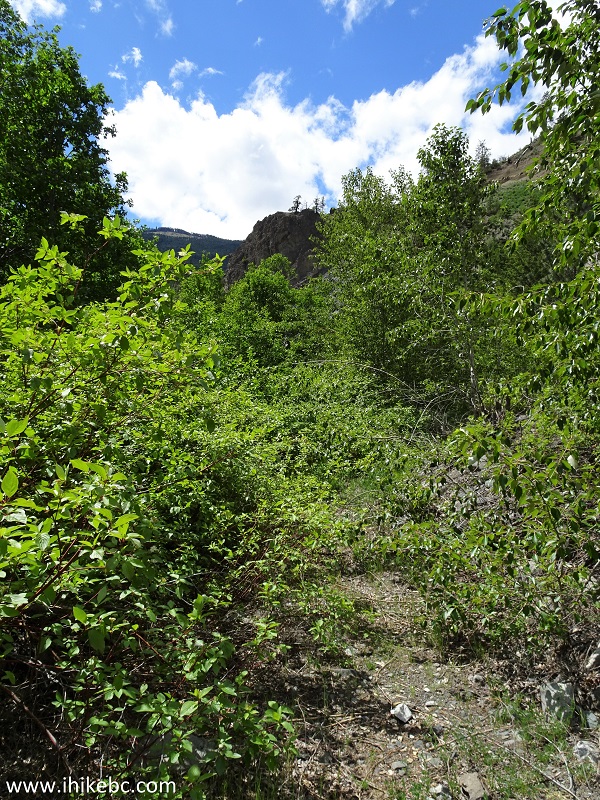
Hiking in British Columbia - Horseshoe Bend Trail
13...it's time to hike on the rocks.
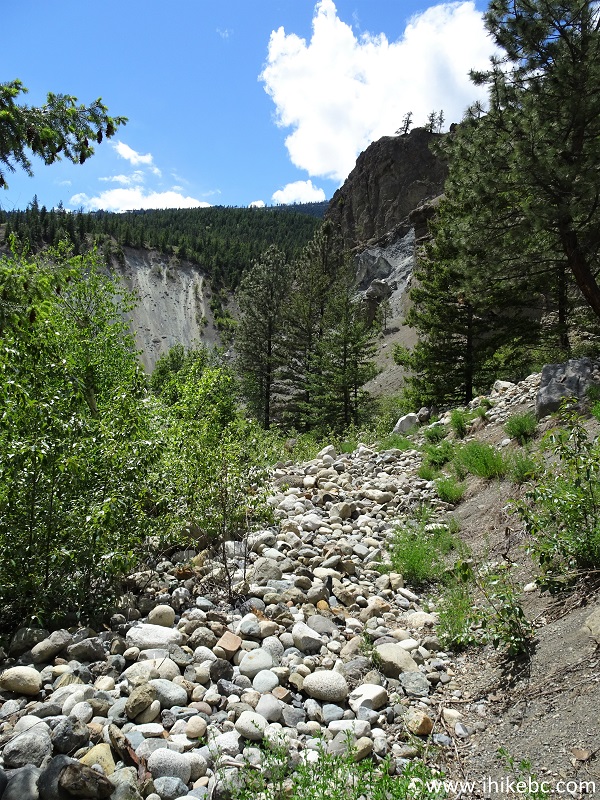
Horseshoe Bend Trail Near Lillooet British Columbia Canada
14. Soon after the rocks, Bridge River comes very close to the trail. And a busted suspension bridge appears ahead.
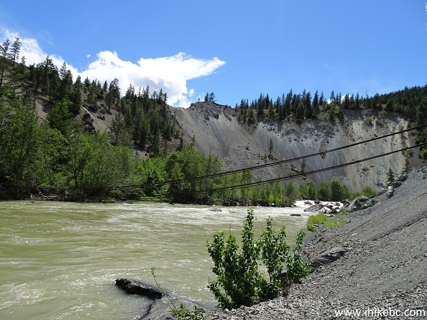
Bridge River Near Lillooet BC Canada
15. Here is the anchor of the former bridge. Coordinates: N 50⁰51.652' W 122⁰09.612'. Elevation: 425 meters.

16. The bridge above Bridge River (no relationship).
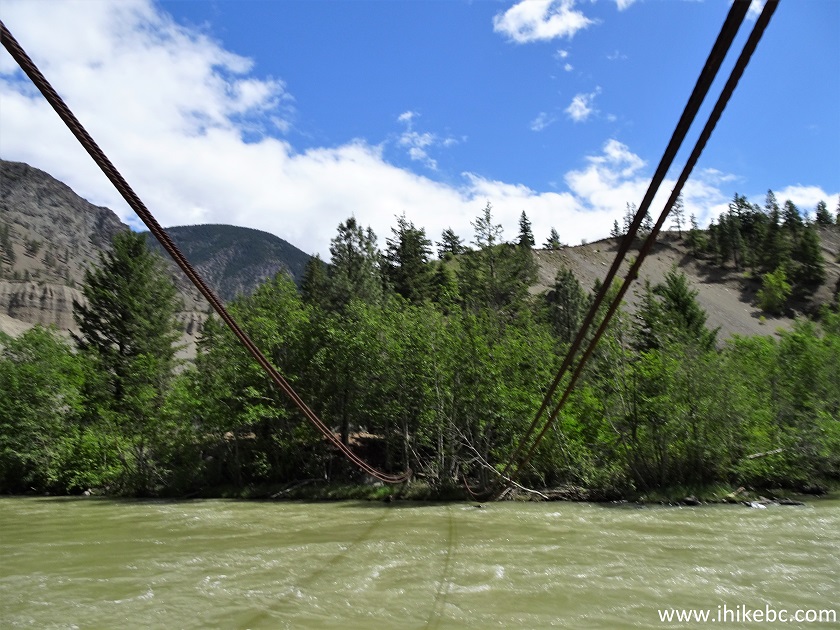
Busted bridge above Bridge River British Columbia Canada
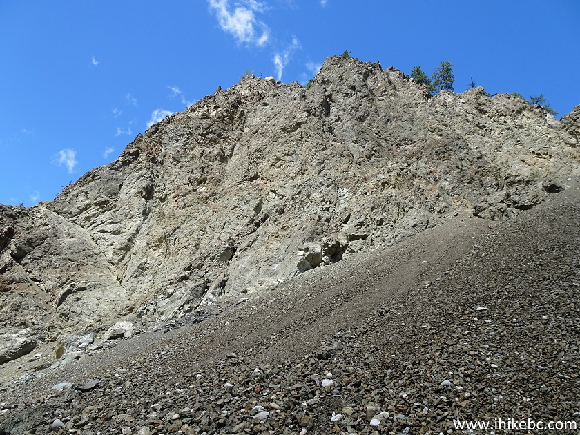
17. Right after the busted bridge, very steep terrain presents a real risk of sliding into the river.
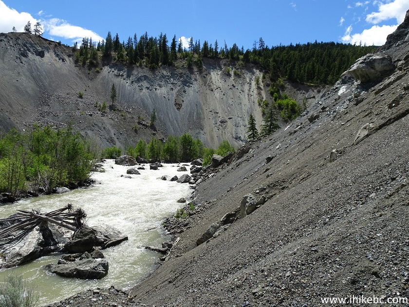
Horseshoe Bend Trail
18. If you would manage to get through, a view of this neat rock with a tree is your reward.
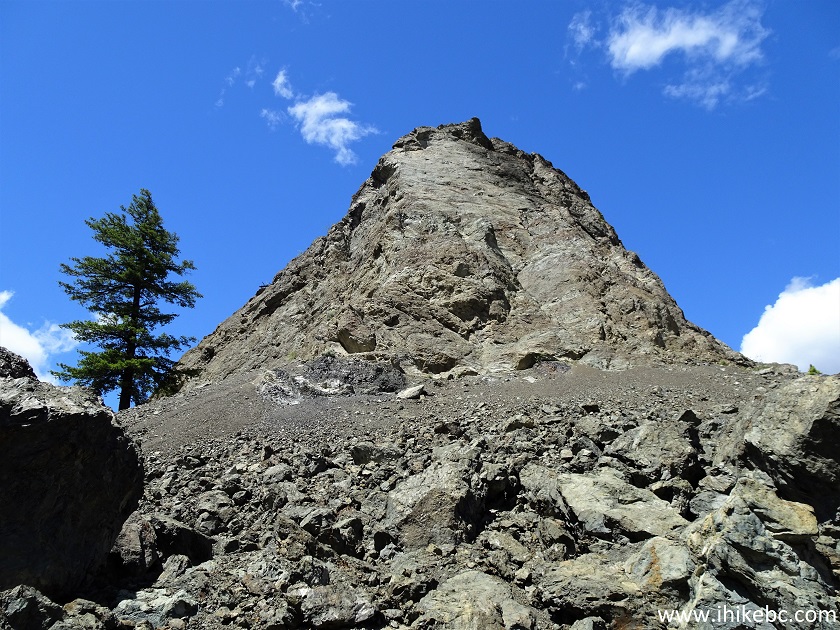
View from Horseshoe Bend Trail by Lillooet British Columbia
Here is our video of the views from this location.
More ihikebc videos are on our YouTube Channel.
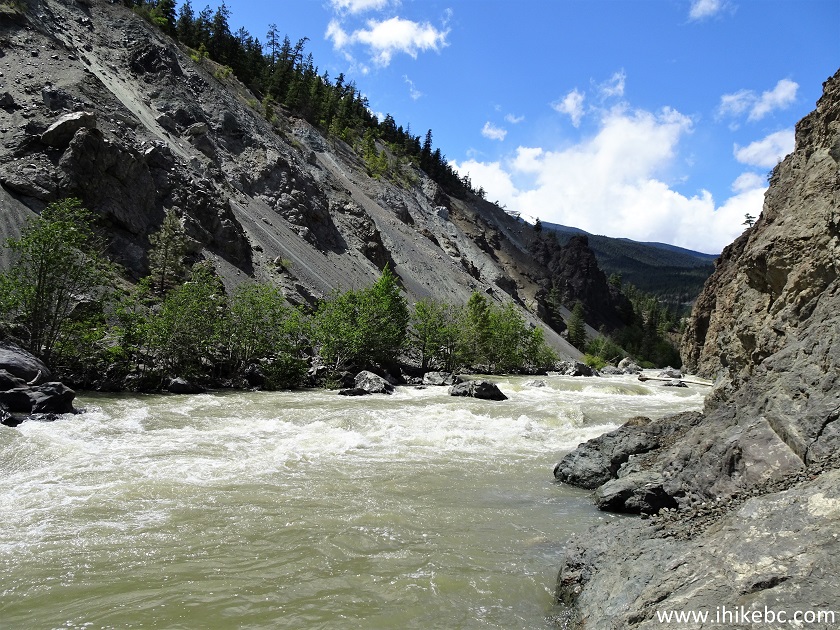
19. Moving on, we are at 1.65 km of the trail here.
Bridge River seen from Horseshoe Bend Trail near Lillooet BC
20. Looking right.
Horseshoe Bend Hike View
21. Then, at 1.80 km, the canyon wall becomes so steep that there is no way to go any further without stepping into the river. Coordinates: N 50⁰51.641' W 122⁰09.834'. Elevation: 425 meters (93 meters elevation loss from the start of the trail).
Bridge River Province of British Columbia
Horseshoe Bend Trail is a neat short hike, featuring a cool blue-coloured pond, an interesting busted bridge, and an impressive large rock. Recommended.


|
 |
Other Trips in Lillooet Area:
|
|
|
|
|
McGillivray
Creek Trail |
|
Other Trips:


![]()


![]()
![]()
![]()
ihikebc.com Trip 212 - Horseshoe Bend Trail Hike (Near Lillooet BC)