![]()
![]()
![]()

Trip 123 - May 22, 2017 (Monday)
Murray Canyon Overlook Trail Hike
Near Tumbler Ridge BC
Trailhead
Location: Northeastern British Columbia. Near Hwy 52 about 84 km
South of Dawson Creek, and 34 km North of Tumbler Ridge.
Liked: Easy access from Highway 52, pleasant walk through the forest, canyon view, Murray River view.
Of note: Low-clearance vehicles might have difficulties getting to the parking area. Hiking poles and boots are recommended.
Northern BC Backroad Mapbook (3rd edition) Trailhead Coordinates: Page 58 (Groundbirch) D7-E7.
We have opened the 2017 hiking season with two easy and one moderately challenging hikes near Tumbler Ridge. This trip report describes Murray Canyon Overlook hike, and the next two cover Quality Falls and Quality Canyon hikes. Tepee Falls hike is also nearby, so it's possible to do all these four hikes in one day.
1. Murray Canyon Overlook Trail leads to a good view of Murray Canyon, which contains Murray River. To get to the trailhead, get off Highway 52 at coordinates N 55⁰17.700' W 120⁰53.873'. Here we are Southbound on BC Highway 52, with a sign indicating 1.5 km to the trailhead.
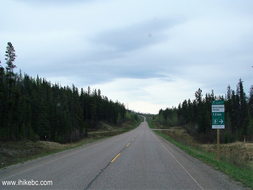
BC Highway 52 near Tumbler Ridge
2. Turn right 300 meters past the sign.
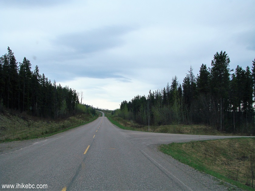
BC Highway 52 at Murray Canyon Overlook Trail access road turnoff
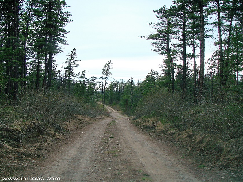
3. The view of the dirt road right after the turnoff. The road is quite smooth until the next turn.
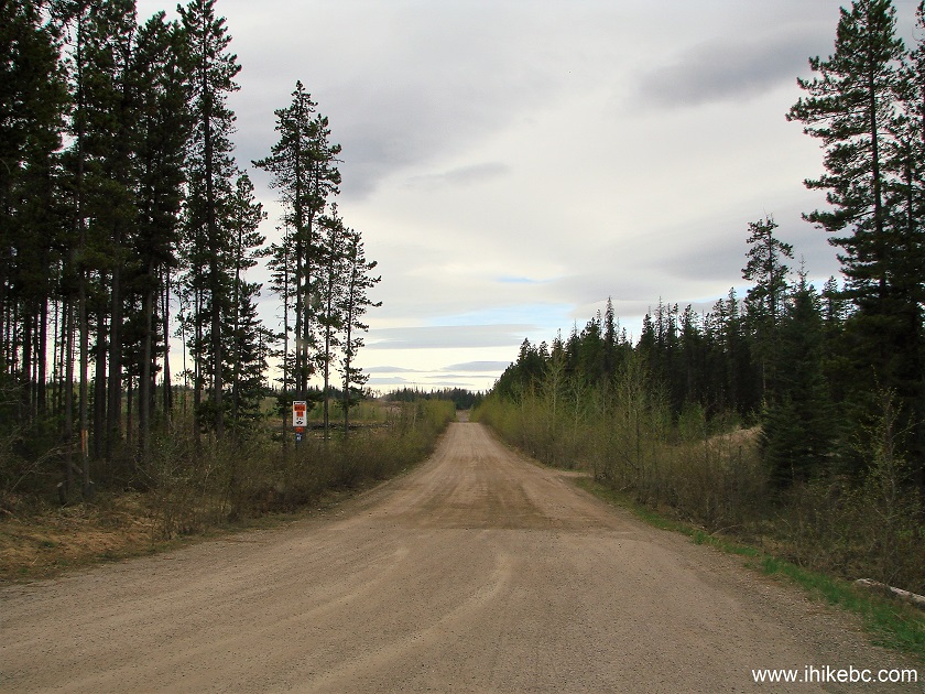
Murray Canyon Overlook Trail access road near Tumbler Ridge BC Canada
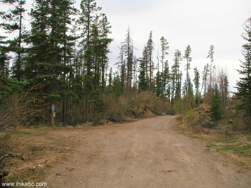
4. Turn right at the fork 900 meters later. If you have a low-clearance vehicle, it would be a good idea to park here. The trailhead is only 300 meters away, and the final stretch features several deep ruts which might prove problematic.
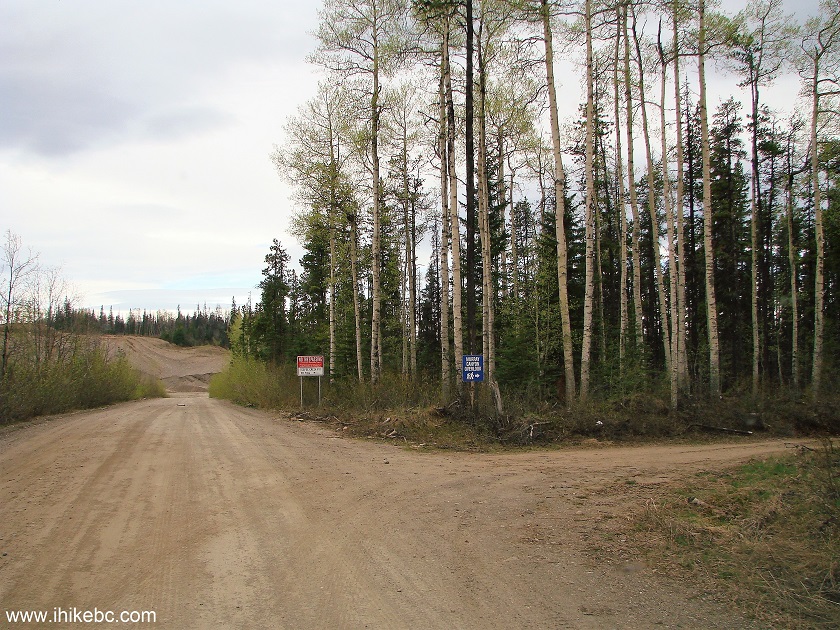
Access road to Murray Canyon Overlook Trail near Tumbler Ridge British
Columbia
5. The final stretch.
Murray Canyon Overlook Trail access road near Tumbler Ridge BC Canada
6. 1.2 kilometers after the Highway 52 turnoff, we are at the trailhead. Plenty of parking here, and there is a large camping area a few hundred meters down the road. Coordinates: N 55⁰17.360' W 120⁰54.739'. Elevation: 955 meters.
Parking area for Murray Canyon Overlook Trail near Tumbler Ridge British
Columbia
7. The trailhead is located on the left side.
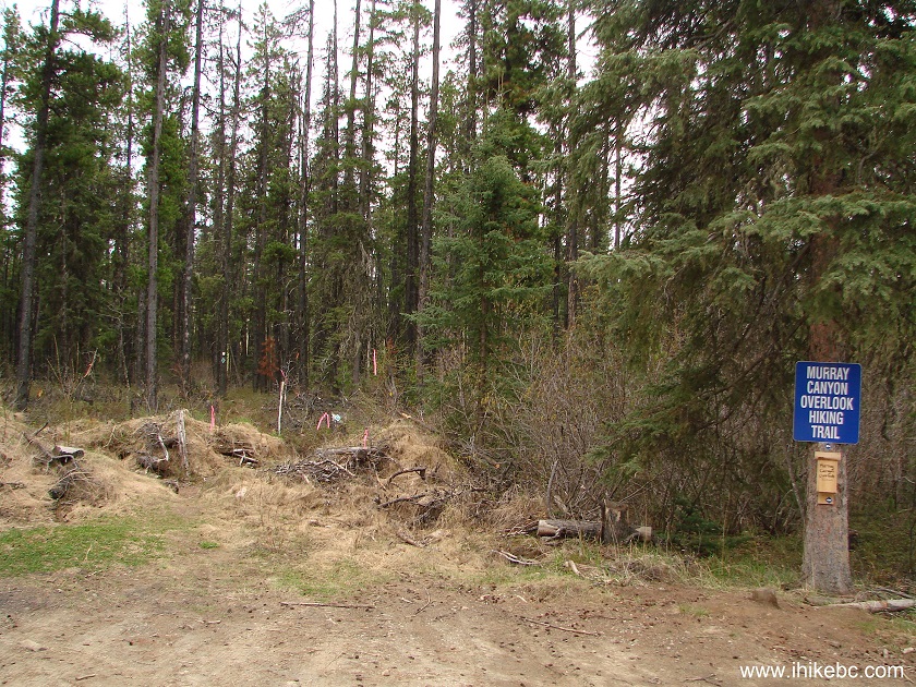
Trailhead for Murray Canyon Overlook Trail near Tumbler Ridge BC
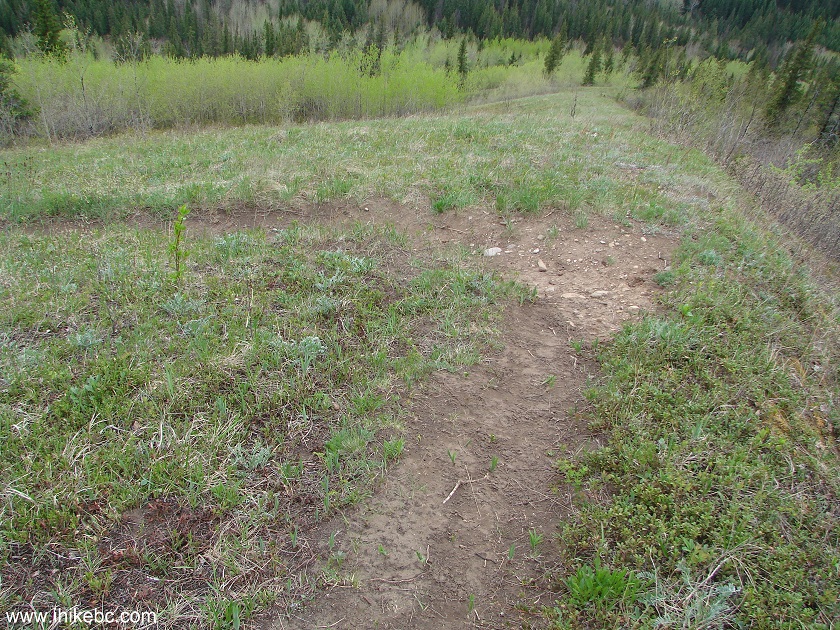
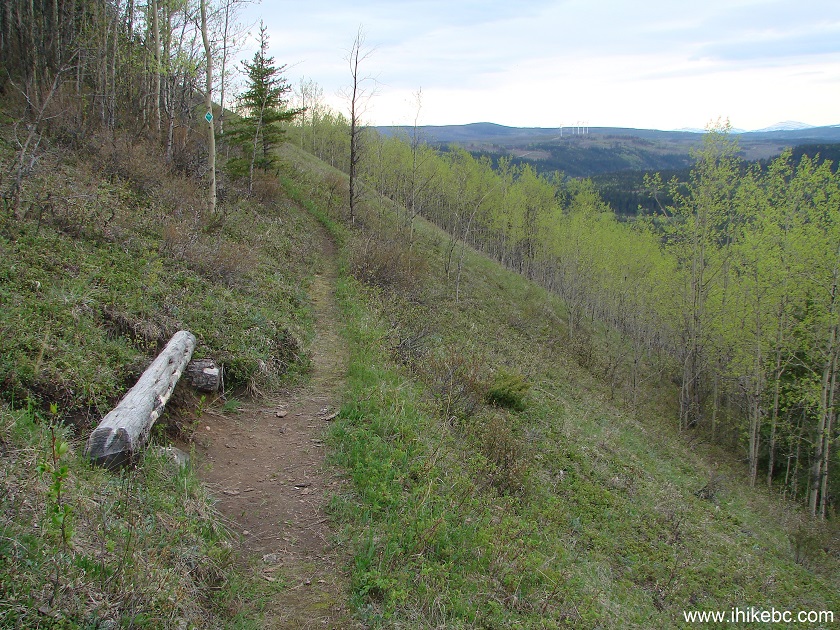
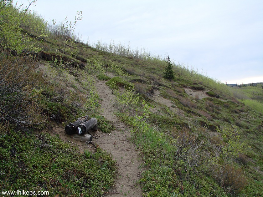
8. This trail is quite easy. At first, the path goes through a forest.

Tumbler Ridge Trail -
Murray Canyon Overlook Trail BC Canada
9. Twenty minutes later, the trail emerges from the forest, and the canyon is straight ahead.
BC Hiking -
Murray Canyon Overlook Trail near Tumbler Ridge BC
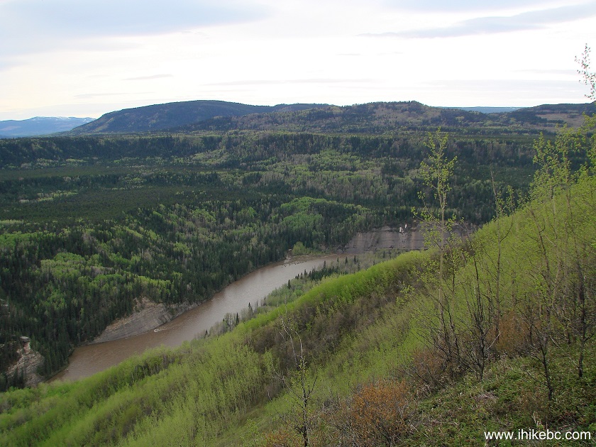
10. Here it is.
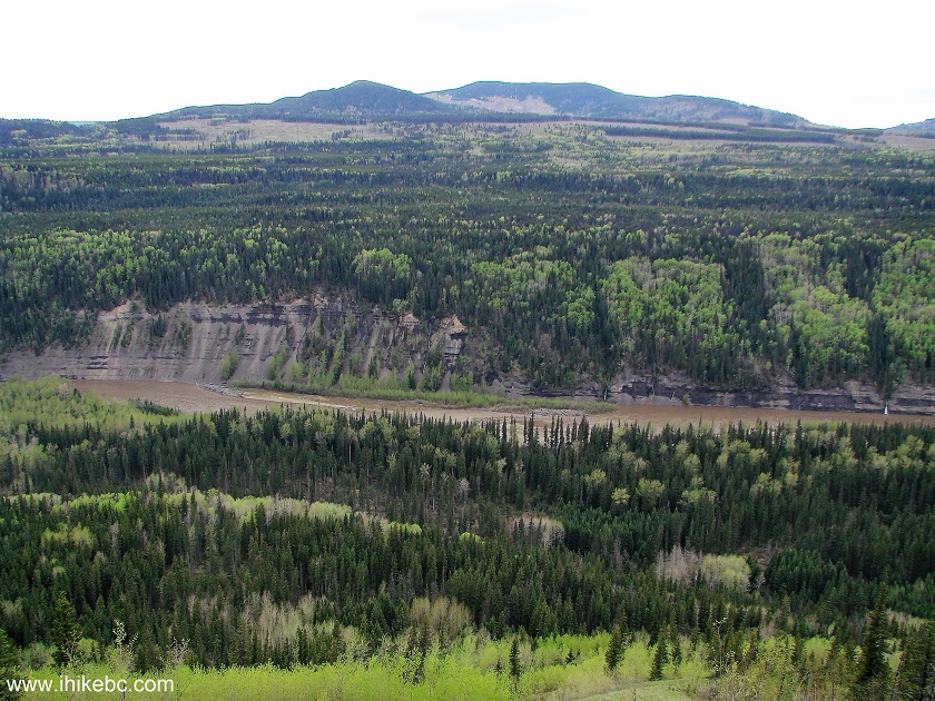
Murray Canyon seen from Murray Canyon Overlook Trail near Tumbler Ridge
British Columbia Canada
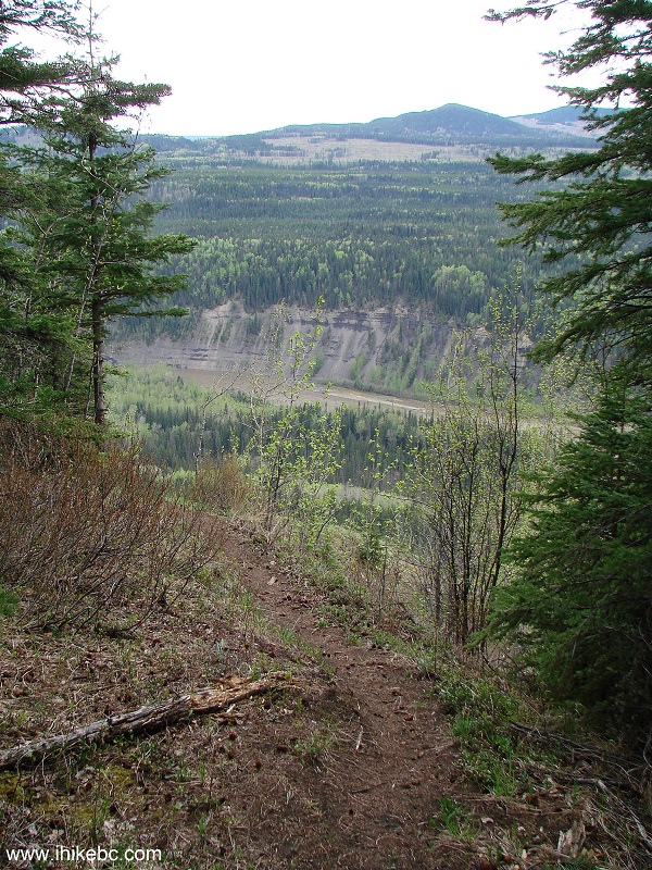
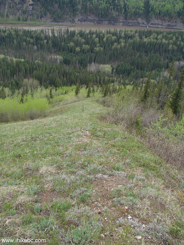
11. The path then descends somewhat steeply, makes a sharp left turn, and proceeds along the canyon.
Murray Canyon Overlook Trail - Tumbler Ridge Hike
12. Watch your step, as it is, indeed, quite steep below the path.
Canada Hiking
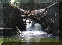
13. Murray River is flowing at the bottom of the canyon.
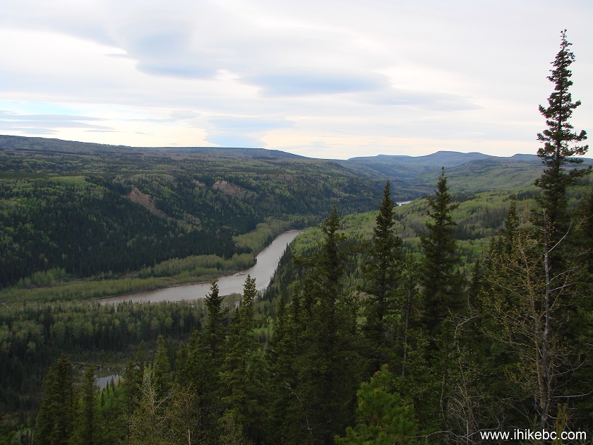
Murray River seen from Murray Canyon Overlook Trail by Tumbler Ridge BC
Canada
14. There are several benches along the path.
Murray Canyon Overlook Trail - Hiking in British Columbia
15. You can also see wind turbines far ahead. Substantial zoom used.
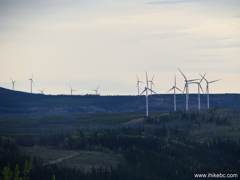
Wind Turbines near Tumbler Ridge BC
16. One more bench. It was quiet, with good views and lots of green.
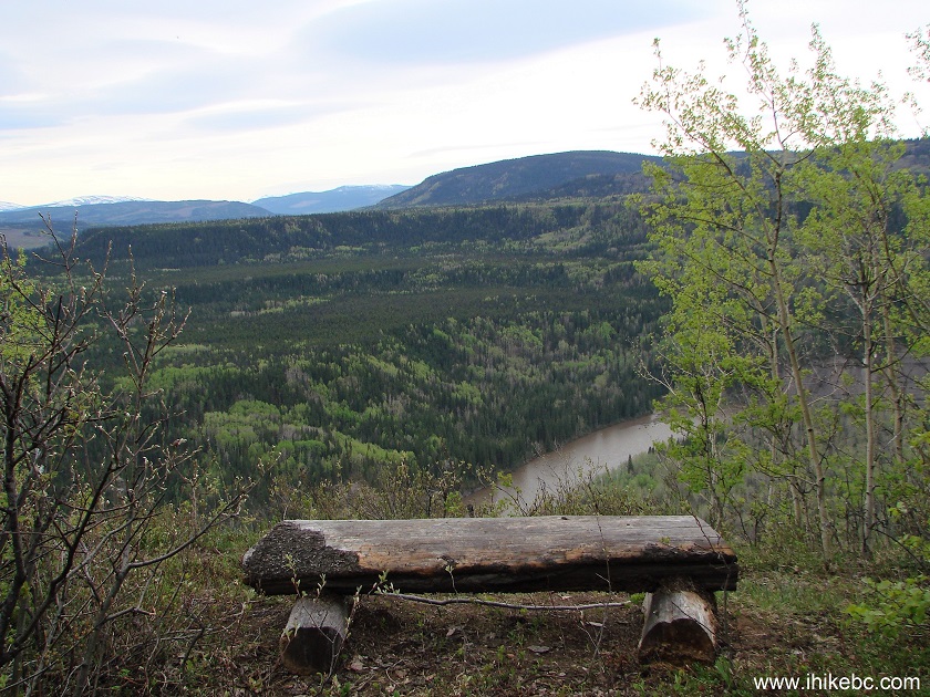
Hike in Tumbler Ridge Area
17. Murray River.
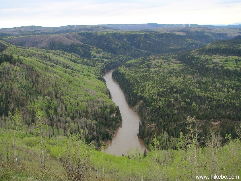
Murray River near Tumbler Ridge BC Canada Hiking
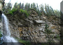
18. Looking right.
Murray Canyon by Tumbler Ridge British Columbia
19. The third bench is located at the end of the trail. The above two photos were taken from near this bench. Coordinates: N 55⁰16.925' W 120⁰55.139'. Elevation: 1,004 meters.
Hike in British Columbia
20. We now have a Garmin GPSMAP 64s, and here are the hiking stats for this trail. Trip odometer (3.87km) = total distance traveled during this hike (round trip), Odometer = total distance ever traveled with this GPS turned on.

Garmin GPSMAP 64s
Murray Canyon Overlook Trail is an easy hike which leads to several good views.


|
 |
Other Trips in Tumbler Ridge BC Area:
|
|
|
|
|
|
|
|
|
|
|
|
|
|
|
|
|
Bergeron
Cliffs Hike
|
 |
Stone Corral Trail  |
|
Windfall Lake Trail
|
 |
Mount Clifford Trail  |
|
Bootski Lake Trail
|
|
Quality Canyon Trail  |


Other Trips:


![]()


![]()
![]()
![]()
ihikebc.com Trip 123 - Murray Canyon Overlook Trail (near Tumbler Ridge BC)