![]()
![]()
![]()

Trip 085 - July 1, 2015 (Wednesday)
Happy Birthday, Canada!
Tepee Falls Trail Hike
Near Tumbler Ridge BC
Location: Northeastern British Columbia between Dawson Creek and
Tumbler Ridge. Approximately 33 kilometers North of Tumbler Ridge on
Highway 52.
Liked: The waterfall, easy trailhead access off Hwy 52, fairly easy and short path.
Of note: No cell phone signal, some logged out areas by the trail, steep unbarricaded drop-offs near the waterfall, the trail is slightly overgrown in parts, which might make your feet wet in the morning or after the rain. Hiking boots and poles are recommended.
Northern BC Backroad Mapbook (3rd edition) Coordinates: Page 58 (Groundbirch) D6.
>>> British Columbia Waterfalls Visits.
Follow @ihikebc Tweet
Tepee Falls trailhead starts right off Highway 52, and goes for three kilometers until it reaches the waterfall and the view of Murray River. It's a good short hike, but, if you go in the morning when the dew is still on the grass, your feet are going to get wet without waterproof boots.
1. We are driving South on Highway 52 between Dawson Creek and Tumbler Ridge. A sign shows where to park for the Tepee Falls Trail.
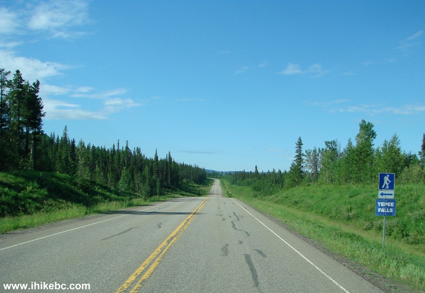
Highway 52 British Columbia Canada
2. Here is that small parking area.
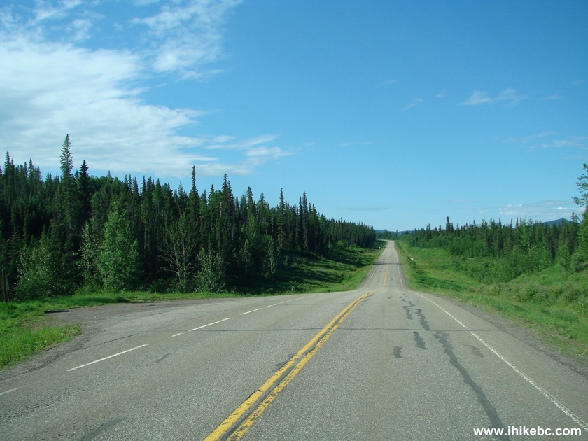
Tepee Falls Parking Area at Highway 52
3. An information board at the parking area shows the map of the trail.
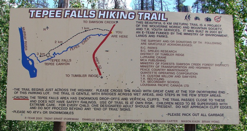
Tepee Falls Trail Map
4. The start of Tepee Falls Trail across the highway.
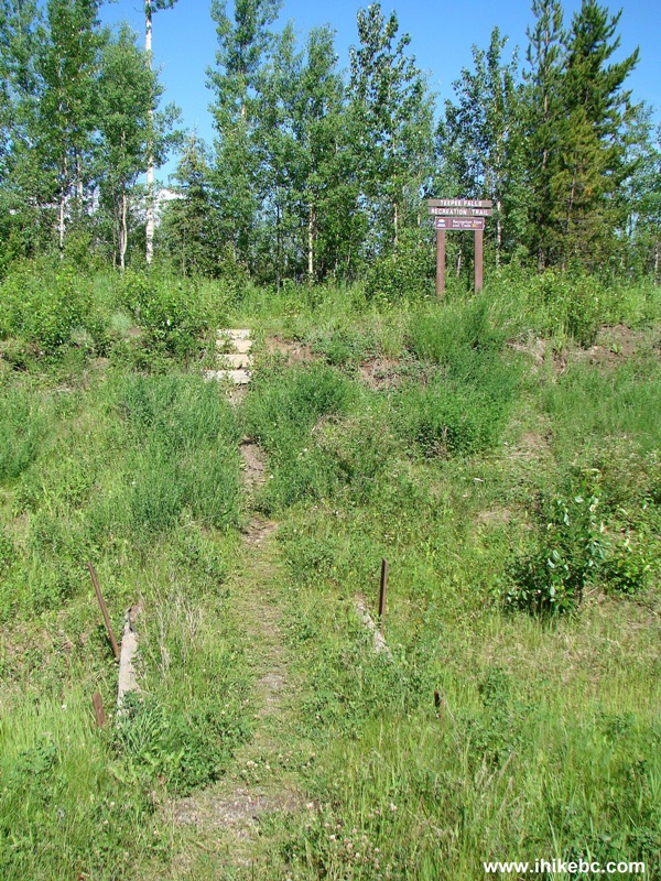
Tepee Falls Trail Start
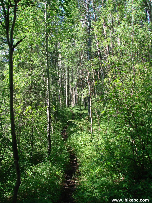
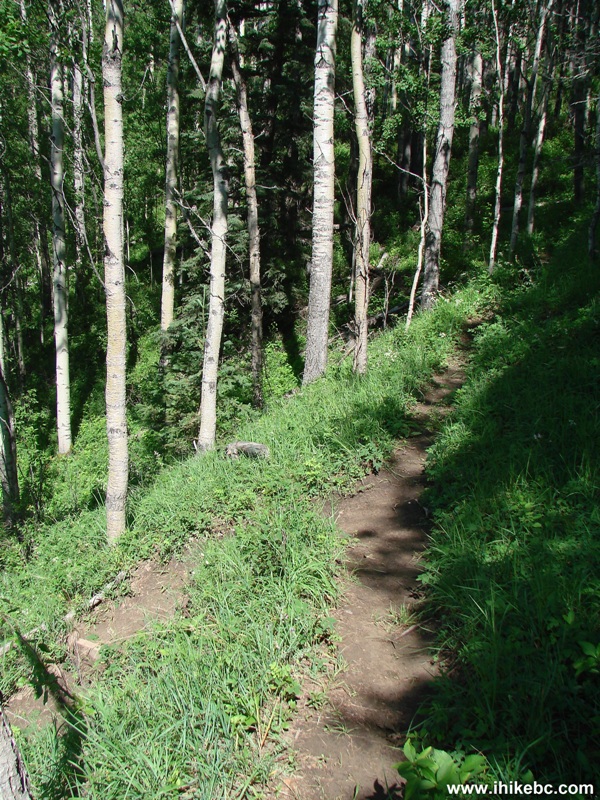
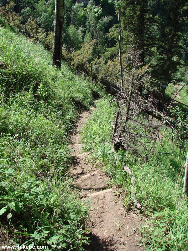
5. At first, the path goes through some young trees.
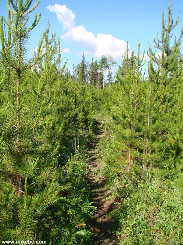
Tumbler Ridge Hiking -
Tepee Falls Trail BC Canada
6. Several bridges help to cross the wettest areas.
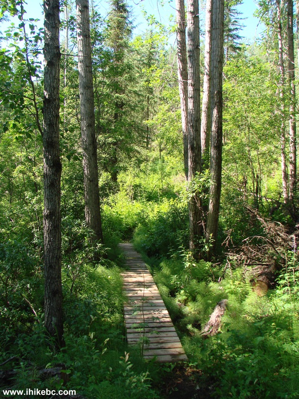
Hiking in Tumbler Ridge Area -
Bridge on Tepee Falls Trail British Columbia
7. Logging has been done by the trail in recent years.
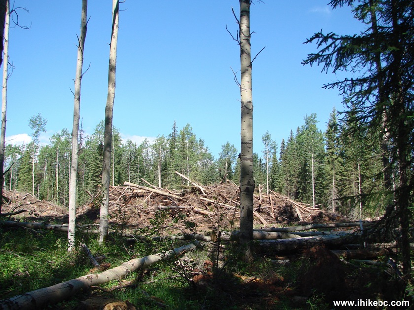
Logging by Tepee Falls Trail BC Canada
8. Leaning on a friend.
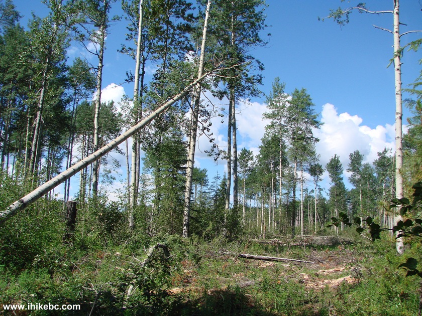
View From Tepee Falls Trail British Columbia
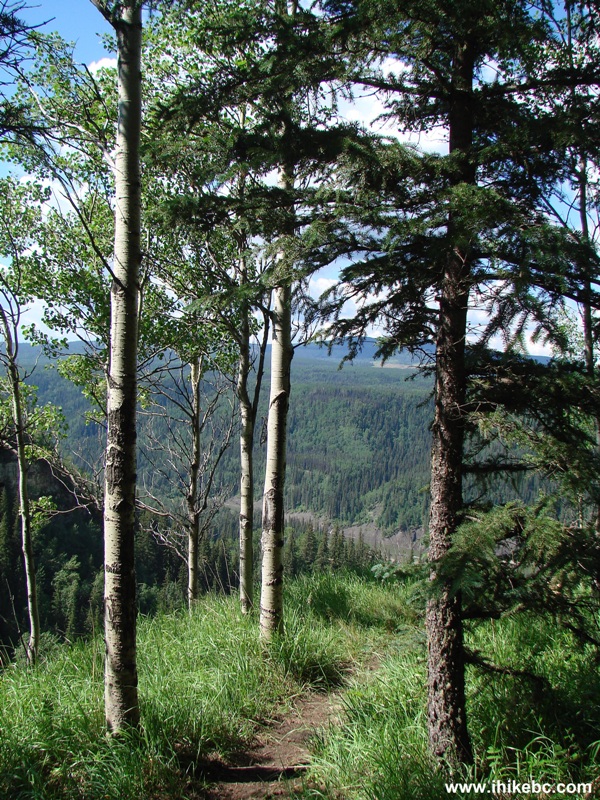
9. The path then goes through a mature forest.
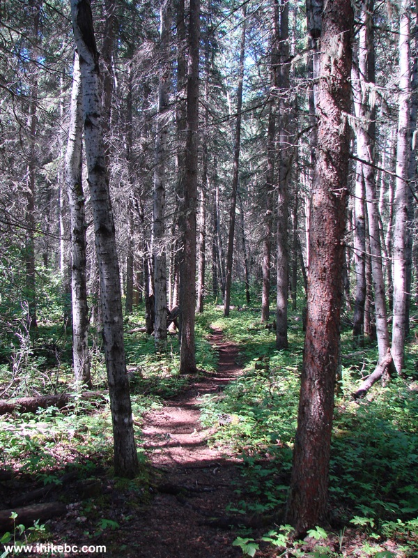
Photo of Tepee Falls - Hiking in British Columbia Canada
10. And, soon, it's time to get your feet wet again. Rain pants kept the legs dry, but the water-resistant hiking boots could not do the same for the feet. Fortunately, it's a short trail, so having wet feet aren't likely to have a substantial impact.
BC Hiking -
Tepee Falls Trail
11. Closer to the end of the trail, a warning arrives to watch out.
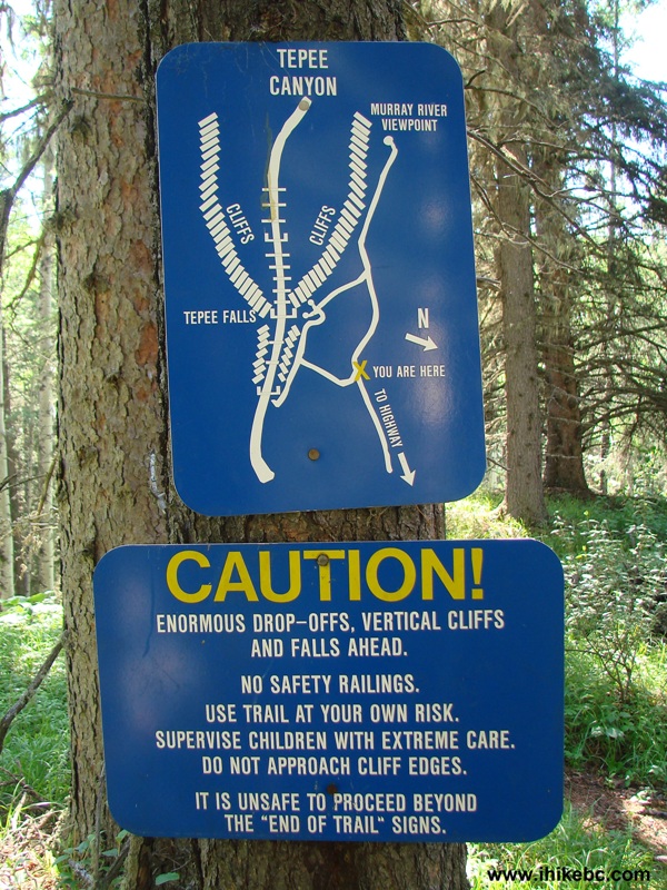
Tepee Falls End of Trail Map
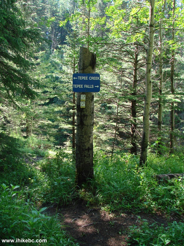
12. Soon, there is a split, with Tepee Creek viewing to the left, and Tepee Falls Trail to the right.
Tepee Falls Trail BC Canada
13. We went left, and checked out Tepee Creek.
Tepee Creek British Columbia
14. Now going towards the waterfall.
Hike in Tumbler Ridge Area -
Tepee Falls Trail British Columbia
15. The first Tepee Falls view arrives a few hundred meters before the official viewing area. This first viewpoint is quite dangerous, as there are no railings at all, and the ground is quite soft there. The view is not as good as from the official viewing area either.
Tepee Falls BC Canada
Here is Our Video of Tepee Falls Seen From the Path:
16. So, we keep on moving. To go straight here would lead to Murray River viewpoint, and turning left leads to the Tepee Falls viewpoint.
Path to Tepee Falls British Columbia
17. We turned left, and encountered the steepest part of the trail. Fortunately, there are steps to assist with descent.
Descent to Tepee Falls Observation Area
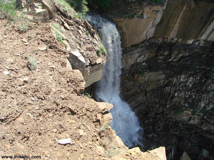
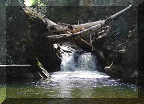
18. The end of trail sign. It turns out this waterfall completely freezes in the winter, allowing ice climbers to do their thing.
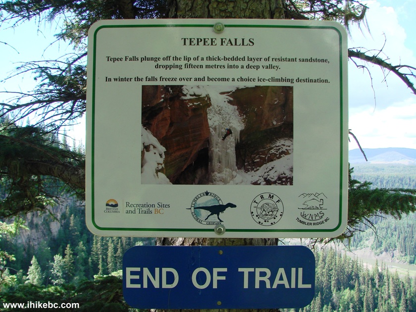
Tepee Falls End of Trail
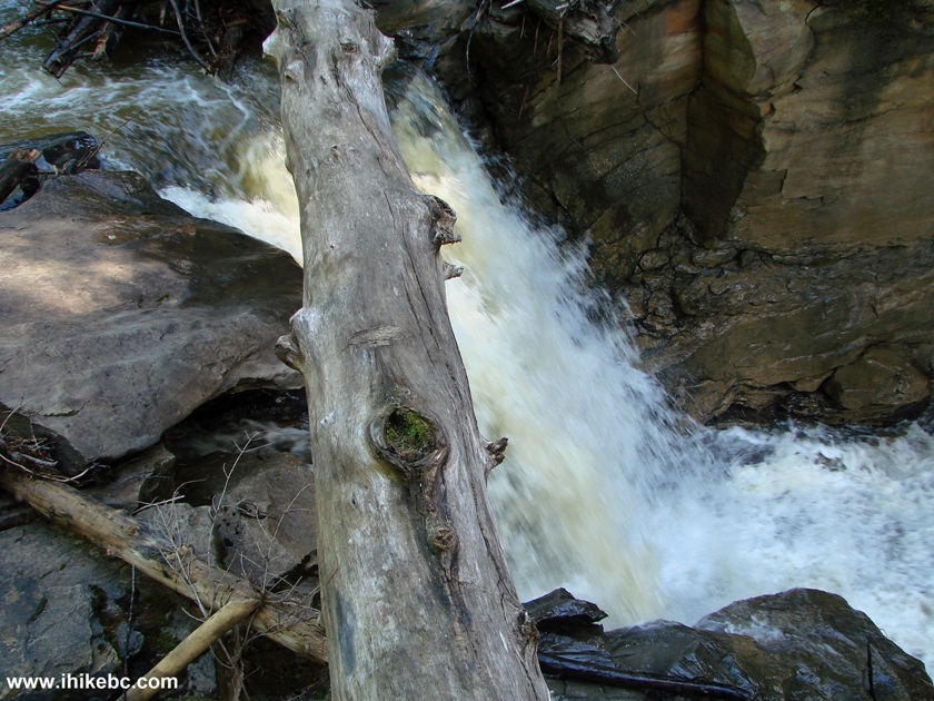
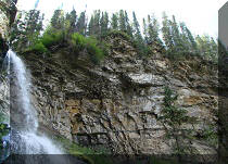
19. There are barricades at the official viewpoint to keep children at bay, but, for the best view, you have to go beyond the barricades - watch your step, if you would choose to do so, as it's quite dangerous out there.
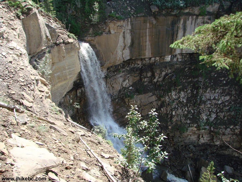
Tepee Falls British Columbia
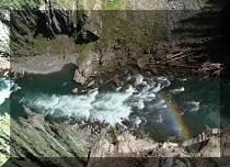
20. This might be better.
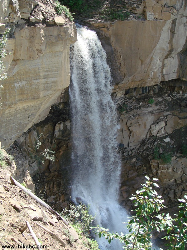
Tepee Falls
Here is Our Video of Tepee Falls From Observation Area:
More ihikebc videos are on our YouTube Channel.
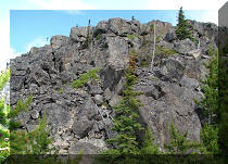
21. A fine cliff view nearby.
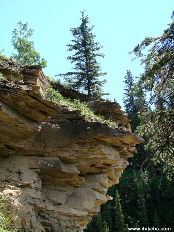
Cliff View by Tepee Falls British Columbia
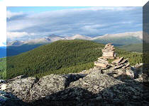
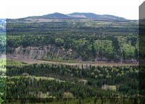
22. We then checked out Murray River viewpoint.
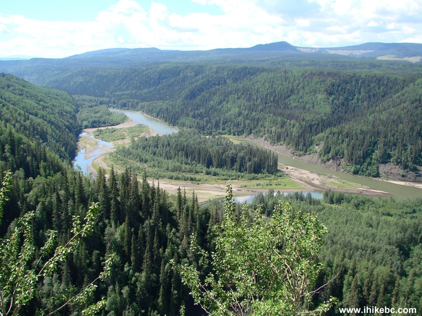
Murray River Viewpoint
23. At the viewpoint, there is a rough path to the bottom of Tepee Falls.
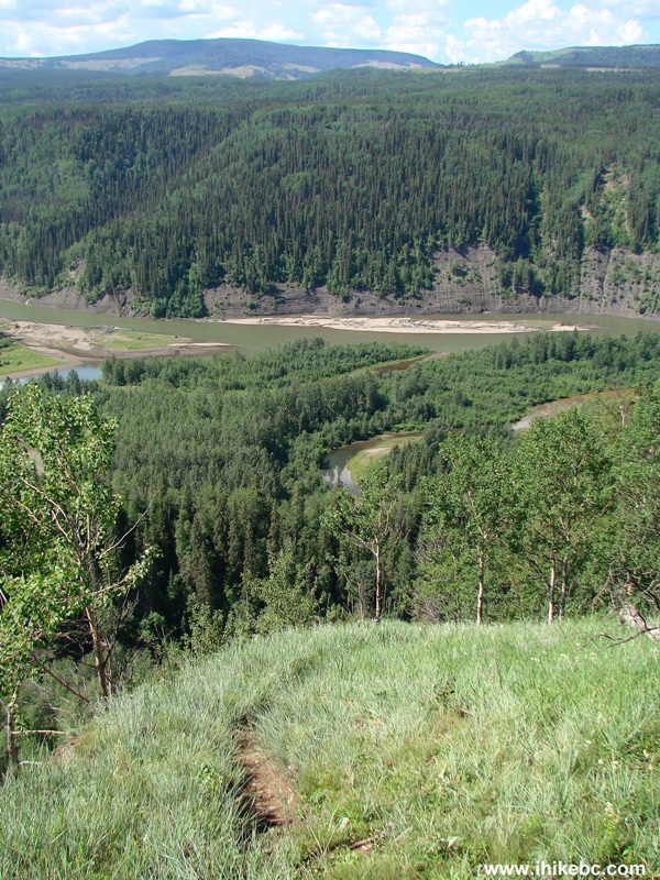
Path to the Bottom of Tepee Falls
Unless you decide to go to the bottom of the waterfall, the round trip to the viewpoints and back should take just over two hours. This is an easy hike which leads to neat views - just watch out for those unbarricaded drop-offs.


|
 |
Other Trips in Tumbler Ridge BC Area:
|
|
|
|
|
|
|
|
|
|
|
|
|
|
|
|
|
Monkman
Falls Hike
|
|
Windfall Lake Trail  |
|
Cowmoose Mtn Trail
|
|
Bootski Lake Trail  |
|
Murray Canyon
Overlook
|
|
Quality Canyon Trail  |


![]()
![]()
![]()
ihikebc.com Trip 085 - Tepee Falls Trail Hike (near Tumbler Ridge BC)