![]()
![]()
![]()

Trip 134 - May 21, 2018 (Monday)
Bullion Pit Mine Canyon Trail Hike
Near Likely BC
Distance From Vancouver to Bullion Pit Mine Rest Area: (via Highways 1 East,
97 North, and Likely Road): approximately 615 kilometers.
Liked: Canyon views, old busted bus.
Of note: The trail is not marked and is "unofficial" at best. The ground is very uneven - hiking poles and boots are highly recommended.
Cariboo Chilcotin Coast Backroad Mapbook (2015 edition) Coordinates for Bullion Pit Mine Approximate Trail Location: Page 43 (Quesnel Forks) G6.
According to Backroad Mapbook, Bullion Pit Mine was in operation between 1870s and until 1942. There is now a large canyon remaining, with very few old pieces of mining equipment still around, as well as an ancient busted bus, which may or may not have been a part of the mine operations. A Bullion Pit Mine Rest Area is located on Likely Road, and features several pieces of machinery, a small shack with some old tools, as well as an information board describing the history of the mine. There is also a short (500 meters) walking trail along the old water delivery canal, and an observation platform for "penstock" - a huge long wooden tray of sorts, used to control water delivery to the mine. But we came here for a canyon trail. There are no posted signs to the trail, and the printed edition of Backroad Mapbook does not show a trail of any kind. However, Backroad Mapbook software in our GPS clearly showed a presence of a trail named..."trail", so we named the trail ourselves. So, here it is, Bullion Pit Mine Canyon Trail hike report.
1. Here is the turnoff from Likely Road to Bullion Pit Mine Rest Area. Check out the previous trip report (Quesnel Forks Historic Site) for directions on how to get up to this point from BC Highway 97 near Williams Lake. This is the same photo as photo #6 of that trip report.
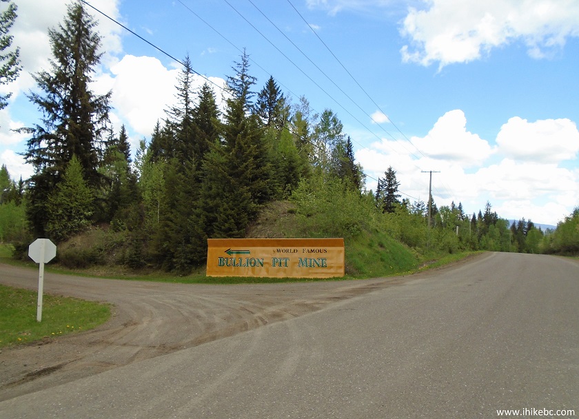
Likely Road at Bullion Pit Mine Rest Area Turnoff
2. Entrance to the rest area. Two pieces of mining machinery on the right side. Just past these two pieces, and along the trees on the right side, is the path to the trail.
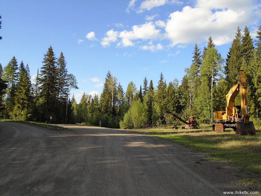
Bullion Pit Rest Area near Likely British Columbia Canada
3. Looking more to the left. That's where we went at first. The information board seen far ahead has interesting facts about the mine. By the way, we searched for a long time, but could not find "Bullion-View Point Trail" off Sharpe Rd (about 1.2 km earlier off Likely Rd) as marked on the information board. Maybe it's there, but the trail we ended up hiking had really good canyon views, anyway.
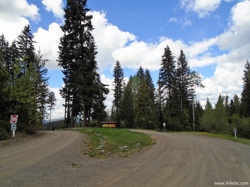
Bullion Pit Rest Area near Likely Province of British Columbia Canada
4. What a neat view right by the information board!
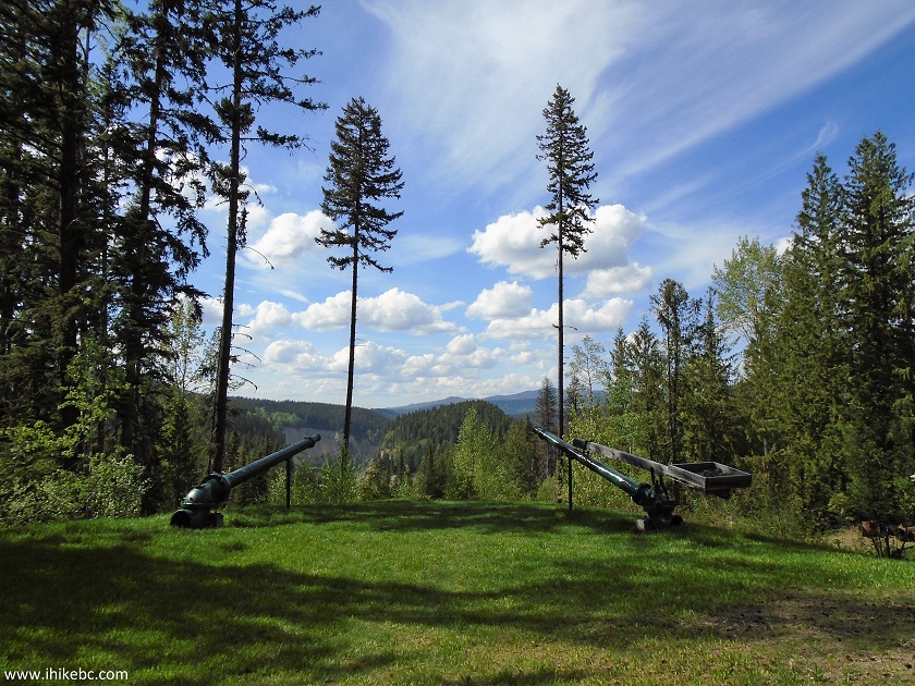
View from Bullion Pit Mine Rest Area
5. To the left of the board, these stairs lead to a shack with some old equipment.
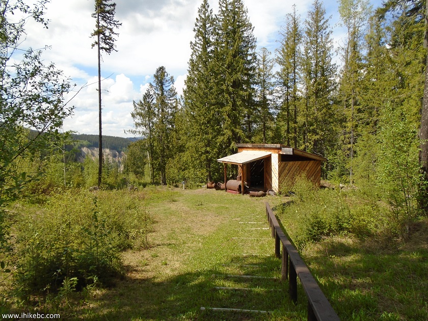
Shack at the Bullion Pit Mine Rest Area near Likely BC Canada
6. Now we are en route to the trail. This is the same sign as seen in the far middle of photo #2.
Bullion Pit Mine Rest Area near Likely in the Province of British Columbia
Canada
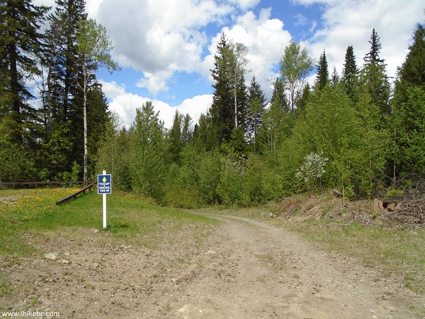
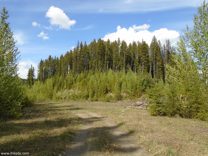
7. A hundred meters later, turning right would lead to the observation platform and a 500-meter-long walking trail, while straight/left is the beginning of Bullion Pit Mine Canyon Trail.

Likely Hiking British Columbia
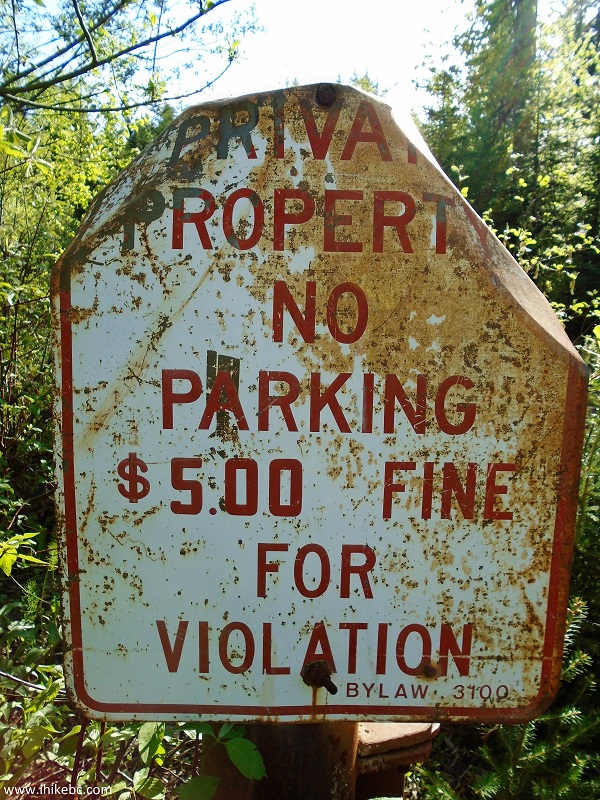
8. Within a minute, we are at an old gate, with two interesting messages.
Coordinates: N 52⁰37.237' W 121⁰37.647'. Elevation:
850 meters.
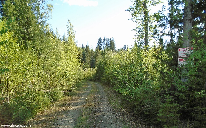
Bullion Pit Mine Canyon Trailhead near Likely BC Canada
9. A message to the right warns against trespassing in an active mining area. Very amusing, considering the mine closed over 75 years ago, and there is almost nothing left of it.
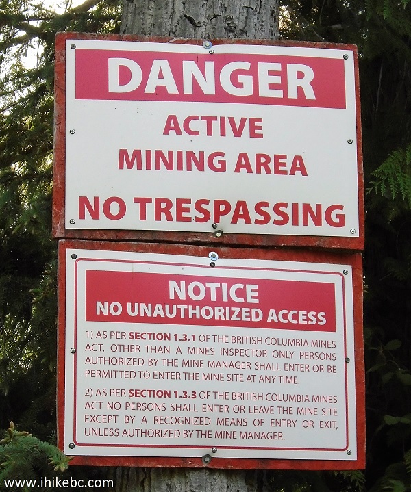
Active Mining Area No Trespassing Sign
10. And, to the left, a five dollar fine awaits anyone parking by the gate.
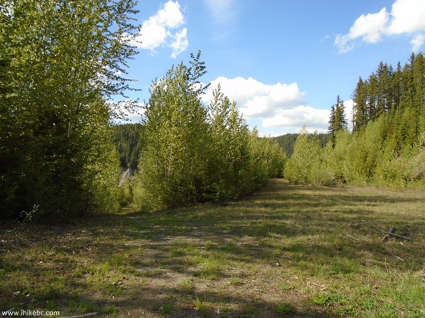
11. Walk down for a few minutes, and then there is this opening. To the right is the busted bus, to the left is the continuation of the trail, and, straight ahead, through some bushes, is a pretty good canyon view from above.
Bullion Pit Mine Canyon Trail near Likely BC Canada
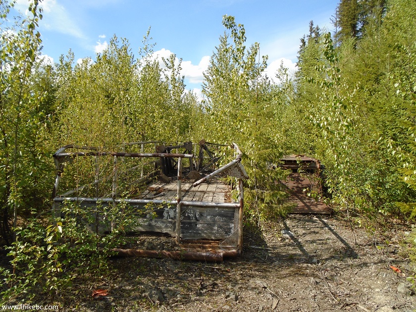
12. We start with the bus on the right side. It's a GMC 9500.
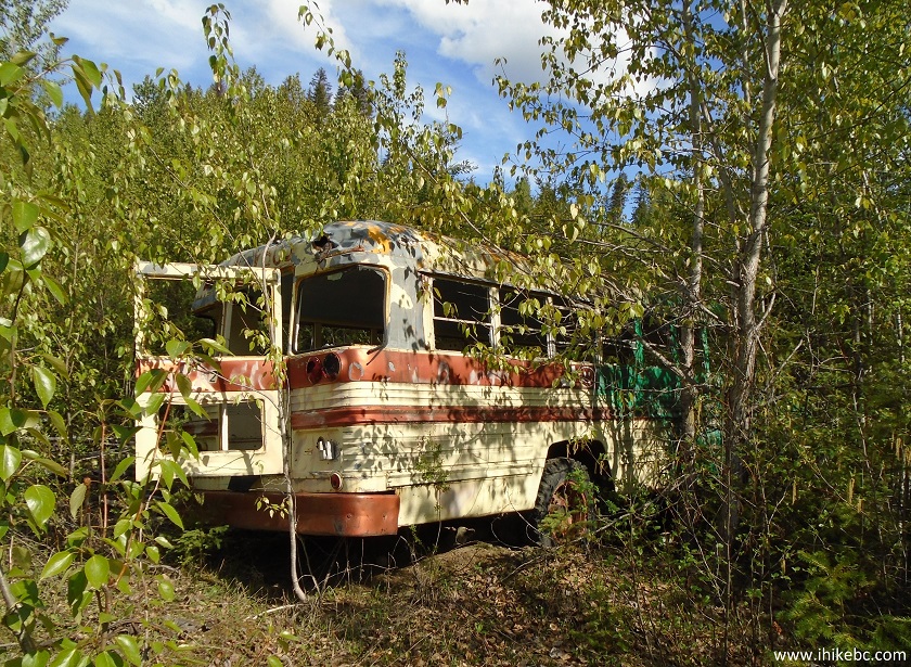
GMC 9500 Busted Bus by Bullion Pit Mine Canyon Trail near Likely British
Columbia
13. Let's go for a ride.
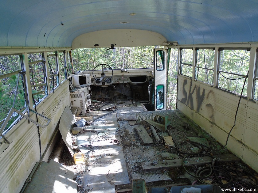
Inside GMC 9500 Bus
14. Going forward though the opening, we are at a point where the trail is to the left, and, a bit further straight ahead, is a canyon view from above.
Bullion Pit Mine Canyon Trail by Likely BC Canada
15. Also nearby, we found some remnants of the mining operation (perhaps?).
Hike in Likely BC Area
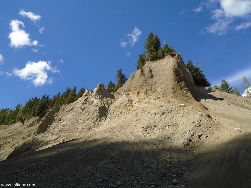
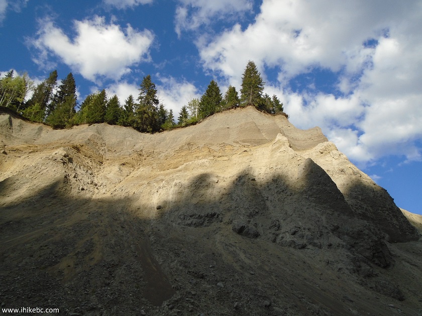
16. And here is the canyon view from above. Be careful, as there are some steep drop-offs there.
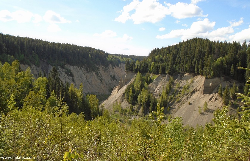
Bullion Pit Mine Canyon View near Likely BC Canada
17. Now descending down the path which started on the left side of the large opening first seen in photo #11.
Bullion Pit Mine Canyon Trail near Likely BC Canada
18. In a few minutes, we are near a pond of sorts, and need to hike around it on the right side, next to the canyon wall.
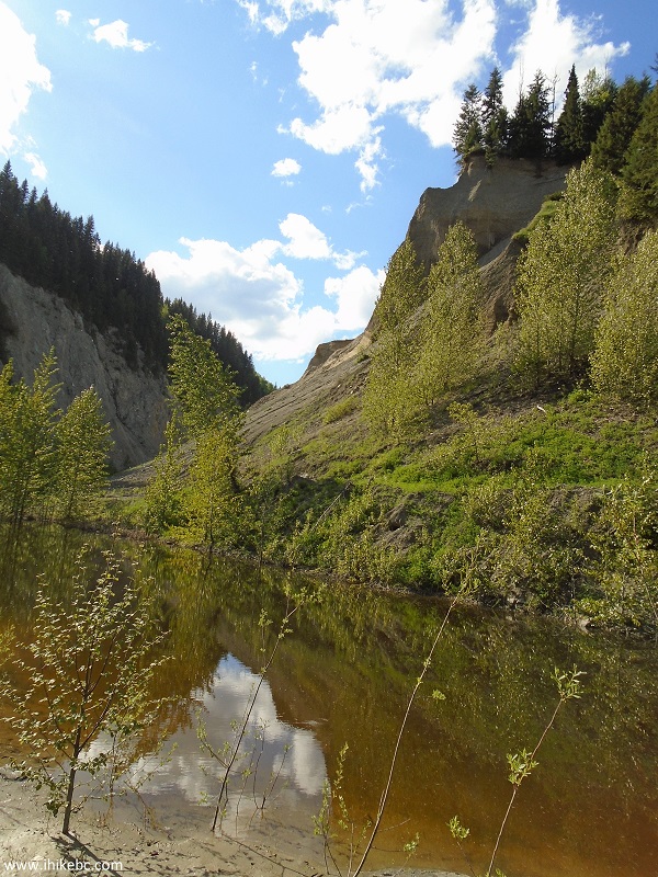
Bullion Pit Mine Canyon Trail near Likely BC Canada
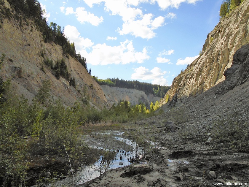
19. Neat canyon views start appearing around here too.
Canyon View from Bullion Pit Mine Canyon Trail near Likely British Columbia
Canada
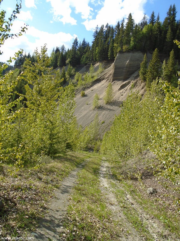
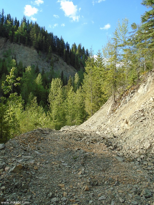
20. However, the ground becomes very uneven, and hiking poles and boots would be of much help going forward.
Bullion Pit Mine Canyon Trail near Likely British Columbia Canada
21. The views are impressive, though, especially at this spot, and, especially, when the sun is shining at the canyon wall.
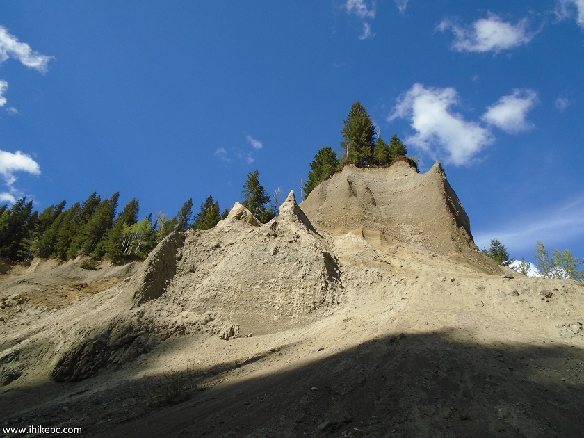
View from Bullion Pit Mine Canyon Trail near Likely BC Canada
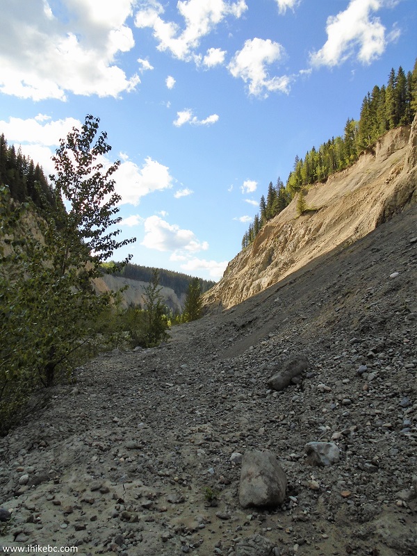
22. Continuing down the unmarked trail.
Bullion Pit Mine Canyon Trail near Likely British Columbia Canada
23. It took just over an hour to reach the end of the trail from the gate. Coordinates: N 52⁰37.851' W 121⁰38.588'. Elevation: 728 meters (a loss of 122 meters from the start of the trail near the gate).
Bullion Pit Mine Trail - Likely Trail
24. A fine view on the way back.
View from Bullion Pit Mine Trail near Likely BC Canada
The whole trail is about 3 kilometers long, and it took us about 2 hours round-trip, with all the numerous stops and exploration. If you are interested in checking out an old busted bus and/or observing good canyon views, Bullion Pit Canyon is the right place to visit.


|
 |
Other Trips in Likely BC Area:
|
Browntop Mountain
Trail
|
|


![]()
![]()
![]()
ihikebc.com Trip 134 - Bullion Pit Mine Canyon Trail Hike (Near Likely BC)