![]()
![]()
![]()

Trip 072 - September 9, 2014 (Tuesday)
Mamquam Lake Trail Hike
Garibaldi Provincial Park (Diamond Head Entrance)
Page 1 of 3
Distance From Vancouver to the Trailhead:
83 kilometers.
Drive for 65 kilometers on Highway 99 North (Sea-to-Sky) to Squamish.
Follow signs to Garibaldi–Diamond Head by turning right from Highway
99 onto Mamquam Rd 3.5 km after Squamish Adventure Centre (which itself
is located on the right side of the road several hundred meters past the
intersection of Highway 99 with Cleveland Avenue), then left on
Highlands Way South 1 km later. Take first right onto University Blvd at
a roundabout 700 meters later. 1.7 km after that make first right at yet
another roundabout, and 100 meters later (7.0 km after Squamish
Adventure Centre) turn left onto Mamquam Road (again). 500 meters later
paved road would end and gravel road would begin. You would drive on
that fairly smooth road (aside from the last 1.5 fairly rough
kilometers) for 10.8 kilometers and would reach the parking lot for
Garibaldi–Diamond Head, 18.3 km after passing by Squamish Adventure
Centre. If this sounds complicated, there are signs to the park before
every turn, so the parking lot is easy to find.
Liked: Many great mountain and nature views, mostly gentle grades, easy to follow trail, bicycles permitted up to Elfin Lakes.
Of note: Remote wilderness area. No cell phone signal. This is a bear country. No tree cover beyond Red Heather shelter – sun protection essential on sunny days. Cloudy weather (like today) may obscure (most of) the views. Hiking poles and boots are recommended to Elfin Lakes, and are highly recommended beyond that area. There is a small but very treacherous trail washout between Opal Cone turnoff and Mamquam Lake – check out the photo in the trip report. Camping fees are required for anyone staying in the park overnight.
Vancouver, Coast & Mountains Backroad Mapbook (2010 edition) Trailhead Coordinates: Page 22 (Squamish) E5.
103 Hikes in Southwestern British Columbia (2008 edition): hikes #22 (Elfin Lakes) and #23 (Mamquam Lake).
Related Website: Garibaldi Provincial Park - BC Parks Official Site.
Follow @ihikebc Tweet
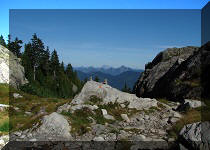
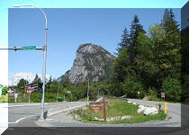
Garibaldi Provincial Park is, arguably, the most beautiful wilderness area near Vancouver, and the Diamond Head part of it is no exception. By starting at the trailhead by the parking lot seen in the photo below, you are close to many great destinations. Today, we did the longest hike of the Diamond Head part of Garibaldi Park (to Mamquam Lake) - a 44 kilometers return trip, which took 12 hours in total. We saved a few hours by using a small bicycle - you can bike up to Elfin Lakes on the Diamond Head trail.
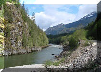
1. We are on gravel road en route to the parking lot.
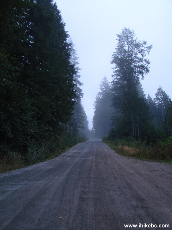
Road to Garibaldi - Diamond Head Parking Lot
2. Garibaldi - Diamond Head parking lot. Coordinates: N 49°45.001', W 123°03.229'. Elevation: 908 meters. Space for about 40 vehicles. There is a lot for about 15 vehicles a few hundred meters down the gravel road. Parking for day users is free.
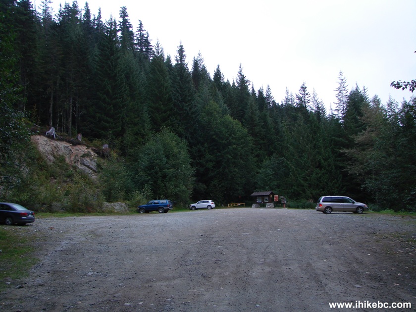
Garibaldi Provincial Park - Diamond Head Parking Lot BC Canada
3. Information stand at the end of the parking lot. This is where you pay for overnight camping anywhere in the park: $10 per person per night (16 years of age and older) and $5 per person per night for children (between 5 and 16 years old). Exception: Elfin Lakes shelter, which costs $15 per person per night, or $35 for a family. Note the large poster warning about the bears.
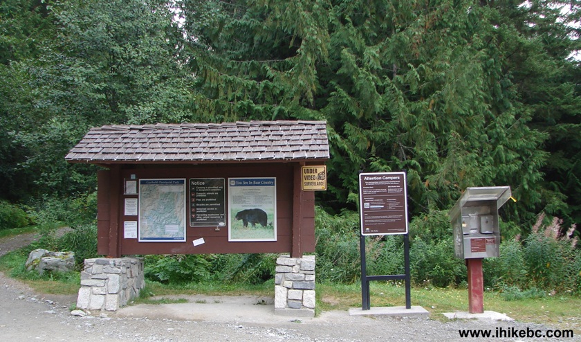
Information Board Garibaldi - Diamond Head Parking Lot
4. The trail begins. We started just after 0730 AM. A sign indicated distances as follows: 5 km to Red Heather shelter (no overnight camping permitted), 11 km to Elfin Lakes (bicycles are allowed up to this point), 22 km to Mamquam Lake (our destination). The trail to Red Heather shelter is featureless, and you are, basically, walking on a logging road while steadily gaining elevation.
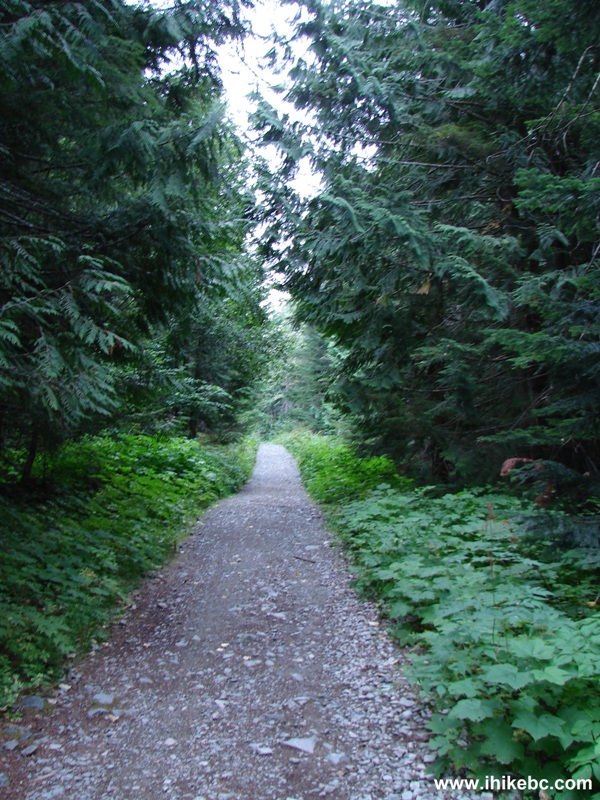
Hiking Trail Garibaldi Provincial Park - Diamond Head BC Canada
5. Red Heather shelter, five kilometers from the start. Coordinates: N 49°45.754', W 123°02.227'. Elevation: 1407 meters.
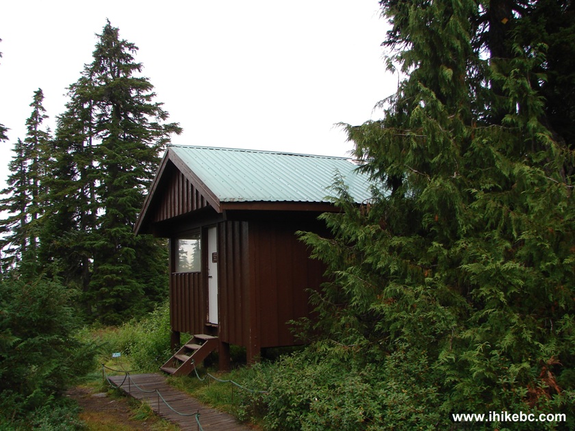
Read Heather Shelter Garibaldi Provincial Park - Diamond Head BC Canada
6. Inside the shelter. There is a stove and lots of wood inside. A note asks to use wood carefully, as it must last the entire winter.
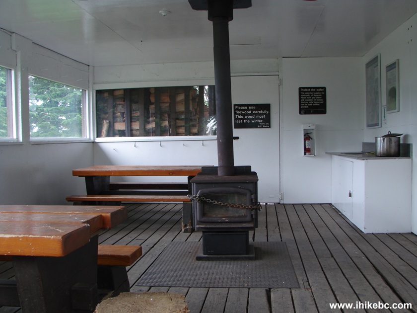
Red Heather Shelter Garibaldi Provincial Park
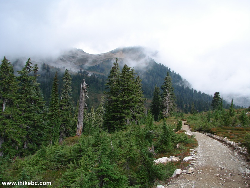
7. After the Red Heather shelter, the views get better. Except today was foggy and cloudy.
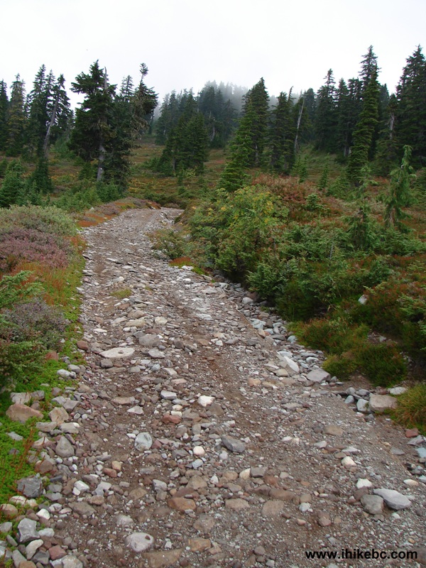
Hiking Trail Garibaldi Provincial Park - Diamond Head British Columbia
Canada
8. This is the worst it got. Then it got better. But sunny weather would certainly allow for better views.
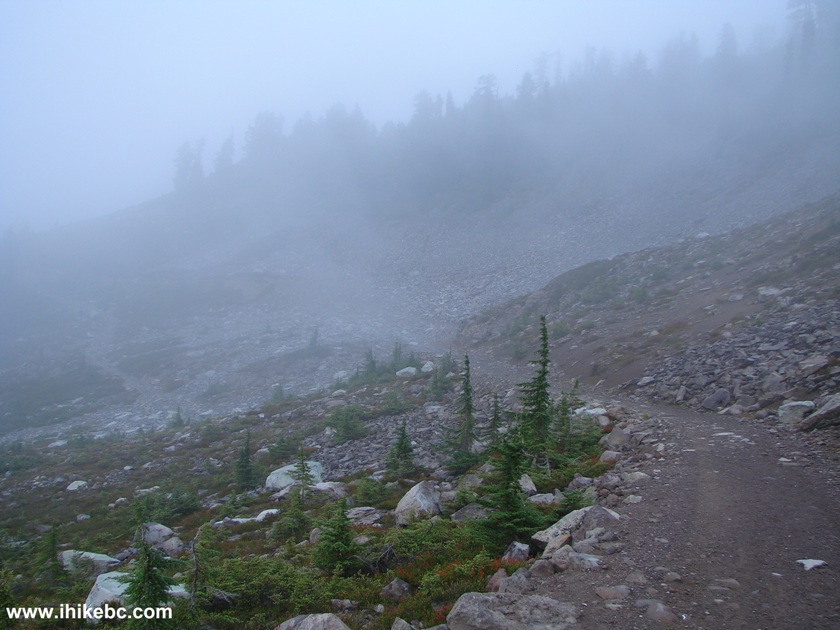
Fog on Hiking Trail Garibaldi Provincial Park - Diamond Head BC Canada
9. Two hours and thirty minutes into the hike, we have reached Elfin Lakes. Coordinates: N 49°47.226', W 122°59.321'. Elevation: 1473 meters. Some time was saved by biking. It would probably take at least thirty minutes longer without a bicycle. There are signs indicating that the first lake (closest to us in this photo) is for swimming, and the second is for drinking water.
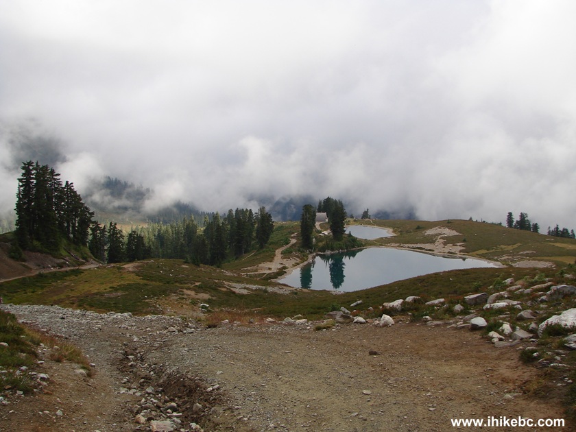
Elfin Lakes Garibaldi Provincial Park - Diamond Head British Columbia
Canada
10. This ranger hut is located by the lake. Four rangers in an ATV passed us by when we were en route to the Red Heather shelter.
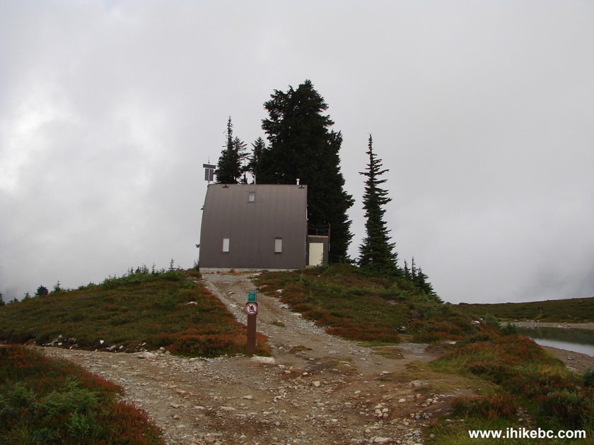
Ranger Hut Elfin Lakes Garibaldi Provincial Park BC Canada
11. Elfin Lakes shelter is about two hundred meters from the ranger station.
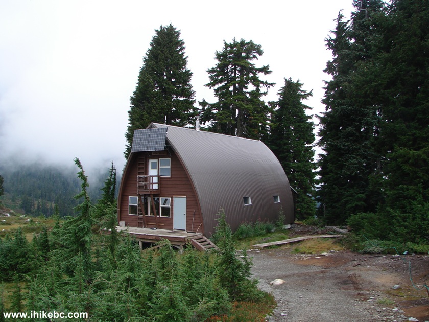
Photo of Elfin Lakes Shelter Garibaldi Provincial Park BC Canada
12. Inside the shelter.
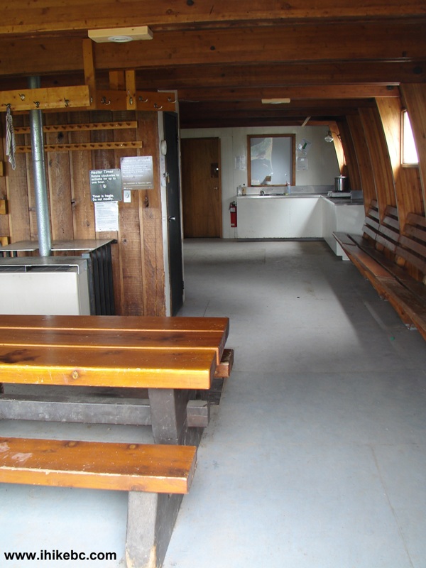
Inside Elfin Lakes Shelter
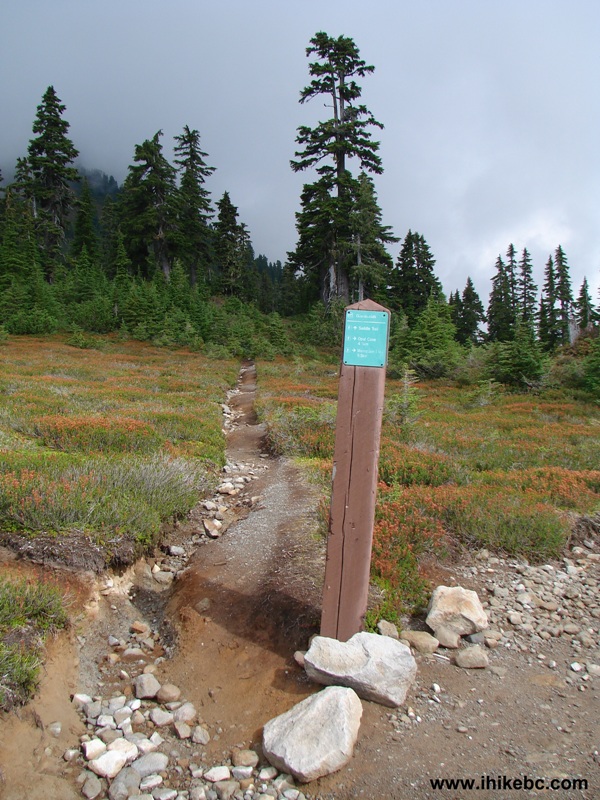
13. Moving on, the Saddle trailhead is 1.5 km away from Elfin Lakes. The Saddle itself is seen in the photo below.
Hiking Trail Garibaldi Provincial Park - Diamond Head BC Canada
14. In fifteen minutes, you come to a split. The sign says: Saddle Trail (straight), Opal Cone (keep right) 4.5 km, Mamquam Lake (also keep right) 9.5 km.
Squamish Hiking -
Saddle Trail Garibaldi Provincial Park - Diamond Head BC Canada
15. And so, we kept right and continued en route to Mamquam Lake.
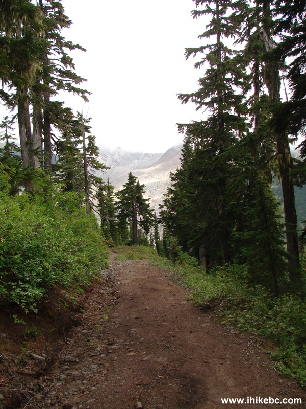
Hiking in Squamish Area - Garibaldi Provincial Park - Diamond Head BC Canada
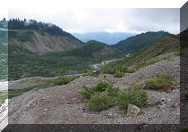
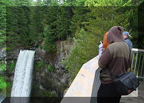
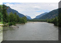
16. Twenty minutes after the Saddle Trail split, a large valley appears straight ahead. The trail first descends to Ring Creek, and then goes up to the other end of the valley seen on the upper right side of the photograph.
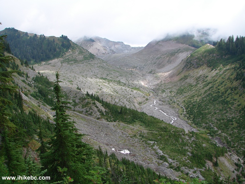
Valley Garibaldi Provincial Park - Diamond Head BC Canada
Here is our video of this valley:
More ihikebc videos are on our YouTube Channel
Our Mamquam Lake Trail Hike Trip Report
Continues on Page 2.


|
 |
Other Trips in Squamish Area:
|
|
|
|
|
|
|
|
|
|
|
|
|
|
|
|
|
|
|
|
|
|
Mamquam River FSR
|
|
|
Seed Peak Trail
|


Other Trips:


![]()
![]()
![]()
Follow @ihikebc Tweet
ihikebc.com Trip 072 - Mamquam Lake Trail Hike Page 1 of 3