![]()
![]()
![]()

Trip 050 - July 19 and 20, 2011 (Tuesday and Wednesday)
Shovel Creek FSR (off Harrison East)
To 11.2 km mark. Plus, coverage of a spur road.
Distance From Vancouver: About 188 km to the beginning of the FSR via
Highway 1 East (to Exit 135), then Highway 9 North (to
Harrison Hot Springs),
then Lillooet Avenue / Rockwell Drive to
Harrison East Main FSR, and then Harrison
East Main FSR for 58.4 km.
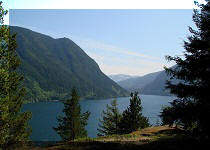
Liked: Several fine views, especially from the spur road.
Of note: Remote wilderness area with no people around for possibly many days, no cell phone coverage, aggressive mosquitoes, the road is badly overgrown in several places, several long rather steep grades with loose surface, two deteriorating bridges (scheduled to be replaced by November of 2011).
Vancouver, Coast & Mountains Backroad Mapbook (2010 edition) Coordinates: Page 25 (Nahatlatch Lake) E5-F5.
Related Website: Chilliwack District FSR Conditions.
Other Forest Service Roads Trips: Chilliwack Bench, Chilliwack Foley, Chilliwack Lake, Chuchinka-Colbourne (North of Prince George), Florence Lake (access to Stave Lake by Mission), Harrison West, Jones Lake (near Hope), Lost Creek (by Mission), Mamquam River (by Squamish), Parsnip West (by Mackenzie), Scuzzy (by Boston Bar), Sowaqua Creek (by Hope), Squamish River Main, Squamish River Ashlu, Squamish River E-Main, Squamish River FSR Washout, Windfall Creek (by Tumbler Ridge).
Follow @ihikebc Tweet
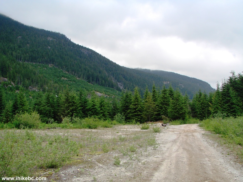
We drove on Harrison East Forest Service Road for 58.4 km, and arrived to the beginning of Shovel Creek FSR. We then traveled on Shovel Creek FSR to the 11.2 km mark, where the road became too narrow, and there was threat of scratching our ride with large stones. We then turned around and went back to a large camping spot. The next morning, we hiked a short unnamed spur road, which lead to several fine views of the valley below.
Please, note, that en route to the 11.2 km mark you would encounter two deteriorating bridges, which have a 4,500 kg GVW load limit each, and are scheduled to be replaced by November of 2011.
Also, there is a large hole in the middle of the road at the 5.7 km mark - major vehicle damage hazard.
Here is a table of the points of interest along Shovel Creek FSR (up to the 11.2 km mark). Zero your odometer at the sign seen in photo #2 below.
| KM | Feature | Side |
| 0.0 | Small waterfall off the bridge | L |
| 2.9 | Deteriorating bridge (4,500 kg GVW) | S |
| 4.9 | Large Camping Area | L |
| 5.5 | Unknown FSR (blocked off) - photos below | R |
| 5.7 | WARNING - Big Hole in the Ground | S |
| 7.2 | Busted camper | L |
| 7.7 | Deteriorating bridge (4,500 kg GVW) | S |
| 8.1 | Road (FSR?) | R |
| 10.6 | Camping Spot | L |
| 11.2 | Debris on the road - scratching hazard | S |
1. We are at the 58.4 km mark of Harrison East Main Forest Service Road, where it splits with Harrison East-Shovel Creek FSR (seen on the right side).
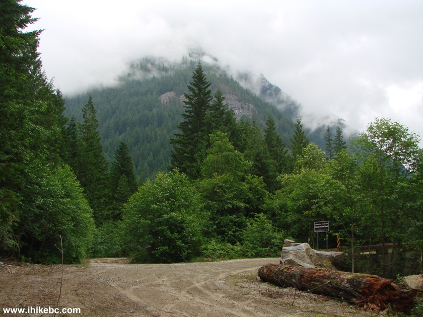
Harrison East FSR British Columbia Canada
2. The beginning of Shovel Creek FSR.
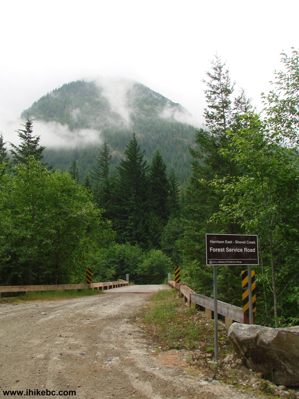
Shovel Creek Forest Service Road British Columbia Canada
3. Looking left from the bridge seen in the photo above.
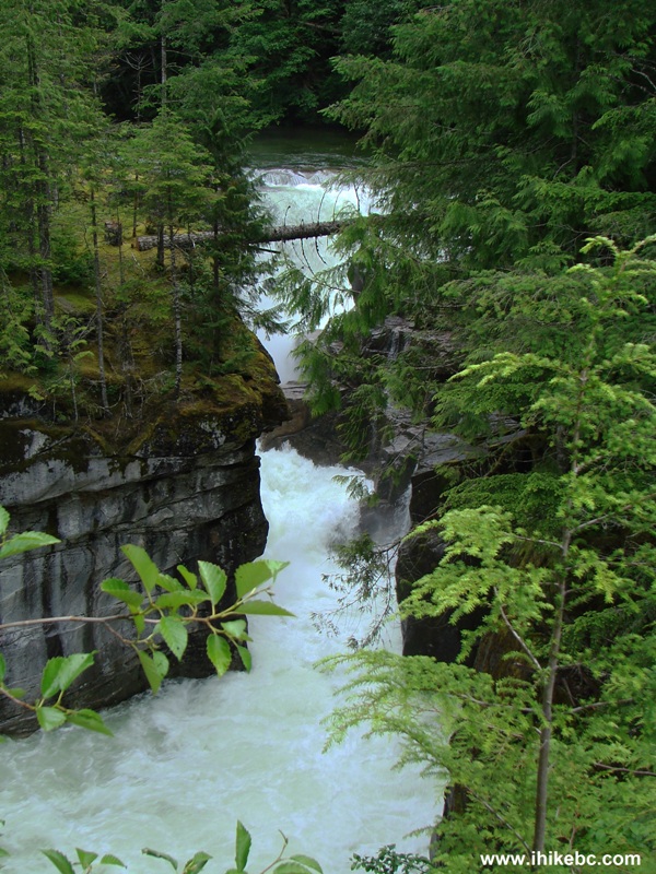
Creek view from the bridge at the beginning of Shovel Creek Forest
Service Road
4. Shovel Creek FSR has several long climbs. They are not very steep, but the surface is loose enough to keep our 2WD vehicle moving slowly.
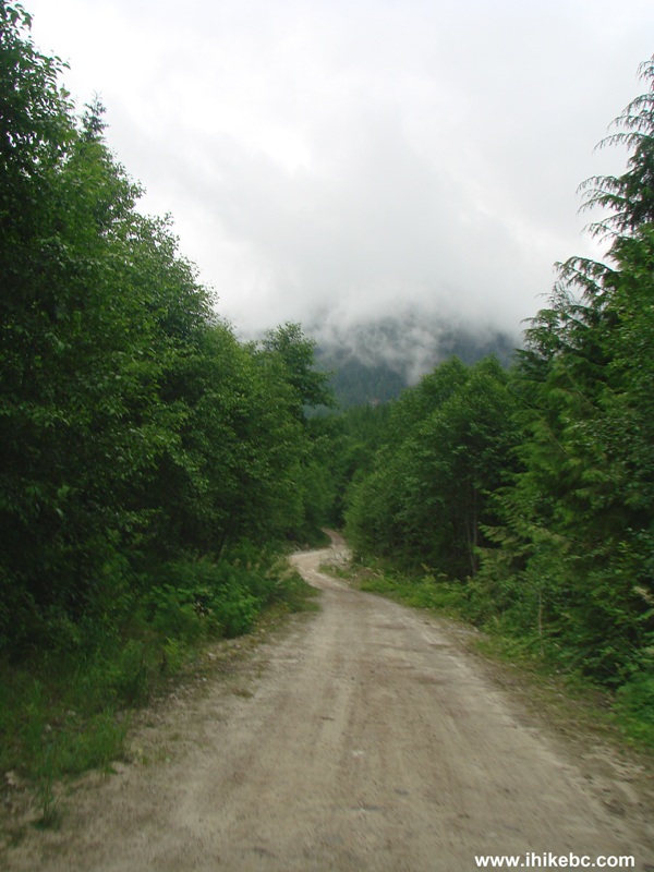
Shovel Creek FSR Province of BC Canada
5. Deteriorating bridge at the 2.9 km mark. 4,500 kg GVW limit.
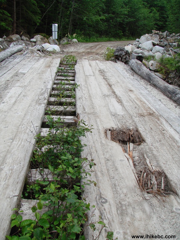
Bridge on Shovel Creek FSR
6. View from the bridge.
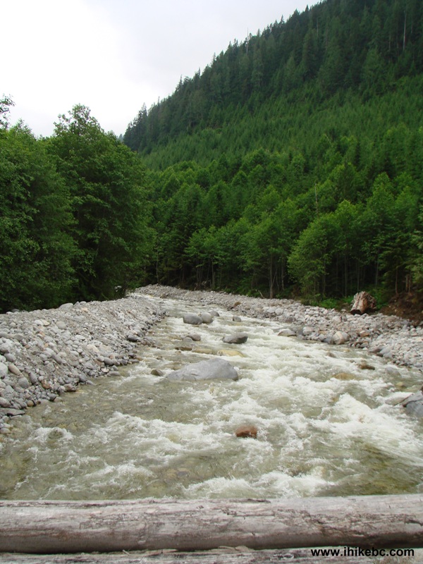
View from the bridge on Shovel Creek Forest Service Road British
Columbia Canada
7. There is a large camping area at the 4.9 km mark, where we spent two peaceful nights. The only noise came from a large waterfall on the other side of the valley.
Camping Area by Shovel Creek FSR British Columbia Canada
8.
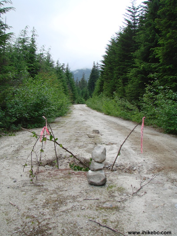
Be very careful at the 5.7 km mark, as there is a large hole in the ground. Right now, the hole is indicated by stones and flagging tape, but that may not be there forever, as the hole can get bigger.
9. A jaw-dropping sight arrives at 7.2 km, as there is a badly busted camper resting on the side of the road.
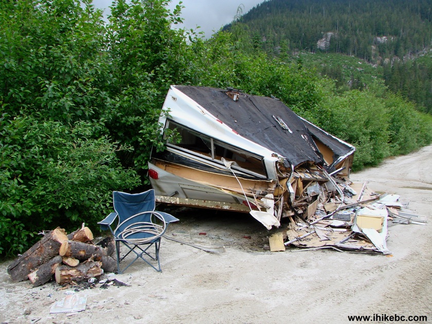
Busted Camper on Shovel Creek Forest Service Road Province of BC Canada
10. It is hard to tell what happened here. It looks like a huge stone fell from the sky and struck the side of the camper. But, most likely, it was somehow rolled.
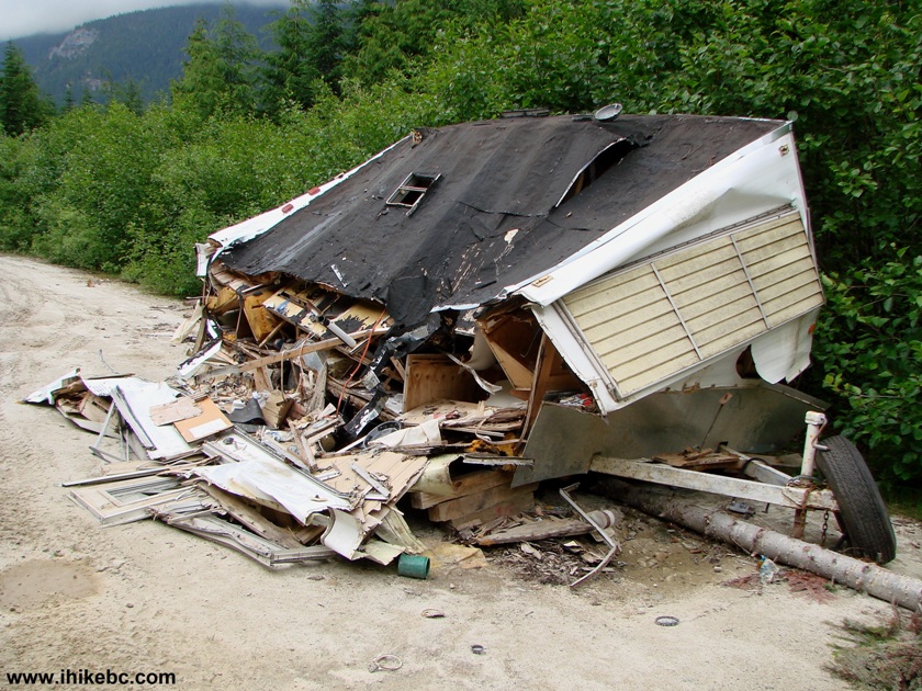
Busted Camper on Shovel Creek FSR British Columbia Canada
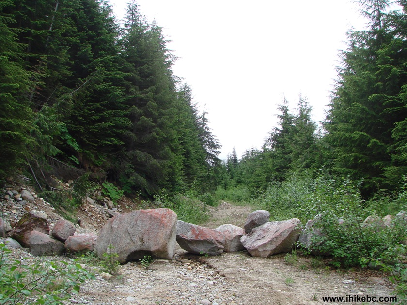
11. The end of our forward progress came at the 11.2 km mark. Looks like there was a slide here, and then the debris was somewhat cleared, but the road appeared to be just a touch too narrow for our wide ride, and we did not feel like scratching the sides against the large boulders lying there. So, turned around and drove back to the camping area seen in photo #7. According to the Backroad Mapbook, Shovel Creek FSR soon becomes Kookipi Creek FSR, and goes for many kilometers until it joins Nahatlatch River FSR.
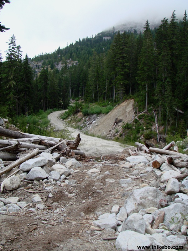
Shovel Creek Forest Service Road BC Canada
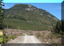
12. The next day, we walked up the road for 600 meters to an unknown FSR. The photo below shows the turnoff at the 5.5 km mark of Shovel Creek FSR.
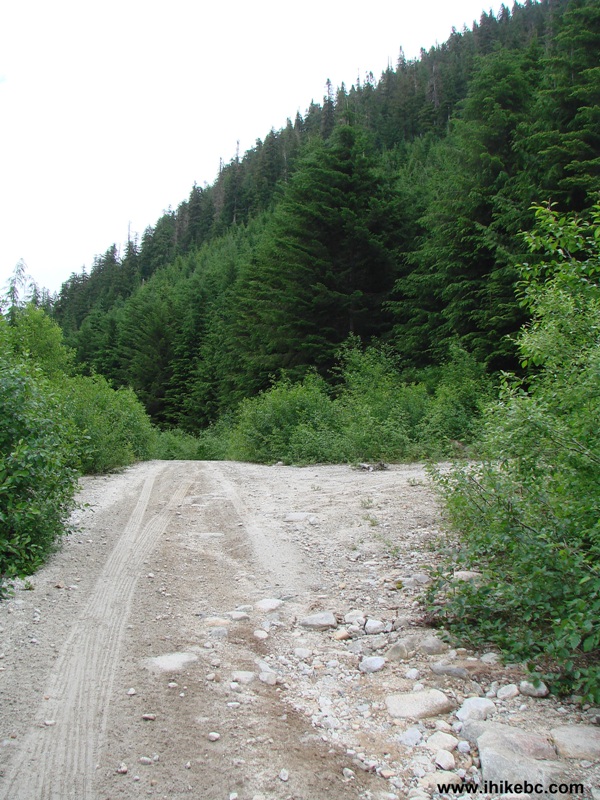
13. This FSR is solidly blocked, so hiking or biking are the only options.
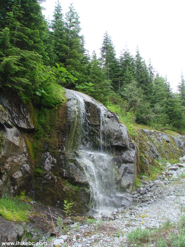
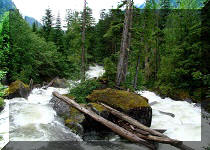
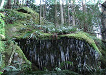
14. Five minutes later, you are crossing a creek and admiring this mini-waterfall.
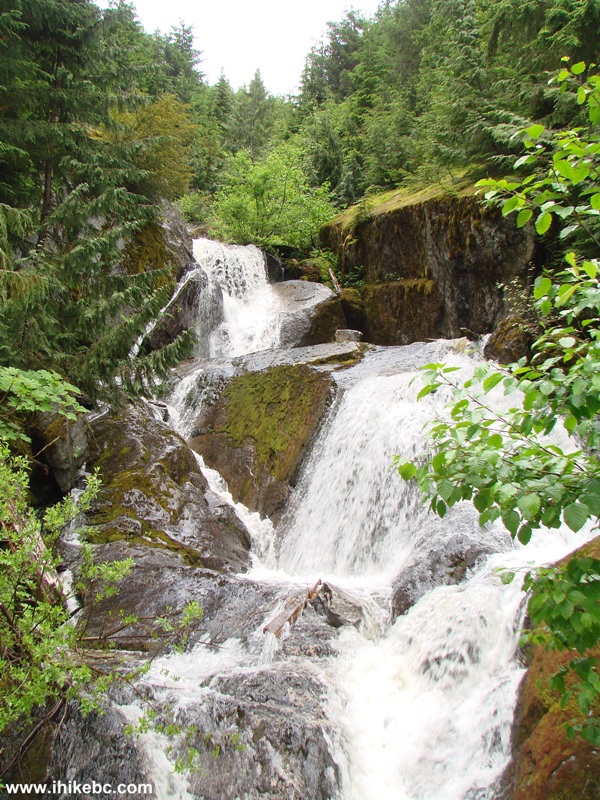
15. Then, you would go through some badly overgrown stretches, steadily gaining altitude. Twenty five minutes after crossing the creek, another mini-falls on the side of the road.
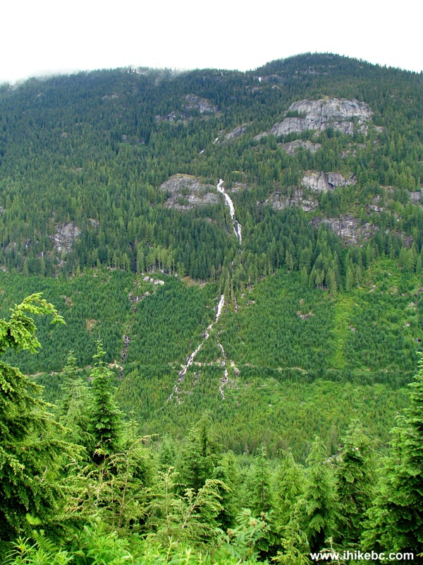
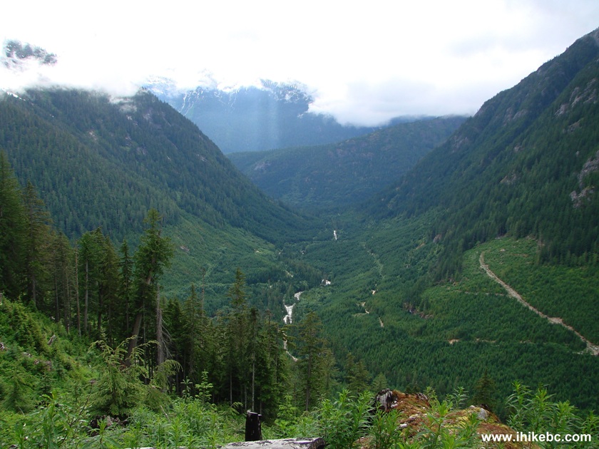
16. And, pretty much right away after that, far in the distance (the other side of the valley) you see what could be Granite Falls, as indicated by the Backroad Mapbook. This waterfall is the one making distant noise as you are camping on Shovel Creek FSR at the 4.9 km mark. There is an obvious FSR leading to Granite Falls, but the next day we just could not find its entrance off Harrison East shortly after the split with Shovel Creek FSR.
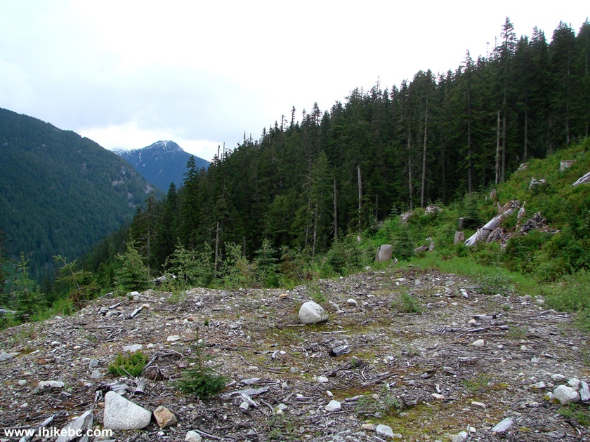
17. The valley had been logged a few years ago. Thank you for the roads, forestry workers!
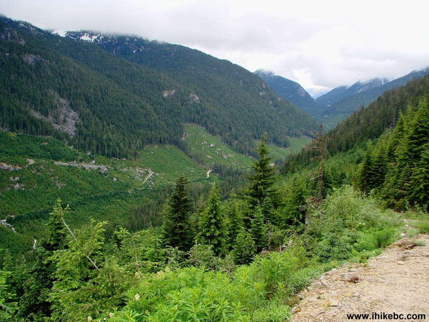
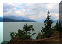
18. Looking left we see an impressive valley.
19. The end of this unnamed FSR comes about an hour after the start.
Overall, Shovel Creek FSR is interesting to explore,
and hiking up the unnamed FSR is a good side trip.
Other Trips in Harrison Hot Springs Area:
Other Trips:


![]()


![]()


![]()
![]()
![]()
![]()
ihikebc.com Trip 050 - Shovel Creek FSR (off Harrison East FSR)