![]()
![]()
![]()

Trip 149 - September 4, 2018 (Tuesday)
Zoa Peak Trail Hike
Coquihalla Summit Recreation Area near Hope, BC
Distance from Vancouver:
About 200 kilometers via Highway 1 East, and
Highway 5 North.
Liked: Easy trailhead access, fairly easy trail, mountain views, valley views, wildflowers, no bugs.
Of Note: Limited parking space, highway noise for much of the trail, several tricky stretches - hiking poles and boots are highly recommended.
Vancouver, Coast & Mountains BC Backroad Mapbook (2nd edition) Coordinates: Page 16 (Coquihalla Summit) E1.
Other good hikes nearby: Yak Peak Trail, Needle Peak Trail.
Other Trips in Hope BC Area: Thacker Mountain Trail, Flat Iron Peak Trail, Sowerby Creek FSR Hike, Dog Mountain Trail, Jones Lake FSR Trip to Jones Lake, HBC Heritage Trail, Sowaqua Creek FSR, Skagit River Trail, Skyline II Trail Hike, Silver Skagit Road, Mount Outram Trail, Othello Tunnels, Eaton Lake Trail, Mount Hope Lookout Trail, Town of Hope BC.
Zoa Peak trail is located in Coquihalla Summit Recreation Area, and is the easiest of the nearby trails, from what we have read. Indeed, Zoa Peak is a fairly easy trail, though it does have a few tricky sections. This hike is also relatively short, with about 3.5 hours round trip time. However, the trail starts at the elevation of over 1,200 meters, so thinner air would make you tired faster than at the sea level under the same conditions. The views, while not overwhelming, are quite decent, and could be even better, provided the sun is shining in the right direction. An added bonus is that the parking lot for Zoa Peak Trail is shared with Falls Lake, so you can do both hiking and fishing on the same day without having to move your vehicle.
1. To get to Zoa Peak trailhead, take Highway 5 (Coquihalla Highway). Here we are Eastbound on Highway 1 by Exit 170 (Hope), and are following the sign to Highway 5 North.
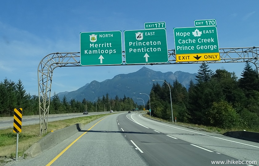
BC Highway 1 East near Hope BC Canada
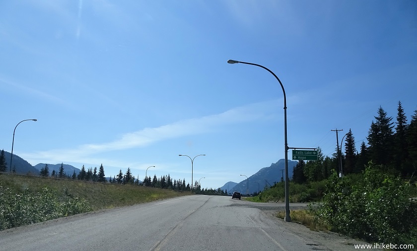
2. Just over 50 kilometers later, take Exit 221 - Falls Lake.
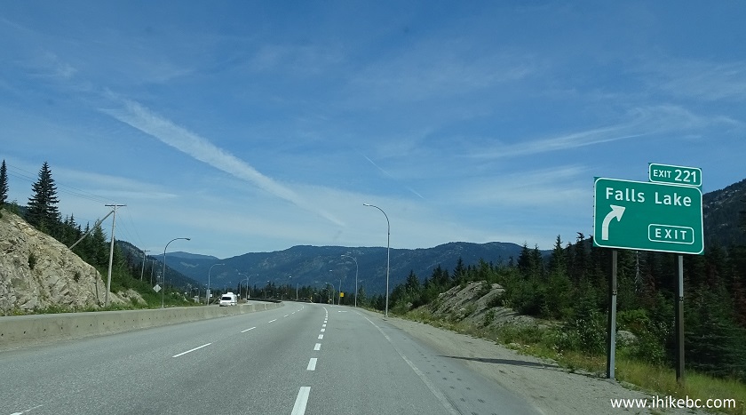
BC Highway 5 North (Coquihalla Highway) near Exit 221 Falls Lake
3. Upon taking Exit 221, follow the signs to Falls Lake. You would make a left turn to go under the highway.
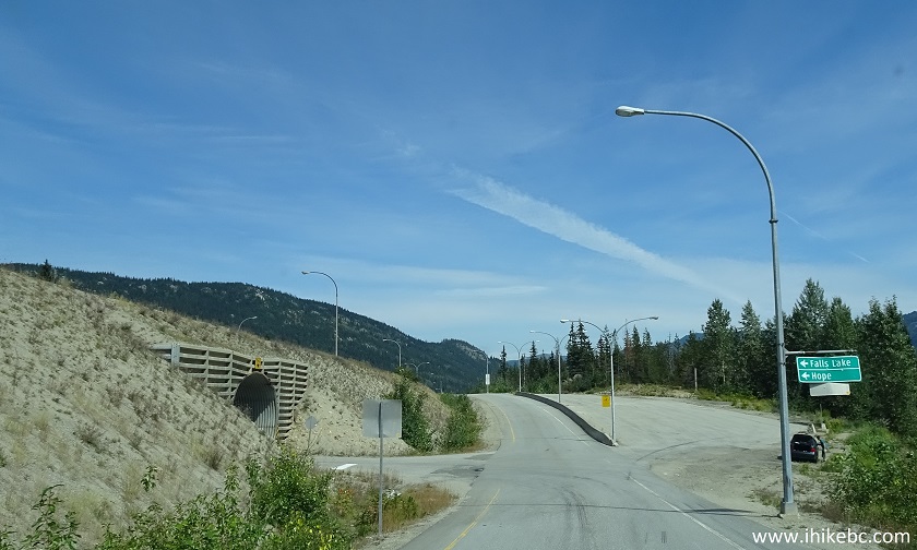
The road to Falls Lake / Zoa Peak Trail parking lot off Exit 221 of BC
Highway 5
4. Here is the tunnel under Highway 5.
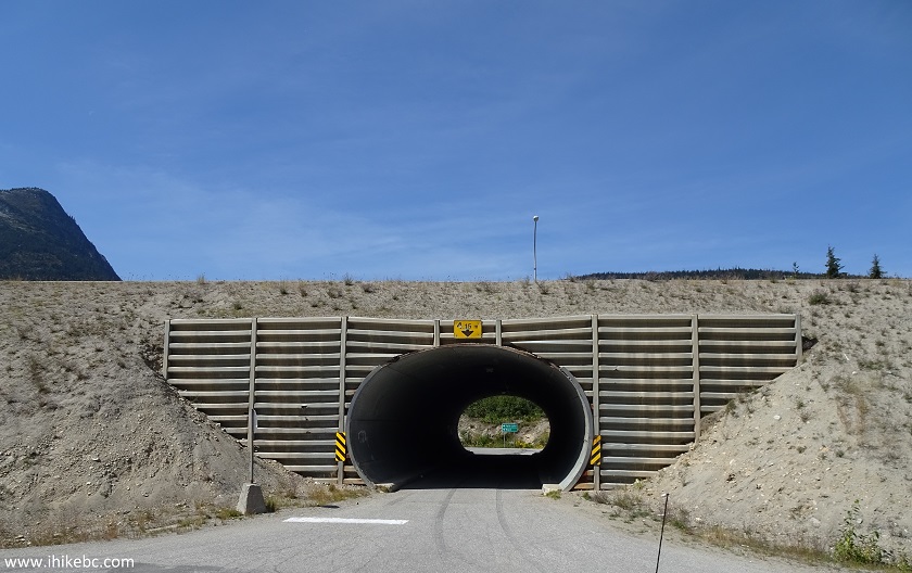
The tunnel under BC Highway 5 by exit 221 Falls Lake
5. Upon driving through the tunnel, turn left, and then right.
The road to Zoa Peak Trail and Falls Lake parking lot off Exit 221 of BC
Highway 5 (Coquihalla Highway)
6. Just over a kilometer later, arrive at the Falls Lake parking lot. There is enough space for about 15 vehicles. There are also several pullouts along the 1 km-long access road, which can accommodate 5-6 vehicles each. The trailhead for both Falls Lake and Zoa Peak trails is seen in the upper middle of the photo below. Coordinates: N 49⁰36.742' W 121⁰03.874'. Elevation: 1,231 meters.
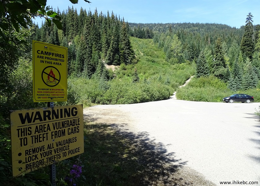
Falls Lake and Zoa Peak Trail parking lot off Exit 221 of BC Highway 5
7. Within a minute, Falls Lake Trail makes a left turn, and the lake is about 900 meters away from there. And this is Zoa Peak Trail after that split.
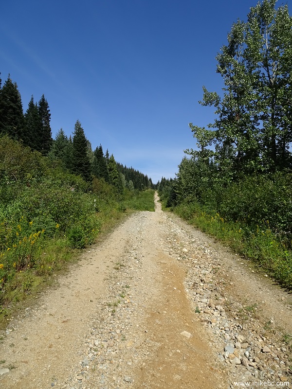
Zoa Peak Trail - Hope Trail British Columbia Canada
8. Less that 400 meters from the start of the trail, turn left at the split seen below.
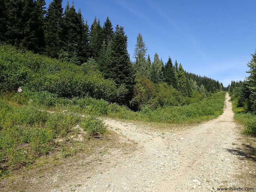
Zoa Peak Trail - Hope Hike British Columbia Canada
9. It gets a bit rough after the turn.
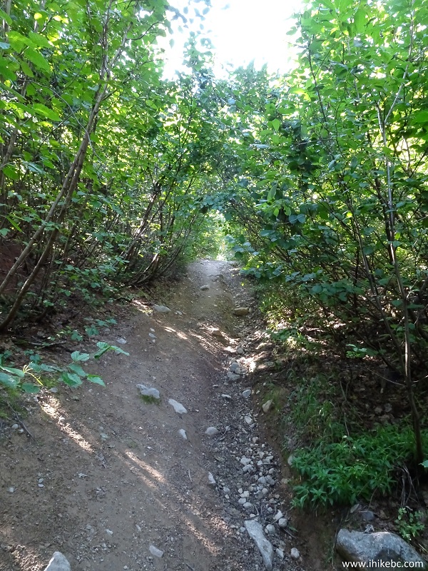
Zoa Peak Trail - Hope Hiking British Columbia
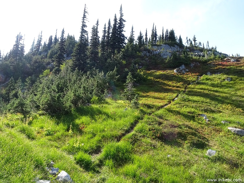
10. But, by and large, this is not a difficult trail, and it gets easier very shortly. Beautiful wildflowers too.
Zoa Peak Trail in Coquihalla Summit Recreation Area - Trail in Hope Area
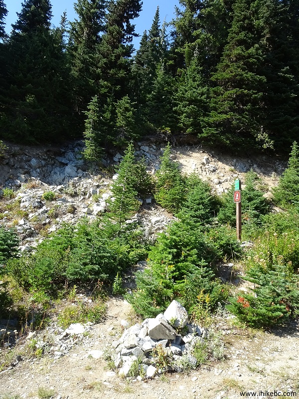
11. About 1.4 km from the start of the trail, make another left turn. Coordinates: N 49⁰37.268' W 121⁰03.753'. Elevation: 1,478 meters. There are currently signs at all the splits up to this point.
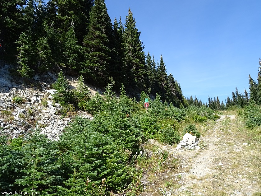
Hiking in Hope BC area - Zoa Peak Trail - Coquihalla Summit Recreation
Area Hiking
12. View of the trail from the road.
Zoa Peak Hiking Trail British Columbia Canada
13. If gets tricky here, if for a very short stretch.
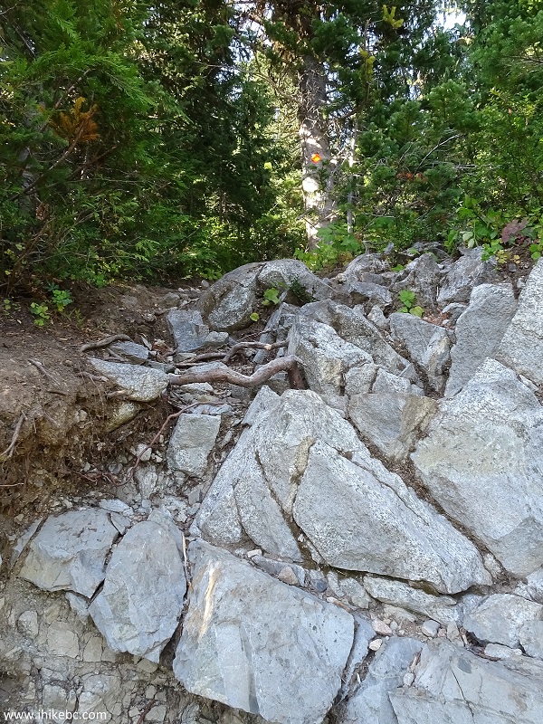
British Columbia Hiking - Zoa Peak Trail near Hope BC Canada
14. You then walk through a forest, until this neat rock outcropping.
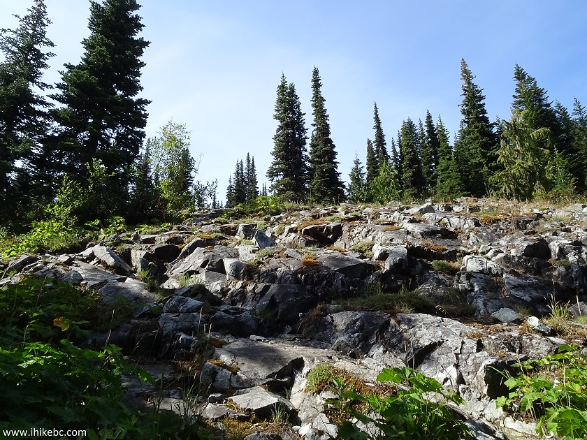
Zoa Peak Trail near Hope BC - hiking in British Columbia Canada
15. Then, it's back into the forest.
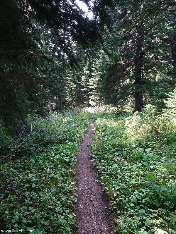
Hike in
Coquihalla Summit Recreation Area - Zoa Peak Trail near Hope British
Columbia
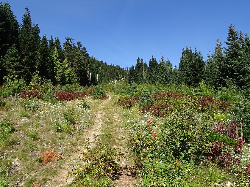
16. After that, the trail enters into a fairly open sub-alpine area, and the views start getting better and better.
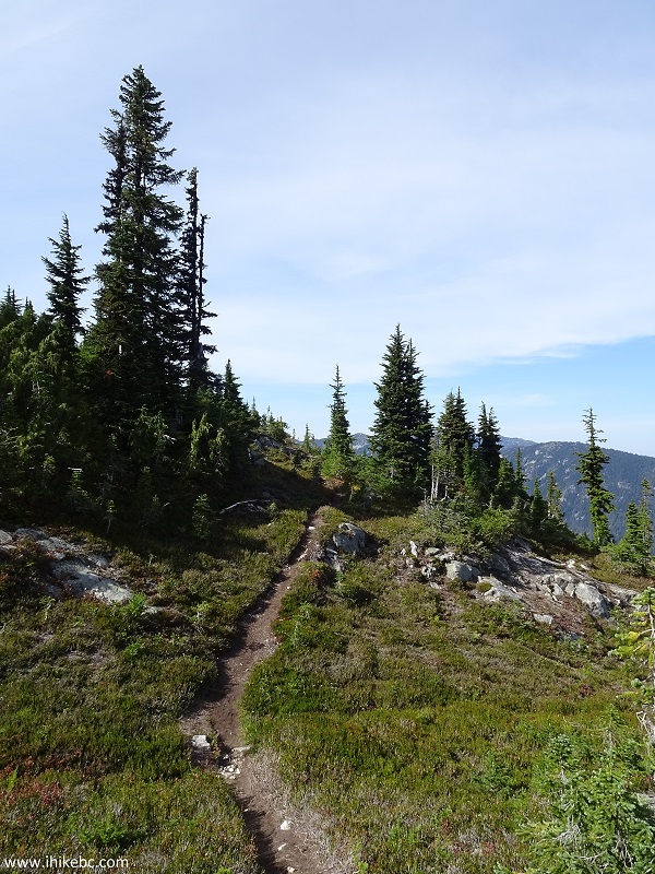
Photo of Zoa Peak Trail - Hike in Canada
17. The valley below looks quite good.

View from Zoa Peak Trail in Coquihalla Summit Recreation Area near Hope
BC Canada
18. Mountain views are very fine as well.
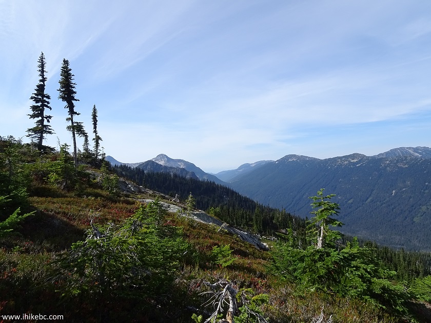
Views from Zoa Peak Trail - Hope Hiking British Columbia Canada
19. The combination of white stones, green vegetation and blue sky is hard to beat.
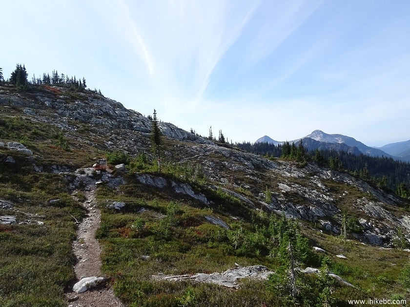
Zoa Peak Trail near Hope BC - British Columbia Hiking
20. Closer to the end of the trail, there is a short side trail on the left side. Coordinates: N 49⁰37.602' W 121⁰05.081'. Elevation: 1,769 meters.
Hiking in BC - Zoa Peak Trail by Hope British Columbia Canada
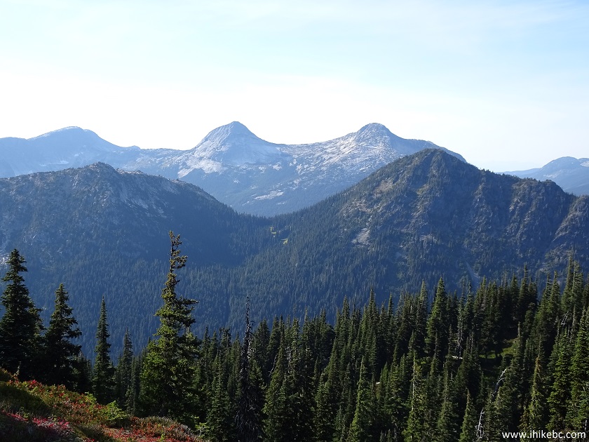
21. The sun was shining right at us, thus all the haze, but it's quite an impressive mountain out there.
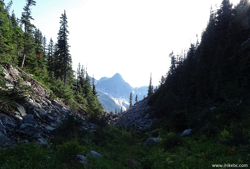
Zoa Peak Trail - side trail for a mountain view
22. You can get closer, but some stone-hopping would be required.

Coquihalla Summit Recreation Area near Hope British Columbia Canada
23. Zooming in.
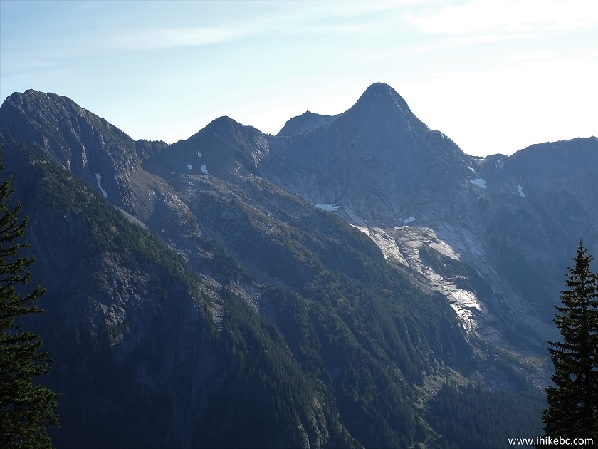
Zoomed view of a mountain near Zoa Peak Trail - hiking in British
Columbia Canada
24. We are back on the main trail, with another neat view straight ahead.
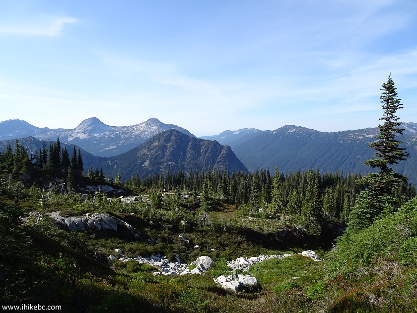
View from Zoa Peak Trail near Hope BC Canada
25. Just over two hours after the start, we are at the peak of Zoa mountain. Coordinates: N 49⁰37.637' W 121⁰05.457'. Elevation: 1,848 meters (617 meters elevation gain from the start of the trail). Total distance traveled: 4.73 km. The rather slow average moving speed of 2.9 km/h (despite a fairly easy trail) has much to do with high elevation at the start of the trail.
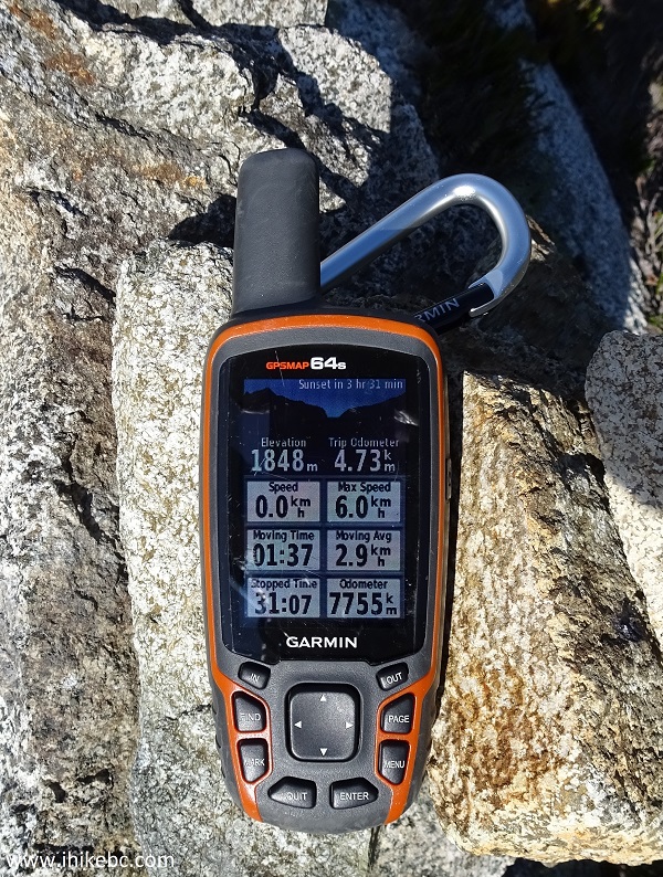
Stats for Zoa Peak Trail Hike near Hope British Columbia Canada
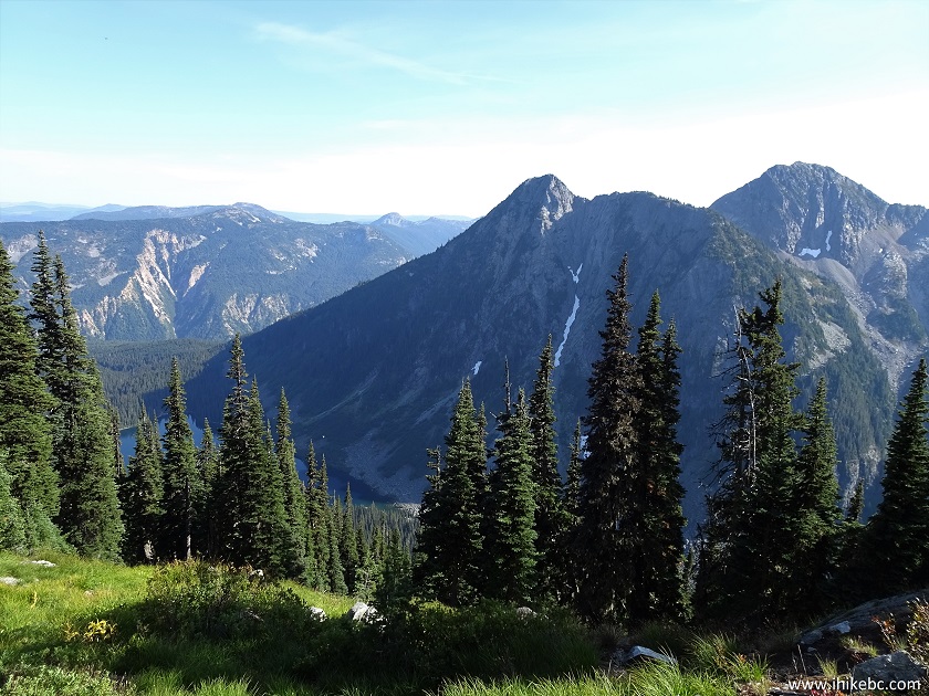
26. Here is a view from the top (where a cairn is located).
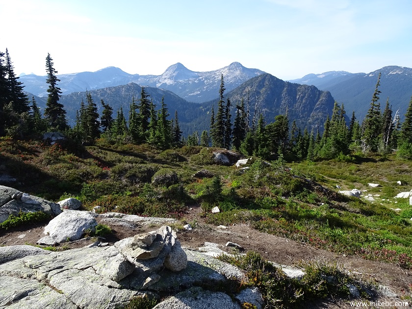
View from the top of Zoa Peak Trail
27. It is possible to walk around for a better view of the mountain seen in the photo above. Here is that better view (slightly zoomed). Coordinates: N 49⁰37.682' W 121⁰05.440'.
Coquihalla Summit Recreation Area near Hope British Columbia Canada
Here is Our Video of the Views From This Location:
More ihikebc videos are on our YouTube Channel.
28. There is another good view on the opposite side of Zoa Peak. It's starting to be blocked by the trees, but it's a fine view nonetheless. Coordinates: N 49⁰37.563' W 121⁰05.503'. That's Falls Lake down below on the left side.
View from Zoa Mountain near Hope BC Canada
The trail is rather easy, the views are rather good, and Zoa Peak Trail is, therefore, rather recommended.


|
 |
Other Trips in Hope BC Area:
|
|
|
|
|
|
|
|
|
|
|
|
|
|
|
|
|
|
|
 |
|
|
|
|
|
Eaton
Peak Route
|
Skyline II West Trail
|
Eaton
Lake Hike 2
|
|
|


Other Trips:


![]()


![]()
![]()
![]()
ihikebc.com Trip 149 - Zoa Peak Trail Hike (Coquihalla Summit Recreation Area Near Hope BC)