![]()
![]()
![]()

Trip 179 - September 4, 2019 (Wednesday)
The Hoodoos Trail Hike
Near Fairmont Hot Springs BC Canada
Location: South-eastern British Columbia, off Highway 93/95, about 2 km South of the town of Fairmont Hot Springs.
Liked: Mountain, hoodoos, and valley views. Short and easy trail. No bugs. The upper part of the trail is a loop.
Of Note: Steep unbarricaded drop-offs at viewpoints. The trail is popular. Some uneven ground. Hiking poles and boots are recommended.
Kootenay Rockies BC Backroad Mapbook (7th Edition) Trailhead Coordinates: Page 31 (Fairmont Hot Springs) B7.
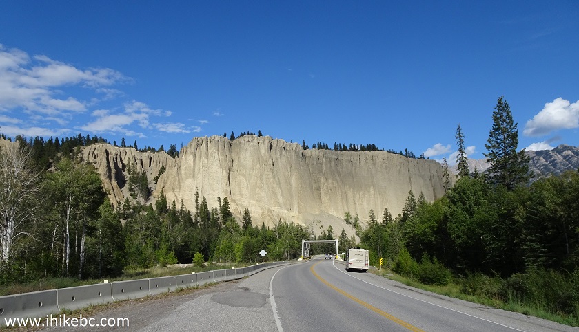
Dutch Creek Hoodoos is an impressive natural landmark, standing right by the side of BC Highway 93/95, several kilometers South of Fairmont Hot Springs. Today, we hiked a short trail to the top of the hoodoos, which also leads to fine views of the mountains and the Columbia River Valley.
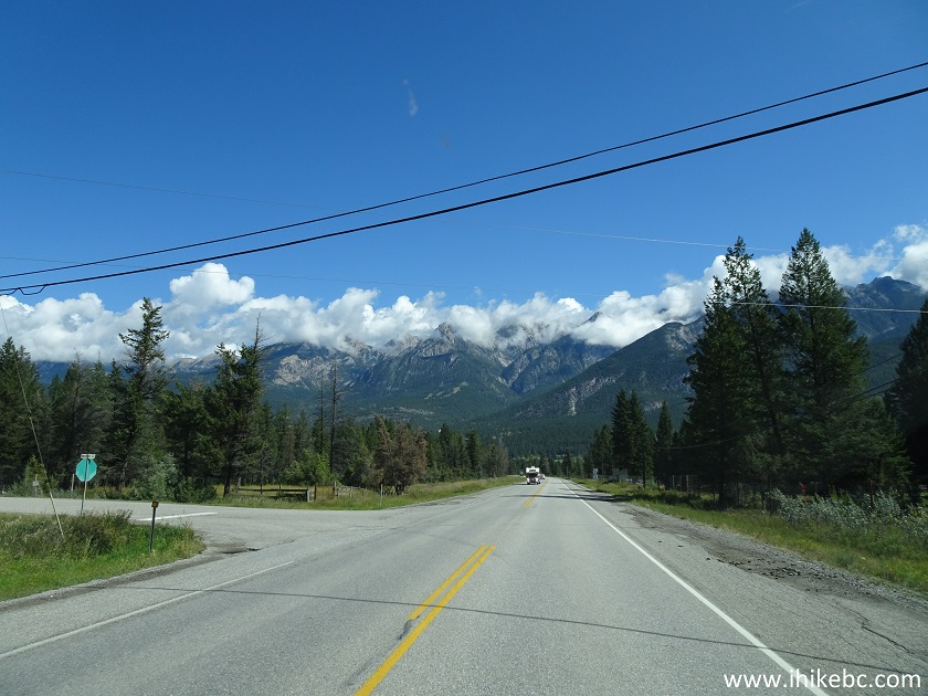
1. The Hoodoos in their entirety are best seen from BC Highway 93/95 Northbound, about 1.3 km South of Westside Rd, which leads to the trail to the top of the hoodoos. There are small pullouts on both sides of the highway. Coordinates: N 50⁰18.647' W 115⁰54.000'. Elevation: 841 meters.
The Hoodoos near Fairmont Hot Springs British Columbia Canada
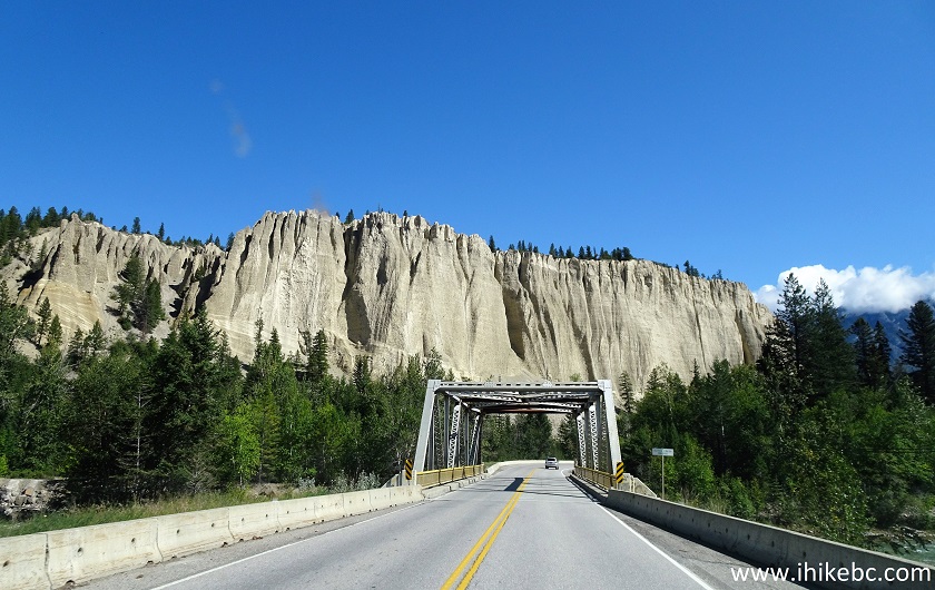
2. A bit closer to the bridge.
The Hoodoos near Fairmont Hot Springs BC Canada
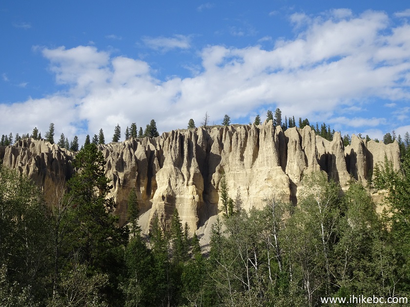
3. A close-up of the hoodoos on the left side.
The Hoodoos British Columbia Canada
4. Going further North on Highway 93/95.
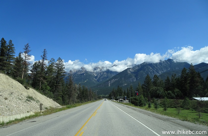
BC Highway 93/95 North near Fairmont Hot Springs BC Canada
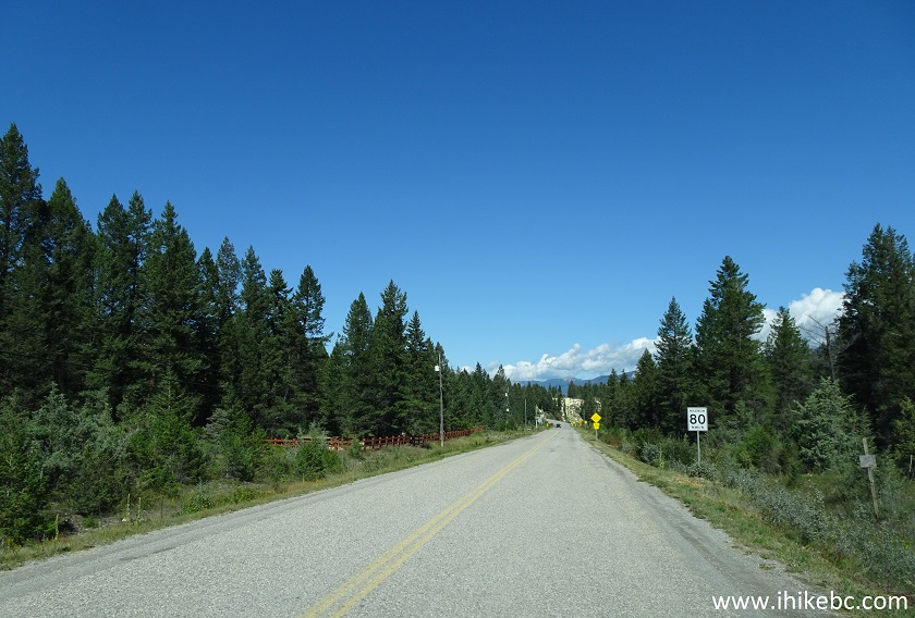
5. About 1.3 kilometers from the hoodoos viewpoint, make a left turn onto Westside Road. Coordinates: N 50⁰18.790' W 115⁰52.960'. Elevation: 819 meters.
BC Highway 93/95 North at Westside Road turnoff
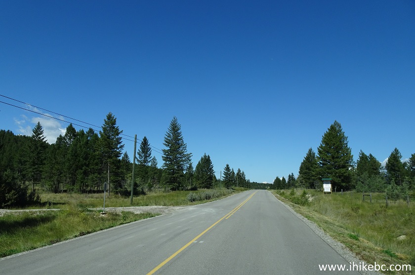
6. Westside Road after the turn from Highway 93/95.
Westside Road near Fairmont Hot Springs BC
7. Make a left turn onto the trailhead access road, 1.1 km after turning from BC Highway 93/95.
Westside Road at The Hoodoos Trail access road turnoff
8. The trailhead access road is only 200 meters long.
The Hoodoos Trail Access Road near Fairmont Hot Springs BC Canada
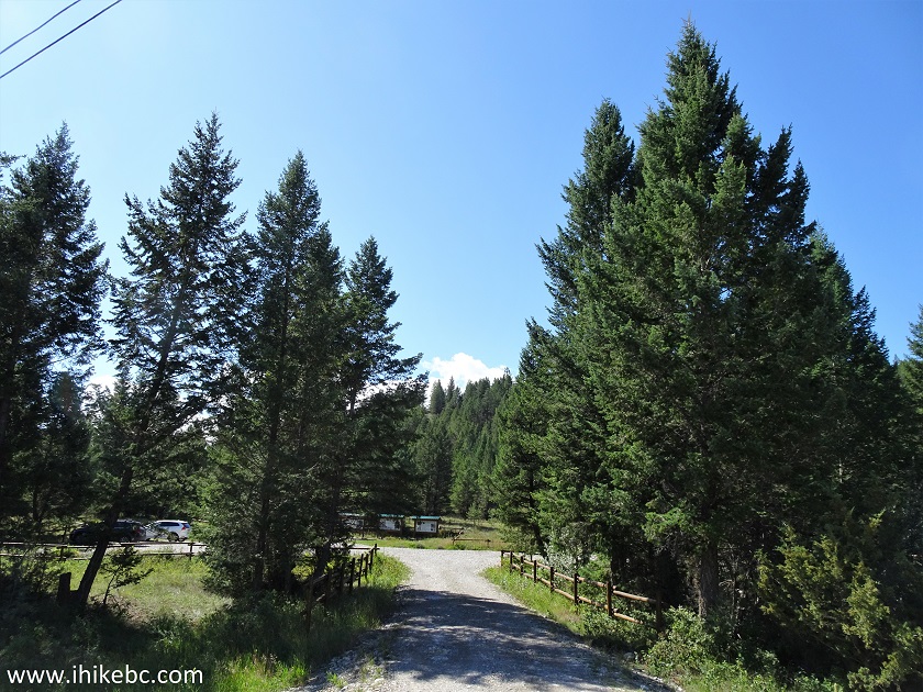
9. Soon, we are at a large parking lot for The Hoodoos Trail. Coordinates: N 50⁰19.357' W 115⁰53.160'. Elevation: 845 meters.
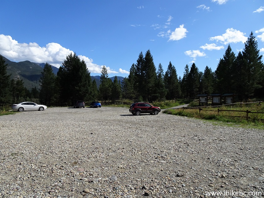
Parking lot for The Hoodoos Trail near Fairmont Hot Springs BC
10. The Hoodoos Trail begins.
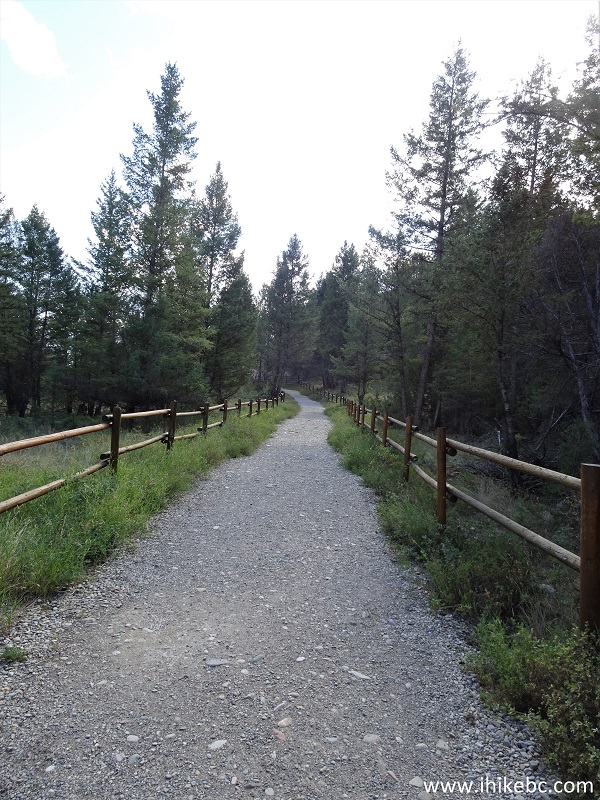
Fairmont Hot Springs Hiking - The Hoodoos Trail
11. This trail is very short, and great views arrive in almost no time. Slight zoom used.
View from The Hoodoos Trail - hike in Fairmont Hot Springs Area
12. Now with lots of zoom.
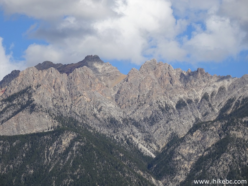
BC Hiking near Fairmont Hot Springs - Mountain View
13. One more.
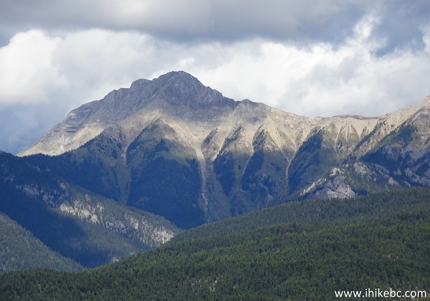
Mountain View by Fairmont Hot Springs - Hike in British Columbia
14. The Hoodoos Trail continues. There is a gentle elevation gain, and no complicated stretches.
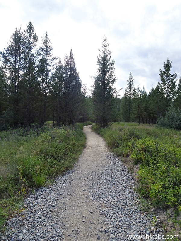
The Hoodoos Trail - hiking in Fairmont Hot Springs British Columbia area
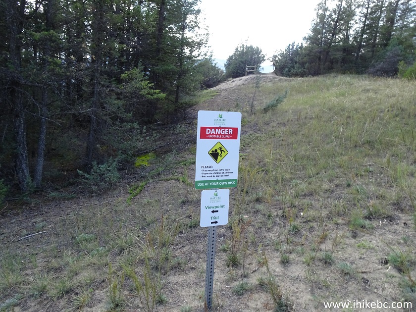
15. The Hoodoos Trail is located in a conservation area.
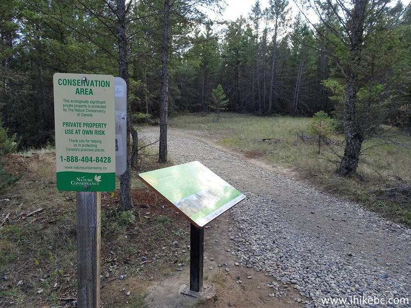
Fairmont Hot Springs Trail - The Hoodoos Trail by Fairmont Hot Springs BC
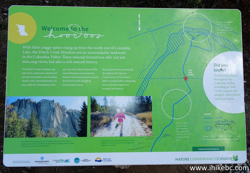
16. Information plaque.
17. The upper part of the trail is a loop, and it begins 1.3 km after the start of The Hoodoos Trail. We turned left.
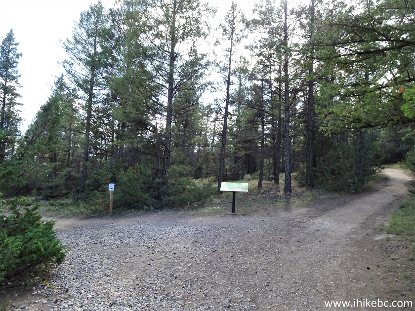
The Hoodoos Trail - Hike in Fairmont Hot Springs Area
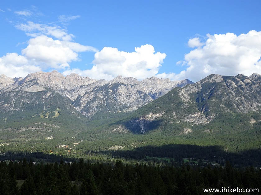
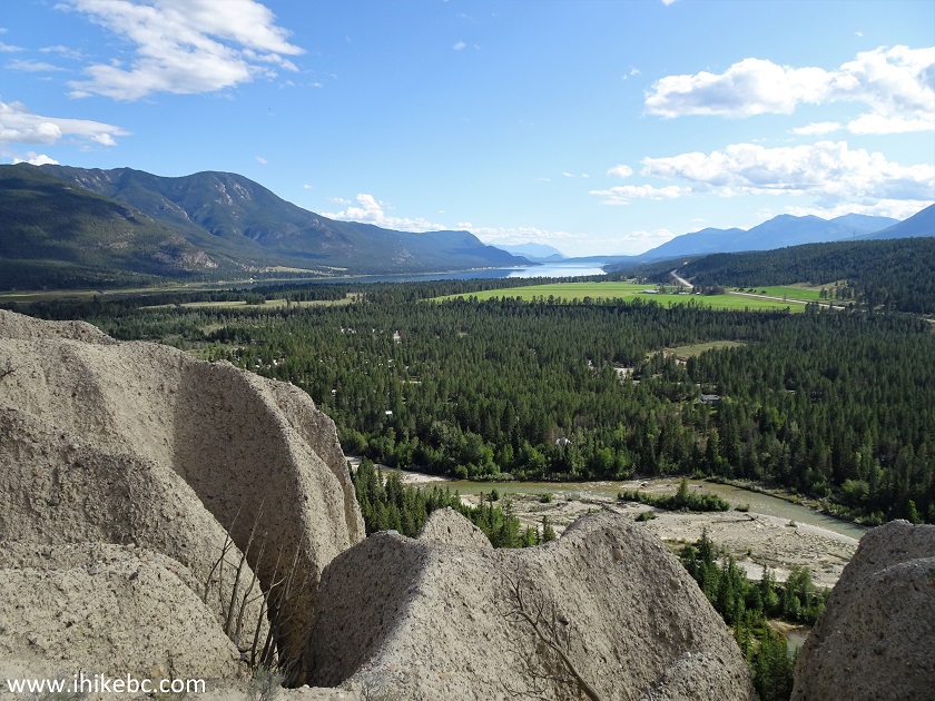
18-20. Very shortly, fine mountain and valley views appear in full panoramic glory. Left to right.
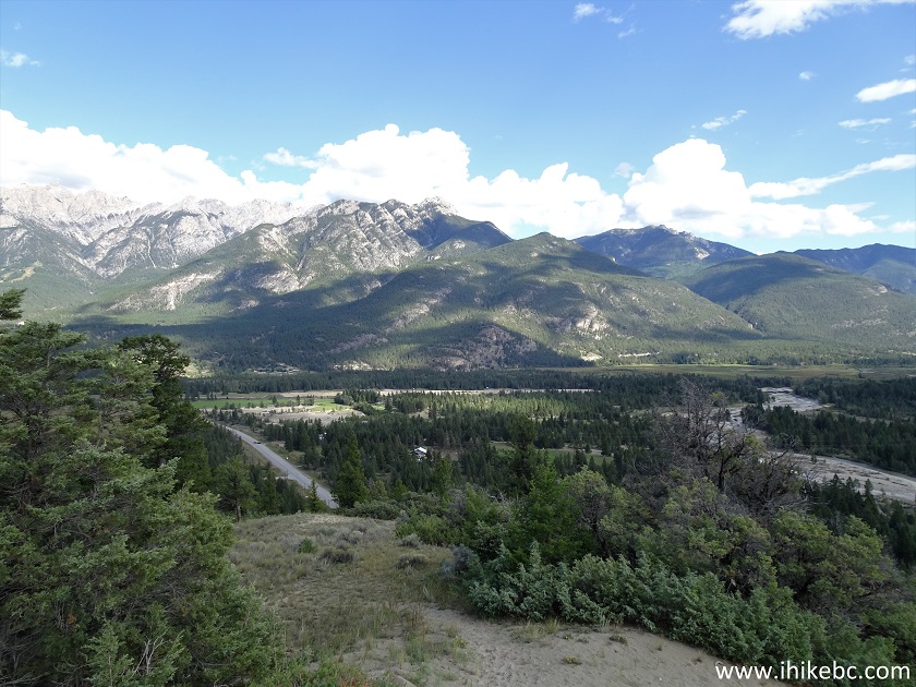
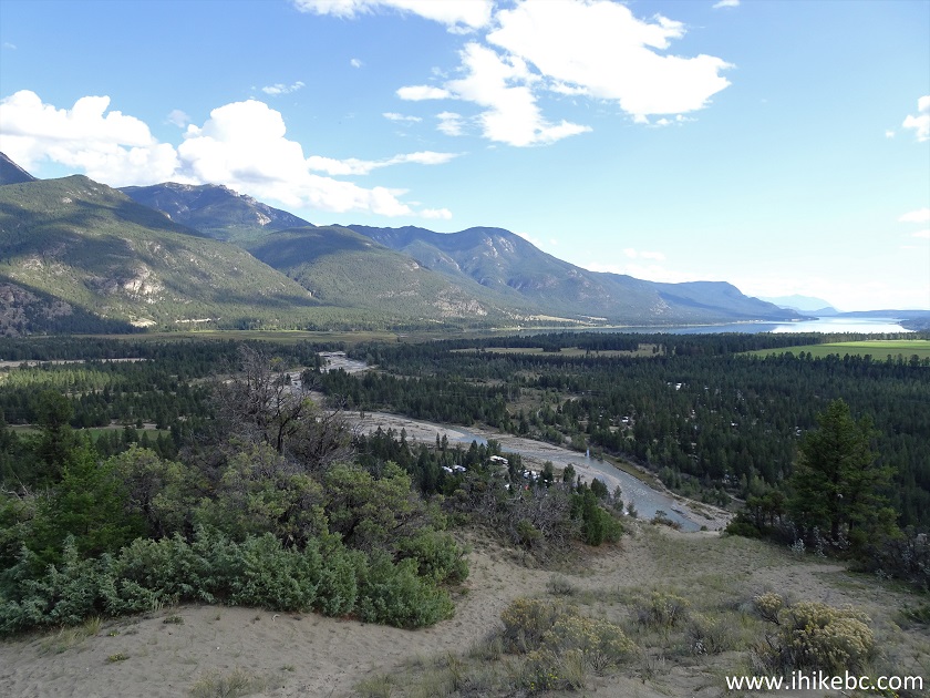
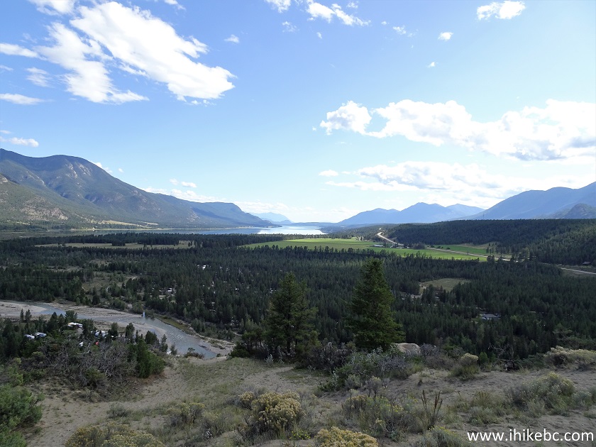
Columbia Valley seen from the Hoodoos Trail near Fairmont Hot Springs BC Canada
Here is our video of the views from this location.
More ihikebc videos are on our YouTube Channel.
21. Another viewpoint is just around the corner. Just watch out for the unbarricaded drop-offs.
22-24. This time we are right on top of the hoodoos. Left to right.
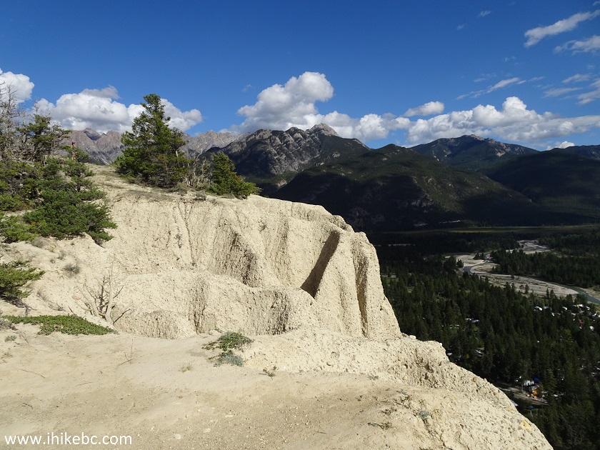
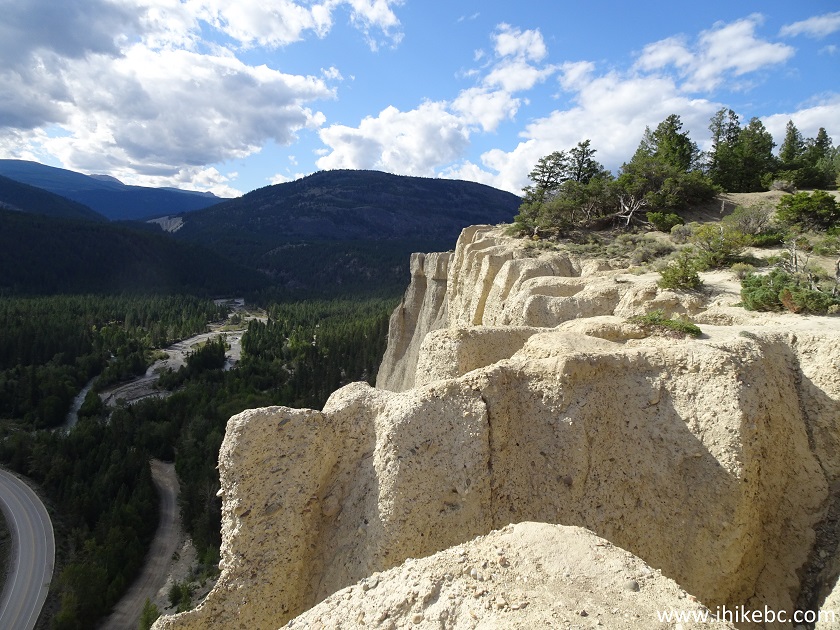
The Hoodoos near Fairmont Hot Springs British Columbia
The Hoodoos Trail is short, easy, and leads to great views. Highly Recommended.


|
 |
Other Trips:


![]()


![]()
![]()
![]()
ihikebc.com Trip 179 - The Hoodoos Trail Hike (Near Fairmont Hot Springs BC)