![]()
![]()
![]()

Trip 112 - July 29, 2016 (Friday)
Windfall Lake Trail Hike
Near Tumbler Ridge BC
Trailhead Location: Northeastern British Columbia, off Windfall Creek Forest Service Road, which begins off Bullmoose Mine Road, which, in turn, starts off BC Highway 29, approximately 20 kilometers North of Tumbler Ridge.
Liked: The views of the lake and mountains, shade in the forest, virtually no mosquitoes, information boards, the second half of the trail can be done in a loop.
Of note: Some parts of the trail are steep, hiking boots and poles are highly recommended, Windfall Creek FSR has numerous deep potholes, including a suspension-busting cross-ditch at the 22.0 km mark.
Northern BC Backroad Mapbook (3rd edition) Trailhead Coordinates: Page 43 (Mount Crum) E4.
Related Trip: Bullmoose Mine Road & Windfall Creek FSR.
Related Website: WNMS Windfall Lake Trail Brochure (PDF File).
Other Trips Off Bullmoose Mine Road: Cowmoose Mountain Trail Hike, Holzworth Meadows Hiking Route, Pinnacle Peak Route Hike.
Windfall Lake Trail shares the trailhead with Pinnacle Peak Route, but, within the first fifty meters, these trails go their separate ways, though it is technically possible to do a giant loop trail, start hiking one trail, and finish at the end of the other. For directions to Windfall Lake Trailhead, check out our Bullmoose Mine Road & Windfall Creek FSR trip report, and Pinnacle Peak Route Hike trip report.
1. We are at the shared Pinnacle Peak Route / Windfall Lake Trail trailhead, with very useful trail brochures neatly stored inside the wooden boxes attached to the tree seen in the photo below. Coordinates: N 55⁰01.271' W 121⁰37.101'. Elevation: 1,230 meters.

Windfall Lake Trailhead near Tumbler Ridge BC Canada
2. Within a minute, Pinnacle Peak Route takes a left turn, and Windfall Lake Trail continues straight ahead, with several interesting information signs attached to trees. Photos of two such signs are at the end of this trip report.

Windfall Lake Trail near Tumbler Ridge British Columbia
3. The first part of the trail is through a forest, with little elevation change.

Tumbler Ridge Trail -
Windfall Lake trail Northeastern British Columbia Canada
4. But your blood pressure might get elevated upon seeing THIS on the ground :)

Bear paw footprint - Windfall Lake trail BC Canada
5. A sturdy boardwalk allows to keep your feet dry while walking through an especially wet area.

BC Trail -
Boardwalk on Windfall Lake trail near Tumbler Ridge BC Canada
6. Things get serious soon after the 3 km mark. There is a split, and the trail on the left is where you would emerge from, should you choose to go a circular route. Or, you can get to the lake and hike back the same way. Coordinates at the split: N 54⁰59.776' W 121⁰37.867'. Elevation: 1,422 meters.

Tumbler Ridge Hike -
Windfall Lake trail circular route split
7. We took the path to the right towards the lake, and the steepest part of the trail appeared in no time. There is even a rope to assist - it's a tricky area, especially if wet.

BC Hike -
Windfall Lake trail British Columbia Canada
8. The steep part doesn't last for very long, and, soon, we were hiking through a meadow, with mountain views appearing as well.

Tumbler Ridge Hiking -
Windfall Lake trail BC Canada
9. Neat.

Windfall Lake trail near Tumbler Ridge BC Hiking
10. Just a bit further...

Trail in Tumbler Ridge Area -
Approaching Windfall Lake in BC Canada
11...and here is the lake - looking right. Coordinates for Windfall Lake at this point: N 54⁰59.296' W 121⁰38.308'. Elevation: 1,508 meters. (278 meters elevation gain from the start of the trail).

Hike in Tumbler Ridge Area -
Windfall Lake BC Canada
12. Looking straight.

Windfall Lake in Northeastern British Columbia Canada
13. Looking left.

Windfall Lake by Tumbler Ridge British Columbia Hiking
14. Once you reach Windfall Lake, there are several further hiking options. We decided to do the circular route. To do that, turn left and walk along the side of the lake until the slope to your left more or less has no trees, so you can go up without being tripped by the roots and scratched by branches. Here we are walking along the lake. At the end of the lake on the left side there are four flat areas to pitch tents, as well as four bear-proof containers.

Hiking in Tumbler Ridge Area by Windfall Lake BC Canada
15. Ascending the slope on the left side.

British Columbia Hiking
16. Climbing up allows for an awesome lake view.

Windfall Lake near Tumbler Ridge BC
17. And those mountains look better and better the higher you go. The following photos were taken after we have already climbed up.

Windfall Lake Route - Mountain View
18....

Canada Hiking
19...

Tumbler Ridge Hiking
Here is our video of the mountains in this area:
More ihikebc videos are on our YouTube Channel.
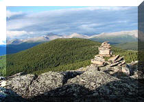
20. Having climbed up the slope, the general idea is to head back on the top of the slope while keeping the lake to the left, and mountains to the right. There is no flagging tape to assist you, but a few cairns provide good landmarks. One such cairn is near a small cave seen in the middle of the photo below. Coordinates for the cave: N 54⁰59.140' W 121⁰37.653'. Elevation: 1,630 meters.

Hike in British Columbia
21. Here is another one. Coordinates: N 54⁰59.248' W 121⁰37.543'. Elevation: 1,626 meters. After this cairn you start descending in earnest while steadily turning left.

Inukshuk on Windfall lake route near Tumbler Ridge BC
22. Upon descent, the hike continues through another meadow.

Windfall Lake route - Tumbler Ridge Hike
23. There is a barely discernible path here and there, but you know you are almost there when flagging tape does, eventually, appear. Coordinates: N 54⁰59.452' W 121⁰37.499'. Elevation: 1,520 meters.

Hike in Tumbler Ridge Area
24. A few minutes later, forest emerges straight ahead, so you get into it, complete your circular route, and rejoin the main trail at the point seen in photo #6.

Windfall Lake route near Tumbler Ridge BC Canada
25. As for further destinations once you reach the lake, here are the options as shown on an information sign at the beginning of the trail.

26. Windfall Lake information sign.

Windfall Lake Trail leads to fantastic views, and takes relatively little time and effort. Highly recommended.


|
 |
Other Trips in Tumbler Ridge BC Area:
|
|
|
|
|
|
|
|
|
|
|
|
|
|
|
|
|
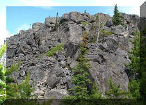
Bergeron
Cliffs Hike
|
 |
Stone Corral Trail  |
|
Cowmoose Mtn Trail
|
|
Bootski Lake Trail  |
|
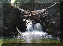
Murray Canyon
Overlook
|
|
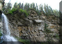
Quality Canyon Trail  |


Other Trips:


![]()


![]()
![]()
![]()
ihikebc.com Trip 112 - Windfall Lake Trail Hike (near Tumbler Ridge BC)