Trip 044 - June 21, 2011 (Tuesday)
Silver Skagit Road near Hope BC
To International Boundary (61.3 km point)
Distance From Vancouver to the Beginning of Silver Skagit Road:
About 140 km via Highway 1 East.Liked: Wide road with few potholes, very few vehicles, great views from suspension bridge and International Point day use area, many camping opportunities along Skagit River (but, after entering Skagit Valley Provincial Park, camping is allowed in paid campgrounds only).
Of note: The road is gravel, with numerous blind turns and deer wandering nearby, with clouds of dust accompanying cars as they move, making it especially important to observe the 60 km/h speed limit. You may need a car wash after coming here. Some logging trucks may be present. Few good views along the road all the way to the suspension bridge 59 kilometers from the start. Remote wilderness area with no cell phone signal.
Vancouver, Coast & Mountains Backroad Mapbook (2010 edition) Coordinates for the Beginning of Silver Skagit Road: Page 15 (Hope) E7.
Related Website: Skagit Valley Provincial Park - BC Parks Official Site.
Other Trips in Hope BC Area: Thacker Mountain Trail, Flat Iron Peak Trail, Needle Peak Trail, Sowerby Creek FSR Hike, Dog Mountain Trail, Jones Lake FSR Trip to Jones Lake, Yak Peak Trail, HBC Heritage Trail, Sowaqua Creek FSR, Zoa Peak Trail, Skagit River Trail, Skyline II Trail Hike, Mount Outram Trail, Othello Tunnels, Eaton Lake Trail, Mount Hope Lookout Trail, Town of Hope BC.
Follow @ihikebc TweetSilver Skagit Road is located near Exit 168 from TransCanada Highway 1. It goes past a few private properties, and then asphalt gives way to slippery and dirty, but fairly wide and pothole-free (but see the trip report) road. Skagit River rapidly flows on the side of the road for many kilometers (anglers, note that Skagit River is catch and release only, but fishing for food is allowed in the lakes).
The best natural attraction before the suspension bridge 59 kilometers after the start is an impressive waterfall 6.1 km into your trip, just before the turnoff to Silver Lake Provincial Park. Silver Skagit Road also leads to four wilderness trails, all of which are listed in the table below. This is a good road to take, if you want peaceful camping and crowd-free hiking. Weekends would obviously be busier than weekdays.
In the table below we have listed the points of interest we have observed along the Silver Skagit Road. Zero your odometer right after you turn onto Silver Skagit Road from Flood-Hope Road. Directions are in the trip report below.
PP = Provincial Park: firearms, ATV, and off-campground camping restrictions are in place. FSR = Forest Service Road.
DUA = Day Use Area (usually holds about 10 vehicles at most, except for the large International Point DUA with space for about 50 vehicles).
|
KM |
Feature |
Side |
|
6.1 |
Waterfall |
Right (R) |
|
6.3 |
Silver Lake PP Turnoff |
R |
|
16.6 |
Left (L) |
|
|
35.7 |
Maselpanic FSR |
R |
|
37.0 |
Skagit Valley PP entrance |
Straight |
|
41.8 |
Silvertip campground |
L |
|
42.7 |
26 Mile DUA |
L |
|
42.6 |
L |
|
|
45.1 |
Shawatum DUA |
L |
|
46.4 |
Rhodonderon DUA |
R |
|
49.3 |
Strawberry DUA |
R |
|
52.5 |
Nepopekum DUA |
R |
|
54.4 |
Whitworth Horse Campers Campground |
R |
|
55.0 |
L |
|
|
58.1 |
Chittenden DUA |
R |
|
58.4 |
Suspension Bridge |
R |
|
58.7 |
Gate (open) |
Straight |
|
60.0 |
Ross Lake Campground |
R |
|
60.4 |
International Point DUA |
R |
|
60.7 |
International Boundary |
Straight |
Here is our July of 2024 video of driving on Silver Skagit Road to the 55 km mark:
More ihikebc videos are on our YouTube Channel.
0. Here are Google Maps directions from Flood-Hope Road to USA border by International Point Day Use Area.
1. We are on Highway 1 East, shortly after Chilliwack, en route to Exit 168 near Hope.

TransCanada Highway 1 in British Columbia past Chilliwack
2. The last chance to fuel up is at the Shell gas station at Exit 135, which you take to get to Bridal Veil Falls, Minter Gardens, and the town of Agassiz. Follow signs to Bridal Veil Falls to get to that gas station. There is a restaurant there too, and the area looked quite festive today.

Photo of Rancher's Restaurant at Exit 135 of TransCanada Highway 1
3. Taking Exit 168.

Highway 1 East in BC near Exit 168
4. After taking Exit 168, follow the Skagit Valley sign seen below and turn right onto Flood-Hope Road.
5. Within a minute, you would reach a flashing yellow light. Here you need to turn right again, this time onto Silver Skagit Road. Zero your odometer after turning. The table above shows the points of interest along the road, and when to expect them.

Flood-Hope Road at Silver Skagit Road near Hope BC Canada
6. The beginning of Silver Skagit Road. Asphalt gives way to gravel in a few kilometers.

Silver Skagit Road Province of British Columbia Canada
7a. The first attraction - an impressive waterfall on the side of the road by the 6.1 km mark.

Waterfall on Silver Skagit Road BC Canada
7b. Very shortly, at 6.3 km, there is a Right turn to Silver Lake Provincial Park. Silver Skagit Road continues on the Left side.
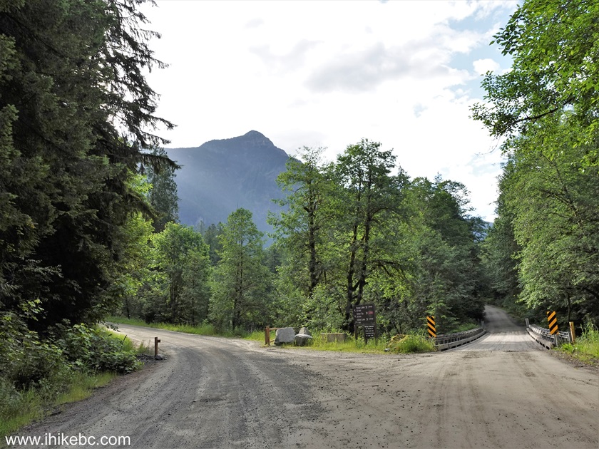
Silver Skagit Road turnoff to Silver Lake Provincial Park - July 2024
photo
8. The road itself looks pretty much the same all the way to the end - tall trees on both sides, and an occasional mountain view ahead.

Silver Skagit Road East of town of Hope British Columbia Canada
9. Skagit Valley Provincial Park entrance is 37.3 km after the start of the road. Camping on the roadside is not permitted past this point. Three campgrounds are available. Whitworth Campground is for campers with horses only ($14 per night). Ross Lake Campground for horseless campers is $16 per night.

Skagit Valley Provincial Park Entrance British Columbia Canada
10. Here is a map of the Skagit Valley Provincial Park, provided at the entrance to the park. Note that "You Are Here" marker is incorrect, as the map was likely moved to its present location. The actual location is to the left, approximately where the horse symbol is shown.

Skagit Valley Provincial Park Map BC Canada
11. It is actually quite surprising that such a rarely used road (we encountered 15 vehicles at most all day long, and that's for 60+ kilometers; albeit, it was a weekday) has such a pothole-free surface. Now we know why - a grader takes care of the potholes. To be fair, there were plenty of potholes after the Nepopekum day use area at km 53.5, but this grader would take care of them in a matter of days.

Picture of a Grader on Silver Skagit Road Province of British Columbia
Canada
12. So, you drive on this mostly featureless road for a long time, and then start enjoying some excellent views by the end of the drive. The suspension bridge is at km 59.0, and this is where the Galene Lakes trailhead (the toughest trail along the road) begins.

Suspension Bridge Silver Skagit Road Skagit Valley Provincial Park BC
Canada
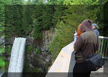
13. The views from the bridge are impressive.

Skagit River
14. Now looking in the opposite direction while standing near the bridge.

Skagit River Province of British Columbia Canada
15. The best views are just two kilometers away, at the large International Point day use area. There are picnic tables there, a playground, and a lake.

International Point Day Use Area Skagit Valley Provincial Park BC Canada
Here is our video of this area:
More ihikebc videos are on our YouTube Channel.
16. Simply beautiful.

View from International Point Day Use Area near USA Border Skagit Valley
Provincial Park
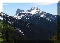
17. The mountain views are very impressive. And when we got there in the middle of the day on a Summer Tuesday, there was a total of one family enjoying it all.

Skagit Valley Provincial Park British Columbia Canada
18. Three hundred meters past the International Point day use area is the United States of America.

International Boundary Skagit Valley Provincial Park British Columbia
Canada
Silver Skagit
Road does not appear to be very popular, and it bodes well for those
hikers and vacationers who want to experience fine British Columbian
nature while avoiding the crowds. Two following trips describe our
Skyline II and Skagit River hikes, and we have not met a single person
on those trails. Not sure about the weekends, but on weekdays this place
is quite likely to be all yours. Enjoy!
Other Trips in Hope BC Area:


Follow @ihikebc Tweet
ihikebc.com Trip 044 - Silver Skagit Road to International Boundary (near Hope BC)

