![]()
![]()
![]()

Trip 104 - May 23, 2016 (Monday)
Bergeron Cliffs Trail Hike
Near Tumbler Ridge BC
Location: Northeastern British Columbia. Turn onto Sanctuary Road off Highway 29 approximately seven kilometers Northwest of Tumbler Ridge, then drive for eight kilometers on a gravel road to the trailhead.
Liked: Cliff, mountain, and valley views. "Under-cliff rest spot" side trail. Shade. Interpretive signs. Relatively benign trail.
Of note: Steep unbarricaded drop-offs. Hiking poles and boots are recommended.
Northern BC Backroad Mapbook (3rd edition) Trailhead Coordinates: Page 44 (Tumbler Ridge) D1.
Related Trip: Bergeron Falls Trail Hike.
Related Website: Map and Brochure of Bergeron Cliffs Hike - PDF file from wnms.ca.
Bergeron Cliffs is a rather short but quite an enjoyable trail, leading to four viewpoints and one brief side trip to an "under-cliff rest spot," where you can see various layered stones piled into several attractive configurations. Bergeron Falls and Bergeron Cliffs hikes share the same trailhead, and split shortly thereafter. There is also a connecting trail between the two. If you do decide to hike both trails in one day, it is probably better to start with Bergeron Falls and then, time and stamina permitting, spend another 2.5 hours or so on the Bergeron Cliffs Trail.
1. For directions to the trailhead, check out our Bergeron Falls Trail Hike trip report. We start with the split where Bergeron Falls Trail is on the right, and Bergeron Cliffs is on the left. This is the same spot as in photo #11 of the Bergeron Falls Trail Hike trip report.
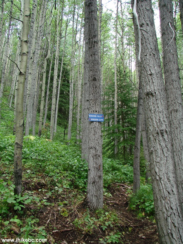
Bergeron Falls and Bergeron Cliffs Trail Split - Tumbler Ridge Trail
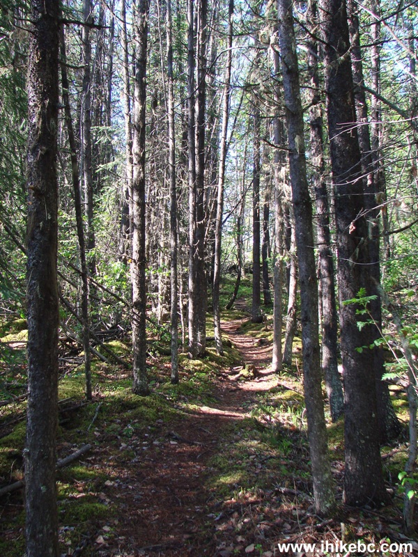
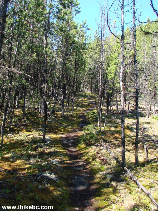
2. Bergeron Cliffs Trail after the split.
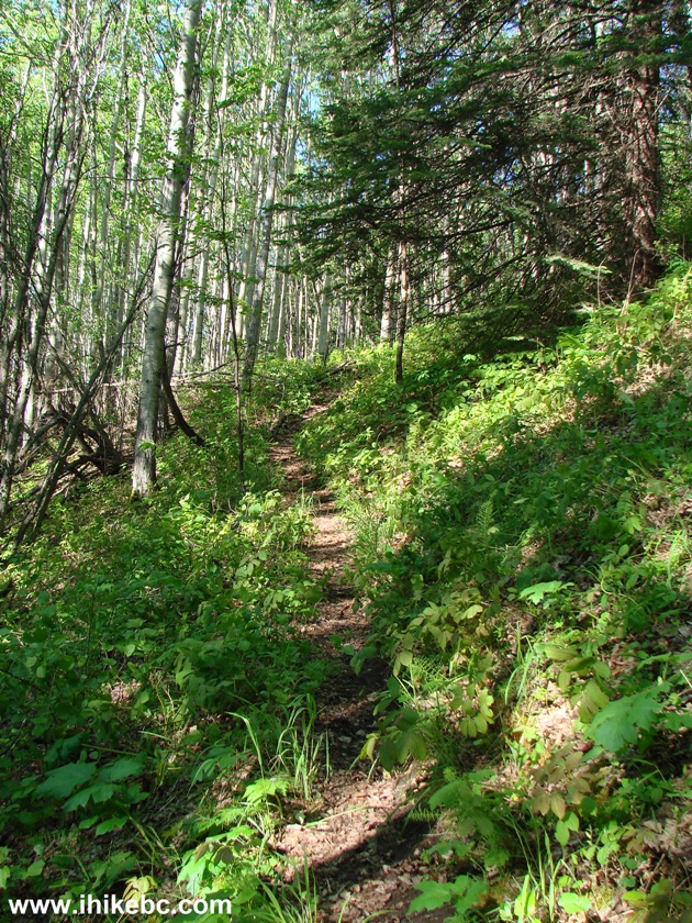
Bergeron Cliffs Trail - Tumbler Ridge Hike BC Canada
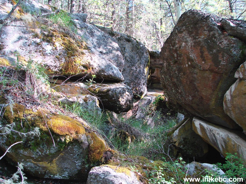
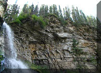
3. Half an hour after the start of the hike, the first attraction is a very short side trail called "under-cliff rest spot."
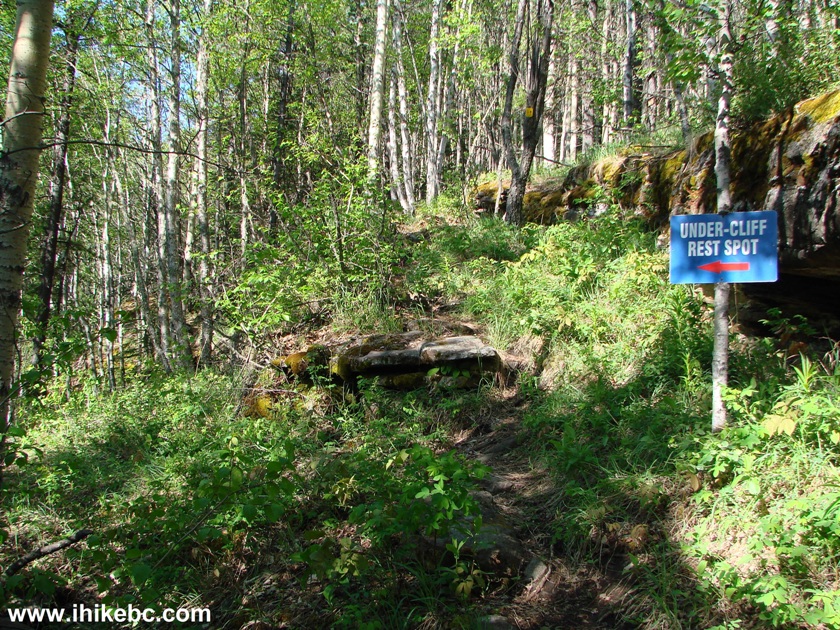
Bergeron Cliffs Trail Under-Cliff Rest Spot Side Trail - Tumbler Ridge
Hiking
4. Here is the rest spot under the cliff.
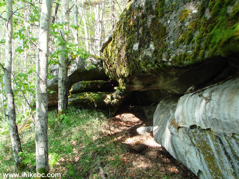
Under-Cliff Rest Spot Bergeron Cliffs Trail - BC Hike Canada
5. And this is just a neat view.
Hike in Tumbler Ridge Area
6. Moving on.
Hiking in Tumbler Ridge Area -
Bergeron Cliffs Trail
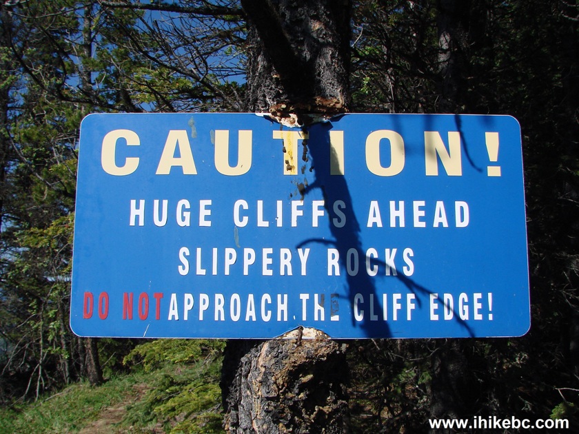
7. Fifteen minutes after the under-cliff rest spot side trail, the first viewpoint arrives, with this warning message.
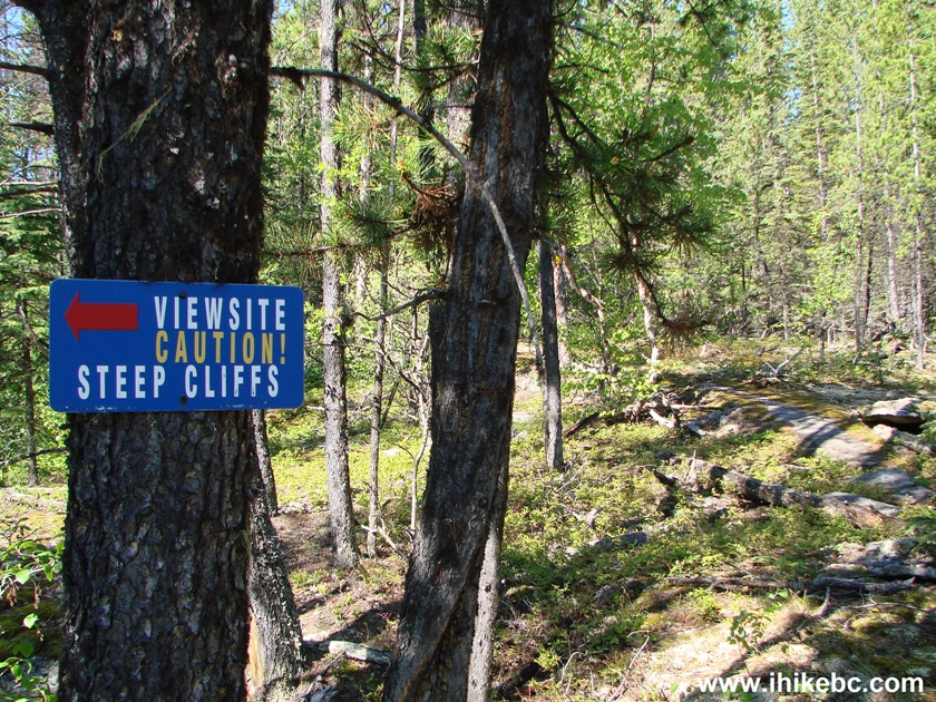
Bergeron Cliffs Trail First Viewpoint Warning Message
8. The first viewpoint. And the drop-off is, indeed, quite steep.
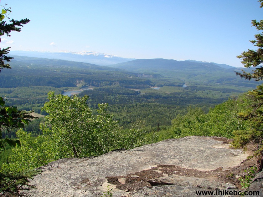
View from Bergeron Cliffs Trail near Tumbler Ridge - British Columbia
Hiking Canada
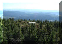
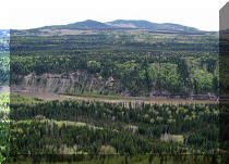
9. That's a big valley, with the Town of Tumbler Ridge barely seen in the far middle of the photo.
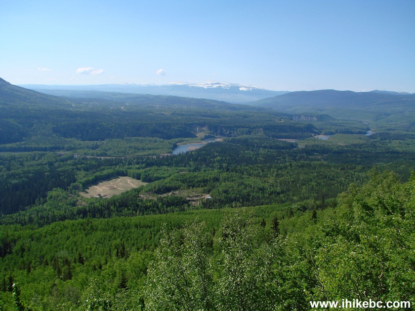
First Viewpoint Bergeron Cliffs Trail - Hike in Canada
10. The trail then continues.
Bergeron Cliffs Trail - Tumbler Ridge Hike
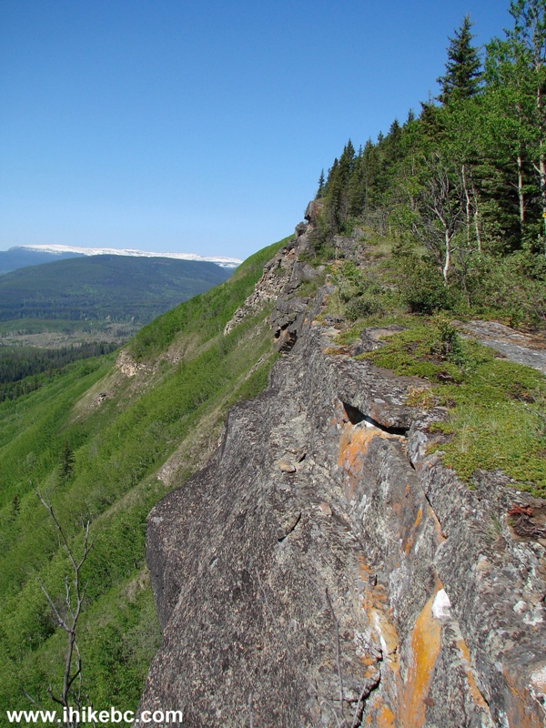
11. The second, most impressive viewpoint also comes with a warning sign. It takes about 1.5 hours from the trailhead to get here. Coordinates: N 55⁰10.635' W 121⁰01.367'. Elevation: 1,115 meters.
Bergeron Cliffs Second Viewpoint Warning Sign
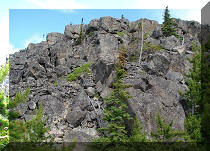
12. Looking to the right from the second viewpoint, there is this cliff...
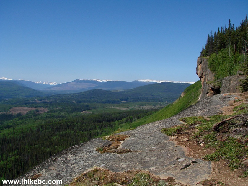
BC Hike -
Cliff Seen from Bergeron Cliffs Trail Second Viewpoint
13...which looks like a face...
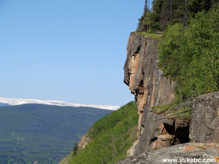
Cliff looks like a face on Bergeron Cliffs Trail BC Canada
14...indeed....
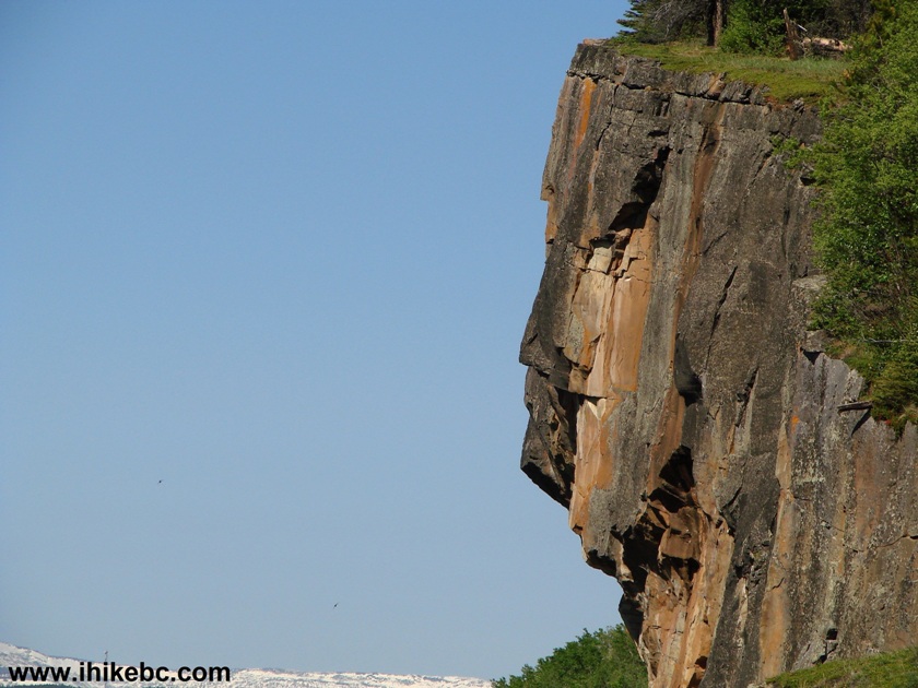
Face-looking cliff Bergeron Cliffs Trail British Columbia
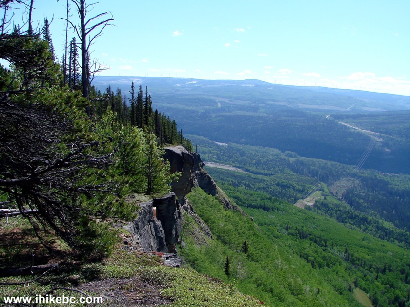
15. A bit more to the left.
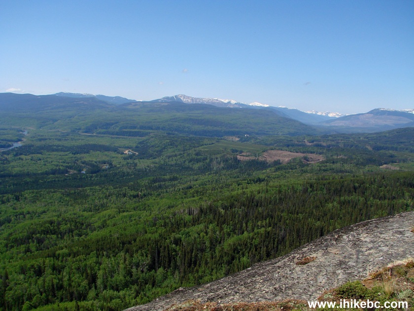
View from Bergeron Cliffs Trail near Tumbler Ridge British Columbia
Canada
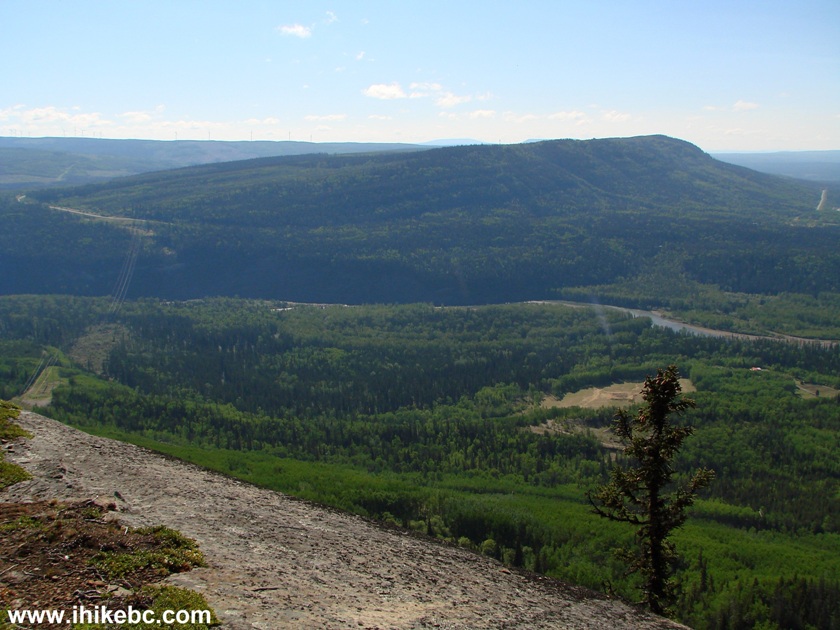
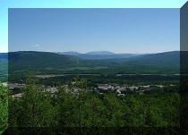
16. Looking straight. The town of Tumbler Ridge can be seen far ahead.
Town of Tumbler Ridge in the distance as seen from Bergeron Cliffs Trail
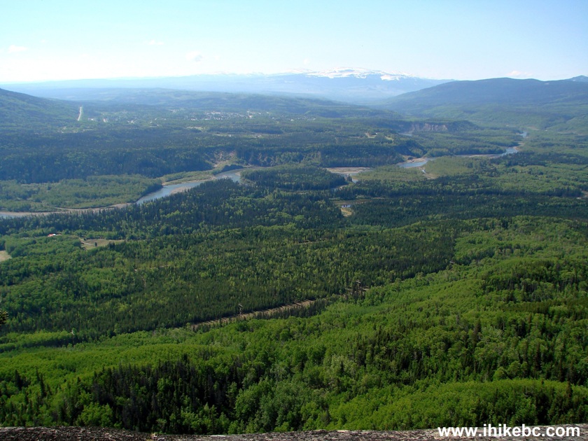
17. And more to the left.
Bergeron Cliffs Trail - view from second viewpoint
Here is our video of the view from the second viewpoint:
More ihikebc videos are on our YouTube Channel.
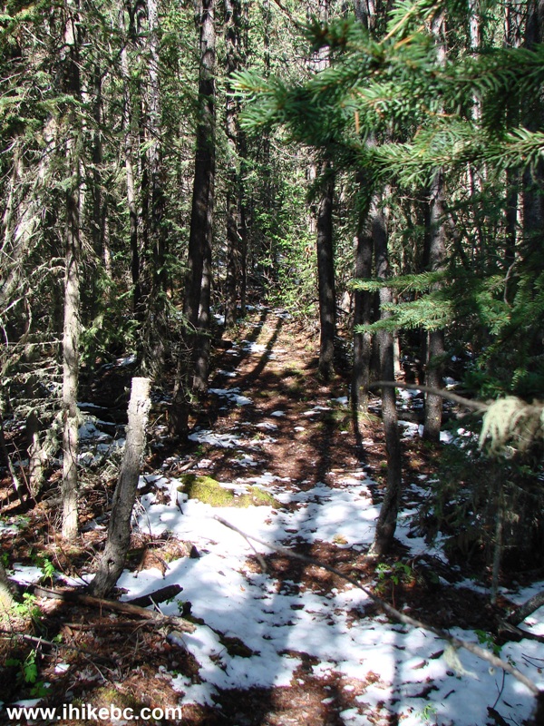
18. After the second viewpoint, the views don't get any better. So, if you are pressed for time, or are too tired after visiting Bergeron Falls, you won't miss much by turning around and heading back to the parking lot. Should you consider going further, though, this is the trail, featuring the remains of a snow dump which occurred several days earlier and, likely, killed all the mosquitoes (not a single bloodsucker on this hike!).
Bergeron Cliffs Trail Province of British Columbia Canada
19. Soon, a third viewpoint provides for the same valley views, but no "stone-faced man" cliff, as we are probably right on top of it by this point of the hike.
Bergeron Cliffs Trail Third Viewpoint
20. Looking left.
View from the third viewpoint of Bergeron Cliffs trail by Tumbler Ridge
BC
21. Walk a bit further and...
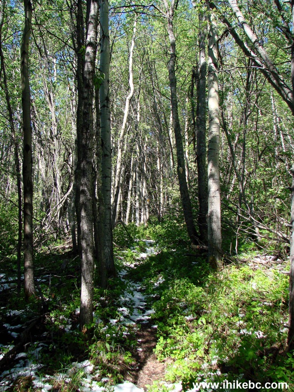
Photo of Bergeron Cliffs trail in Northeastern British Columbia Canada
22...here is the end. Coordinates: N 55⁰09.301' W 120⁰56.393'. Elevation: 1,168 meters.
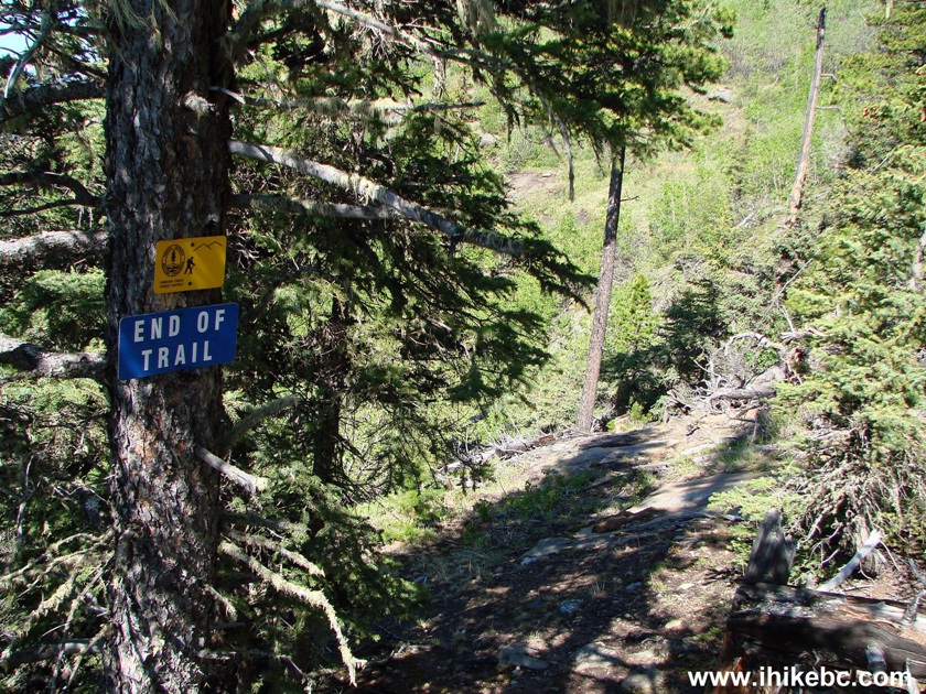
End of Bergeron Cliffs trail
23. Looking right.
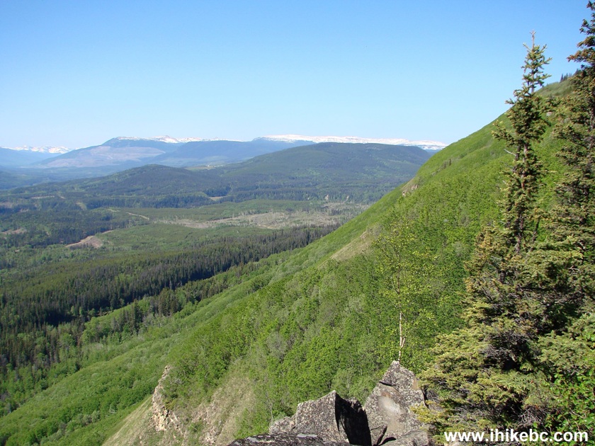
View from the end of Bergeron Cliffs trail
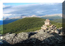
24. A neat stone formation below.
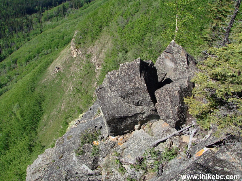
View at the end of Bergeron Cliffs trail BC Canada
Bergeron Cliffs is definitely recommended, especially the second viewpoint.


|
 |
Other Trips in Tumbler Ridge BC Area:
|
|
|
|
|
|
|
|
|
|
|
|
|
|
|
|
|
Monkman
Falls Hike
|
|
Windfall Lake Trail  |
|
Cowmoose Mtn Trail
|
|
Bootski Lake Trail  |
|
Murray Canyon
Overlook
|
|
Quality Canyon Trail  |


Other Trips:


![]()


![]()
![]()
![]()
ihikebc.com Trip 104 - Bergeron Cliffs Trail Hike (near Tumbler Ridge BC)