![]()
![]()
![]()

Trip 063 - August of 2013
Boundary Bay to Port Hardy
Flight in a Cessna 172
Page 1 of 3
We used to fly a Cessna 172 recreationally out of
Boundary Bay airport (CZBB) located in Delta, British Columbia. Here is
a story about our most memorable
flight from Boundary Bay to
Port Hardy (CYZT) via
Sechelt (CAP3), which
took place in August of 2013. Port Hardy is located on the Northern
Vancouver Island.
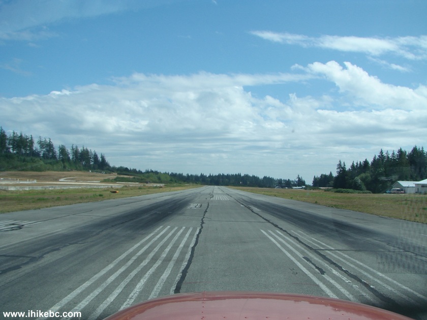
1. Before the flight at Boundary Bay Airport. CZBB tower is seen far ahead above the propeller.
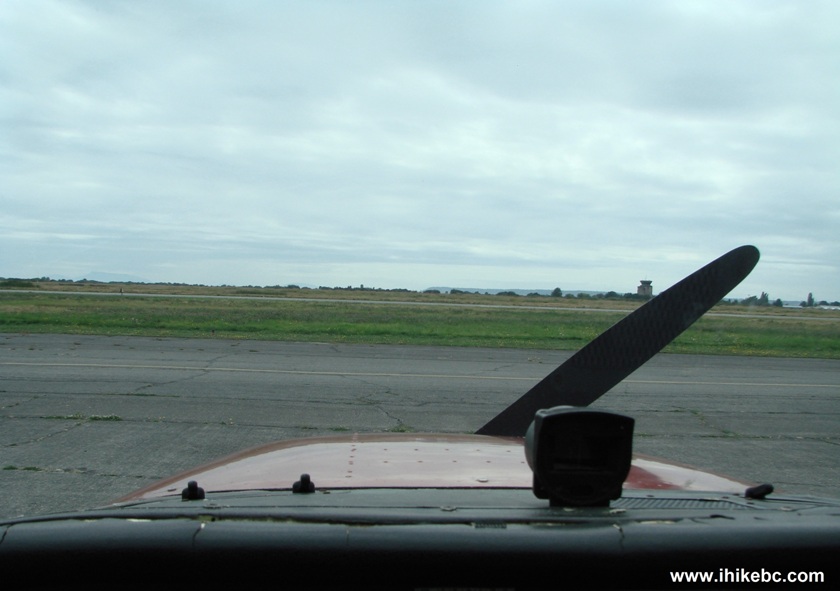
Boundary Bay Airport (CZBB) Delta British Columbia Canada
2. Flying by the Alex Fraser bridge. Altitude restriction in this area is not higher than 1,200 feet without clearance from the YVR control tower.
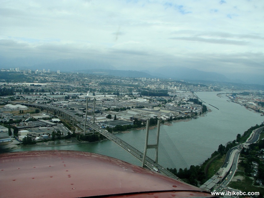
Flying Above Alex Fraser Bridge Delta British Columbia Canada
3. Approaching Second Narrows bridge. Vancouver on the left. North Vancouver on the right.
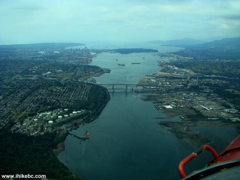
Second Narrows Bridge Seen From the Air BC Canada
4. North Vancouver on the foreground, and then Lions Gate Bridge leads to Stanley Park, which is attached to downtown Vancouver.
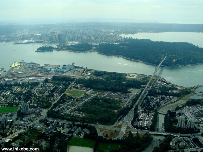
North Vancouver and Stanley Park Seen from the Air
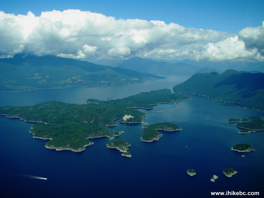
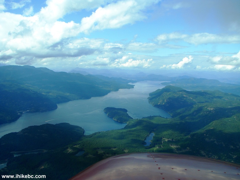
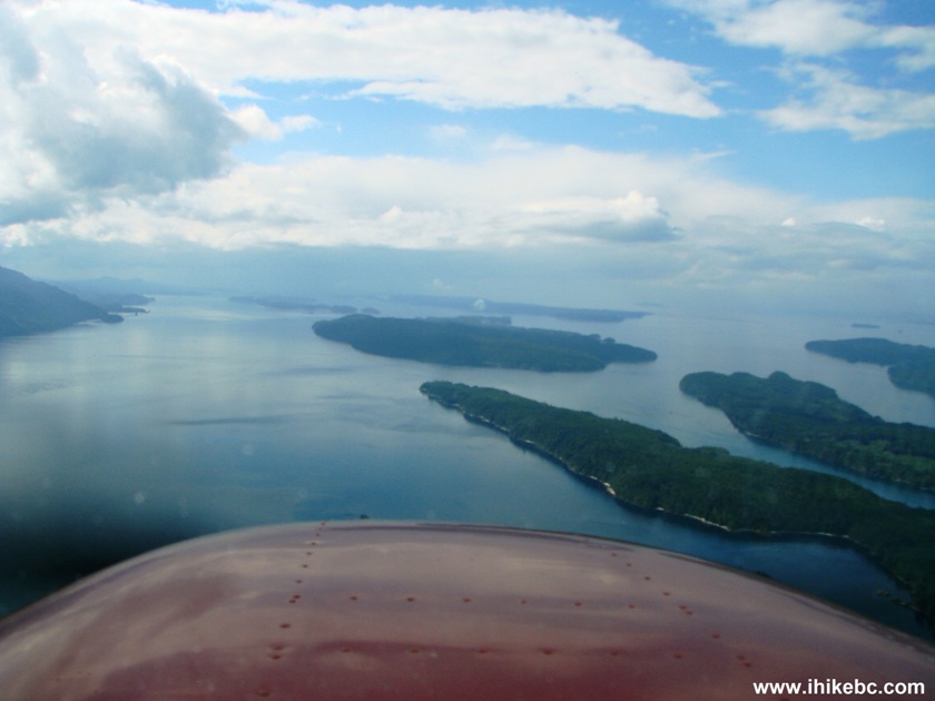
5. The most beautiful part of the flight begins: water, islands, mountains, lots of green.
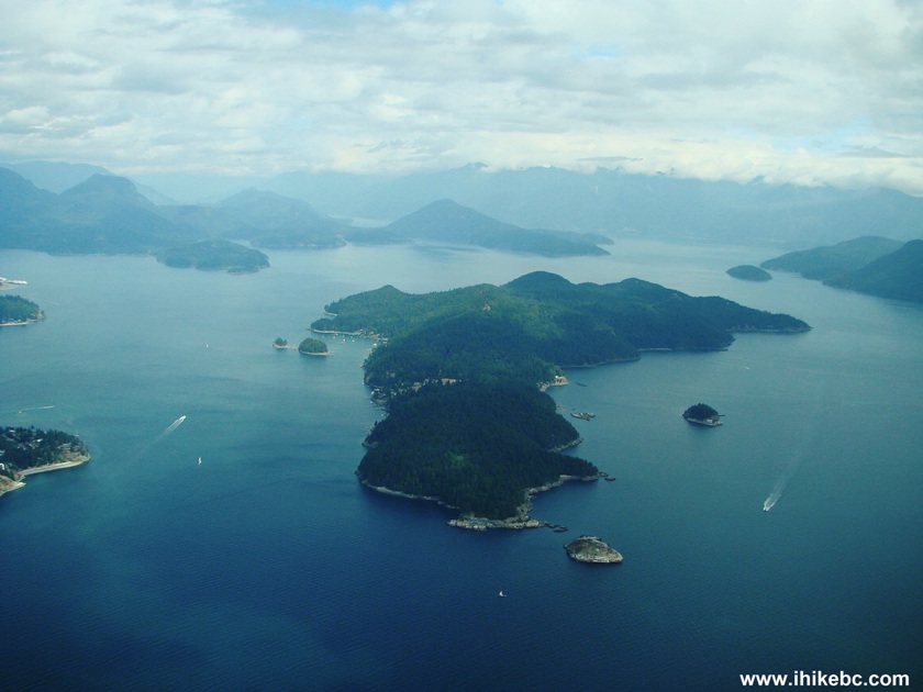
British Columbia Islands Seen from the Air
6. Flying above the town of Sechelt before landing at the Sechelt aerodrome. The landing is tricky due to high trees on approach and a short runway.
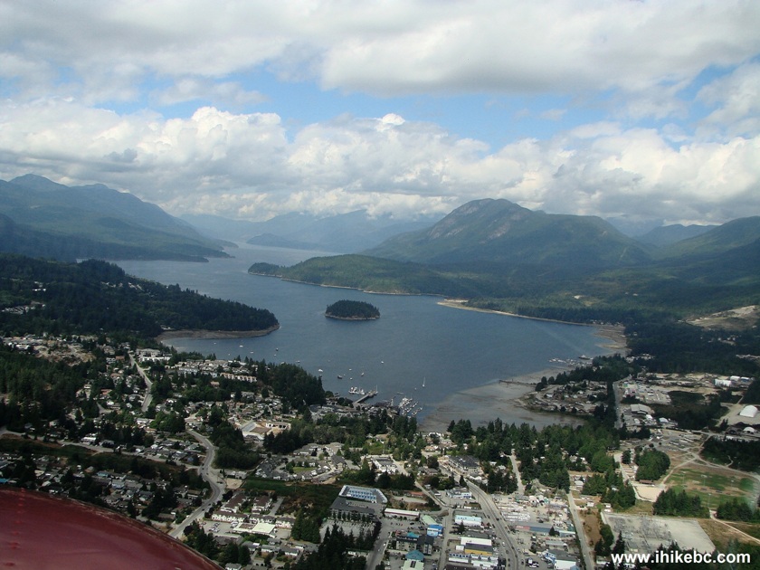
Sechelt Harbour British Columbia Canada
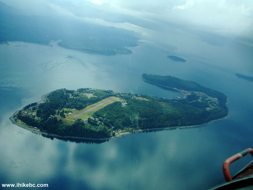
7. Sechelt aerodrome (code CAP3).
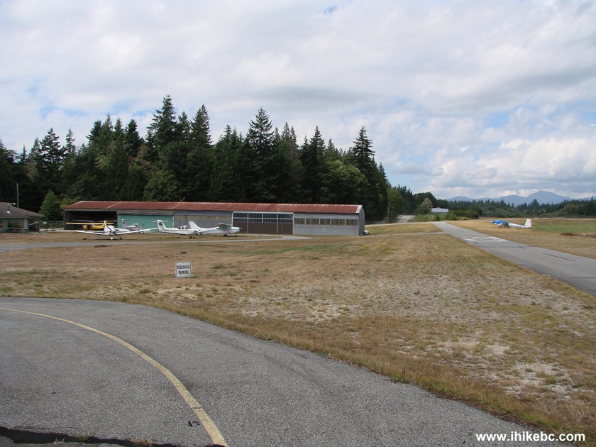
CAP3 Sechelt Airdrome British Columbia Canada
8. Piper Aerostar (C-GVMO) parked at the Sechelt aerodrome.
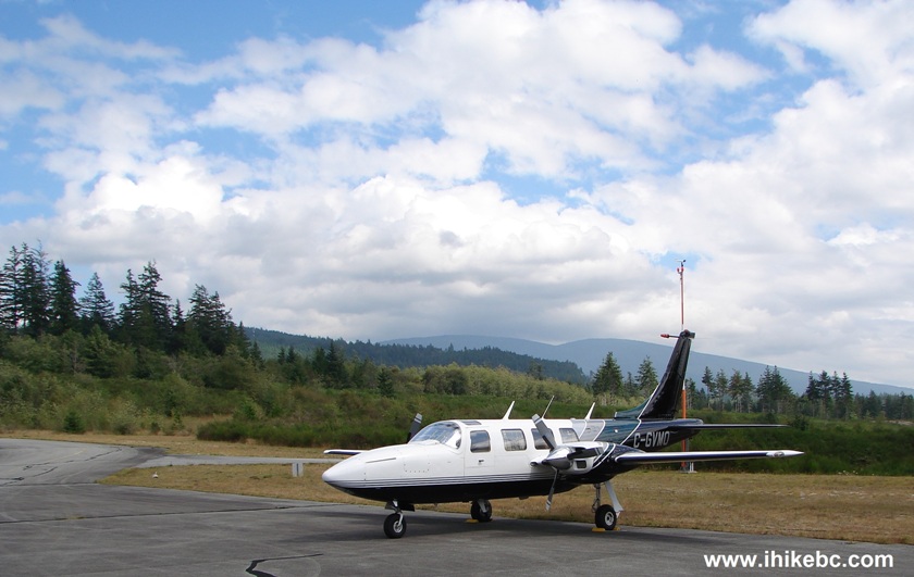
Piper Aerostar Parked at Sechelt Aerodrome (CAP3) BC Canada
9. We are ready for takeoff at Sechelt on Runway 11.
Ready for Takeoff at Sechelt Aerodrome (CAP 3) Runway 11
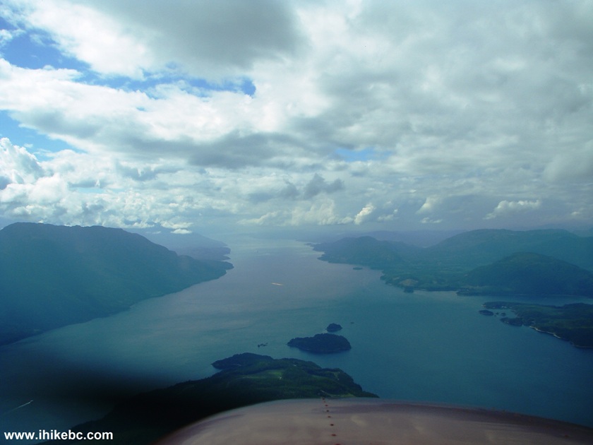
10. En route to Port Hardy. More of Beautiful British Columbia on display.

Flying Above British Columbia Canada
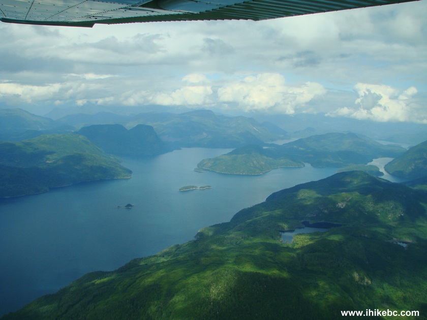
11. Lots of pretty small islands.
British Columbia Islands Seen from the Air
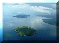
12. Savary Island near Powell River is one of a kind - a boomerang on the water.
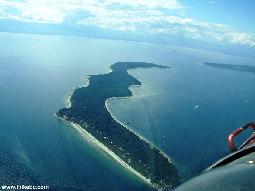
Savary Island BC Canada
13. There were many boats moored by Savary Island.
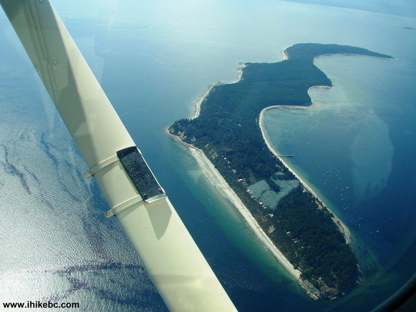
Savary Island British Columbia Canada
Here is our video of the
views from this area on the way back.
More ihikebc videos are on our YouTube Channel.
14. Moving on.
Flying above Southwestern British Columbia Canada
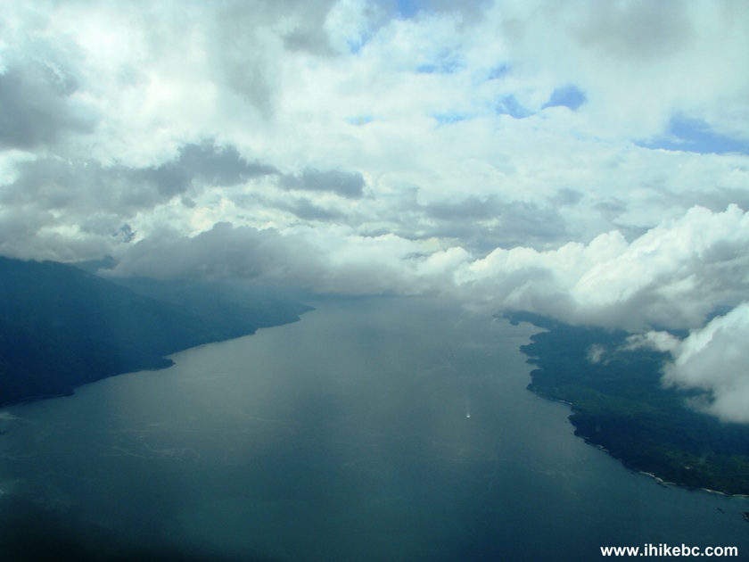
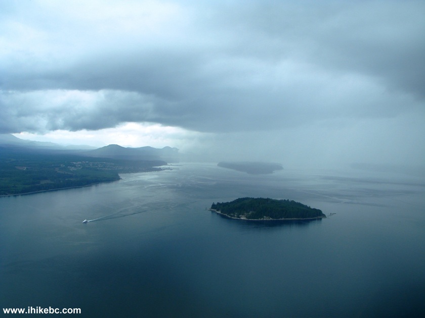
15. But what's with those low clouds...the minimum vertical distance from the clouds VFR (Visual Flight Rules) aircraft must maintain is 500 feet...
Johnstone Strait BC Canada
16. Really nice views, but the clouds...
Flying Near North-eastern Vancouver Island British Columbia Canada
17. The clouds were getting lower, so we had to keep descending. It's quite legal to fly right above the water, but this is not a seaplane, so, if the engine quits, our gliding distance would be less than desirable.
Flying to Port Hardy from Boundary Bay in Cessna-172
18. We were getting close to Port Hardy, and the clouds seemed to level
off.
Approaching Port Hardy Airport in Cessna-172
20. Here is another unusual sight - Cormorant Island (across the strait from Port McNeill) has an aerodrome (named Alert Bay - CYAL), and its runway takes about a third of the entire island. From the looks of the clouds way ahead, it was possible that we could use this runway for an unscheduled stop.
Cormorant Island BC Canada
20. This is where we started to feel rather uncomfortable. This was our first time in the area, and, while we were tuned to the Port Hardy VOR, there was no GPS in the aircraft, and we did not feel like flying near the hills in this weather. Things got really interesting after the Port Hardy control tower advised they were unable to provide vectors for landing. They did say the visibility was eight miles at the airport, so if we could just get past this nasty spot...
21. Hello!
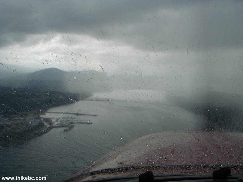
Flying through rain in Cessna 172
Our Trip Report Continues on Page 2.


|
 |
Other Trips:


![]()


![]()
![]()
![]()
Follow @ihikebc Tweet
ihikebc.com Trip 063 - Flight in Cessna 172 (from Boundary Bay to Port Hardy) Page 1 of 3