![]()
![]()
![]()

Trip 139 - August 10, 2018 (Friday)
Hixon Falls and Chutes
Near Hixon, British Columbia, Canada
Location: Off Highway 97 in
Central British Columbia, near a small town of Hixon, which by itself is
located halfway between Quesnel (to the South) and Prince George (to the
North), approximately 60 kilometers from each city.
Liked: Relatively easy access off Highway 97, short easy trails, waterfall view, chute view, no bugs.
Of Note: The waterfall trail is very popular, a high-clearance vehicle may be needed to reach the trailhead, semi-dangerous rock-hopping across the creek is required to get the best views, hiking poles and boots are recommended (highly recommended, if rock-hopping is planned).
Cariboo Chilcotin Coast BC Backroad Mapbook (4th edition) Approximate Falls Location: Page 56 (Hixon) D3.
>>> British Columbia Waterfalls Visits.
A very pleasant surprise awaits anyone travelling on Highway 97 in Central British Columbia, when they drive through the town of Hixon. Less than four kilometers from the highway, there are two short trails: one to a neat waterfall, and the other to some "chutes", which is a narrowing in a gorge, making creek water flow faster. There is only one such chute with an easy access, but it's a good one. The road leading to both trailheads (they are two hundred meters apart) is gravel, a bit narrow and with steep drop-offs, and contains some potholes which may not be to the liking of low-clearance vehicles. The chutes trail was all ours, as it doesn't seem to be all that popular. On the contrary, within 30 minutes that we spent on the waterfall trail, we have met five different groups of people, the majority of them children, some of whom carried floatation devices to enjoy a cool pool of water below the waterfall. This trail is, in fact, so popular, that a travel advisor recommended it to us when we asked for trails "around Prince George" in the Prince George Tourist Information Centre, 60 kilometers to the North of Hixon. He said it was one of his favourites.
1. We are Northbound on Highway 97, North of Quesnel, on a very smoky day.
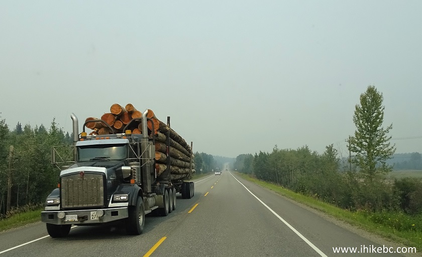
BC Highway 97 North of Quesnel British Columbia Canada
2. Once in Hixon, watch for this bridge. Make a right turn shortly after crossing it.
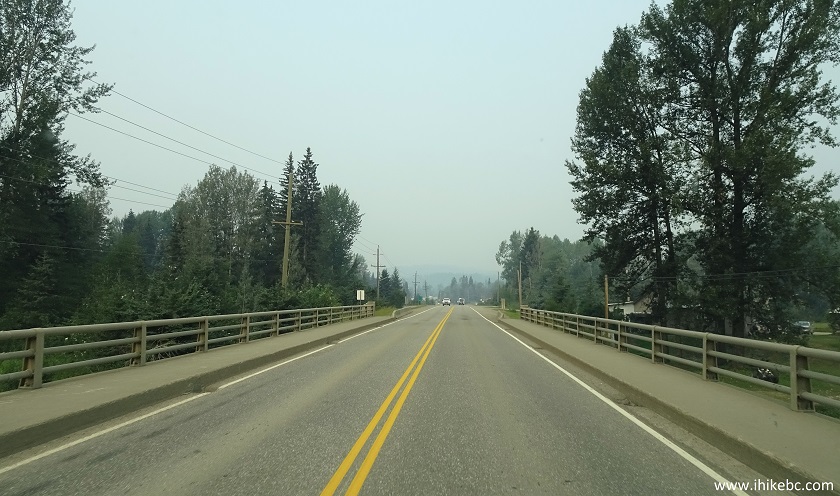
Highway 97 in Hixon BC Canada
3. And here is that right turn from Highway 97 onto Hixon Creek Road. Coordinates: N 53⁰25.318' W 122⁰35.251'.
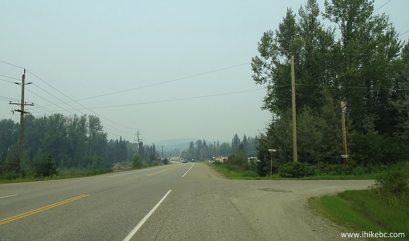
Highway 97 North at Hixon Creek Road turnoff in Hixon British Columbia
4. Hixon Creek Road's asphalt soon turns into gravel, which is in a good shape, save for some potholes. A high-clearance vehicle may be required. Stay left at the split pictured below at the 2.0 km mark.
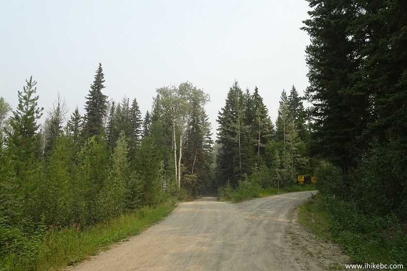
Hixon Creek Road leading to Hixon Falls
5. 3.8 kilometers after turning from Highway 97, make a left turn at this T-junction.
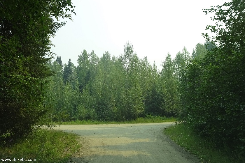
Hixon Creek Road near Hixon Falls parking area
6. The parking area for Hixon Falls would be straight ahead, with the trail starting at the far end of the parking area. Coordinates: N 53⁰26.890' W 122⁰33.589'. Elevation: 634 meters.
Hixon Falls parking area near Hixon BC Canada
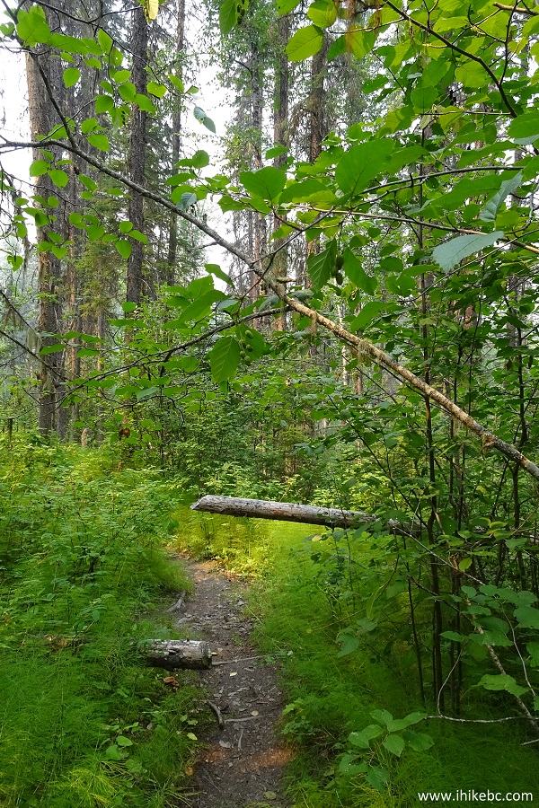
7. It's a short trail, 10 minutes or so.
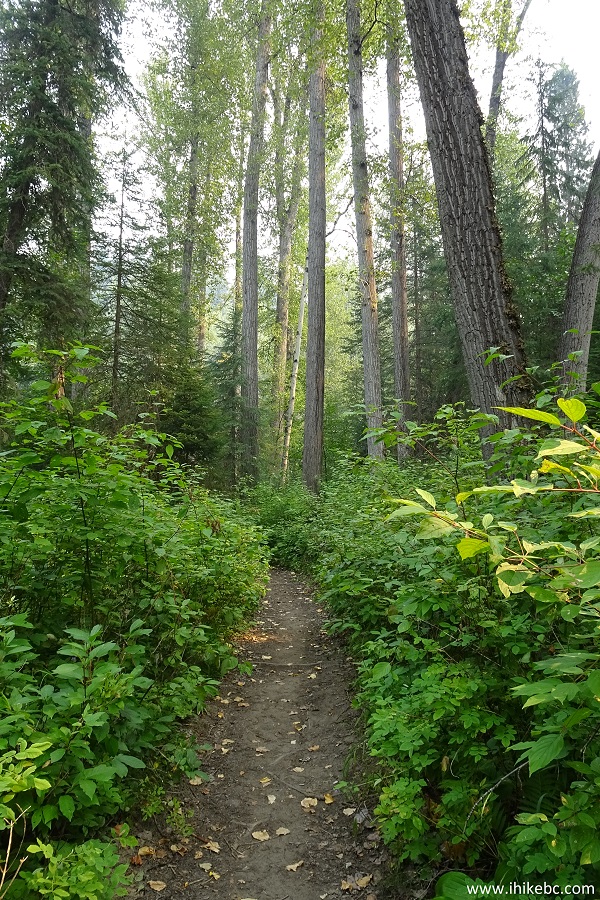
Hixon Trail - Hixon Falls trail
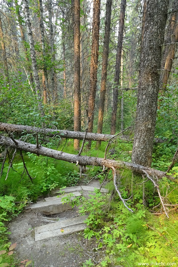
8. The only obstacle is a short steep descent and climb, which became necessary after this bridge called it quits.
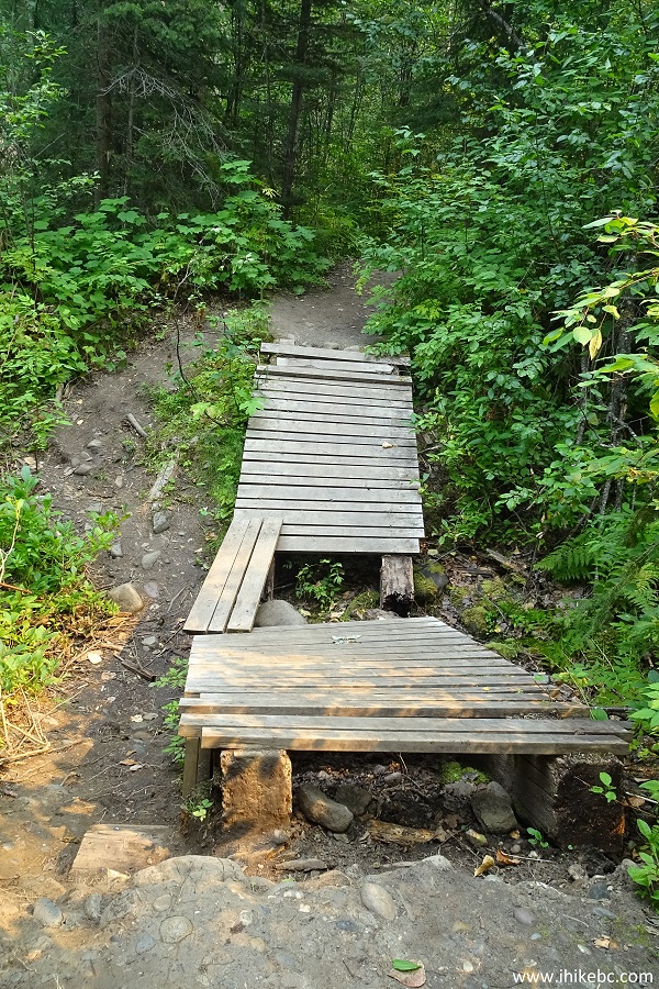
Hiking in Hixon BC - Hixon Falls Trail
9. Getting closer to Hixon Falls.
Hixon Falls Trail near Hixon British Columbia Canada
10. And there it is, in the distance.
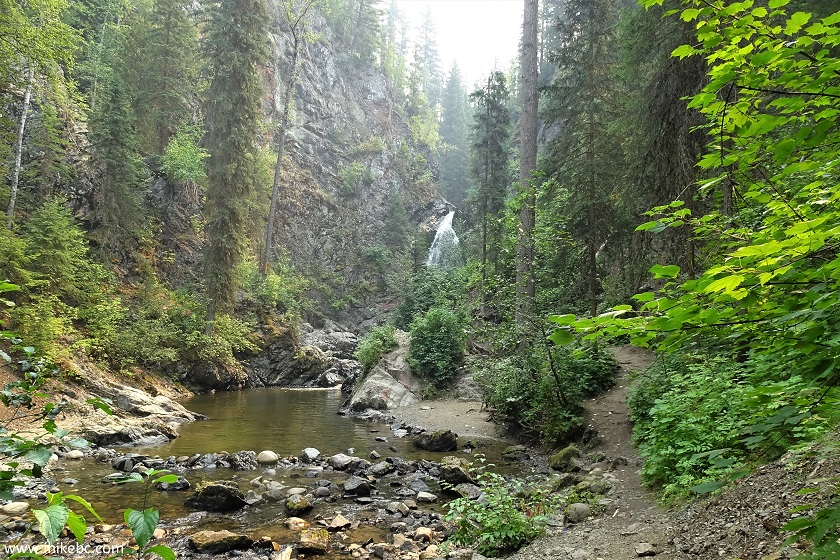
Hixon Falls seen from Hixon Falls Trail
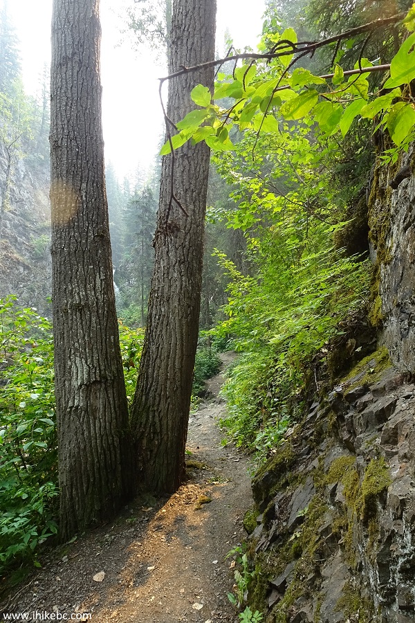
11. A neat natural scene near the waterfall.
Hixon Falls Trail - Trail in Hixon BC Area
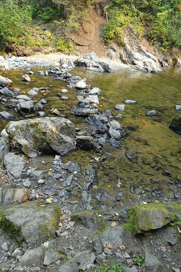
12. And here is a pool, so beckoning on a hot day like today.
Pool of water by Hixon Falls near Hixon - Hiking in BC Canada
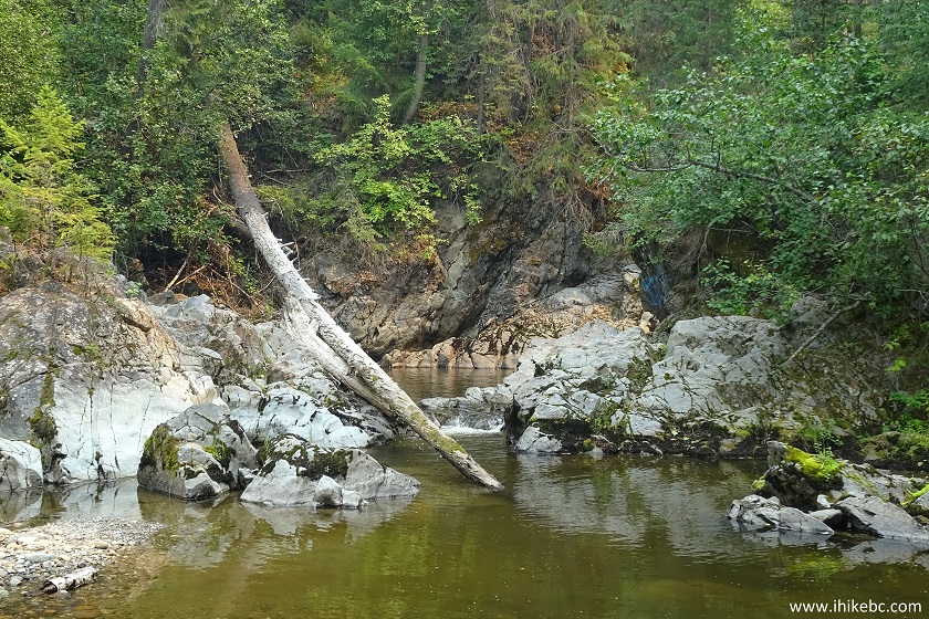
13. Initially, the waterfall is substantially obstructed by the rock face and vegetation, so hopping on these stones is required to get a good view. This is where hiking boots and, especially, poles, would come very handy.
Hixon Hiking
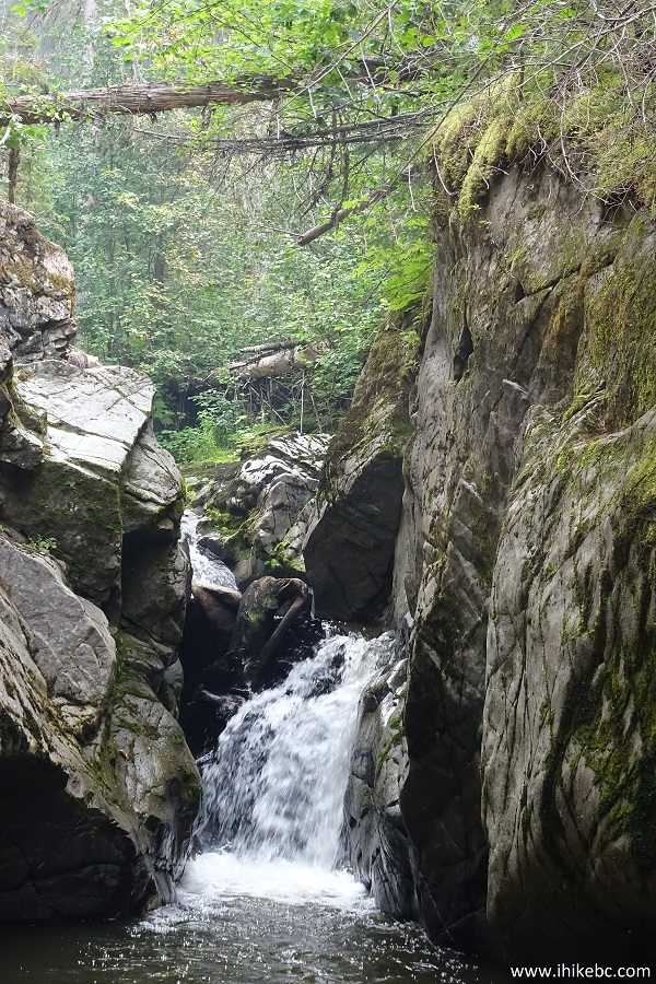
14. If you do get across, Hixon Falls would appear in all its glory. Looks almost tropical, doesn't it.
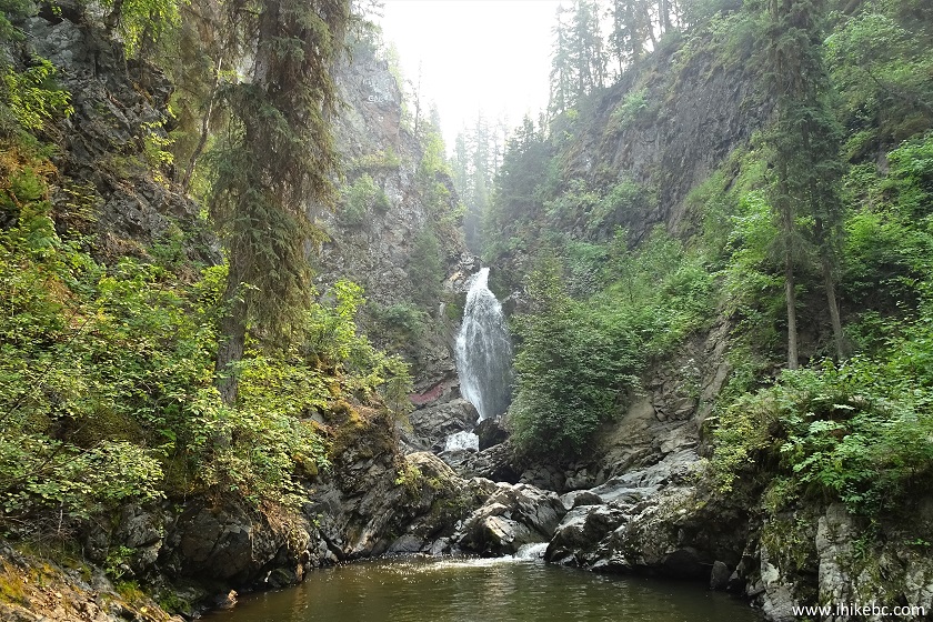
Hixon Falls near Hixon BC Canada
15. Zooming in.
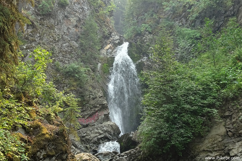
Hixon Falls by Hixon British Columbia
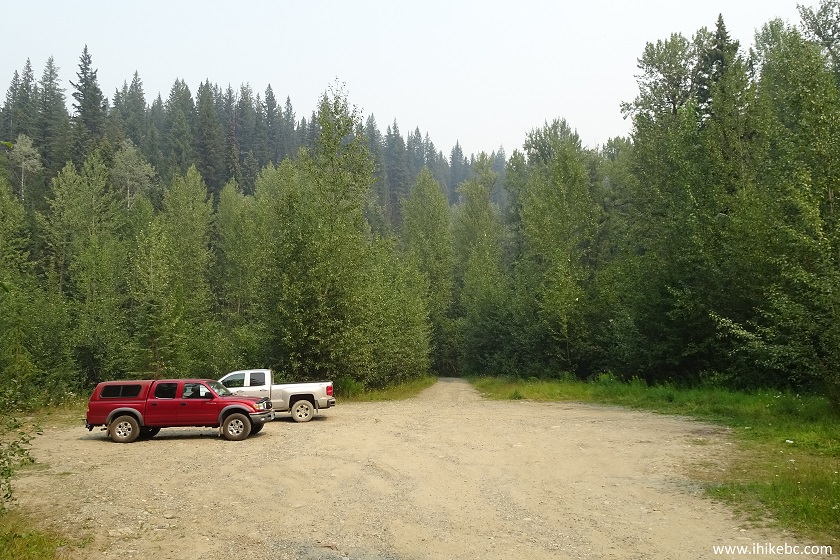
16. Now it's time to visit Hixon Chutes. The parking area for the trailhead is two hundred meters back on Hixon Creek Road. You would drive past this place en route to Hixon Falls trailhead. The trail starts straight ahead - a small opening can be observed in the trees.
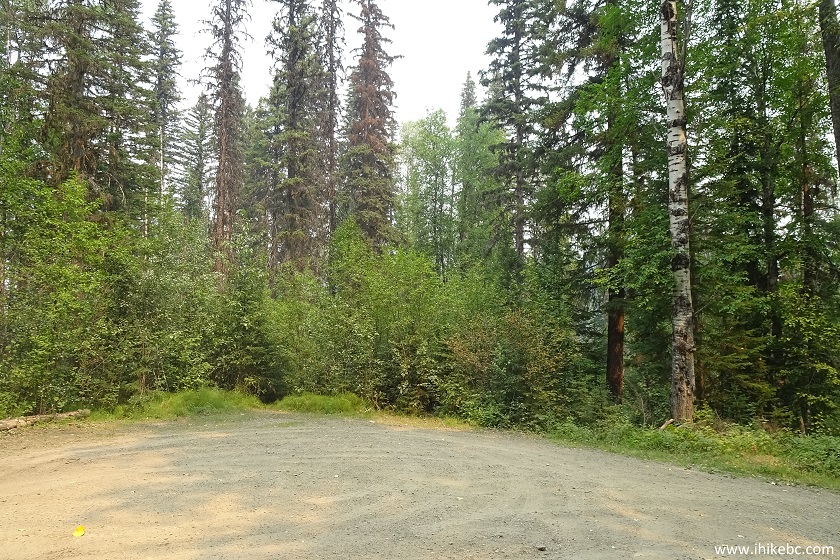
Parking area for Hixon Chutes near Hixon British Columbia
17. The Chutes trail has a larger elevation change, than the Falls trail, which hardly has any. That said, the Chutes trail is easy to hike, and it takes about 10 minutes as well.
Hixon Chutes Trail - Hiking in Hixon BC
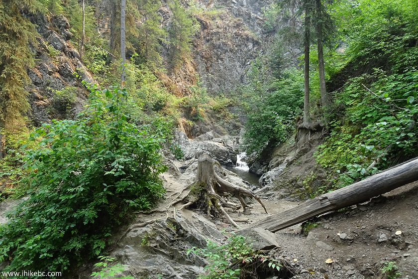
18. Unlike the Falls trail, the Chutes trail has some fallen trees, so ducking skills are required to reach your destination.
Hixon Hiking - Hixon Chutes Trail
19. The end of the Chutes trail also features a pool of water.
Pool of Water by Hixon Chutes - British Columbia Hiking
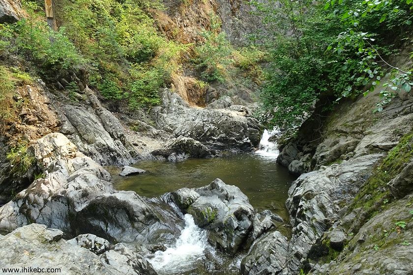
20. The main attraction is the chute which is the easiest to see. Rock hopping is required here as well.
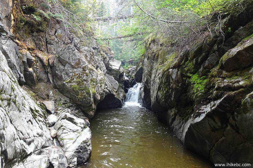
Hixon Chute - Hike in Hixon BC Area
21. Neat.
Hixon Creek flowing through Hixon Chute
22. Looking back.
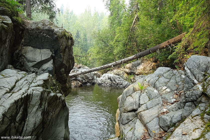 Z
Z
A view near Hixon Chutes - Hiking in Hixon British Columbia Canada Area
23. And here is a part of what you would need to tackle to see the views above.
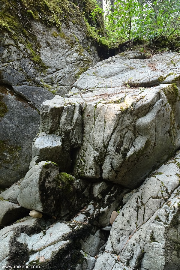
Near Hixon Chutes by Hixon BC
Hixon Falls and Chutes are two easy trails which lead to good views. The popularity of this destination is certainly justified.


|
 |
![]()
![]()
![]()
ihikebc.com Trip 139 - Hixon Falls and Chutes (Hixon BC)