![]()
![]()
![]()

Trip 080 - May 15-16, 2015 (Friday-Saturday)
Kinuseo Falls Visit
Monkman Provincial Park Near Tumbler Ridge BC
Page 1 of 2
Location: Northeastern British Columbia, approximately 63 kilometers Southeast of Tumbler Ridge,
near the end of Murray River Forest Service Road.
Liked: Short and easy paths to the waterfall viewing platforms, the ability to get to the bottom of the waterfall, shapes created by the spray from the Falls, quite decent access via Murray River Forest Service Road.
Of note: Remote area, numerous potholes on the short asphalted stretch of the Murray River FSR before the gravel road begins.
Northern BC Backroad Mapbook (3rd edition) Waterfall Coordinates: Page 44 (Tumbler Ridge) B6.
Related Websites: Monkman Provincial Park - BC Parks, Tumbler Ridge Tourist Information.
Other Trips off Murray River FSR: Stone Corral Trail Hike, Monkman Falls Hike, Nesbitt's Knee Falls Trail Hike, Barbour Falls Trail Hike.
>>> British Columbia Waterfalls Visits.
Follow @ihikebc Tweet
Our first scenic trip in Northeastern British Columbia is to one of BC's most impressive natural attractions - Kinuseo Falls.
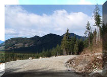
1. To get to Kinuseo Falls, take Highway 52. Here we are driving on Highway 52 Southeast of Tumbler Ridge. Check the map to ensure you do not get confused, as Highway 52 is a bit of a tricky road, and has two parts going North and South, but only one of those parts actually goes East. You need to be on that East-going part of Highway 52 to get to Kinuseo Falls.
BC Highway 52 East Near Tumbler Ridge
2. Approximately 13 kilometers East of Tumbler Ridge, there is a turnoff to Murray River Forest Service Road, which leads to Kinuseo Falls viewpoint.
BC Highway 52 East Turnoff to Murray River Forest Service Road
3. Murray River FSR begins at Coordinates N 55⁰01.550' W 120⁰57.663'. The road is asphalted for a few kilometers until it reaches Quintette Mine, pictured below. This asphalted stretch is full of numerous deep potholes.
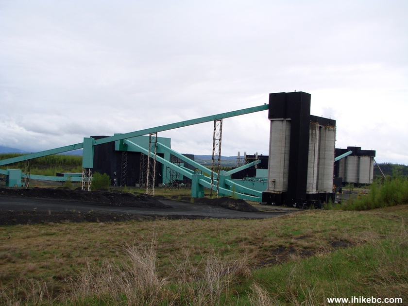
Quintette Mine off Murray River FSR
4. After the mine, the road turns to gravel, and the potholes become far less numerous. Shortly, the road goes through two small tunnels...
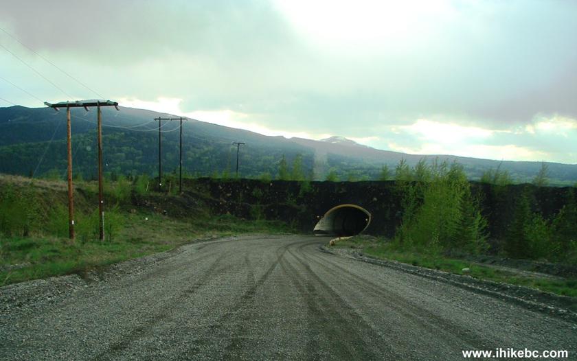
Tunnel on Murray River Forest Service Road BC Canada
5...and there would be a neat Murray River view on the left side, seen while crossing a small bridge.
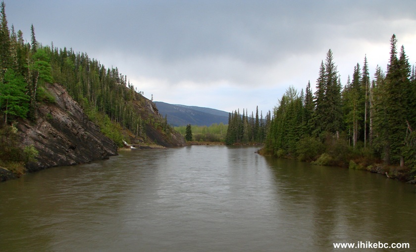
River View off Murray River FSR British Columbia Canada
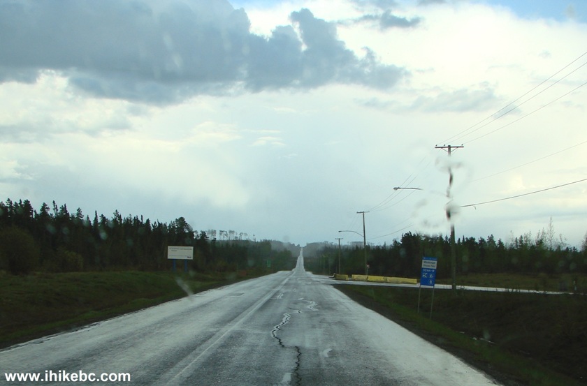
6. Information signs keep advising how much longer before the Falls.
Murray River Forest Service Road BC Canada
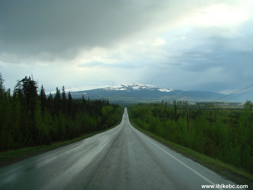
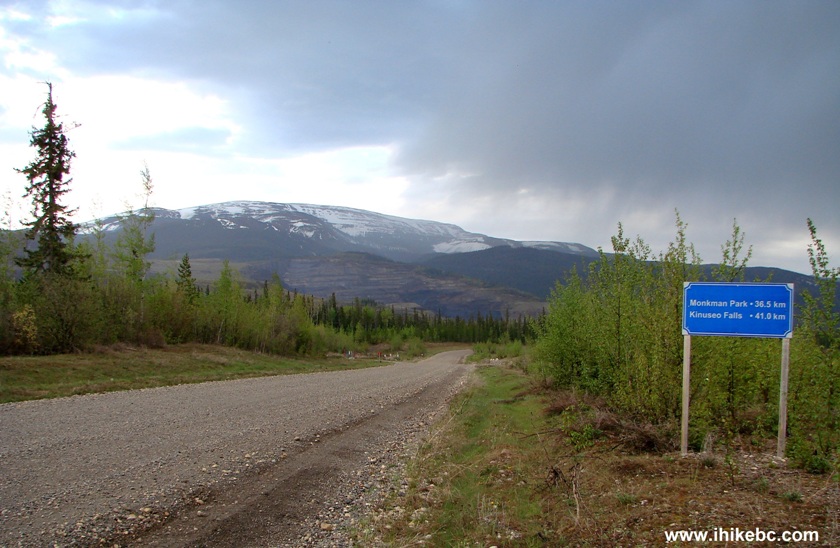
7. Murray River Forest Service Road has pleasant, if unspectacular, views. To be fair, it was rather cloudy, so we might have missed something there. The photo below was taken the next day, after we camped on the side of Murray River FSR. There are very few quality camping spots along this road, though there is a campground not far from Kinuseo Falls, and, besides, it is possible to camp at the Kinuseo Falls parking lot too.

Photo of Murray River FSR British Columbia Canada
8. There are several hikes, plus other waterfalls to see in the Murray River FSR area. For example, a side road at the 21.4 km mark leads to Nesbitt's Knee Falls and Barbour Falls, while Greg Duke Trail begins at 44.1 km mark. A very neat Stone Coral Trail is at the 48 km mark. Get a map of hiking trails around Tumbler Ridge (available at information centres in various towns in Peace Region), as there are quite a few. Meanwhile, at the 46.3 km mark, there is an entrance to Monkman Provincial Park.
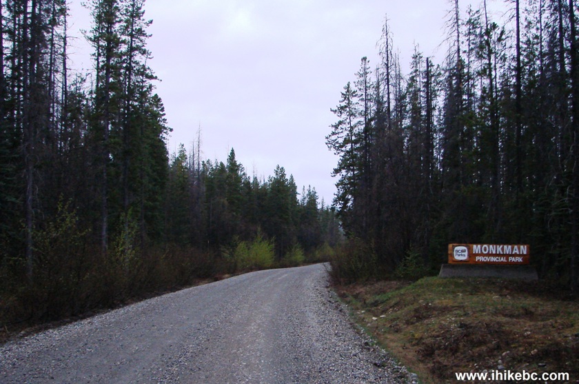
Entrance to Monkman Provincial Park BC Canada
9. Shortly, a sign appears advising that to get to the Kinuseo Falls campground and to Monkman Lake Trailhead you need to drive straight, while to get to Kinuseo Falls a turn to the right would be required.
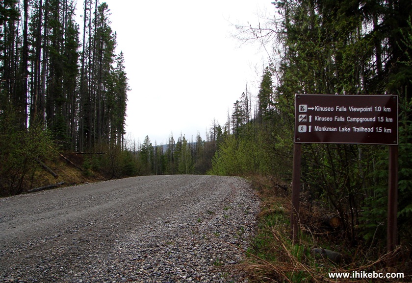
Signage on Murray River Forest Service Road British Columbia Canada
10. Here is the turnoff to Kinuseo Falls viewpoint parking lot - 49.8 km after the beginning of Murray River Forest Service Road.
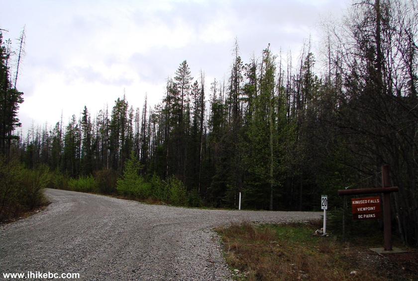
Kinuseo Falls Viewpoint Off Murray River FSR British Columbia Canada
11. One kilometer later, the parking lot is in front of us. Coordinates: N 54⁰46.951' W 121⁰11.338'. To the right (seen in photo #29 on the next page, but not in the photo below) is a short trail to the upper viewing platform. In the middle left of the photo below, behind the message board, is an even shorter trail to the lower viewing platform.
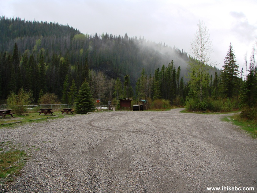
Kinuseo Falls Viewpoint Parking Lot BC Canada
12. Here is the trail to the lower viewing platform.
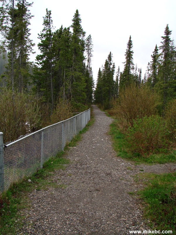
Path to Kinuseo Falls Lower Viewing Platform
13. Lower viewing platform.
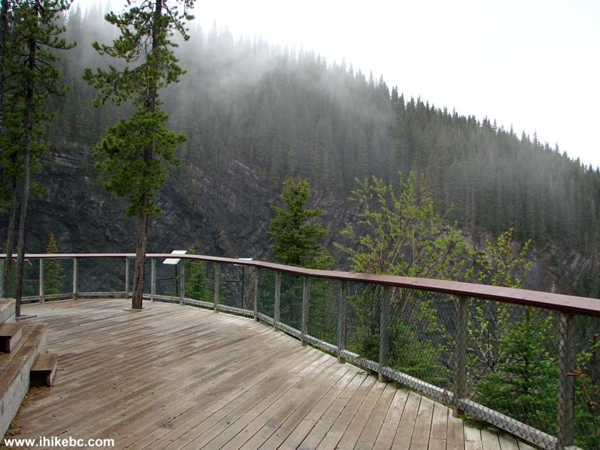
Kinuseo Falls Lower Viewing Platform
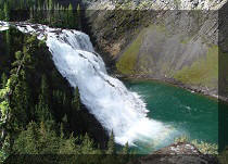
14. It rained the night before, so Kinuseo Falls was roaring.
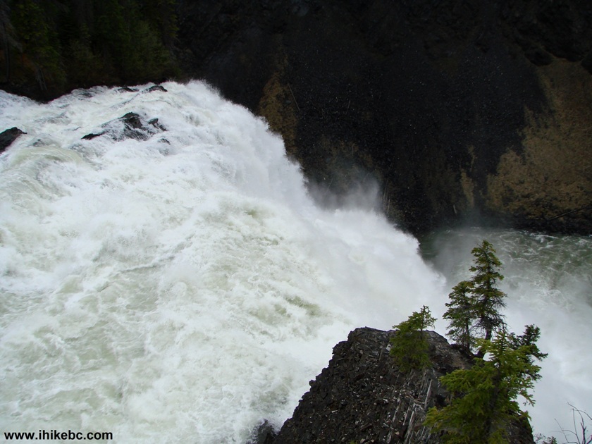
Kinuseo Falls British Columbia Canada
Here is our Video of Kinuseo Falls View from the Lower Platform:
More ihikebc videos are on our YouTube Channel.
15. Murray River after Kinuseo Falls, as seen from the lower viewing platform.
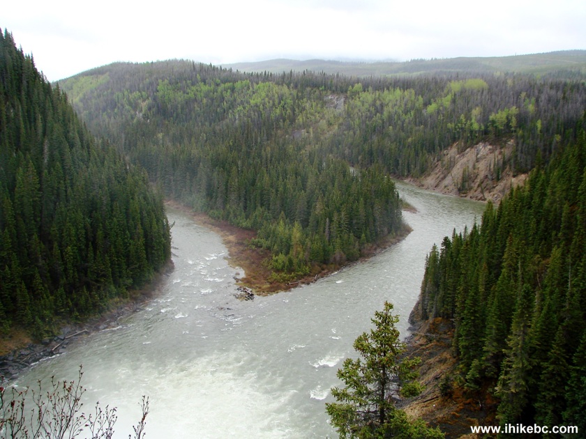
Murray River FSR Canada
16. Up to this point, you could have walked in flip-flops and be fine. But, should you desire to take a short but quite steep path to the bottom of the Falls, hiking boots and poles are highly recommended.
Start or the Path to the Bottom of Kinuseo Falls
17. The trail begins mildly enough, but then steepens considerably.
Trail to the bottom of Kinuseo Falls BC Canada
18. In a few minutes, there is a split. Going left here is less steep, than going right, leads to a slightly better (and closer) view of the Falls, and would subject you and your camera to much less spray.
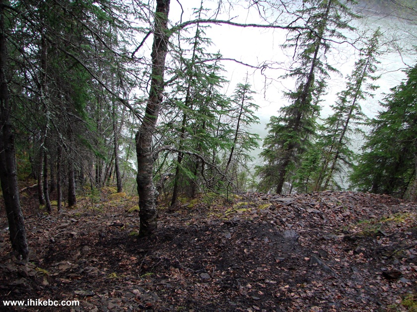
Trail to the Bottom of Kinuseo Falls British Columbia
Our Kinuseo Falls Trip Report Continues on Page 2.


|
 |
Other Trips in Tumbler Ridge BC Area:
|
|
|
|
|
|
|
|
|
|
|
|
|
|
|
|
|
Monkman
Falls Hike
|
|
Windfall Lake Trail  |
|
Cowmoose Mtn Trail
|
|
Bootski Lake Trail  |
|
Murray Canyon
Overlook
|
|
Quality Canyon Trail  |


Other Trips:


![]()


![]()
![]()
![]()
Follow @ihikebc Tweet
ihikebc.com Trip 080 - Kinuseo Falls Visit (Monkman Provincial Park near Tumbler Ridge) Page 1 of 2