![]()
![]()
![]()

Trip 187 - May 30, 2020 (Saturday)
Cheslatta Falls Trail Hike
Near Vanderhoof BC
Trailhead Location: Approximately 130 kilometers from the town of Vanderhoof via Highway 16 West, Bearhead Road, Telegraph Road, Kenney Dam Road, Kluskus FSR, 500 Rd (Kluskus-Natalkuz FSR), Kenney Dam, and Holy Cross FSR. Or, a slightly shorter route via Kenney Dam FSR to Kenney Dam and, then, to Holy Cross FSR. Or directly from Highway 16 near Fraser Lake via Holy Cross FSR. Located near the 159 km sign of Holy Cross FSR, and near Cheslatta River Recreation Site.
Liked: Cheslatta Falls views, Cheslatta River views, a view of the island in the river, few bugs, the second half of the trail is a loop.
Of Note: Unbarricaded drop-offs and slippery stones by the main waterfall viewpoint, several short steep sections, the trail is somewhat popular. Hiking poles and boots are recommended to the main viewpoint, and are highly recommended to the lower viewpoint. Boaters advisory - grounding danger on Cheslatta River near the waterfall viewpoint.
Northern BC Backroad Mapbook (3rd edition) Trailhead Coordinates: Page 9 (Fraser Lake) A6.
Related Websites: Cheslatta River - Wikipedia, Kenney Dam - Wikipedia.
Other Trips in Vanderhoof Area: Cutoff Butte Trail Hike, Greer Creek Falls Trail Hike.
>>> British Columbia Waterfalls Visits.
Cheslatta Falls Trail is a short and neat hike, and leads to a very
impressive two-stage waterfall. It can be observed up close from near
its edge, as well as from the bottom (unclear how close one can get
there), which allows for a more complete waterfall view. It would take
much longer to drive to Cheslatta Falls from Highway 16 than to hike the
trail, which is just over one kilometer long. In addition, there is a
neat small
rocky island in Cheslatta River, which can be seen from the trail. Also,
it is possible to get up Cheslatta River in a boat to view the Falls.
Just beware of the grounding danger, as one boat was actually stuck in
the river at the time of our hike.
There are several ways to get to the trailhead in a vehicle. The direct
route is to take Holy Cross Forest Service Road from Highway 16 East of
Fraser Lake. However, as we reached Cheslatta Falls Trail from the other
end of Holy Cross FSR, we do not know the condition of the road past the
159 km marker (driving up). The 8 km part we drove from 167 km (end of
Holy Cross FSR, where it connects with Kenney Dam FSR via Kenney Dam) to
159 km is fairly rough, but not too bad, and a speed of 40-50 km per
hour is possible. We did drive Kenney Dam Road on the way back from
Kenney Dam to Kluskus FSR, and then retraced our route which we took to
reach Greer Creek Falls, described in
trip report #185.
Both Kenney Dam Rd and Kluskus FSR are in good shape. After hiking to Greer Creek Falls, we went to
Cutoff Butte Trail (trip
report #186) via Kluskus FSR and 500 Rd, which then ended at Kenney Dam.
So, if you want to reach Cheslatta Falls trailhead from Highway 16 near
Vanderhoof the same way we did, check out trip reports #185 and #186.
For a quicker route, instead of turning from Kenney Dam Road onto
Kluskus FSR as seen in photo #8 of
Greer Creek Falls trip
report, keep going straight on Kenney Dam Rd until the end, where it
meets with Holy Cross FSR via Kenney Dam, as described in this trip
report.
1. We finished hiking Cutoff Butte Trail, and drove for slightly over 11
km till the end of 500 Rd (Kluskus-Natalkus FSR). Here is the end of
this road. Coordinates: N 53⁰34.853’ W
124⁰56.844’. Elevation: 856 meters. To the right is the beginning of Kenney Dam Road. To the left
is Kenney Dam. Turning left and crossing Kenney Dam would lead to Holy
Cross FSR in 0.7 km, and Holy Cross FSR would lead to Cheslatta Falls
Trail in 8.0 km.
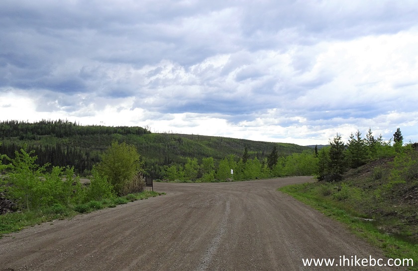
Kluskus-Natalkuz FSR at Kenney Dam FSR
2. Looking at Kenney Dam from the left side near the intersection.
Kenney Dam British Columbia
3. Now from the right side.
Kenney Dam
4. And now straight up.
Kenney Dam near Vanderhoof BC
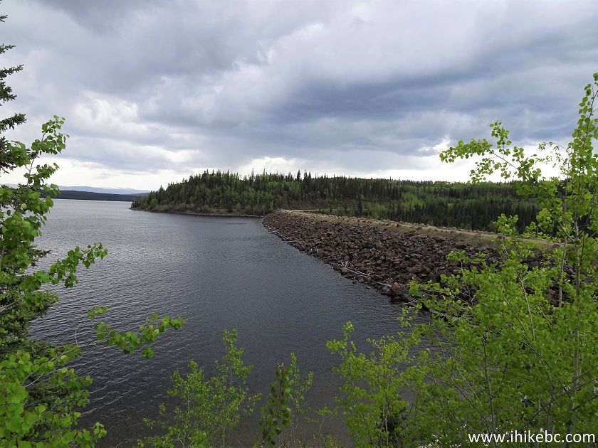
4. View of Knewstubb Lake (part of Nechako Reservoir) from Kenney Dam.
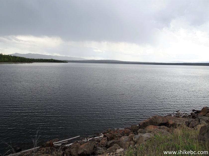
Knewstubb Lake
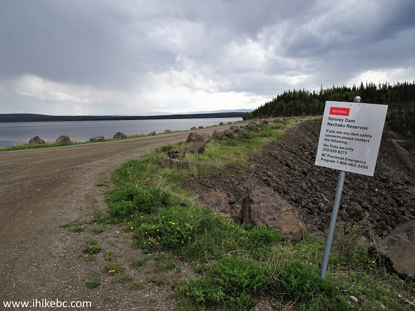
5. Cross Kenney Dam, and take the road on the right 0.6 km after the intersection seen in photo #1.
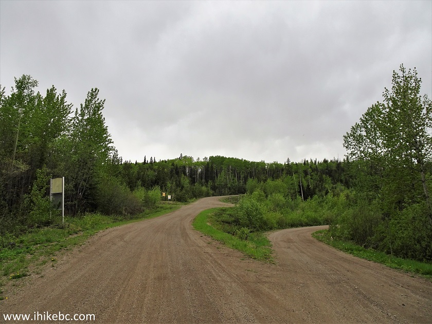
6. One hundred meters later is the start (or, rather, the end) of Holy Cross FSR.
Holy Cross Forest Service Road
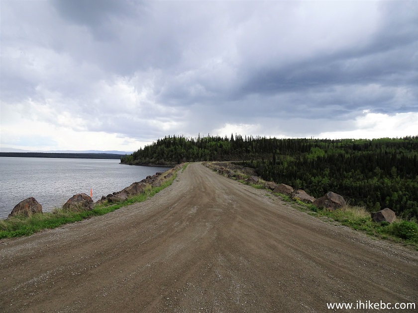
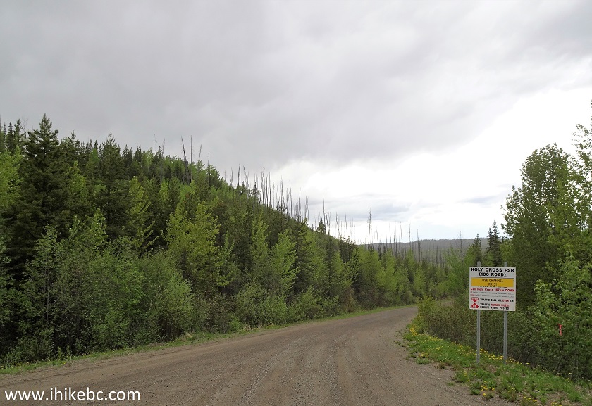
7. Cheslatta Falls trailhead is 8 kilometers further on Holy Cross FSR, just before the bridge, on the right side. But, 250 meters before the bridge, right after the 159 km sign, is the entrance to Cheslatta River Recreation Site, where we spent the night before the hike.
Holy Cross FSR at Cheslatta River Recreation Site Turnoff
8. The entrance.
Cheslatta River Recreation River Entrance
9. The recreation site. Empty but for some mosquitoes. Large.
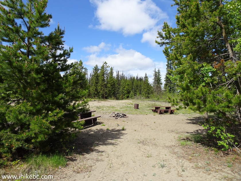
Cheslatta River Recreation Site
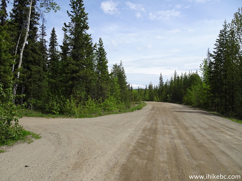
10. Here is the bridge 8 kilometers from the end of Holy Cross FSR.
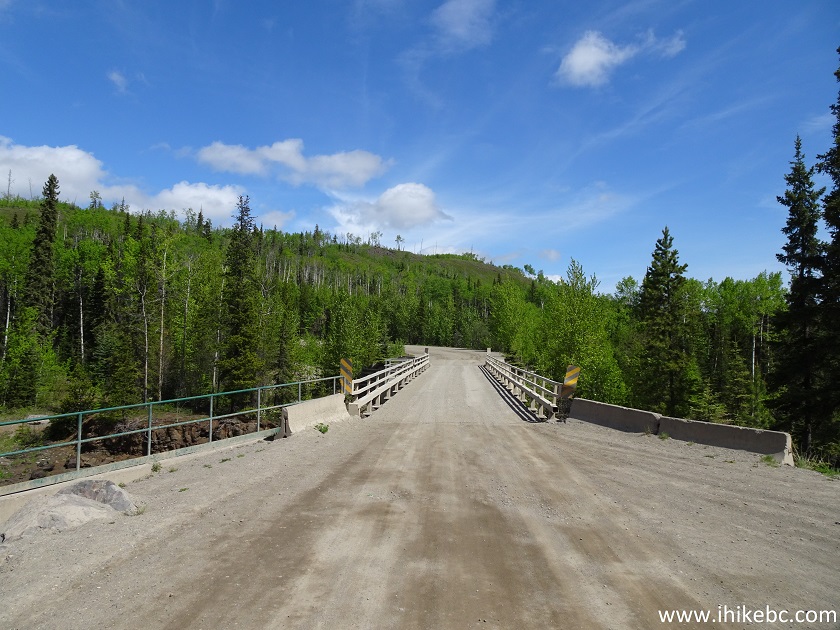
Holy Cross Forest Service Road British Columbia
11. A neat view of Cheslatta River from the bridge. Looking left.
Cheslatta River British Columbia Canada
12. Now looking right.
Cheslatta River
13. Cheslatta Falls trailhead is just before the bridge, on the right side. Coordinates: N 53⁰38.536’ W 124⁰57.123. Elevation: 764 meters. The sign has nothing to do with the trail - it actually warns not to park or walk on the bridge, as you cannot hear approaching traffic.
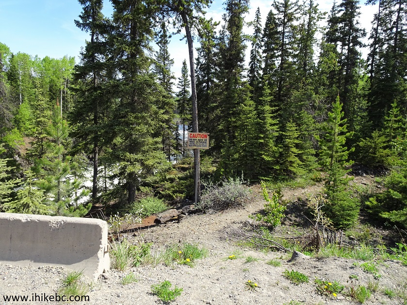
Cheslatta Falls Trailhead - Vanderhoof Hiking
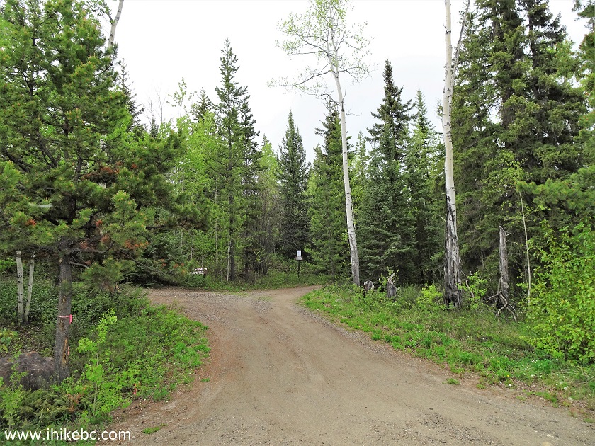
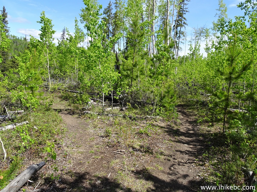
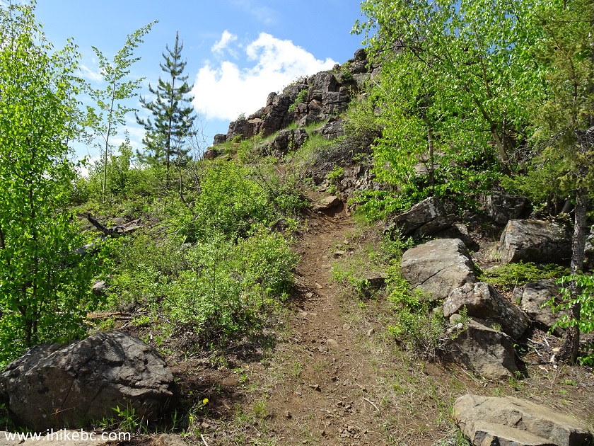
14. Cheslatta Falls Trail shortly after the start. It's quite an easy trail until the very end.
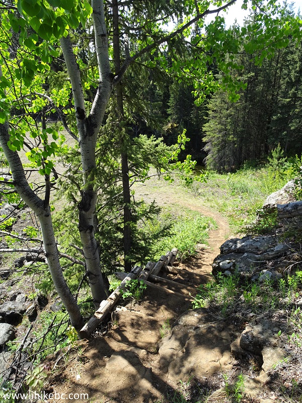
Cheslatta Falls Trail - Vanderhoof Trail
15. And, hardly 100 meters after the trail begins, this very cool island appears on the left side.
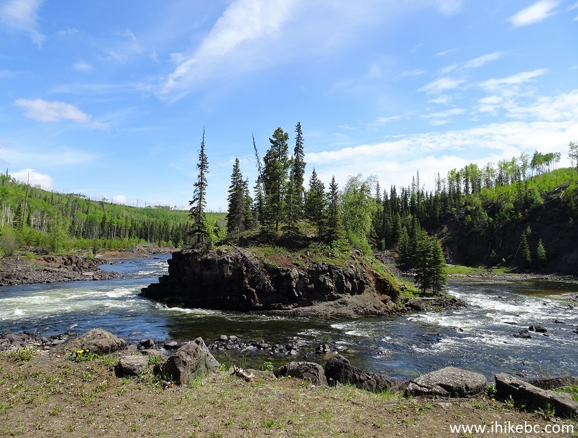
Vanderhoof Hike - Cheslatta River Island seen from Cheslatta Falls Trail
16. A bit further, a view from above.
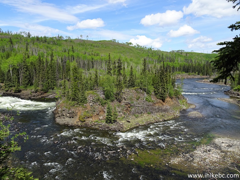
Cheslatta River British Columbia
17. Slightly more to the right.
Cheslatta River
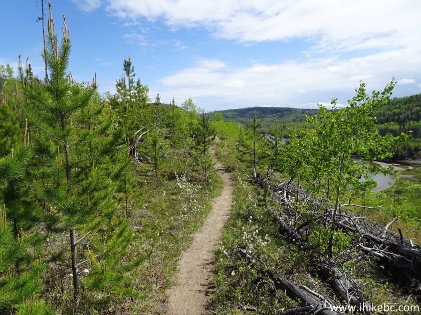
18. At 340 meters, there is a split, allowing to hike the second part of the trail in a loop. We took the path to the right. Returning via the path on the left allows for a few more fine river views.
Trail in Vanderhoof Area - Cheslatta Falls Trail
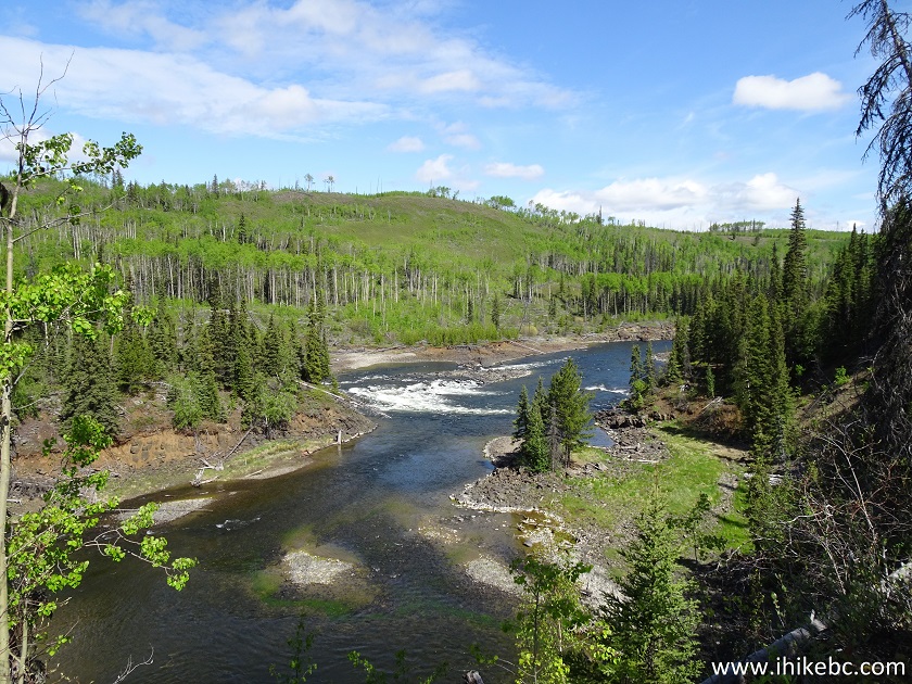
19. Just over a kilometer after the start, Cheslatta Falls Trail approaches its end.
Cheslatta Falls Trail - Hike in Vanderhoof Area
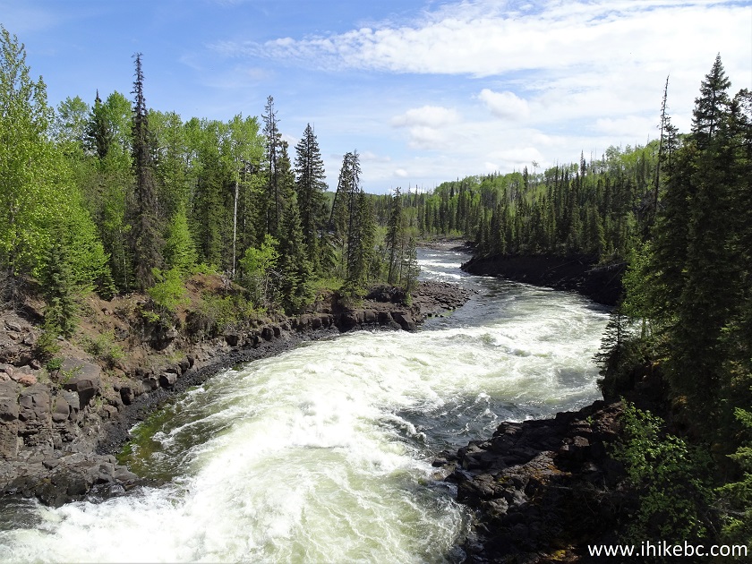
20. And, soon, the view of Cheslatta River downstream of the waterfall appears in front of you. Coordinates: N 53⁰38.725’ W 124⁰56.324’. Elevation: 750 meters (14 meters elevation loss from the start of the trail). The waterfall is to the left. And, straight ahead, there was a view of Cheslatta River with a stuck boat. We heard it rev its engine in vain attempt to move forward.
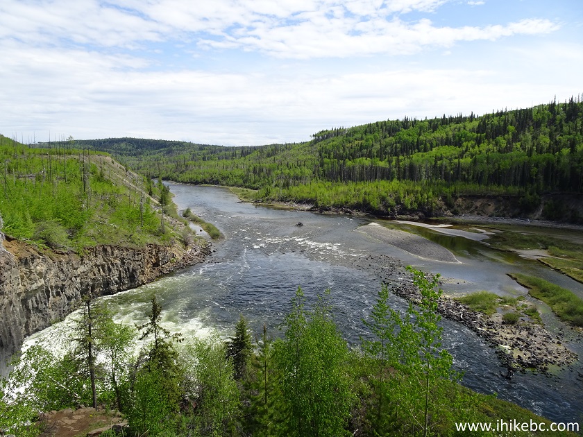
Cheslatta River - Hiking in Vanderhoof Area
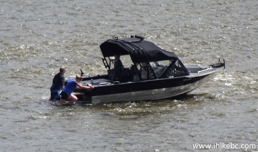
21. The folks on the boat even tried to push it. Hopefully, they got out ok. There was another boat in the vicinity, so, it appears, boating up Cheslatta River to see the waterfall is fairly popular.
Boat Stuck near Cheslatta Falls
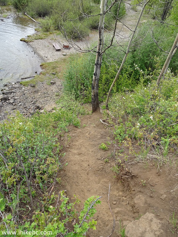
22. To get to the upper (main) waterfall view, one has to descend down a short path partially made of large stones. It's not terribly complicated, but does require some dexterity.
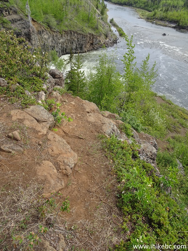
Cheslatta Falls Trail
23. Here we are looking back after this short descent.
British Columbia Hiking - Cheslatta Falls Trail
24. Then, turn left, walk for a few meters, climb past these new set of stones, and...
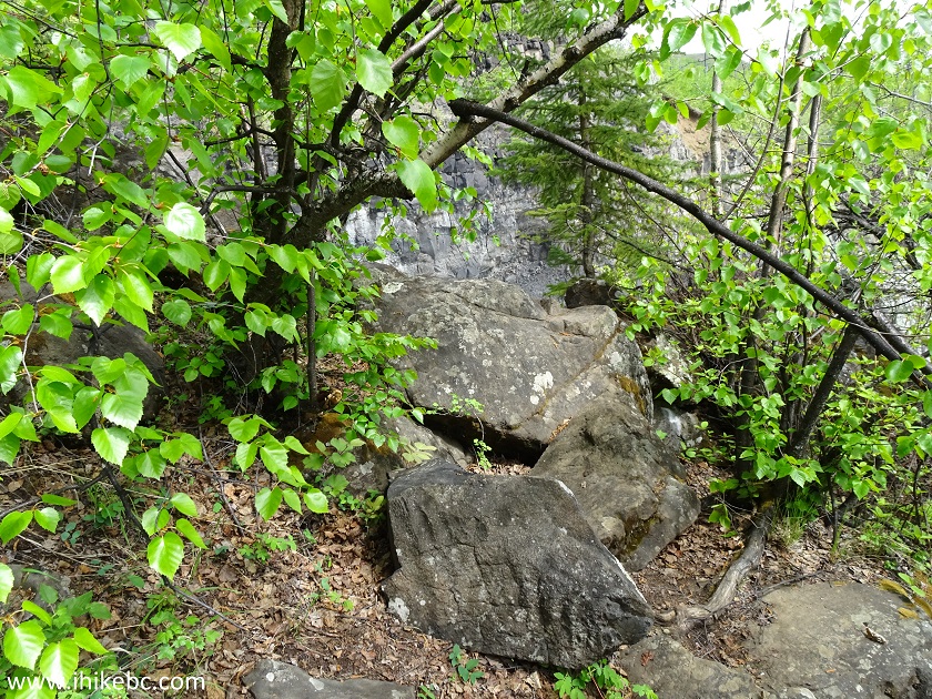
BC Hiking
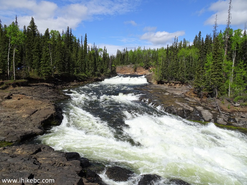
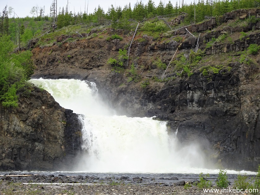
25-28. ...enjoy Cheslatta Falls up close. Looking left to right. WARNING - DANGEROUS AREA. The entire viewing area is one unbarricaded drop-off, with very slippery stones near the water. Watch out.
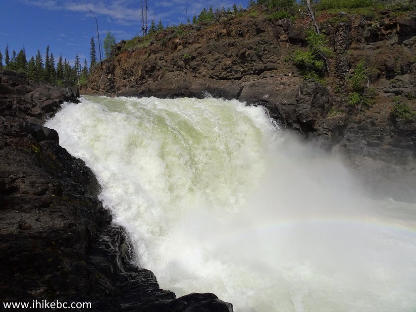
Cheslatta Falls
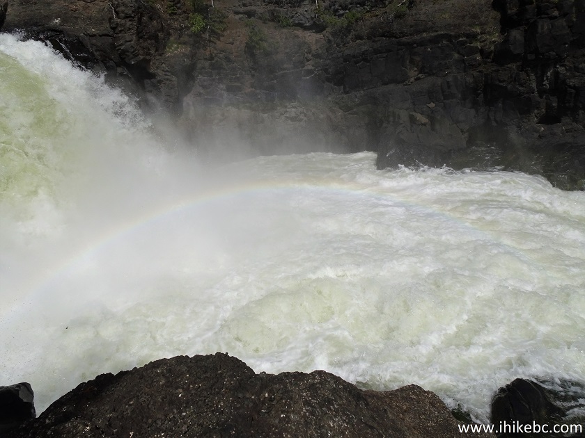
Cheslatta Falls British Columbia
Cheslatta Falls near Vanderhoof BC Canada
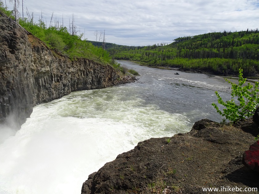
Cheslatta Falls and Cheslatta River
Here is our video of Cheslatta Falls from this point.
29. An obvious short path leads to the bottom of the waterfall. It's quite steep.
Cheslatta Falls Trail
30. Looking back at the steep path after the descent.
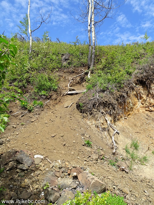
Hike in British Columbia Area
31. To get to the view seen below, you would have to jump over a creek about one meter long. It's possible to get much closer, but then you would have to wade in shallow water (seen in the middle of the photo below) for about 20 meters, to get to a small island, also seen below, on the right side. In the background is the hill we descended while hiking the trail. We are on top of that hill in photo #19.
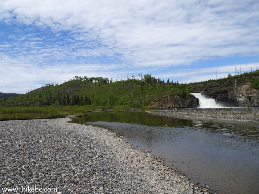
Cheslatta Falls British Columbia
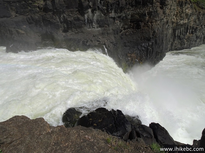
32. Zoomed view of Cheslatta Falls from the bottom viewpoint.
Cheslatta Falls
Here is our video of Cheslatta Falls from the bottom.
More ihikebc videos are on our YouTube Channel.
33. There is definitely more to this trail than just the waterfall. This neat view is near the descent seen in photo #22.
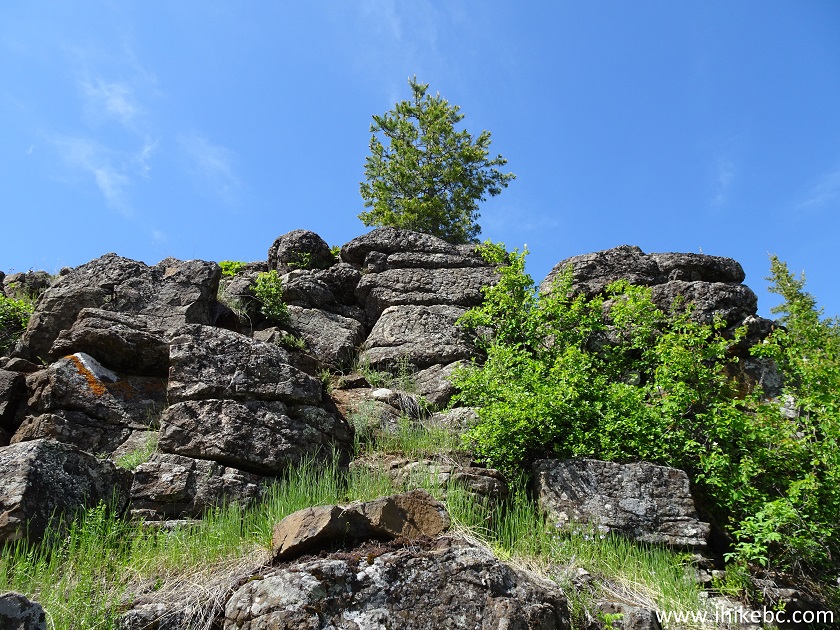
British Columbia Hiking
Cheslatta Falls Trail is short, fairly easy, picturesque, and leads to an impressive waterfall. Just watch out for the drop-off and slippery stones. Highly recommended.


|
 |
Other Trips:


![]()
![]()
![]()
ihikebc.com Trip 187 - Cheslatta Falls Trail Hike (near Vanderhoof BC)