![]()
![]()
![]()

Trip 077 - February 17, 2015 (Tuesday)
Harrison East Forest Service Road
Second Trip
Page 1 of 2
Distance From Vancouver:
About 130 km to the beginning of the FSR via
Highway 1 East (to Exit 135), then Highway 9 North (to
Harrison Hot Springs),
and Lillooet Avenue / Rockwell Drive.
Liked: The waterfalls and the lake views are still there. The road past the turnoff to Shovel Creek FSR has been fixed (but there is now a gate at km 62). There is now a bridge where a creek stopped us in 2011, allowing to go much further into the wilderness without the need to cross the fast-flowing water on foot.
Of note: Remote wilderness area, no cell phone signal. The road surface is now MUCH worse than in 2011, and the potholes are numerous and large. There is now an ongoing construction of a hydroelectric project starting at the 45 km mark and continuing for several kilometers - you would be driving through a construction zone, so watch out. At the 55 km mark there is now a very bad stretch of the road for about 500 meters, which would likely stop all low-clearance vehicles. Also, much of the area we hiked in 2011 has been extensively logged, so the views are not as great in the later part of the FSR.
Vancouver, Coast & Mountains Backroad Mapbook (2010 edition) Coordinates for the Beginning of the FSR: Page 14 (Harrison Lake) G7.
Previous Trip: 049 - Harrison East First Trip Report - this is where we describe many other highlights of Harrison East FSR, and provide directions for getting to the beginning of the road.
Related Website: Chilliwack District FSR Conditions.
Other Forest Service Roads Trips: Chehalis (by Harrison Mills), Chilliwack Bench, Chilliwack Foley, Chilliwack Lake, Chuchinka-Colbourne (North of Prince George), Harrison West, Florence Lake (access to Stave Lake by Mission), Jones Lake (near Hope), Lost Creek (by Mission), Mamquam River (by Squamish), Nahatlatch (near Boston Bar), Parsnip West (near Mackenzie), Shovel Creek (off Harrison East), Sowaqua Creek (by Hope), Squamish River Main, Squamish River Ashlu, Squamish River E-Main, Squamish River FSR Washout, Windfall Creek (by Tumbler Ridge).
Follow @ihikebc Tweet
We enjoyed hiking Harrison East so much in 2011, that in 2015 the expectations were high for even greater views, as four years ago low-hanging clouds concealed much of the surrounding terrain. Alas, the area we liked so much has been logged, so the views were definitely not nearly as good as before. Also, and probably because it wasn't raining, we did not see any mountain waterfalls, like in 2011 (except the one right after the split with Shovel FSR). But, there was still something new to discover. And, it was also quite interesting to compare how certain areas have changed in 4.5 years since our first visit.
1. We drove through the construction zone for the hydroelectric project after dark, so all the photos would be on the second page, since we took them on our way back. But we start with bad news. The bridge below is located between km 54 and 55. It was completely dark when we crossed it, so the ugliness of what came next was not obvious at all.
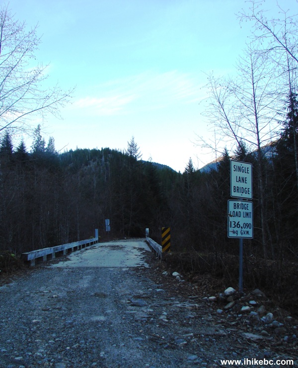
Harrison East FSR BC Canada
2. And what followed was about 500 meters of a messed-up road. It was so bad, that, after a few hundred meters, we seriously considered stopping right then and there in the middle of the road, and resuming driving only in the morning, in order to avoid damaging our vehicle. However, after walking forward with a flashlight for a few hundred meters, we realized that the bad stretch ends soon, and it was possible to weave our way around the REALLY bad stuff. So, we did just that. Here is a part of that nasty stretch, and it does not truly reflect the badness of it all. By the way, we have a high-clearance 2WD. Low clearance vehicles are likely to get at least some damage by driving through this stretch of Harrison East FSR.
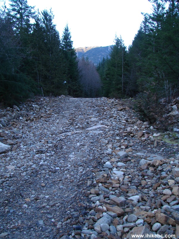
Photo of rough stretch Harrison East FSR BC Canada
3. Now the good stuff. This glacier appears a few kilometers prior to the Shovel Creek FSR turnoff.
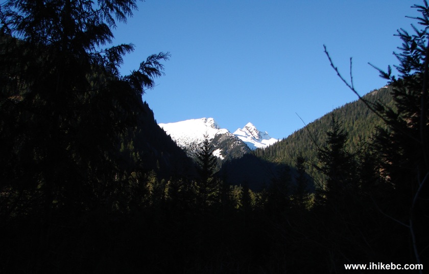
Glacier View off Harrison East FSR BC Canada
4. Zooming in. Very nice.
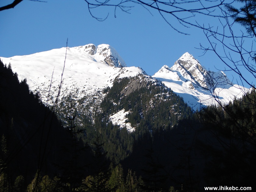
Picture of a Glacier Harrison East FSR British Columbia Canada
5. The road is now fixed past Shovel Creek FSR, with no more deep cross-ditches. However, there is a locked gate at the 62 km mark. Just before the gate there is a bridge, and here was the view from that bridge in 2011.
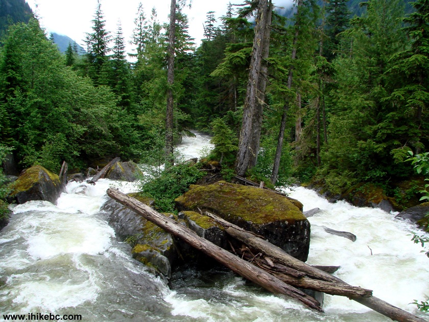
2011 River View off Harrison East FSR BC Canada
6. Compare that to 2015.
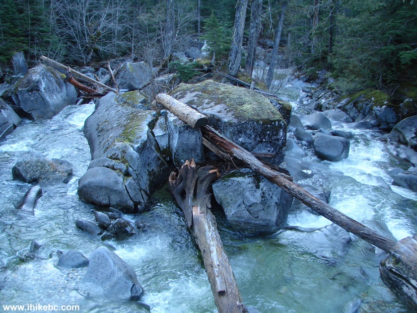
2015 River View Off Harrison East Forest Service Road BC Canada
7. Here is that locked gate at the 62 km mark. Be careful, if it's open, as some people got locked in, as witnessed by several less than diplomatic writings on the gate. Coordinates for the 62 km mark, a few hundred feet before the gate: N 49⁰49.122' W 121⁰53.194'.
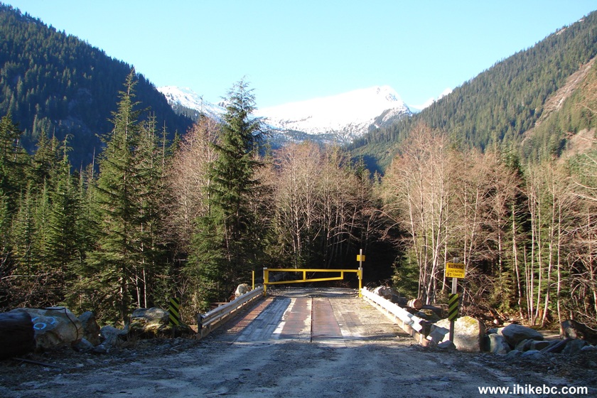
Locked Gate Harrison East FSR BC Canada
8. It's time to walk. Soon, we encountered a large stone on the side of the road.
Harrison East Forest Service Road British Columbia Canada
9. Here is what the stone looked like in 2011.
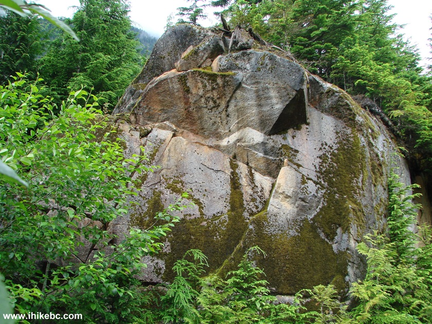
2011 Large Stone Harrison East FSR BC Canada
10. Modern times.
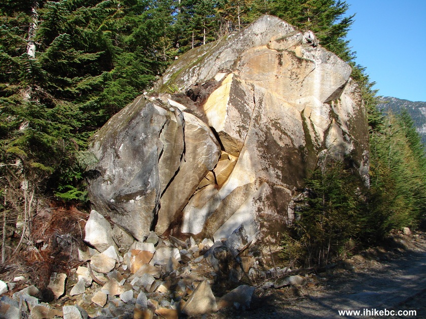
2015 Large Stone Harrison East FSR Province of British Columbia Canada
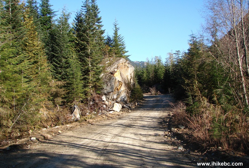
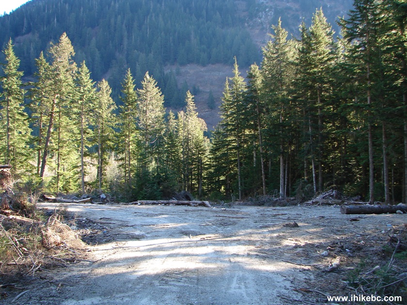
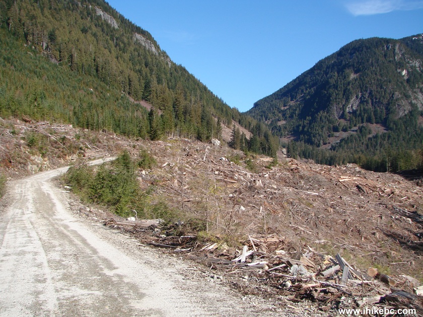
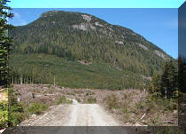
11. After the 64 km mark, we reached a spot where the ugly part begins. Coordinates: N 49⁰50.089' W 121⁰53.354' Elevation: 629 meters. Extensive logging has been done here probably in the last year or two.
Harrison East FSR BC Canada
12. There is a split at the spot seen in the photo above. At first, we took the road on the right, not knowing where to go anymore, as everything looked so much different from 2011.

13. This road to the right went uphill, and it became possible to see the glacier behind us.

14. Zooming in.

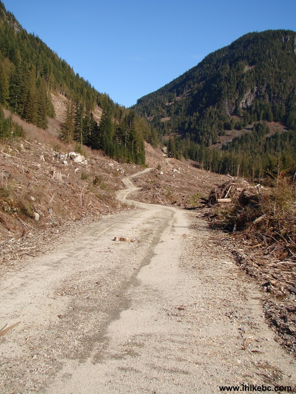
15. As it became apparent that the road on the right was not the right road, we returned to the split.

16. Taking the left road now. This turned out to be the continuation of Harrison East.
Harrison East Forest Service Road British Columbia Canada
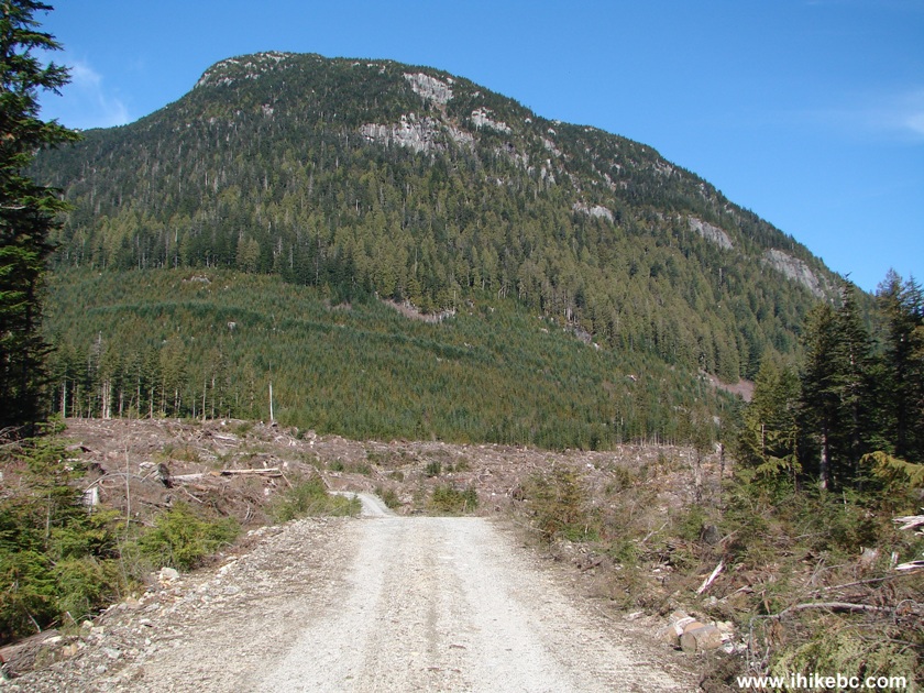
17. Lots and lots of logging happened here.
Logged Area By Harrison East FSR BC Canada
18. There is actually a left split soon after you take this left road, and it appears that, by following that left split, you would get an even better view of the glacier seen in photos #13 and #14. But we kept going straight.
Harrison East FSR British Columbia Canada
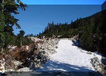
19. After a few kilometers, there is a beautiful spot. This is what it looked like in 2011.
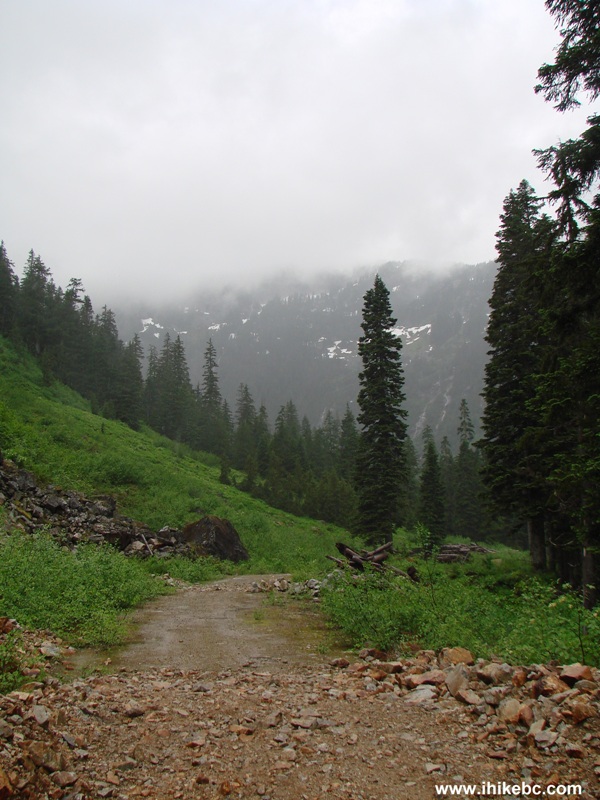
Photo of Harrison East FSR BC Canada
20. Without the fog - in 2015.
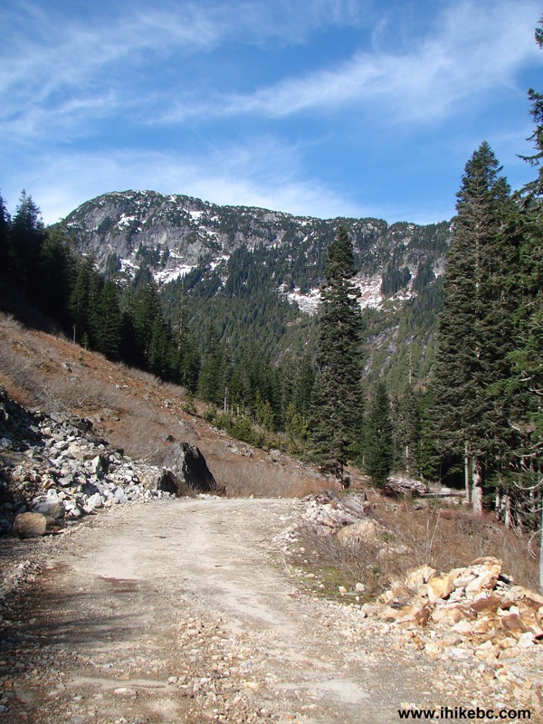
Harrison East Forest Service Road BC Canada
Our 2015 Harrison East Trip Report Continues on Page 2.


|
|
 |
Other Trips in Harrison Hot Springs Area:
|
|
|
|
|
|
|
|
|
|
|
|
Other Trips:


![]()


![]()
![]()
![]()
Follow @ihikebc Tweet
ihikebc.com Trip 077 - Harrison East Forest Service Road (Second Trip) Page 1 of 2