![]()
![]()
![]()

Trip 091 - July 31, 2015 (Friday)
Holzworth Meadows Hiking Route
Near Tumbler Ridge BC
Location: Northeastern British Columbia, about 50 kilometers
North of Tumbler Ridge.
Liked: Mountain views, creek views, whistling gophers, the hike can be done as a circle.
Of note: Remote wilderness area, some potholes on the access road, mosquitoes, flies on top of Theropod Peak, no tree shade in the alpine, some wet sections, very windy on the ridge. Hiking poles and boots are highly recommended.
Northern BC Backroad Mapbook (3rd edition) Coordinates: Page 43 (Mount Crum) F4.
Related Trip: Bullmoose Mine Road & Windfall Creek FSR.
Other Trips Off Bullmoose Mine Road: Cowmoose Mountain Trail Hike, Windfall Lake Trail Hike, Pinnacle Peak Route Hike.
Holzworth Meadows trailhead is located off Windfall Creek FSR, which, in turn, branches off Bullmoose Mine Road. Check out our Bullmoose Mine Road & Windfall Creek FSR trip report for directions on how to get to Bullmoose Mine Road. Holzworth Meadows Hiking Route is (arguably) a more spectacular and substantially safer alternative to Pinnacle Peak Route Hike, which is located further along Windfall Creek Forest Service Road.
1. We start with a photo taken from the same spot as photo #7 of the Bullmoose Mine Road & Windfall Creek FSR trip report, where Windfall Creek FSR is seen on the left side branching off Bullmoose Mine Road.
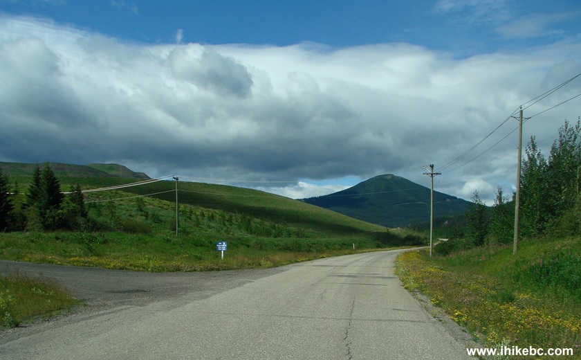
Bullmoose Mine Road at Windfall Creek Forest Service Road by Tumbler
Ridge BC Canada
2. Now driving on Windfall Creek FSR. It's a fairly smooth road, though occasional potholes are deep enough to make you want to watch your speed.
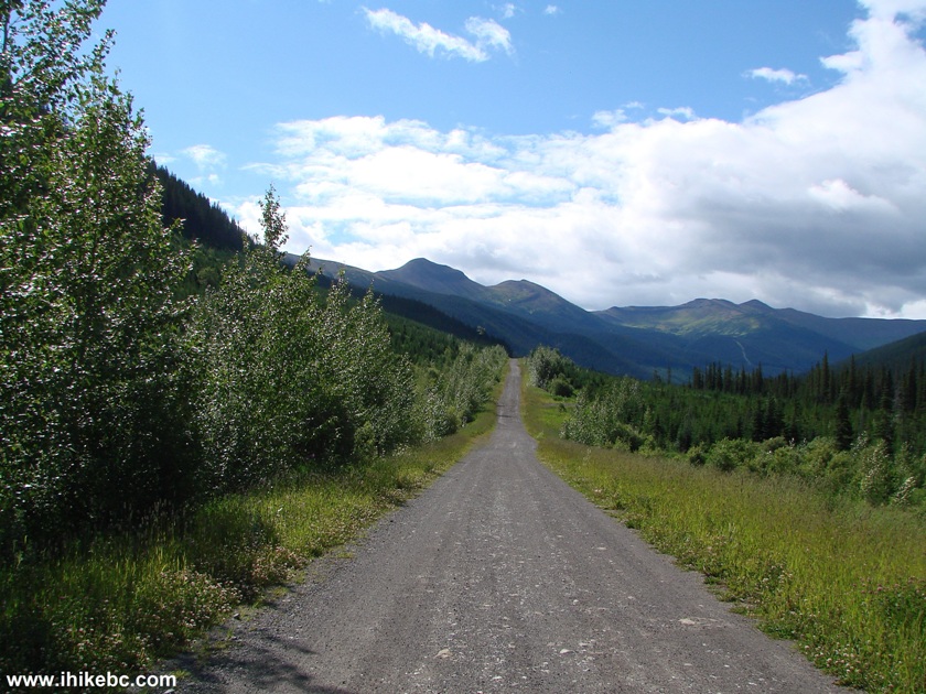
Windfall Creek FSR British Columbia Canada
3. About 14 kilometers after turning onto Windfall Creek FSR, right after crossing a small bridge, you would see Holzworth Meadows trailhead on the left side. Driving a bit further would allow you to use a small parking area on the right side of the road.
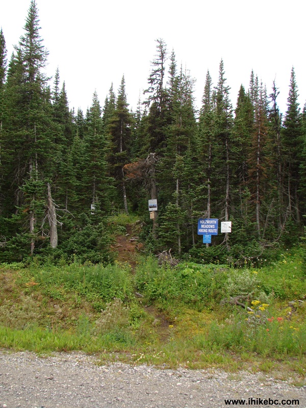
Holzworth Meadows Trailhead
4. At first, the path goes through a forest, but, soon, the terrain opens up.
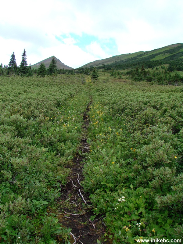
Tumbler Ridge Hiking -
Holzworth Meadows Hiking Route BC Canada
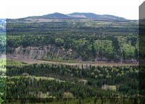
5. Looking back.
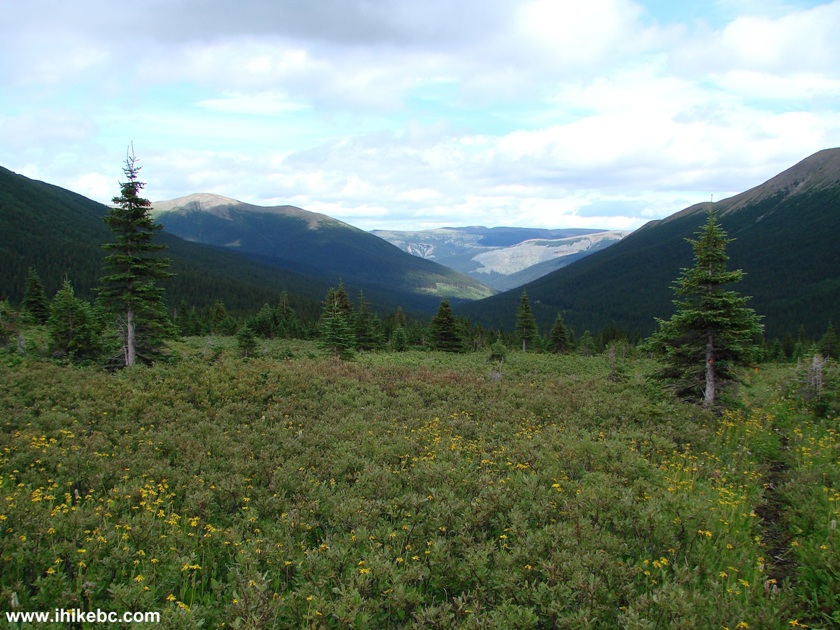
View From Holzworth Meadows Hiking Route by Tumbler Ridge BC
6. Twenty-five minutes into the hike, there is a split. The (barely visible) path on the left is where you would come from at the end of the hike, after completing a circle.
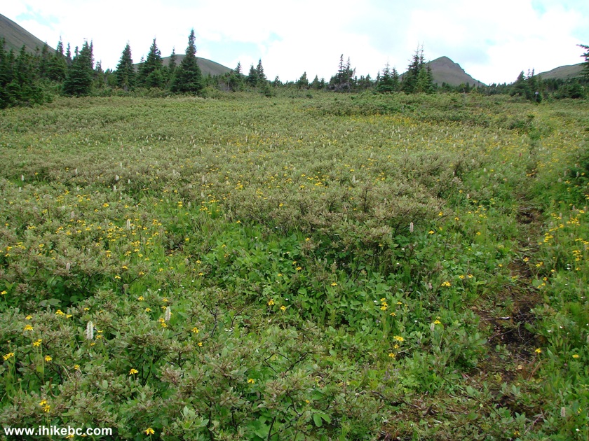
Hiking in Tumbler Ridge Area - Holzworth Meadows Route British Columbia Canada
7. Within several minutes of taking a path on the right, an arduous climb begins. It is steeper than it looks.
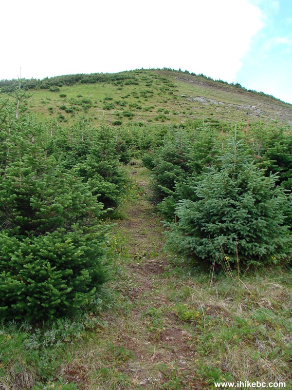
Climbing a Ridge Holzworth Meadows Hiking Route - BC Hiking Canada
8. In thirty minutes, we are on top of a ridge. Coordinates: N 55⁰01.588' W 121⁰31.552'. Elevation: 1,834 meters. It's windy up there, and mosquitoes, finally, left us alone.
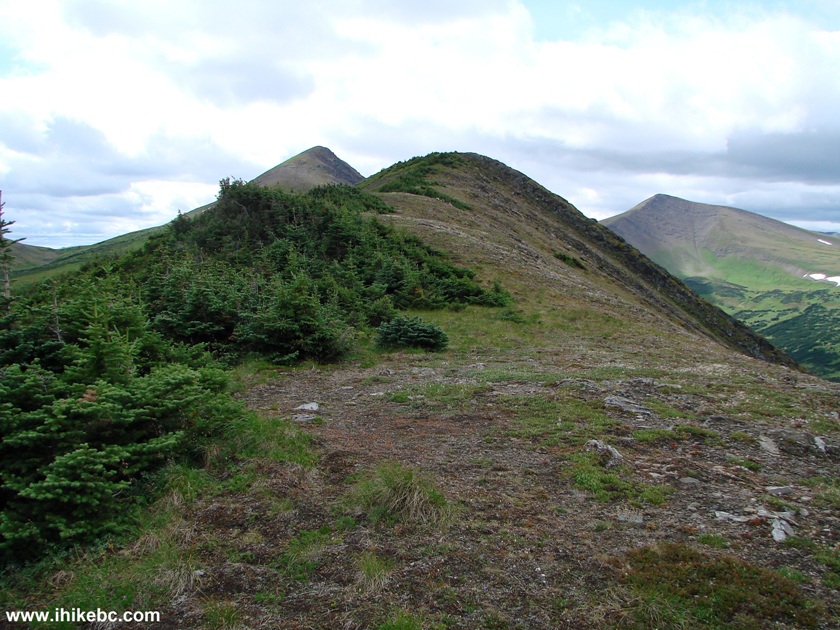
Photo of Ridge Top Holzworth Meadows Route BC Canada - Tumbler Ridge
Hike
9. Looking right.
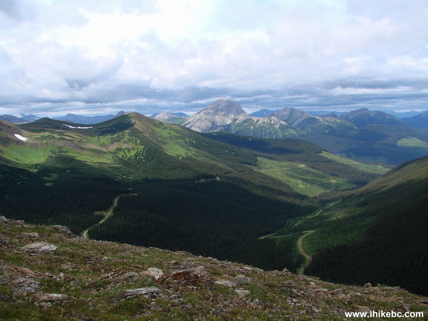
View From Ridge Holzworth Meadows Hiking Route British Columbia Hiking Canada
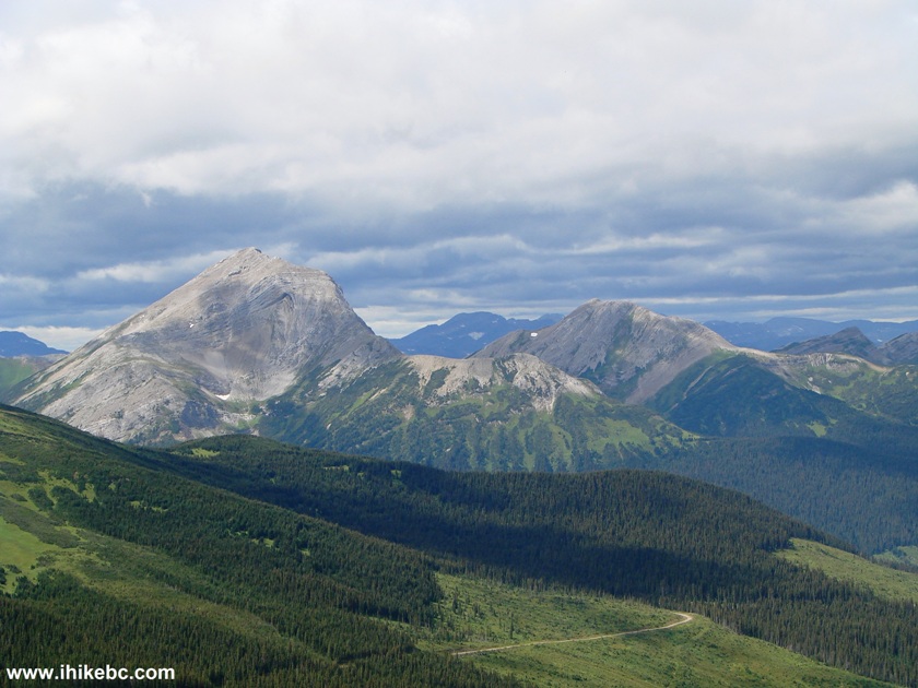
10. Zooming in to check out an impressive mountain.
11. Looking left. We would pass in front of these mountains on our way back.

View From Ridge Holzworth Meadows Hiking Route - Tumbler Ridge Hiking British Columbia
Canada
Here is our video of the views from the ridge:
12. Now we are going straight towards the Theropod Peak, seen in the middle-left of the photo below.
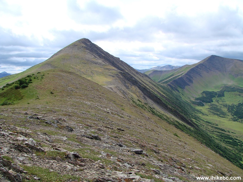
Theropod Peak Holzworth Meadows Hiking Route BC Canada
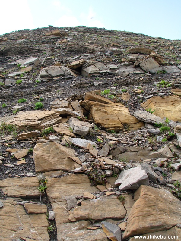
13. The Theropod Peak is quite steep, and is a good challenge. It is possible not to climb this mountain, and still complete the circle hike.
Theropod Peak by Tumbler Ridge - Hike in BC Canada
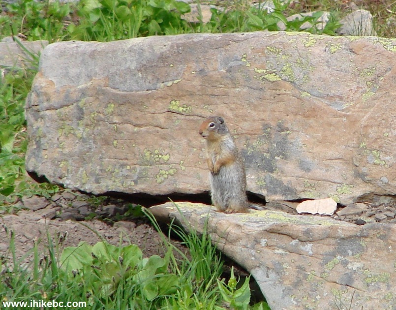
14. Numerous gophers kept us entertained with their high-pitched whistles.
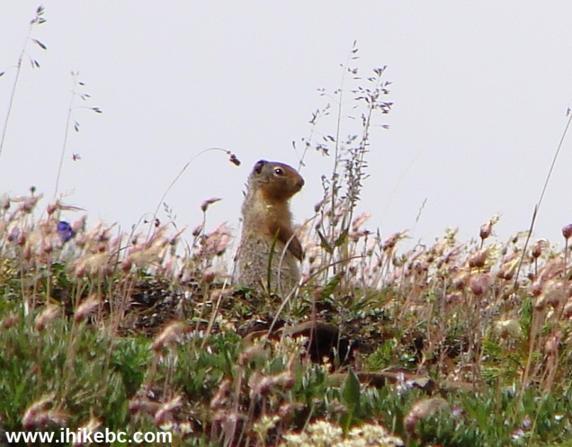
Gopher BC Canada
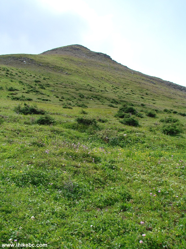
15. Still climbing the Theropod Peak.
Theropod Peak - Hike near Tumbler Ridge BC
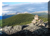
16. Took about forty minutes to get to the top, and here it is. Hundreds of some strange flies made the top of Theropod Peak their home, and started buzzing around and landing on us in a hurry.
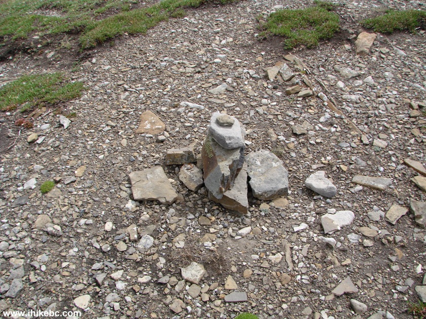
Inukshuk on Top of Theropod Peak Holzworth Meadows Hiking Route BC
Canada
17. Looking straight from the top of Theropod Peak.
View from Theropod Peak British Columbia
18. Looking right. Windfall Creek FSR is visible below on the left side. The FSR to the right, seen in the middle of the photo, branches off Windfall Creek FSR soon after the Holzworth Meadows trailhead.
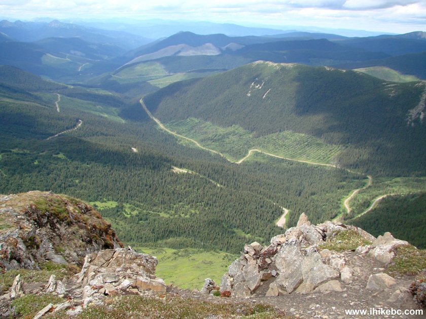
Windfall Creek FSR Seen from Theropod Peak by Tumbler Ridge BC
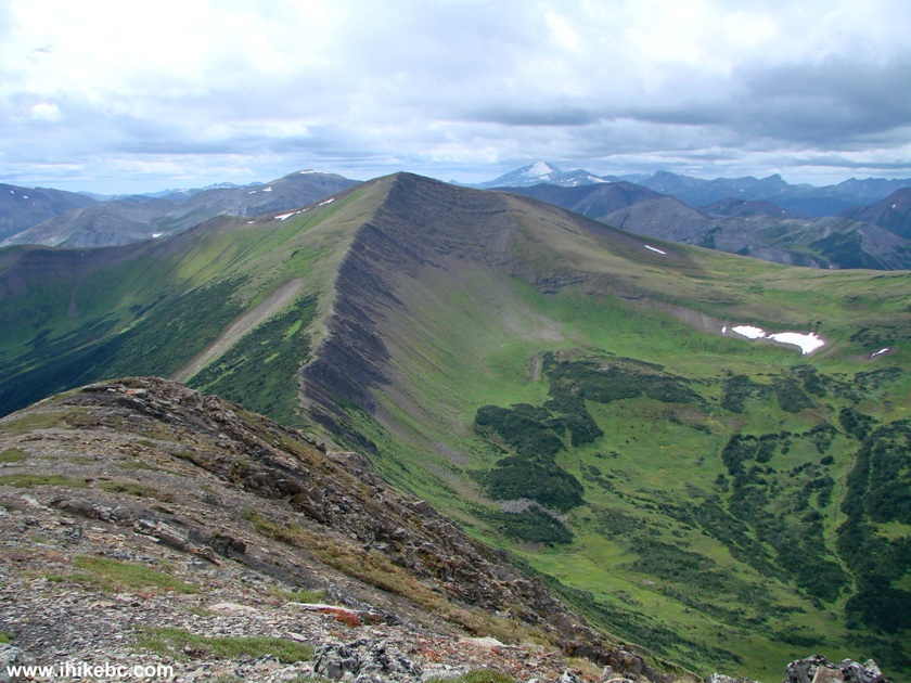
19. Looking back. The light-green ridge in the middle is the one in photo #8.
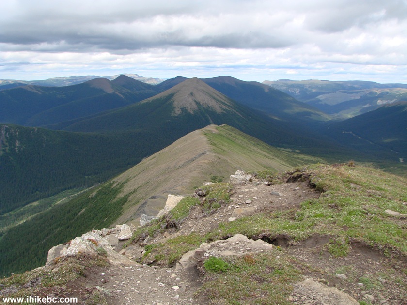
View from Theropod Peak Holzworth Meadows Hiking Route
20. Now looking left from Theropod Peak.
View from Theropod Peak BC Canada
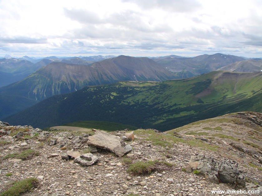
21. Looking back and left we see the same mountains as in photo #11. We are going to hike in front of them upon descending from Theropod Peak.

Holzworth Meadows Hiking Route by Tumbler Ridge British Columbia Canada
Here is our video of the views from the top of Theropod Peak:
More ihikebc videos are on our YouTube Channel.
22. Now hiking back.

Holzworth Meadows Hiking Route
23. Another gopher.
Gopher
24. Soon, we started walking along a picturesque creek. The mountains seen in photos #11 and #21 are on the right side at this point.
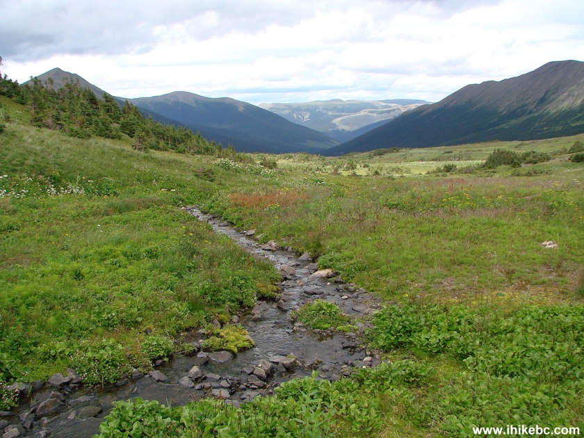
Creek Along Holzworth Meadows Hiking Route
25. It sure didn't hurt that the flowers were in bloom.
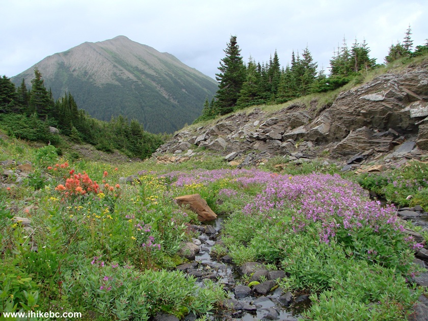
Holzworth Meadows Hiking Route BC Canada
26. Walking along the creek is rather treacherous, due to all the stones and uneven ground. Watch for a sign (seen on the left side of the photo below) directing you back to the trailhead. Once you turn left and start walking away from the creek, in a few minutes you would arrive to a split seen in photo #6.
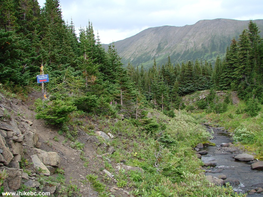
Photo of Holzworth Meadows Hiking Route By Tumbler Ridge British
Columbia
Quite unexpectedly, Holzworth Meadows turned out to be one of the best hikes we have ever had, due to great views, a relatively easy trail, and the ability to make this a much shorter or longer outing, depending on whether you want to climb other peaks in the immediate vicinity. Most definitely recommended, though try to hike when the ground is more or less dry, as, otherwise, you might be facing a mini-swamp out there.


|
 |
Other Trips in Tumbler Ridge BC Area:
|
|
|
|
|
|
|
|
|
|
|
|
|
|
|
|
|
Monkman
Falls Hike
|
|
Windfall Lake Trail  |
|
Cowmoose Mtn Trail
|
|
Bootski Lake Trail  |
|
Murray Canyon
Overlook
|
|
Quality Canyon Trail  |


Other Trips:


![]()


![]()
![]()
![]()
ihikebc.com Trip 091 - Holzworth Meadows Hiking Route (near Tumbler Ridge BC)