![]()
![]()
![]()

Trip 129 - August 30, 2017 (Wednesday)
Panorama Ridge Trail Hike
Garibaldi Provincial Park (North of Squamish BC)
Page 1 of 2
Distance From Vancouver: 98 km via Highway 1 West and Highway 99 (Sea-to-Sky) North. Make a right turn 33 km past the Squamish Welcome Centre. Then, drive 3 km to the parking lots and the Black Tusk / Panorama Ridge / Garibaldi Lake trailhead near Rubble Creek.
Liked: Views of Black Tusk, Garibaldi Lake, Black Tusk Lake. Creek views with wildflowers. Virtually no bugs.
Vancouver, Coast & Mountains Backroad Mapbook (2010 edition) Coordinates: Page 22 (Squamish) C1-D1-E1.
103 Hikes in Southwestern British Columbia (2008 edition): hike #21.
Related Website: Garibaldi Provincial Park - BC Parks Official Site.
Related Trip in Garibaldi Provincial Park: Black Tusk Trail Hike.
Panorama Ridge Trail is very popular for a good reason - relatively close to Metro Vancouver, easy access off Highway 99, (for the most part) moderately challenging trail, and simply grand views of lakes and mountains. This trail is about 15 km one way, and follows the same route as Black Tusk Trail until a split, where one turns to the left to visit Black Tusk, and goes straight to Panorama Ridge. We visited Black Tusk in 2010, and were very impressed. This time, while there was no "is this for real?" factor from the first visit almost seven years ago, the views were still absolutely amazing. For more photos of this Park and more complete directions, check out our Black Tusk Trail trip report.
1. To get to Panorama Ridge trailhead (the same trailhead is also shared by Black Tusk and Garibaldi Lake trails) from Vancouver, take Highway 1 West, which would turn into Highway 99 Sea-to-Sky North by Horseshoe Bay, and drive towards Whistler. 33 km past Squamish Adventure Centre (a large building on the right side just past Cleveland Avenue intersection), there would be a turnoff to Garibaldi Provincial Park - Black Tusk. Here we are Northbound on Highway 99, with a sign on the right side indicating 2 km before the turnoff.
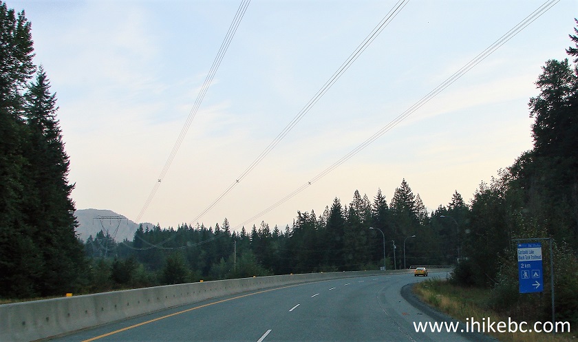
BC Highway 99 Sea-to-Sky near Garibaldi Provincial Park (Black Tusk)
turnoff
2. Once you turn, there would be a 2.7 km-long paved access road to the parking lots. You would have to park along that road, if the lots would be full. Make sure to observe the "no parking" signs on one side of the road. Here is one of the parking lots. Both lots combined would hold about 100 vehicles. Elevation is 555 meters.
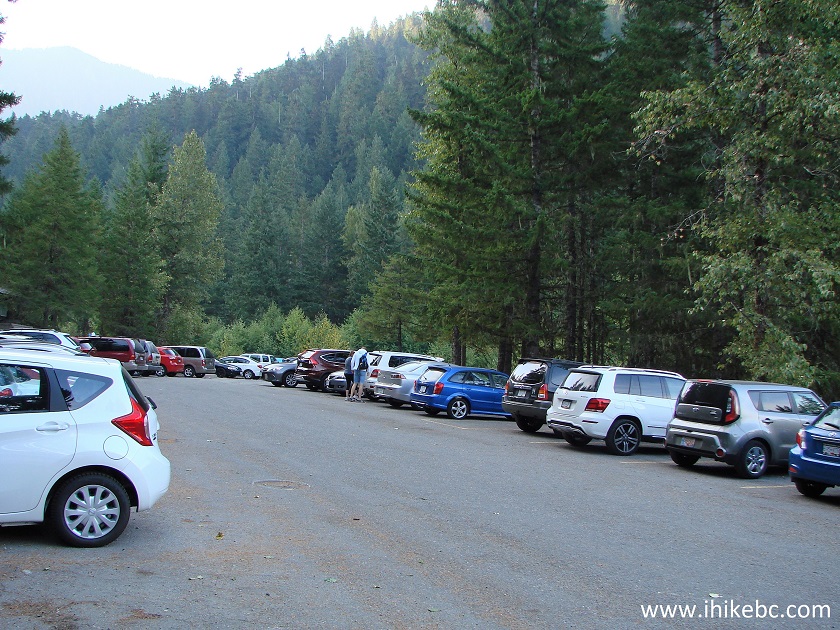
Panorama Ridge - Black Tusk - Garibaldi Lake parking lot
3. The first six kilometers from the parking lot to the main split were not much fun. Faster people behind you, slower people ahead of you, a steady stream of people returning from camping trips and going in the opposite direction - all of that reminded of the overcrowded Joffre Lakes Trail. Some of the hikers were chatting, a few had music playing, and many raised at least a bit of dust. And this was a Wednesday. Weekends are going to be even busier. There is absolutely nothing to see until the main split, which we reached in 1 hour and 45 minutes of very brisk uphill hiking. This map is located at the split, and the numbers and arrows we put on it are as follows: 1 - Parking lot, 2 - Main split (to the left are Panorama Ridge and Black Tusk trails, as well as Taylor Meadows campground. To the right is Garibaldi Lake Trail and campground). 3 - Black Tusk / Panorama Ridge trail split. 4 - The end of Panorama Ridge Trail.
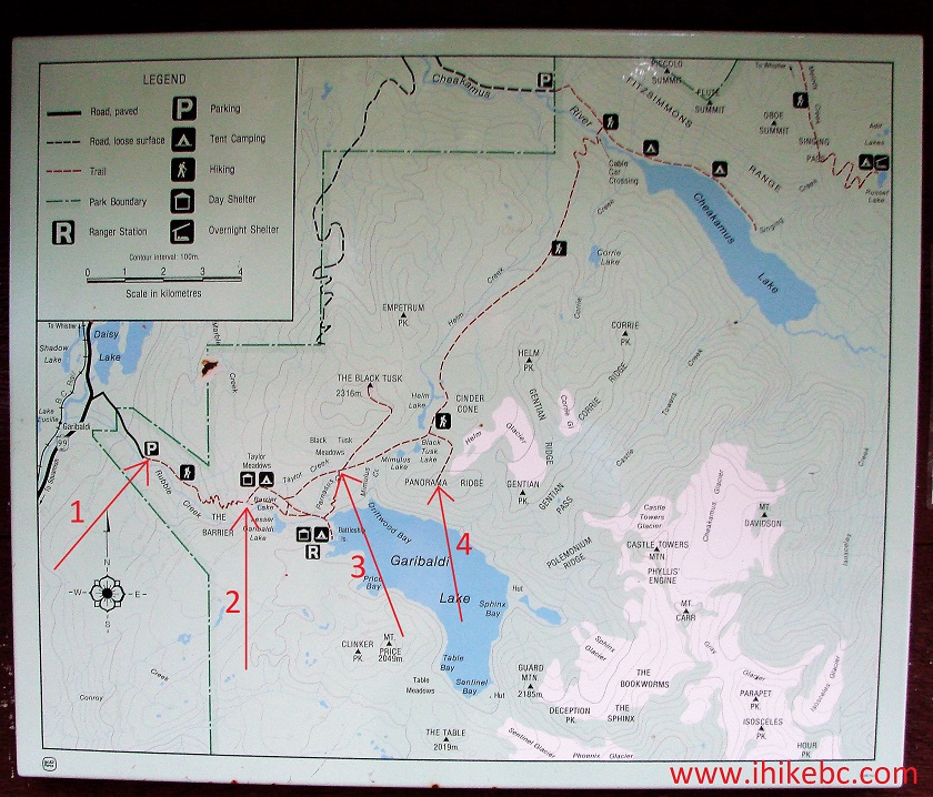
Garibaldi Provincial Park map
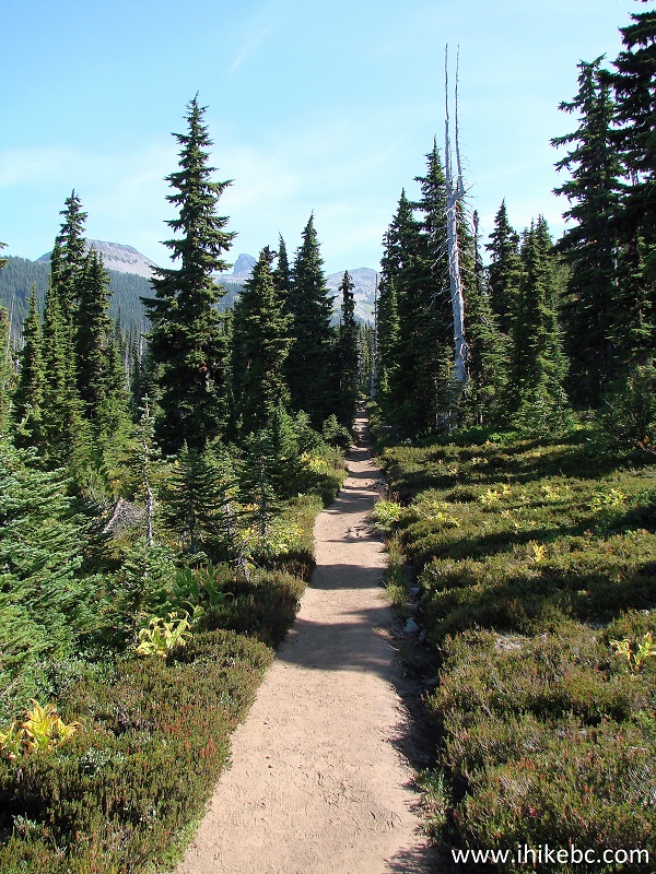
4. After the main split, it got much quieter, as the majority of people were going to and from Garibaldi Lake. Here we are en route to Taylor Meadows.
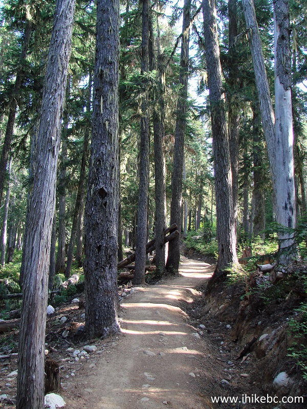
Squamish Hike -
Garibaldi Provincial Park British Columbia Canada
5. Now around the Taylor Meadows area.
Squamish Hiking -
Taylor Meadows Area Garibaldi Provincial Park British Columbia Canada
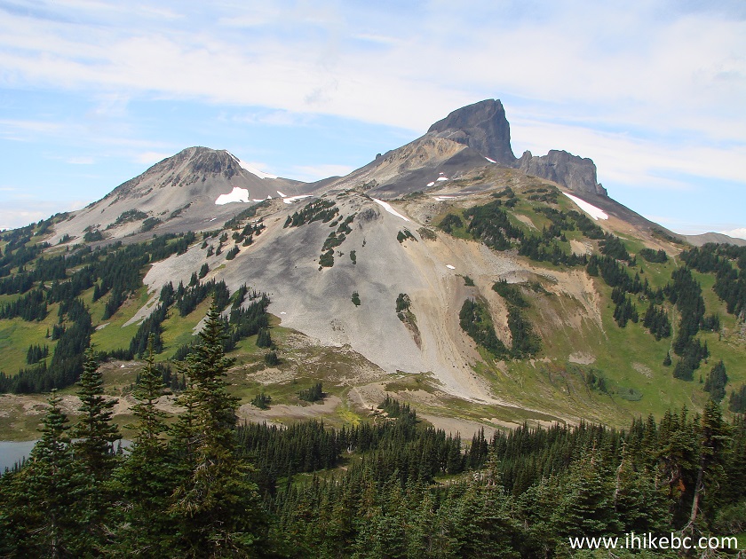
6. Good mountain views started to appear. For more views, check out our Black Tusk Trail trip report.
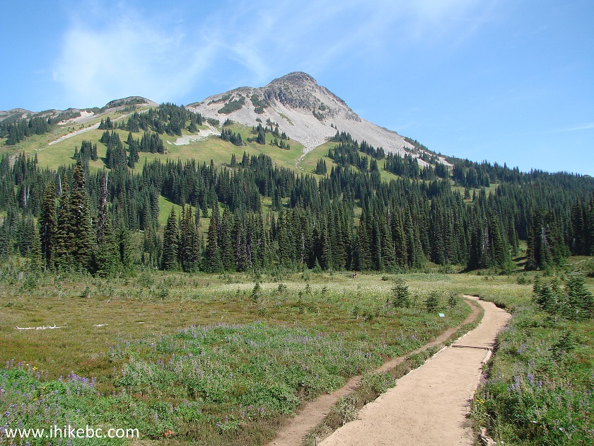
Garibaldi Provincial Park BC Canada Hiking
7. Here is the Black Tusk / Panorama Ridge trail split. Took us 3 hours to get here from the parking lot.
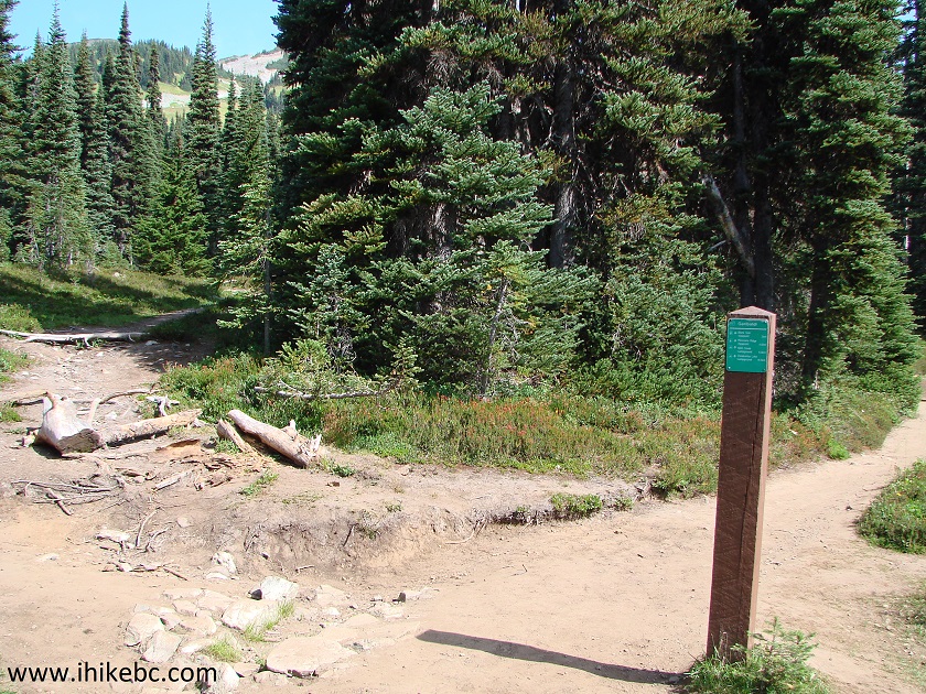
Garibaldi Provincial Park Black Tusk and Panorama Ridge trails split
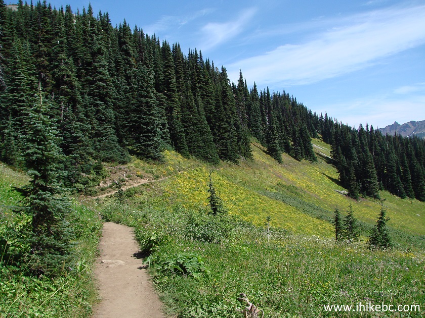
8. After the split (Panorama Ridge trail is on the right), good views started coming in abundance. First of all, there were several creeks with lush wildflowers along the edges.
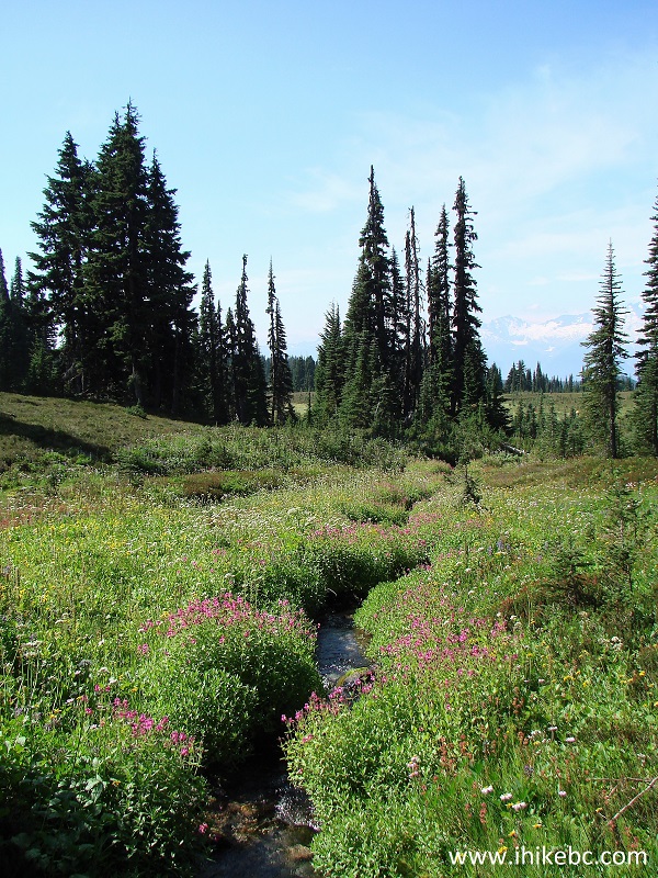
Garibaldi Provincial Park Hiking
9. Beware of muddy sections. There was very little mud on the trail today, but it hasn't rained in a while.

10. The trail continues.
Panorama Ridge Trail in Garibaldi Provincial Park British Columbia
Canada
11. One more split arrives shortly. To the left is Helm Creek Trail to Chekamus Lake. Panorama Ridge Trail is to the right.
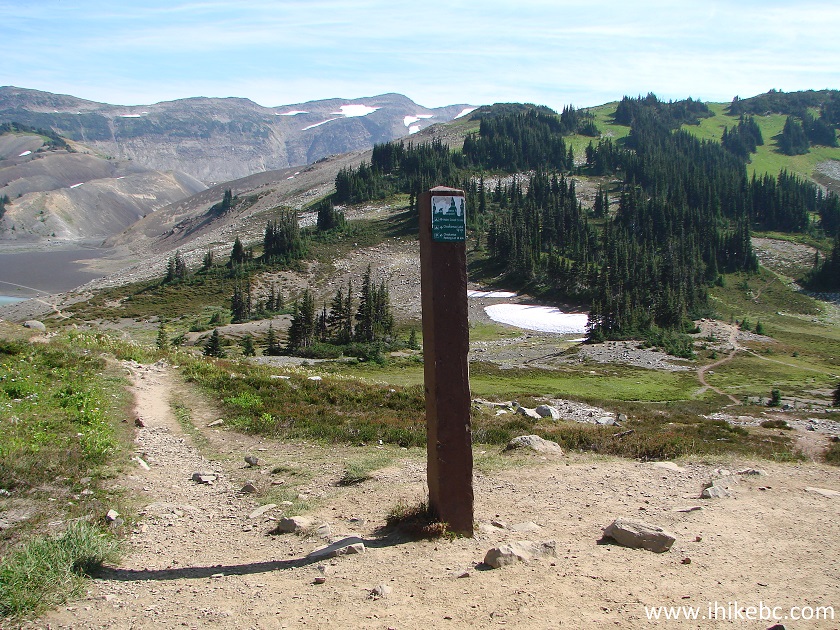
Panorama Ridge and Helm Creek trails split in Garibaldi Provincial Park
BC Canada
12. After this split, things get really interesting. To the left is a neat valley.
Squamish Trail - Panorama Ridge Trail
13. More to the left.
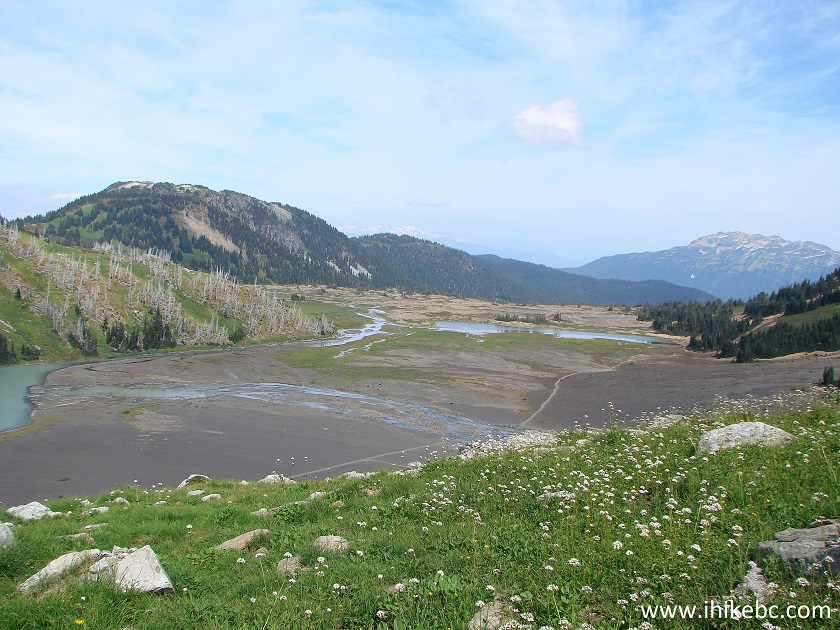
Hike in Garibaldi Provincial Park
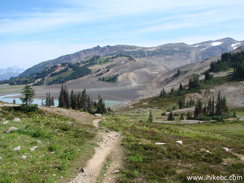
14. In front and then, as the path continues and makes a turn, to the right is Black Tusk Lake (closest of the two).
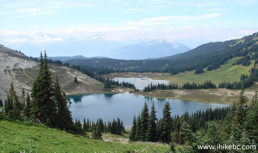
Black Tusk Lake Province of BC Canada
15. And behind you...
Black Tusk Mountain Garibaldi Provincial Park British Columbia Canada
16. Panorama Ridge, in the meanwhile, is starting to take shape straight ahead.
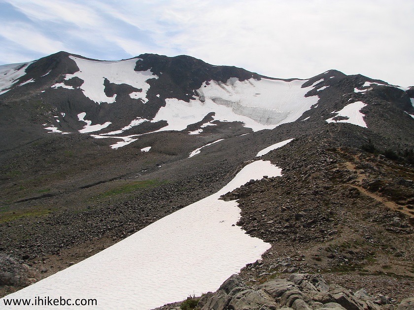
Garibaldi Provincial Park Panorama Ridge Trail
Our Panorama Ridge Trail trip report Continues on Page 2.


|
 |
Other Trips in Squamish Area:
|
|
|
|
|
|
|
|
|
|
|
|
|
|
|
|
|
|
|
|
|
|
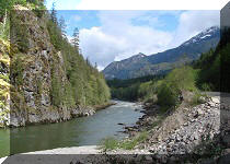
Mamquam River FSR
|
|
|
Seed Peak Trail
|


Other Trips:


![]()


![]()
![]()
![]()
ihikebc.com Trip 129 - Panorama Ridge Trail Hike (Garibaldi Provincial Park North of Squamish BC) Page 1 of 2