![]()
![]()
![]()

Trip 273 - September 15, 2022 (Thursday)
Fletcher-Gardiner Trail Hike
Babine Mountains Provincial Park
Near Smithers BC
Liked: A fairly easy trail, lake views, shade in the forest, no bugs.
Northern BC Backroad Mapbook (3rd edition) Trailhead Coordinates: Page 36 (Smithers) C4.
Related Website: Babine Mountains Provincial Park - BC Parks Official Website.
At over 13.5 km (one way) from the parking lot Fletcher-Gardiner Trail is by far the longest in Babine Mountains Provincial Park, and one of the easiest too, as there are no steep stretches along the trail and the elevation change is very gradual. The major obstacle are numerous long mud stretches, which were quite substantial even today, at the end of a fairly dry season. In the Spring and early Summer, it's likely to be quite a swamp out there. Also, two small creeks need to be crossed, and we managed to stone-hop across them, but wading would be the only option, should the water level be higher.
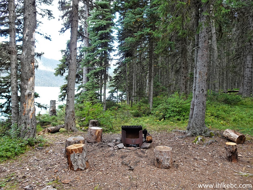
A major disappointment is the lack of good views for such a long trail. There is literally nothing to look at until the end of the hike at Lower Reiseter Lake, which is not bad, but definitely far from spectacular, hardly justifying such a long hike. There is a small campground there with a fire pit, a bear cache, a picnic table, a boat with paddles, and even a plastic toilet without cabin but with numerous flies trapped under the lid. So, if you are interested in camping by a fairly large lake, Fletcher-Gardiner Trail might be a good option. Also, it appears to be possible to hike at least a bit around the lake, which is connected to another lake by a creek (river?), so there could be better views further on. There is also a mountain across the lake, and it appears possible to hike it, if you can get through all the trees.
*All trail distances are based on a GPS odometer and are approximate.
1. Here is a Google Maps location of Babine Mountains Provincial Park.
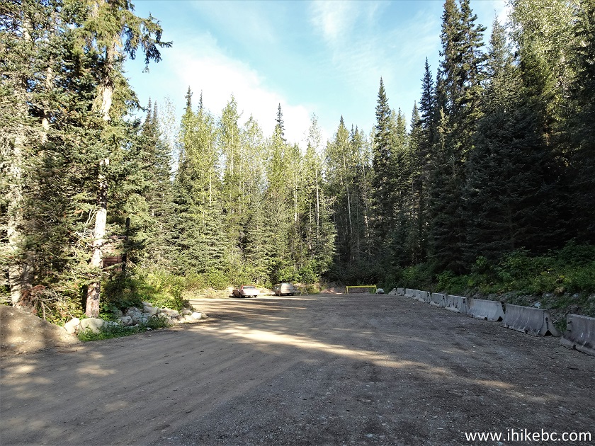
2. This is a parking lot at the end of the access road in Babine Mountains Provincial Park, which is 4.3 km from the park entrance located on Driftwood Road. For photo-directions on getting up to the park entrance from Highway 16, check out Malkow Lookout Hike trip report, and Harvey Mountain Hike trip report.
Babine Mountains Provincial Park Fletcher-Gardiner
Parking Lot
3. Here is a map of Babine Mountains Provincial Park. We have indicated as follows: Red square - parking lot. Red dot - Fletcher-Gardiner trailhead. Red arrow - Fletcher-Gardiner Trail. Blue square - end of the trail by Lower Reiseter Lake.
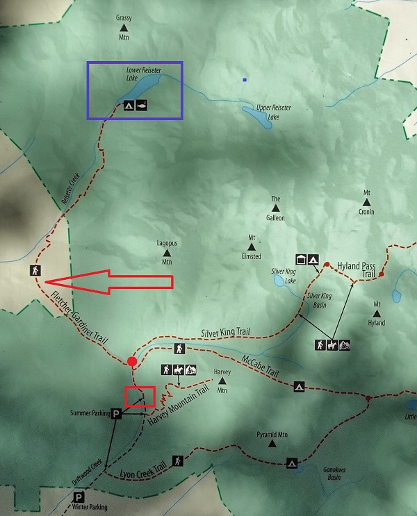
Babine Mountains Provincial Park Map
4. This is the start of the trailhead access road by the parking lot. Coordinates: N 54°52.455’ W 126°58.308’. Elevation: 1,023 meters.
Fletcher-Gardiner Trailhead Access Road
5. At 1.4 km of the access road, McCabe trailhead is to the right, and the way to Fletcher-Gardiner Trail is to the left.
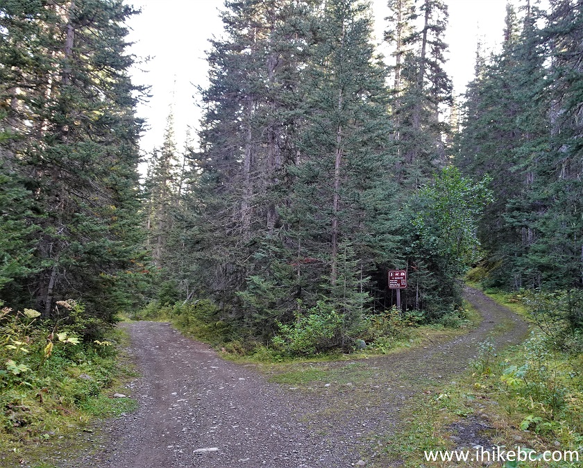
McCabe Trailhead - Babine Mountains Provincial Park -
Smithers Hiking
6. At 1.47 km, there is a bridge.
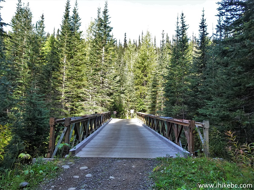
Hike in Smithers Area - Babine Mountains Provincial
Park
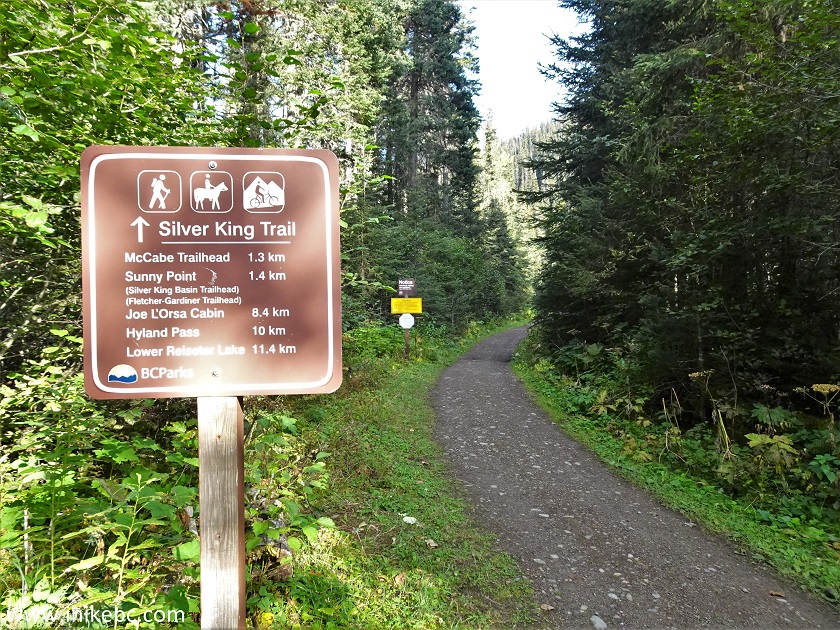
7. After the bridge, there is a split. To the right is Silver King Trail and, eventually, Hyland Pass Trail. To the left is Fletcher-Gardiner trailhead.
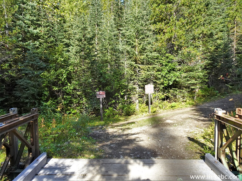
Fletcher-Gardiner Trailhead - Babine Mountains
Provincial Park
8. Fletcher-Gardiner trailhead. Coordinates: N 54°53.157’ W 126°58.661’. Elevation: 1,050 meters. The sign says 10 km to Lower Reiseter Lake, but it's more like 12 km.
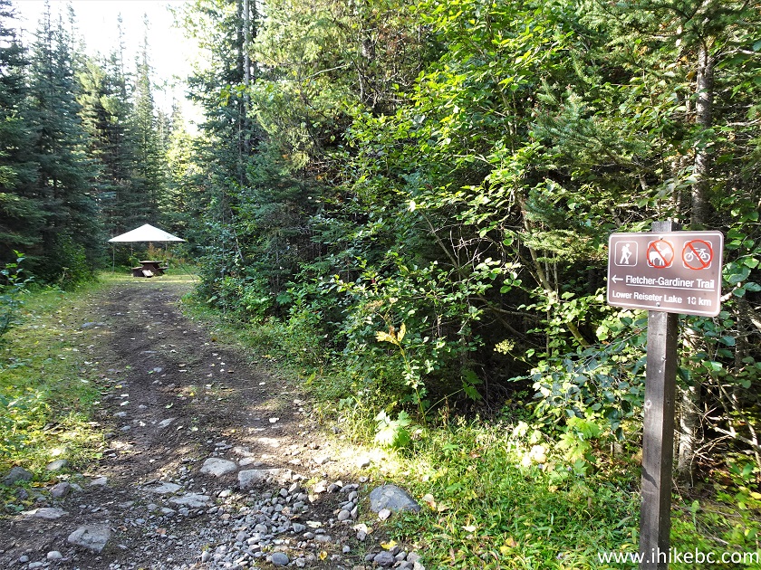
Fletchiner-Gardiner Trailhead
9. Fletcher-Gardiner Trail begins. At 25 meters here.

Hike in Smithers Area - Fletcher-Gardiner Trail
10-11. At 50 meters, a trail info sign.
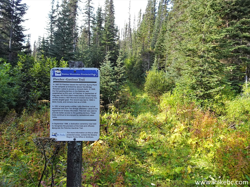
Fletcher-Gardiner Trail
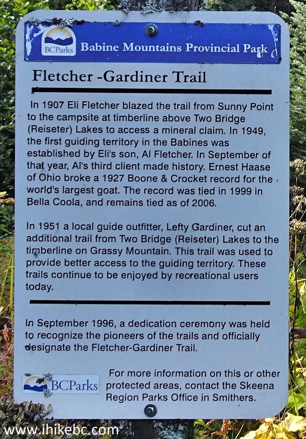
Fletcher-Gardiner Trail Information
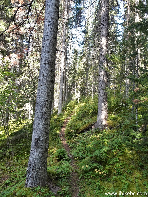
12. Fletcher-Gardiner Trail is quite easy for the first 6.5 km, which is a dirt track, albeit with several long mud stretches and two small creek crossings. At 1.68 km here.
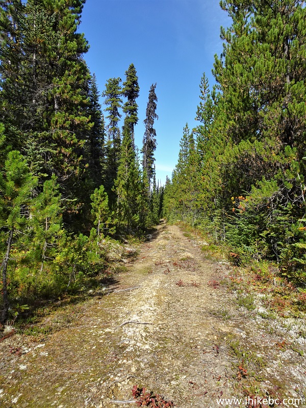
Smithers Trail - Fletcher-Gardiner Trail
13. Now at the 1.92 km mark.
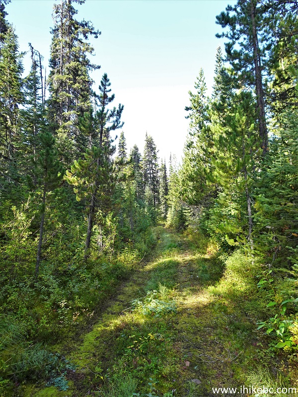
Babine Mountains Provincial Park Hiding -
Fletcher-Gardiner Trail
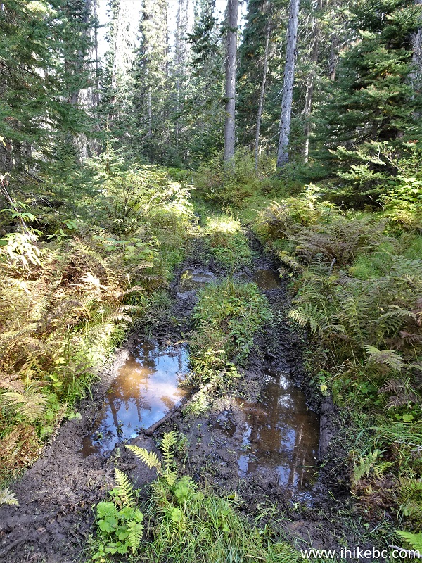
14. And here comes the mud - at 3.78 km. Even at the end of a fairly dry season this is quite substantial. Must be quite a swamp earlier in the season or after a heavy rain.
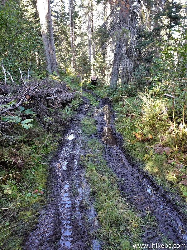
Fletcher-Gardiner Trail Muddy Stretch
15. The first creek crossing comes at the 4.87 km mark.
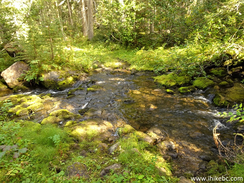
Fletcher-Gardiner Creek Crossing
16. At 5.62 km it's time to cross the second creek. We were able to stone-hop across both creeks this time, but wading might be required should the water level be any higher.
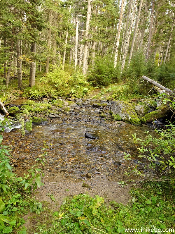
Second Creek Crossing Fletcher-Gardiner Hike
17. Another muddy stretch at 6.18 km of Fletcher-Gardiner Trail.
Muddy Stretch of Fletcher-Gardiner Trail near
Smithers British Columbia Canada
18. At 6.50 km, the dirt track ends at this turnaround point. Approximate Coordinates: N 54°55.337’ W 127°00.972’. Elevation: 981 meters.
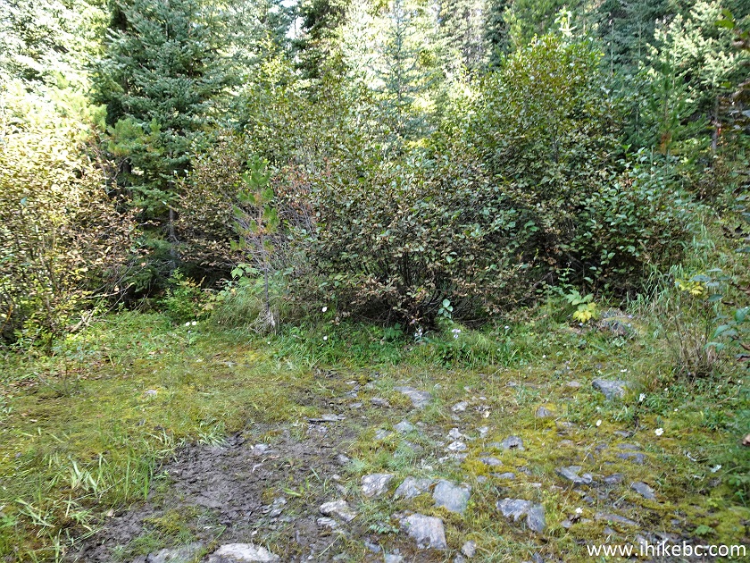
British Columbia Hiking - Fletcher-Gardiner Trail
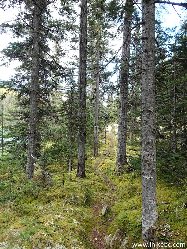
19. Now it's time for a real hiking trail - another 5.5 km to Lower Reiseter Lake, and the trail gets a bit steeper, though nothing too extreme. At 1.65 km here.
Hike in Smithers Area - Fletcher-Gardiner Trail
20. There is very little of interest to see all trail long until the lake, with this small bridge being one of the very few exceptions.
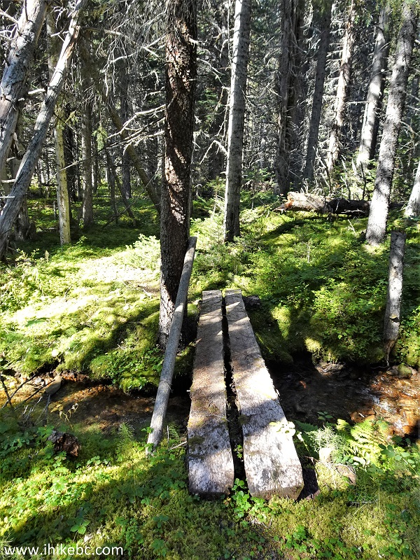
Hike in Canada - Fletcher-Gardiner Trail
21. A sign at 5.10 km from the end of the dirt track.
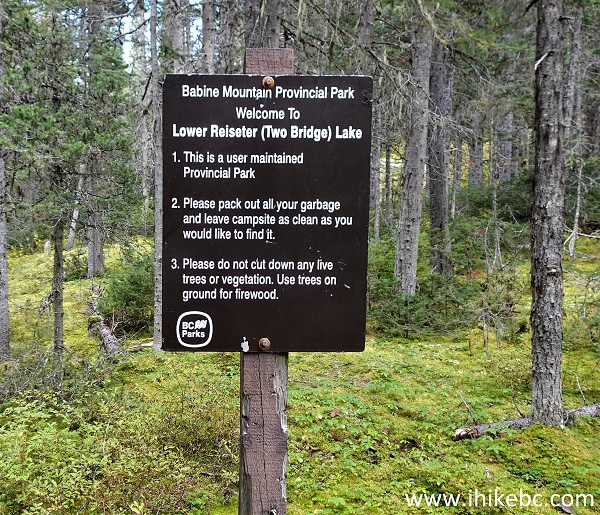
Fletcher-Gardiner Trail in Babine Mountains
Provincial Park British Columbia
22. Just a bit further, and...
Babine Mountains Provincial Park Hiking -
Fletcher-Gardiner Trail
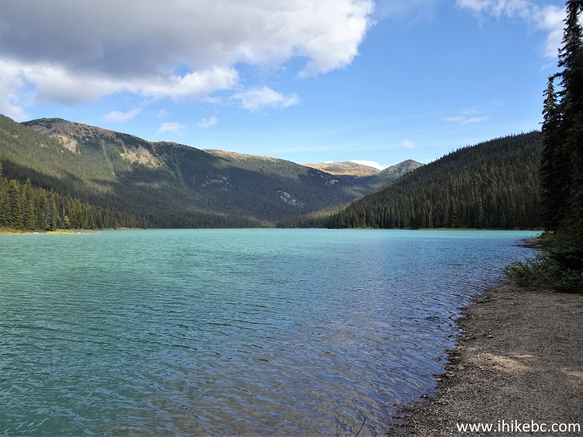
23. ...here comes Lower Reiseter Lake. It's a decent-looking lake, about 1.5 km-long, but, unless you are here to camp or want to explore further, it's hardly worth the 27 km round-trip hike from the parking lot, especially considering spectacular alternatives in Babine Mountains Provincial Park.
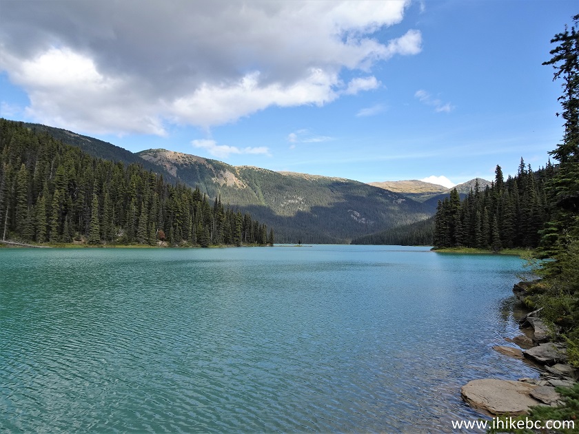
Lower Reiseter Lake
24. Another look at the lake, located about 5.50 km from the end of the dirt track.

Lower Reiseter Lake - Babine Mountains Provincial
Park
25. Here is the campground. Coordinates: N 54°57.497’ W 126°58.965’. Elevation: 1,170 meters.
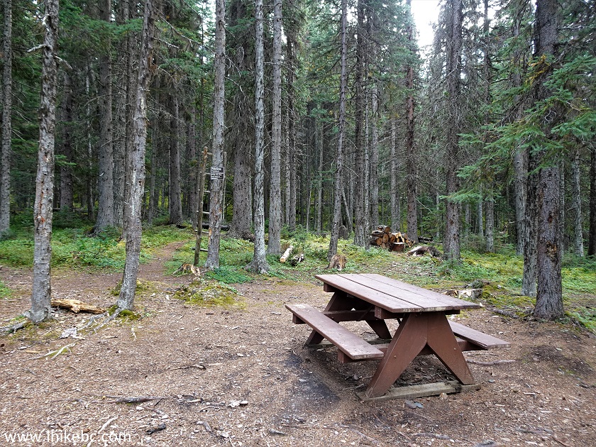
Lower Reiseter Lake Camping Area
Camping at Babine Mountains Provincial Park Lower
Reiseter Lake
26. This boat has paddles and is, by the looks of it, available to anyone who wants to use it.
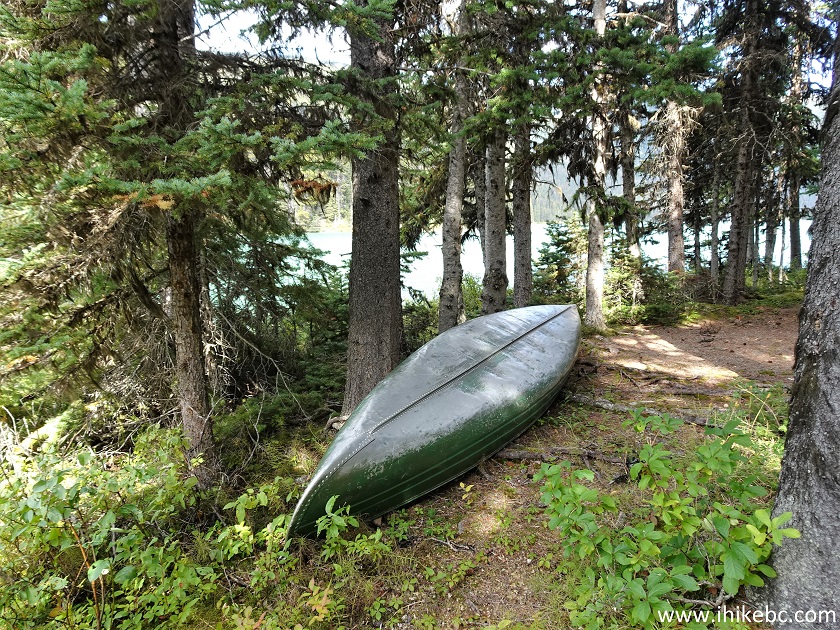
Boat for Lower Reiseter Lake Boating
27-28. Lower Reiseter Lake view from the campground. Plain and zoomed. It appears to be possible to hike around the lake and get to the Grassy Mountain on the other side, though it might not be easy due to all the vegetation.
Lower Reiseter Lake British Columbia
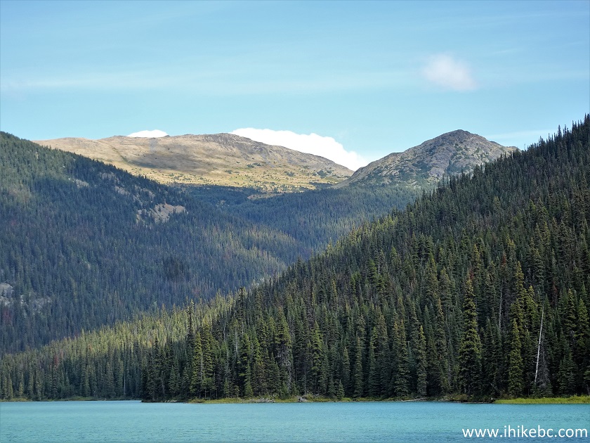
Grassy Mountain British Columbia
29-30. A bear cache at the campground contains several axes. There is also an open air toilet nearby, but, once you open the lid, dozens of flies which are camping inside would be eager to meet you, so beware.
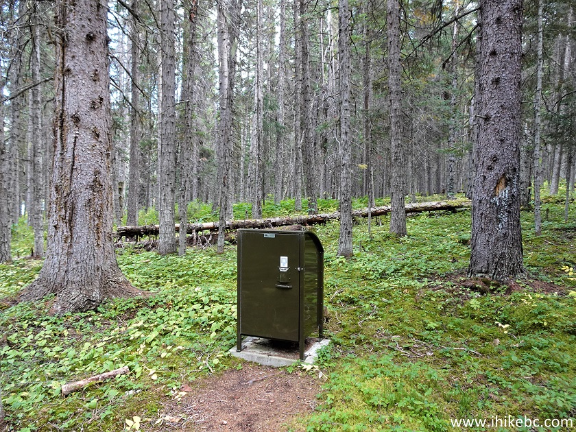
Bear Cache - Lower Reiseter Lake near Smithers BC
Canada
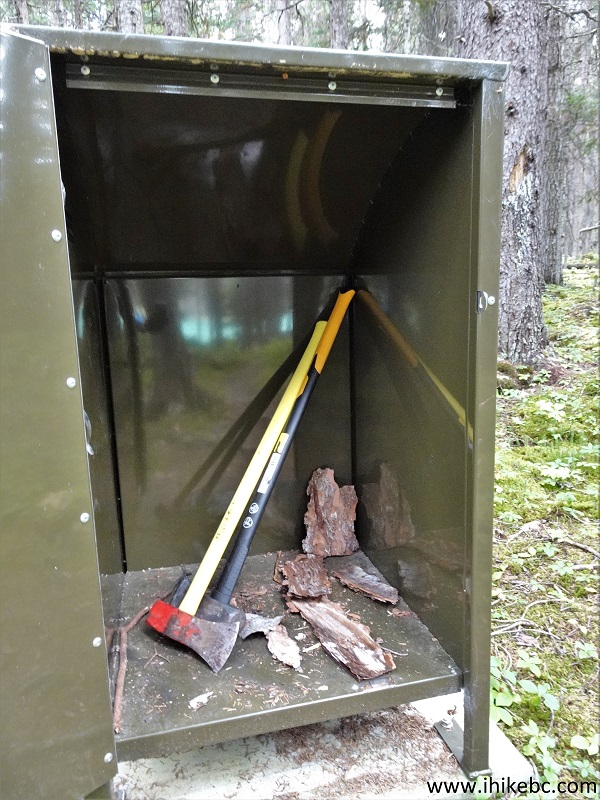
Axes - Lower Reiseter
Lake Campground
Here is our video of the
views from the campground.
More ihikebc videos are on our YouTube Channel.
Fletcher-Gardiner Trail is rather easy, but has very little
hiking value, especially compared to other trails in Babine Mountains Provincial
Park. Recommended to the campers among us.


|
 |
Other Trips in Smithers BC Area:
|
|
|
|
|
|
|
|
|
|
|
|
|
Crater Lake Trail  |
Other Trips:


![]()
![]()
![]()
ihikebc.com Trip 273 - Fletcher-Gardiner Trail Hike (Near Smithers BC)