![]()
![]()
![]()

Trip 303 - October 5, 2023 (Thursday).
Lucky 4 Mine Trail Hike
Near Hope BC
Page 1 of 2
Liked:
Jones Lake views, mountain views, shade in the forest, colourful sub-alpine plants, (almost) no bugs.
Of Note: No signs at all for this trail, the last 2 km of the trailhead access road is for 4x4 high clearance short wheelbase vehicles only, no shade in the alpine and sub-alpine, a very brushed-in section for over 1 km – rain paints / rain coat / waterproof boots are highly recommended, moderately difficult trail, slippery sections, some muddy spots, a few small creek crossing (some wading could be required early in the season or after a heavy rainfall), rocks and roots, hiking poles and boots are highly recommended.
Vancouver, Coast & Mountains Backroad Mapbook (2019 edition) Trailhead Coordinates: Page 5 (Chilliwack Lake) C3.Lucky 4 Mine Trail starts off a Jones Lake FSR 12.5 km split spur road (2.6 km-long), and continues for about 7.4 km to a good viewpoint of surrounding mountains. Fine Jones Lake views are also there. Foley Glacier, which can be seen from Jones Lake, is located near the end of the hike. Apparently, there used to be a mine near the glacier, hence the trail name. However, from what we could gather online, the mine entrance is quite hard to find, and to get there requires traversing very challenging terrain, so it's better left to those who know what they are doing.
The trail appears to be rarely traveled, and there are no signs at all pointing to the trail or indicating the trail start. There is a very overgrown stretch (hundreds of meters) around the middle of the trail, which is bound to thoroughly soak you, unless you have rain gear and waterproof boots. One the plus side, the views are quite good once you get to sub-alpine, and the bugs are (almost) not there.
*All trail distances are based on a GPS odometer and are approximate.
1. We are at the 12.5 km mark of Jones Lake Forest Service Road near Hope, BC. Our Jones Lake FSR trip report includes directions on getting there from Highway 1. Take a road on the left at the split pictured below. Any regular vehicle (with good tires) should make it up to this point. It's about 2.6 km from here to Lucky 4 Mine trailhead.
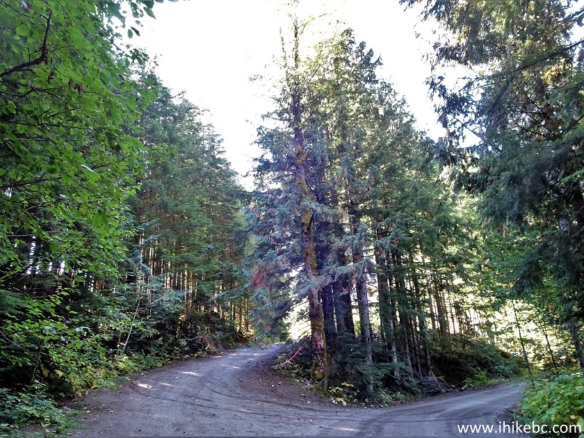
Jones Lake FSR
Here is our video of
driving on the access road.
More ihikebc videos are on our YouTube Channel.
2. The spur road 100 meters after the turn. Unless you have a short wheelbase high clearance 4x4, park at a large opening seen straight ahead and hike the rest of the way. The road gets rough and with cross-ditches 700 meters later. Or see if you can get to a spot pictured in photo #6.
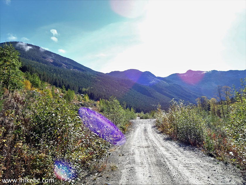
Lucky 4 Mine Trail access road
3-4. Stay right at the split at the 400 meter mark of the spur road.

Lucky 4 Mine Trail access road off Jones Lake Forest
Service Road
5. Now at 700 meters.
Lucky 4 Mine Trail access road near Hope BC
6. We parked at this spot 70 meters later, good for one vehicle. There is a substantial cross-ditch right after that.
Lucky 4 Mine Trail access road by Hope British
Columbia
7. Another cross-ditch (which stopped us from driving any further when we initially tried to see how far we can drive) is at 900 meters of the spur road. It's even deeper than the ditch near the parking spot above. It is deeper than it looks.
Cross-ditch on Lucky 4 Mine Trail access road
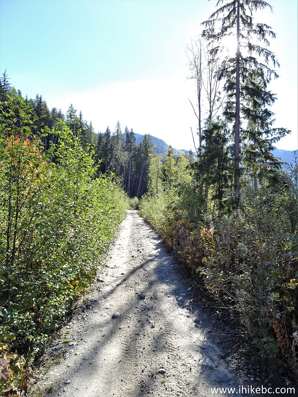
8. At about 1.4 km of the spur road, anything but short wheelbase high clearance 4x4 vehicles would likely get stuck for sure.
Rough access road to Lucky 4 Mine Trail
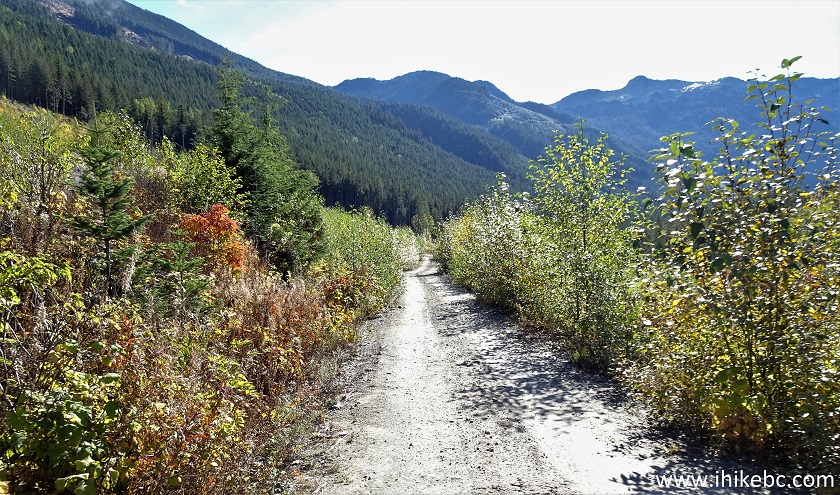
9. 300 meters later.
Lucky 4 Mine Trail access road
10. Arriving to the end of the spur road, about 2.6 km from Jones Lake Main FSR (12.5 km split). Coordinates: N 49⁰12.062’ W 121⁰35.262’. Elevation: 745 meters. Lucky 4 Mine Trail starts straight ahead. No signs of any kind indicate the presence of this trail. There is enough space to park a few vehicles here.
Lucky 4 Mine Trail 4x4 parking area
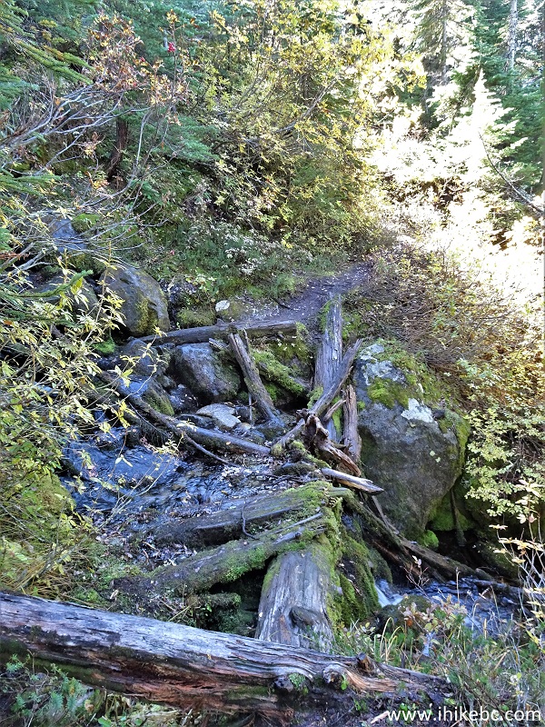
11-12. Go down a small hill at the end of the road and cross a creek.

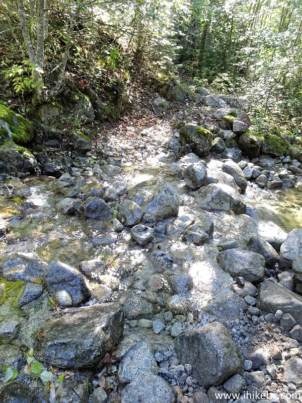
Creek crossing at the start of Lucky 4 Mine Trail
near Hope BC Canada
13. A large boulder 100 meters later.
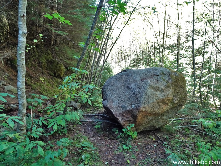
Hiking in Hope BC area - Lucky 4 Mine Trail
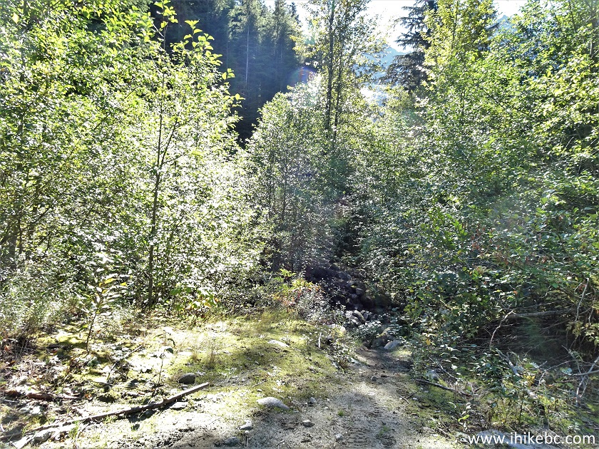
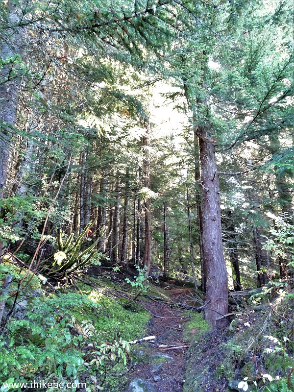
14. It's quite a pleasant hike in a forest for a while. At 1.29 km here.
Lucky 4 Mine Trail in Hope BC area
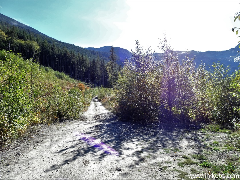
15. The first mountain view arrives at the 1.73 km mark of Lucky 4 Mine Trail.
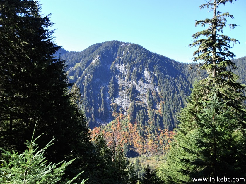
Lucky 4 Mine Trail mountain view
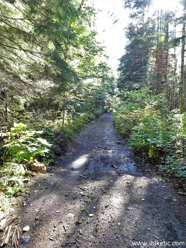
16. Still a good hike in the forest at 1.84 km of the trail.
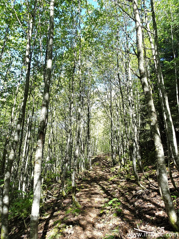
Lucky 4 Mine Trail forest hiking
17. Things get complicated when a badly overgrown stretch begins at 2.96 km. It is about 300 meters long, and there was so much moisture on the leaves that we got thoroughly soaked. Rain gear kept us relatively dry, but the boots were not as waterproof as we hoped, so spare dry socks came handy.
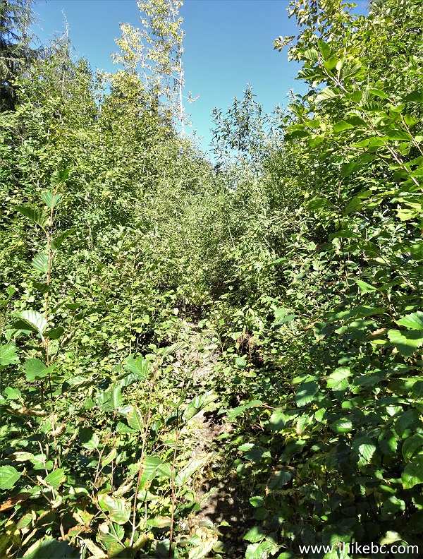
Hike in British Columbia
18. 80 meters later.
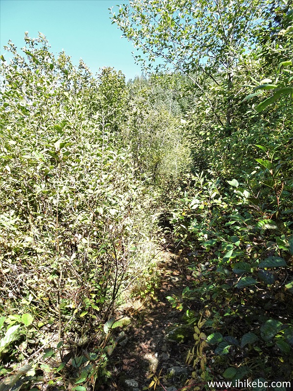
Overgrown Lucky 4 Mine Trail near Hope BC Canada
19. The badly overgrown stretch ends at the entrance to the forest at the 3.25 km mark. Coordinates: N 49⁰11.572’ W 121⁰34.574’. Elevation: 1,200 meters.
Hiking Lucky 4 Mine Trail in Hope BC area
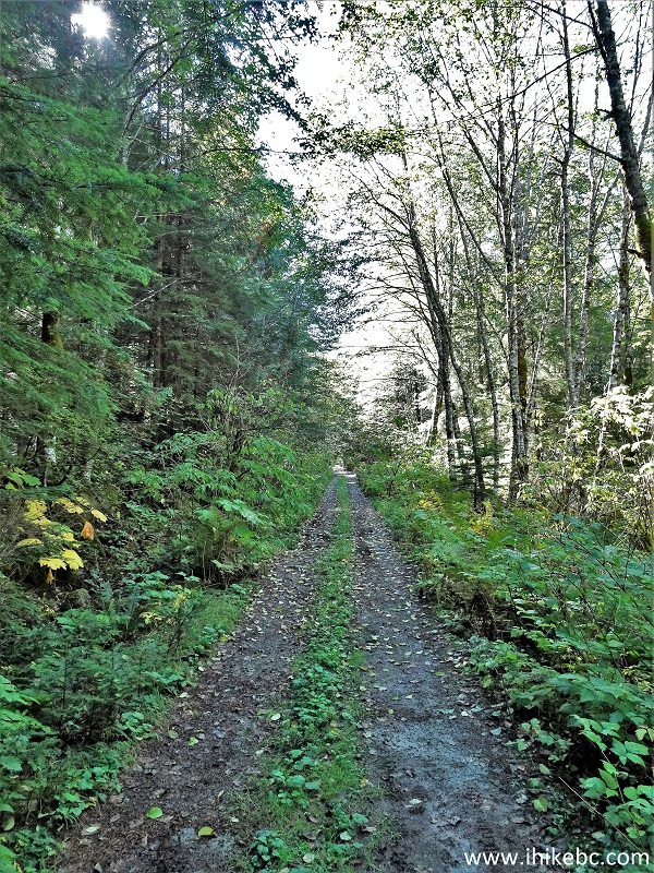
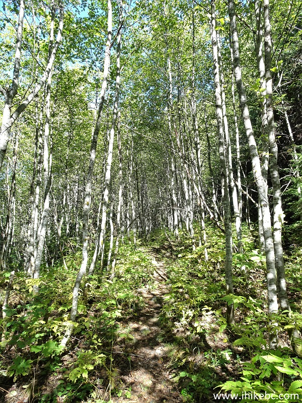
20. Another fine forest hike ensues. At 3.49 km.
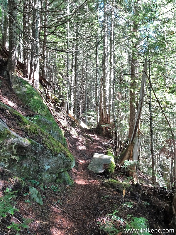
Hiking in Hope British Columbia area - Lucky 4 Mine
Trail
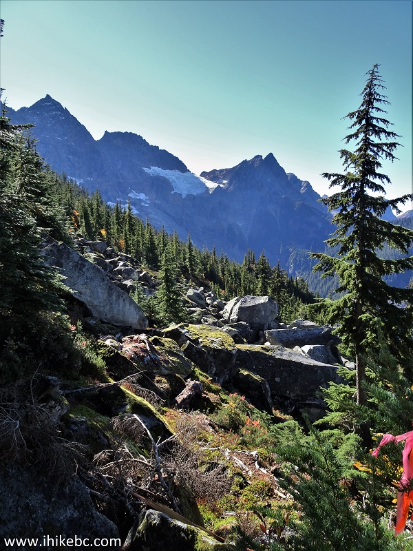
21-22. The next good mountain view comes at 4.23 km of Lucky 4 Mine Trail. Plain and zoomed.

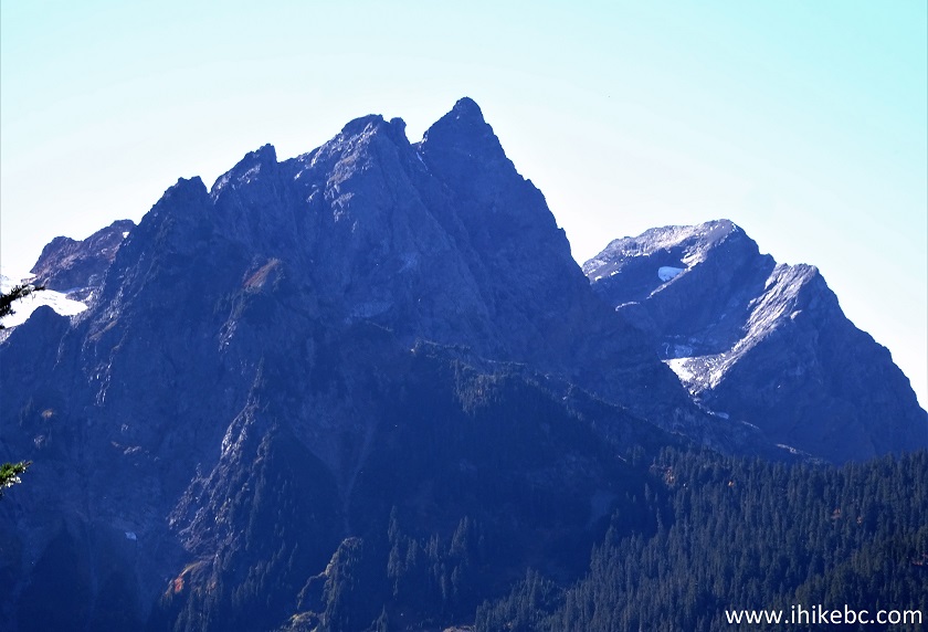
British Columbia mountain
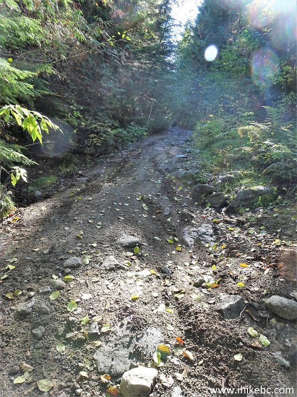
23. At 4.65 km, a fairly complicated stretch of the hike.
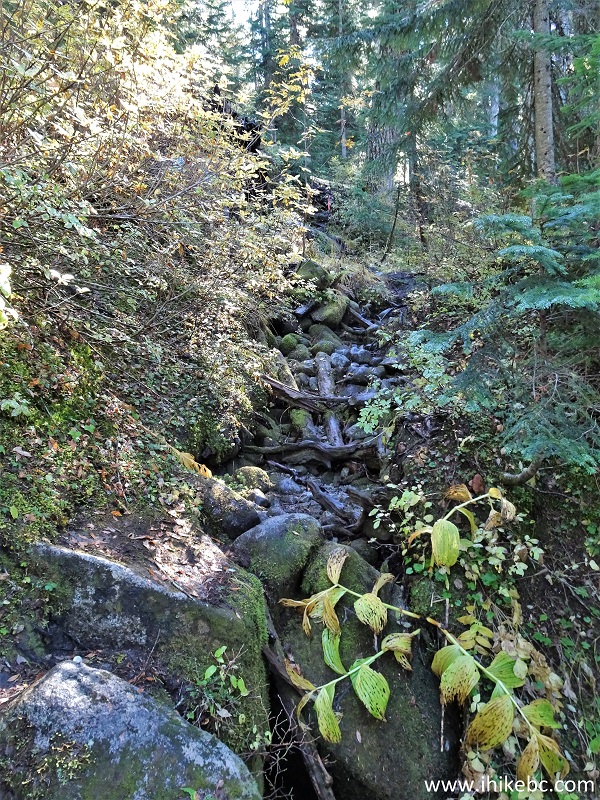
Lucky 4 Mine Trail rough stretch
24. The challenging stretch ends at 4.84 km, and a good path resumes.
Lucky 4 Mine Hike British Columbia Canada
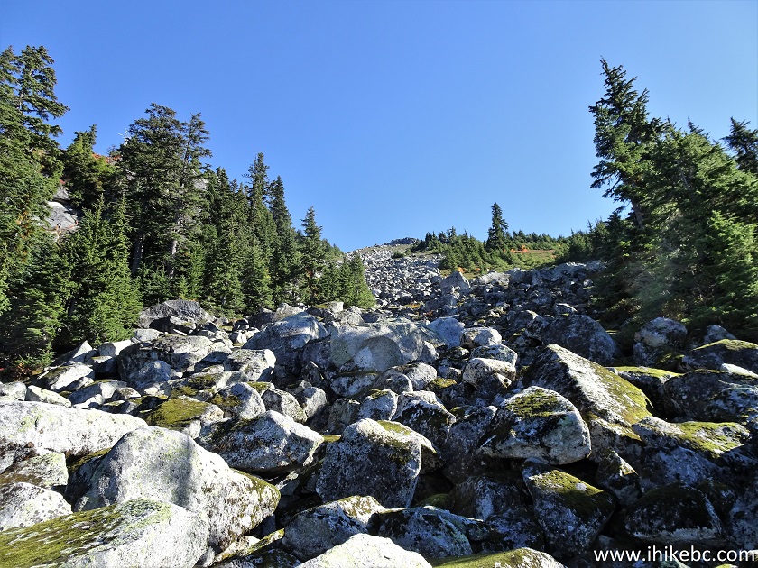
25. At 5.54 km, a boulder field begins. Coordinates: N 49⁰10.801’ W 121⁰34.251’. Elevation: 1,490 meters. There is a decent path on the left side - otherwise, you would need to do fairly challenging stone-hopping. Find the path - it is right there, though a bit obstructed by fallen trees.
Lucky 4 Mine Trail boulder field
26. Looking left while crossing the boulder field.
Boulder field - Lucky 4 Mine Trail - near Hope BC
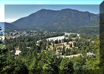
27-28. The boulder field also signals the arrival of sub-alpine and Jones Lake views. Here it is, at 5.84 km. Plain and zoomed.

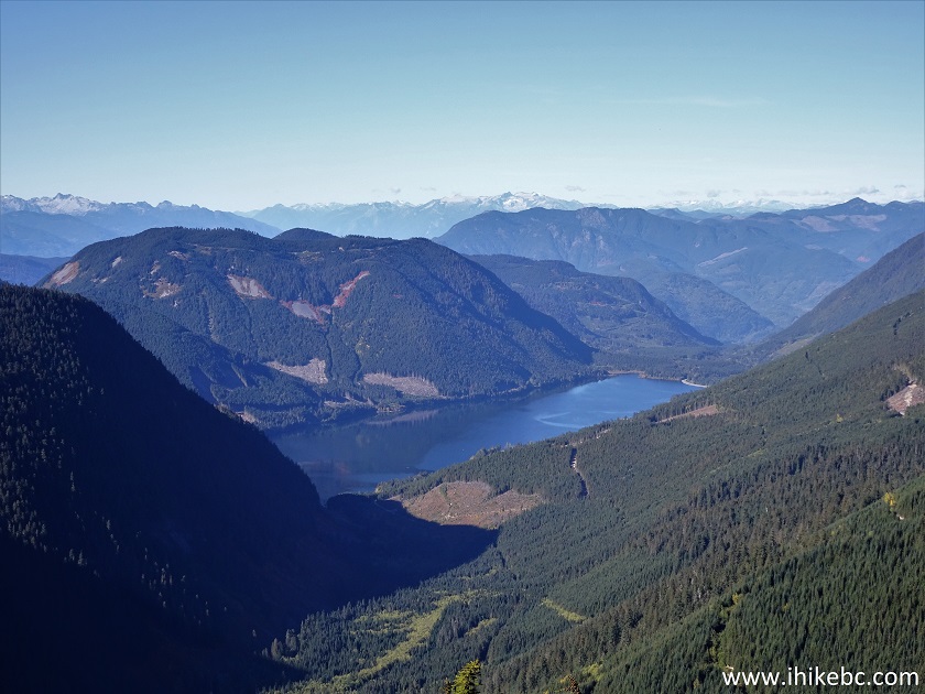
Jones Lake British Columbia
Our Lucky 4 Mine Trail Hike trip report Continues on Page 2.


|
 |
Other Trips in Hope BC Area:
|
|
|
|
|
|
|
|
|
|
|
|
|
|
|
|
|
|
|
 |
|
|
|
|
|
Eaton
Peak Route
|
Skyline II West Trail
|
Eaton
Lake Hike 2
|
|
|


Other Trips:


![]()
![]()
![]()
ihikebc.com Trip 303 - Lucky 4 Mine Trail Hike (near Hope, BC)
Page 1 of 2