![]()
![]()
![]()

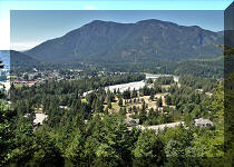
Trip 029 - August 11, 2010 (Wednesday)
Mount Outram Trail
Near Manning Provincial
Park by Hope BC
Distance From Vancouver: 150 km on Highway 1 East to Hope, then about 35 km on Highway 3 to the entrance to Manning Provincial Park (8 km further than Hope Slide Rest Area). Park at the parking lot by the large marmot statue on the left side of the highway.
Liked: Mountain views from the top. Shade in the forest.
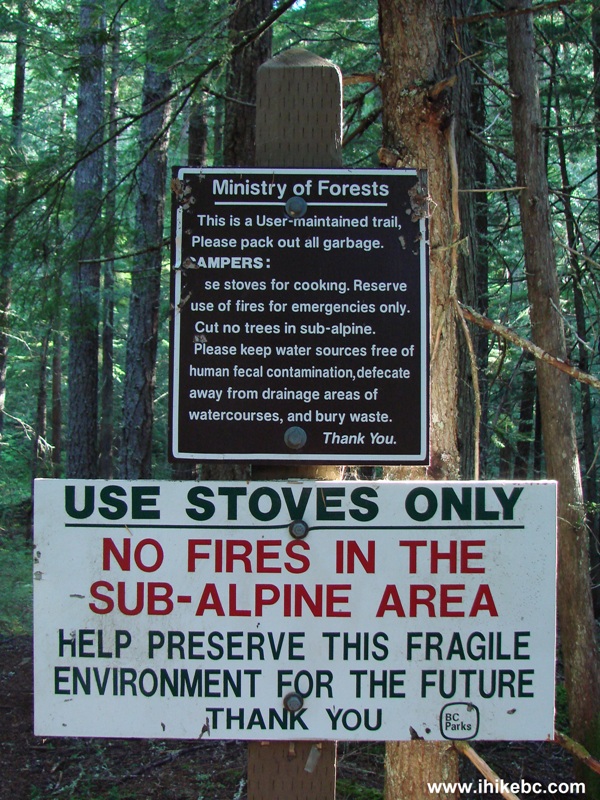
Of note: Long and gruelling trail. Narrow path through the forest next to steep drop-offs. Loose rock closer to the top. This trail is semi-dangerous when dry, dangerous when wet. Hiking boots and poles, and sun protection (if it's sunny) are highly recommended. Mosquitoes galore in the sub-alpine area between the forest and bare rocks near the top of the mountain. Not much to see in the forest. No shade beyond the forest. Constant hum from Highway 3 for much of the trail. Remote wilderness area with few visitors.
Vancouver, Coast & Mountains Backroad Mapbook (2010 edition) Coordinates: Page 6 (Skagit Valley) D2.
103 Hikes in Southwestern British Columbia (2008 edition): hike #94.
Other Trips in Hope BC Area: Thacker Mountain Trail, Flat Iron Peak Trail, Needle Peak Trail, Sowerby Creek FSR Hike, Dog Mountain Trail, Jones Lake FSR Trip to Jones Lake, Yak Peak Trail, HBC Heritage Trail, Sowaqua Creek FSR, Zoa Peak Trail, Skagit River Trail, Skyline II Trail Hike, Silver Skagit Road, Othello Tunnels, Eaton Lake Trail, Mount Hope Lookout Trail, Town of Hope BC.
Follow @ihikebc TweetMount Outram Trail wore us out like no other trail we remember. This trail is not as steep as Lincoln Mountain Trail, but it is very long and treacherous. First, you steadily go up through a featureless forest for several hours, then feed the mosquitoes in the sub-alpine area (20+ satisfied bloodsuckers in our case), and, finally, try not to break a foot far away from the nearest hospital, while walking on loose rocks going up a steep grade, only to discover that the peak is further away than you thought, and the views hardly get any better. If you want to reach the peak, get ready for at least a ten-hour round trip hike. But, if you are happy with going through the sub-alpine and not climbing up the loose rocks beyond that, you can still see great mountain views and would save at least two hours of hiking. If the rocks are wet, it would be wise not to climb them anyway.
1. Mount Outram Trail starts by the parking lot at the entrance to Manning Provincial Park. Parking is free.
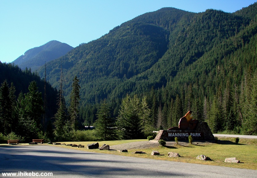
Manning Park Entrance the Province of British Columbia Canada
2. Soon after the beginning, the path goes past a huge wall of large rocks.
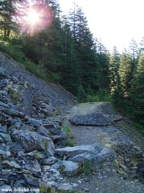
Mount Outram Trail Beginning not far from the town of Hope BC Canada
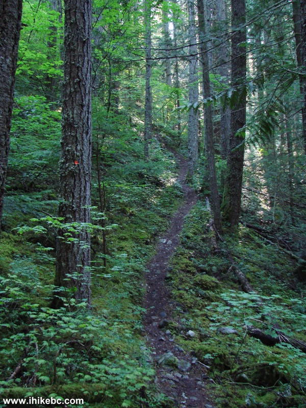
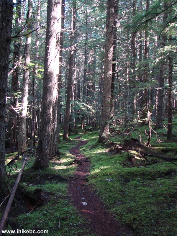
3. But, then, the forest begins and the views end.
Mount Outram Trail BC Canada
4. Mount Outram Trail is actually located outside of Manning Provincial Park, and there is a park boundary sign very soon after the trail begins. For the next several hours, we would be mostly steadily gaining elevation up a very narrow path. Watch your step, as the drop-offs are quite steep.
Mount Outram Trail near Manning Provincial Park BC Canada
5. The only entertainment in the forest arrives about an hour into the hike, as a "human head" tree, complete with an eye, nose and moustache is waiting for you.
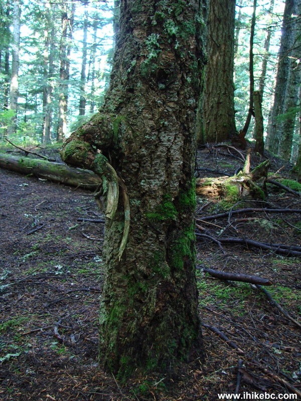
Photo of a tree looking like a human head the province of British Columbia Canada
6. Then, there is the only substantial flat stretch, before the path goes up again.
Mount Outram Hiking Trail BC
7. This stream crosses the path later on, and it could present a problem during the spring runoff.
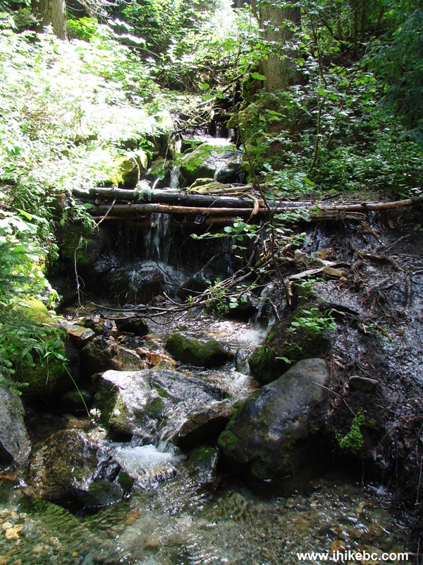
Creek crossing Mount Outram Trail BC Canada
8. Finally, close to 2.5 hours after the commencement of the hike, some mountain views started to appear, as we left the forest and entered the sub-alpine area.
Mount Outram Trail Sub Alpine Area the Province of BC Canada
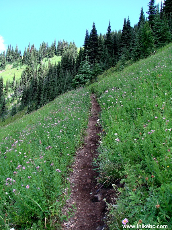
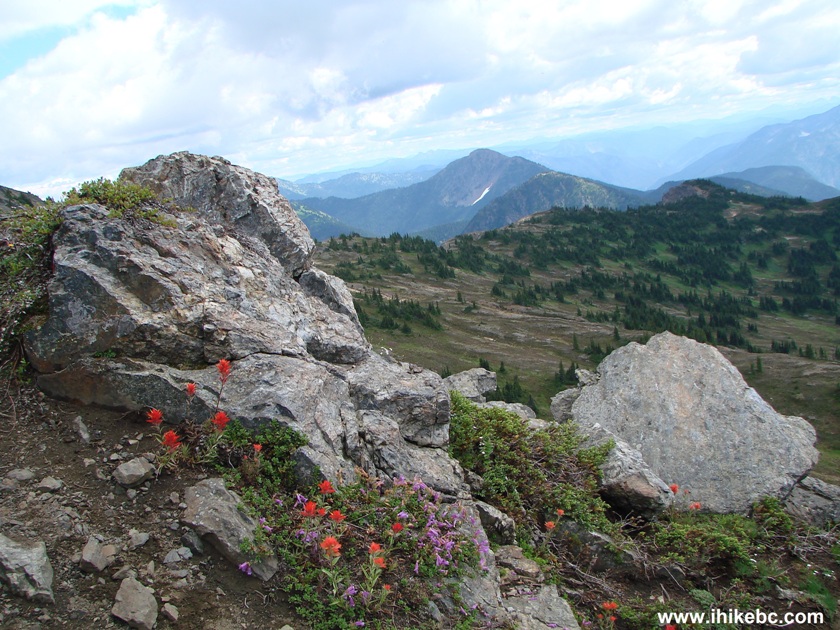
9. The flowers were still in bloom, though they were wilting by now.
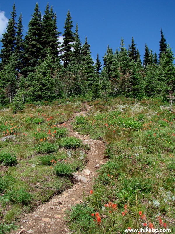
Blooming Flowers on Mount Outram Trail BC Canada
10. Mount Outram in full glory. Looks like we can see the top, right? But, no, it's not the top. Loose rock is beyond that, and there are a few more apparent "peaks" ahead, beyond which there is more climbing required to reach the true top.
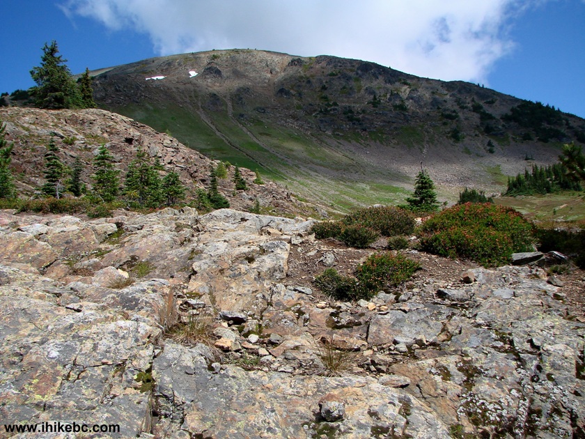
British Columbia Hiking -
Mount Outram BC Canada
11. A bit further down the trail.
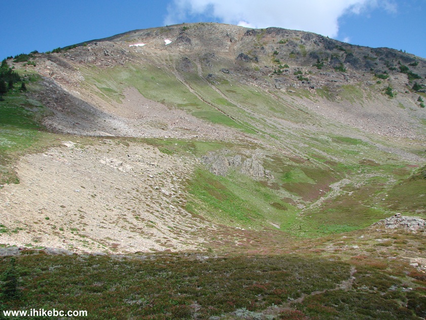
Hiking in BC - Mount Outram Trail near Hope British Columbia Canada
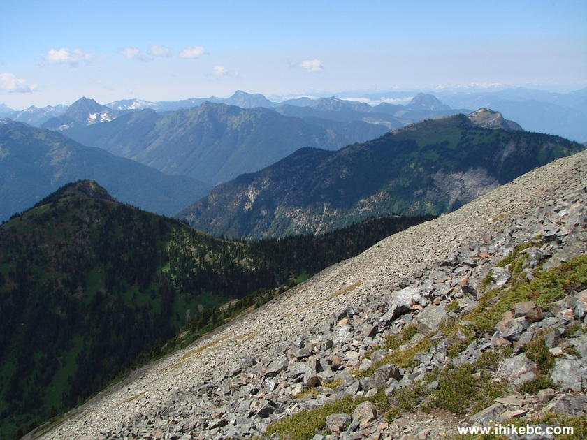
12. As you stop to rest, fine mountain views behind you keep things interesting.
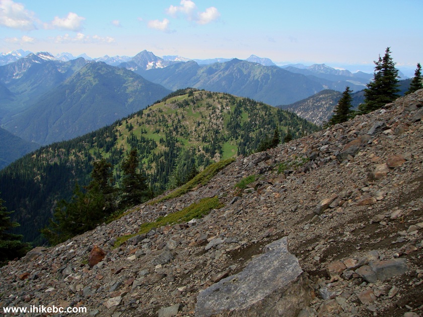
View from Mount Outram BC Canada - Hiking in Hope BC Area
13. See the lake on the left side? There is one more lake to the left of that. And, once you come to full view of that second lake, the mountain views would not get much better. So, that could be a good end to your forward progress.
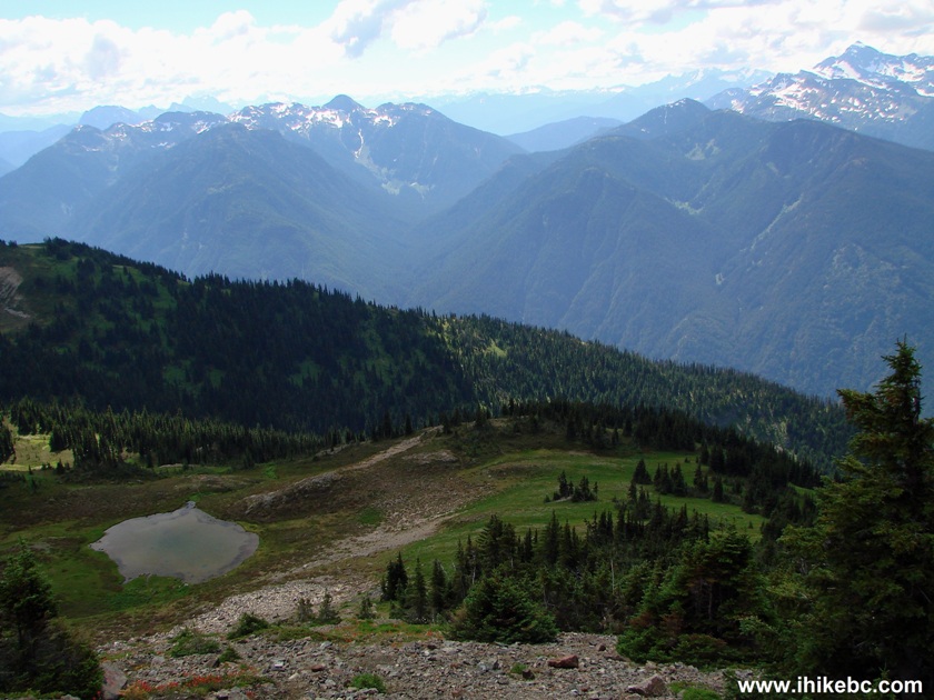
Mountains and a Lake seen from Mount Outram the Province of British Columbia Canada
14. Now looking slightly to the right.
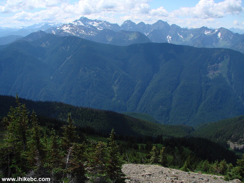
Views from Mount Outram British Columbia Canada
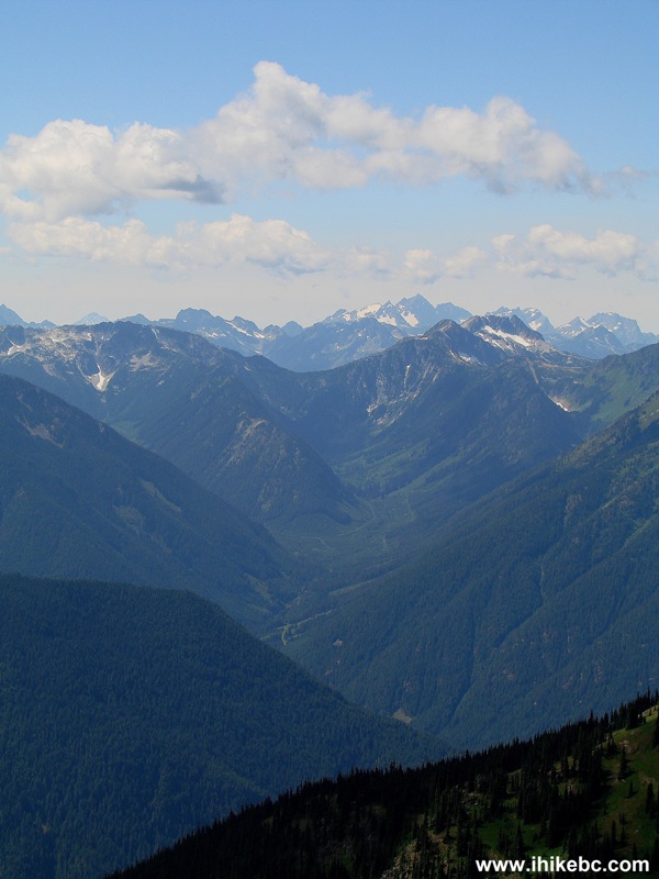
15. A bit more to the right.
Mount Outram Hiking Trail Views BC Canada
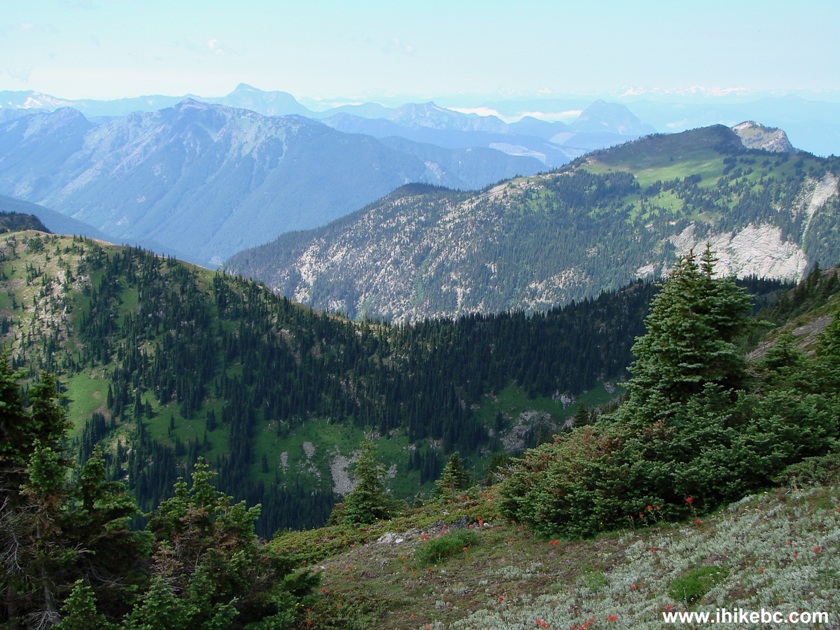
16. And, finally, further to the right we can see a very interesting valley. Substantial zoom used.
Valley Seen from Mount Outram
17. If you still want to get to the top of Mount Outram, you would have to climb for more than an hour, and then, obviously, descend on your way back. So, the hike would be extended by a few hours, and that's the kind of terrain you would have to conquer.
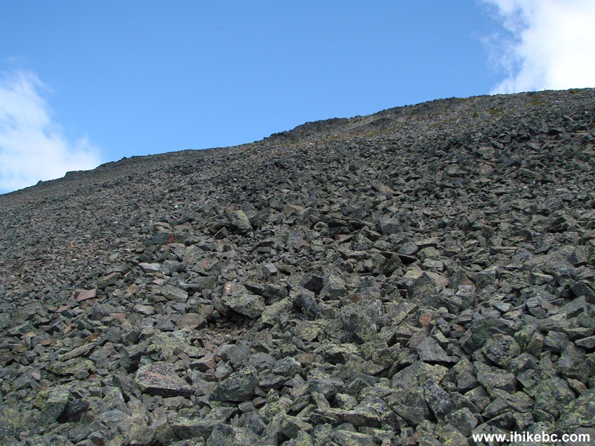
Loose Stones on Mount Outram the Province of British Columbia Canada
18. But, one way or another, great views are everywhere.
19. And one more.
Here is our video of the views from Mount Outram trail near the peak.
More ihikebc videos are on our YouTube Channel
.
We stopped about 30 minutes before reaching the
peak (or what looked like a peak, anyway), as there was a couple sitting
there, and we did not want to disturb them. Other than that couple, we
have not seen any people all day long, to give you an idea of how few
people come this way. Mount Outram = tough trail & neat views.
Other Trips in
Hope BC Area:
Other Trips:
ihikebc.com
Trip 029 -
Mount Outram Trail Hike
(near Manning Provincial Park by Hope BC)


Eaton
Peak Route

Skyline II West Trail
Eaton
Lake Hike 2


![]()


![]()
![]()
![]()
![]()