![]()
![]()
![]()

Trip 313 - July 2, 2024 (Tuesday)
Skyline II West Trail Hike
From Silver Skagit Road to Hozameen Ridge Junction (12 km one way)
Near Hope, BC
Liked: Mountain views, Ross Lake view, shade in the forest, colourful plants in sub-alpine.
Vancouver, Coast & Mountains Backroad Mapbook (2019 edition) Trailhead Coordinates : Page 6 (Skagit Valley) F6.
103 Hikes in Southwestern British Columbia (2008 edition): hike #78.
Related Websites: Skagit Valley Provincial Park - BC Parks official site, Manning Provincial Park - BC Parks official site.
Related Trip: 045 - Skyline II (West) Trail Hike (partial).
Follow @ihikebc TweetSkyline II West Trail starts at the 55 km mark of Silver Skagit Road (which begins off Flood-Hope Road near Hope, BC by Highway 1 Exit 168), about 5 km before Silver Skagit Road ends at International Point Day Use Area and the United States border. This moderately difficult trail takes a long time to get to anything worth looking at, but then rewards you with fine views of double-peaked Hozomeen Mountain and Ross Lake, as well as a bunch of remote mountains.
We already hiked Skyline II West Trail in June of 2011, but hit a lot of snow around the 9 km mark and stopped there. This time, we were able to get to Hozameen (sic) Ridge Junction at about the 12 km mark. From there, it is possible to hike the above-mentioned ridge, or continue for another 13 km or so to the East trailhead located off BC Highway 3. There is, thus, an option to make it a one way hike via a car shuttle. Though, considering the driving distance between the trailheads, it would be rather hard to make it a one day trip. Mowich wilderness camp located about 1 km past the Hozameen Ridge Junction might be of use to those wishing to make it an overnight adventure.
Silver Skagit Road was closed from November of 2021 (when an atmospheric river did some serious road damage) until Spring of 2024, so (just about?) no one hiked Skyline II West Trail for about 2.5 years. Thus, quite a bit of the trail has encroaching vegetation, and we would have been substantially scratched were it not for rain pants, which were also quite helpful to frustrate some mosquitoes at the beginning of the hike. Also, Silver Skagit Road was in rather rough shape with numerous potholes (2WD regular clearance vehicles - ok), but two days later it was graded, and is in much better shape now (but it can certainly deteriorate again over time).
Be careful when driving on Silver Skagit Road - watch for wildlife and incoming vehicles, especially logging trucks and other industrial equipment.
*All trail distances are based on a GPS odometer and are approximate.
1. Here are Google Maps directions from Flood-Hope Road near Hope, BC to Skyline II West Trailhead.
2. We are at the beginning of Silver Skagit Road. Flood-Hope Road is just behind us. It is 55 km from here to Skyline II Trail. For more information on Silver Skagit Road, check out our 2011 trip report.

Silver Skagit Road Hope British Columbia Canada
3. Now at the 18.4 km mark of Silver Skagit Road. Watch for incoming traffic, especially logging trucks.

Silver Skagit Road
4. At 21.3 km. Also be on a lookout for wildlife. We saw several deer, a hare, a marmot and a bear.

Driving on Silver Skagit Road near Hope BC Canada
5. At the 55.0 km mark of Silver Skagit Road we are arriving to Skyline II Trail on the left side.

Silver Skagit Road at Skyline II Trailhead parking lot
6. There are no signs of any kind leading to the trailhead, and the only sign is at the trailhead around the corner on the left side. So, watch your odometer (55.0 km from the start of Silver Skagit Road) and also look for this parking space by the trailhead.

Parking lot for Skyline II Trail near Hope British Columbia
7. The parking space and the trailhead.

Skyline II Trail parking lot and trailhead
Here is our video of driving on Silver Skagit Road to Skyline II Trail.
8. Skyline II West Trail start. Coordinates: N 49⁰02.490' W 121⁰04.135'. Elevation: 490 meters. The sign states 13 km to Mowich camp, and 25 km to Strawberry Flats (eastern end of the trail).

Skyline II Trailhead
9. Skyline II Trail begins. At 55 meters.

Hiking in Hope BC Area -Skyline II Trail
10-11. At 610 meters, there is a Centennial Trail junction. Centennial Trail runs parallel to Silver Skagit Road.

Skyline II Trail at Centennial Trail

Skagit Valley Provincial Park Trail Sign
12. Skyline II Trail at 2.20 km. There are a bunch of switchbacks, and nothing too steep, though this trail does gain substantial altitude.
Hiking in British Columbia - Skyline II Trail
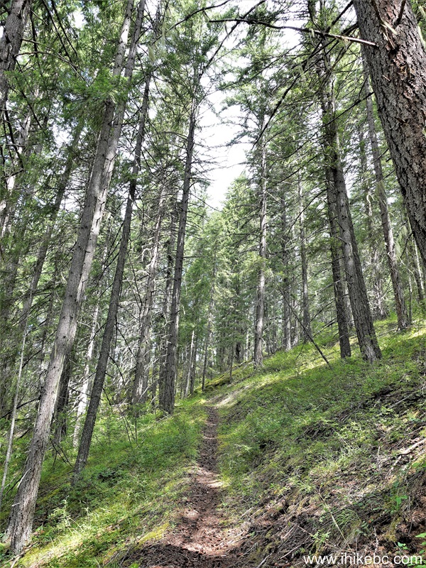
13. There are many parts of the trail with encroaching vegetation, like here at the 2.70 km mark.

Hiking in Canada - Skyline II Trail near Hope BC
14-15. At 3.75 km, Skyline II Trail enters Manning Provincial Park.

Manning Provincial Park Entrance via Skyline II Trail

E.C.Manning Provincial Park Boundary Sign
15. A small bridge at 4.07 km.

Skyline II Trail
16. Now at 6.60 km of Skyline II West Trail. Not much to see for a long time.

Hiking in Hope British Columbia Canada Area - Skyline II Trail
17-18. Finally, a decent view of Hozomeen Mountain appears at the 9.07km mark (plain and zoomed).


Hozomeen Mountain Zoomed View from Manning Provincial Park - Skyline II
Trail
18. At 9.48 km, we are out of the woods, and there is limited tree cover.

Skyline II Hike near Hope BC Canada
19. And the views are getting better and better. At 9.60 km.

View from Skyline II Trail in Manning Provincial Park
20. At 9.72 km of Skyline II West Trail in Manning Provincial Park.

Skyline II West Trail in Manning Provincial Park in British Columbia
Canada
21. Hozomeen Mountain (now with both peaks visible) at 10.21 km of Skyline II Trail.

Hozomeen Mountain view from Skyline II Trail near Hope BC
22. At 10.80 km, the best view of the hike is almost there.

Skyline II West Trail
23-24. The best, most panoramic view of Skyline II West Trail is at the 10.93 km mark. Coordinates: N 49⁰02.500' W 120⁰59.641'. Elevation: 1,780 meters. Left to right.


View from Skyline II West Trail in Manning Provincial Park
25. Zooming in for a better view of Ross Lake. The USA is to the left, and Canada is to the right.

Ross Lake
26. A zoomed view of Hozomeen Mountain.

Hozomeen Mountain
27-29. With more zoom, let's check out the peaks above Ross Lake.


Here is our video of the views from this location.
More ihikebc videos are on our YouTube Channel.
30. Now the view from 11.02 km of the trail.

View from Skyline II Hike near Hope BC
31. At 11.84 km, we have reached Hozameen (sic) Ridge Junction. Coordinates: N 49⁰02.119' W 120⁰59.326'. Elevation: 1,785 meters (1,295 meters elevation gain from the trailhead for an average grade of 11%). The ridge begins on the right side, and straight ahead is the continuation of Skyline II Trail, with Mowich camp being about 1 km further, and the eastern end of the trail by Highway 3 about 13 km away.

Skyline II West Trail at Hozomeen Ridge Junction
32. In this picture we are looking from the other side. We came from the right, and the ridge is straight ahead.

Hozomeen Ridge Trail and Skyline II West Trail
Skyline II West Trail has several impressive views, but it takes a long drive and a rather long hike to see them. Recommended.


|
 |
Other Trips in Hope BC Area:
|
|
|
|
|
|
|
|
|
|
|
|
|
|
|
|
|
|
|
 |
|
|
|
|
|
Eaton Peak
Route
|
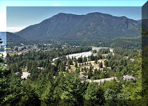
Town of Hope BC Visit
|
Eaton Lake
Hike 2
|
|
Skyline I Trail
|


Other Trips:


![]()
![]()
![]()
ihikebc.com Trip 313 - Skyline II West Trail Hike
(From Silver Skagit Road to Hozameen Ridge Junction) near Hope, BC