![]()
![]()
![]()

Trip 045 - June 22, 2011 (Wednesday)
Skyline II (West) Trail Hike (partial)
Skagit Valley Provincial Park
Near Hope BC
Distance From Vancouver: 196 km. First, drive 140 km on Highway 1 East to Exit 168, then take Silver Skagit Road for 56.1 km.
Liked: Peacefulness, well-maintained trail, creek views, some mountain views.
Of note: Remote wilderness area with no cell phone signal and, likely, no other people (especially on a weekday). The trail is not marked, making it impossible to follow with the snow on the ground. Trekking poles, hiking boots and sun protection (if sunny) are highly recommended.
Vancouver, Coast & Mountains Backroad Mapbook (2010 edition) Coordinates: Page 6 (Skagit Valley) E6-F6-G6.
103 Hikes in Southwestern British Columbia (2008 edition): hike #78.
Related Websites: Skagit Valley Provincial Park - BC Parks official site, Manning Provincial Park - BC Parks official site.
Related Trip: 313 - Skyline II West Trail Hike.
Other Trips in Hope BC Area: Thacker Mountain Trail, Flat Iron Peak Trail, Needle Peak Trail, Sowerby Creek FSR Hike, Dog Mountain Trail, Jones Lake FSR Trip to Jones Lake, Yak Peak Trail, HBC Heritage Trail, Sowaqua Creek FSR, Zoa Peak Trail, Skagit River Trail, Silver Skagit Road, Mount Outram Trail, Othello Tunnels, Eaton Lake Trail, Mount Hope Lookout Trail, Town of Hope BC.
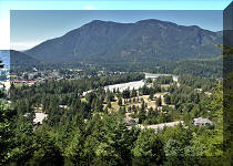
Follow @ihikebc TweetSkyline II Trail is located in Skagit Valley Provincial Park. The terrain of this hike is moderately difficult, with some easy stretches. We hiked the trail until stopped by deep snow by about the 9 km mark. As the trail is not marked, it was impossible to follow it any further. We did get some mountain views, making it a worthwhile hike. This trail goes all the way to near Highway 3 at Manning Provincial Park, so, if you have two vehicles, it is possible to make it a one-way trip via a car shuttle.
To get to Skyline II trail, you need to take Silver Skagit Road, as described in our previous trip.
Here is our July of 2024 video of driving on Silver Skagit Road to the 55 km mark:
More ihikebc videos are on our YouTube Channel.
0. Here are Google Maps directions from the beginning of Flood-Hope Road to Skyline II Trailhead.
1. We are at the 56.1 km of Silver Skagit Road, and Skyline II Trail parking area is seen on the left side.
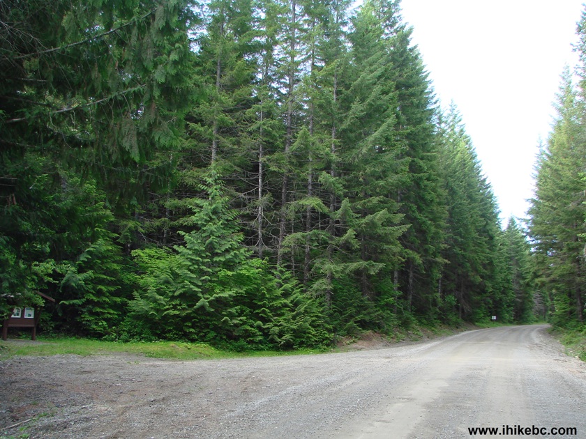
Silver Skagit Road Skagit Valley Provincial Park British Columbia Canada
2. The map of the Skyline II Trail at the parking area info stand. We planned to go to Mowich Camp and back, but could not even reach the Hozameen Ridge Trail intersection.
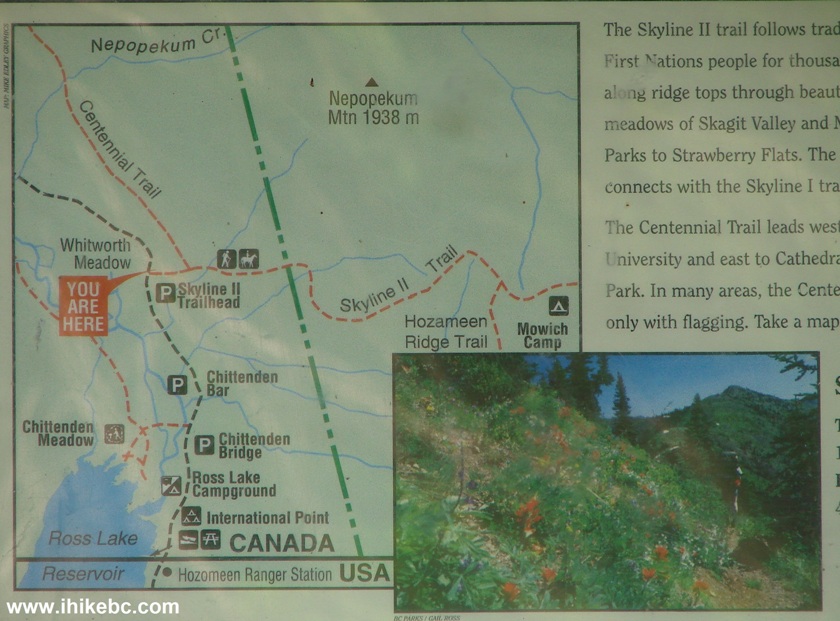
Skyline II Trail Map Photo
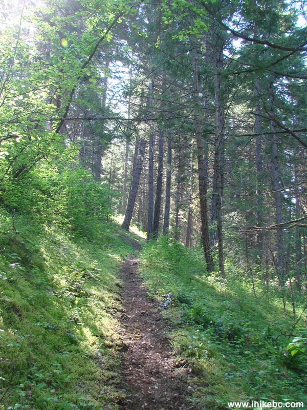
3. The trail begins. The distances are indicated as follows: 13 km to Mowich Camp (elevation 1,310 meters), and 25 km to the Strawberry Flats (Highway 3 trail end).
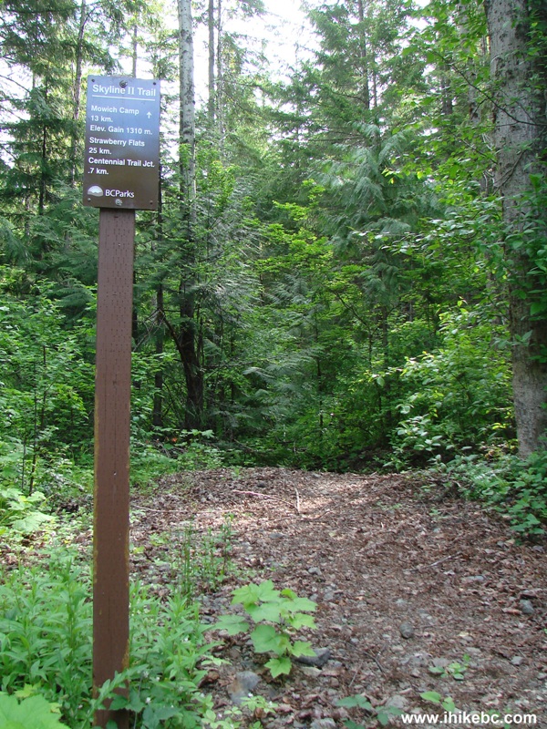
Photo of Skyline II Trail Entrance BC Canada
4. Your best chance to get your feet wet comes immediately after the beginning of the hike. This creek does not look threatening, but the branches you step on give way very easily, and, if you have no hiking poles, crossing without getting wet would be problematic.
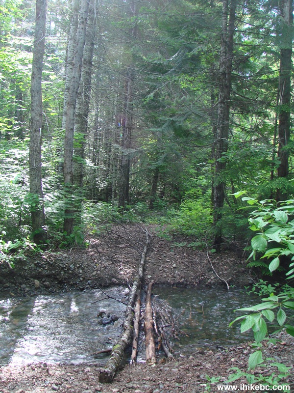
Skyline II Trail Picture Province of British Columbia Canada
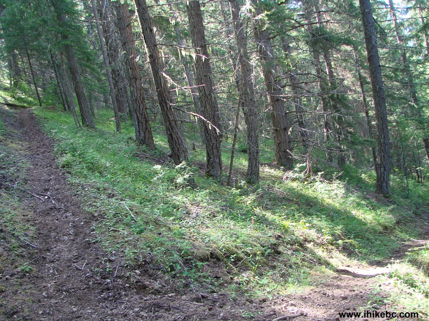
5. And, then, the hike continues through a mostly featureless forest. The path is quite wide and fairly smooth by hiking standards, with few roots and stones.
Hiking in Hope BC Area - Skyline II Trail Skagit Valley Provincial Park
6. There are numerous switchbacks on Skyline II Trail. This is good for making the hike less strenuous. But, with the snow on the ground, getting lost would be very easy, as this is the first such a long hiking trail that we can remember that is not marked at all, aside from two or three pieces of flagging tape.
Switchback on Skyline II Trail - Hope Hiking British
Columbia Canada
7. The only real attraction before the arrival of the mountain views is this bridge across a picturesque creek. The bridge is quite old and worn out, but still looks and feels very sturdy.
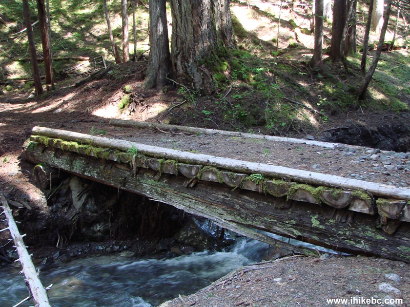
Bridge Across a Creek at Skyline II Trail - Hiking in British Columbia Canada
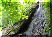
8. The creek view is quite good too.
BC Hiking - Skyline II Trail Creek Photograph
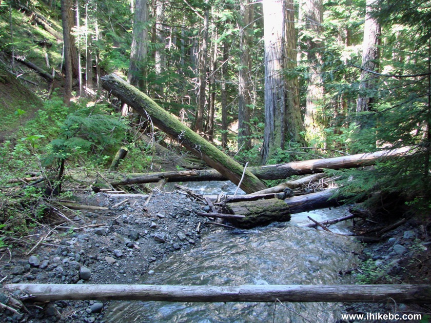
9. Here is a good obstacle to tackle, as these trees have fallen in such a way that it is quite challenging to go either over or under the trees. Solution: detour on the left side.
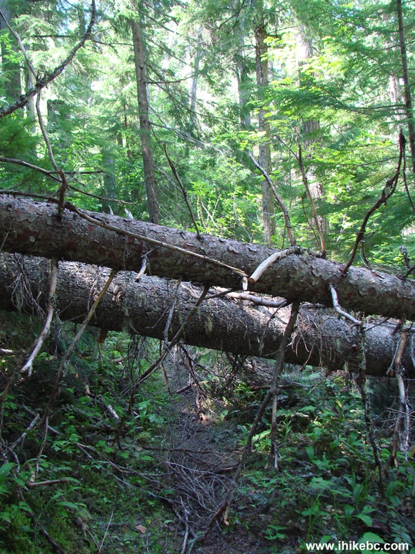
Skyline II Trail Obstacle - Hiking in Hope Area Province of British Columbia Canada
10. At about the 9 km mark, we encountered very deep snow.
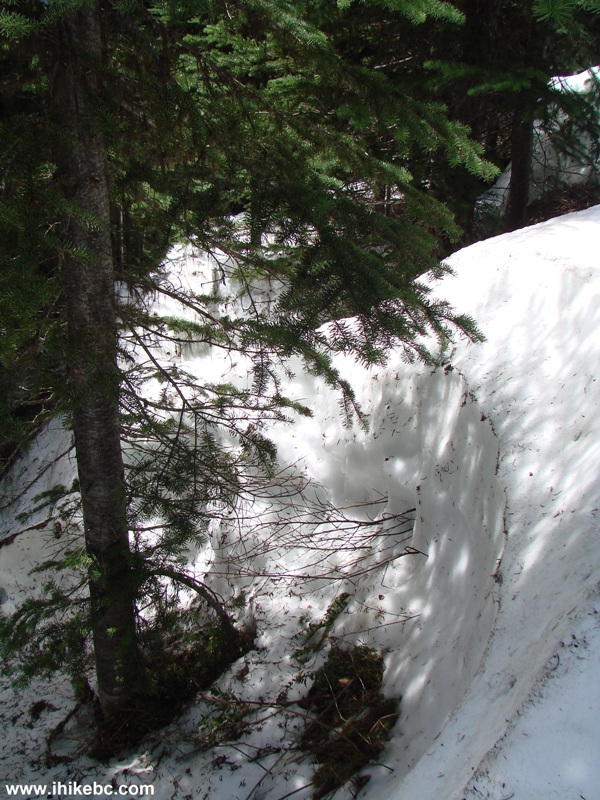
Snow on Skyline II Trail BC Canada
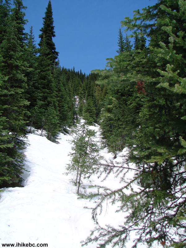
11. The trail is not marked, so where to go from here?
12. Time to go back. We tied two ribbons to a tree to indicate the point we have reached, and to mark the trail a little bit.
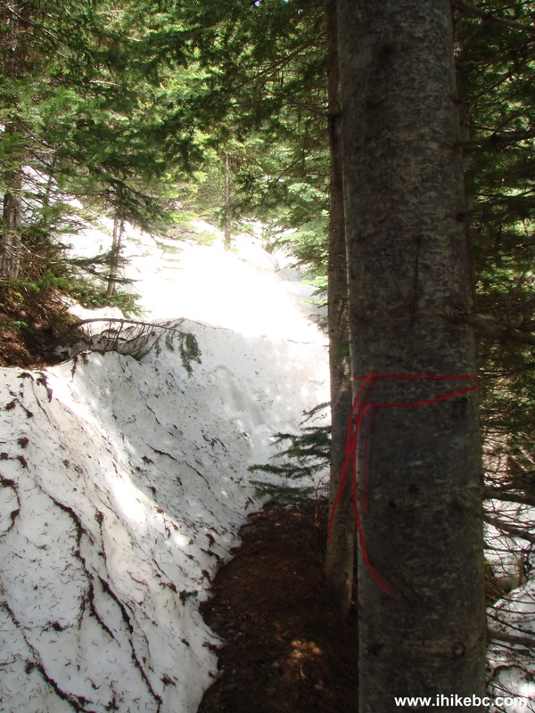
Skyline II Trail British Columbia Canada
13. It was not just a good exercise, though. Shortly before hitting the snow, we've got a full view of Hozomeen Mountain that kept appearing through the trees for several kilometers prior to that.
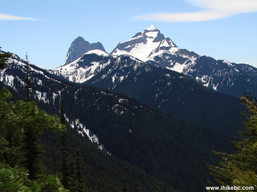
Hozomeen
Mountain seen from Skyline II Trail BC Canada
14. A neat peak indeed.
Double-peaked Hozomeen Mountain in Washington State, USA
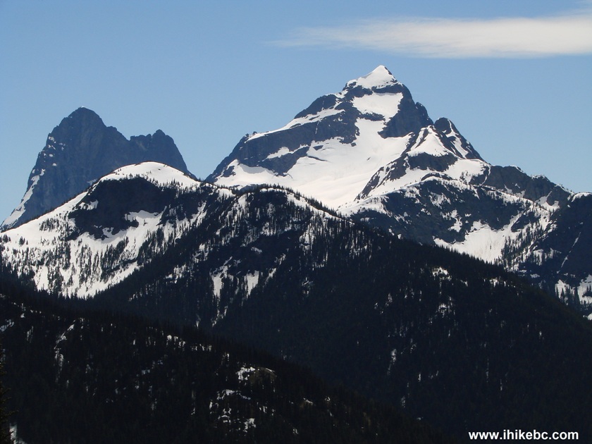
15. And, to the right, there were other mountains too.
Skyline II Trail View BC Canada
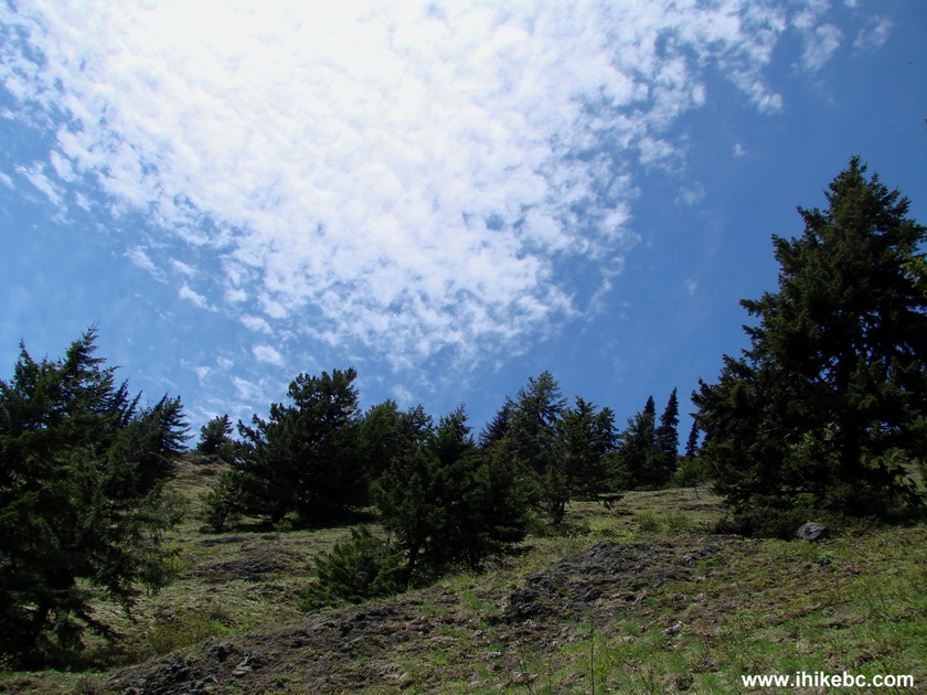
16. Finally, unusual clouds made the day even more interesting.
We may not have reached the best views, but have seen enough to make it a good trip. If you decide to take this trail, beware of the snow, which is so deep and so early in the trail that it would take probably until the beginning of September for it all to melt. If you want a trail in this area which likely stays snow-free for most of the year, check out our next trip along Skagit River.
On July 2 2024, we hiked Skyline II West Trail all the way to Hozameen Ridge Junction (12 km one way), and here is our trip report.


|
 |
Other Trips in Hope BC Area:
|
|
|
|
|
|
|
|
|
|
|
|
|
|
|
|
|
|
|
 |
|
|
|
|
|
Eaton
Peak Route
|
Skyline II West Trail
|
Eaton
Lake Hike 2
|
|
|


Other Trips:


![]()


![]()
![]()
![]()
Follow @ihikebc Tweet
ihikebc.com Trip 042 - Skyline II Trail Hike (Near Hope BC)