![]()
![]()
![]()

Trip 289 - August 1, 2023 (Tuesday)
Flat Iron Peak Trail Hike
Off
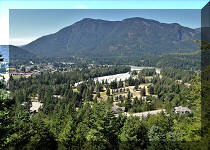
BC Highway 5 (Coquihalla) near Hope, BC
Liked: Panoramic mountain views, Needle Peak views, a small picturesque lake, several tarns, no bugs.
Of Note: High altitude trail, the trail is popular, almost no shade, windy in sub-alpine at the end of the trail, uneven ground, rocks and roots, hiking poles and boots are highly recommended (steep terrain on Needle Peak Trail).
Vancouver, Coast & Mountains Backroad Mapbook (2019 edition) Trailhead Coordinates: Page 16 (Coquihalla Summit) D2.
A hike across the highway: Yak Peak Trail.
Another good hike nearby: Zoa Peak Trail.
Other Trips in Hope BC Area: Thacker Mountain Trail, Needle Peak Trail, Sowerby Creek FSR Hike, Dog Mountain Trail, Jones Lake FSR Trip to Jones Lake, HBC Heritage Trail, Sowaqua Creek FSR, Skagit River Trail, Skyline II Trail Hike, Silver Skagit Road, Mount Outram Trail, Othello Tunnels, Eaton Lake Trail, Mount Hope Lookout Trail, Town of Hope BC
Follow @ihikebc TweetFlat Iron Peak Trail starts at the 3.33 km mark of Needle Peak Trail, which itself is located off BC Highway 5 (Coquihalla Hwy) about 44 km North of Hope. Check out our previous trip report for directions on getting from BC Highway 5 to Flat Iron trailhead.
Flat Iron Trail is only 1.5 km long, and is easy-to-moderately difficult. It leads to very fine views of a small lake (with Needle Peak in the background), located just before the final climb to Flat Iron Peak, which has a fairly large and quite scenic sub-alpine area, where you can wander around for hundreds of meters in all directions and observe panoramic mountain views, as well as several interesting tarns.
* All hiking distances are based on a GPS odometer and are approximate.
1-2. We are at the 3.33 km mark of Needle Peak Trail, where Flat Iron Trail begins on the right side. These are the same photographs as photos #43 and #44 of Needle Peak Trail Hike trip report. Coordinates: N 49⁰34.205' W 121⁰08.240'. Elevation: 1,820 meters.

Flat Iron Peak Trailhead

3. Here is a view of Flat Iron Peak and its large sub-alpine area from Needle Peak.

Flat Iron Peak British Columbia Canada
4. Flat Iron Peak Trail shortly after the start.

Flat Iron Peak Trail near Hope BC Canada
5. At the 190 meter mark of the hike. Very little shade. The trail actually goes down for a bit around here.

Hike in Hope BC Area - Flat Iron Peak
6. A fine view to the right at 625 meters of Flat Iron Peak Trail.

View from Flat Iron Peak Trail near Hope BC Canada
7. Getting closer to the lake. At 990 meters here.

British Columbia Hiking - Flat Iron Peak Trail
8. Looking back at 1.04 km, there is a fine view of Needle Peak.

Needle Peak British Columbia
9. At 1.25 km, here is the lake. Coordinates: N 49⁰33.827' W 121⁰08.949'. Elevation: 1,810 meters. Didn't look like much at first.

Flat Iron Peak Hike British Columbia Canada
10. Climb this wall, and the top of Flat Iron Peak is right there. It's not as hard as it looks. The best approach is from the right side of the lake.

11. Another look at the lake. Still not much.

Hiking in British Columbia, Canada
12. But then, voila, things started to get much more interesting.

Flat Iron Peak Hike near Coquihalla Highway
13. Especially when we climbed up a bit, and Needle Peak provided a fine background.

Needle Peak British Columbia Canada
14. Another angle.

Needle Peak
15. And the lake looks just as fine up close.

Flat Iron Peak Lake
16. How about that.

Flat Iron Peak Hike
17. Looking back from the middle of the lake, where there is a bit of a dry area allowing to cross without getting your feet wet. Or walk around on the right side if the water level is high, as it's not too far.

Hike in British Columbia
18. Here we are crossing in the middle of the lake, with a path ahead to the top of the Flat Iron Peak.

Flat Iron Peak Trail
19. Looking right.

Hike in Canada - Flat Iron Peak Trail
Here is Our Video of the Views From The Lake Area:
20. Proceeding along the path.

Hike in Hope BC Area - Flat Iron Peak Trail
21. It's a moderately difficult stretch for a few hundred meters, including this spot.

Flat Iron Peak Hike
22. Looking back at the lake.

Coquihalla Area Hiking
23. Getting close to the end of the trail. More of a route now.

Flat Iron Peak Hike in Hope British Columbia Area
24. Another look back at the lake and Needle Peak.

Needle Peak view from Flat Iron Peak Trail
25. And we are almost there, with a communication tower straight ahead.

Flat Iron Peak Hike in British Columbia, Canada
26. Here it is. Coordinates: N 49⁰33.883' W 121⁰09.239'. Elevation: 1,905 meters. And we can count it as the end of Flat Iron Peak Trail.

Communication Tower Flat Iron Peak British Columbia
27. Here is what Needle Peak and the lake look like from the sub-alpine at the top of Flat Iron Peak.

Needle Peak BC
28. We walked around the sub-alpine and found some interesting views. There is a valley.

View from Flat Iron Peak in British Columbia Canada
29. A heart-shaped tarn.

Tarn British Columbia Flat Iron Peak near Hope BC
30. Panoramic mountain views.

Views from Flat Iron Peak Province of British Columbia Canada
31-32. And Vicuna Peak in the distance, with some and much zoom.


Vicuna Peak
Here is Our Video of the Views From The Top of Flat Iron Peak:
More ihikebc videos are on our YouTube Channel.
You need to hike a challenging Needle Peak Trail before getting to substantially easier (and even more picturesque) Flat Iron Peak Trail, but the views are certainly worth it. Highly recommended.


|
 |
Other Trips in Hope BC Area:
|
|
|
|
|
|
|
|
|
|
|
|
|
|
|
|
|
|
|
|
|
|
|
|
|
Eaton
Peak Route
|
Skyline II West Trail
|
Eaton
Lake Hike 2
|
|
|


Other Trips:


![]()


![]()
![]()
![]()
ihikebc.com Trip 289 - Flat Iron Peak Trail Hike (Off BC Highway 5 near Hope, BC)