![]()
![]()
![]()

Trip 046 - June 23, 2011 (Thursday)
Skagit River Trail Hike
Skagit Valley Provincial Park
Distance From Vancouver:
183.5 km. First, drive 140 km on Highway 1 East to Exit 168,
then take Silver Skagit Road for 43.5 km.
Liked: Fairly easy trail, river views, blooming rhododendrons, meeting a deer.
Of note: Remote wilderness area with no cell phone signal. Tough hill and descent shortly after camp paths split. Hiking poles and boots are recommended.
Vancouver, Coast & Mountains Backroad Mapbook (2010 edition) Coordinates for the Trailhead: Page 6 (Skagit Valley) C5.
103 Hikes in Southwestern British Columbia (2008 edition): hike #77.
Related Website: Skagit Valley Provincial Park - BC Parks Official Site.
Other Trips in Hope BC Area: Thacker Mountain Trail, Flat Iron Peak Trail, Needle Peak Trail, Sowerby Creek FSR Hike, Dog Mountain Trail, Jones Lake FSR Trip to Jones Lake, Yak Peak Trail, HBC Heritage Trail, Sowaqua Creek FSR, Zoa Peak Trail, Skyline II Trail Hike, Silver Skagit Road, Mount Outram Trail, Othello Tunnels, Eaton Lake Trail, Mount Hope Lookout Trail, Town of Hope BC.
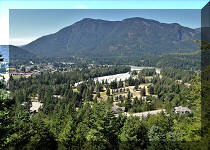
Follow @ihikebc TweetSkagit River Trail is located in Skagit Valley Provincial Park near Hope BC. This trail lacks monumental mountain views, but has such a great natural variety, that you would hardly miss the magnificent peaks seen from Skyline II Trail, for example. The elevation change is minimal, meaning that this trail is likely snow-free for most of the year. The only real challenge comes after the main path splits, with the left one leading to Harlequin Flats Camp located very close to the split, while the right path continues the hike all the way to Highway 3 (making it possible to do this as a one-way trip) via Delacy Camp 7.5 kilometers further, which was our final destination today.
The rhododendrons were in bloom during our hike. And meeting a curious deer made this an even more memorable adventure.
Here is our July of 2024 video of driving on Silver Skagit Road to the 55 km mark.
We arrive to Skagit River Trail trailhead at 01:04:55.
More ihikebc videos are on our YouTube Channel.
0. Here are Google Maps directions of driving on Silver Skagit Road to Skagit River Trail trailhead.
1. To get to Skagit River Trailhead, you need to take Silver Skagit Road, described in Trip #44. Shortly after crossing this bridge (seen below) located right after the 26 Mile Day Use Area, you would arrive to Skagit River trailhead at 43.5 km of Silver Skagit Road.
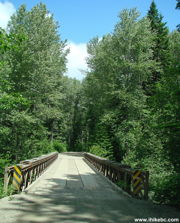
Silver Skagit Road British Columbia Canada
2. A few hundred meters later is the parking area and the trailhead on the left side of the road.
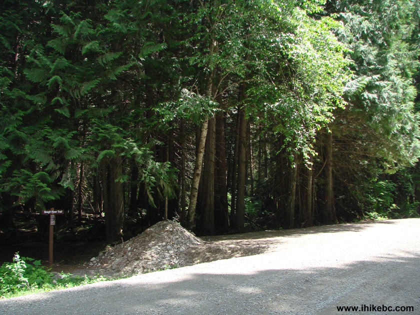
Silver Skagit Road at Skagit River Trailhead Province of BC Canada
3. We would make it to Delacy Camp today - 10.5 km from the start of the hike. Sumallo Grove is at Highway 3 in Manning Provincial Park.
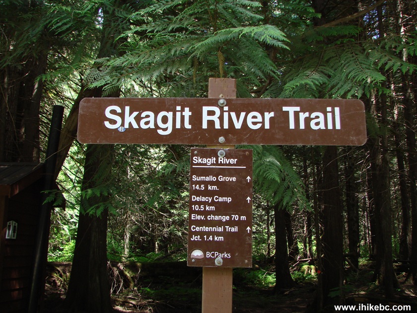
Distances from Skagit River Trailhead - Hiking in Hope BC Area
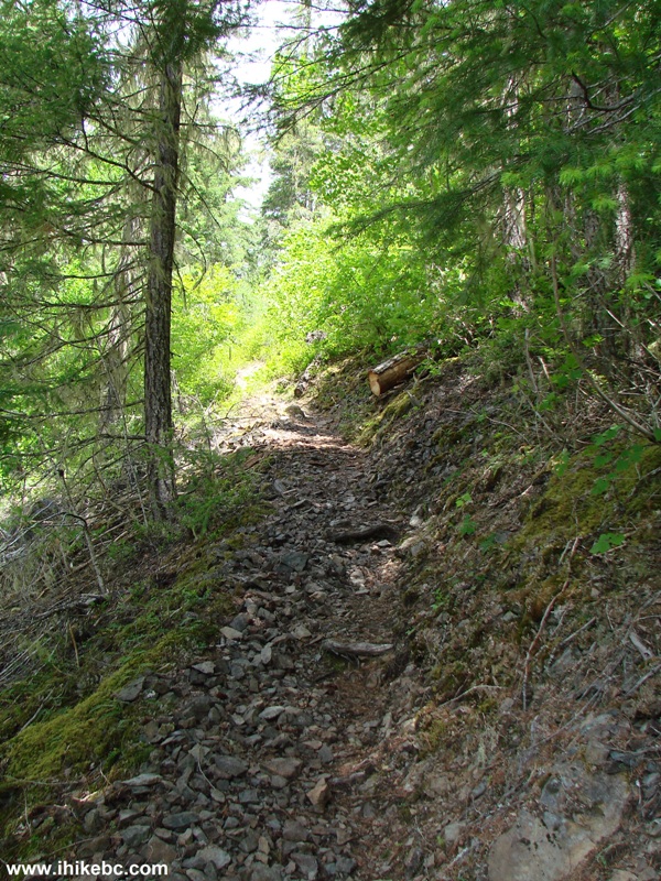
4. Skagit River Trail is easy, for the most part.
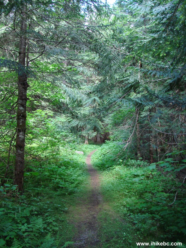
Hope Hiking - Skagit River Trail BC Canada
5. And look who we met - a curious deer. It was partially hidden by the trees at first, but then made a few steps forward to see who was aiming a camera in its direction. The distance was about 30 meters. Then, the deer ran away. It was jumping like a kangaroo - quite hilarious.
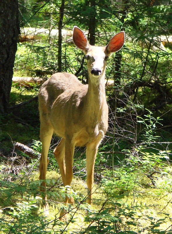
Deer on Skagit River Trail British Columbia Canada
Here is our video of this deer:
More ihikebc videos are on our YouTube Channel.
6. An interesting stump statue by the trail.
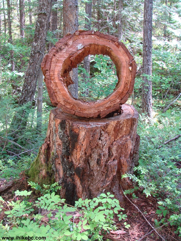
Skagit River Trail British Columbia Canada
7. And then there was this grove of rhododendrons, which apparently bloom only in mid-June, as per "103 Hikes in Southwestern British Columbia" by Jack Bryceland and Mary and David Macaree.
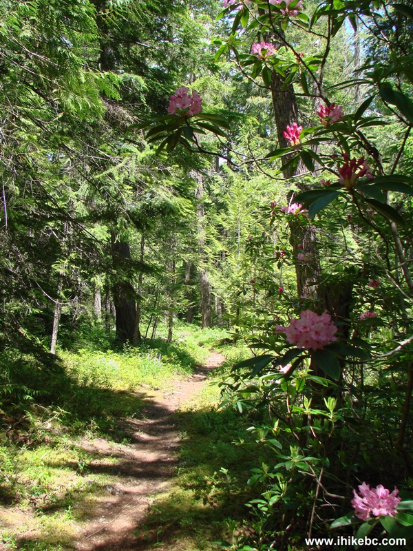
Rhododendrons on Skagit River Trail - Hiking in British Columbia Canada
8. Nice flowers.
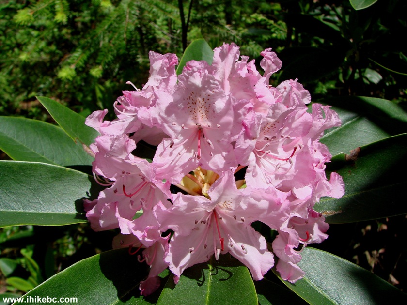
Rhododendron Flower British Columbia Canada
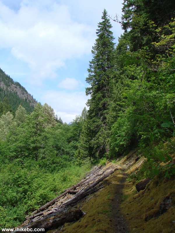
9. About an hour after the start of the hike, we reached a split, where the left path very shortly leads to Harlequin Flats camp. And the right path continues all the way to Sumallo Grove via Delacy Camp. This is where hiking boots and poles would come handy, as you are facing the biggest challenge of the trip - a steep stony hill, followed by an equally steep downhill. This photo does not do justice to how steep it actually is out there.
Skagit River Trail - BC Hiking in Hope Area
10. At least you get to enjoy a good view while huffing and puffing along the trail.
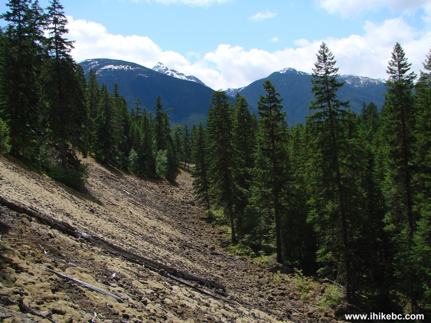
View from Skagit River Trail
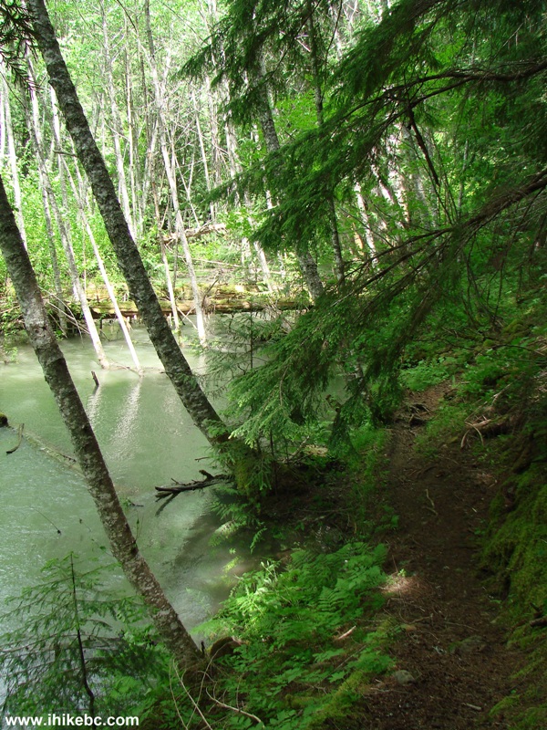
11. After the hill, the path starts running next to Skagit River for the first time.
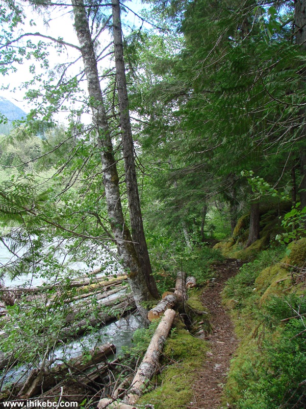
Picture of Skagit River Trail - hiking in British Columbia Canada
12. The views are quite decent too.
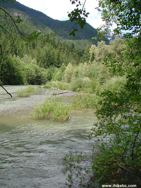
Skagit River British Columbia Canada - Hope Area Hiking
13. The trail continues along the river for a while.
Skagit River Hiking Trail BC Canada
14. Almost looks like a jungle, eh?
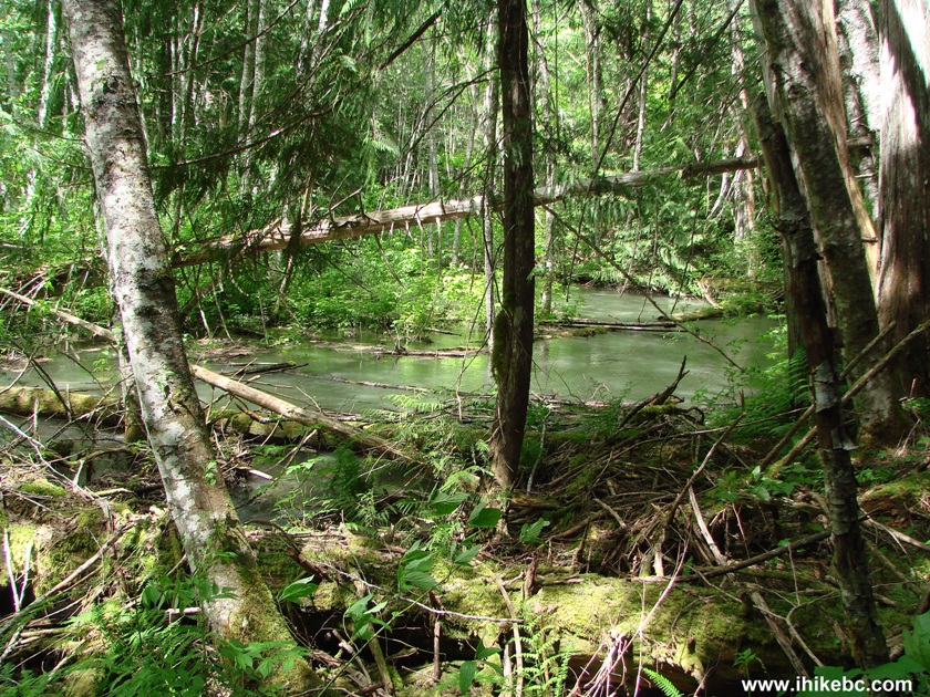
Hope Hiking - View from Silver Skagit Trail - British Columbia Canada
15. Another good view of the river.
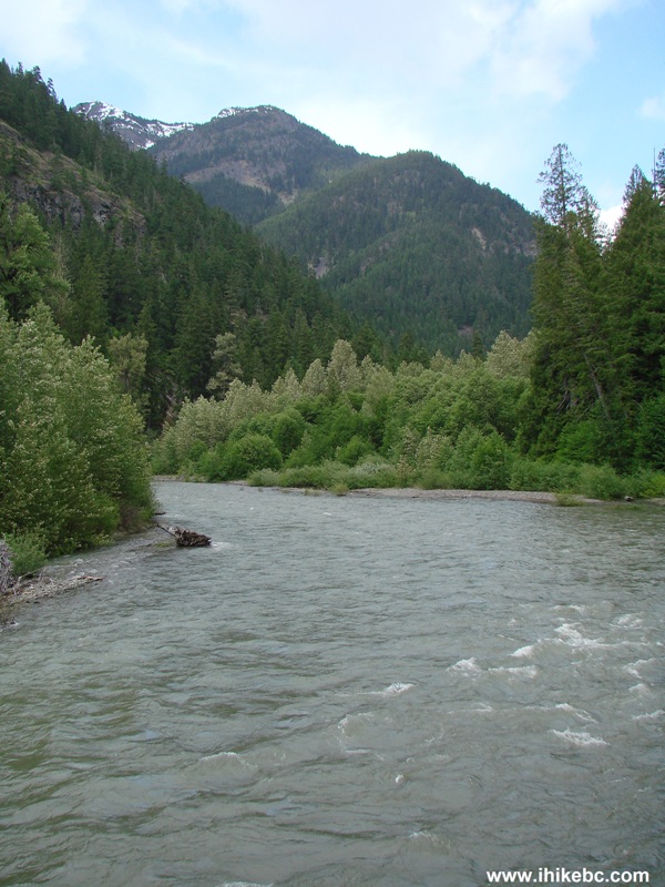
Skagit River Seen from Hiking Trail
16. Three hours into the hike comes a fairly dangerous stretch, where you need to stay away from the left edge to avoid falling down the stony hill.
Skagit River Trail Province of British Columbia Canada
17. It does not last long, though, and, soon, the path enters a rather neat-looking forest.
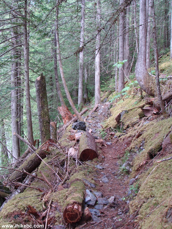
Hiking in Hope BC Area - Skagit River Trail
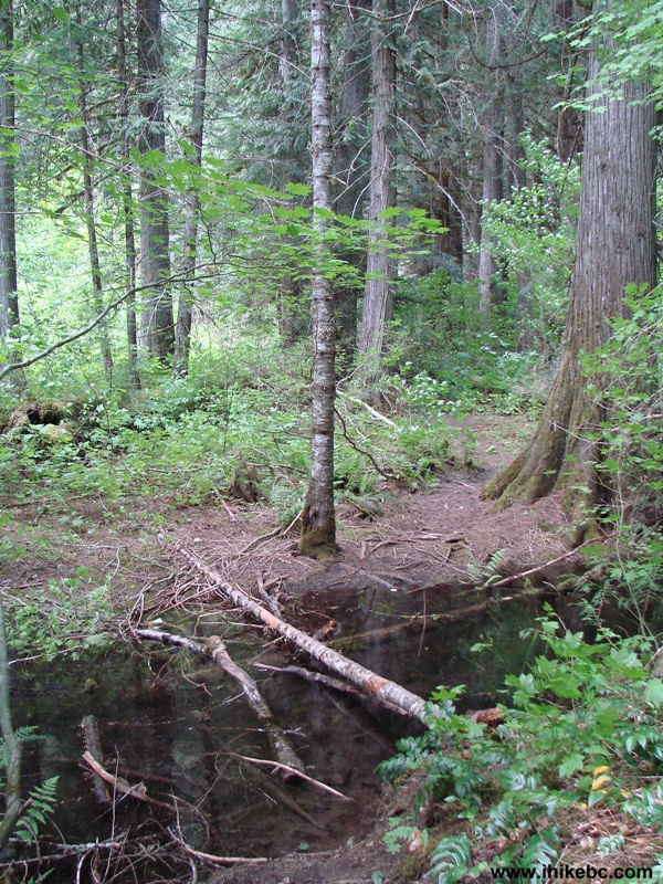
18. Three and a half hours into the hike comes a water crossing, where having a hiking pole for support would come very handy.
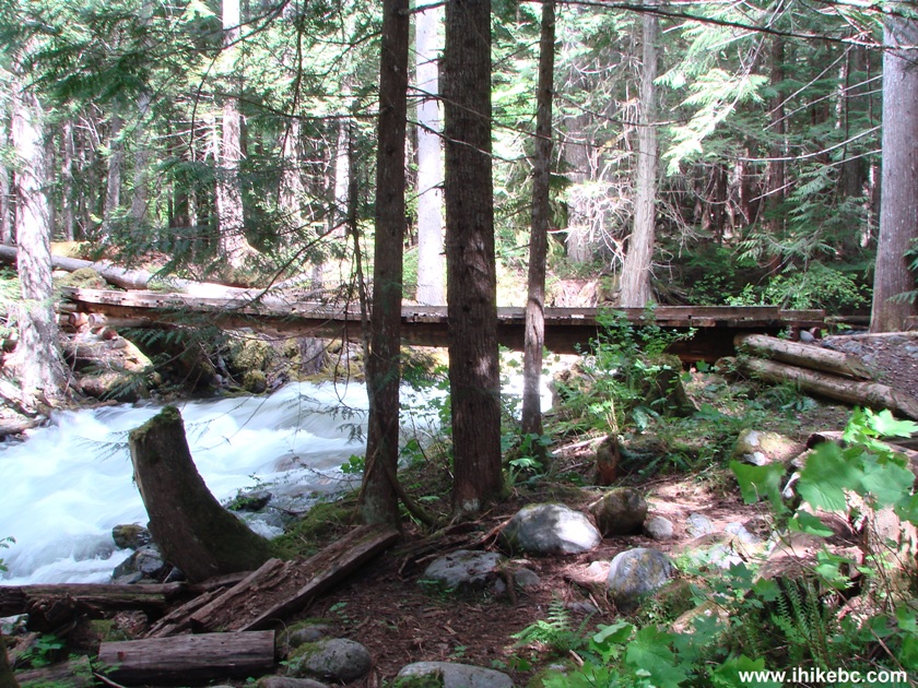
19. While hiking Skagit River Trail, you would also be going across three fast-flowing creeks on sturdy bridges. Here is the last bridge before Delacy Camp.
Skagit River Trail near Hope BC Canada
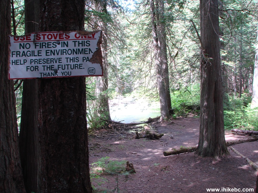
20. Delacy Camp itself. Nothing but flat ground. There is one table with benches, two bear-proof containers, and a toilet in the middle of the forest (no cabin). This was our final destination before we went back.
Delacy Camp Skagit River Trail BC Canada
Skagit River trail is a good all-season hike, which does not feature any spectacular views, but does not bore you either. Recommended.


|
 |
Other Trips in Hope BC Area:
|
|
|
|
|
|
|
|
|
|
|
|
|
|
|
|
|
|
|
 |
|
|
|
|
|
Eaton
Peak Route
|
Skyline II West Trail
|
Eaton
Lake Hike 2
|
|
|


Other Trips:


![]()


![]()
![]()
![]()
Follow @ihikebc Tweet
ihikebc.com Trip 046 - Skagit River Trail Hike (Near Hope BC)