Trip 080 - May 15-16, 2015 (Friday-Saturday)
Kinuseo Falls Visit
Monkman Provincial Park Near Tumbler Ridge BC
Page 2 of 2
Location: Northeastern British Columbia,
approximately 63 kilometers Southeast of Tumbler Ridge, near the end of
Murray River Forest Service Road.
Liked: Short and easy paths to the waterfall viewing platforms, the ability to get to the bottom of the waterfall, shapes created by the spray from the Falls, quite decent access via Murray River Forest Service Road.
Of note: Remote area, numerous potholes on the short asphalted stretch of the Murray River FSR before the gravel road begins.
Northern BC Backroad Mapbook (3rd edition) Waterfall Coordinates: Page 44 (Tumbler Ridge) B6.
Related Websites:
Monkman Provincial Park - BC Parks,
Tumbler Ridge
Tourist Information.
Other Trips off Murray River FSR:
Stone Corral Trail Hike,
Monkman Falls Hike,
Nesbitt's Knee Falls
Trail Hike, Barbour Falls Trail Hike.
>>> British Columbia Waterfalls Visits.
Follow @ihikebc Tweet
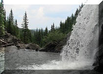
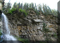
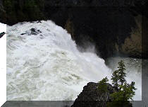
19. The appearance of Kinuseo Falls on this day reminded of a huge flow of water from the gates of a dam. We took numerous photos from the middle and bottom of the path to the bottom of this waterfall, and what follows is a compilation which shows a sort of a sequence, which starts from the water hitting the rocks below, and ends with the spray forming various shapes as it dissipates.
Here is our video of Kinuseo Falls view from the middle of the path:
25. Kinuseo Falls seen from the bottom.

Kinuseo Falls British Columbia Canada
Here is Our Video of Kinuseo Falls from the bottom of the waterfall:
26. Murray River seen from the middle of the path to the bottom of the waterfall.

Murray River at Kinuseo Falls British Columbia Canada
27. Murray River seen from the bottom of the path.

Photo of Murray River Seen by Kinuseo Falls
28. And then you hike up.

Path from the Bottom of Kinuseo Falls to the Lower Viewing Platform
29. Once you get back to the parking lot, a path to the upper viewing platform awaits.

Start of the Path to Kinuseo Falls Upper Viewing Platform
30. It's yet another easy path to the viewing platform.

Picture of the Path to Kinuseo Falls Upper Viewing Platform
31. Kinuseo Falls upper viewing platform.

Kinuseo Falls Upper Viewing Platform
32a. The view of Kinuseo Falls from the upper viewing platform.

Kinuseo Falls British Columbia Canada
32b. The same view on a sunny day.

Kinuseo Falls
Here is our Video of Kinuseo Falls from the Upper Viewing Platform:
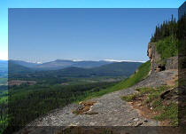
33. Looking to the right, we see Murray River.

Murray River BC Canada
34. If you would walk for 25-30 minutes along a path which begins at the upper viewing platform right behind this totally perplexing sign, you would see Kinuseo Falls from yet another vantage point.

Start of the Path to Remote View of Kinuseo Falls
35. A note of caution: be prepared to duck under and crawl over about 10-12 fallen trees, like the ones pictured below. Hiking boots and poles are recommended for this path.

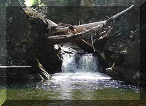
Path to Remote View of Kinuseo Falls
36. Your reward.

Kinuseo Falls British Columbia Canada
Here is our Video of Kinuseo Falls from Far Away:
More ihikebc videos are on our YouTube Channel.
There are definitely few waterfalls like this, so it's definitely worth a visit.
|
 |
Other Trips in Tumbler Ridge BC Area:
| Monkman Falls Hike |
|
Windfall Lake Trail  |
| Cowmoose Mtn Trail |
|
Bootski Lake Trail  |
| Murray Canyon Overlook |
|
Quality Canyon Trail  |
Other Trips:


Follow @ihikebc Tweet
ihikebc.com Trip 080 - Kinuseo Falls Visit (Monkman Provincial Park near Tumbler Ridge) Page 2 of 2


