![]()
![]()
![]()

Trip 077 - February 17, 2015 (Tuesday)
Harrison East Forest Service Road
Second Trip
Page 2 of 2
Distance From Vancouver: About 130 km to the beginning of the FSR via Highway 1 East (to Exit 135), then Highway 9 North (to Harrison Hot Springs), and Lillooet Avenue / Rockwell Drive.
Liked: The waterfalls and the lake views are still there. The road past the turn off to Shovel Creek FSR has been fixed (but there is now a gate at km 62). There is now a bridge where a creek stopped us in 2011, allowing to go much further into the wilderness without the need to cross fast-flowing water on foot.
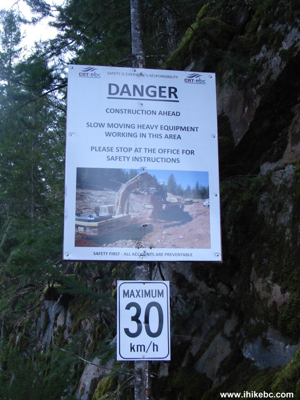
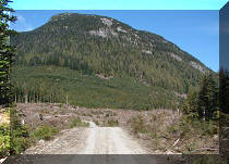
Of note: Remote wilderness area, no cell phone signal. The road surface is now MUCH worse than in 2011, and the potholes are numerous and large. There is now an ongoing construction of a hydroelectric project starting at the 45 km mark and continuing for several kilometers - you would be driving through a construction zone, so watch out. At the 55 km mark there is now a very bad stretch of the road for about 500 meters, which would likely stop all low-clearance vehicles. Also, much of the area we hiked in 2011 has been extensively logged, so the views are not as great in the later part of the FSR.
Vancouver, Coast & Mountains Backroad Mapbook (2010 edition) Coordinates for the Beginning of the FSR: Page 14 (Harrison Lake) G7.
Previous Trip: 049 - Harrison East First Trip Report - this is where we describe many other highlights of Harrison East FSR, and provide directions for getting to the beginning of the road.
Related Websites: Chilliwack District FSR Conditions.
Other Forest Service Roads Trips: Chehalis (by Harrison Mills), Chilliwack Bench, Chilliwack Foley, Chilliwack Lake, Chuchinka-Colbourne (North of Prince George), Florence Lake (access to Stave Lake by Mission), Harrison West, Jones Lake (near Hope), Lost Creek (by Mission), Mamquam River (by Squamish), Nahatlatch (near Boston Bar), Parsnip West (near Mackenzie), Shovel Creek (off Harrison East), Sowaqua Creek (by Hope), Squamish River Main, Squamish River Ashlu, Squamish River E-Main, Squamish River FSR Washout, Windfall Creek (by Tumbler Ridge).
Follow @ihikebc Tweet
21. Here is where we stopped in 2011 - the flow was fast, the creek was rather deep, and there was no bridge. Coordinates: N 49⁰51.618' W 121⁰52.323'.
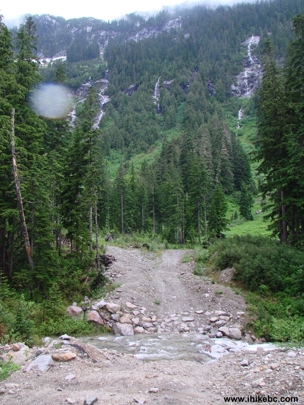
2011 Harrison East FSR BC Canada
22. We brought flip-flops with us in 2015 in hopes of crossing the creek and continuing to the end of the road. But there was no need for that - logging companies not only cut the trees, but also build the roads which allow explorers to get this far into the wilderness to begin with. Thank you, forestry workers!
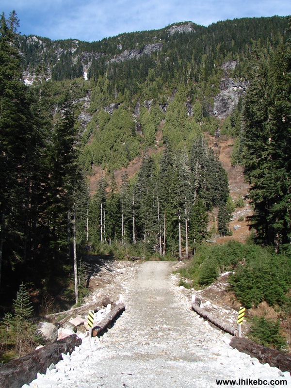
2015 Harrison East FSR British Columbia Canada
23. Here is a comparison of a stump in the creek. 2011 version.
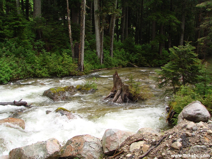
2011 Creek Harrison East FSR BC Canada
24. Now.
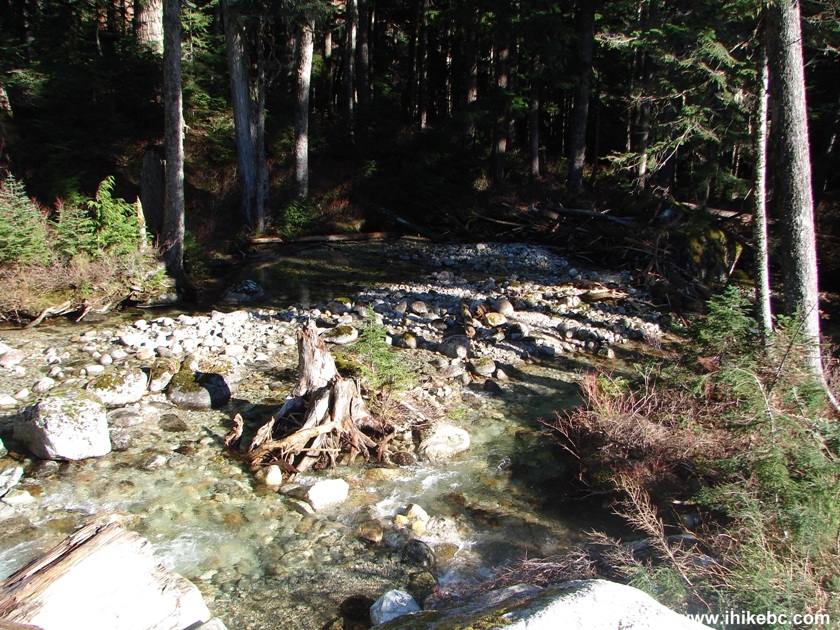
2015 Creek Harrison East Forest Service Road BC Canada
25. Having crossed the bridge, we continued up Harrison East Forest Service Road (which might actually be called Big Silver Creek FSR at this point, but there are no signs at all about that).
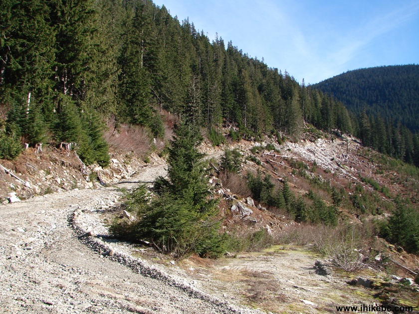
Photo of Harrison East FSR BC Canada
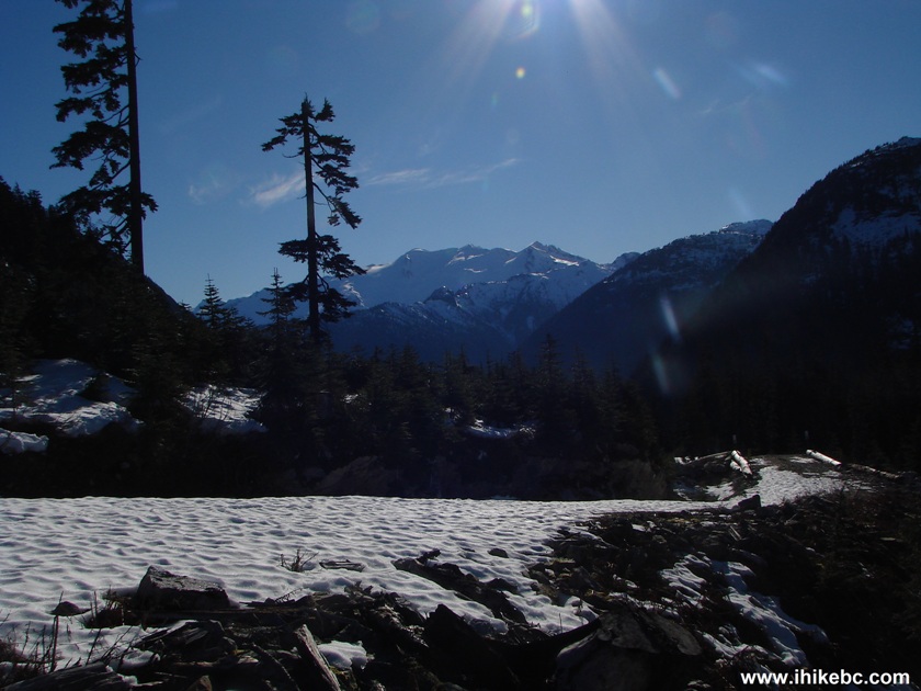
26. Snow started to appear at the elevation of 1,020 meters.
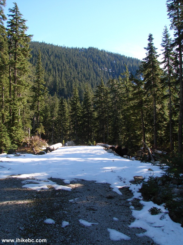
Harrison East Forest Service Road British Columbia Canada
27. And, soon, we had somewhat of a real winter around us. The snow was easy to walk on, as the morning sun hadn't softened it yet. Just a few hours later it became softer, though not by much.
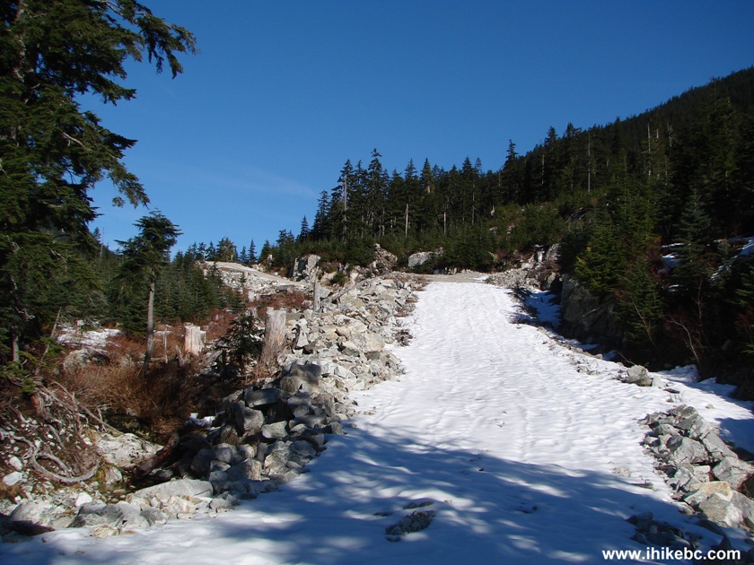
Picture of Harrison East FSR Province of BC Canada
28. The scenery was pleasant, but not overly impressive. So, after realizing that the road goes on for much longer (we could see it on the other side of the valley to our left), we decided to stop at this split and head back. Coordinates: N 49⁰52.183' W 121⁰51.389'.
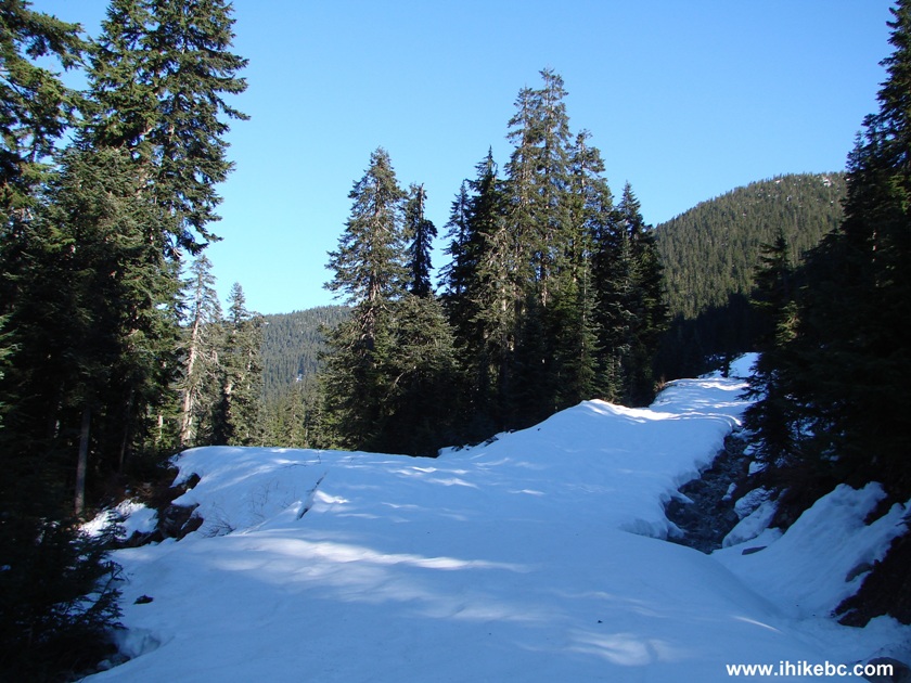
Harrison East FSR BC Canada
29. If the sun is at the right angle, on your way back you are going to see a large glacier in full glory. But for that you would probably need to be here early in the morning. A few hours later all you see is this.
Glacier Seen From Harrison East FSR BC Canada
30. Lots of zoom.
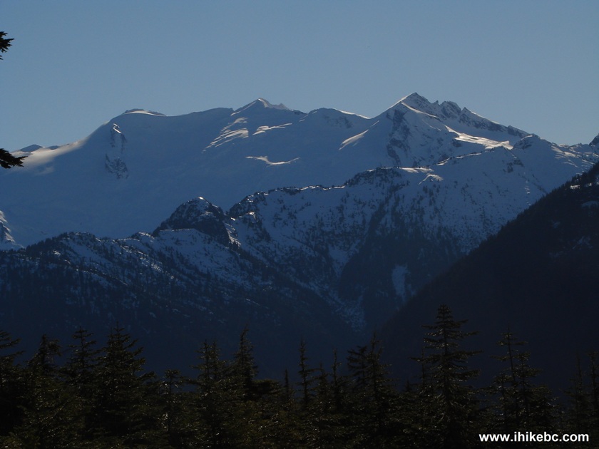
Photo of Glacier Seen From Harrison East Forest Service Road BC Canada
31. We are back at the gate. The hike is over. Time to the snowy split: 4 hours with lots of stops and a side trip. Time back to the gate: 2.5 hours.
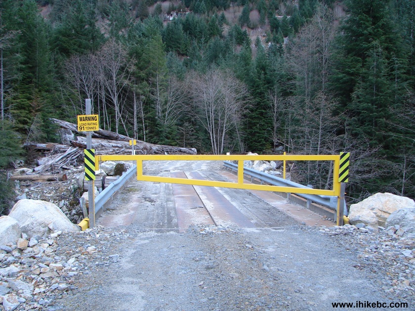
Locked Gate Harrison East FSR After 62nd Kilometer
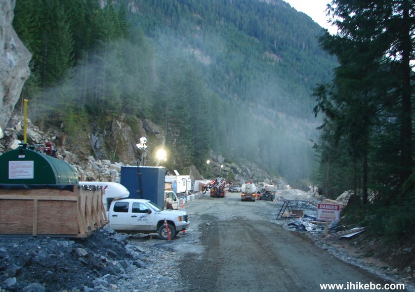
32. And then we drove back through the construction zone, and this time had enough light to take photos. This sign is posted just before Gold Creek, so we are at about km 49 of Harrison East and are heading back to the beginning of the FSR. After this sign, there would be some construction going on.
Harrison East FSR Construction Warning Sign
33. After Gold Creek.
Harrison East Forest Service Road Construction
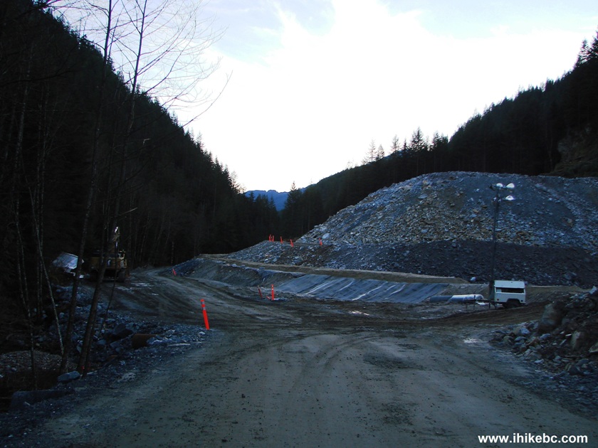
34. Between km 47 and 46. Just behind the pickup truck in the middle of the photo, there is a tunnel on the left side.
Hydroelectric Project Harrison East FSR British Columbia Canada
35. Here it is.
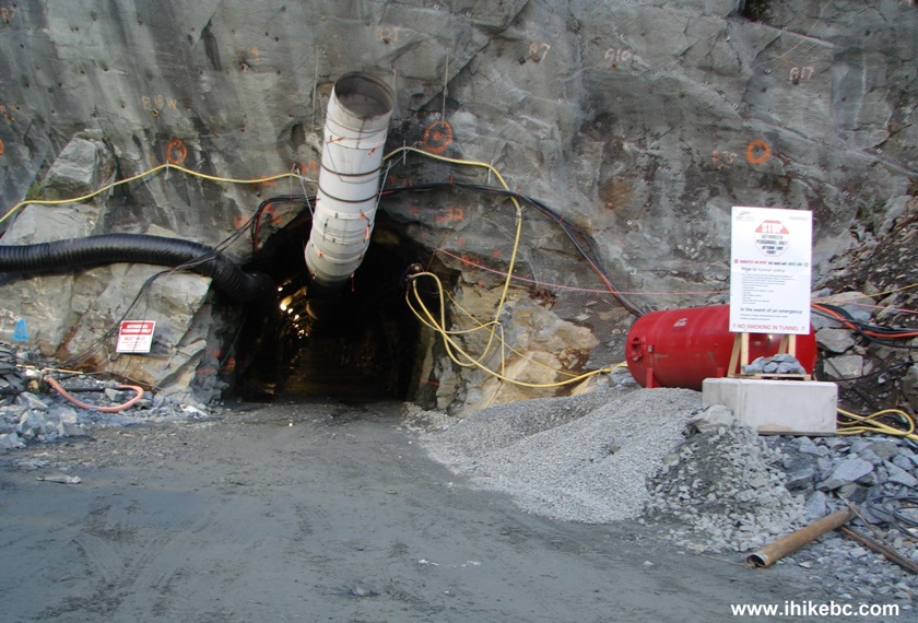
Tunnel as a Part of Hydroelectric Project Harrison East Forest Service
Road British Columbia Canada
36. Zooming in.
Hydroelectric Project Harrison East FSR BC Canada
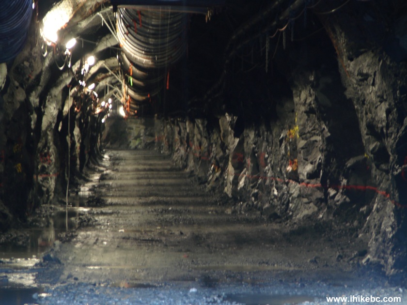
37. A bit further down the road - lots of turbines waiting to be installed. Apparently, this is called Big Silver Creek Hydroelectric Project - it's run-of-river project by Innergex Renewable Energy, Inc.
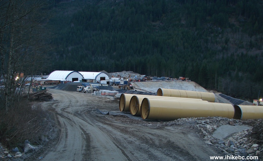
Turbines for Hydroelectric Project Harrison East FSR British Columbia
Canada
38. Work camp.
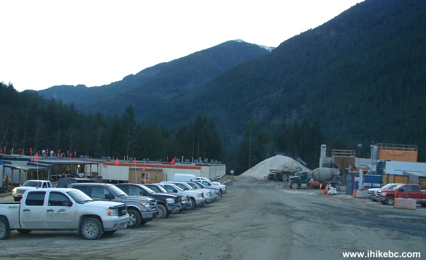
Workers Camp Hydroelectric Project Harrison East Forest Service Road BC
Canada
If you haven't been to Harrison East before, this could be an interesting trip. But the repeat value has been diminished due to all the logging and substantially worsened road condition.
Other Trips in Harrison Hot Springs Area:
|
|
|
|
|
|
|
|
|
|
|
|
Other Trips:


![]()


|
|
![]()
![]()
![]()
Follow @ihikebc Tweet
ihikebc.com Trip 077 - Harrison East Forest Service Road (Second Trip) Page 2 of 2