![]()
![]()
![]()

Trip 049 - July 19 and 21, 2011 (Tuesday and Thursday)
Harrison East Forest Service Road Trip
To about 68 km mark, somewhat close to the end of the road
Page 2 of 3
Big changes
for Harrison East -
Click here for 2015 trip report
Distance From Vancouver: About 130 km to the beginning of the FSR via Highway 1 East (to Exit 135), then Highway 9 North (to Harrison Hot Springs), and Lillooet Avenue / Rockwell Drive.
Liked: The smoothest road surface of all the FSRs visited, waterfalls, lake views, relatively few people (on a weekday).
Of note: Logging
trucks in the area, no cell phone reception, brutal mosquitoes.
Vancouver, Coast & Mountains Backroad Mapbook (2010 edition)
Coordinates
for the Beginning of the FSR: Page
14 (Harrison Lake) G7.
Related Website: Chilliwack District FSR Conditions.
Subsequent Trip: 077 - Harrison East FSR Second Trip.
Other Forest Service Roads Trips: Chehalis (by Harrison Mills), Chilliwack Bench, Chilliwack Foley, Chilliwack Lake, Chuchinka-Colbourne (North of Prince George), Clear Creek (off Harrison East), Florence Lake (access to Stave Lake by Mission), Harrison West, Jones Lake (near Hope), Lost Creek (by Mission), Mamquam River (by Squamish), Nahatlatch (near Boston Bar), Parsnip West (by Mackenzie), Scuzzy (by Boston Bar), Shovel Creek (off Harrison East), Sowaqua Creek (by Hope), Squamish River Main, Squamish River Ashlu, Squamish River E-Main, Squamish River FSR Washout, Windfall Creek (by Tumbler Ridge).
Follow @ihikebc Tweet
Harrison East Forest Service Road runs for about 22 kilometers along the East side of Harrison Lake, and then diverts into some of the finest Southwestern BC wilderness. We have driven to the split with Shovel Creek Forest Service Road (58.4 km mark), and decided to drive further on Harrison East. But that's where numerous cross ditches began to appear, and we got badly stuck far away from the nearest human being. Thank God for Tow Truck in a Box - we got out! We then drove on Shovel Creek FSR, hiked an unnamed FSR the next day (Wednesday), and then on Thursday returned to the split and hiked Harrison East close to the end, or about 70 km mark.
The first two pages of this trip report describe our Tuesday adventure, and the third page is dedicated to the Thursday hike. Shovel Creek FSR trip report follows Harrison East FSR trip report. During all of our trip, low-hanging clouds concealed much of the surrounding wilderness, plus the rain was fairly frequent. In sunny weather you are likely to see even more.
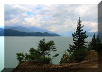
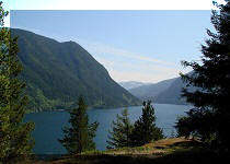
19. At the 20.2 km mark, Cogburn Beach Recreational Area begins, and it runs along the road for 1.6 km, meaning you would have to pay the $13 overnight fee, if you park your vehicle there. But, hey, the view is pretty good.
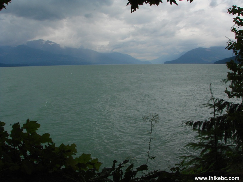
Harrison Lake Seen from Harrison East Forest Service Road Province of
British Columbia Canada
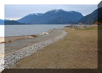
20. At around the 22 km mark of Harrison East FSR, the road reaches about midpoint of the lake and then veers to the right and leaves the lake behind. This is the last view before the lake disappears from your sight.
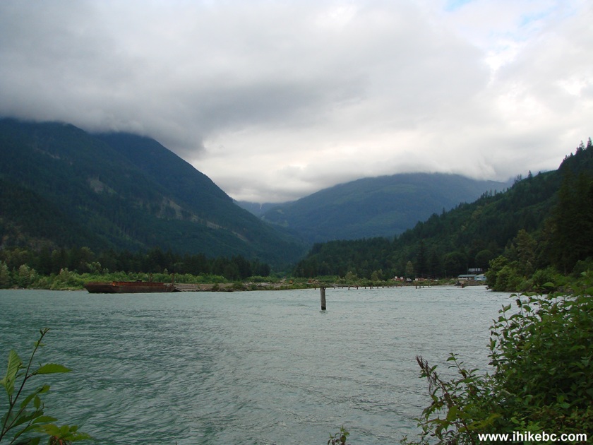
Harrison Lake BC Canada
21. At 31.3 km, there is a large Tamihi Co. active logging camp. It appears the workers are there 24/7, and this could be a good place to come for assistance, especially first aid. We have encountered just one more vehicle shortly after the camp, and then have not seen anyone for several days.
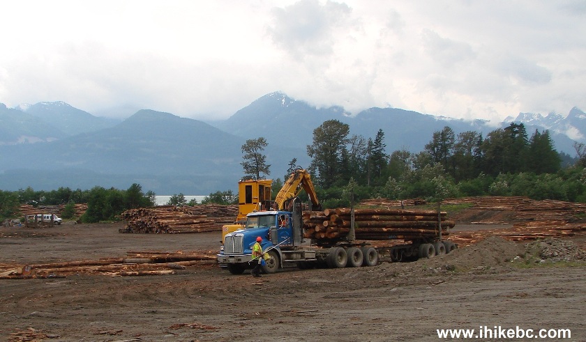
Tamihi Logging Camp Harrison East FSR Province of BC Canada
22. At the 42.9 km mark, there is a split. Harrison East is to the right, but there is no sign saying so. At first, we took the left road...

23. ...but got stuck on a hill about 3 km later, because it was a new road being built, so it was nothing but a smooth pile of dirt, where the run-of-the-mill tires of our 2WD ride had little traction. It was very easy to back up, though.

24. The best part of the detour was discovering this cool construction truck.
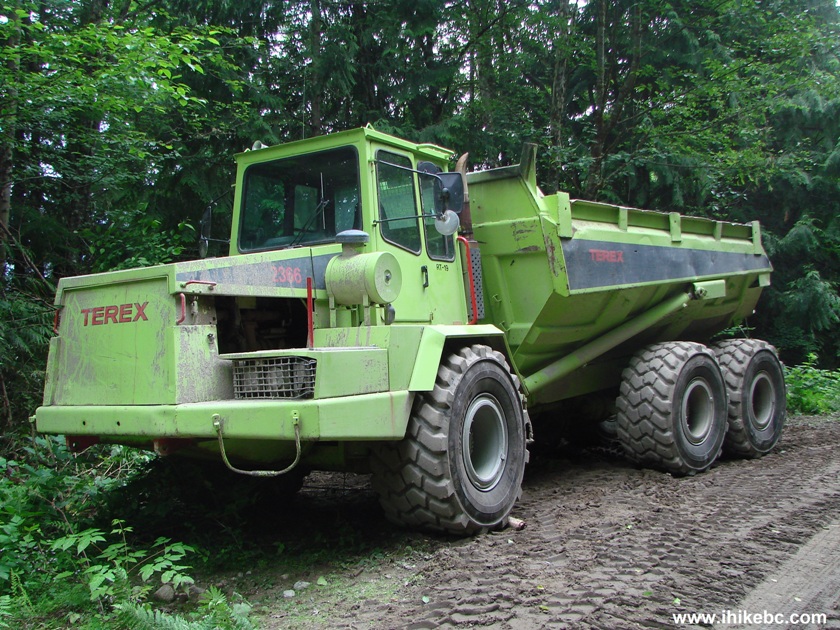
Terex Truck
25. Thus, we returned to the split pictured in photo #22, and took the road on the right. Yellow FSR mileage markers appeared very soon, indicating we were on Harrison East again. This very ancient sign (note the hyphenated "to-day") must have been here for decades. It is located about two hundred feet past the split, and warns of non-existing (as of the time of writing) logging trucks further on.

26. There is an enormous camping area at the 46.0 km mark. It can easily accommodate at least 50 vehicles and several hundred campers. The photo below shows about a half of the actual camping spot.
Harrison East FSR Large
Camping Area British Columbia Canada
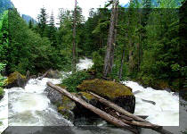
27. The best views after the lake come at the 47.9 km mark, when you are crossing the bridge over what appears to be Gold Creek (judging by the map in the Backroad Mapbook), which looks very much like a river, perhaps due to all the runoff.
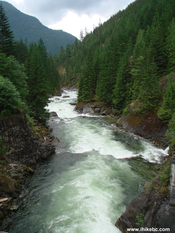
Gold Creek Harrison East FSR BC Canada
28. Looking the other way. Not bad either.
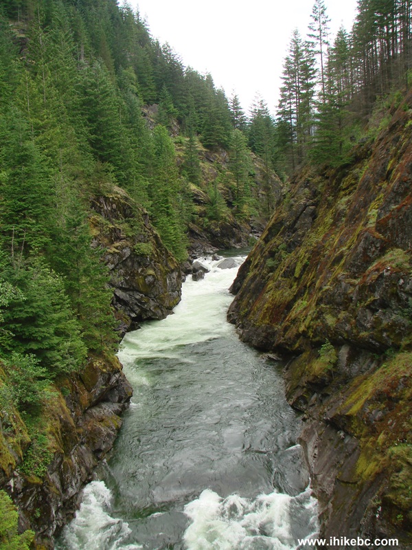
Gold Creek Seen from Harrison East Forest Service Road BC Canada
Here is our video of Gold Creek:
More ihikebc videos are on our YouTube Channel.
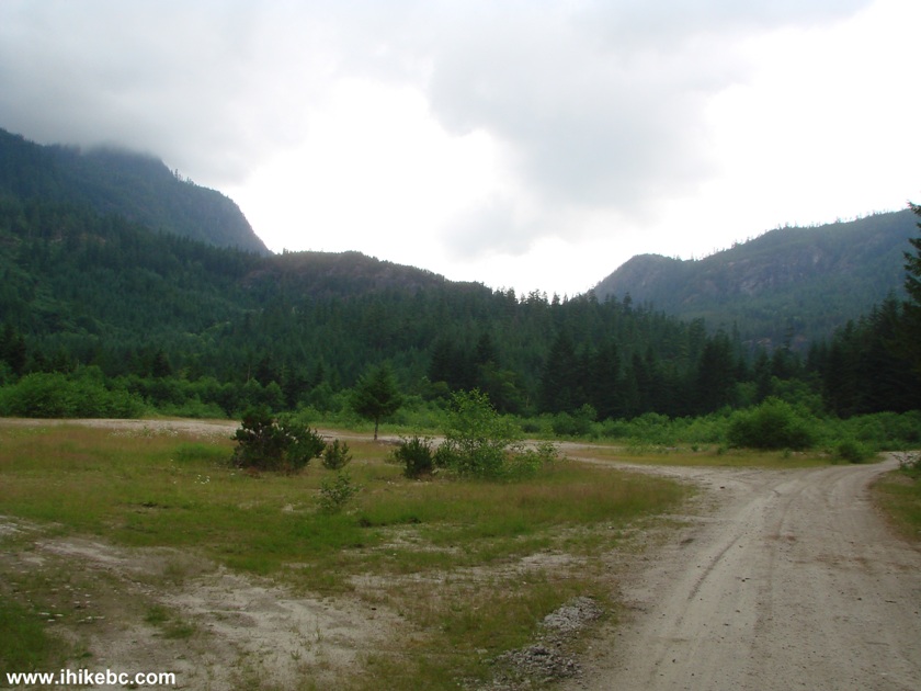
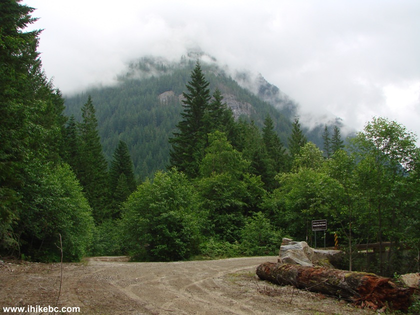
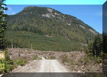
29. After that, the road gets slightly overgrown, but still is pretty good by FSR standards. It is substantially rougher, however, than before the 42 km mark (or so). It would be hard to drive much faster than 25 km/h from the 42 km mark onwards.
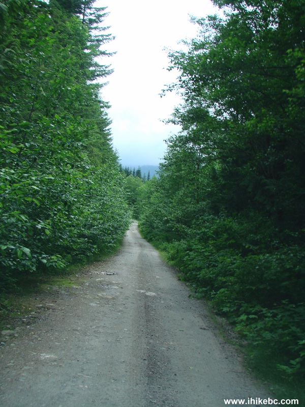
Harrison East FSR
30. A few kilometers later, this exposed rock looks very neat.
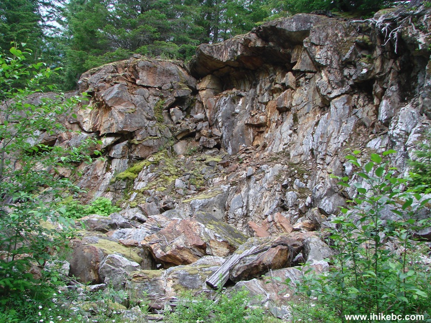
Exposed rock on the side of Harrison East Forest Service Road British
Columbia Canada
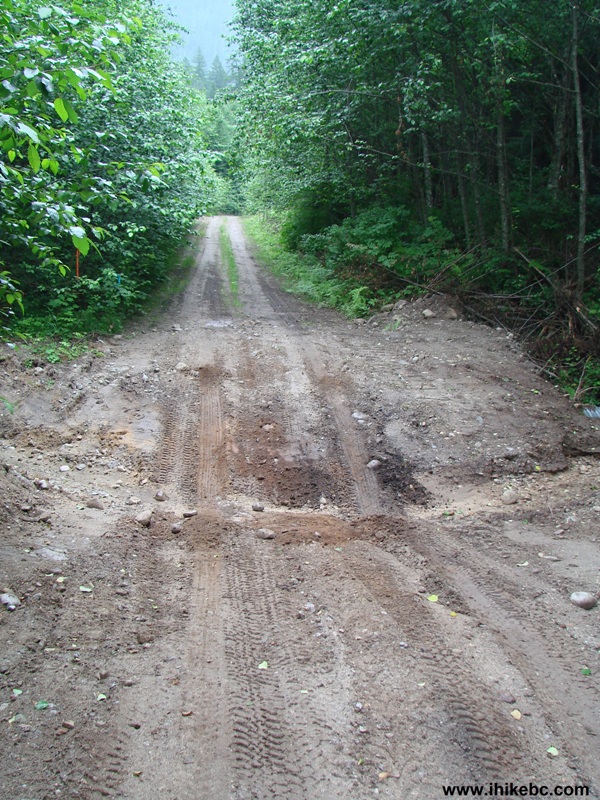
31. The end of 2WD road for Harrison East FSR arrives at the 58.4 km mark, where it splits with Shovel Creek FSR (seen on the right side).
Harrison East FSR at Shovel Creek FSR Province of British Columbia
Canada
32. But, since we did not know that we should not have gone any further, we did go forward on Harrison East, and started crossing ditches one after another. Crossing the fifth ditch proved to be a mistake. Our vehicle's front and back bottom hit the ground pretty hard. We then crossed the sixth ditch, but turned around before the seventh (which was a good idea, as we found out on Thursday). But then our rig got seriously stuck in the fifth ditch (pictured below) on the way back...and that was about 25 kilometers after we had seen the last human being.
The Fifth Cross Ditch on Harrison East FSR
33. Tow Truck in a Box came to the rescue and worked as advertised. One of the best investments for any 2WD driver taking the vehicle off road. That and a folding shovel. And work gloves, of course. Religious people would be wise to pray in such a situation. Non-religious people would be wise to become instantly religious.
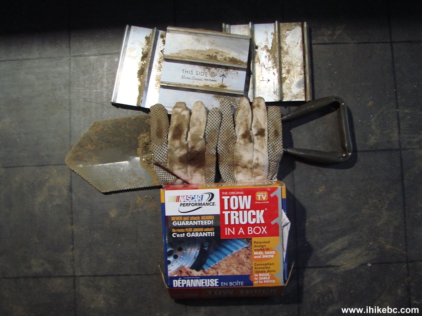
Tow Truck in a Box
34. The plates need to be stuck under the drive wheels, and then the vehicle would have a fighting chance. Here is the scene after we got out.

After that, we returned to the split with Shovel Creek FSR and drove on Shovel Creek for 11.2 km, which is described in the next trip report. But the following page shows our hiking trip further on Harrison East, which we did on Thursday. Great views are waiting for you there, and it is probably possible to make it pretty far through the numerous cross ditches and creek crossings in a high-clearance 4x4 or ATV.
Our Harrison East FSR Trip Report
Concludes on
Page 3.
Other Trips in Harrison Hot Springs Area:
Other Trips:


![]()


![]()


![]()
![]()
![]()
![]()