Trip 325 - September 20, 2024 (Friday)
Seed Peak Trail Hike
Near Squamish BC
Page 3 of 3
Liked: Fine mountain and valley views, a neat tarn in the Seed Peak bowl, November Lake, no bugs.
Vancouver, Coast & Mountains Backroad Mapbook (2019 edition) Trailhead Coordinates:
Page 12 (Pinecone Burke Provincial Park) A1. Follow @ihikebc TweetSeed Peak Trail starts off the 33.1 km mark of Mamquam River FSR near Squamish BC. It shares the trailhead with Mount Gilliespie Trail, and the two trails go their separate ways 2.5 km later. Seed Peak Trail then continues for 250 meters to the alpine, where another kilometer or so gets you to the peak, or there in an option to descent into a small bowl, which is what we did without climbing to the peak.
Throughout the trail, there are very fine mountain and valley views. A small November Lake to the right of the trail looks quite good too. Apparently, Pinecone Lake can be observed from the top of Seed Peak. While we saw no bugs during this late September hike, several reviewers on another site mentioned hordes of those, albeit not of a biting variety, so take care.
As far as getting to the trailhead, Mamquam FSR is in decent shape as of the time of writing, and a medium clearance 4x2 should have no trouble getting within 800 meters of the trail, where a steep loose hill would stop all non 4x4 vehicles. There is a good parking spot in that area, and a hike to the trailhead is a rather scenic one too.
Check out our Mamquam River Forest Service Road Trip Report for details on getting to the 31.8km mark of the FSR where we begin our coverage in this trip report.
*All trail distances are based on a GPS odometer and are approximate.
56. Seed Peak Trail at the 2.32 km mark.

Seed Peak Trail / Mount Gilliespie Trail
57. 40 meters later.
Seed Peak Hike
58. A panorama looking left at 2.44 km of Seed Peak Trail near Squamish, BC.
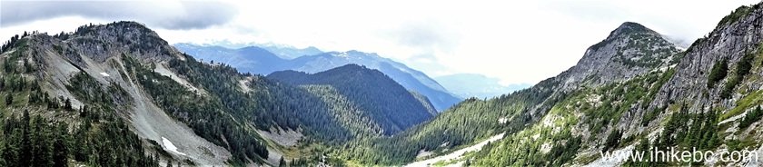
Panoramic View from Seed Peak Trail near Squamish BC Canada
59. At 2.50 km, there is a junction. Coordinates: N 49⁰38.962' W 122⁰50.431'. Elevation: 1,720 meters. Seed Peak Trail (to the left) and Mount Gilliespie Trail (to the right) go their separate ways.
Seed Peak Trail / Mount Gilliespie Trail junction
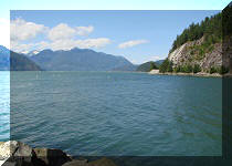
60. But right before that, there is a 120 meter-long rather easy descent on the right side to a good view of November Lake. Here is how it looks from the trail.

November Lake view from Seed Peak Trail
61. A bit closer.
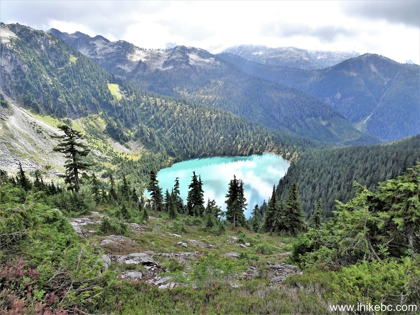
November Lake British Columbia
62. 120 meters from the trail.

November Lake
63. We then resumed hiking towards Seed Peak by turning left at the junction seen in photo #59. This is how it looks immediately after the 2.50 km split.
Seed Peak Trail British Columbia
64. Looking left ten meters later.

British Columbia Hiking
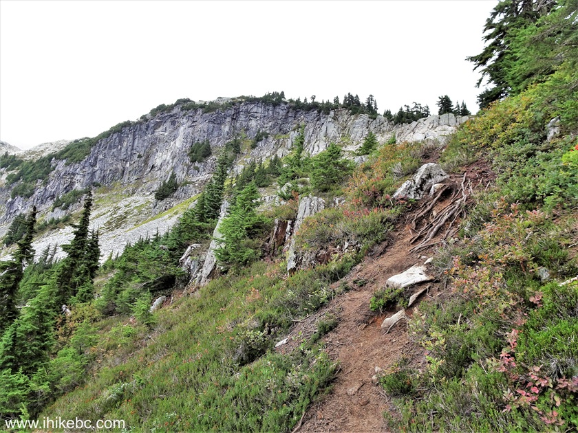
65. Looking back at 2.52 km of Seed Peak Trail at the ridge we have hiked to get here.
Seed Peak Hike in Squamish BC Area
66-67. Looking left from the same spot, then a bit more to the right.

View from Seed Peak Trail near Squamish BC
68. At 2.56 km of Seed Peak Trail.

Seed Peak Hike
69. Looking back at 2.58 km.
Hike in British Columbia - Seed Peak Trail
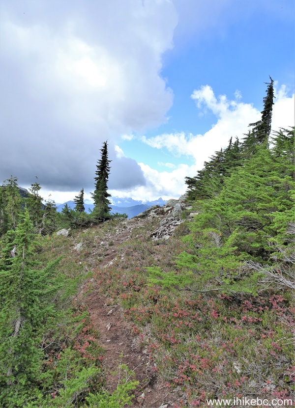
70. Getting close to the alpine 20 meters later.

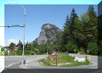
71. And here is the beginning of Seed Peak alpine area, at 2.75 km of the trail. Coordinates: N 49⁰39.027' W 122⁰50.439'. Elevation: 1,780 meters.
Seed Peak Hike Alpine Area
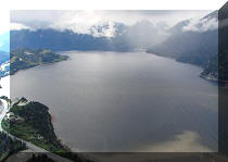
72-73. The alpine starts straight ahead, and the peak itself is to the left, about one kilometer away. We decided to skip the peak, though, apparently, there is a good view of Pinecone Lake to be had if you don't mind what looked like rather treacherous hiking conditions (steep surface and loose stones). Another option, which is what we did, is to descend into a bowl with a neat tarn. But, before that, about a hundred meters to the right once you reach the alpine, there is another fine view of November Lake. Coordinates: N 49⁰38.993' W 122⁰50.366'. Elevation: 1,765 meters.

November Lake near Squamish BC Canada
Here is our video of November Lake and the surrounding area.
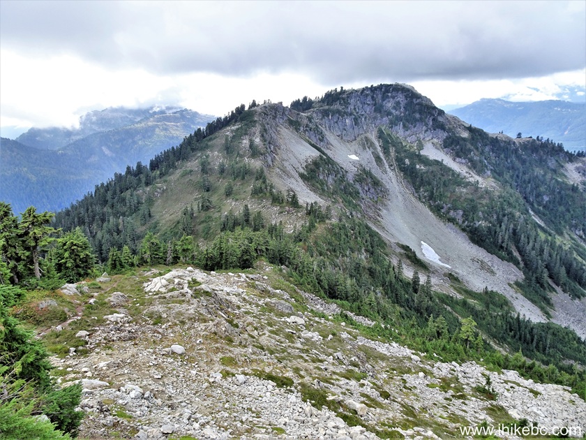
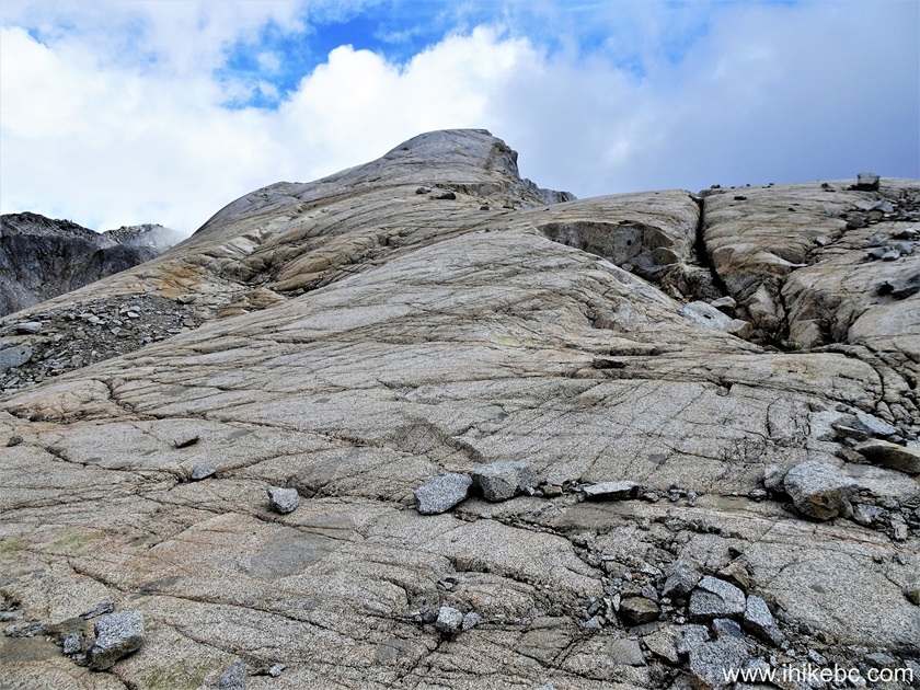
74. We have now turned left from where we have reached the alpine, and hiked for 110 meters, with Seed Peak seen on the left side. It is steeper than it looks once you get to the base of the peak, but the route to the bowl is not steep at all.
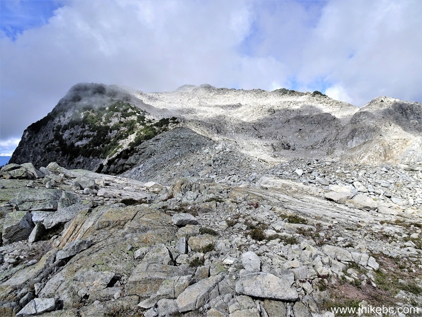
Seed Peak alpine area
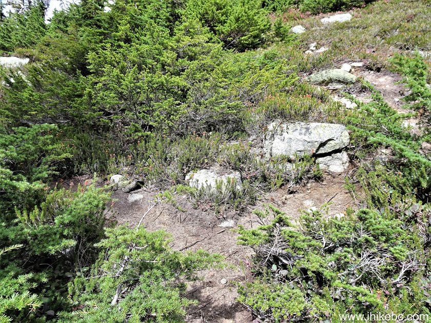
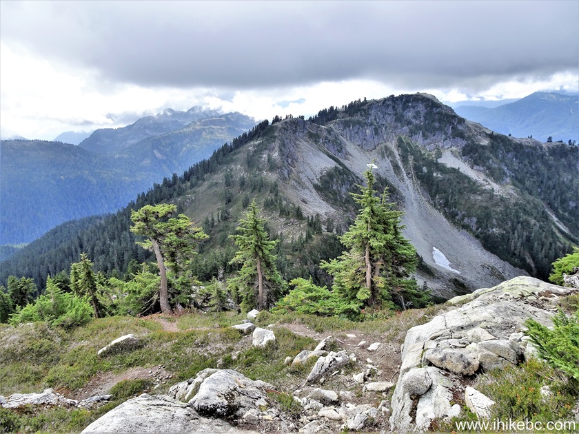
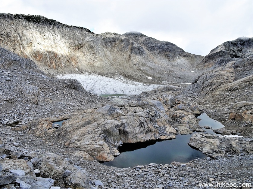
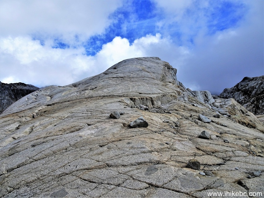
75. At 240 meters, time to get down to the bowl on the right side.

Seed Peak bowl area
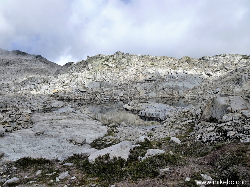
76. There is a neat tarn inside the bowl.
Tarn inside Seed Peak bowl
77. The straight up descent is just over a hundred meters long, but you need to find the right line to get down and weave a bit to avoid the steepest parts.
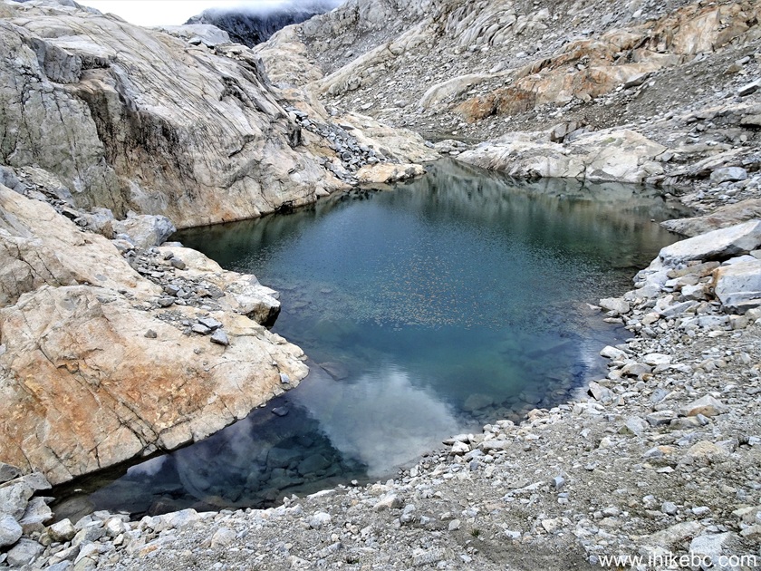
Seed Peak bowl tarn
78-79. We then climbed a mini-peak inside the tarn. It's not very high. Coordinates: N 49⁰39.196' W 122⁰50.365'. Elevation: 1,750 meters.
Seed Peak bowl peak
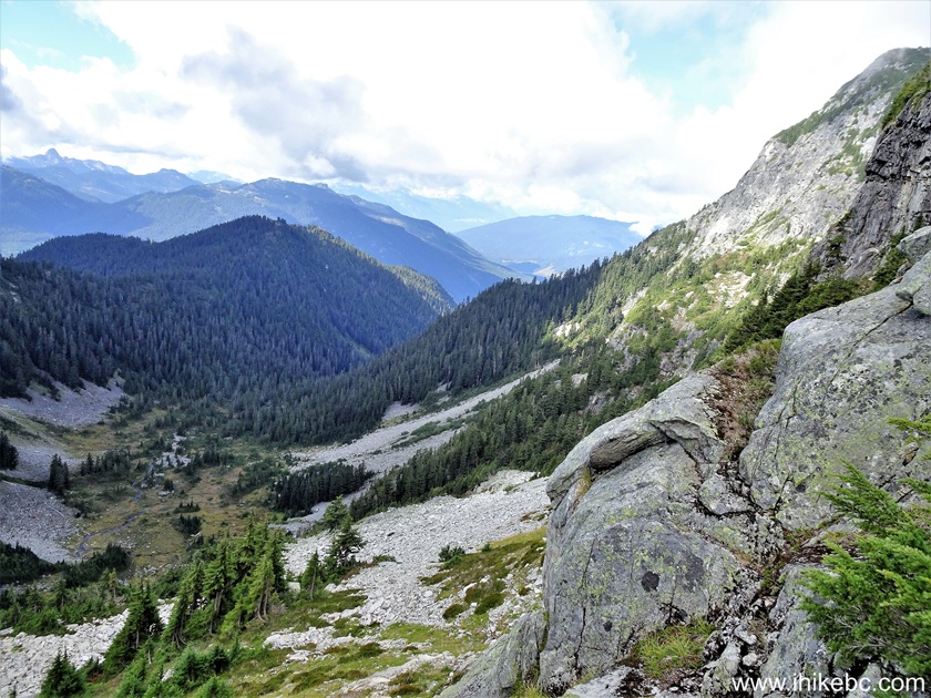
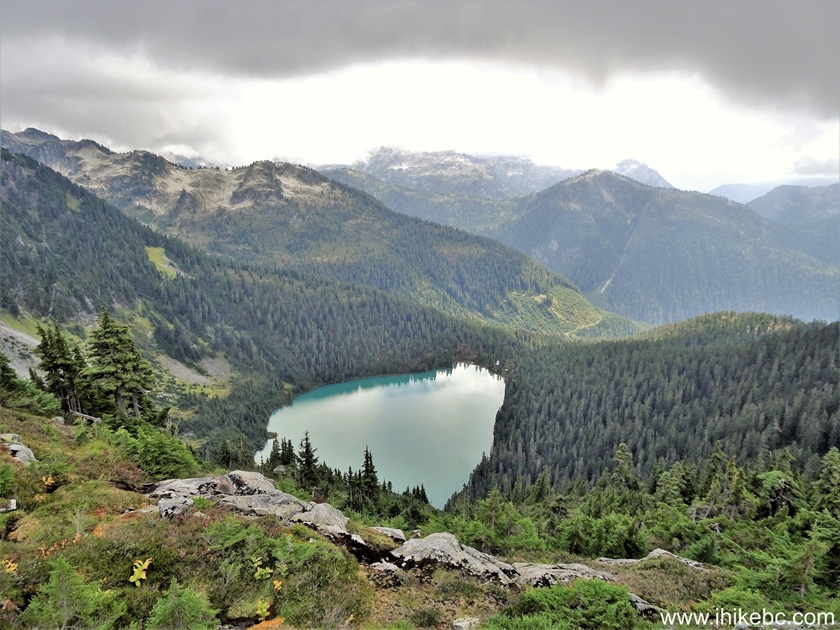
80. The view from the bowl peak.

Hiking in Squamish area - Seed Peak bowl
Here is our video of the views from this location.
More ihikebc videos are on our YouTube Channel.
Seed Peak Trail features many very fine views, and comes highly recommended.


|
 |
Other Trips in Squamish Area:
|
|
|
|
|
|
|
|
|
|
|
|
|
|
|
|
|
|
|
|
|
|
Mamquam River FSR
|
|
|
Panorama Ridge Trail
|


Other Trips:


![]()


![]()
![]()
![]()
ihikebc.com Trip 325 - Seed Peak Trail Hike (near Squamish, BC) -
Page 3 of 3