![]()
![]()
![]()

Trip 043 - June 14, 2011 (Tuesday)
Brandywine Falls Provincial Park
Between Squamish and Whistler BC
Coverage of the Waterfall and the Trail to Cal-Сheak Suspension Bridge
Distance From Vancouver:
106.5 km via Highway 1 West and
Highway 99 (Sea-to-Sky) North.
Liked: The waterfall, "shifting ground" visual effect, easy path to Cal-Cheak Suspension Bridge, and the bridge itself.
Of note: The waterfall is a very popular
attraction - get ready for big crowds on weekends. Railroad crossing is
required to reach Brandywine Falls. There are two paths to Cal-Cheak
Suspension Bridge, and the one starting by the waterfall is much rougher
than the other path, starting closer to the parking lot. Railroad crossing is required to reach the
suspension bridge too.
Vancouver, Coast & Mountains Backroad Mapbook (2010 edition)
Coordinates:
Page 29 (Whistler) D7.
Related Website: Brandywine Falls Provincial Park - BC Parks Official Site.
>>> British Columbia Waterfalls Visits.
Follow @ihikebc Tweet
Brandywine Falls is a huge waterfall, and one of the most beautiful and easily accessible ones in Southwestern British Columbia. After you park your vehicle, 10 minutes via an easy path is all it takes to reach the viewing platform. If you feel like walking a bit more, why not take a path to Cal-Cheak Suspension Bridge. The round trip time is about two hours. Beware, though. There are two paths which lead to the bridge, and one path is much rougher than the other. See the trip report below for directions.
1. We have crossed Lions Gate Bridge in Vancouver en route to Brandywine Falls.
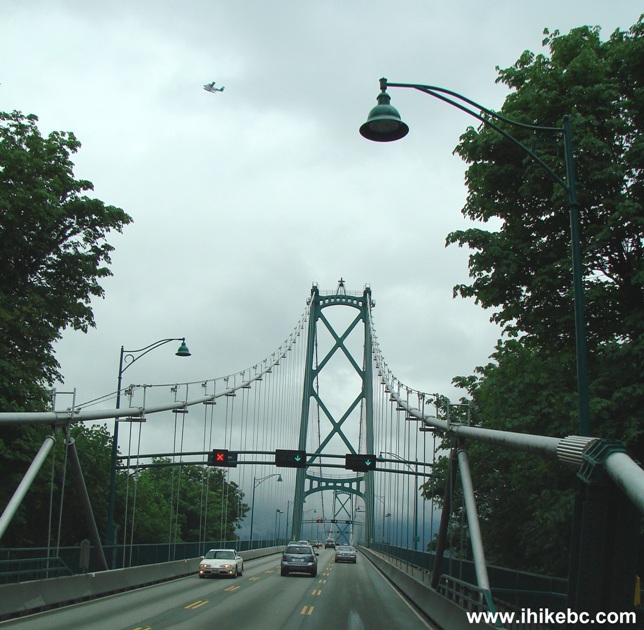
Lions Gate Bridge Vancouver BC Canada
2. Howe Sound never ceases to impress.
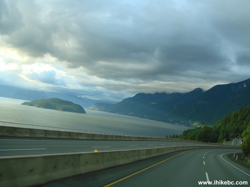
Howe Sound seen from Highway 99 (Sea-to-Sky)
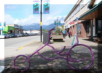
3. We are now driving on Highway 99 North past the Squamish Adventure Centre in Squamish BC. Brandywine Falls Provincial Park is 41.5 km further North.
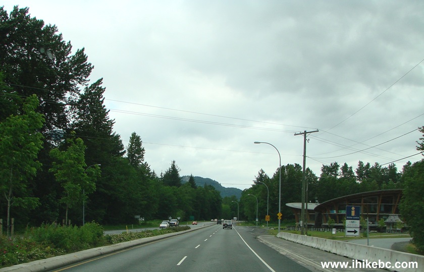
Highway 99 Sea-to-Sky in Squamish British Columbia Canada
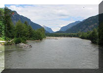
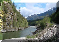
4. Since Howe Sound ends by Squamish, the great views pretty much end there as well. Beyond Squamish, this bridge is one of the few sights worth mentioning en route to the falls.
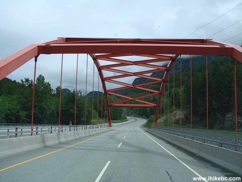
BC Highway 99 Sea-to-Sky between Squamish and Whistler
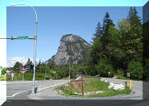
5. 41.5 kilometers past Squamish Adventure Centre, get ready to turn right.
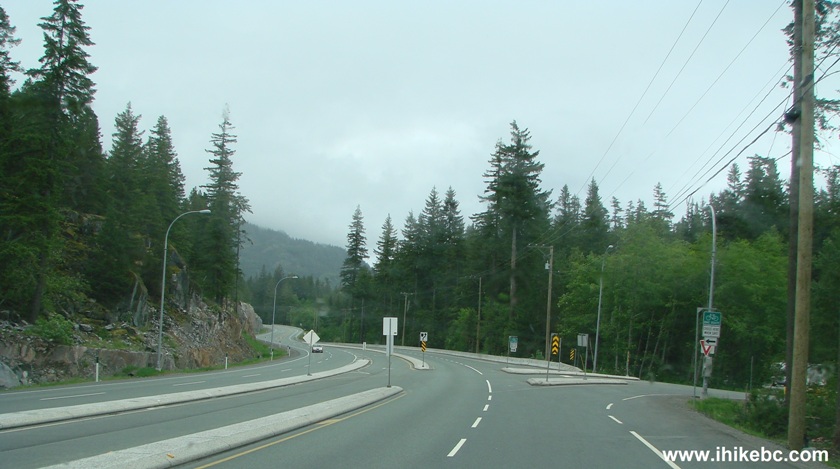
BC Highway 99 Sea-to-Sky at the Brandywine Falls Provincial Park
6. We have arrived to Brandywine Falls Provincial Park.
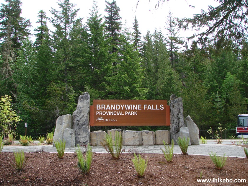
Brandywine Falls Provincial Park Province of BC Canada
7. The parking lot for regular vehicles has about 50 spots, and the bus/RV lot can hold another 10-15 vehicles. On a busy weekend, the parking could be tight.
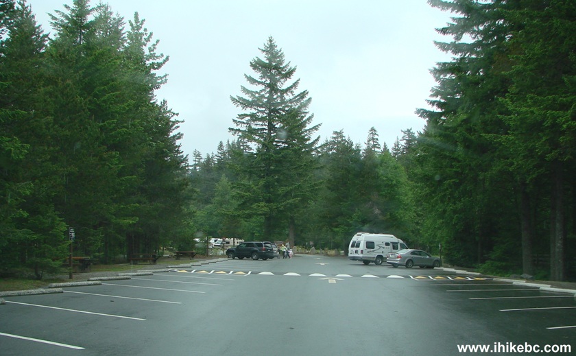
Brandywine Falls Parking Lot South of Whistler BC Canada
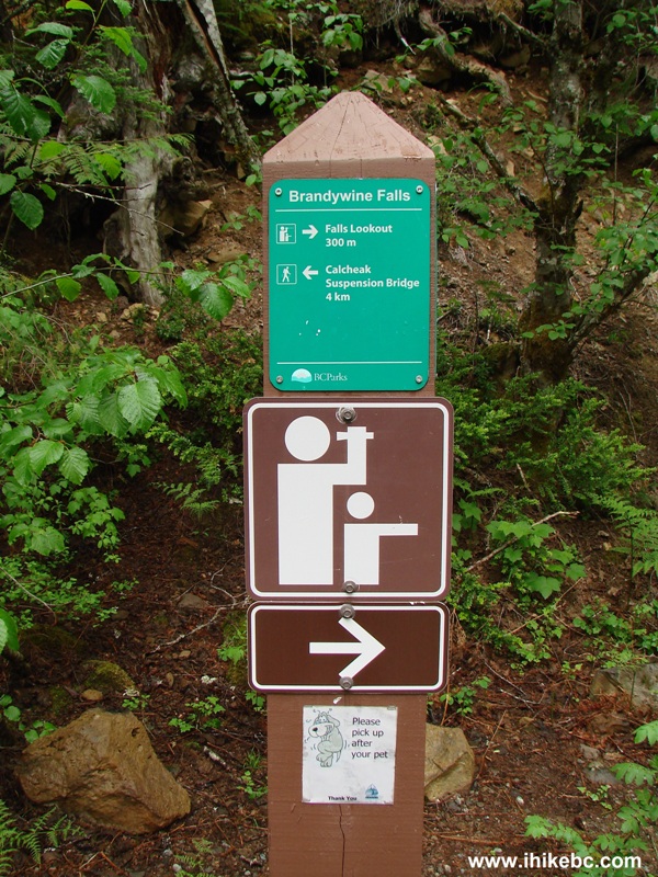
8. To reach the waterfall, you need to walk across a bridge which has a roof above it. This is an important landmark, if you want to go to Cal-Cheak Suspension Bridge, as the easy path to the bridge starts just to the left after you cross this small bridge. You can see the green directional sign far ahead in the photo below.
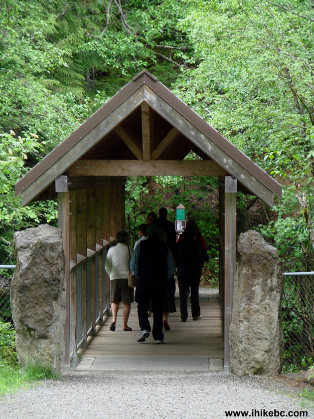
Photo of Brandywine Falls Provincial Park
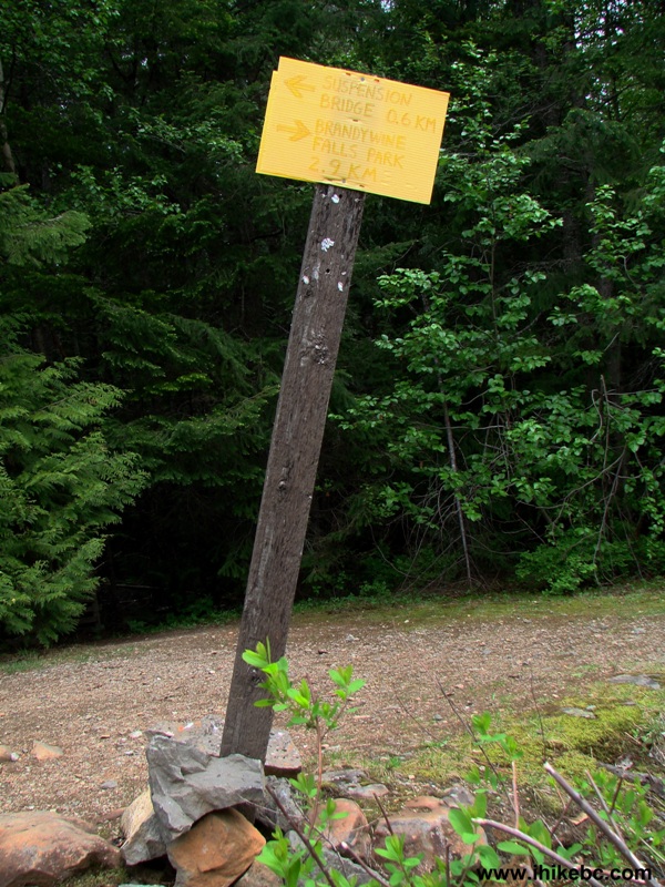
9. Here is the close-up of that directional sign. As mentioned above, the easy path to Cal-Cheak Suspension Bridge starts here - just turn left. To reach Brandywine Falls you need to turn right. And, very close to Brandywine Falls viewing platform, is another sign directing you to Cal-Cheak Suspension Bridge. However, that sign leads to a much rougher path. Beware, as there is nothing written on either of those signs to indicate which path is easy, and which one is hard. The difference between the paths is very substantial. The easy path can be tackled by just about anyone, as it has a few small hills, and that's about it. The difficult path requires a proper level of fitness. Hiking boots and poles would come handy there too.
Cal-Cheak Suspension Bridge Directional Sign near Whistler BC Canada
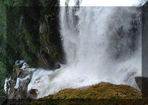
10. At the waterfall viewing platform.
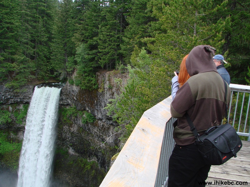
Brandywine Falls from the Observation Platform Province of British
Columbia Canada
11. And here is a trick for your eyes. Stare at the waterfall for 5-10 seconds, and then quickly look to the left - you would see the canyon rising. Better yet - look to the right beyond the platform, where the path is located - you would see the path moving up, as if pushed from below. It's quite something to behold.
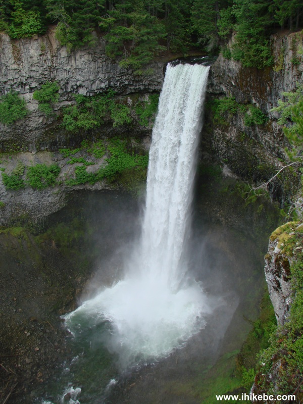
Brandywine Falls BC Canada
Here is our video of Brandywine Falls:
More ihikebc videos are on our YouTube Channel.
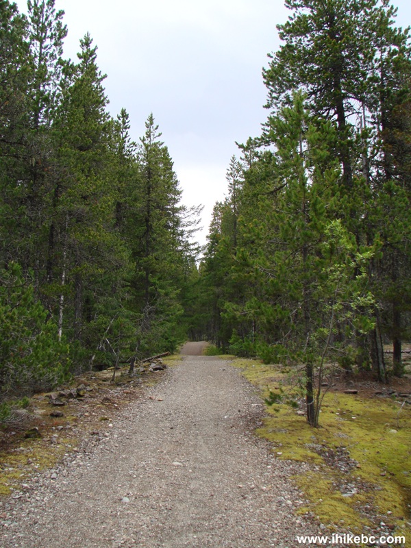
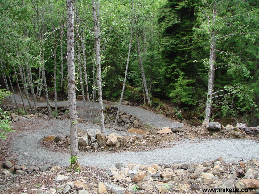
12. After the waterfall, we returned to the directional sign seen in photo #7, and turned left to go to Cal-Cheak Suspension Bridge. As mentioned above, this path is quite easy, unlike the path which starts by Brandywine Falls.
Calcheak Suspension Bridge Trail Province of BC Canada
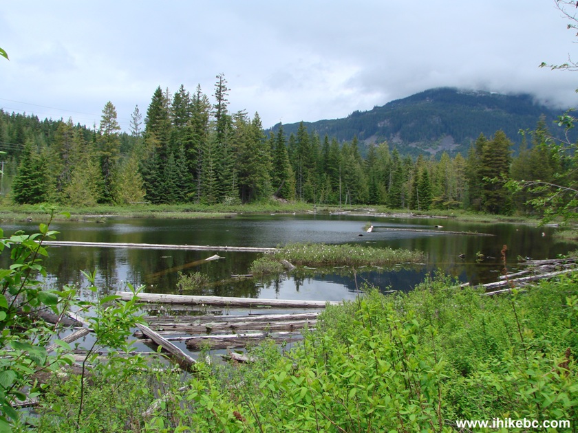
13. There are several small lakes on both sides of the path. This is the best looking one, and it comes after you come to a T-Junction, where you would need to turn right. Turning left leads to Highway 99, which noise is, alas, quite prominent as you are walking on this path. The rougher path has very little to no noise, if that is a deal breaker for you.
14. Soon, you cross the railroad tracks and see this sign. This is where the rough and easy paths meet. So, if you want to walk a loop, that's where you take the rough path to get back to the parking lot, but not before you go check out the bridge first, of course.
15. Here is the suspension bridge. It is not very high, but quite long.
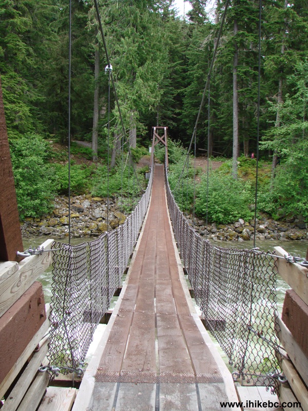
Cal-Cheak Suspension Bridge
16. There is a map of the nearby area at the campground located by the bridge. The suspension bridge is depicted at the bottom of the map on the left side. Highway 99 is seen in the upper left corner.
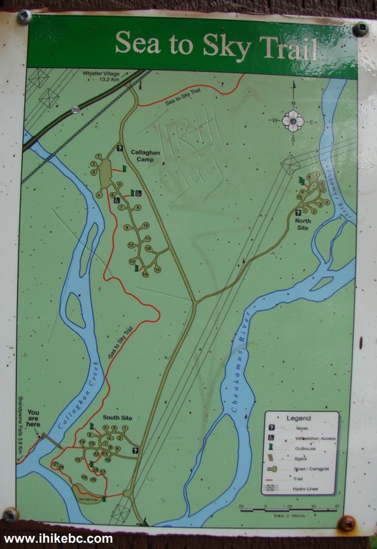
Map of Cal-Cheak Campgrounds off BC Highway 99 South of Whistler Canada
17. Cal-Cheak South Campground has several level sites. The cost of camping is $11 per night. Maximum allowed stay is 14 consecutive days.
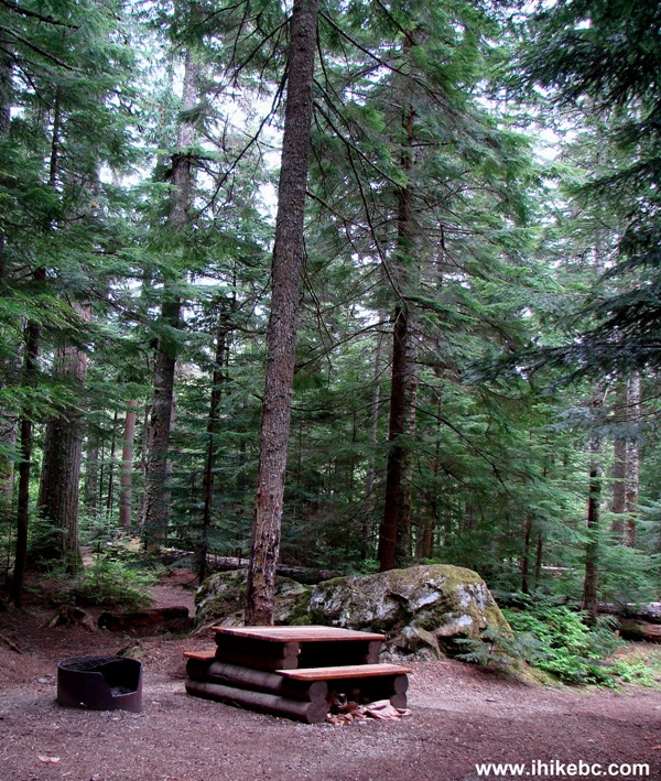
Picture of Cal-Cheak South Campground
18. Cal-Cheak Suspension Bridge seen from the other side (from Cal-Cheak South Campground).
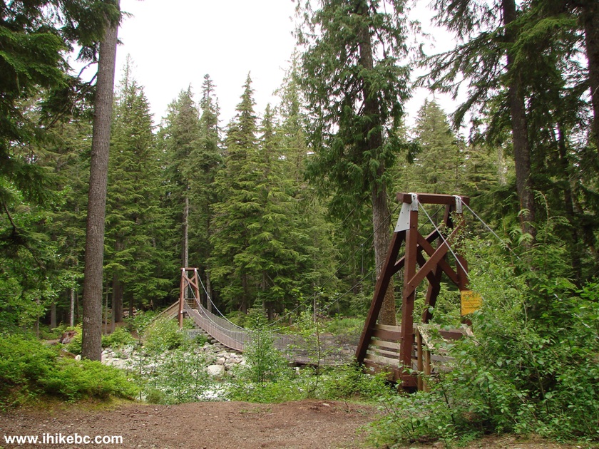
Cal-Cheak Suspension Bridge BC Canada
19. On the way back, at the sign seen in photo #12, we took the rough path to get back to Brandywine Falls Provincial Park. In exchange for your sweat, you get interesting views and less noise from Highway 99.
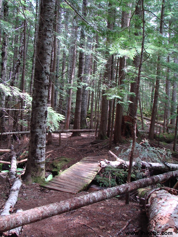
Calcheak Suspension Bridge Path Province of British Columbia Canada
20. This ladder comes handy, but ups and downs on the rough path are plentiful, while ladders are few.
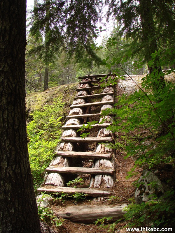
Cal-Сheak Suspension Bridge Hiking Trail
near Whistler BC Canada
21. Nicely done.
Hiking in Whistler Area - Cal-Cheak Suspension Bridge Trail
If all you want is to take a look at an awesome waterfall and spend no more than 30 minutes doing so, Brandywine Falls Provincial Park gives you that opportunity. And, if you have a few hours at your disposal, walking to Cal-Cheak Suspension Bridge via the easy path, or challenging yourself via the rough path, are your options as well. Highly recommended.


|
 |
Other Trips in Squamish Area:
|
|
|
|
|
|
|
|
|
|
|
|
|
|
|
|
|
|
|
|
|
|
Mamquam River FSR
|
|
|
Seed Peak Trail
|


Other Trips:


![]()


![]()
![]()
![]()
Follow @ihikebc Tweet
ihikebc.com Trip 043 - Brandywine Falls Provincial Park (Between Squamish and Whistler BC)