![]()
![]()
![]()

Trip 261 - September 1, 2022 (Thursday)
Wokkpash Corridor (ATV/Hike/Bike/4x4) Trail
Churchill Road Trailhead to Racing River (about 20 km out of 54 km total length)
North of Fort Nelson BC / Near Toad River BC
Page 1 of 2
Liked: A fairly easy biking trail, mountain views, no bugs.
Of Note: Remote wilderness area, MacDonald Creek crossing at the beginning of the trail is required (wading, if biking or hiking - got foot protection?), Racing River appears impossible to cross in a vehicle (too fast and deep), no tree cover.
Northern BC Backroad Mapbook (3rd edition) Trailhead Coordinates: Page 80 (Steamboat) B5.
Related Trip Report: Wokkpash Loop Trail Hike.
Wokkpash Corridor ATV/4x4/Biking/Hiking trail (Churchill Mine Road trailhead) is a 54 km-long trail located in Northern British Columbia, about 157 km North of Fort Nelson, the last population centre with shops and services. There is an eatery with a small store and a gas station in Toad River, 34 km to the South. This trail leads to Wokkpash Loop Hiking Trail (covered in the next trip report), and is a fine trail in its own right due to several good views, and just a fairly easy and pleasant biking experience. That said, McDonald Creek needs to be waded, and, if you are in a vehicle, it may not be possible to cross it, if the water level is too high. All motorized vehicles would be stopped by Racing River, about 20 km from Highway 97. You may be able get to that spot from the other side (not sure where the other end starts), but we have not explored that area, and do not know the conditions.
There are also side roads here and there, but we did not check them out, so there could be more discoveries in this area.
*All trail distances are based on a GPS odometer and are approximate.
1. Here are Google Maps directions from Fort Nelson to Toad River. Wokkpash Corridor Trail (Churchill Mine Road trailhead) is located 34 km South of Toad River.
2-3. Chances are you will see caribou while driving through Stone Mountain Provincial Park, located just South of Churchill Mine Road Wokkpash Corridor trailhead. These are very interesting animals, often hanging out by the highway.
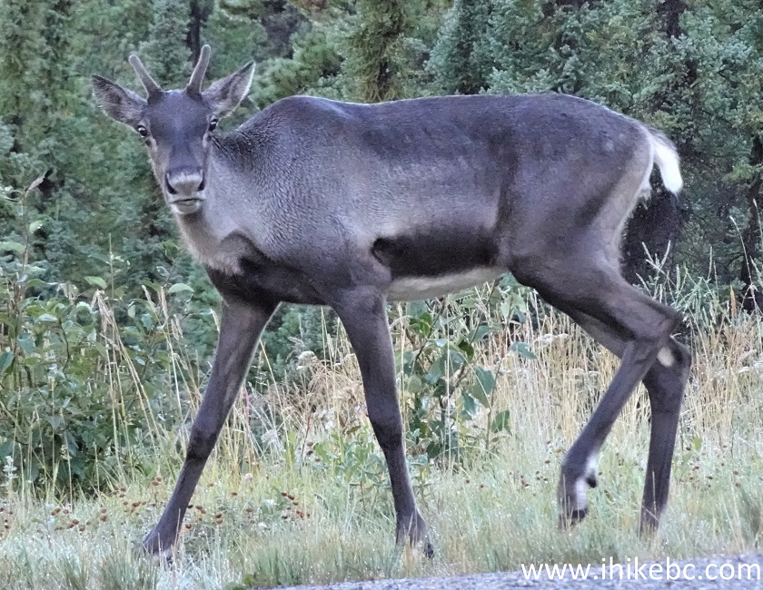
Caribou

BC Caribou
4. We are Northbound on BC Highway 97 (Alaska Highway), about 156 km North of Fort Nelson, passing by a sign showing 35 km to Toad River.
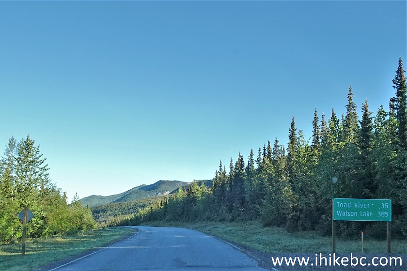
BC Highway 97 (Alaska Highway) South of Toad River
5. Within a kilometer, a well-defined left turnoff leads to Wokkpash Corridor ATV/4x4/Hiking/Biking Trail (and, eventually, to Wokkpash Loop Hiking Trail). Coordinates: N 58°41.896’ W 124°51.922’. Elevation: 1,020 meters.
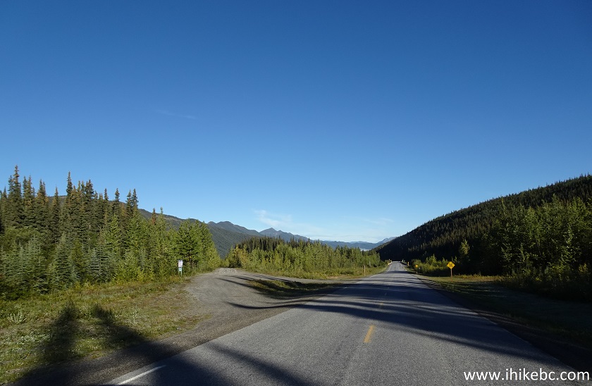
BC Highway 97 at Churchill Mine Road (Wokkpash Corridor Access)
6-8. Here is a close-up of the information board seen in the middle-left of the photo above. The board is talking about Wokkpash LOOP Trail. Wokkpash Corridor Trail leads to Wokkpash Loop trailhead in about 17 km from Highway 97, and then goes its separate way. In photo #7 the red square is our starting point at Churchill Mine Road, and the blue square is the other end of Wokkpash LOOP Trail at MacDonald Creek trailhead, 7.5 km South of Churchill Mine Road trailhead (and across from Baba Canyon Trail).
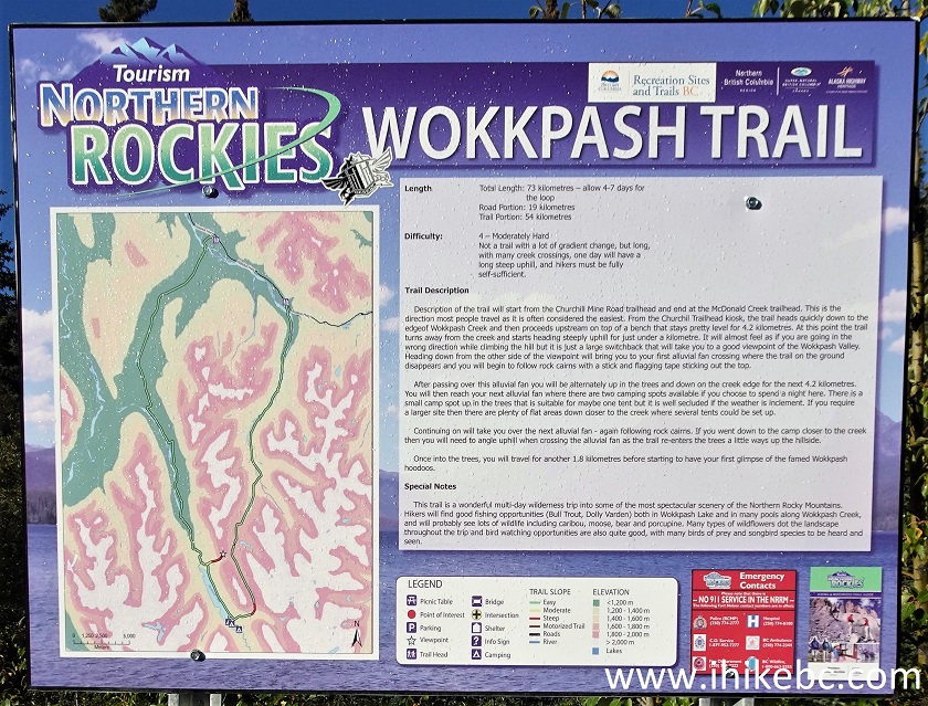
Wokkpash Trail Information Board
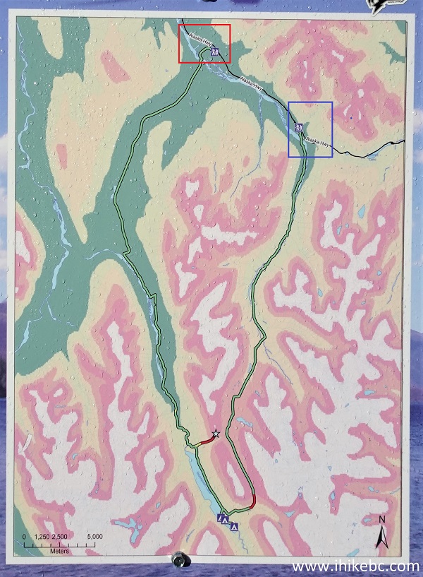
Wokkpash Loop Trail Map
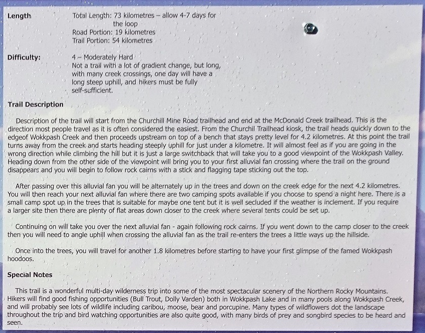
Wokkpash Loop Trail Information
9. From Highway 97, it's 2 km to MacDonald Creek, which has substantial flat surface nearby for quality camping. The road is smooth enough for all regular vehicles, even with trailers. Here we are 600 meters from the highway.
Churchill Mine Road near Toad River BC
10. At 1.9 km, the sign advises it's 20 km to the Wokkpash Loop trailhead. Perhaps, this sign was moved here from elsewhere, as, at this point, the Wokkpash Loop trailhead is about 15.5 km away. The sign also warns of flash floods, which may strand you for several days.
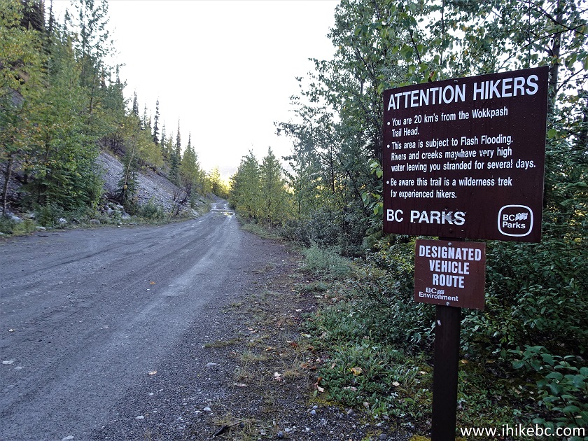
Churchill Mine Road Hiking Advisory
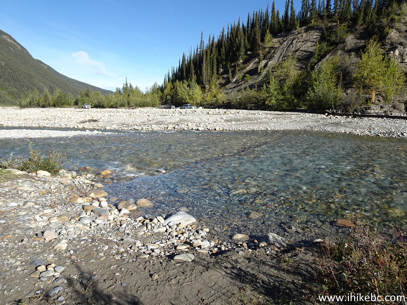
11. About 100 meters later, we are at MacDonald Creek. Coordinates: N 58°41.765’ W 124°53.299’. Elevation: 940 meters.
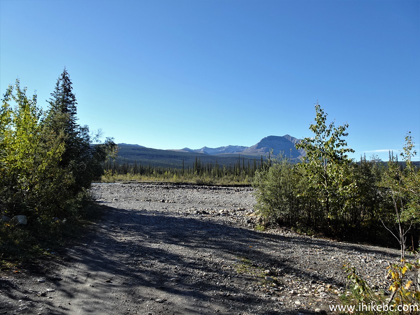
End of Churchill Mine Road by McDonald Creek
12. Wading is the only option here for the hikers and bikers among us. Depending on the water level, ATVs and 4x4s may proceed further as well.
McDonald Creek South of Toad River BC Canada
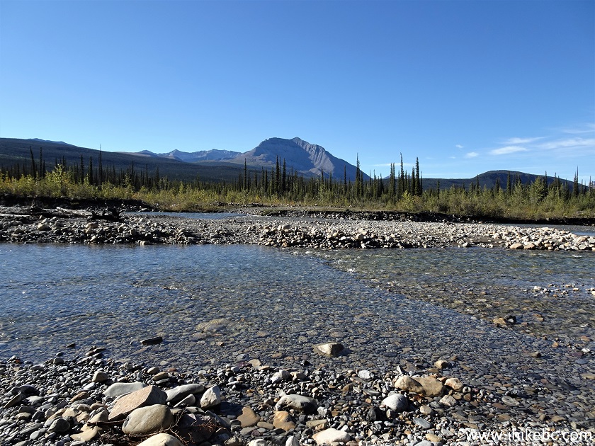
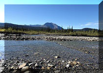
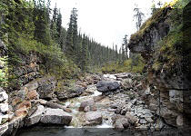
13. There are two streams separated by a short island.
McDonald Creek Northern British Columbia
14. The second stream is deeper than the first. It wasn't too bad today, at the end of the season and with no recent rains - about 30 cm deep at most.
McDonald Creek at Wokkpash Corridor
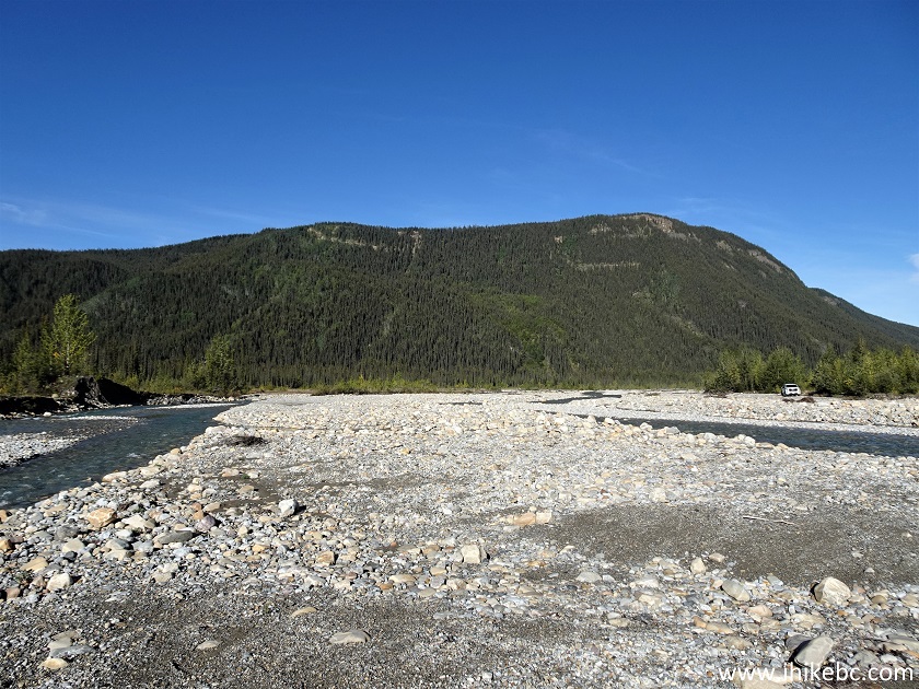
15. Looking back at what we have just crossed.
McDonald Creek North of Fort Nelson BC
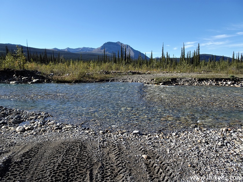
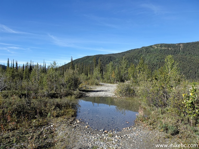
16. Subsequent trail distances are from the point where we crossed MacDonald Creek. There is this large puddle just 30 meters further down the trail. We went around on the right side, after hiding flip-flops nearby. The flip-flops proved invaluable for MacDonald Creek crossing, as the bottom consists of stones, some of which might be sharp enough to cause substantial foot damage.
Wokkpash Corridor Trail
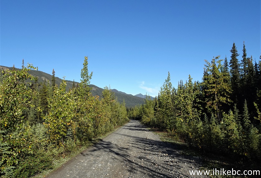
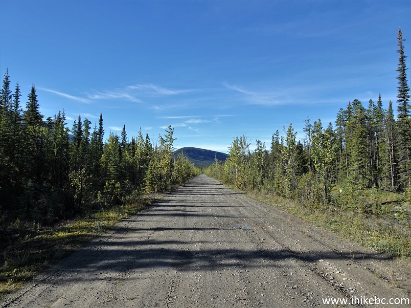
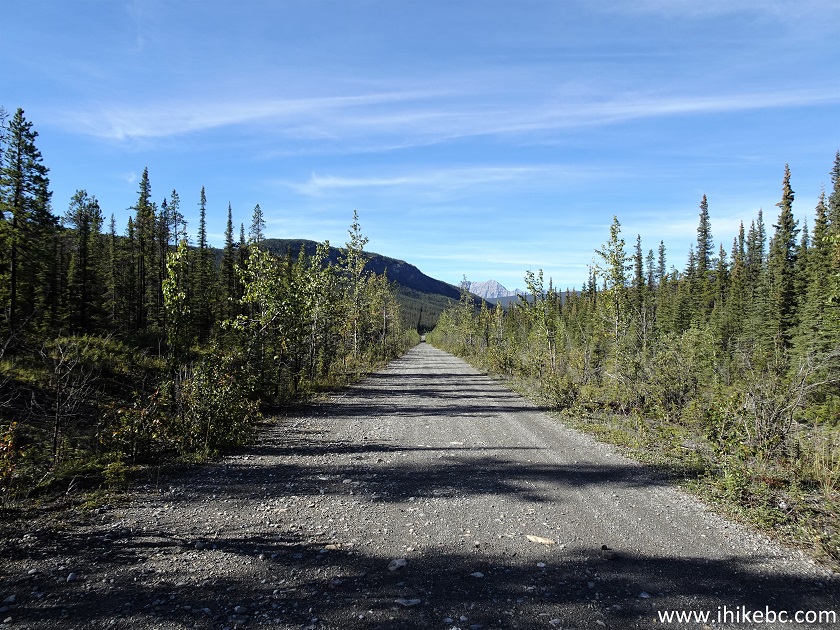
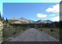
17. Then, nice and easy biking began. It's packed dirt and gravel there, and the road has few steep hills. At 590 meters here.
Wokkpash Corridor Trail North of Fort Nelson British Columbia Canada
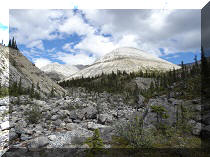
18. The next obstacle is surface full of loose stones due to yet another creek at 1.68 km. We had to cross this creek several times, and, again, it wasn't much of a problem at the end of the season. Wading wasn't required, though biking had to stop for a bit because of all those large loose stones.
Northern British Columbia ATV Trail - Wokkpash Corridor Trail
19. The challenging stretch is about 500 meters long. At 1.92 km here.

Northern British Columbia Hiking Trail - Wokkpash Corridor Trail
20. Crossing the creek at 2.05 km.

Northern British Columbia Horse Trail - Wokkpash Corridor Trail
21. Biking again at 2.60 km from MacDonald Creek crossing.
Wokkpash Corridor Trail near Toad River BC Canada
22. Still nice and easy at 4.53 km.
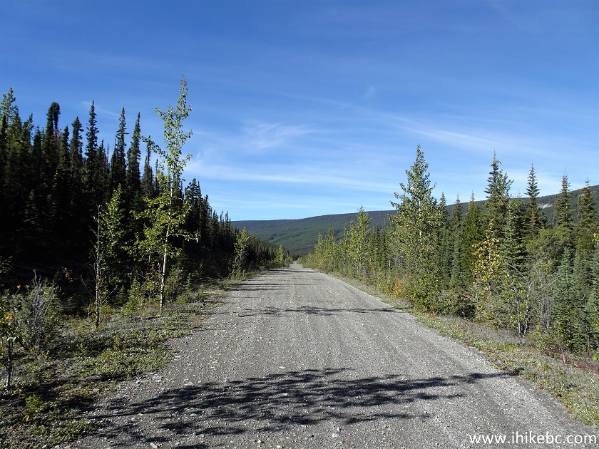
ATV Trail in Northern BC - Wokkpash Corridor Trail
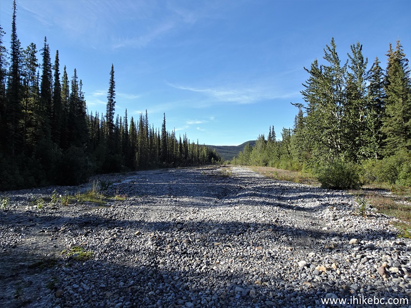
23. A large puddle at 7.42 km.
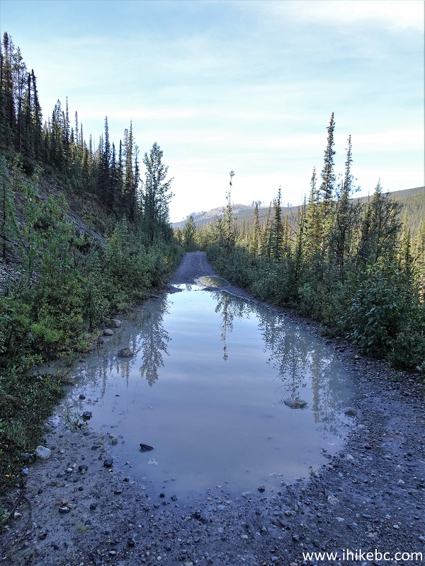
Wokkpash Corridor Trail Puddle
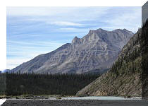
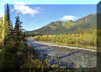
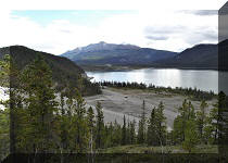
24-25. There wasn't much view-wise up to this point, but here at 8.05 km things started to change. A plain and slightly zoomed views.

Wokkpash Corridor Trail British Columbia Canada
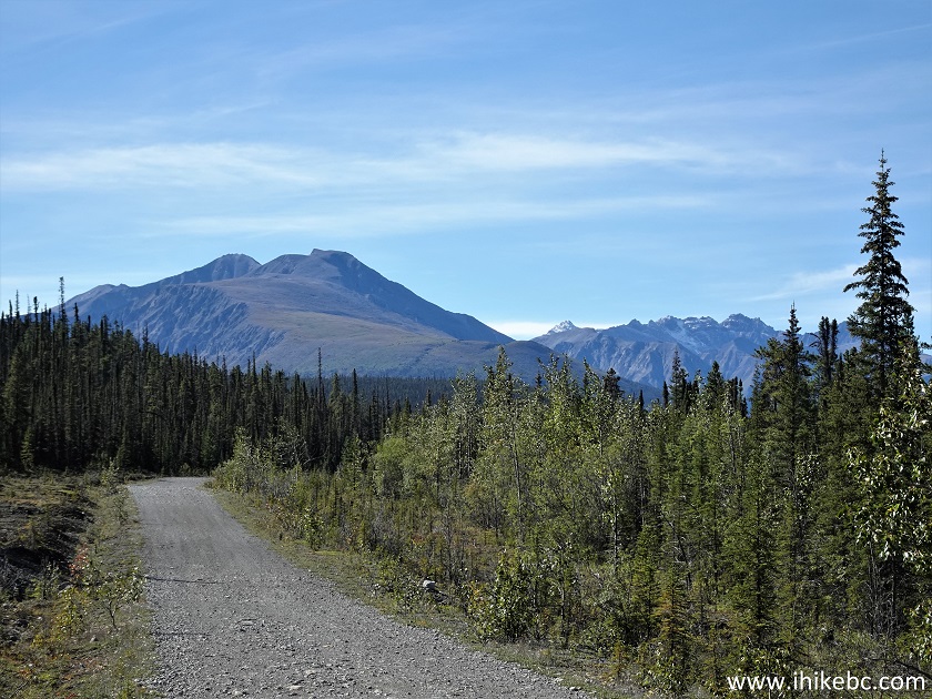
Mountain View - Wokkpash Corridor Trail
Our Wokkpash Corridor Trail Trip Report Continues on Page 2.


|
 |
Other Trips in Fort Nelson Area:
|
|
|
|
|
|
|
|
|
|
|
|
|
|
|
|
Other Trips:


![]()
![]()
![]()
ihikebc.com Trip 261 - Wokkpash Corridor (ATV/Bike/Hike/4x4) Trail (North of Fort Nelson BC) Page 1 of 2