![]()
![]()
![]()

Trip 266 - September 5, 2022 (Monday)
Old Alaska Highway Trail Hike
Muncho Lake BC
Page 1 of 2
Of Note: Some bugs, the side path to all the main views is very steep (hiking poles and boots are essential for that path, and are recommended otherwise), steep unbarricaded drop-offs closer to the end of the side trail, encroaching vegetation in some parts of the trail – long pants and a long-sleeve shirt are recommended.
Northern BC Backroad Mapbook (3rd edition) Approximate Trailhead Coordinates: Page 79 (Muncho Lake) E3.
Old Alaska Highway Trail is located in Northeastern British Columbia, in an unincorporated community of Muncho Lake, about 252 km North of Fort Nelson, the closest town with more-or-less limited services, including a hospital. As the name suggests, the trail used to be Alaska Highway when originally built, but, as years went by, some parts of the highway were slightly moved, including the stretch by Muncho Lake, so this trail came into existence. There are two trailheads for Old Alaska Highway Trail - the south one (by Strawberry Flats Campground), and the north one, about 1.4 km further on Highway 97.
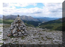
Today, we started at the south trailhead, finished at the north trailhead, and then hiked 1.4 km on the highway to return to the parking lot. This trail can be as easy or as difficult as you want it to be. If all you are interested in is an easy pleasant hike with a decent view of Muncho Lake, then ignore a very challenging side trail which rapidly gains elevation but provides great panoramic views of Muncho Lake and the surrounding mountains. If, however, you are properly equipped and do not mind the climb and the subsequent descent, this trail is as good as it gets in the views department, and will certainly not disappoint.
It is better to hike here early in the morning or on a cloudy day, as, otherwise, the sun would be shining in your eyes, somewhat affecting the views of Muncho Lake, like it did today. But, even then, Old Alaska Highway is one impressive hike.
*All trail distances are based on a GPS odometer and are approximate.
1. Here is a Google Maps location of Muncho Lake, where Old Alaska Highway Trail can be found.
2. We are Northbound on BC Highway 97 (Alaska Hwy), entering Muncho Lake.
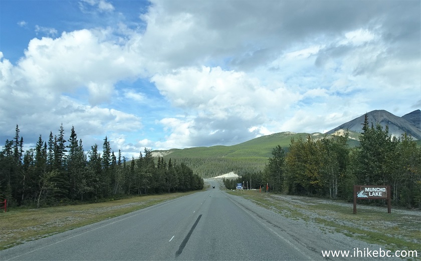
BC Highway 97 (Alaska Highway) Muncho Lake British Columbia Canada
3. Muncho Lake, BC. There are two gas station (at the north and south ends of the lake), as well as Northern Rockies Lodge at the north end.
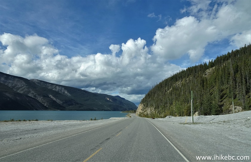
Muncho Lake BC Canada
4. Strawberry Flats Campground is located 2.2 km from Muncho Lake sign.
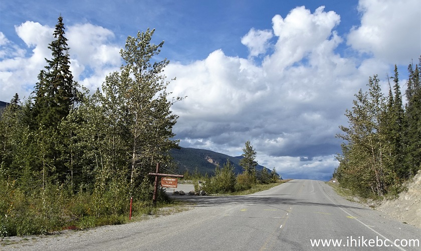
BC Highway 97 at Strawberry Flats Campground in Muncho Lake British
Columbia Canada
5. Just 200 meters later, on the right side, is the parking lot for the south trailhead of Old Alaska Highway Trail. Coordinates: N 58°56.950’ W 125°46.265’. Elevation: 870 meters. It's 252 km North of Fort Nelson, and 3.0 km North of Red Rock Canyon Trail. Going further North from here, it is 1.4 km to Old Alaska Highway north trailhead, 3.7 km to an awesome Stone Sheep Trail, and 7.2 km to Northern Rockies Lodge (gas, ice, eatery, lodging).
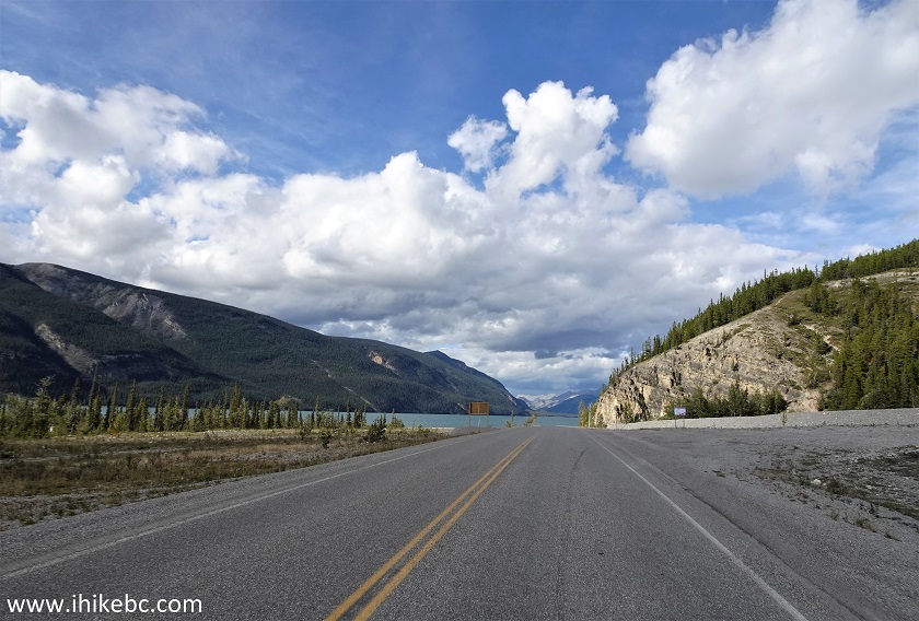
Muncho Lake BC at Old Alaska Highway Trail SOUTH Parking Lot
6-8. The info board describes the hike and has a trail map. If you just go South-North, there are a few moderately difficult short climbing stretches at the beginning and at the end. However, for the best views of Muncho Lake and the mountains you need to take that short but very red side trail.
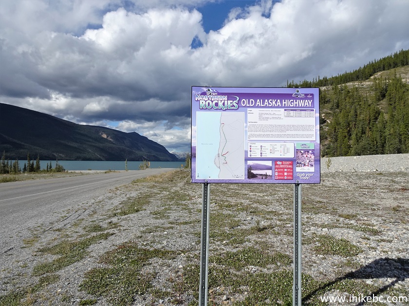
Old Alaska Highway Trail Information Board
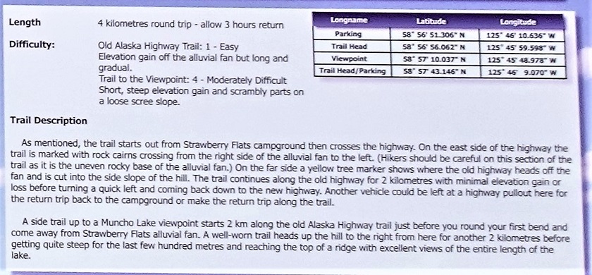
Old Alaska Highway Trail Information
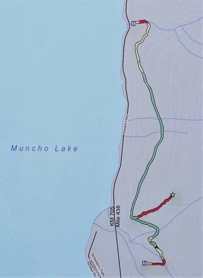
Old Alaska Highway Trail Map Muncho Lake BC Canada
9. On the right side (south side) of the large parking lot is the trailhead for Old Alaska Highway Trail.
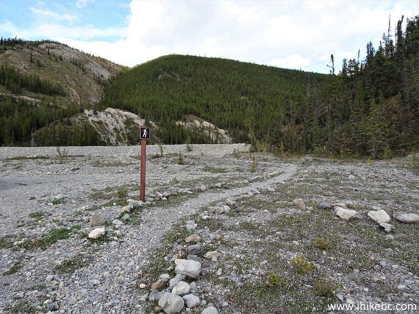
Old Alaska Highway Trailhead
10. Keep to the right to cross the dyke at the easiest spot.
Muncho Lake Hiking - Old Alaska Highway Trail
11. The easiest spot of the dyke is on the very right side.
Old Alaska Highway Trail Muncho Lake BC Canada
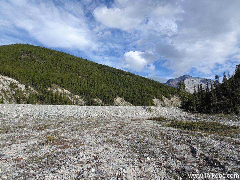
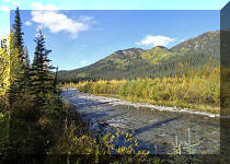
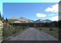
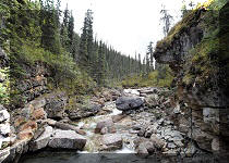
12. Having crossed the dyke 100 meters from the trailhead, head in the 10 o-clock direction, where the arrow is pointing at a very obvious large sand spot. If there is too much water (there was none during our hike late in the season) and you don't feel like wading, drive 1.4 km further North on Alaska Highway to the north trailhead, where there is no such obstacle. Also, if you keep going up the river bed here, there are some interesting hoodoos in about 700-800 meters on the right side, and, potentially, some good views further on (we did not go there).
Old Alaska Highway Trail - Hiking in British Columbia Canada
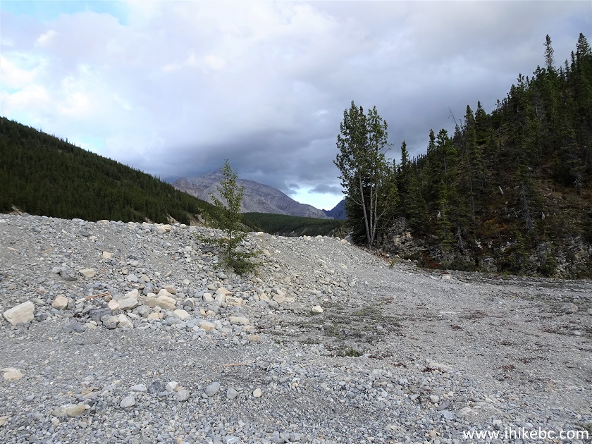
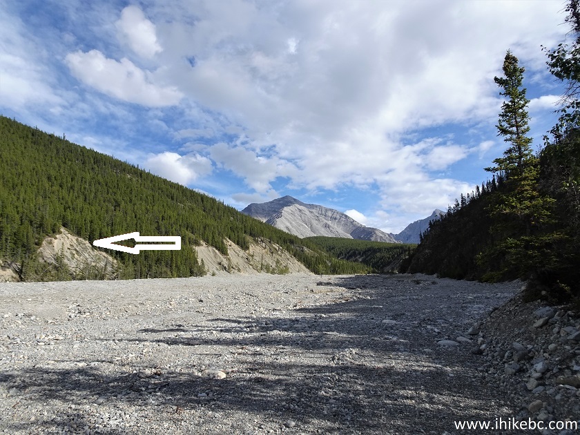
13. At 300 meters, we can see the continuation of the trail at the bottom of the large sand spot.
Old Alaska Highway Trail in Northeastern British Columbia Canada
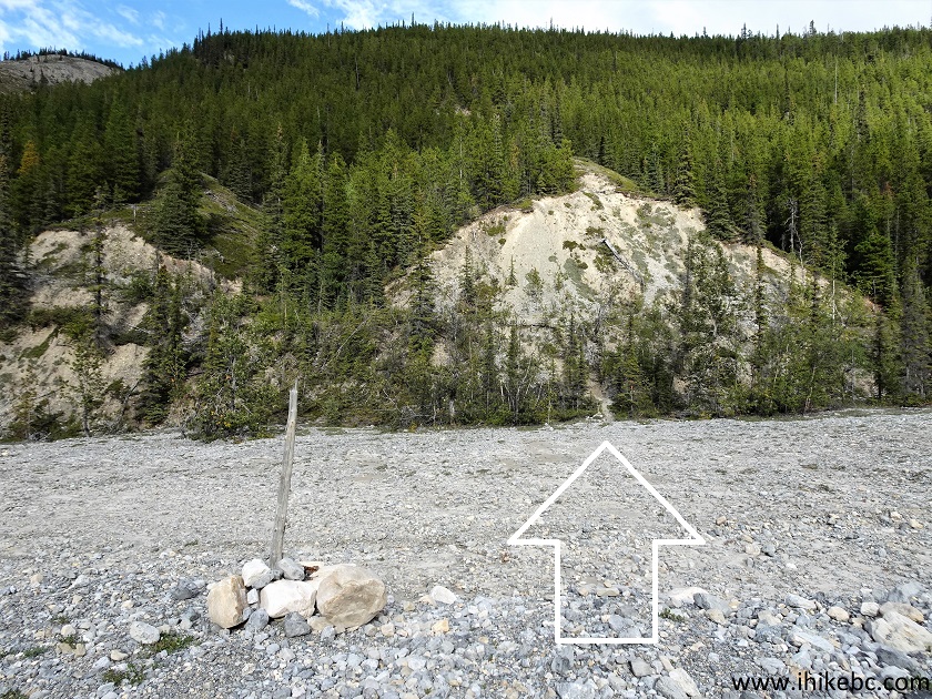
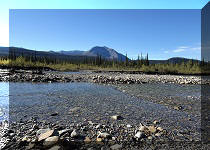
14. The river bed crossing is done at about 330 meters, and the very obvious trail starts to climb up. Coordinates: N 58°56.935’ W 125°45.864’. Elevation: 860 meters.
Muncho Lake BC - Old Alaska Highway Trail Hike
15. Old Alaska Highway Trail at 365 meters from the south trailhead.
Old Alaska Highway Trail North of Fort Nelson BC Canada
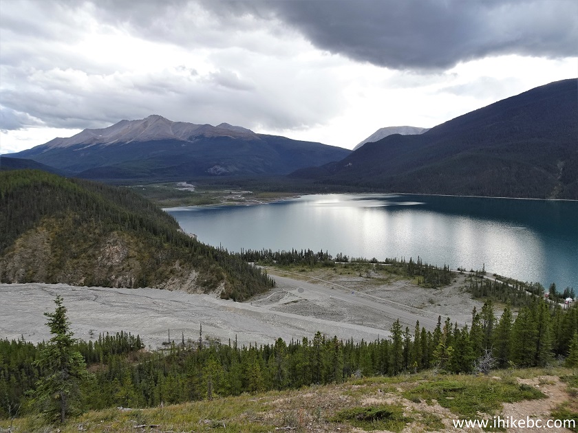
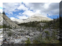
16. You can still get a decent view of Muncho Lake without having to climb the tough side trail. At 615 meters here.
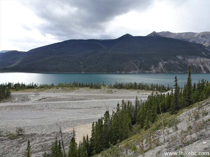
Muncho Lake BC
17. Now at 800 meters of Old Alaska Highway Trail in Muncho Lake, BC.
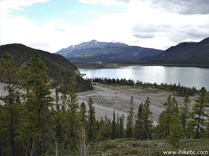
Muncho Lake View from Old Alaska Highway Trail
18. The split arrives at 885 meters. Coordinates: N 58°57.086’ W 125°46.094’. Elevation: 900 meters. It's 1.4 km from here to Old Alaska Highway north trailhead, if you go straight - easy hiking but not much to see. And, if you are properly equipped and want to check out some really awesome views, a very tough side trail starts on the right side of the split.
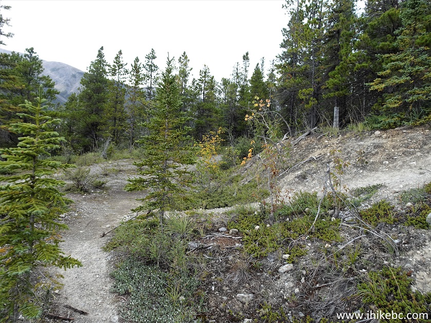
Old Alaska Highway Trail Split British Columbia Canada
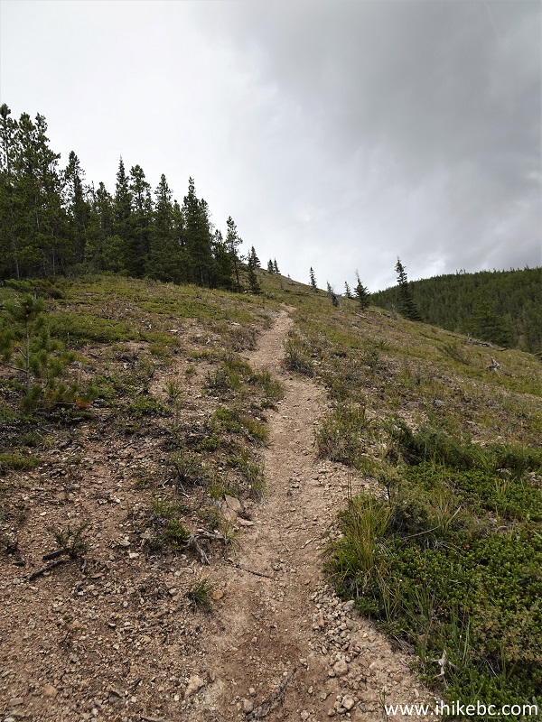
19. We turned right. 30 meters from the split.
Muncho Lake Hiking - Old Alaska Highway Trail
20. Now at 90 meters.
Old Alaska Highway Trail in Muncho Lake British Columbia
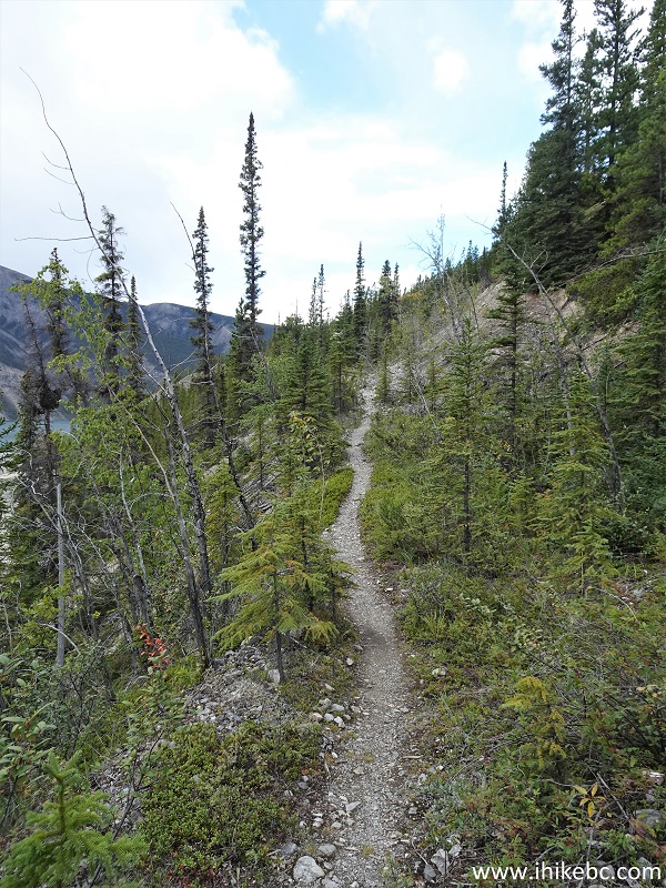
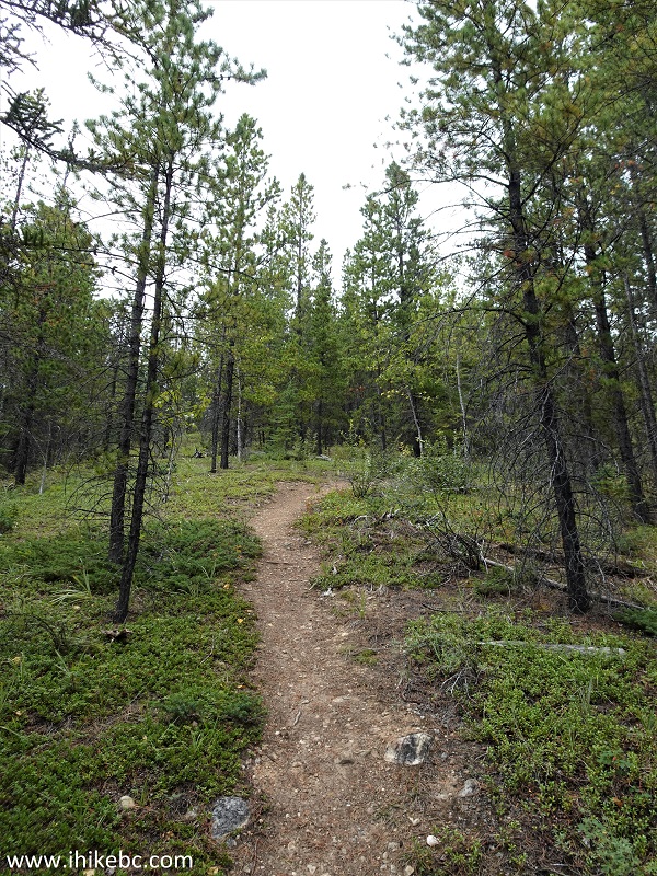
21. The side trail goes in and out of the woods. At 140 meters from the split.
Old Alaska Highway Hike in Muncho Lake BC Canada
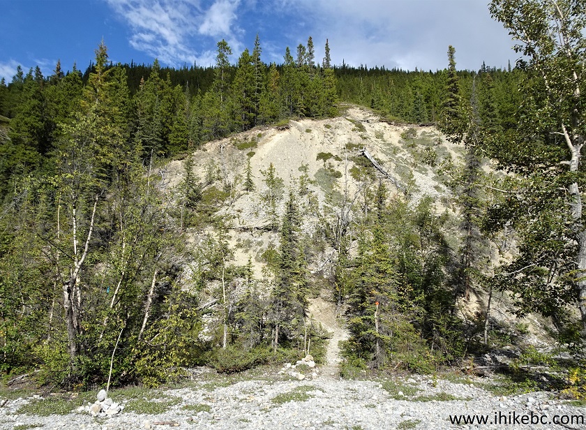
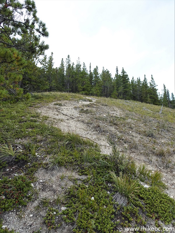
22-23. Looking right and back at 210 meters.
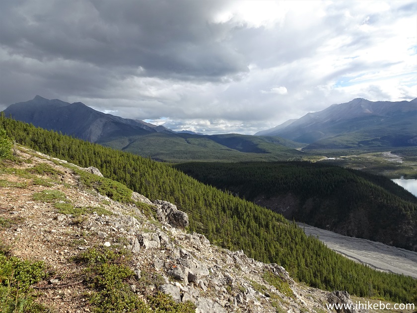
Muncho Lake
Our Old Alaska Highway Trail Hike Trip Report Continues on Page 2.


|
 |
Other Trips in Fort Nelson Area:
|
|
|
|
|
|
|
|
|
|
|
|
|
|
|
|
Other Trips:


![]()
![]()
![]()
ihikebc.com Trip 266 - Old Alaska Highway Trail (Muncho Lake BC) Page 1 of 2