![]()
![]()
![]()

Trip 261 - September 1, 2022 (Thursday)
Wokkpash Corridor (ATV/Hike/Bike/4x4) Trail
Churchill Road Trailhead to Racing River (about 20 km out of 54 km total length)
North of Fort Nelson BC / Near Toad River BC
Page 2 of 2
Liked: A fairly easy biking trail, mountain views, no bugs.
Of Note: Remote wilderness area, MacDonald Creek crossing at the beginning of the trail is required (wading, if biking or hiking), Racing River appears impossible to cross in a vehicle (too fast and deep), no tree cover.
Northern BC Backroad Mapbook (3rd edition) Trailhead Coordinates: Page 80 (Steamboat) B5.
Wokkpash Corridor ATV/4x4/Biking/Hiking trail (Churchill Mine Road trailhead) is a 54 km-long trail located in Northern British Columbia, about 157 km North of Fort Nelson, the last population centre with shops and services. There is an eatery with a small store and a gas station in Toad River, 34 km to the South. This trail leads to Wokkpash Loop Hiking Trail (covered in the next trip report), and is a fine trail in its own right due to several good views, and just a fairly easy and pleasant biking experience. That said, MacDonald Creek needs to be waded, and, if you are in a vehicle, it may not be possible to cross it, if the water level is too high. All motorized vehicles would be stopped by Racing River, about 20 km from Highway 97. You may be able get to that spot from the other side (not sure where the other end starts), but we have not explored that area, and do not know the conditions.
There are also side roads here and there, but we did not check them out, so there could be more discoveries in this area.
*All trail distances are based on a GPS odometer and are approximate.
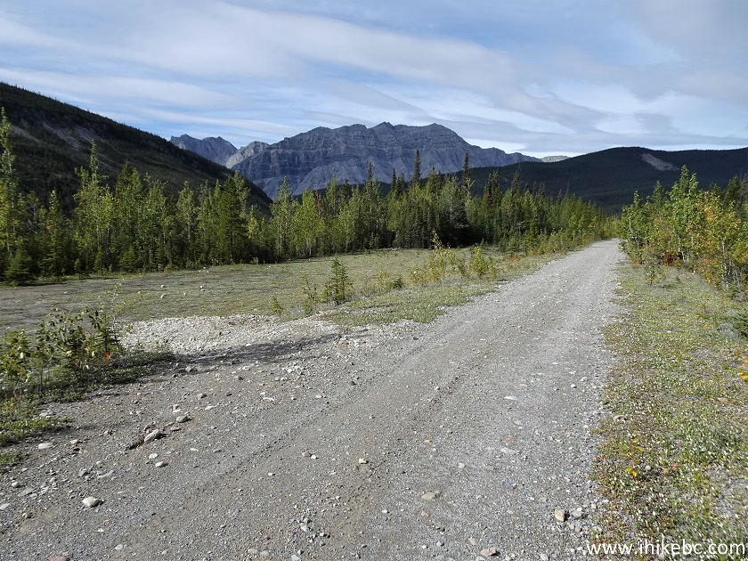
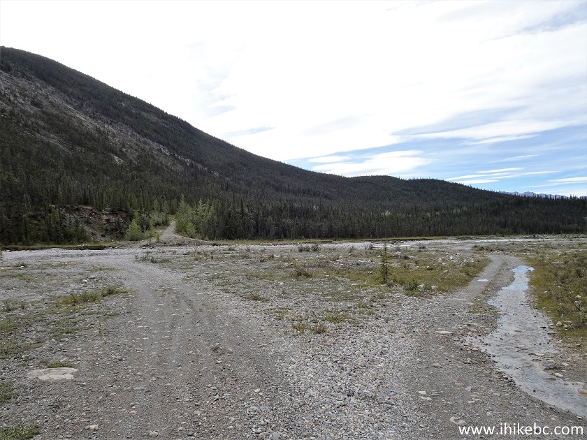
26. At 8.72 km from MacDonald Creek, we are approaching an enormous open area. Hundreds of vehicles may camp here, should there be a need.
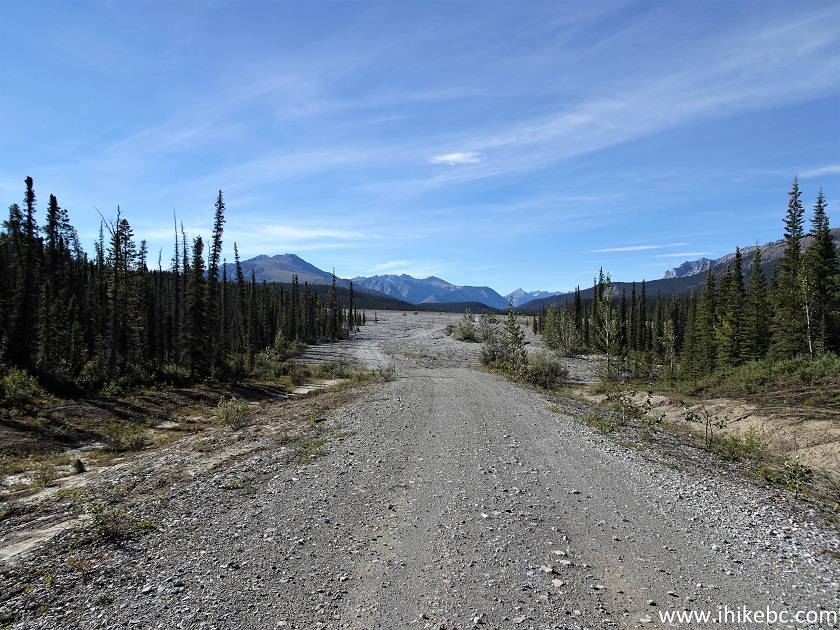
Wokkpash Corridor Trail
27. The open area is about 800 meters long, 300 meters wide to the left, and 100 meters wide to the right. It was quite windy here - should be good for keeping the bugs away, if they ever show up.
Wokkpash Corridor Trail near Toad River BC Canada
28. Comes with a fine mountain view too.
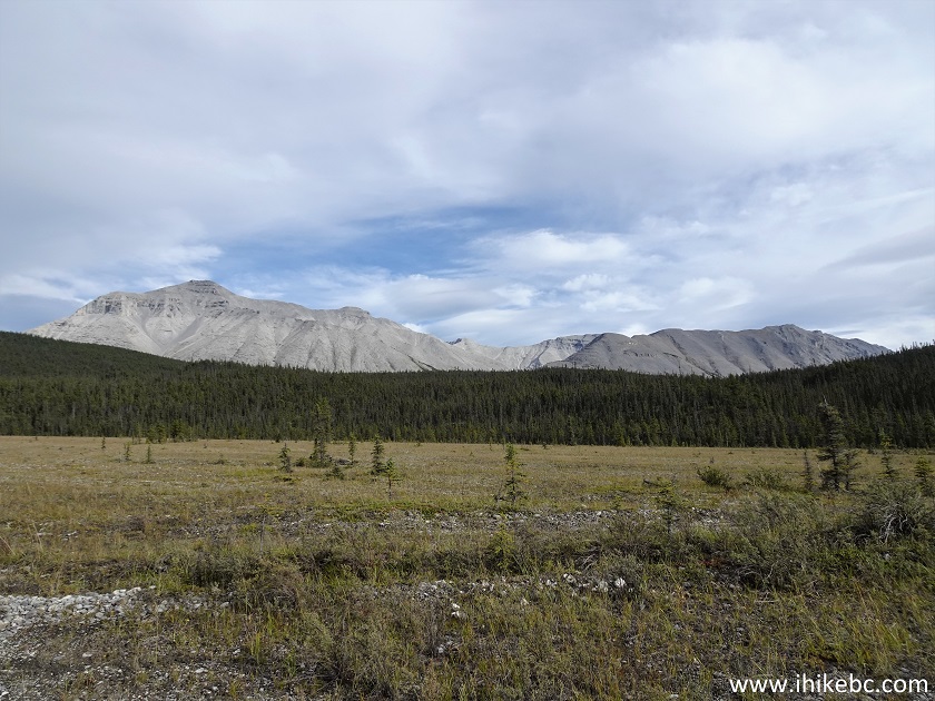
View from Wokkpash Corridor Trail North of Fort Nelson British Columbia
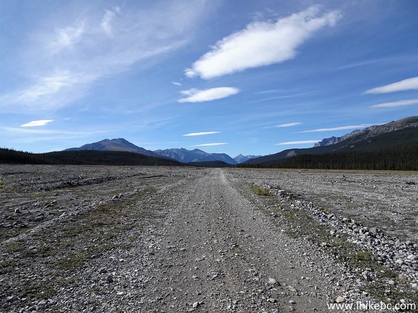
29. At 10.15 km, we are at the end of the large open area.
Wokkpash Corridor ATV Trail in Northern British Columbia Canada
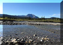
30. Within a kilometer of the open area, there is this lake, which is about 700 meters long. We did not see an easy way to access the lake, but did not look much for it either.
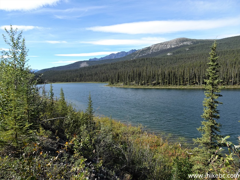
Lake by Wokkpash Corridor Trail
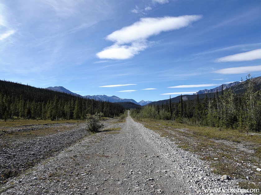
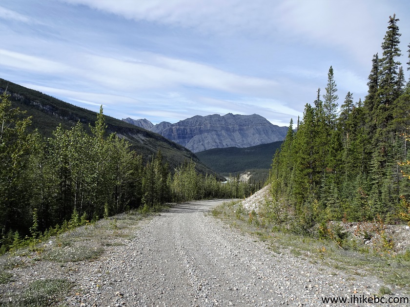
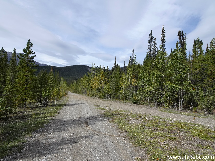
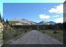
31. Wokkpash Corridor Trail at 12.72 km from MacDonald Creek. Still easy to bike.
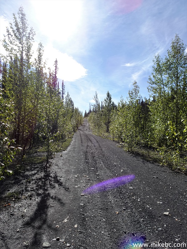
Wokkpash Corridor Horse Trail in British Columbia Canada
32-33. At 13.20 km, there is a split. Hikers are invited to take the road on the left, while motorized vehicles take the right one. In fact, there is no difference. Both roads converge less than 4 km later, the only difference being the road on the right misses Wokkpash Loop trailhead by 400 meters, so a left turn after the merge would be in order to reach that trailhead, should you decide to take the road on the right.
Wokkpash Corridor Trail by Toad River BC
Wokkpash Corridor Biking Trail North of Fort Nelson BC
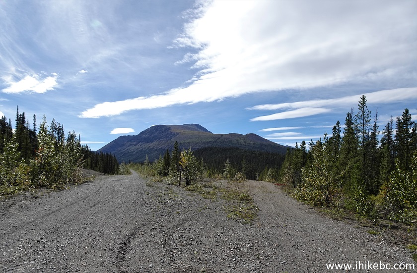
34-35. We took the road on the left, and a fine view appeared at 15.07 km. Plain and zoomed.
British Columbia ATV Trail - Wokkpash Corridor Trail
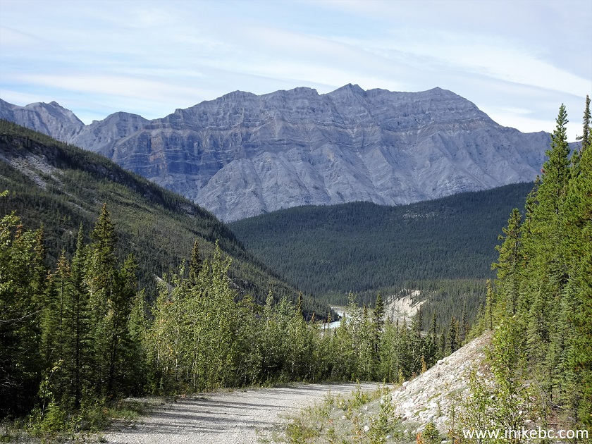
British Columbia Horse Trail - Wokkpash Corridor Trail
36. This is also where the longest descent of the trip took place - 1.4 km. Moderately steep - we were able to bike up on the way back.
Wokkpash Corridor Trail
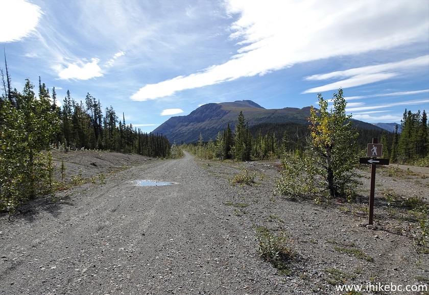
37-38. At 15.5 km, the descent ends at Wokkpash Loop trailhead. There is a large open area there too, should one wish to park their vehicle prior to starting the hike, and/or do some camping.
Wokkpash Corridor Trail at Wokkpash Loop Trail
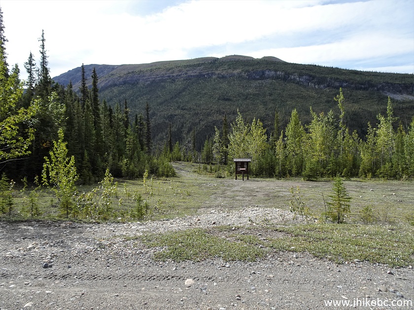
Wokkpash Loop Trail Parking Area
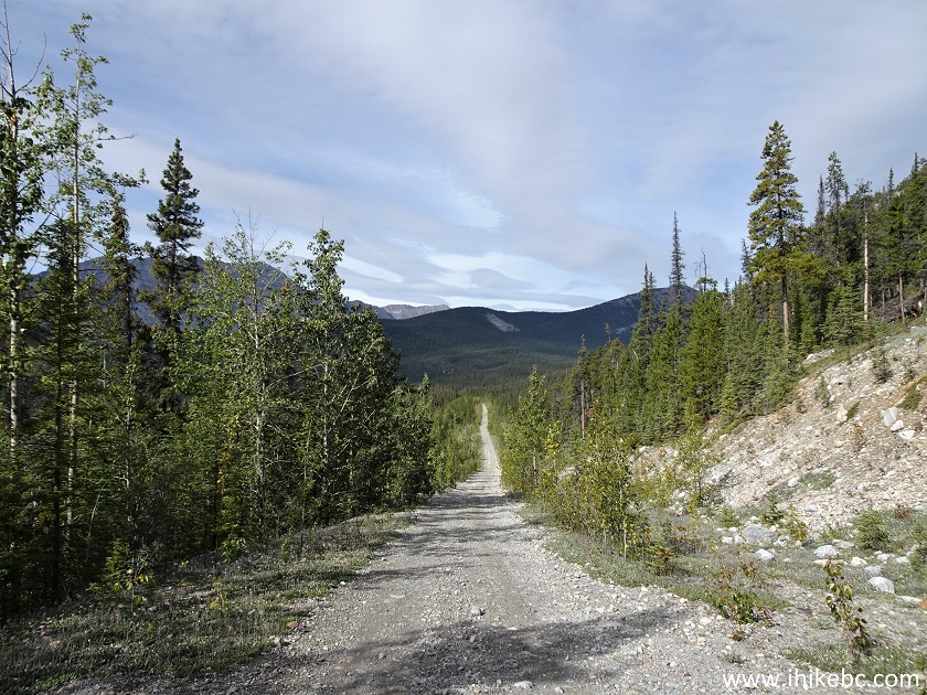
38. We will cover Wokkpash Loop Trail in the next trip report, but, for the time being, continuing biking on Wokkpash Corridor Trail, and here is that merge of the "hiking" path with the "motorized" path at 15.94 km.
Wokkpash Corridor Trail British Columbia Canada
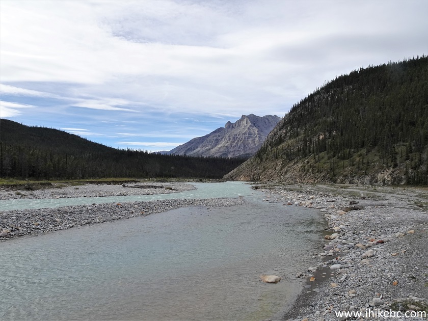
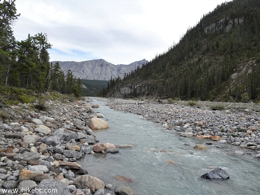
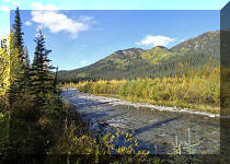
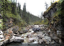
39. Wokkpash Corridor Trail reaches Racing River at 17.7 km from MacDonald Creek (19.7 km from Highway 97). Racing River can probably be waded, but driving across it is a bad idea, as it is very fast and appears rather deep (deeper than MacDonald Creek we crossed at the beginning, anyway). Since we came here to hike Wokkpash Loop Trail, that was it for us as far as checking out Wokkpash Corridor Trail, which, apparently, continues for another 35km or so. The continuation of the trail is seen past Racing River far ahead in the middle-left of this photograph.
Wokkpash Corridor Trail near Racing River
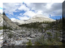
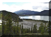
40-42. Looking right, we see a very fine mountain. Plain and zoomed views. Racing River appears quite docile here, but it has a second stream, which can be seen in the video below, and that stream sure looks dangerous for any vehicles. Even crossing on foot may not be a good idea without a second person controlling the crossing person with an attached rope.
Racing River BC Canada

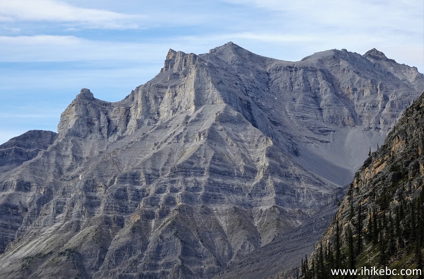
Mountain by Wokkpash Corridor Trail
43. Looking left now at the "docile" part of Racing River.
Racing River British Columbia
Here is our video of the views from this location, including the dangerous part of the river.
More ihikebc videos are on our YouTube Channel.
Wokkpash Corridor Trail offers an easy and pleasant biking experience,
several fine mountain views, and an access to Wokkpash Loop Trail. High water
level of MacDonald Creek may make things complicated from the get go, however.
Recommended.


|
 |
Other Trips in Fort Nelson Area:
|
|
|
|
|
|
|
|
|
|
|
|
|
|
|
|


![]()
![]()
![]()
ihikebc.com Trip 261 - Wokkpash Corridor (ATV/Hike/Bike/4x4) Trail (North of Fort Nelson BC) Page 2 of 2