![]()
![]()
![]()

Trip 260 - June 17, 2022 (Friday)
Mount Daniel Trail Hike
North of Sechelt BC
Near Madeira Park (BC Sunshine Coast)
Liked: A fine view from the top, lots of fern first half of the trail, shade in the forest, almost no bugs.
Of Note: A moderately difficult trail with several short steep sections, hiking poles and boots are recommended, unbarricaded drop-offs at the main viewpoint, some traffic noise at the viewpoints, broken glass and garbage at the main viewpoint, no facilities.
Vancouver, Coast & Mountains Backroad Mapbook (5th edition) Park Coordinates: Page 9 (Sechelt) B1.
Mount Daniel Trail is located on BC Sunshine Coast, about 41 km North of Sechelt, off Garden Bay Road, 3.3 km from Highway 101. Going further on Garden Bay Road would eventually lead to Pender Hill Trail, covered in the previous trip report.
Of the two trails, Pender Hill is shorter, easier, and has better views. That said, Mount Daniel Trail has a decent, albeit partially obstructed, view from the top as well, and is a worthwhile hike too. This hike is about 2.4 kilometers long one way, and is moderately difficult, with several short steep sections. The second half of Mount Daniel Trail goes through Garden Bay Marine Provincial Park.
All trail distances are based on a GPS odometer and are approximate.
1. Here are Google Maps directions from Sechelt to Mount Daniel Trailhead. Mount Daniel Trailhead is located 800 meters past Pender Harbour Landfill Site, and 1.2 km past Barbash Road.
2. We are westbound on Garden Bay Road, North of Sechelt, about 3.3 km after turning from BC Highway 101, with Mount Daniel Trail parking lot seen on the left side. Coordinates: N 49°38.854’ W 124°00.272’. Elevation: 80 meters. There are no facilities.
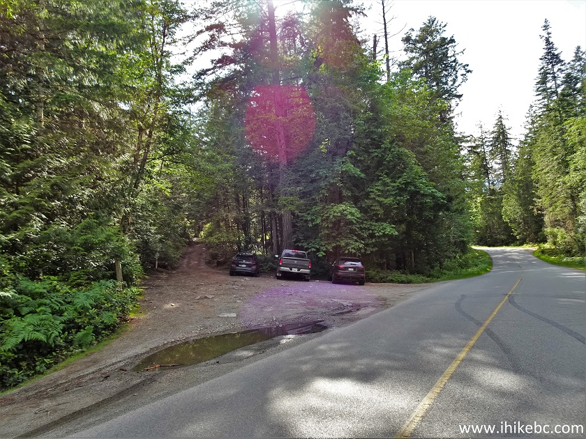
Mount Daniel Trail Parking Lot - Garden Bay Road - Madeira Park BC
Canada
3. Should the lot be full, a pullout is located approximately 100 meters ahead on the right side.
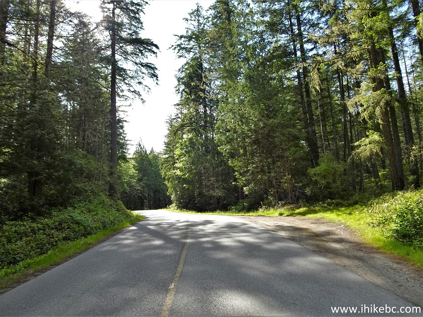
Garden Bay Road Sunshine Coast BC
4. An information board at the Mount Daniel Trail parking lot.
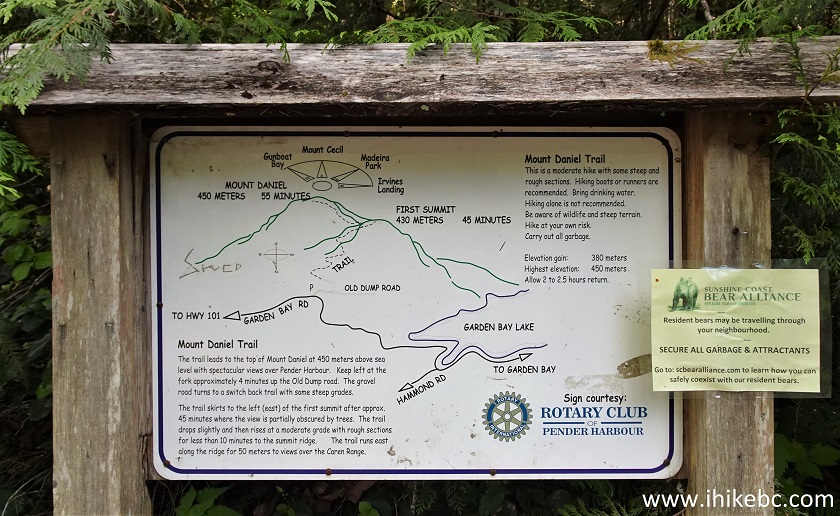
Mount Daniel Trail Information Board
5. The hike begins. It appears it is possible to drive up for 340 meters, as the road is decent and there are no signs prohibiting that, but we saw no vehicles there, as everyone parked by Garden Bay Road.
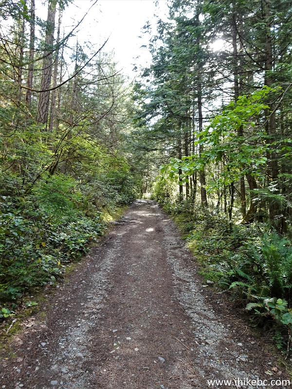
Mount Daniel Trail Hike near Sechelt British Columbia
6. Stay left at a split 160 meters from the trailhead. A sign shows that bicycles are allowed on this trail, as challenging for biking as it is.
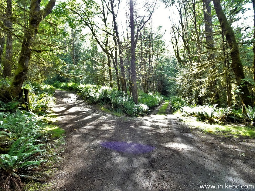
BC Sunshine Coast Hiking - Mount Daniel Trail
7. Mount Daniel Trail at 250 meters.
Mount Daniel Trail
8. And here is that spot at 340 meters, where it appears vehicles can reach without much trouble. After that, the trail is definitely for hiking and biking only.
Hike in Sechelt BC Area - Mount Daniel Trail
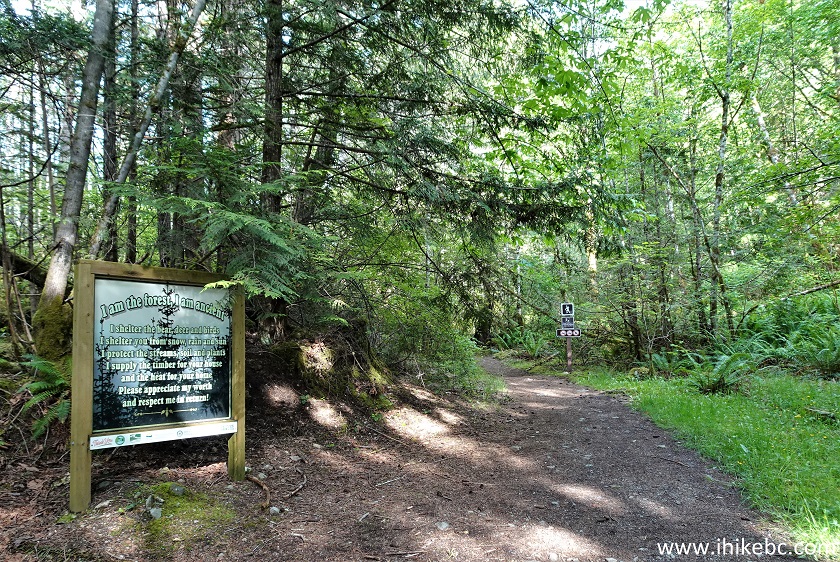
9. An interesting information board.
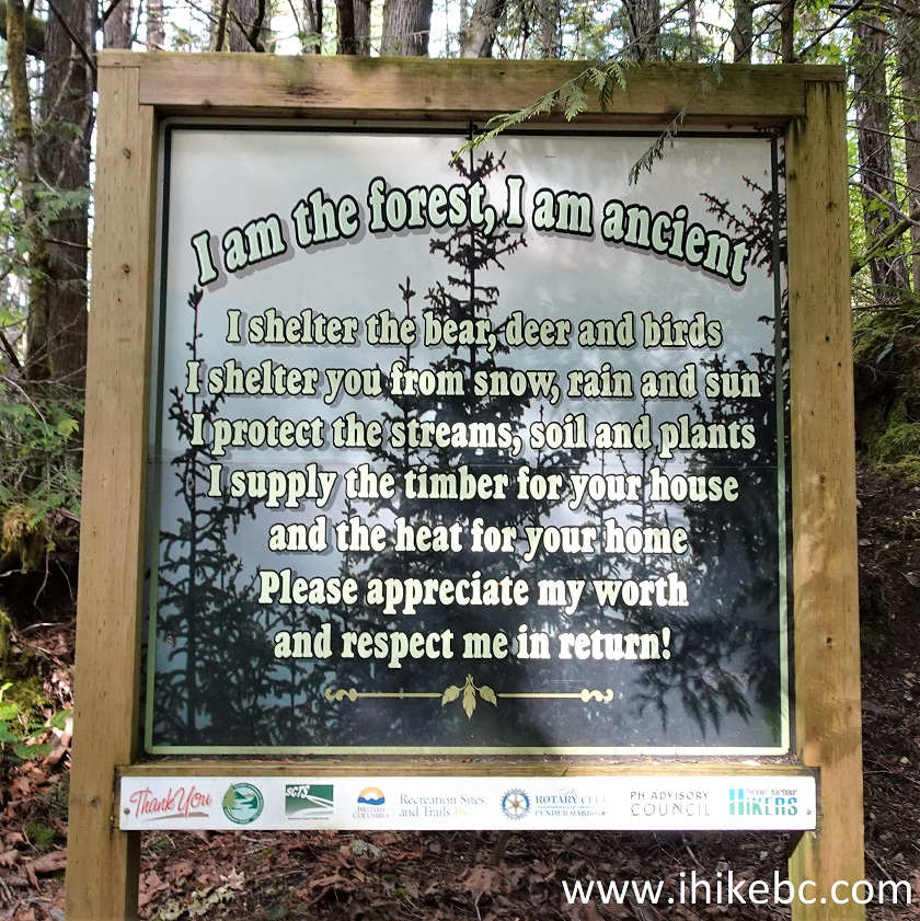
Forest Preservation Information Board
10. And the trail sign right by the board.
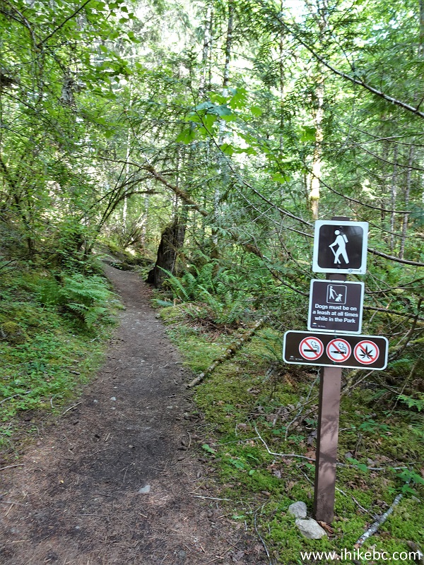
Mount Daniel Trail - Sunshine Coast - British Columbia - Canada
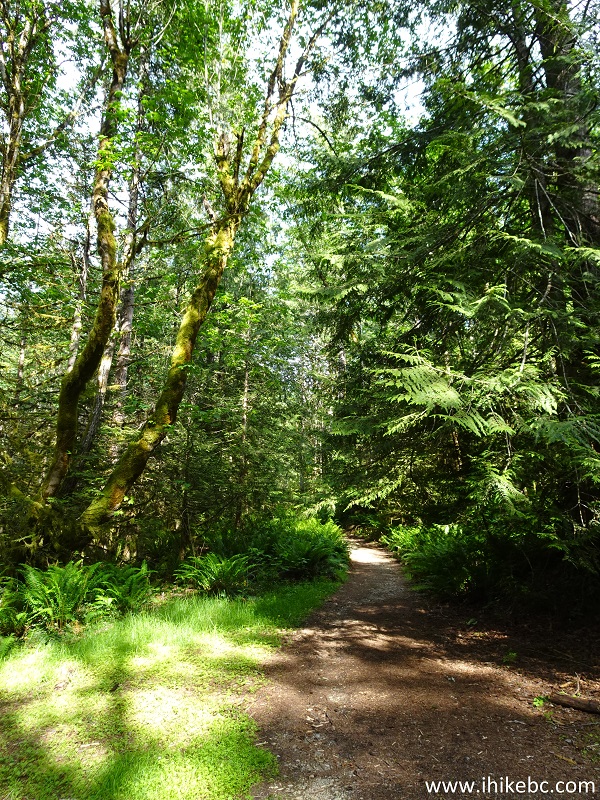
11. Mount Daniel Trail at 440 meters from Garden Bay Road.

Hike in Sechelt BC Area - Mount Daniel Trail
12. At about 700 meters, lush fern adorns both sides of the path for several hundred meters. Fern has substantial presence for the first half of the hike.
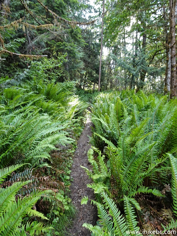
Fern on Mount Daniel Trail Sunshine Coast BC Canada
13. At 1.25 km, Mount Daniel Trail enters Garden Bay Marine Provincial Park. Nothing changes hike-wise, but rules and regulations applicable to BC provincial parks are now in effect.
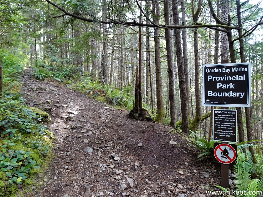
Garden Bay Marine Provincial Park Boundary on Mount Daniel Trail near
Madeira Park BC
14. Mount Daniel Trail at 1.40 km.
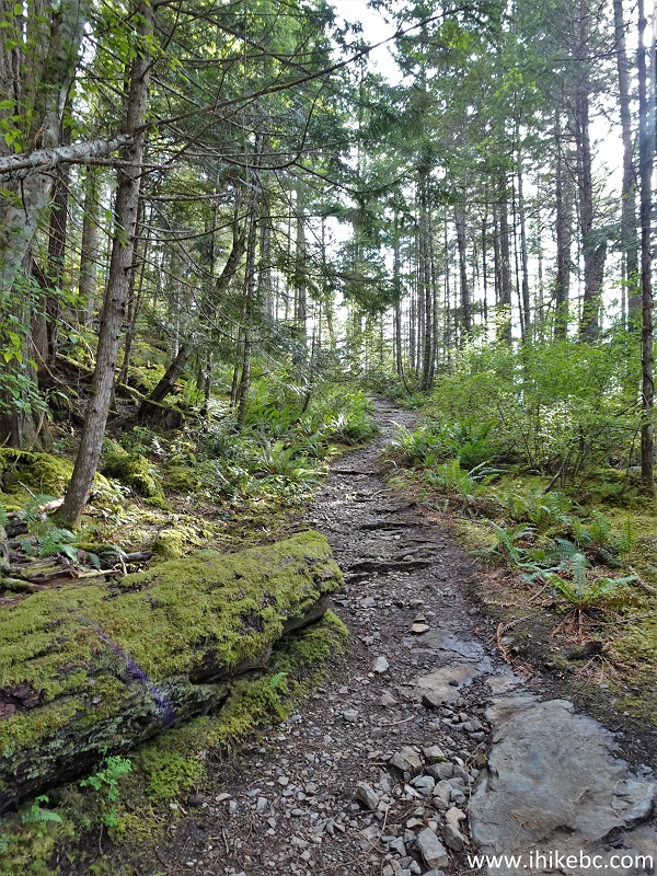
British Columbia Hiking on BC Sunshine Coast
15. At 2.28 km from the parking lot, there is a notice advising of the sensitive nature of this environment.
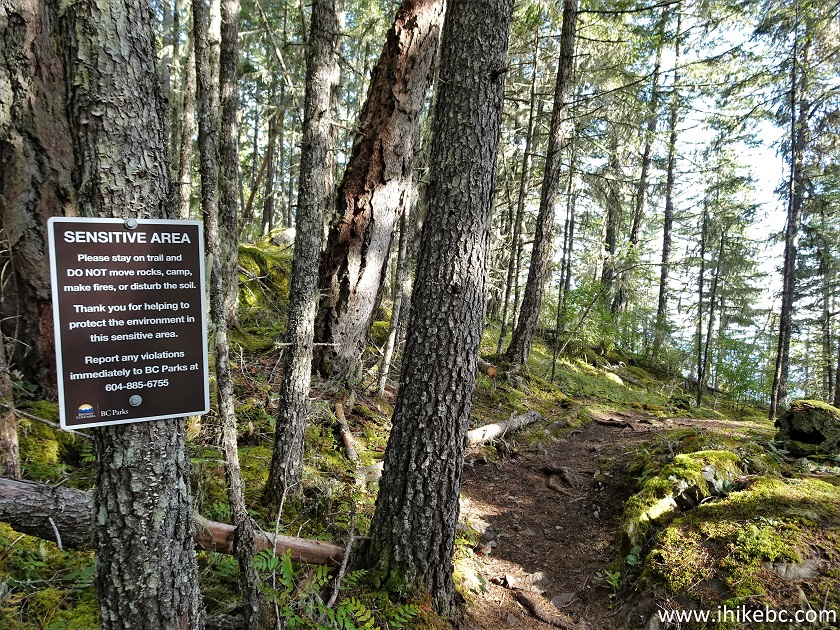
Mount Daniel Trail British Columbia Canada
16. At 2.35 km, we are very close to the end of Mount Daniel Trail.
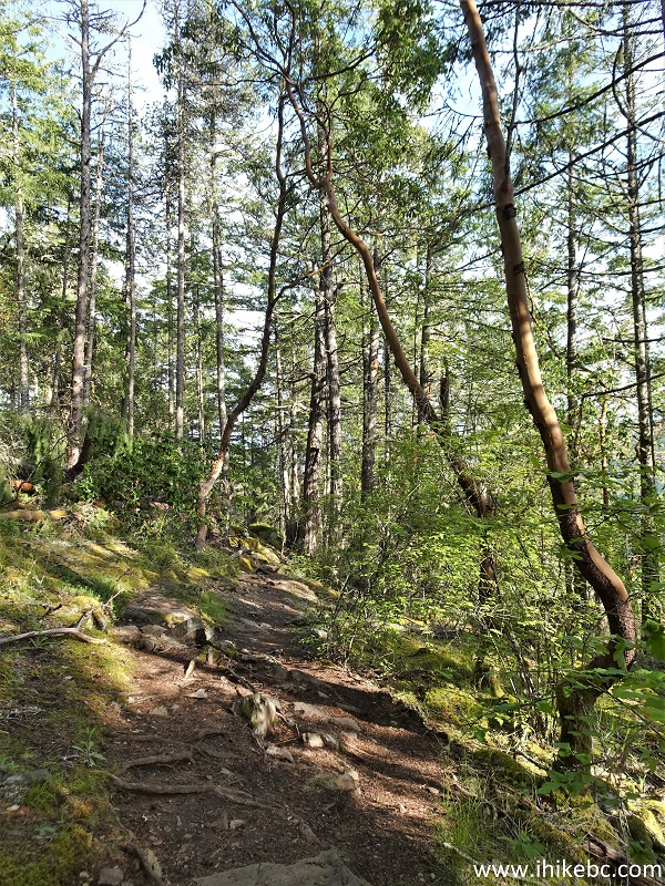
BC Sunshine Coast Hiking - Mount Daniel Trail - near Madeira Park
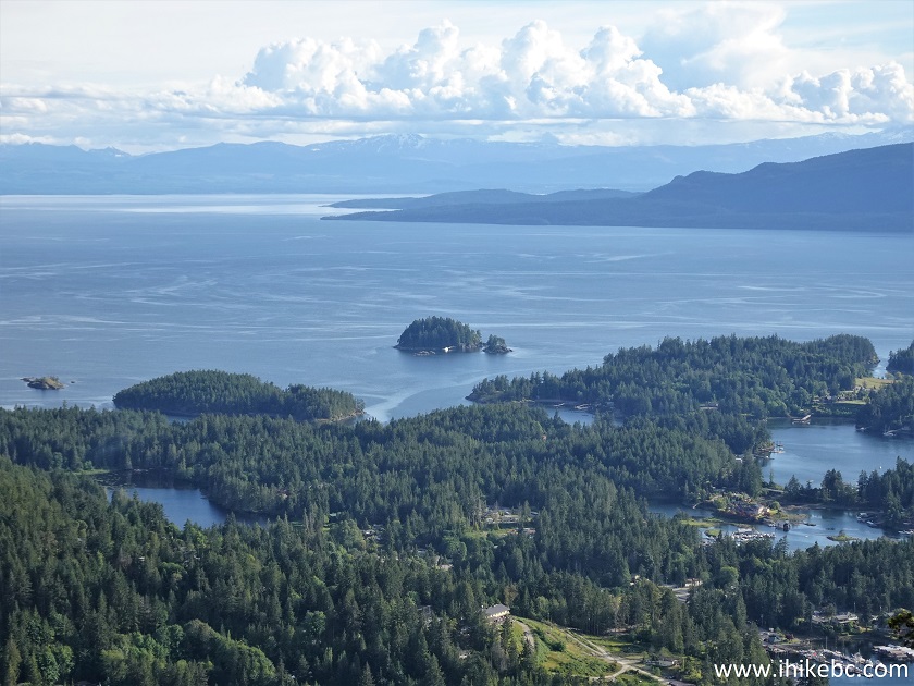
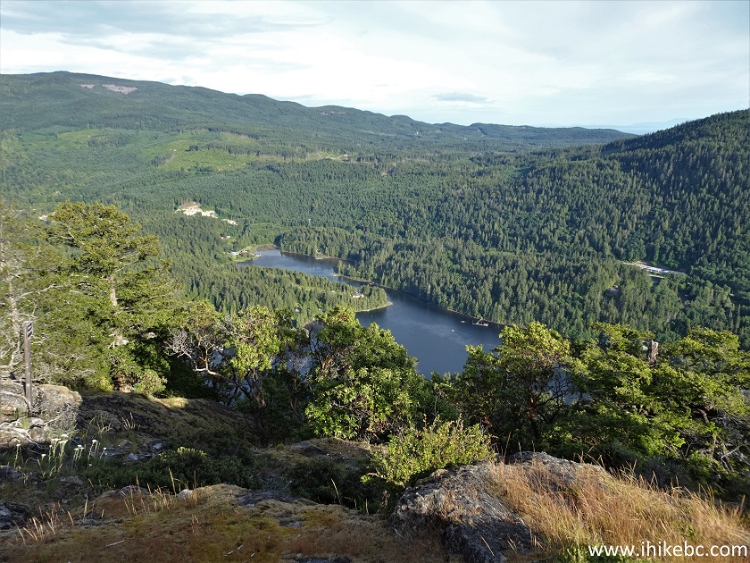
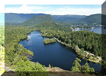
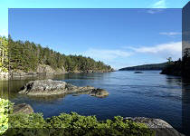
17. And we are at the first (main) viewpoint at 2.40 km from Garden Bay Road parking lot. Coordinates: N 49°38.151’ W 124°00.410’ Elevation: 450 meters (370 meters elevation gain from the parking lot, for an average grade of about 15%).
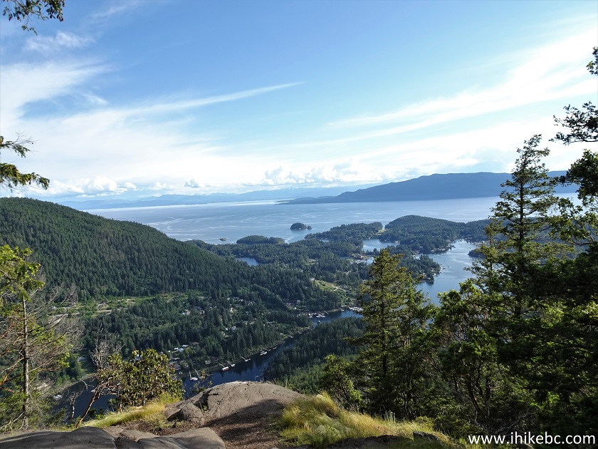
View from Mount Daniel - Sunshine Coast - British Columbia
18. A fine view indeed. Albeit, it could have been better were it not for trees partially blocking the view, especially on the right side.
BC Sunshine Coast - View from Mount Daniel
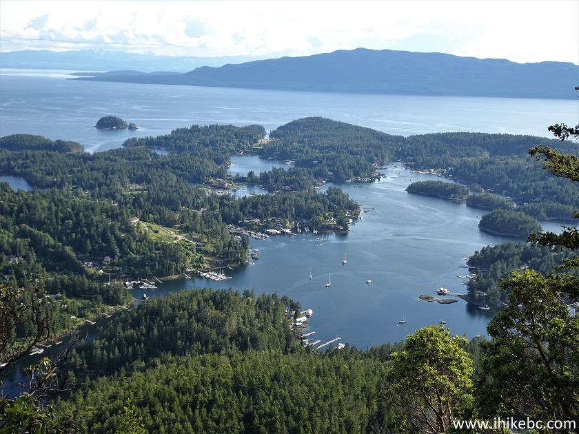
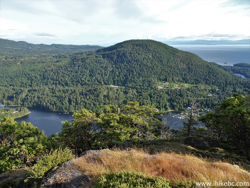
19. Zooming in.
Zoomed view from Mount Daniel
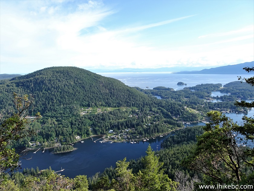
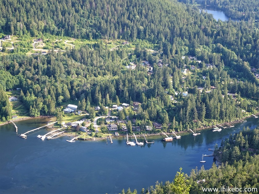
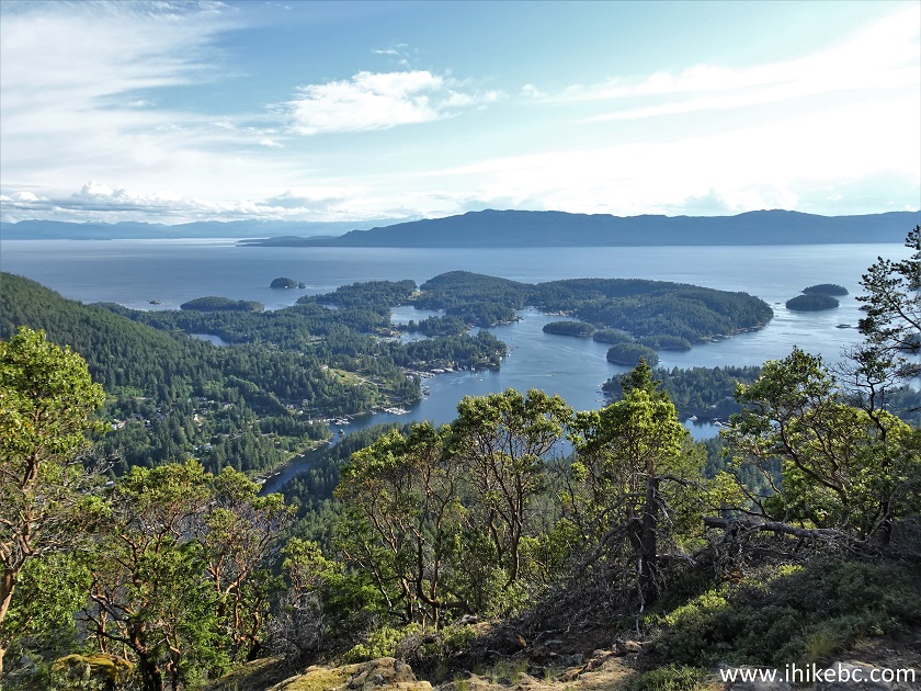
20. Looking right.
BC Sunshine Coast view from top of Mount Daniel
21. Zooming in once again.
Zoomed view from the top of Mount Daniel - British Columbia Sunshine
Coast
Here is our video of the views from this location.
More ihikebc videos are on our YouTube Channel.
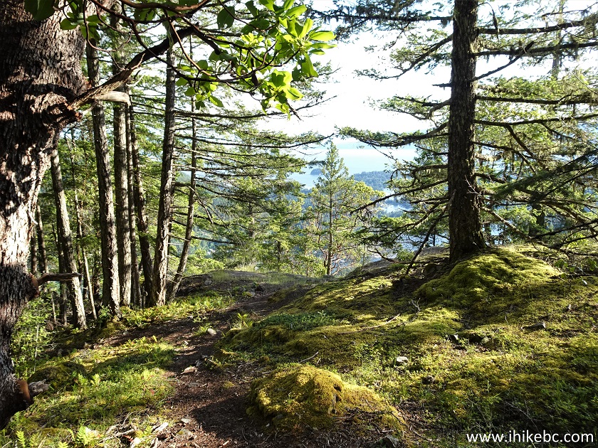
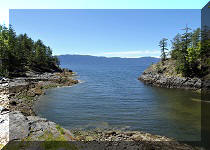
22. The trail continues past the first viewpoint for less than 100 meters and reaches its end (and a second viewpoint).
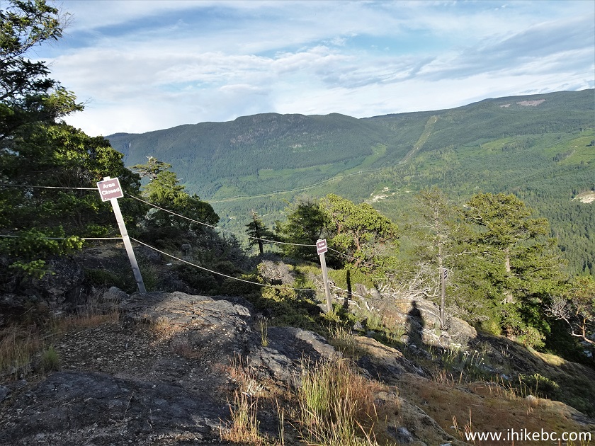
Mount Daniel British Columbia
23-25. The views from the second viewpoint are not as good, though looking to the right is a bit better due to less obstruction by the trees. Left to right.
View from Mount Daniel British Columbia
26. A fine view on the way back where the turnoff to the first viewpoint is located.
Mount Daniel Hike near Sechelt BC Canada
Mount Daniel Trail is fairly challenging, if not too long, and leads to a decent view. Recommended.


|
 |
Other Trips on BC Sunshine Coast:
|
|
|
|
|
|
|
|
|
|
|
Other Trips:


![]()
![]()
![]()
ihikebc.com Trip 260 - Mount Daniel Trail Hike (BC Sunshine Coast North of Sechelt)