![]()
![]()
![]()

Trip 127 - July 28, 2017 (Friday)
Summit Ridge Trail Hike
Stone Mountain Provincial Park
(North of Fort Nelson)
Location: Northeastern British Columbia, in Stone Mountain
Provincial Park, by Highway 97, approximately 138 kilometers North of
Fort Nelson.
Liked: Easy access to trailhead off Highway 97. Fairly easy trail. Panoramic mountain views. Few bugs.
Of note: Several short steep stretches. Loose stones and dirt in some parts of the trail. Small sharp loose stones on final approach. Large hole in the ground partially hidden by vegetation (between first and second hills). Windy in the alpine. Hiking poles and boots are highly recommended.
Northern BC Backroad Mapbook (3rd edition) Approximate Trailhead Location (not marked on the map):
Page 80 (Steamboat) C5.Related Website:
Stone Mountain Provincial Park - BC Parks official site.Other Trips in Fort Nelson Area: Dunedin Trail, Fort Nelson BC Visit, Teetering Rock Trail, Summit Peak Trail, Stone's Sheep Trail.
Summit Ridge Trail is located in Northeastern British Columbia, in Stone Mountain Provincial Park, about 1.5 hr drive from Fort Nelson. This trail is relatively easy, and leads to impressive panoramic mountain views. There are several distinct parts of the trail: initial climb, first hill climb, flat stretch (with a very dangerous partially hidden hole in the ground - see photo #15), second hill climb to the final destination.
1. We are Northbound on Highway 97, about 136 kilometers North of Fort Nelson, and are entering Stone Mountain Provincial Park.
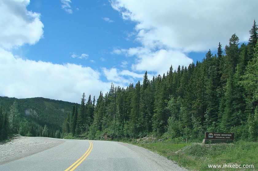
BC Highway 97 at Stone Mountain Provincial Park entrance
2. Two kilometers later, park at a large gravel lot on the right side. Garbage cans for your convenience. A pit toilet is located at Summit Peak trailhead 1.2 kilometers further North (on the right side). Coordinates for the parking lot: N 58⁰39.267' W 124⁰37.887'. Elevation: 1,236 meters.
Parking area for Summit Ridge Trail in Northeastern British Columbia
Canada
3. The trailhead is across the highway, by the poles seen on the far left of the photo above.
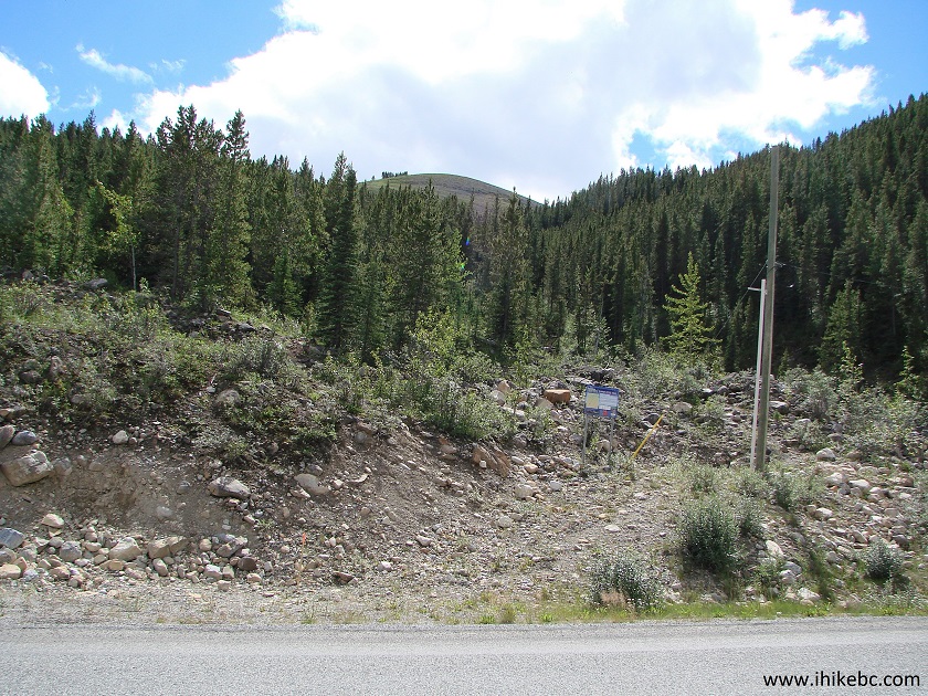
Summit Ridge Trailhead British Columbia Canada
4. Summit Ridge Trail information board. Red colour indicates steep conditions.
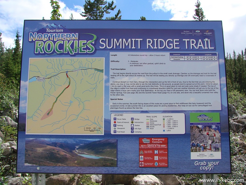
Summit Ridge Trail Information Board
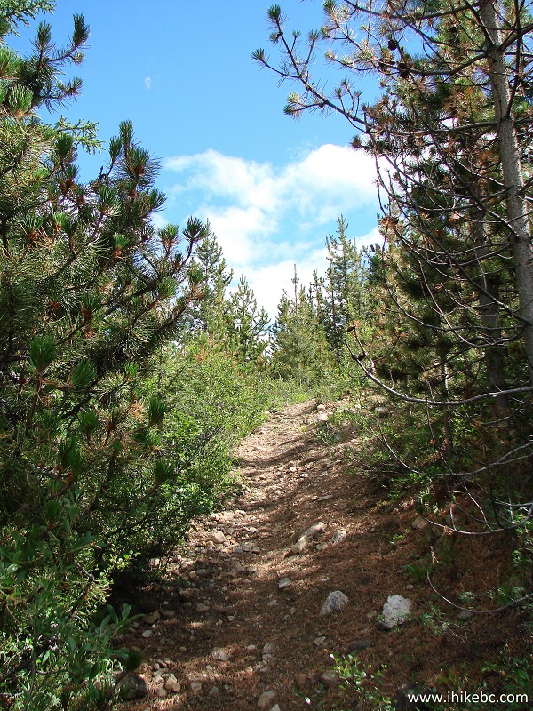
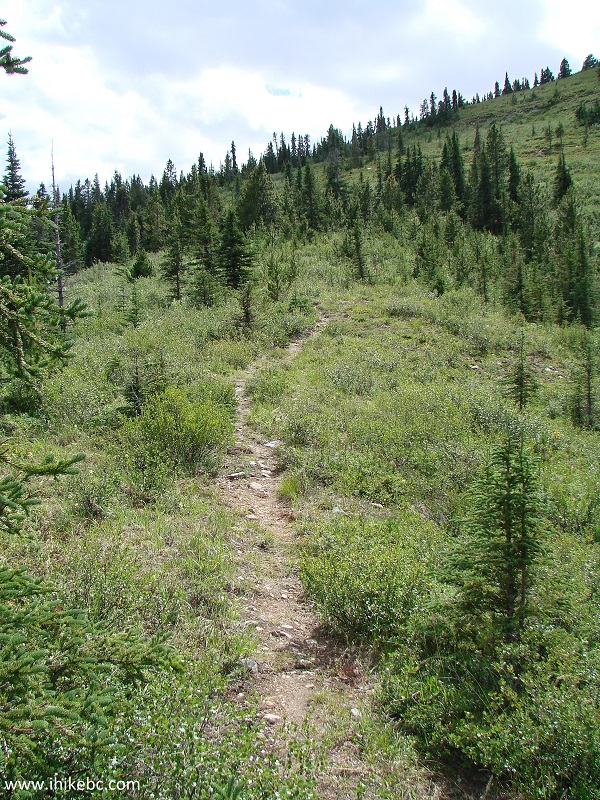
5. The trail begins. It's quite easy to follow at first.
BC Hiking - Summit Ridge Trail in Northeastern British Columbia
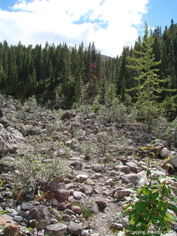
6. Rocks are followed shortly by (mostly) dirt.
Hiking in BC - Summit Ridge Trail North of Fort Nelson
7. Then, there is a dirt/rock mix.
Summit Ridge Trail - Hiking in British Columbia
8. A neat view to the left.
View from Summit Ridge Trail in Stone Mountain Provincial Park British
Columbia Canada
9. Looking back. Not bad either.
Summit Ridge Trail view Northeastern British Columbia Canada
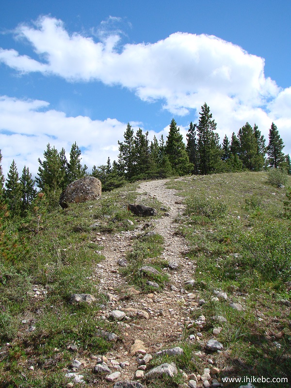
10. About twenty minutes into the hike, the trail enters a stand of small trees. There is a split there, with some unknown trail going to the left. Stay to the right, and start climbing the first hill, keeping as much to the right as possible. Coordinates for the trail split (not pictured): N 58⁰39.054' W 124⁰37.763'. Elevation: 1,373 meters.
Summit Ridge Trail Stone Mountain Provincial Park BC Canada
11. Climbing the first hill.
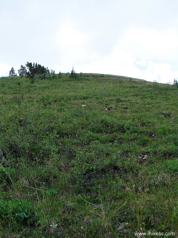
Hiking in Northern BC - Summit Ridge Trail
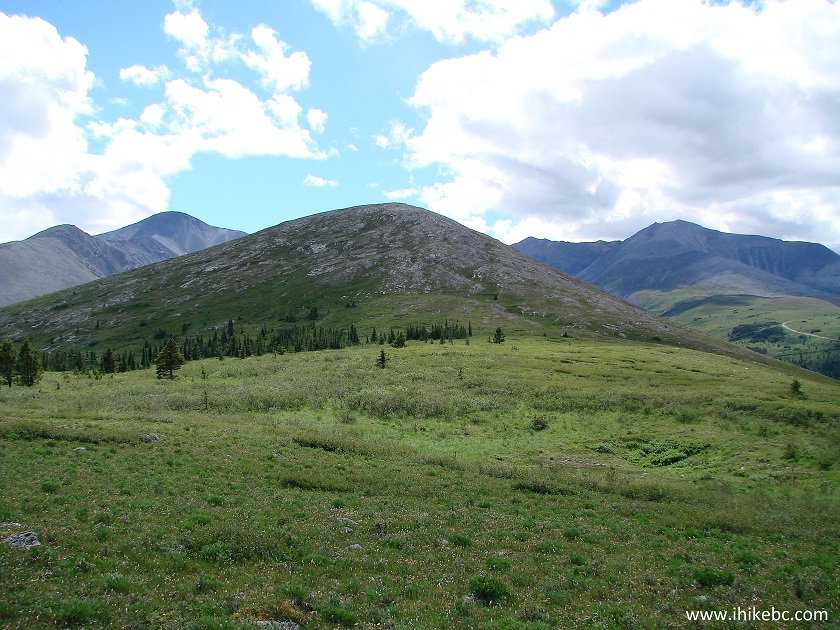
12. We are on top of the first hill, with the second hill seen in the background, and the flat stretch (not seen) ahead before the second hill.
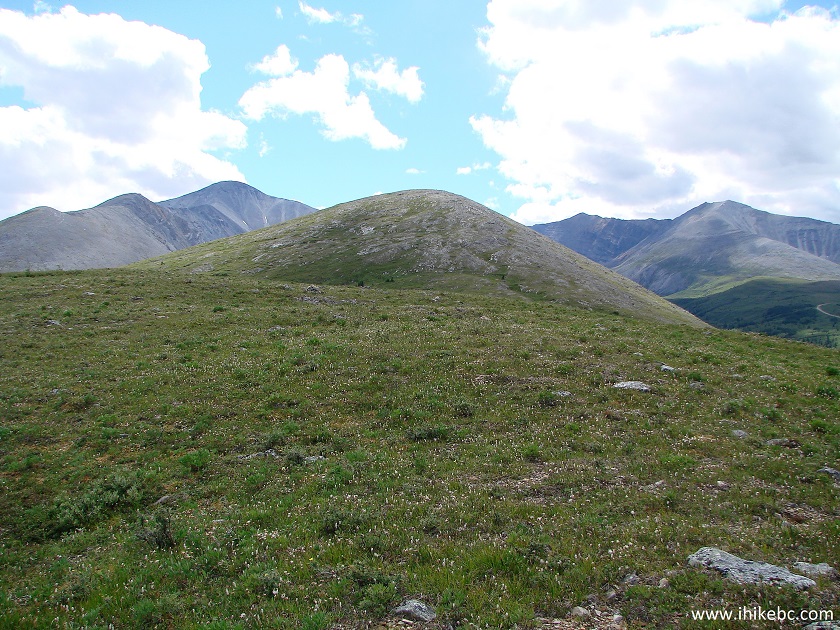
Summit Ridge Trail - Hiking in Northern British Columbia
13. Here is that flat stretch. If you keep as much to the right as you can, chances are pretty good that you won't come even close to the nasty hole in the ground, pictured in photo #15. But, still, beware, and watch after your dog.
Summit Ridge Trail Northeastern British Columbia Canada
14. A fine view to the left. Partially cropped at the bottom.
View from Summit Ridge Hiking Trail North of Fort Nelson BC Canada
15. And here is that hole (warning - dangerous area). The really bad thing about it is that it's partially hidden by vegetation, and sneaks up on you, especially if you are not watching your step. It's about 2 meters long, 1.5 meters wide, and 2 meters deep. Coordinates: N 58⁰38⁰623' W 124⁰38.168'.
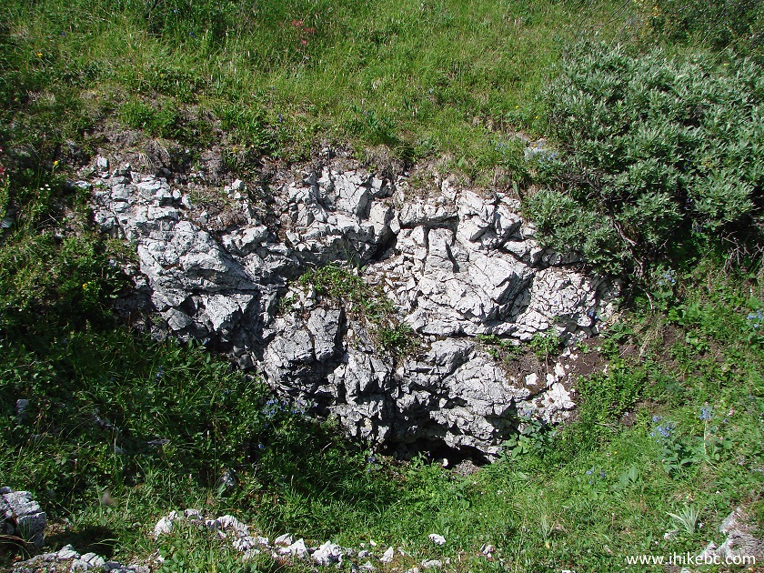
Dangerous Hole - Summit Ridge Trail BC Canada
16. The trail all but disappears after the first hill, but a series of cairns are there to guide you.
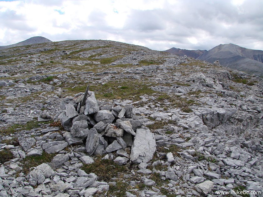
Hike in Stone Mountain Provincial Park
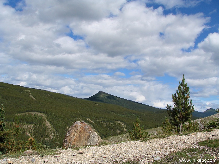
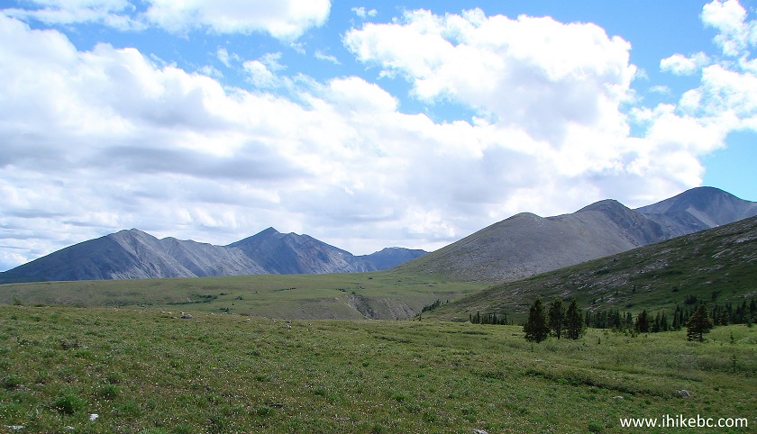
17. The scenery to the right really starts to show itself after the first hill climb, and gets even better after you start climbing the second hill. Looking to the right.
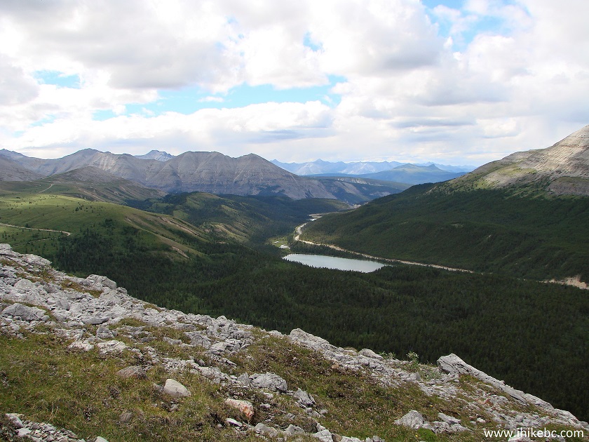
View from Summit Ridge Trail in Stone Mountain Provincial Park British
Columbia Canada
18. More to the right.
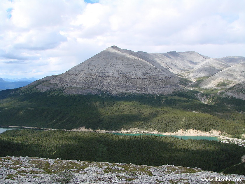
View from Summit Ridge Trail - BC Hiking
19. And some more. The mountain on the right side is Summit Peak, which we hiked the next day.
Hiking in British Columbia - View from Summit Ridge Trail North of Fort
Nelson
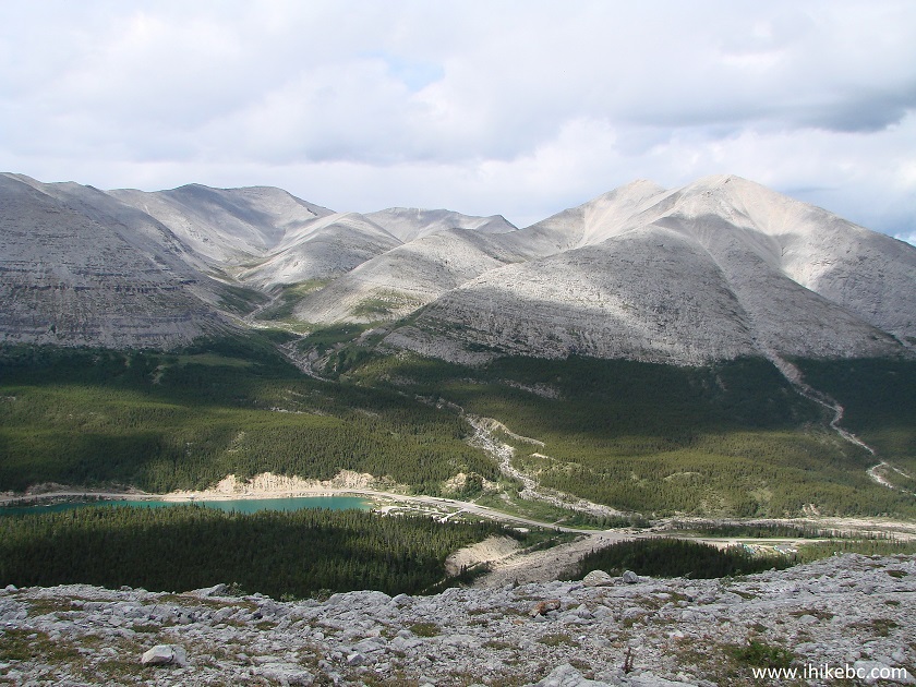
20. A sea of green behind us.
Alaska Highway Hiking in Stone Mountain Provincial Park British Columbia
Canada
21. We are at the final destination on top of the second hill, with a large cairn to mark the occasion. Coordinates: N 58⁰38.325' W 124⁰38.601'. Elevation: 1,639 meters (403 meters elevation gain from the start of the trail).
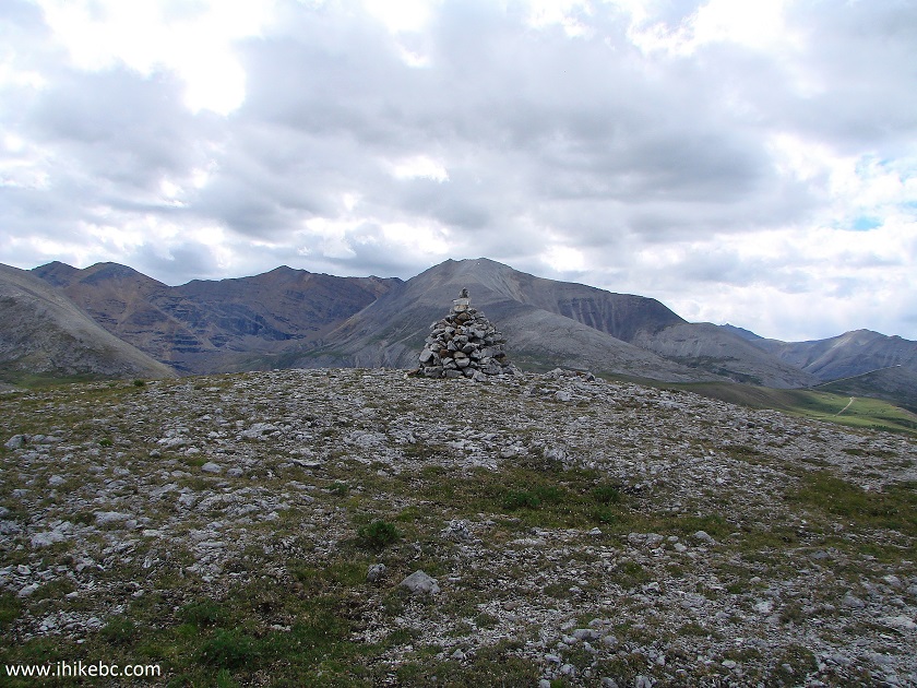
The end of Summit Ridge Trail Northeastern British Columbia Canada
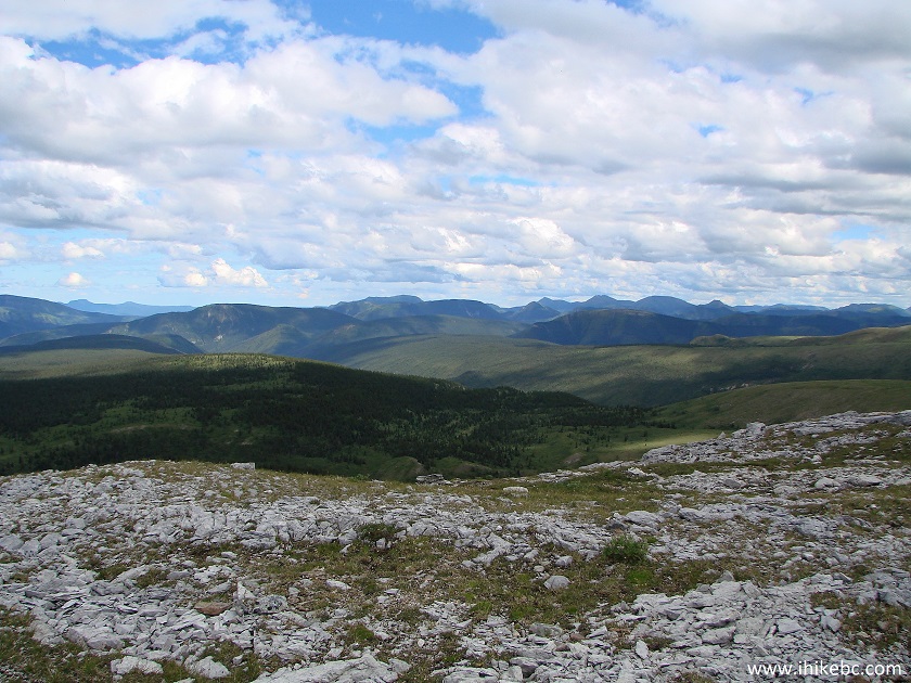
22. One more look to the right.
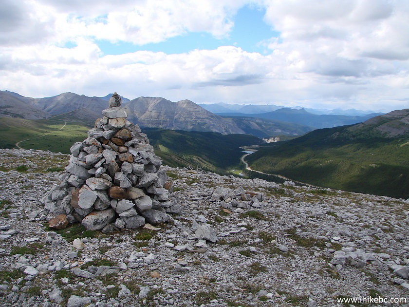
View from the end of Summit Ridge Trail
23. Looking straight ahead past the cairn.
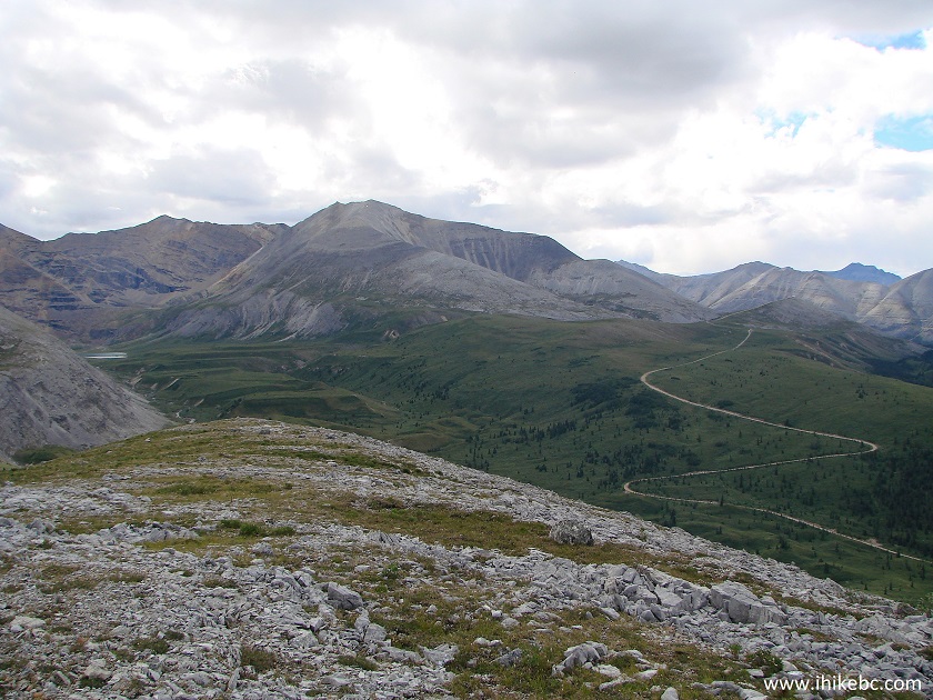
Stone Mountain Provincial park Hiking North of Fort Nelson BC Canada
Here is our video of the views from the end of Summit Ridge hike:
More ihikebc videos are on our YouTube Channel.
24. Our stats for the climb. One hour and twenty minutes is all it took, with a total distance of 2.7 kilometers.
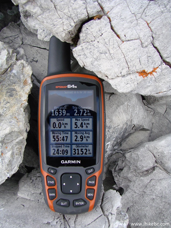
Garmin GPSmap 64s
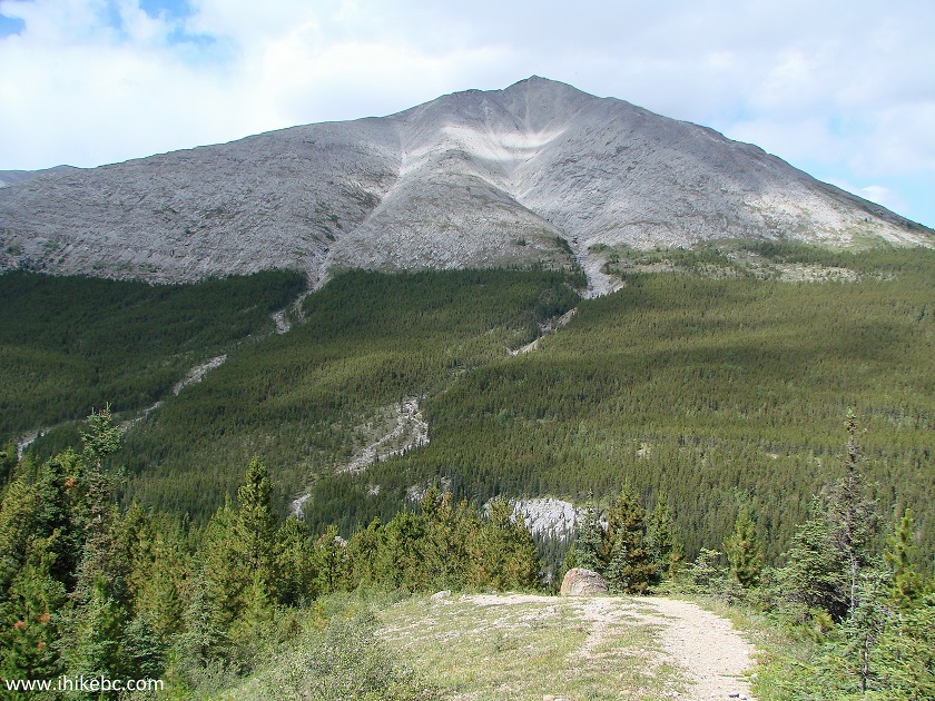
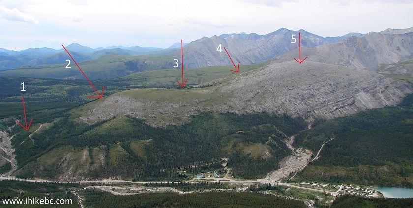
25. The next day, we hiked Summit Peak Trail, and took a photo of the entire Summit Ridge, as it's located directly across from Summit Peak. The numbers are as follows: 1- initial climb, 2 - first hill climb, 3 - flat area (with a hole in the ground), 4 - second hill climb, 5 - final destination (large cairn).
Summit Ridge Trail in Stone Mountain Provincial Park
Summit Ridge Trail is relatively short and easy, and offers great views. Just watch for that hole in the ground. Highly recommended.


|
 |
Other Trips off Alaska Highway / BC Hwy 97:
|
|
|
|
|
|
|
Other Trips:


![]()


![]()
![]()
![]()
ihikebc.com Trip 127 - Summit Ridge Trail Hike (Stone Mountain Provincial Park)