![]()
![]()
![]()

Trip 263 - September 2, 2022 (Friday)
Baba Canyon Hike
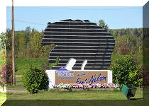
North of Fort Nelson BC / Near Toad River BC
Page 1 of 2
Of Note: No cell signal, limited tree coverage, a very treacherous trail frequently composed of small and large boulders, several creek crossings required (wading may be necessary in high water), (semi-)experienced and well equipped hikers only, hiking poles and boots are essential.
Northern BC Backroad Mapbook (3rd edition) Approximate Trailhead Coordinates: Page 80 (Steamboat) B5.
Baba Canyon is located off BC Highway 97 (Alaska Highway), approximately 150 km North of Fort Nelson and 41 km South of Toad River. The parking lot for Baba Canyon is pretty much right across from the parking lot for MacDonald Creek trailhead of Wokkpash Loop Trail, covered in the previous trip report. The hike is straightforward - go up MacDonald Creek for about 2.75 km to a split, where you take a left drainage and then hike as much or as little as you want after that. We stopped at the 2.65 km mark after the split (for a total distance of 5.4 km one way), but it is possible to hike much further, as well as climb the nearby mountains. Throughout, there are impressive mountain views, a variety of haphazard stone formations in the creek bed, and several fine small waterfalls.
This hike is better done late in the season, as high water level in McDonald Creek would force you to wade more than you might want. That said, the waterfalls would certainly be more impressive the more water there is in the creek. There is a path here and there on both sides of the creek, but crossing the creek is required several times. We managed to do stone-hopping this late in the season, but get ready for substantial wading, should you desire to get to the best views of the hike.
As there are numerous opportunities to get hurt in Baba Canyon due to a whole lot of loose stones large and small, as well as frequent slippery nature of the surface, this hike is suitable for folks with at least some hiking experience, and with all the necessary hiking equipment.
*All trail distances are based on a GPS odometer and are approximate.
1. We are Northbound on BC Highway 97 (Alaska Highway), approximately 150 km North of Fort Nelson.
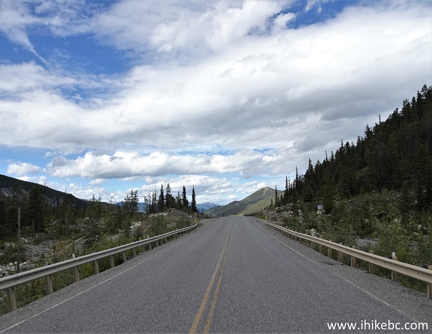
BC Highway 97 near Toad River British Columbia
2. Just after crossing the bridge seen in the photo above, make a right turn onto Baba Canyon parking lot access road. MacDonald Creek trailhead of Wokkpash Loop Trail is on the left just a bit further down Highway 97.
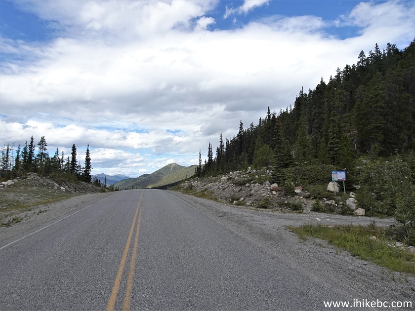
BC Highway 97 at Baba Canyon access road turnoff
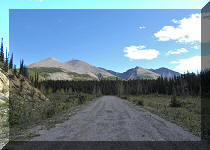
3. The access road is very short - 100 meters or so.
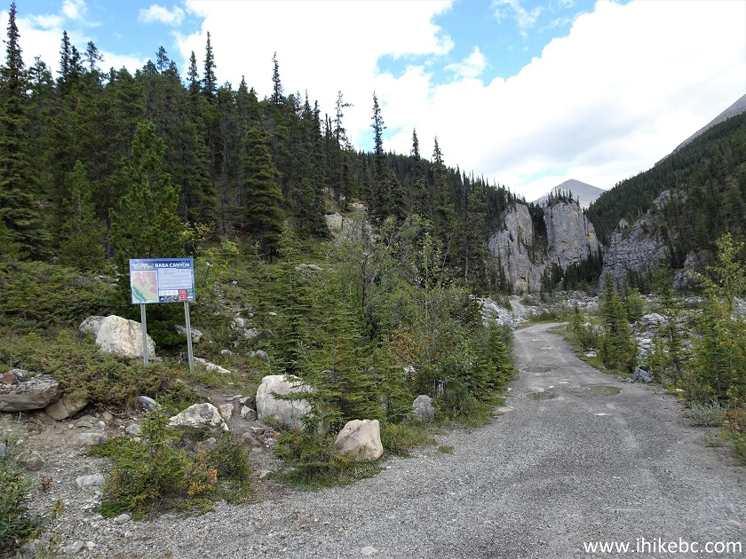
Baba Canyon Access Road
4-6. Here is Baba Canyon information board, including a trail description and a map. Basically, hike up to the creek split, and then take the left drainage. There is an option of climbing up on the right side at the split for a viewpoint, but we did not do that, as it appeared too steep. Besides, there were great views everywhere anyway, and the sun was shining from behind, so climbing up to look back (which is what the board is suggesting, as we understand), is better be done in the early morning or on a cloudy day to avoid the sun glare.
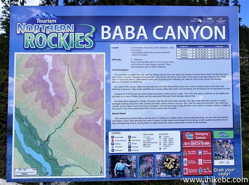
Baba Canyon Information Board
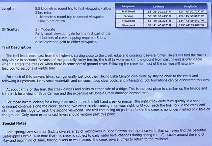
Baba Canyon Trail Information
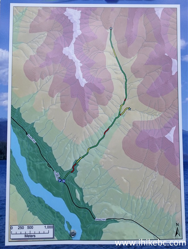
Baba Canyon Trail Map
7. Baba Canyon parking lot. Coordinates: N 58°39.546’ W 124°45.832’. Elevation: 1,130 meters.
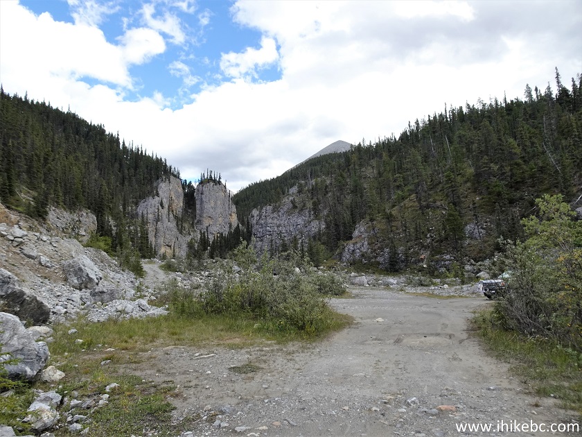
Baba Canyon Trail Parking Lot
8. Baba Canyon Trail begins.
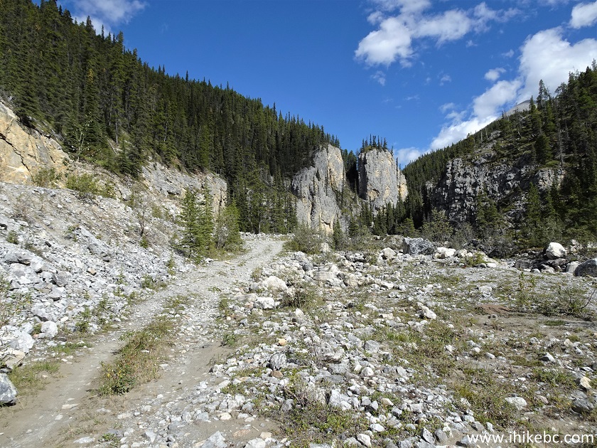
Baba Canyon Trailhead
9. The first fine view arrives at 140 meters from the parking lot.
Northern British Columbia Hiking - Baba Canyon Trail
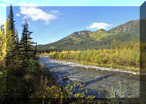
10. At 180 meters, the first crossing of MacDonald Creek. The general idea is to head upstream, however you can. There is an occasional obvious path on either side of the creek. Do keep in mind that this is the end of a fairly dry season, and the water level would be substantially higher earlier in the Summer or after a heavy rainfall.
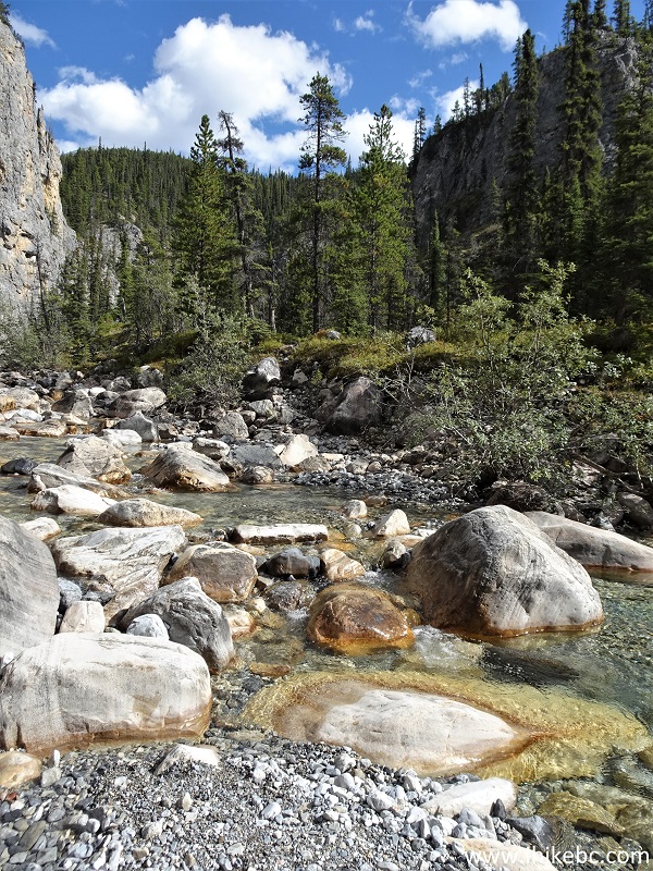
MacDonald Creek at Baba Canyon - Northern British
Columbia - Canada
11. At 450 meters, an obvious path leads us forward.
Baba Canyon Trail Hike
12. Another MacDonald Creek crossing at 600 meters from Baba Canyon parking lot.
MacDonald Creek Northern British Columbia Canada
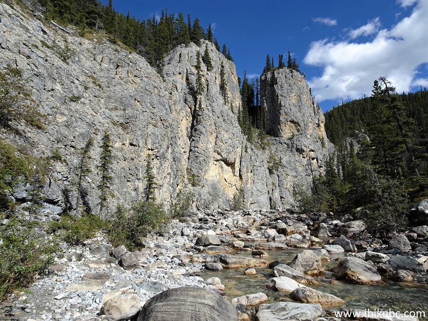
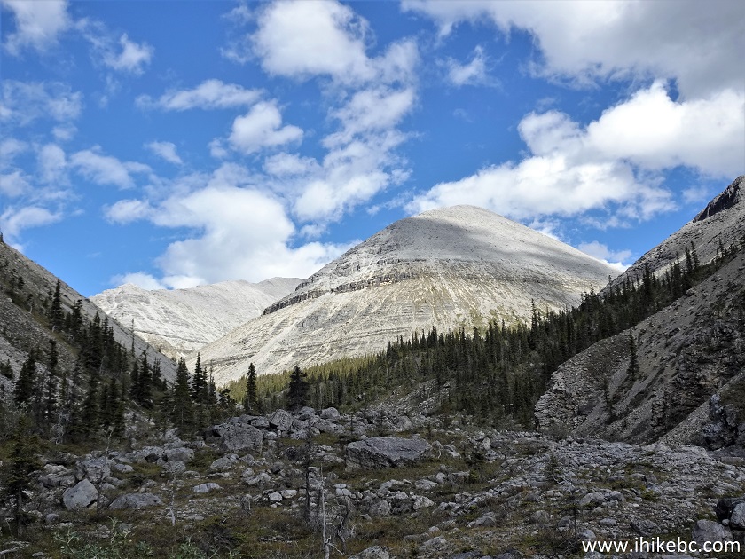
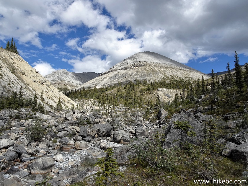
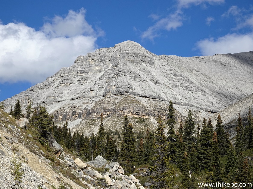
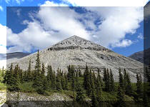
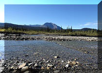
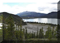
13. At 700 meters, we see a mountain in the distance, which is a part of a very impressive mountain group.
British Columbia Hiking - Baba Canyon
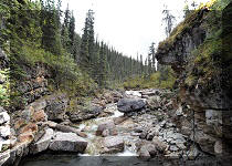
14. Waterfall #1 arrives at 1.04 km of the hike.
Baba Canyon
15. Hiking up a creek bed is a lot of fun, but not without its dangers. Hiking poles and boots are essential here.
Baba Canyon British Columbia
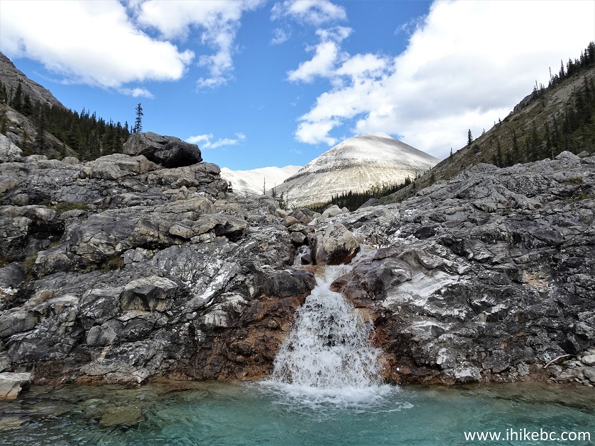
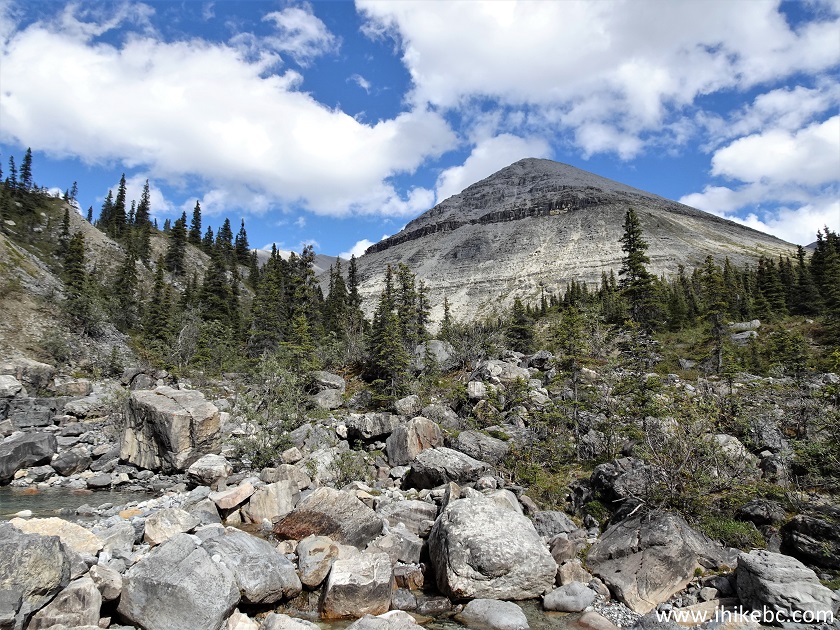
16. At 2.0 km we see the same mountain as in the photos above, but with much sun illumination. As well, waterfall #2 can be observed in the middle of the photo.
Baba Canyon North of Fort Nelson BC Canada
17. On the way back, we discovered a path which goes above this waterfall, so here is a view from that point.
Baba Canyon Waterfall
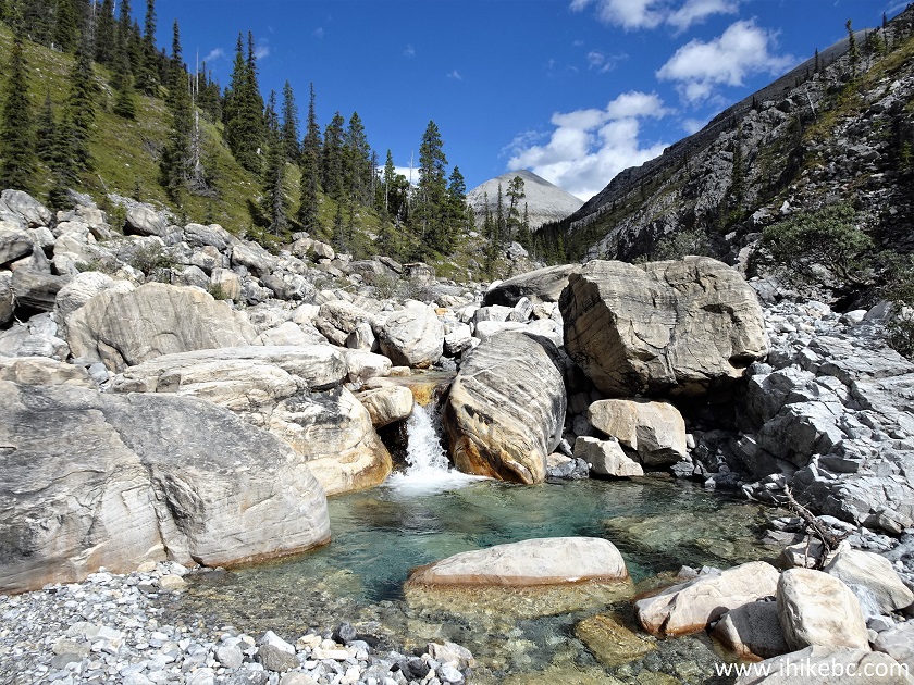
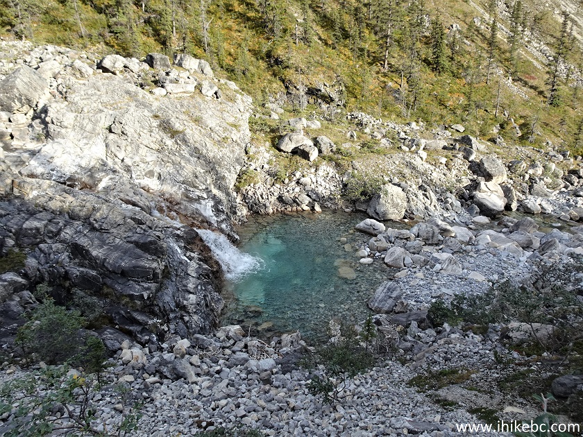
18. But, while hiking up we went through the creek bed, and here is a close-up view of waterfall #2. At 2.06 km here.
Waterfall in Baba Canyon in Northern British Columbia
Here is our video of the views from this location.
More ihikebc videos are on our YouTube Channel.
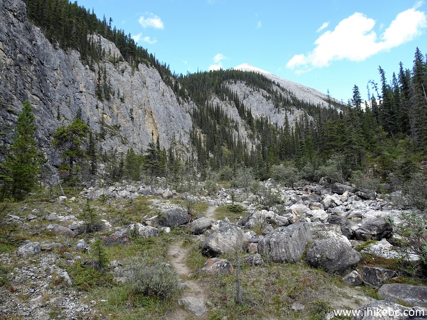
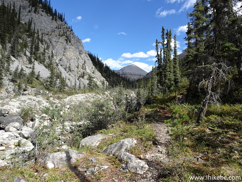
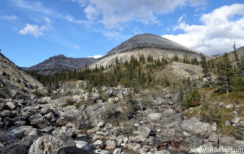
19. At 2.15 km, we are getting closer to that mountain we saw from a while back, and another mountain is starting to appear to the left of the first one.
Baba Canyon
20. There is a canyon on the left side at 2.30 km. We did not go there, but looks like a promising area to explore.
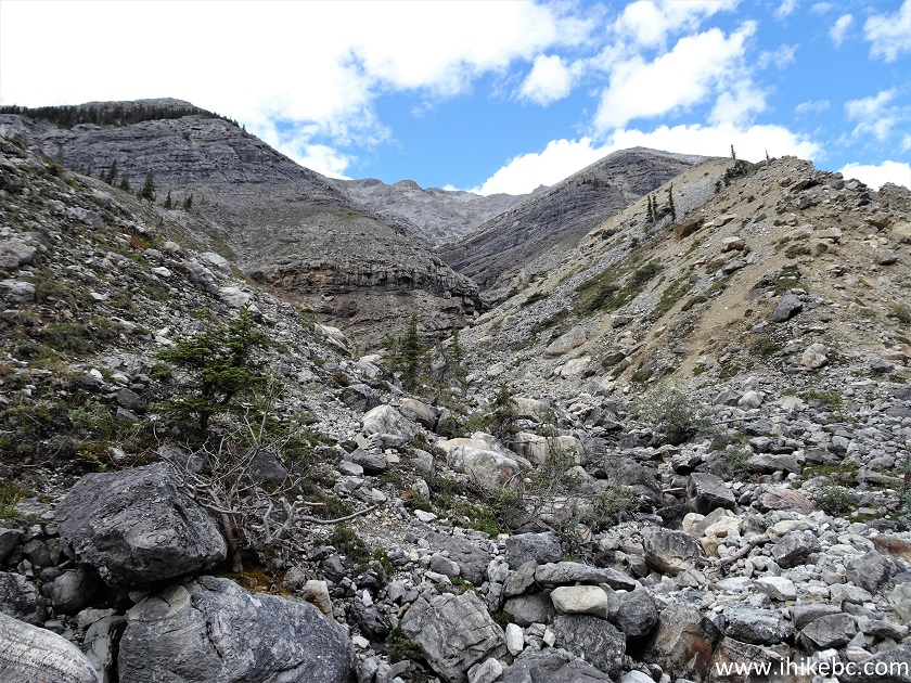
Baba Canyon Hike
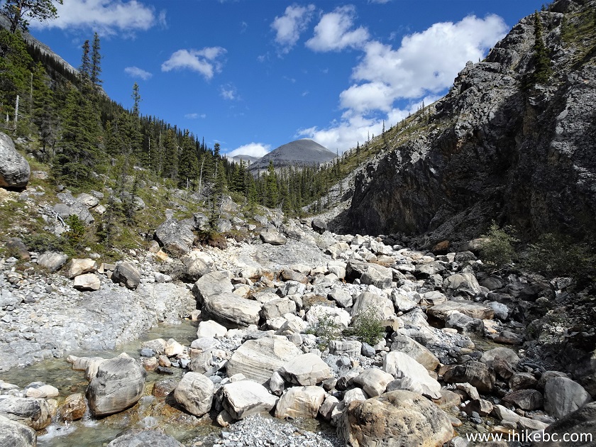
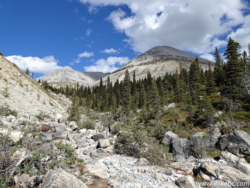
21. At 2.50 km, we are getting close to the split in creek drainages.
Hiking Baba Canyon North of Fort Nelson BC Canada
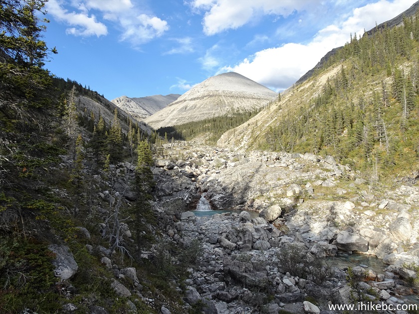
22. And here is that split, at 2.75 km. The info board recommends climbing on the right side to take a look back at MacDonald Creek drainage, which we did not do due to the sun, and it also appeared quite steep there, though doable. As for this split, the info board says take the left drainage, which is what we did.
Baba Canyon Mountains
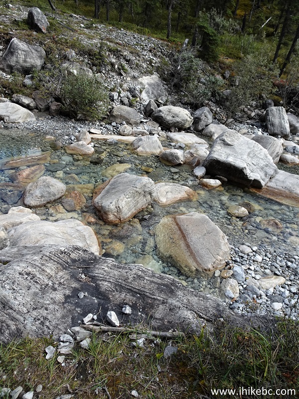
23. Going forward, the distances would be counting from the split above. Here is an example of a fine haphazard stone formation, 70 meters from the split.
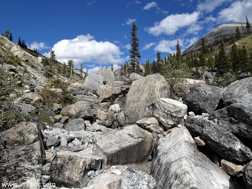
Baba Canyon British Columbia Canada
24-25. At 140 meters, the second mountain becomes more and more visible. Plain and zoomed views.
Baba Canyon Mountain View
26. At 320 meters, we are still hiking up the creek bed. The path on the side of the creek all but disappears after the creek drainage split.
Hike in British Columbia - Baba Canyon
Our Baba Canyon Hike Continues on Page 2.


|
 |
Other Trips in Fort Nelson Area:
|
|
|
|
|
|
|
|
|
|
|
|
|
|
|
|
Other Trips:


![]()
![]()
![]()
ihikebc.com Trip 263 - Baba Canyon Hike (North of Fort Nelson BC) Page 1 of 2