![]()
![]()
![]()

Trip 155 - June 3, 2019 (Monday)
Greendrop Lake Trail Hike
Via Lindeman Lake in Chilliwack Lake Provincial Park
Page 2 of 2
Distance from Vancouver to the Trailhead: 136 kilometers: 90.5 km from Vancouver via Highway 1 East (Grandview Hwy entrance to Hwy 1) to Exit 119 (Yale Rd / Vedder Rd) in Chilliwack. Then, 5.5 km on Vedder Road to Chilliwack Lake Road. Then 40 km on Chilliwack Lake Road to the trailhead parking lot.
Liked: Lake views, mountain view, haphazard stone formations, waterfall at Greendrop Lake, a fairly easy trail, shade in the forest, almost no bugs.
Of Note: The trail is popular, some muddy sections, the trail becomes moderately challenging after Lindeman Lake. Hiking boots and poles are recommended (to Lindeman Lake) and are highly recommended on the trail to Greendrop Lake. Backcountry camping is subject to a $5 per day fee.
Vancouver, Coast & Mountains BC Backroad Mapbook (2nd edition) Trailhead Coordinates: Page 5 (Chilliwack Lake) F5.
103 Hikes in Southwestern British Columbia (2008 edition): hike #74.
Related Website: Chilliwack Lake Provincial Park - BC Parks Official Site.
Other Trips in or near Chilliwack Lake Provincial Park: Chilliwack Lake Forest Service Road, Radium Lake Trail, Chilliwack Lake Provincial Park.
Other Trips in Chilliwack Area: Williams Ridge Trail, Mount Thom Lookout Loop Trail, Vedder Rotary Loop Trail, Teapot Hill Trail Hike, Chilliwack Dyke Trail, Mount Cheam Peak Trail, Ling Lake Trail Hike (off Chilliwack Foley FSR), Chilliwack Foley FSR, Chilliwack Bench FSR, Elk-Thurston Trail, Slesse Memorial Trail, Downtown Chilliwack BC Visit, Minter Gardens, Town of Agassiz BC, Bridal Veil Falls Provincial Park.
Little did we know slightly less than nine years ago, in August of 2011, while hiking Radium Lake Trail in Chilliwack Lake Provincial Park, that a much better (albeit substantially more crowded) alternative exists just a few kilometers away. Greendrop Lake Trail (called Post-Greendrop trail in Backroad Mapbook) goes for just over seven kilometers, and is vastly more picturesque than its Radium Lake counterpart. Greendrop Lake Trail takes you past Lindeman Lake with its camping area, and ends at Greendrop Lake, where camping is also quite popular. The trail to Lindeman Lake takes about an hour, and is easy enough for schoolchildren, of whom we met a school bus-full today. Past Lindeman Lake, the trail is more complicated, and features substantially fewer fellow hikers. It takes another 1.5 to 2 hours to get to Greendrop Lake, and one would have to cross several boulder fields, and climb over very large fallen trees at the end of the trail. Flora Lake trailhead starts at the same parking lot, and, depending on trail conditions, it may be possible to hike in a loop, though taking into consideration that Flora Lake Trail is much more difficult than Greendrop Lake Trail.
26. At the end of Lindeman Lake, a short ladder brings you down, and then there is more stone-hopping to be done. It's another 1.5-2 hours to Greendrop Lake from Lindeman Lake.
Greendrop Lake Trail - Hiking in Chilliwack BC area
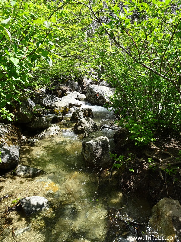
27. Stone-hopping would also be useful to avoid getting your feet wet in some muddy sections.
Chilliwack Hiking - Greendrop Lake Trail
28. Then, there is one more boulder field to cross.
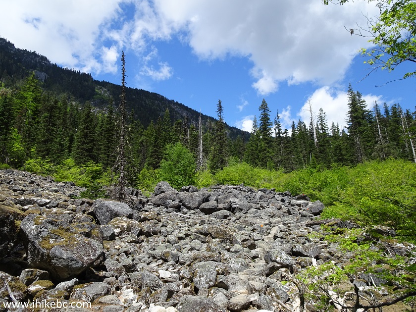
Greendrop Lake trail - Chilliwack Trail in British Columbia Canada
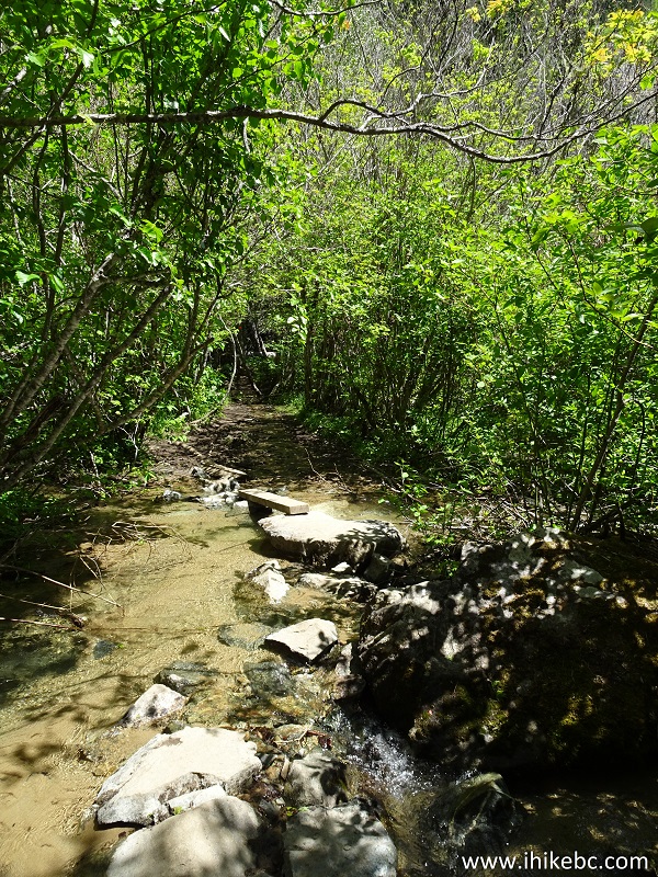
29. And more stone-hopping is in store. Stay to the right after the first stone seen in the bottom right corner - it allows to walk around this area.
Greendrop Lake Trail - Hiking in British Columbia
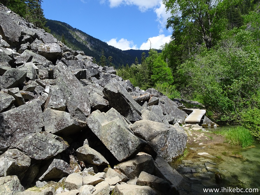
30. This next boulder field was the longest by far - about several hundred meters.
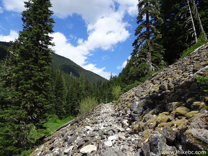
British Columbia Hiking - Greendrop Lake Trail in Chilliwack Lake
Provincial Park
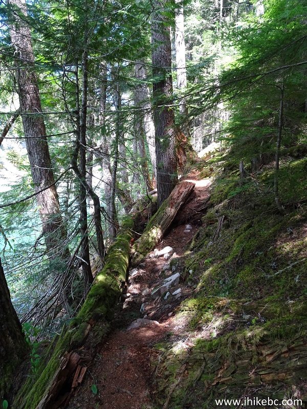
31. It's not all stones - the trail also goes through a forest with its numerous roots.
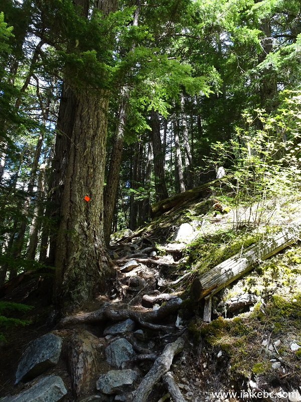
BC Hiking - Greendrop Lake Trail near Chilliwack British Columbia Canada
32. One more bridge across Post creek (thus, the Post-Greendrop trail name in Backroad Mapbook).
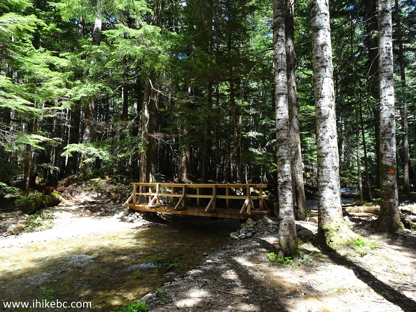
Post Creek near Chilliwack BC
33. The view from the bridge.
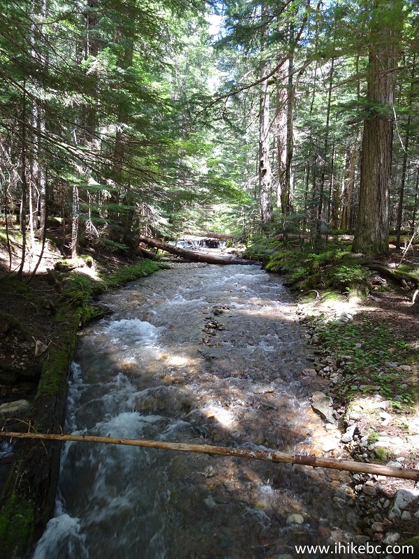
Post Creek in Chilliwack Lake Provincial Park
34. And here is the other Greendrop Lake / Flora Lake trails connector, indicated by a white arrow in photo #9. It's 700 meters from here to Greendrop Lake. If you do the math with the distances shown on the stand seen below, the distance from the trailhead to Greendrop Lake is 6.0 km. Our GPS distance indicator showed 8+ kilometers that we hiked to Greendrop Lake, albeit with several short side trips.
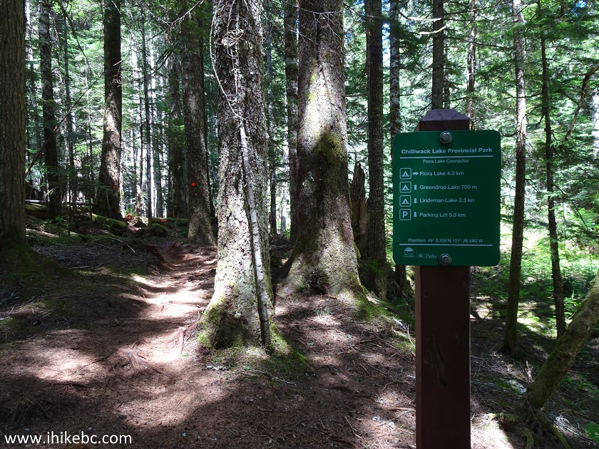
Greendrop Lake Trail - Trail in Chilliwack Area
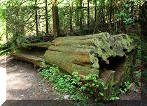
35. The final obstacle just several hundred meters before Greendrop Lake are these large fallen trees.
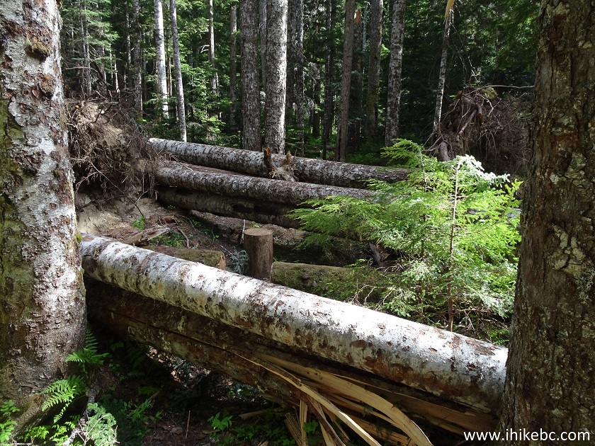
Greendrop Lake trail in Chilliwack Lake Provincial Park - hiking in
British Columbia
36. And here it is - Greendrop Lake camping area. It took us less than 3 hours to get here from the trailhead, despite numerous stops to take photos, and a few very short side trips. Coordinates: N 49⁰08.282' W 121⁰26.150'. Elevation: 932 meters (298 meters elevation gain from the trailhead).
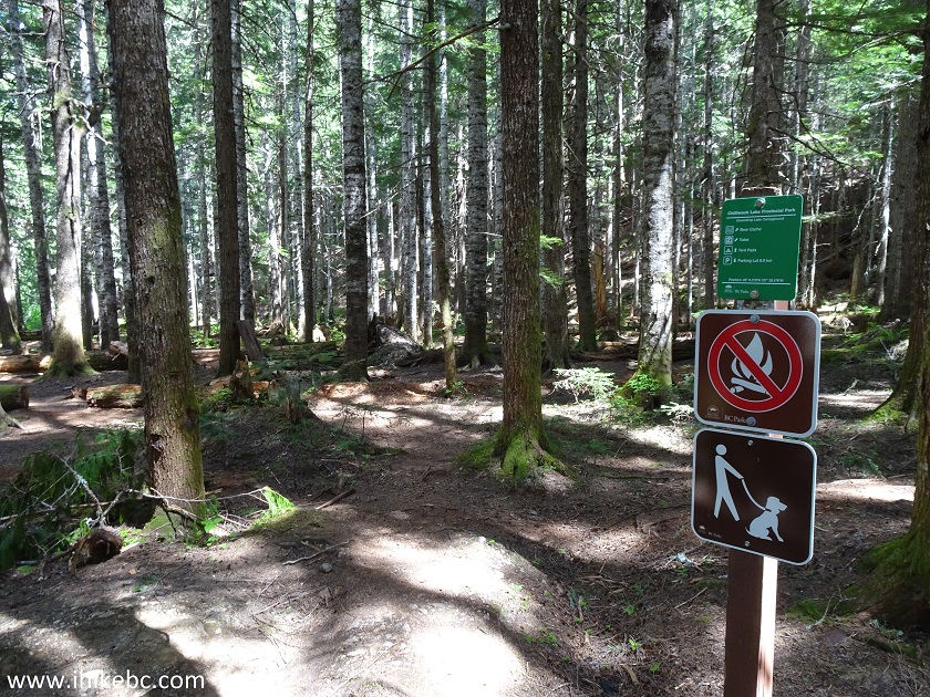
Greendrop Lake Camping Area in Chilliwack Lake Provincial Park
37. Camping it is.
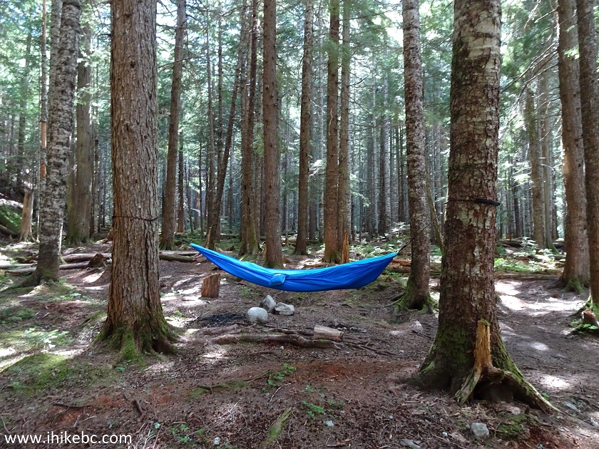
Camping by Greendrop Lake - Camp in Chilliwack Area
38. A tent by Greendrop Lake.
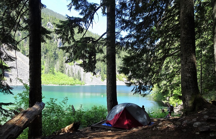
Greendrop Lake in Chilliwack Lake Provincial Park
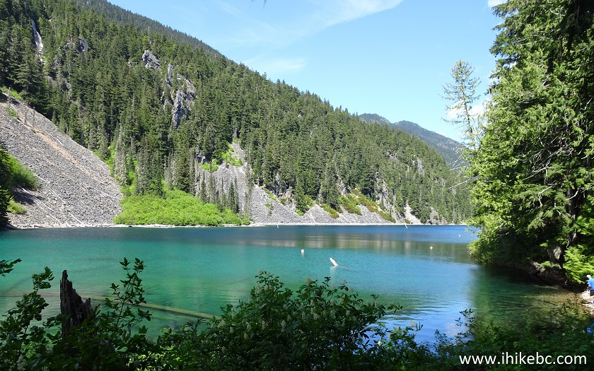
39. Greendrop Lake is not all that impressive.
Greendrop Lake near Chilliwack BC Canada
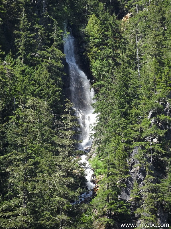
40. But it features a very neat waterfall on the other side of the lake - zoomed view.
Greendrop Lake Waterfall - near Chilliwack BC Canada
Here is Our Video of Greendrop Lake Falls:
More ihikebc videos are on our YouTube Channel.
41. Both the Backroad Mapbook printed edition, and the Backroad Mapbook software in our GPS showed a trail on the left (North) side of Greendrop Lake, connecting, eventually, with Silver-Skagit Road. However, we could see no trail on that side of the lake, and the terrain is way too steep there, so who knows. There is, however, a short trail on the South side of the lake, as seen in this photograph.
A trail by Greendrop Lake - Hike in Chilliwack Area
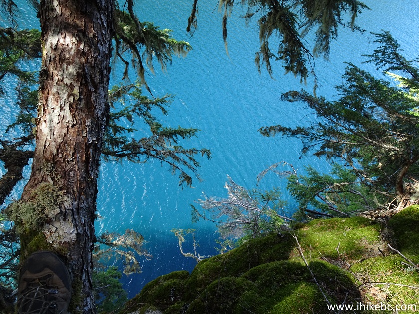
42. You can take this trail to get to a few good fishing / swimming spots.
Hiking by Greendrop Lake near Chilliwack BC
43. About 500 meters from the camping area, the easy trail along the lake ends at this bench / fire pit / waterfall observation point. Coordinates: N 49⁰08.400' W 121⁰25.969'. Elevation: 951 meters.
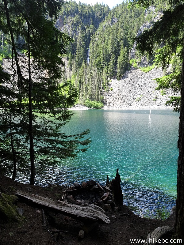
Greendrop Lake British Columbia Canada
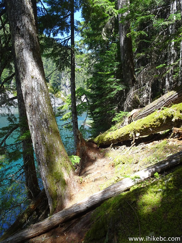
44. It is possible to carry on, but the terrain gets very steep, and comes really close to the edge of the lake at some point.
Greendrop Lake
Whether it's an easy hike to Lindeman Lake, or a more challenging hike to Greendrop Lake, this trail has a lot to offer to hikers of many different levels of experience. Highly recommended.


|
 |
Other Trips in Chilliwack BC Area:
|
|
|
|
|
|
|
|
|
|
|
|
|
|
|
|
|
|
|
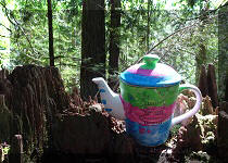
Teapot Hill Trail
|
|
Vedder Rotary Trail
|
|
Mount Thom Trail
|
|
Flora Lake Trail  |

Other Trips:


![]()


![]()
![]()
![]()
ihikebc.com Trip 155 - Greendrop Lake Trail Hike (Near Chilliwack BC) Page 2 of 2