![]()
![]()
![]()

Trip 056 - August 15, 2011 (Monday)
Radium Lake Trail Hike
Chilliwack Lake Provincial Park BC Canada
Distance From Vancouver to Trailhead:
138 kilometers: 90.5 km from Vancouver
(Grandview Hwy entrance to Hwy 1 East) to Exit 119 (Yale Rd / Vedder Rd)
in Chilliwack. Then 5.5 km on Vedder Road to Chilliwack Lake Road. Then
40.5 km on Chilliwack Lake Road to Chilliwack Lake Provincial Park. Then
walk South for about 10 minutes along the lake to the trailhead located across a bridge.
Liked: Mountains around the lake. Several creek crossings. Fairly interesting forest. Very few bugs except right at the lake.
Of note: Remote wilderness area. Limited number of good views. The trail is easy to moderately challenging, but can be dangerous in wet conditions. Many fallen trees make parts of the trail a bona fide obstacle course. Hiking poles and boots are highly recommended. Several stretches of the trail are grossly overgrown - be very careful while hiking through these stretches, as the ground could be uneven, and there are some hidden holes in the middle of the path - a high potential for a broken ankle. The lake itself is more like a pond - it is that small.
Vancouver, Coast & Mountains Backroad Mapbook (2010 edition) Coordinates: Page 5 (Chilliwack Lake) E6.
103 Hikes in Southwestern British Columbia (2008 edition): hike #73.
Related Website: Chilliwack Lake Provincial Park - BC Parks Official Site.
Other Trips in or near Chilliwack Lake Provincial Park: Flora Lake Trail, Greendrop Lake Trail, Chilliwack Lake Forest Service Road, Chilliwack Lake Provincial Park.
Other Trips in Chilliwack Area: Williams Ridge Trail, Mount Thom Lookout Loop Trail, Vedder Rotary Loop Trail, Teapot Hill Trail Hike, Chilliwack Dyke Trail, Greendrop Lake Trail, Mount Cheam Peak Trail, Ling Lake Trail Hike (off Chilliwack Foley FSR), Chilliwack Foley FSR, Chilliwack Bench FSR, Elk-Thurston Trail, Slesse Memorial Trail, Downtown Chilliwack BC Visit, Minter Gardens, Town of Agassiz BC, Bridal Veil Falls Provincial Park.
Follow @ihikebc TweetRadium Lake Hiking Trail start is located in Chilliwack Lake Provincial Park. Check out our previous trip report for trailhead directions. This trail does not lead to many good views, though the mountains around the lake look impressive. For better views, it appears you would need to continue on to Mt. Webb trail, which is much steeper, and starts at Radium Lake.
1. We are about to cross the bridge separating Chilliwack Lake Provincial Park camping area from the Radium Lake trailhead.
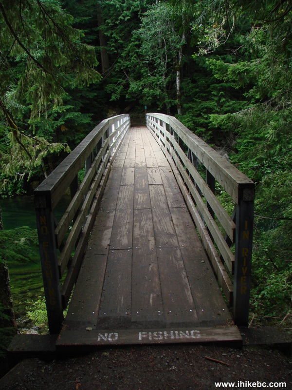
Bridge in Chilliwack Lake Provincial Park British Columbia Canada
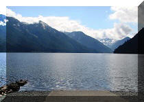
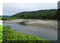
2. A fine view of Chilliwack Lake from the bridge.
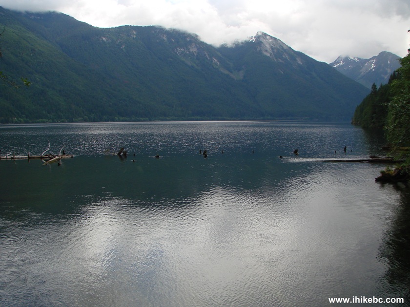
Chilliwack Lake Province of British Columbia Canada
3. Having crossed the bridge, check out the challenge ahead of you.
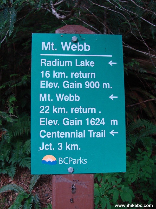
Mount Webb Trail and Radium Lake Trail Hiking Distance Indicator
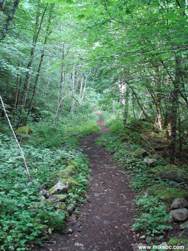
4. The trail is wide and easy at the beginning.
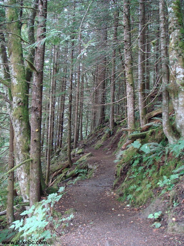
Chilliwack Hiking -
Radium Lake Trail Chilliwack Lake Provincial Park
5. The path goes along a river for a while. This is actually a part of TransCanada Trail.
Chilliwack Area Hiking - Radium Lake Trail
6. The first major split. Turn left here, away from the river. Signage provided.
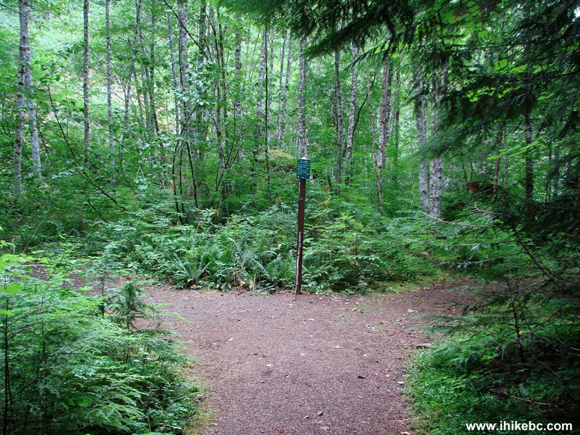
Radium Lake Hike near Chilliwack British Columbia
7. Twenty-five minutes after the beginning of the hike, the second major split arrives. To the right is Centre Creek Trail. To the left is Radium Lake Trail.
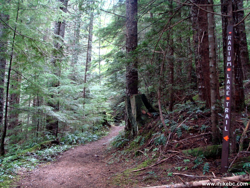
British Columbia Hiking - Radium Lake Trail
8. Fifteen minutes later, the trail is briefly overgrown. But this is not as bad as what is coming later.
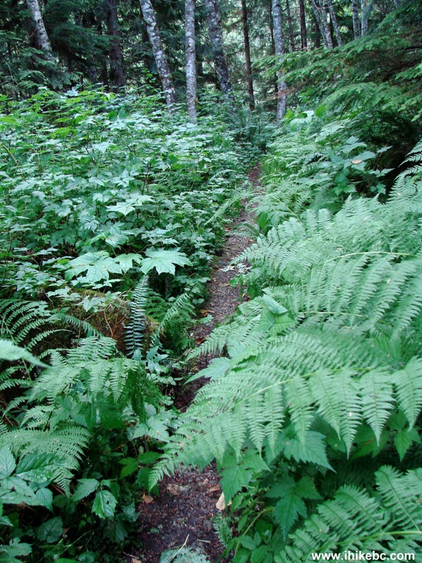
Radium Lake Trail - BC Hiking
9. Soon, the trail goes across an interesting suspension bridge.
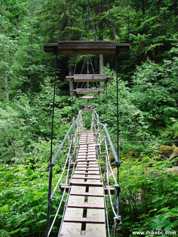
Suspension Bridge Radium Lake Trail Province of BC Canada
10. Twenty minutes later, it is time for Radium Creek crossing (there are a total of three crossings) on a fairly wide log seen above a fallen tree.
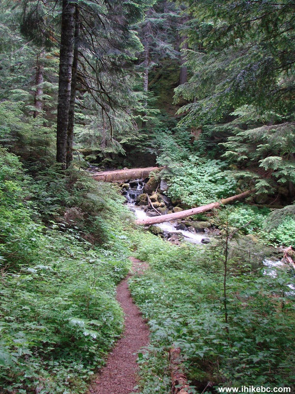
Radium Lake Trail - Hiking in British Columbia Canada
11. A fine view from the log.
Radium Creek British Columbia Canada
12. There are some roots on the path.
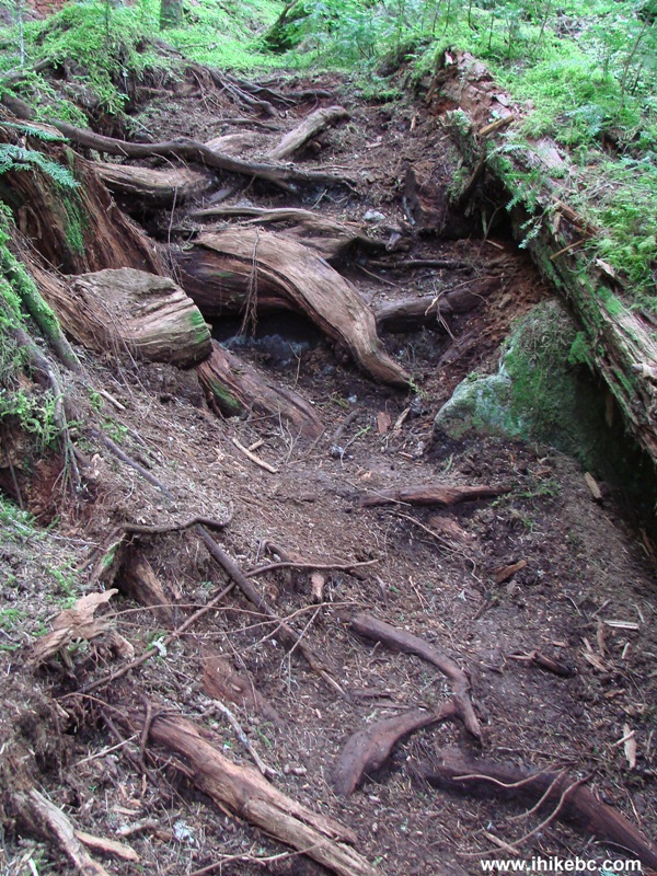
Radium Lake Trail Hiking BC Canada
13. And here is another creek crossing.
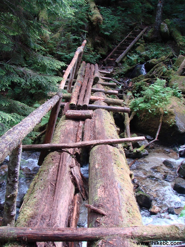
Photo of a Bridge Across Radium Creek BC Hiking Canada
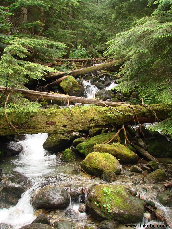
14. Right after that, the most impressive view of Radium Creek arrives, complete with a mini-waterfall.
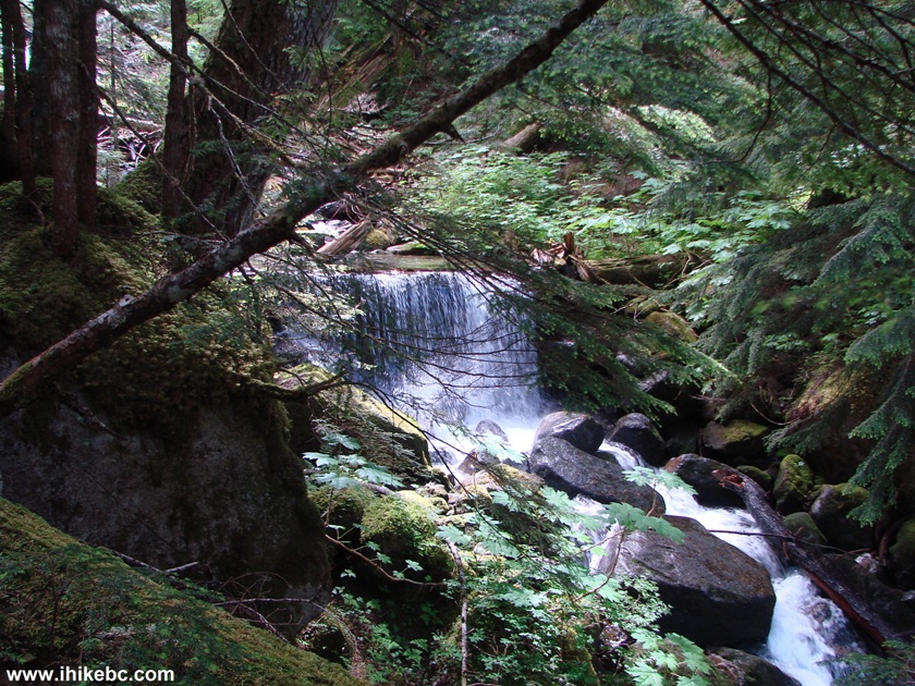
Radium Creek Province of British Columbia Canada
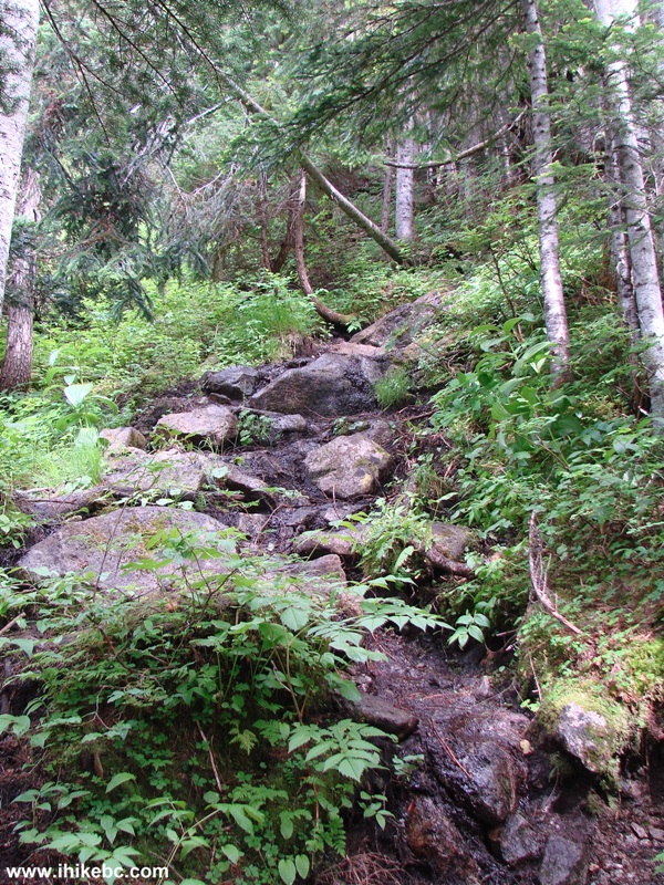
15. In less than ten minutes is the most dangerous part of the trail. It is grossly overgrown for several hundred meters. A long-sleeved shirt and pants would protect from scratches here. But the biggest danger lies in several holes in the ground, which you need to see through the vegetation, in order to avoid injuring your ankle(s). This is where hiking poles would come very handy.
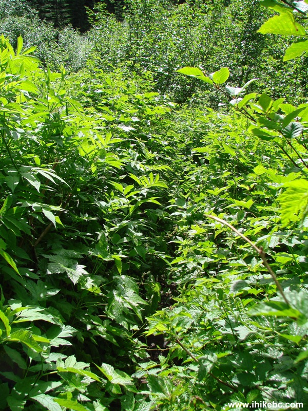
Radium Lake Trail - Hiking in Chilliwack Area
16. Moving on, we get to use this ladder.
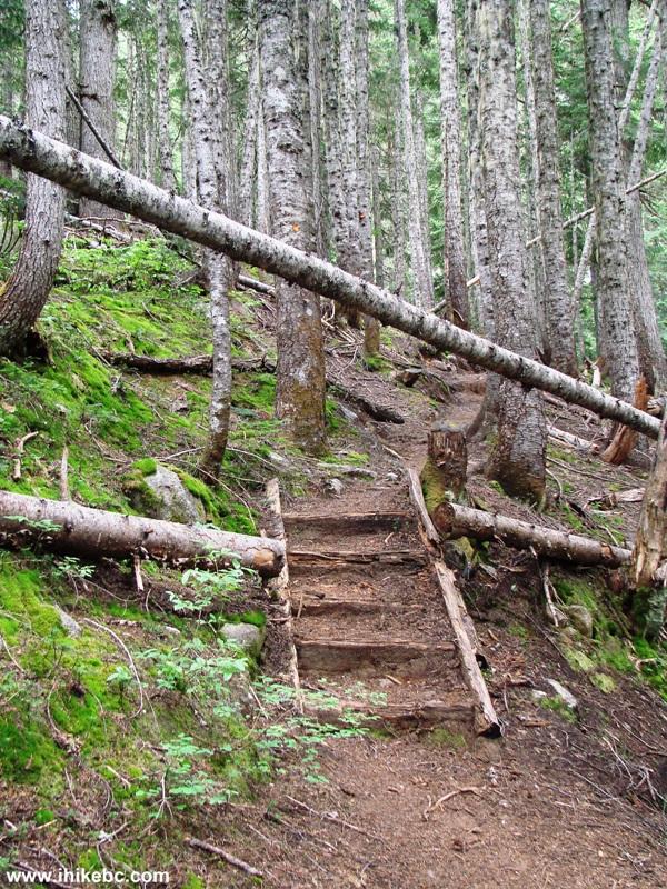
Radium Lake Trail - Chilliwack Hiking BC Canada
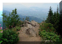
17. And, then, a final steep stretch before the lake.
BC Hiking -
Radium Creek Trail
18. Radium Lake turned out to be very, very small. Also, the area around the lake is quite marshy, so be careful not to get your feet wet.
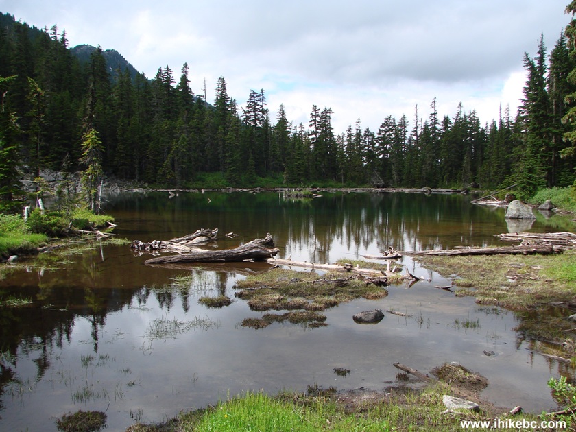
Radium Lake Province of BC Canada
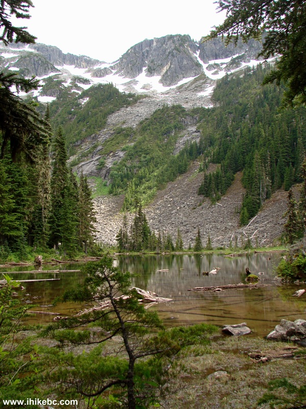
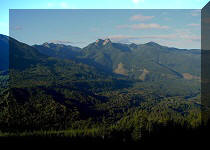
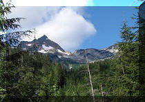
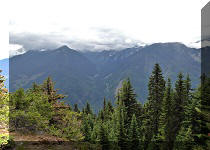
19. At least, the mountains near the lake looked good.
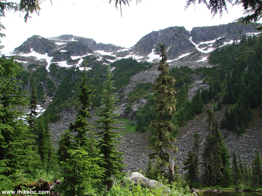
Mountains Around Radium Lake British Columbia Canada
20. It took some manoeuvring around the marsh to get our best shot of the lake.
Radium Lake BC Canada
Radium Lake is a decent trail, though it offers few views, compared to many other trails. "103 Hikes in Southwestern British Columbia" has an impressive photo of many mountains on the page describing this trip. However, to actually see that view, you would need to be on Mount McDonald, as stated in the book. And that mountain is a few hours of strenuous hiking away from Radium Lake. Hiking time to the lake - 2 hours 50 minutes. Return hike time - 2 hours 10 minutes.
For a much better (albeit substantially more crowded) nearby alternative, try hiking Greendrop Lake Trail.


|
 |
Other Trips in Chilliwack BC Area:
|
|
|
|
|
|
|
|
|
|
|
|
|
|
|
|
|
Greendrop Lake Trail
|
|
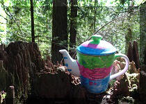
Teapot Hill Trail
|
|
Vedder Rotary Trail
|
|
Mount Thom Trail
|
|
Flora Lake Trail 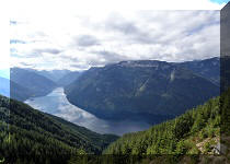 |

Other Trips:


![]()


![]()
![]()
![]()
Follow @ihikebc Tweet
ihikebc.com Trip 056 - Radium Lake Trail Hike (Near Chilliwack BC)