![]()
![]()
![]()

Trip 100 - May 13, 2016 (Friday)
Tabor Mountain Sawdust Trail Hike
Near Prince George BC
Trailhead
Location: 24 kilometers East of Prince
George off Highway 16.
Liked: Trail signs, a few interesting views, shade, ability to bike (though it's quite bumpy), potentially a looping trail.
Of note: Numerous mosquitoes, dirt trails (muddy when wet), several trails are not suitable for hiking, hiking poles and boots are recommended.
Northern BC Backroad Mapbook (3rd edition) Trailhead Coordinates: Page 12 (Prince George) E3.
Tabor Mountain is located near Prince George, and has several entrances and numerous trails. It appears to be popular in the winter, but can also be hiked, and today we decided to hike and bike in a loop. Here's what happened:
1. We are Eastbound on Highway 16, approaching Tabor Mountain's Hickory Wing entrance. When you see this sign about 24 kilometers after leaving Prince George, you are almost there.
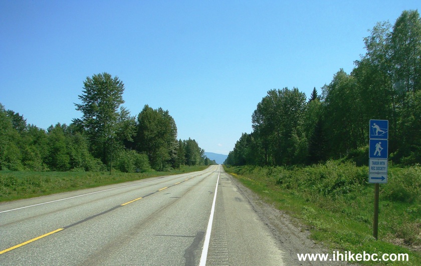
BC Highway 16 East of Prince George near Tabor Mountain
2. And here is the turnoff. Coordinates: N 53⁰55.540' W 122⁰22.978'. Elevation: 756 meters.
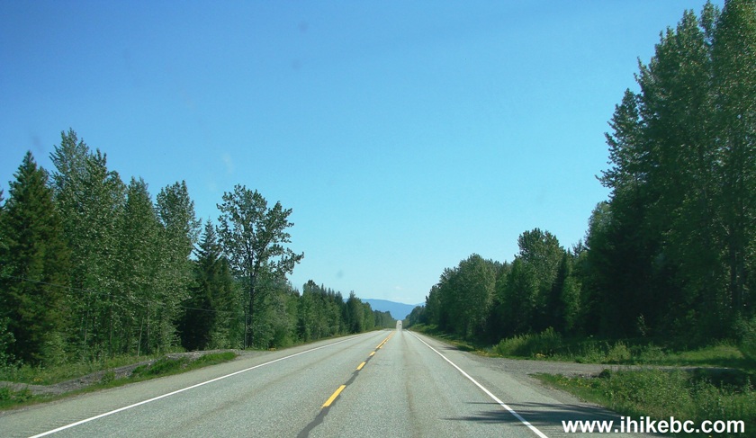
British Columbia Highway 16 Turnoff to Tabor Mountain Hickory Wing
Entrance
3. After turning right, here's what you see.
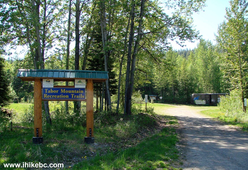
Tabor Mountain Recreation Trail Entrance Near Prince George British
Columbia Canada
4. There is a large parking area for 50-60 vehicles, as well as a former railcar serving as a shelter.
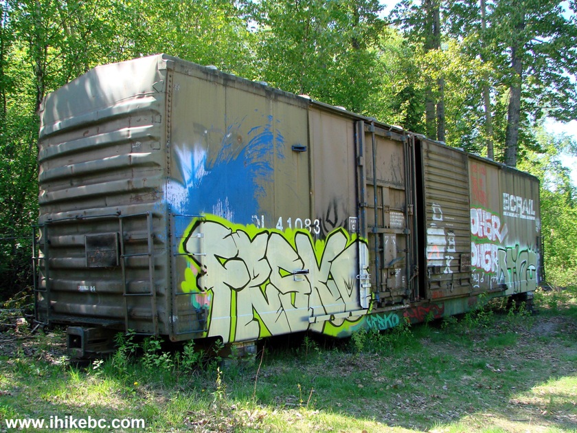
Shelter Made of a Former Rail Car Tabor Mountain BC Canada
5. To the left of the shelter, there are a few warning messages, an information stand, and a gate.
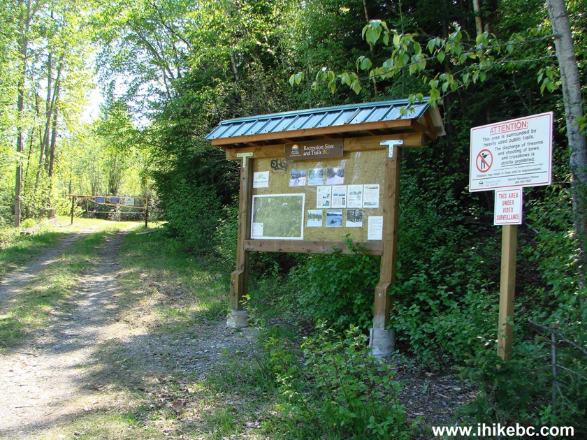
Prince George Hiking - Mount Tabor - Hike in British Columbia
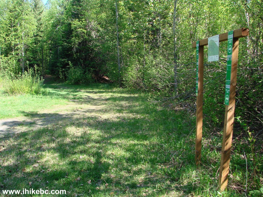
6. Beyond the gate, the signs indicate as follows: Hickory Wing Trail and Troll Lake cabin are to the right, while East Touring Trail, Birchleg Trail and Sawdust Trail are to the left.

7. There is also this map there, and we have indicated with the numbers in the photo below as follows: 1 - our entrance off Highway 16; 2 - Sawdust/Birchleg Trail we took for the first 1.5 kilometers; 3 - Sawdust Trail we further took for another 1.9 kilometers after the split with Birchleg Trail; 4 - continuation of Sawdust Trail (for some reason called Jackrabbit on the map) which got very muddy, so we turned back. 5 - Bowes Creek Trail which we took for about 100 meters before losing the trail due to overgrowth and returning to Beaver Lodge to continue Sawdust Trail (which, as mentioned above, was too muddy, so we returned to the parking lot the same way we came). And the plan was to hike a loop, which is quite doable, by looking at the map. Perhaps, taking Birchleg Trail when it split with Sawdust would have accomplished that objective, but that remains to be seen.
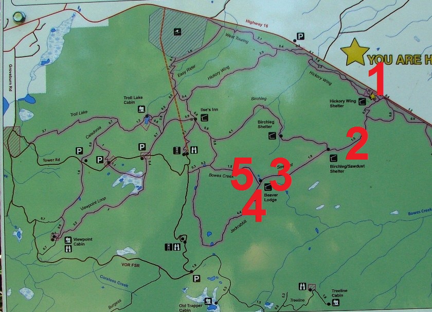
Trail Map Tabor Mountain British Columbia Canada
8. So, we went left towards Sawdust and Birchleg trails.
Hike in Prince George Area - Tabor Mountain
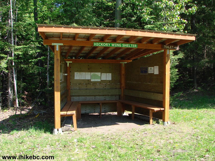
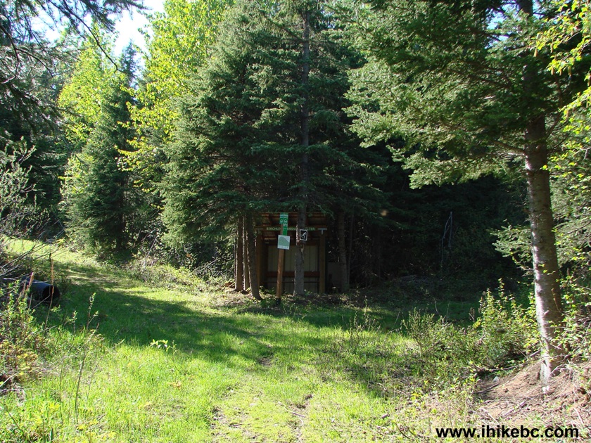
9. Shortly, there is this Hickory Wing shelter. A pit toilet is located nearby.
Hickory Wing Shelter Tabor Mountain Near Prince George BC Canada
10. A lot of information is posted inside the shelter.

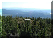
11. Fifteen minutes later, McGregor lookout spur on the left side.
Sawdust/Birchleg Trails split with McGregor Lookout Trail Tabor Mountain
British Columbia
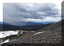
10. Ten minutes after that (biking did help to shave minutes off), here is a view from McGregor lookout. Coordinates: N 53⁰55.173' W 122⁰22.596'.
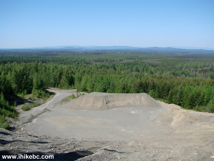
View from McGregor Lookout - Tabor Mountain near Prince George BC Canada
11. We then returned to the split seen in photo #9 and continued our hiking/biking adventure. Twenty minutes later, a sign appeared with an arrow pointing to the "old sawmill site."
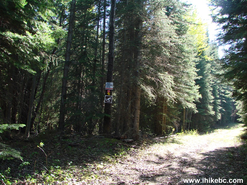
Sawdust/Birchleg Trail - Old Sawmill Site viewpoint - Tabor Mountain BC
Canada
12. In a hundred meters, this neat-looking reddish pile of sawdust was all that we could find. And a barrel on top, of course. There was some piece of metal lying nearby too, but it was not possible to tell if it came from the sawmill. Perhaps, the site became overgrown? We saw only endless trees behind the sawdust pile, and went back to the main trail.

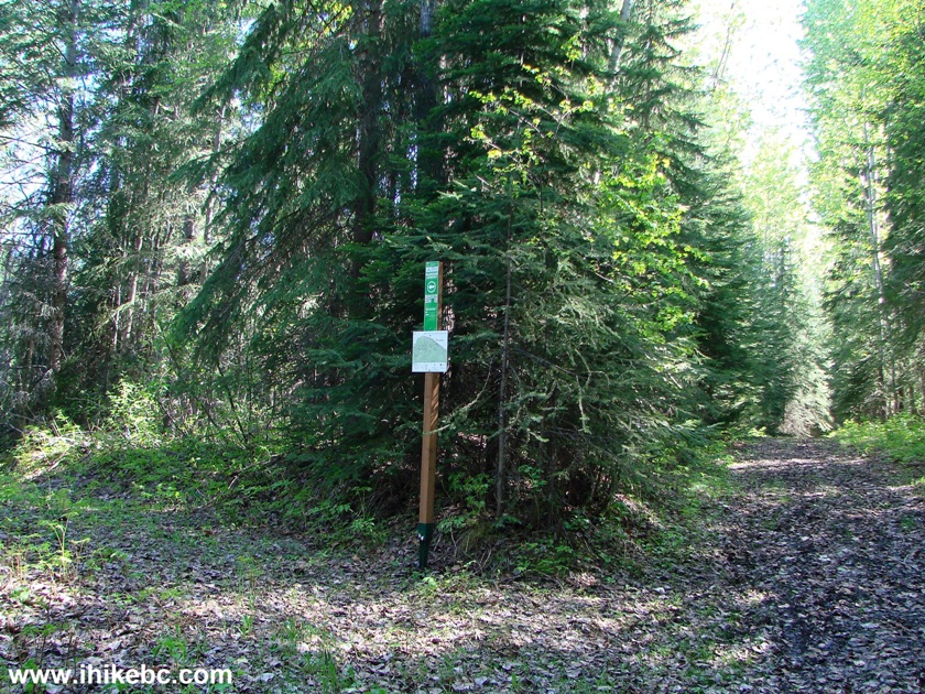
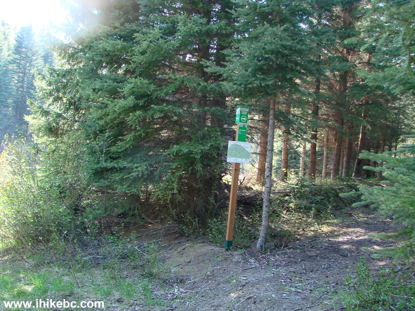
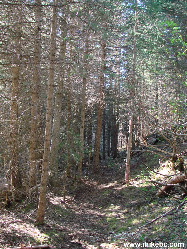
13. Twenty more minutes, and a Sawdust / Birchleg trails split is ahead. We turned left and stayed on Sawdust trail.
Tabor Mountain Sawdust Trail split with Birchleg Trail
14. The first substantially muddy spot arrived shortly. A harbinger of things to come.
Sawdust Trail Tabor Mountain Hiking near Prince George British Columbia Canada
15. Half an hour of hiking and biking after the trail split, and we are at yet another split - Bowes Creek Trail on the right, and Sawdust on the left.
Hike in Prince George Area -
Tabor Mountain Sawdust Trail Split with Bowes Creek Trail
16. Beaver Lodge shelter to the right of the split. There is a fire ring there too.
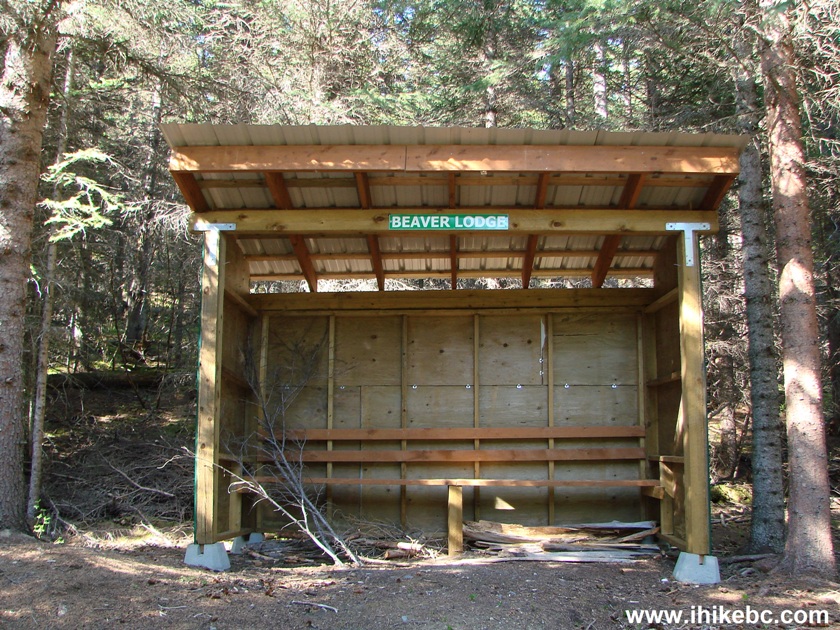
Beaver Lodge Shelter on Tabor Mountain BC Canada
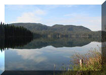
17. The pond in front of the Beaver Lodge shelter. A view from the right side (from Bowes Creek Trail).
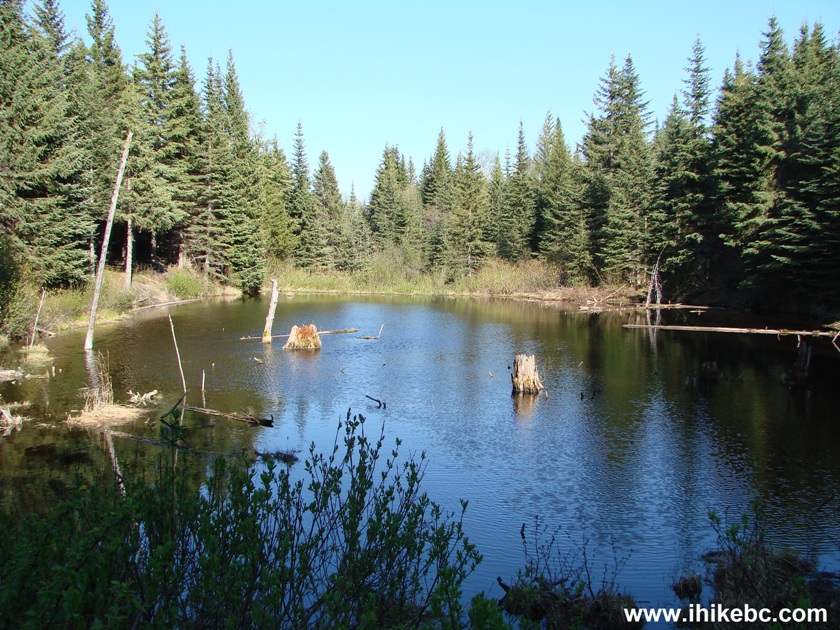
Pond by Beaver Lodge Shelter on Tabor Mountain in British Columbia
Canada
18. We then took Bowes Creek Trail in hopes of avoiding having to go an extra three kilometers on Sawdust Trail (called Jackrabbit on the map, but Sawdust on the trail sign). However, in a few hundred meters Bowes Creek Trail became overgrown and we turned around. In the photo below, we are still en route to the overgrown part (not pictured).
Bowes Creek Trail Tabor Mountain BC Hiking Canada
19. Right where we could not see the continuation of Bowes Creek Trail, there was this old Sawdust Trail sign.

20. We then returned to the split seen in photo #15, and continued on Sawdust Trail. Our first challenge was having to cross this creek.
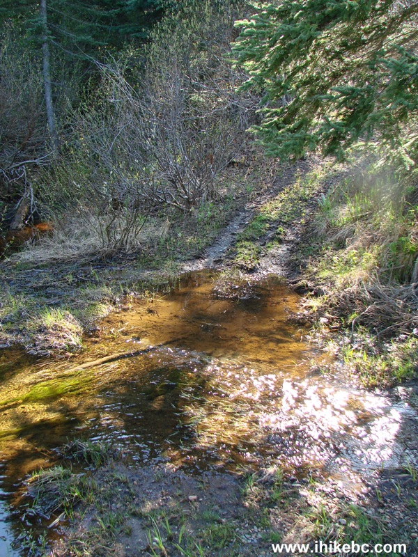
Sawdust Trail on Tabor Mountain - Hike in British Columbia
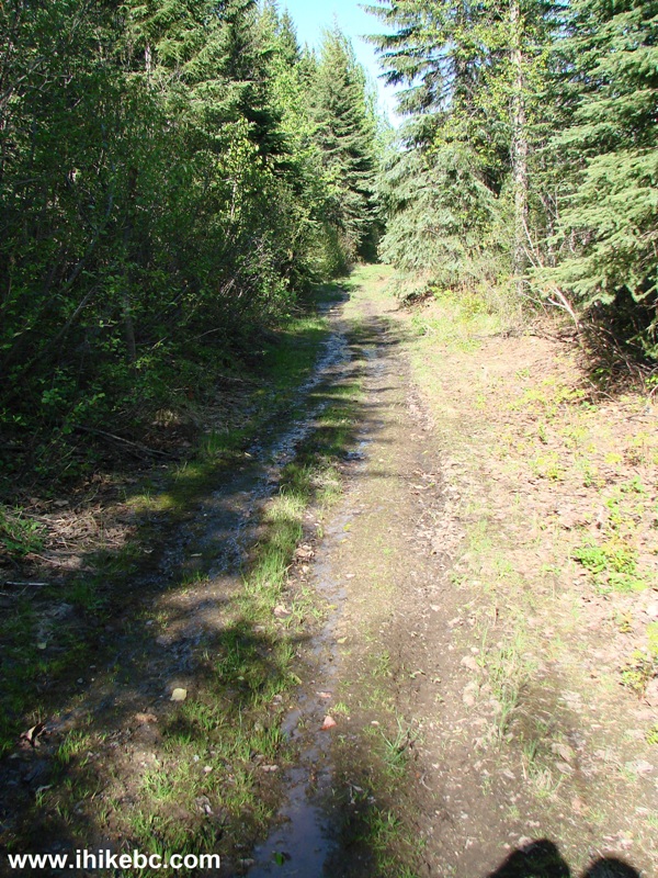
21. Then, things got quite muddy for about one hundred meters.
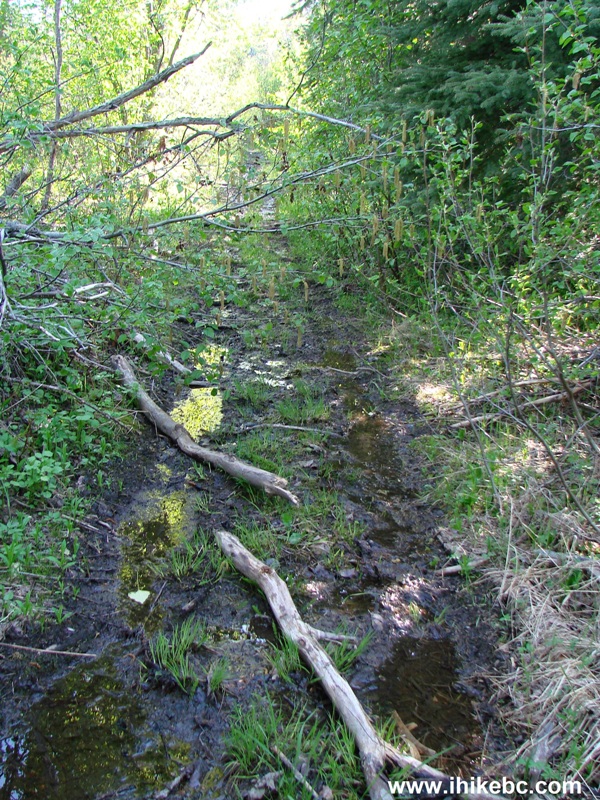
Muddy Sawdust Trail - Tabor Mountain British Columbia
22. We went forward, until things got quite muddy again very soon. The beginning of this 4.4 km stretch of Sawdust Trail did not look promising at all, and we ended our forward progress here. Coordinates: N 53⁰54.121' W 122⁰25.762'. Elevation: 1,092 meters.
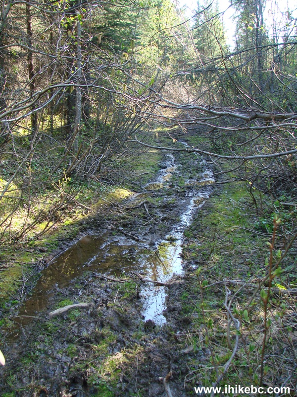
Photo of Sawdust Trail on Tabor Mountain near Prince George BC
It then took us less than half an hour to bike back, as it was mostly downhill. This sure was a good sweat breaker, and, despite numerous aggressive mosquitoes and the condition of the trails which we took, we still saw a few good views. That said, unless you know of better trail options (Birchleg?), it's hard to recommend hiking or biking this part of Tabor Mountain. But, since we likely saw less than 10% of what this mountain has to offer, and since there are several other entrances along Highway 16, chances are pretty good that there are better adventures available on these mountain trails.


|
 |
Other Trips in Prince George BC Area:
|
|
|
|
|
|
|
|
|
|
|
|

Other Trips:


![]()


![]()
![]()
![]()
ihikebc.com Trip 100 - Tabor Mountain Sawdust Trail Hike (near Prince George BC)