![]()
![]()
![]()

Trip 158 - June 17, 2019 (Monday)
Grizzly Den Trail Hike
Sugarbowl - Grizzly Den Provincial Park
Near Prince George BC
Location of Trailhead: Approximately 105 kilometers East of Prince
George, via Highway 16 and Hungary Creek FSR.
Liked: Mountain views at the end of the trail, two cool cabins, shade in the forest, the ability to hike in a loop via Raven Lake trail.
Of Note: Many mosquitoes, snow at higher elevations. Hiking poles and boots are recommended (to the second cabin) and are essential (beyond the second cabin).
Northern BC Backroad Mapbook (3rd edition) Trailhead Coordinates: Page 13 (Purden Lake) F5.
Related Website: Sugarbowl - Grizzly Den Provincial Park (official BC Parks website).
Another Trip in Sugarbowl - Grizzly Den Provincial Park: Viking Ridge Trail Hike.
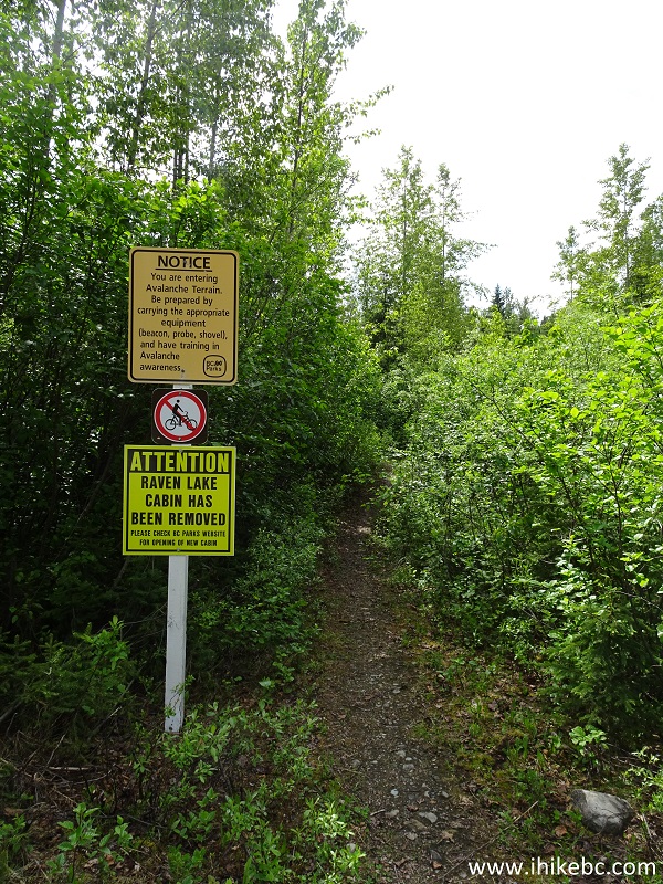
Grizzly Den Trail is located in Sugarbowl - Grizzly Den Provincial Park, east of Prince George. Unlike Viking Ridge Trail, located within 20 minutes driving distance, Grizzly Den Trail is not nearly as steep, and its meadows are not as large or wet. Most importantly, the mosquitoes are not as numerous or aggressive. Viking Ridge does have an edge in the views category, but Grizzly Den features two very neat cabins, and the views at the end of the trail are quite good too. Also, it's possible to hike a loop and connect to Raven Lake Trail. You would have to then hike for about 2.5 kilometers on Hungary Creek FSR to get back to your vehicle at the Grizzly Den trailhead. Do note that the connecting trail between Grizzly Den and Raven Lake trails is not marked, and a GPS would be very helpful to find your way.
1. We are Eastbound on BC Highway 16, approximately 90 kilometers East of Prince George, and 4.2 km East of Viking Ridge Trail parking area, getting ready to turn right onto Hungary Creek Forest Service Road.
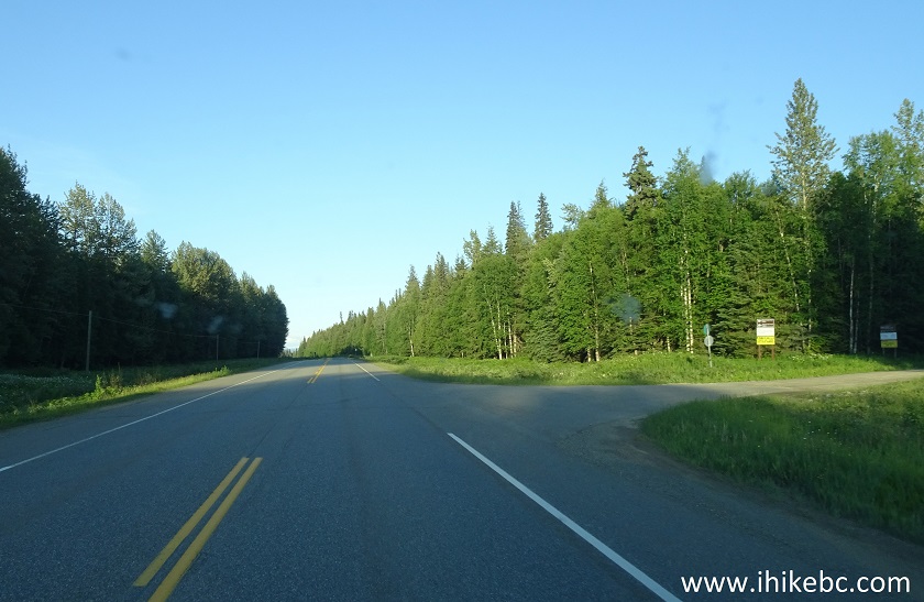
BC Highway 16 at Hungary Creek FSR turnoff East of Prince George
2. Immediately after turning onto Hungary Creek FSR. Coordinates: N 53⁰51.771' W 121⁰31.274'. Elevation: 726 meters.
Hungary Creek Forest Service Road near Prince George BC Canada
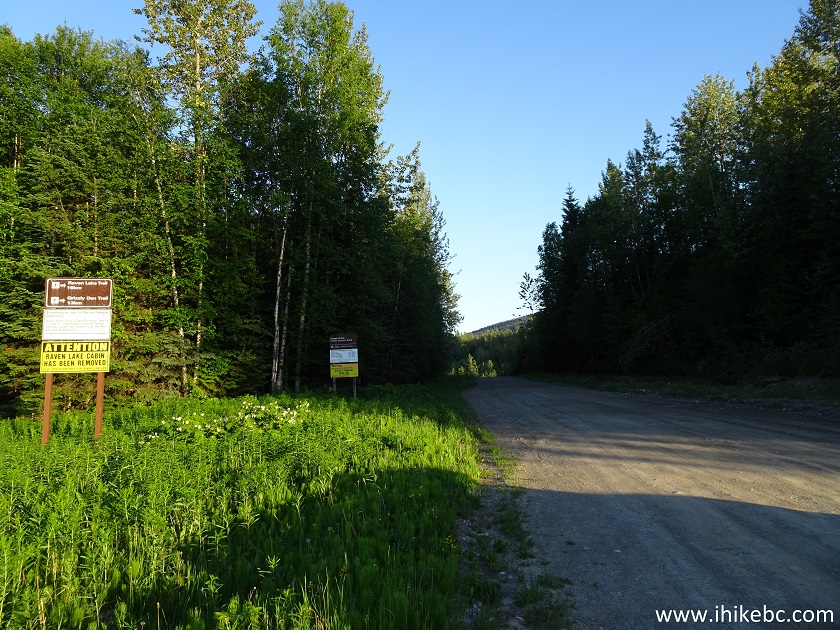
3. Hungary Creek Forest Service Road is suitable for all regular clearance vehicles all the way to Grizzly Den trailhead parking 12.5 km later. Here we are at the split where Grizzly Den Trail parking is to the left (in a hundred meters or so), while Hungary Creek FSR continues to the right for 2.6 km and ends at the Raven Lake trailhead. Hungary Creek FSR past this split becomes fairly rough, so a high clearance vehicle might be required beyond this point.
Hungary Creek FSR split
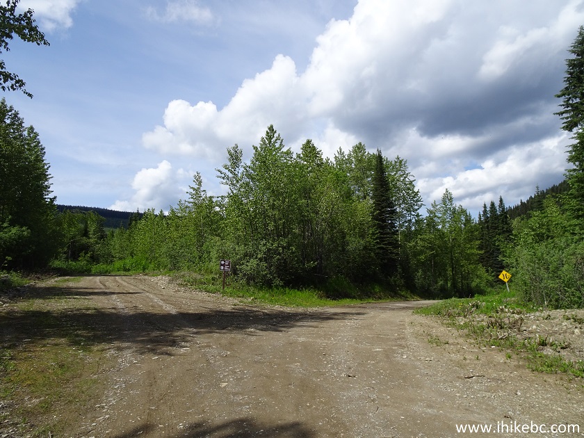
4. Now at the Grizzly Den trail parking area. The trail begins at the yellow sign seen ahead. Coordinates: N 53⁰46.787' W 121⁰29.793'. Elevation: 1,157 meters.
Grizzly Den Trail Parking Area near Prince George British Columbia
5. Here is a map of the trails in the Sugarbowl - Grizzly Den Provincial Park, posted by the trailhead. We have indicated on the map as follows: orange arrow: Viking Ridge trailhead; burgundy arrow: Highway 16 at Hungary Creek FSR; yellow arrow: Raven Lake Trail parking area; red arrow: Grizzly Den trail parking area; blue arrow: 8 Mile cabin; green arrow: Grizzly Den cabin.
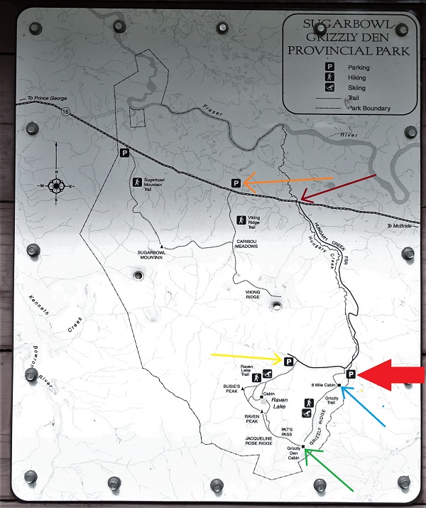
Sugarbowl - Grizzly Den Provincial Park Map
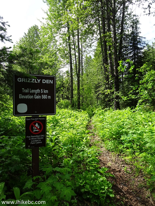
6. Grizzly Den trailhead.
Prince George Hiking - Grizzly Den Trail
7. There is some steepness to this trail, but gaining 560 meters in over 5 kilometers of hiking is not that difficult. Do note that, for good views, one has to climb a ridge, and the total elevation for this hike would be 700 meters.
Prince George Hike - Grizzly Den Trail
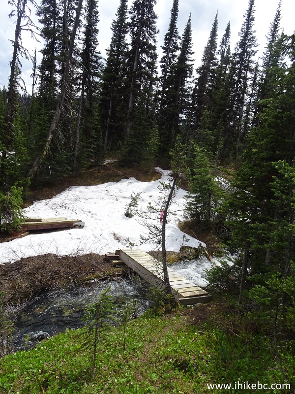
8. A fine bridge arrives 500 meters from the start of the trail.
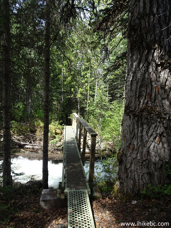
Hiking in Prince George area - Grizzly Den Trail
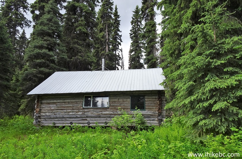
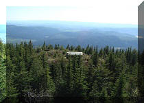
9. Grizzly Den Trail features two neat shacks, both with outhouses in the vicinity. Here is the first shack, called 8 Mile Cabin, located 900 meters from the start of the trail. Both cabins are stocked with firewood.
8 Mile Cabin - Grizzly Den Trail - Hike in Prince George Area
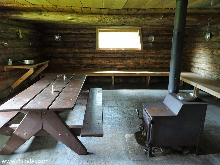
10. Inside the 8 Mile Cabin.
Inside 8 Mile Cabin by Grizzly Den Trail near Prince George British
Columbia Canada
9. Looking the other way. It is also possible to climb into the attic.
Grizzly Den Trail 8 Mile Cabin
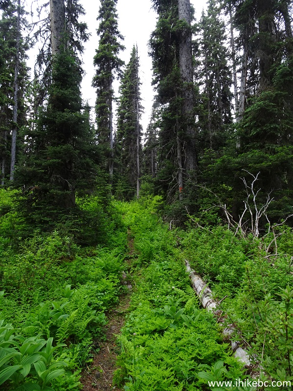
10. There is not much to see on this trail until the second cabin.
Grizzly Den Trail - Prince George Trail
11. There are some small creeks here and there, and a few foot bridges allow to cross larger streams.

Sugarbowl - Grizzly Den Provincial Park British Columbia Canada
12. Here is one of those foot bridges.
Trail in Prince George Area -
Grizzly Den Trail
13. Just like Viking Ridge Trail, Grizzly Den Trail has some meadows, but they are not as large or wet. Also, snow is likely going to be on this trail (almost?) all Summer long, especially closer to Grizzly Den cabin.
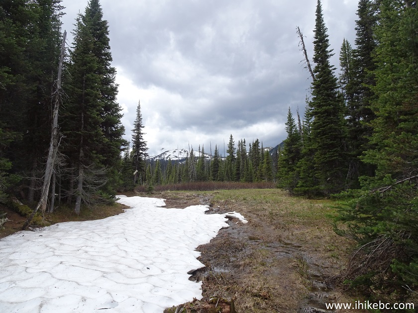
Meadows on Grizzly Den Trail - Hiking in Prince George BC area
14. Speaking of the meadows.
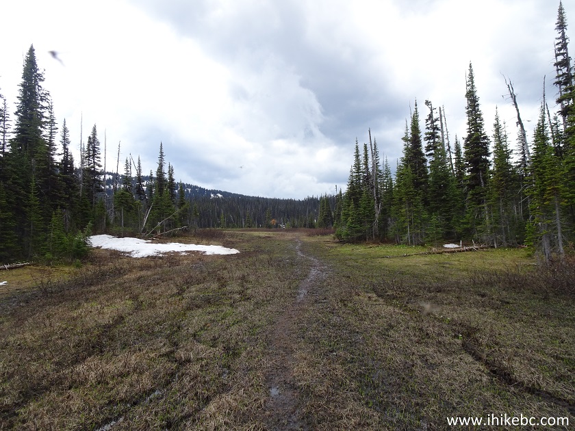
British Columbia Hiking - Grizzly Den Trail near Prince George
15. And, then, it was hiking on snow.
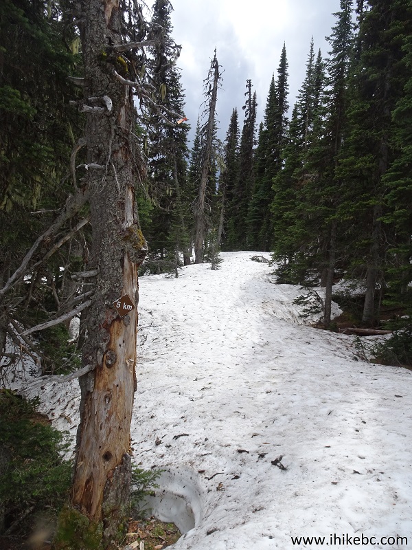
Hiking in BC - Grizzly Den Trail near Prince George
16. The arrival of Grizzly Den cabin.
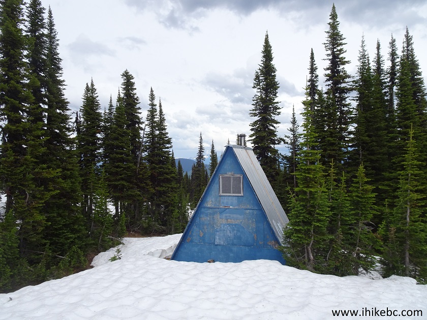
Grizzly Den Cabin near Prince George BC Canada
17. The cabin comes with a (prairie) dog.
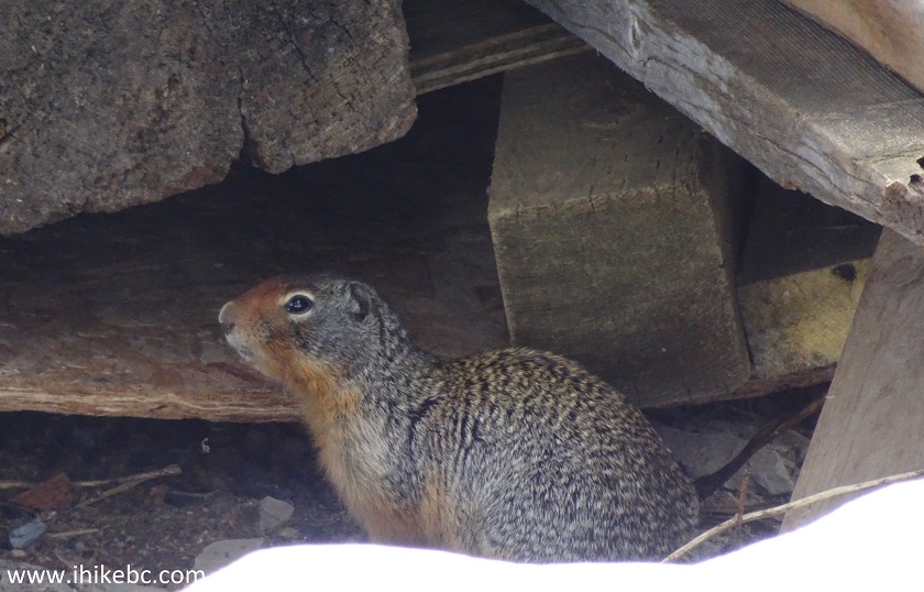
Prairie Dog in Sugarbowl - Grizzly Den Provincial Park near Prince
George BC Canada
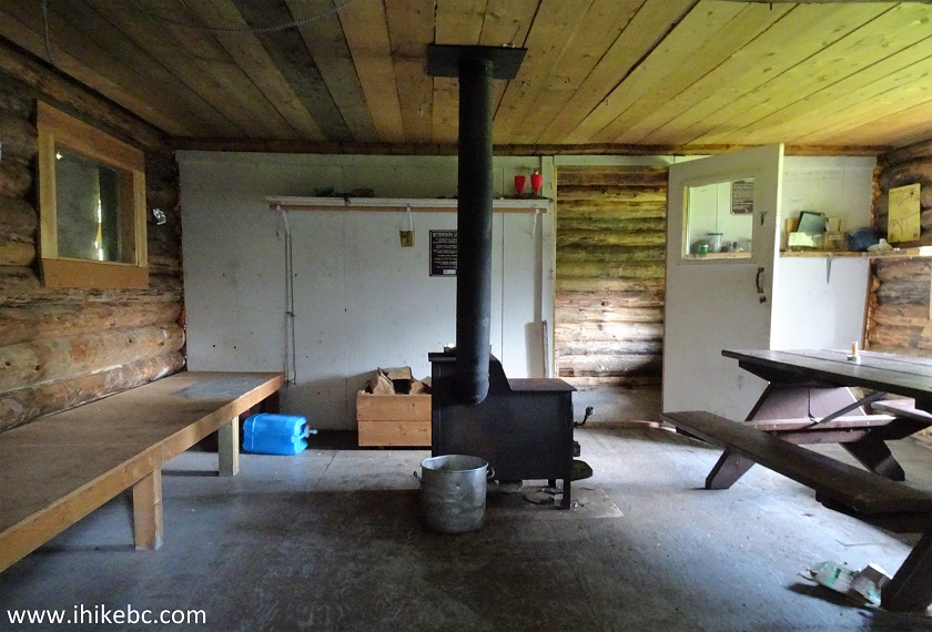
18. Inside the Grizzly Den cabin.
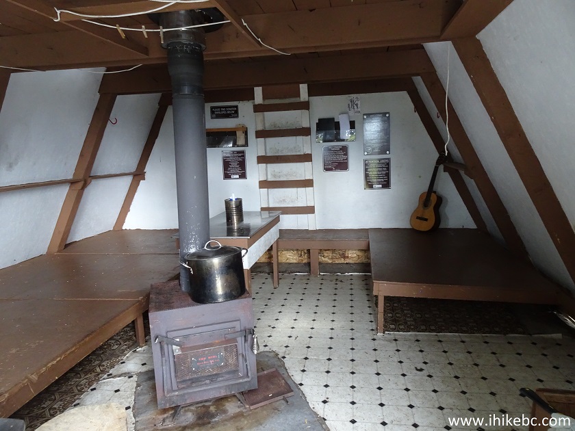
Grizzly Den Cabin by Grizzly Den Trail
19. The opposite side. The attic is also available, should the ground floor get too crowded.
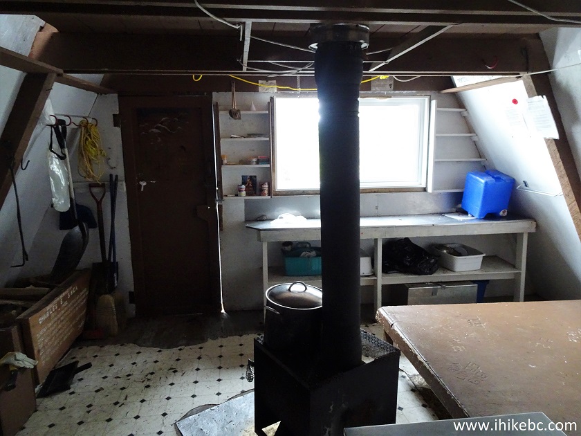
Inside Grizzly Den Cabin
20. The views arrive shortly after the cabin. There is this ridge beyond the cabin, which needs to be ascended. Hiking poles and boots would be essential here, not only because of the snow, but also because the ground consists of small loose unstable rocks.
Sugarbowl - Grizzly Den Provincial Park
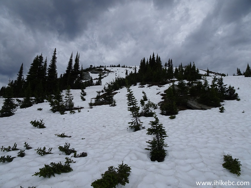
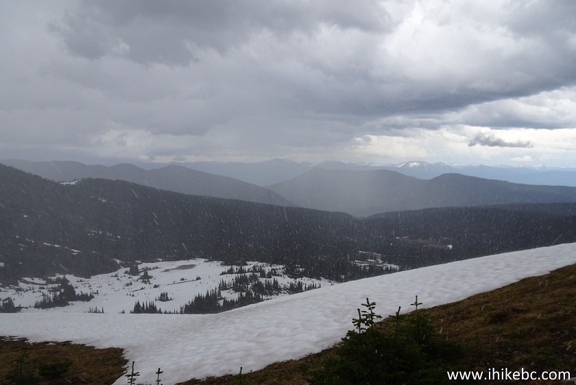
21. The higher you climb, the better the view behind you.
Hiking in British Columbia
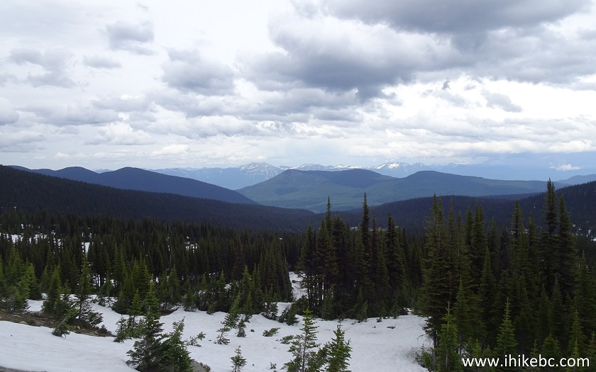
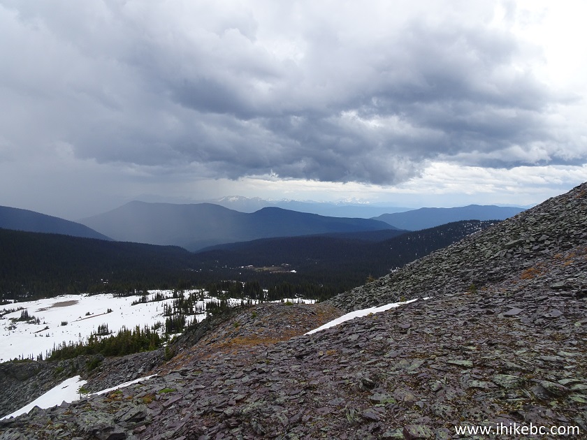
22. Looking to the left.
BC Hiking
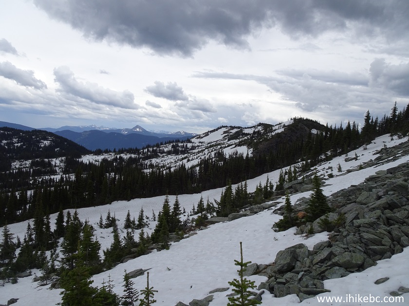
23. Looking to the right.
British Columbia Hiking
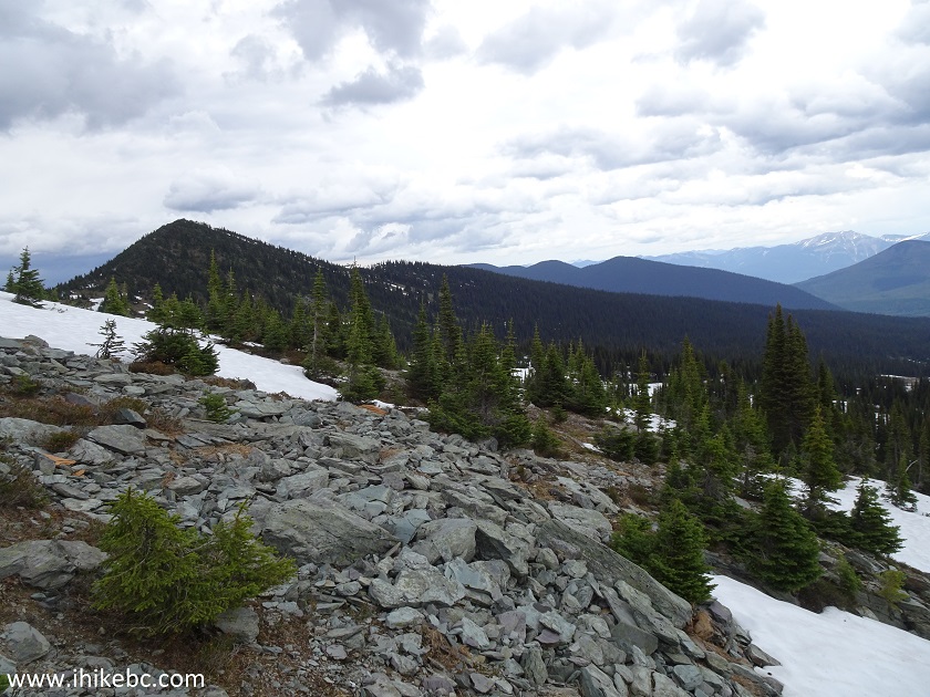
24. Now on top of the ridge. Coordinates: N 53⁰44.310' W 121⁰32.508'. Elevation: 1,857 meters (700 meters elevation gain from the start of the trail).
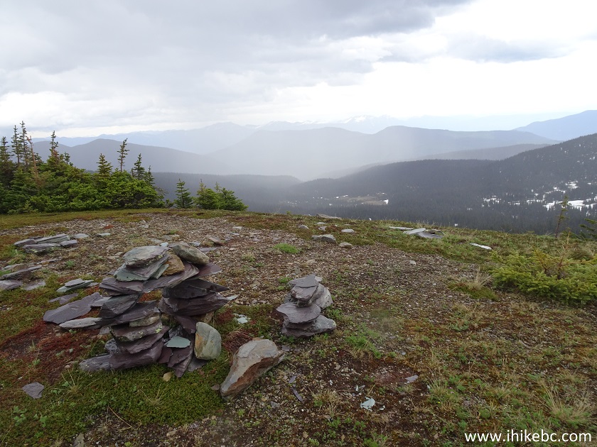
Ridge above Grizzly Den Cabin - Hiking in BC
Here is our video of the views from the top of the ridge above Grizzly Den cabin.
More ihikebc videos are on our YouTube Channel.
25. We got hit by rain and hail shortly after climbing up.
Rain in Sugarbowl - Grizzly Den Provincial Park
26. A few minutes later.
Hiking in Prince George Area
Grizzly Den Trail has half the steepness, half the mosquitoes, and less than half of the wet and muddy meadows than Viking Ridge Trail. But, also, only half the views. But features two cabins. Recommended.


|
 |
Other Trips in Prince George BC Area:
|
|
|
|
|
|
|
|
|
|
|
|
Other Trips:


![]()


![]()
![]()
![]()
ihikebc.com Trip 158 - Grizzly Den Trail Hike (near Prince George BC)