![]()
![]()
![]()

Trip 209 - May 20, 2021 (Thursday)
BC Highway 40 Trip
Lillooet to Gold Bridge
Page 2 of 2
Liked: Fine views of Carpenter Lake, Bridge River Canyon, and Marshall Creek Falls. Access to Gun Creek Recreation Site, many trails and several FSRs.
Of Note: Frequently narrow and winding road with steep unbarricaded drop-offs. Much of the road is gravel. Dust from passing vehicles on gravel surface, especially along Carpenter Lake. Rockfall hazard. Numerous large and small rocks on the road. Avalanche hazard in the winter season. No cell phone signal for most of the road.
Vancouver, Coast & Mountains Backroad Mapbook (5th edition) Coordinates: Page 53 (Lillooet) C6-B5-A4, Page 52 (Seton Portage) G4-F3-E3-E4-D5-C5-B4-A4, Page 51 (Gold Bridge) G4-F3-E3-D3-C3-B3.
Related Website: DriveBC (road conditions).
Other Trips in Lillooet Area:
Highway 12
Valley Lookout Trail, Horseshoe Bend
Trail, Camelsfoot Peak
Trail,
Red Rock Trail.
Other Road Trip Reports:
TransCanada Highway 1 and BC Highway 99 Loop,
BC
Highway 20 (Williams Lake to Bella Coola).
BC Highway 40 runs for just over 100 kilometers from the town of
Lillooet to a tiny community of
Gold Bridge. Along the way, this
semi-dangerous, partially unpaved road passes by some very impressive
views. Interestingly, this highway does not appear to be officially
numbered. Aside from ONE mentioning on a sign in Lillooet (indicated with
a red arrow in photo #6), there isn't a single sign along this highway
showing its number. The number 40, however, does appear in maps, and
many folks in BC do know what "Highway 40" refers to. There are three
roads which compose Highway 40: it starts in Lillooet where Moha Road
begins off Main Street. Shortly, Moha Road turns into Bridge River Road
(also known as Lillooet-Pioneer Road). Finally, at Terzaghi Dam,
Carpenter Lake Road along Carpenter Lake takes over as Highway 40 all
the way to Gold Bridge.
The main difficulty while driving on Highway 40 is watching the road while checking out all the
great views around you. Considering the number of blind corners, the
need to dodge numerous small and large rocks littering the highway, and
steep unbarricaded drop-offs, it's much safer to pull over for a
particularly good view.
Also, Highway 40 does get used by logging trucks and other industrial
traffic, so watch out for that too, especially on particularly narrow
stretches of the road.
BC Highway 40 starts in the town of Lillooet, and there are two ways to get there from Vancouver: first is Highway 1 East to Lytton via Fraser Valley-Hope-Yale-Boston Bar, then take Highway 12 from Lytton to Lillooet. Or, like we did this time, Highway 1 West to Horseshoe Bay, then Highway 99 (Sea-to-Sky) via Squamish-Whistler-Pemberton to Lillooet. The latter is a more scenic, albeit a more challenging drive, with steep grades past Pemberton. If driving on Highway 97 South towards Cache Creek, turn right onto Highway 99 a few kilometers before Cache Creek, and you'll get to Lillooet that way too.
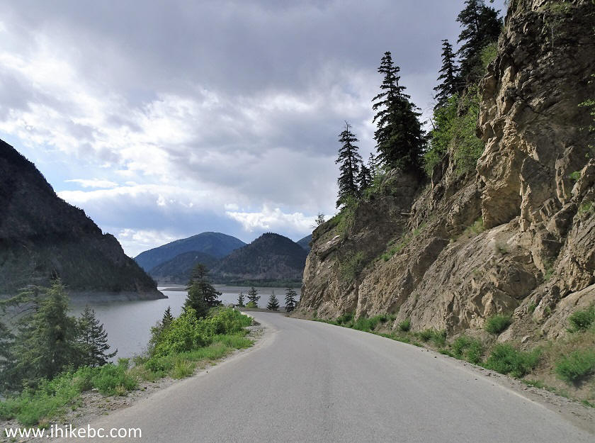
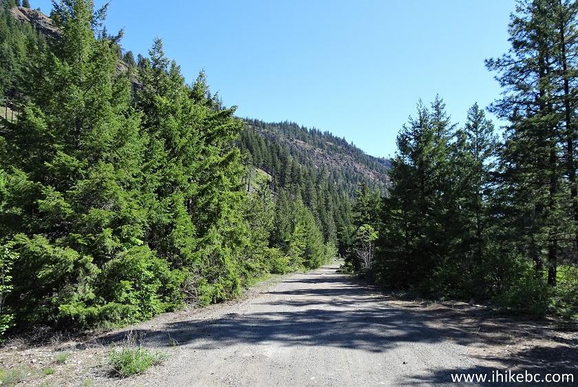
31. BC Highway 40 (Carpenter Lake Road by now) shortly after the beginning of Carpenter Lake.
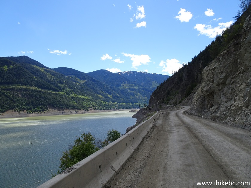
BC Highway 40 by Carpenter Lake
32. A substantial challenge on Highway 40 is frequent rockfall. Here is an example, and some rocks are substantially larger.
Rockfall on BC Highway 40
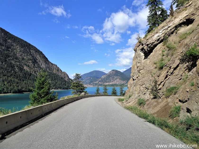
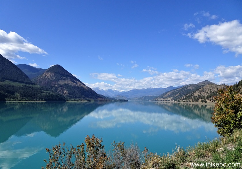
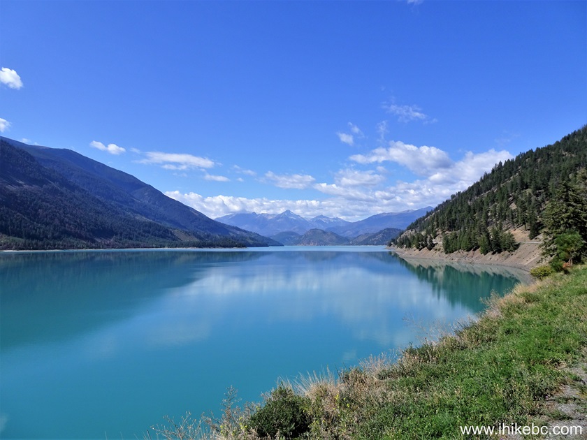
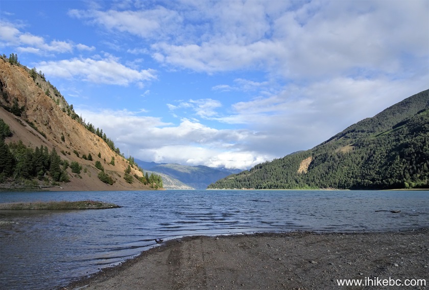
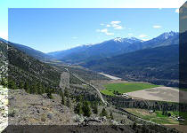
33. Much depends on the sun, but Carpenter Lake looks great in many different spots. At 50.2 km here.
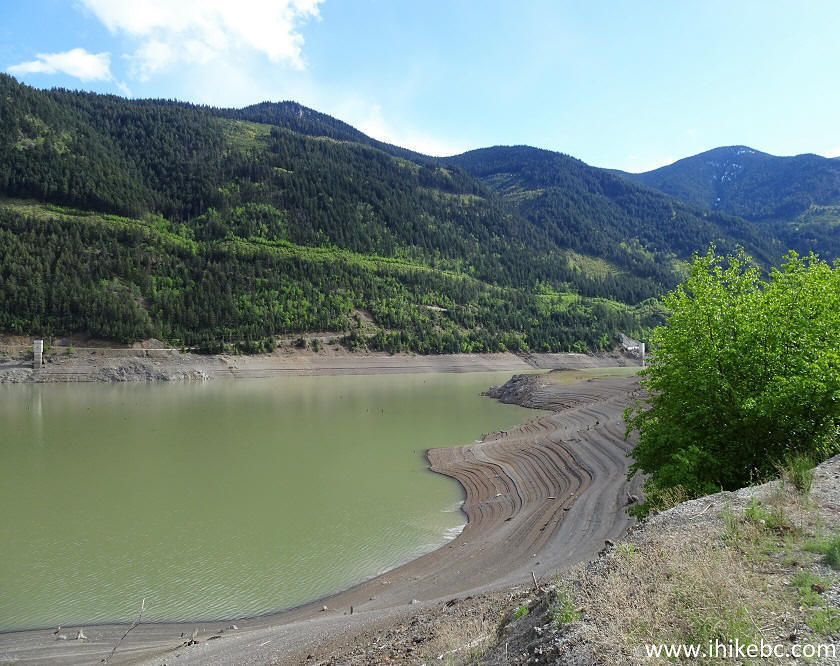
Carpenter Lake between Lillooet and Gold Bridge BC Canada
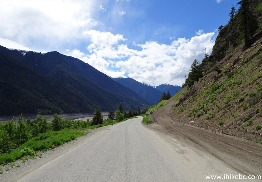
34. Now at 59.1 km from the start of Highway 40.
Carpenter Lake
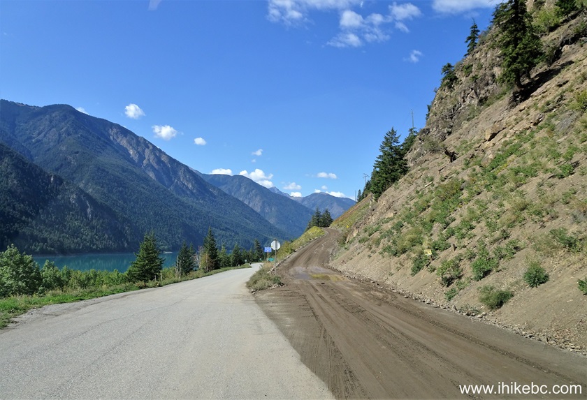
35a. BC Highway 40 / Carpenter Lake Road at 64.9 km.
BC Highway 40
35b. Here is the same spot in 2024.
BC Highway 40 - Carpenter Lake Road
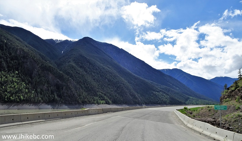
36a. Marshall Lake Road turnoff at 68.2 km.
BC Highway 40 at Marshall Lake Road
36b. The same location in September of 2024.
Marshall Lake Road start off Carpenter Lake Road near Lillooet BC
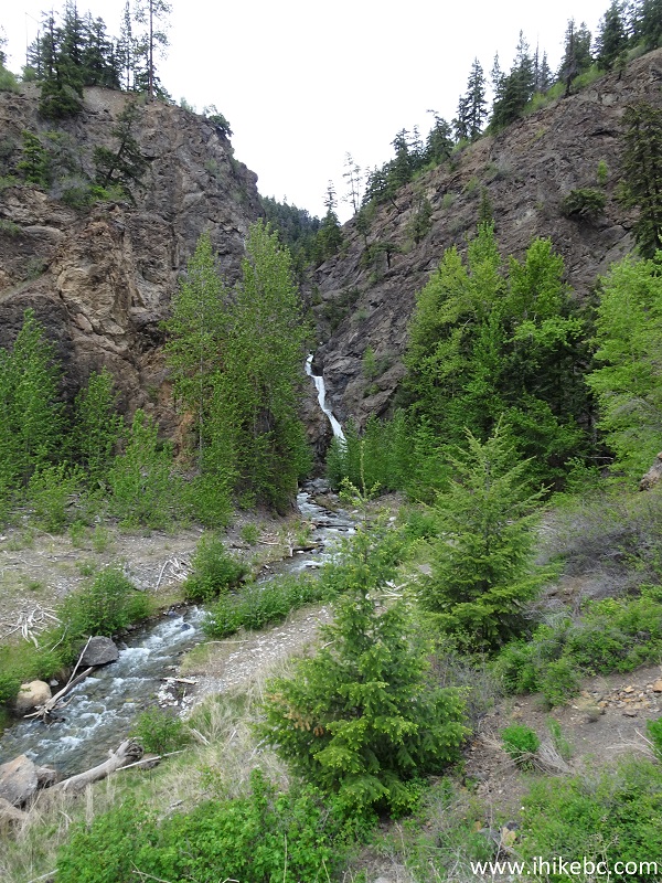
37. Just over a kilometer later, don't miss a neat Marshall Creek waterfall. It (almost) hides about 200 meters from the highway, on the right side. There is a trail to get to the waterfall. It's located by Marshall Creek bridge, seen below. Coordinates: N 50⁰50.554' W 122⁰27.626'. Elevation: 651 meters. The parking area is just after the bridge, but the waterfall access trail is before the bridge.
BC Highway 40 by Marshall Creek Bridge
38. Here is the waterfall view from the bridge.
Marshall Creek Falls from BC Highway 40
39. Now with some zoom.
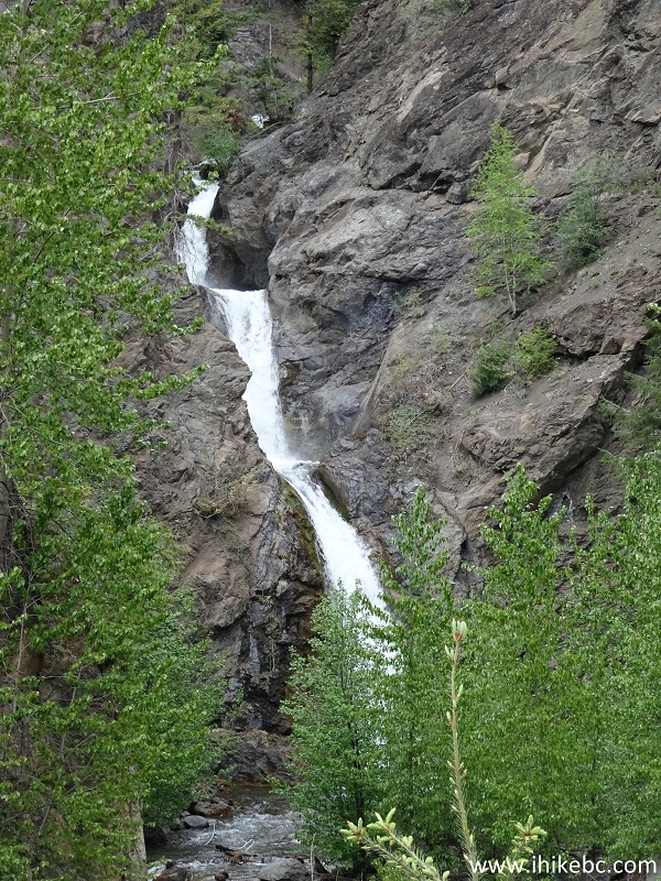
Marshall Creek Falls British Columbia
40. And here is an up-close view from the trail.
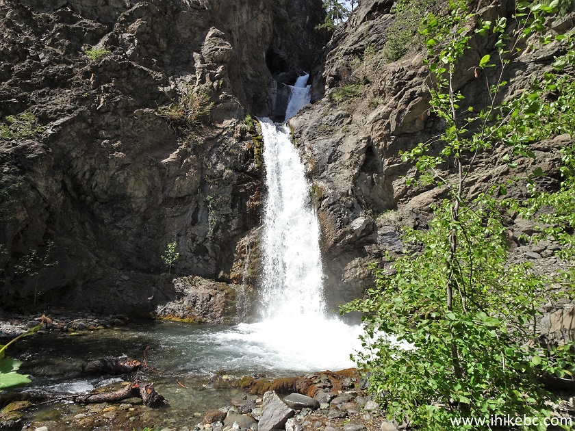
Marshall Creek Falls
Here is our video of Marshall Creek Falls.
More ihikebc videos are on our YouTube Channel.
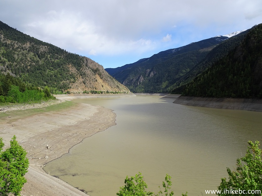
41. At 76.9 km, quite a view of Carpenter Lake.
Carpenter Lake British Columbia Canada
42. Not bad either.
Carpenter Lake
43a. Just a bit further.
Carpenter Lake seen from BC Highway 40
43b. Now a view from 81.5 km of BC Highway 40 / Carpenter Lake Road. September of 2024.
Carpenter Lake near Gold Bridge BC
43c. Also from September of 2024, this photo of Carpenter Lake at the 84.4 km mark.
Carpenter Lake British Columbia Canada
44a. Carpenter Lake Road (BC Highway 40) and Carpenter Lake seen at 82.3 km from the start of the highway.
View from BC Highway 40 near Gold Bridge British Columbia
44b. At 91.5 km, Tyaughton Lake Road begins off BC Highway 40. This way to South Chilcotin Mountains Provincial Park. September 2024 photo.

Tyaughton Lake Road at Carpenter Lake Road (BC Highway 40)
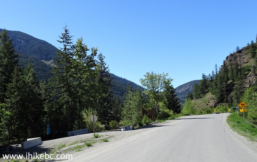
44c. At 95.2 km, Gun Creek Recreation Site (by BC Hydro) is on the left side (pit toilet, garbage can, recycling bins, Carpenter Lake access).
Gun Creek Recreation Site entrance off BC Highway 40
45. At 103.0 km, Carpenter Lake Road and BC Highway 40 come to an end. To the left, across the bridge, is a town of Gold Bridge, covered in the following trip report. Straight ahead is a road to Gun Lake, as well as a seasonal 4x4 road to Pemberton (via Hurley River FSR) - access to Green Mountain Trail.
BC Highway 40 Western End near Gold Bridge BC
46. The rest of our trip report is dedicated to Gun Creek Recreation Site (by BC Hydro), and our trip to the dry bottom of Carpenter Lake. Gun Creek Recreation Site turnoff, pictured below, is at 95.2 km, about 8 kilometers before the bridge seen in the photo above. Coordinates: N 50⁰53.696' W 122⁰46.391'. Elevation: 665 meters.
BC Highway 40 at Gun Creek Recreation Site Turnoff
47. Here is a sign.
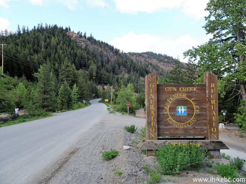
Gun Creek Recreation Site Sign by BC Highway 40
48. The entrance off BC Highway 40 (Carpenter Lake Road).
Entrance to Gun Creek Recreation Site by BC Hydro
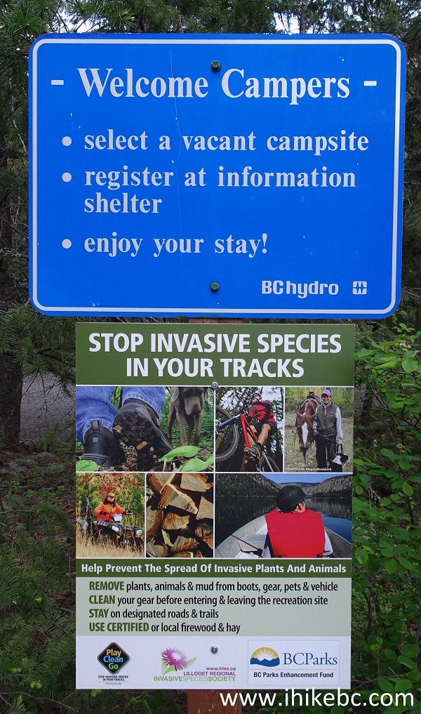
49. The signs say a free registration is required, and will be checked. However, the registration slips were not present, and no one showed up to check them for the two nights we spent at the recreation site.
50. Here is one of the camping spots at Gun Creek Recreation Site. There are 16 sites, 4 pit toilets, garbage bins, and even recycling bins. Kudos to BC Hydro!
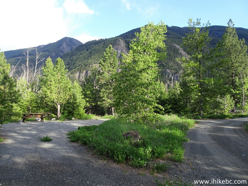
Gun Creek Recreation Site
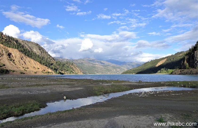
51-52. During the Second World War, many Japanese-Canadians were sent to internment camps away from the coast, and one such camp, called the town of Minto, was right in this area. An info board speaks of that occurrence, and a sign points to the town of Minto, which was flooded by Carpenter Lake when the dam was built, but can apparently be seen when the water level is low.
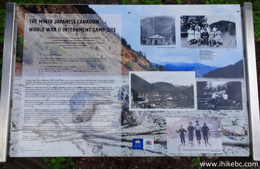
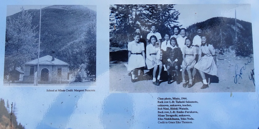
Town of Minto Information Board
53. After entering Gun Creek Recreation Site, turn immediately to the left to get to Old Minto Townsite, as the blue sign says.
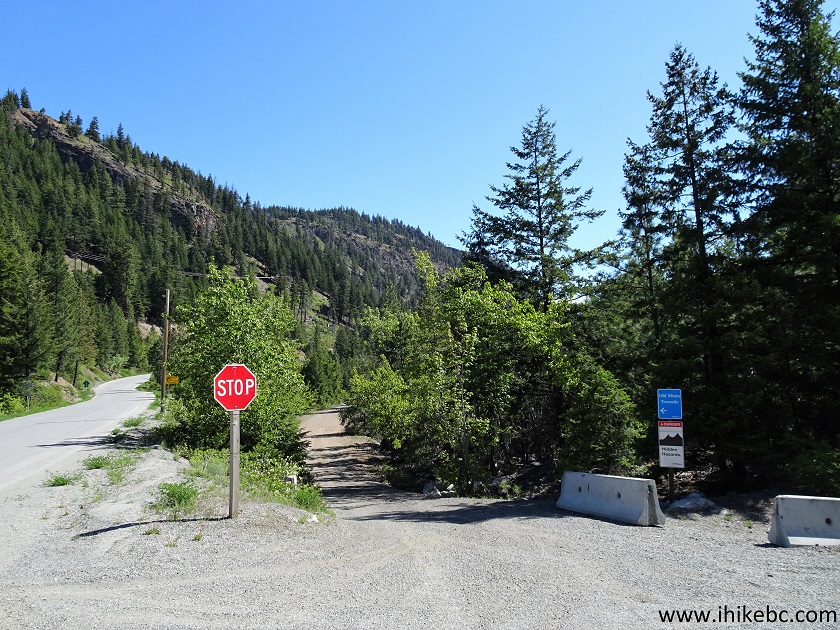
54. So, we drove in that direction.
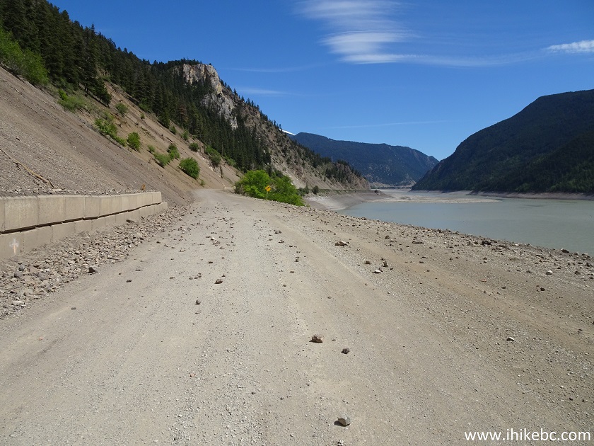
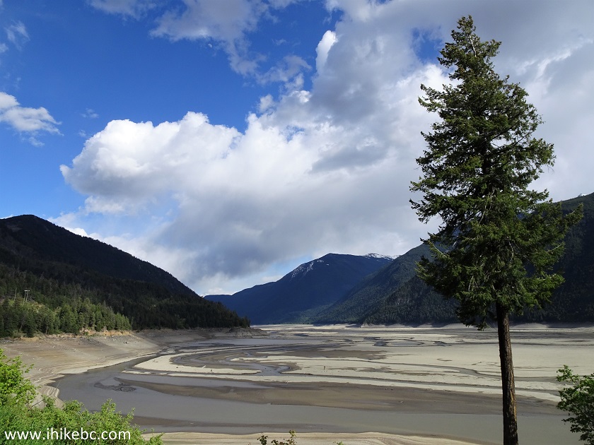
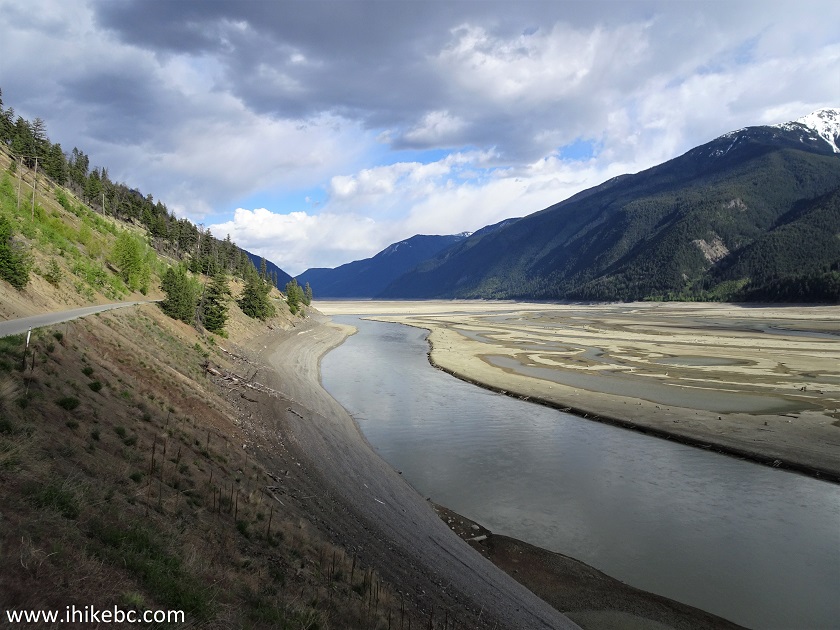
55. Carpenter Lake is a hydroelectric reservoir with many hazards. September of 2024 photo.
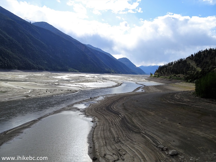
56. It was certainly cool to drive on the bottom of a lake.
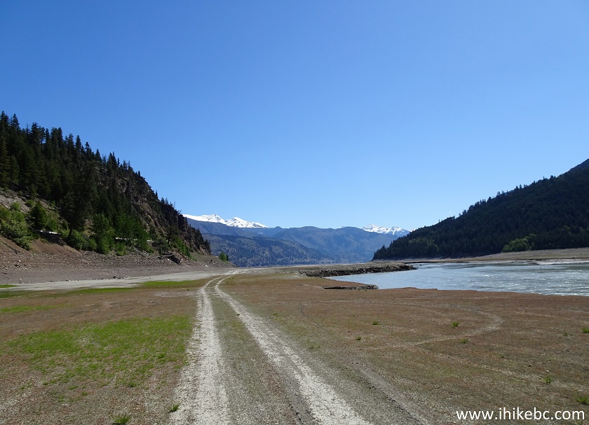
Dry Bottom of Carpenter Lake
57. Nice views, but no Minto! It's either completely gone, or where is it? We drove for 1.6 km and had to stop because of the buckled ground.
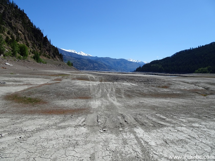
Driving on the Bottom of Carpenter Lake
58. A few hundred meters later, a large drop-off would stop all motorized traffic. So, no Minto here, at least none that we could find.
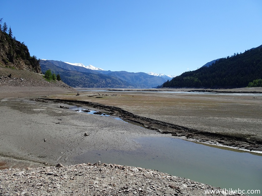
Carpenter Lake Dry Bottom
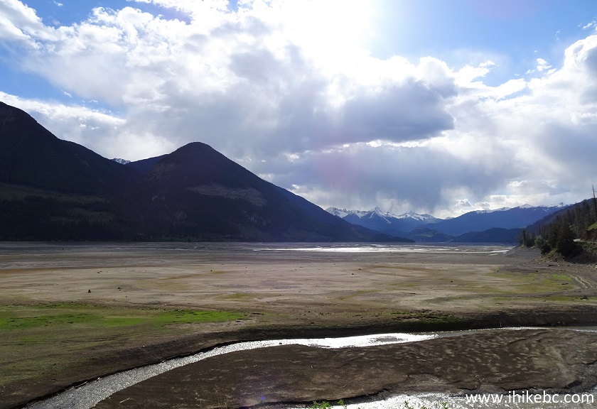
59-60. And a few more photos of Carpenter Lake from this location, made in September of 2024.
BC Highway 40, despite all of its hazards, has numerous very impressive views, and leads to many recreational opportunities. Highly recommended.


|
 |
Other Trips in Lillooet Area:
|
|
|
|
|
McGillivray
Creek Trail |
|
Other Trips:


![]()


![]()
![]()
![]()
ihikebc.com Trip 209 - BC Highway 40 Trip (Lillooet to Gold Bridge) Page 2 of 2