![]()
![]()
![]()

Trip 210 - May 20-21, 2021 (Thursday-Friday), and September of 2024.
Towns of Gold Bridge & Bralorne BC Visit
About 100 km West of Lillooet, British Columbia, via BC Highway 40.
Liked: Gold Bridge school building, Gold Bridge 24/7 free Wi-Fi signal outside of the library (details are posted on the library door), mountains and canyon views from the road connecting Gold Bridge and Bralorne, old buildings in Bralorne.
Of Note: Narrow and winding road with steep unbarricaded drop-offs between Gold Bridge and Bralorne. No cell phone signal. 2024 Update: there is now a non-stop remote industrial hum in Gold Bridge, which resembles a distant jet engine noise.
Vancouver, Coast & Mountains Backroad Mapbook (5th edition) Coordinates: Page 51 (Gold Bridge) B4.
Related Websites: Wiki - Gold Bridge BC, Wiki - Bralorne BC.
Other BC Cities, Towns and Locations We Have Visited: Agassiz, Bella Coola, Bralorne, Chilliwack, Fort Nelson, Gibsons, Gold Bridge, Harrison Hot Springs, Hope, Horseshoe Bay, Merritt, Mission, Nanaimo (Old City Square), Prince George, Prince Rupert, Smithers, Squamish, Telkwa, Tofino, Tumbler Ridge, Vancouver (Seawall), Vancouver (Stanley Park), West Vancouver (Ambleside Park).
Gold Bridge (population: 43) and Bralorne (population: 60) are two historical British Columbia towns connected to the Gold Rush years of the 19th and 20th centuries. We visited these towns at the end of our BC Highway 40 trip. Check out our previous trip report for directions on how to get to Gold Bridge. A smooth paved 11 km-long road (albeit narrow and winding, and with unbarricaded drop-offs) links Gold Bridge and Bralorne. There was a fair bit of traffic on that road, with most of it appearing to be coming from an industrial site(s) located on Kingdom Lakes Forest Service Road, which starts at 6.3 km of the Gold Bridge-Bralorne connector. A very neat pullout at 7.0 km allows for a great panoramic mountain view, and, just a hundred meters further, another viewpoint makes it possible to see a large canyon.
There is a gas station (possibly seasonal, self-serve, credit cards only, no attendant) and an ambulance station in Gold Bridge, and a gas pump and a fire hall in Bralorne, which also has a working pay phone.
We have also visited Gold Bridge in 2024, so some photos are from that visit and are marked as such.
And here is our video of driving the entire Highway 40 from Lillooet to Gold Bridge.
It also shows driving around Gold Bridge, starting at the 02:04:00 mark.
1-2. Here are Google Maps locations of Gold Bridge, BC and Bralorne, BC.
3. We are at the end of BC Highway 40, with a sign indicating that a left turn (across the bridge) would lead to Gold Bridge and Bralorne. Going straight would, eventually, lead to Green Mountain Trail (via Hurley River FSR).

BC Highway 40 End Near Gold Bridge British Columbia Canada
4. The bridge across Hurley River leads to the town of Gold Bridge.

Bridge Across Hurley River Near Gold Bridge BC
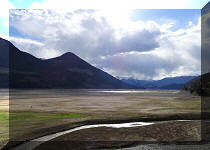
5. The view of Hurley River from the bridge. Hurley River flows into Carpenter Lake.

Hurley River British Columbia Canada
6. Just across the bridge, we are entering the town of Gold Bridge. This is now Bralorne Road.

Entering Gold Bridge Sign
7. Welcome to Gold Bridge. Population: 43.

Welcome to Gold Bridge Sign
8. A few hundred meters later, before the main town buildings, a self-serve Esso gas station is on the left side of Bralorne Road. Credit cards only. No attendant. Might be unavailable in off-season.

Esso Gas Station Gold Bridge BC Canada
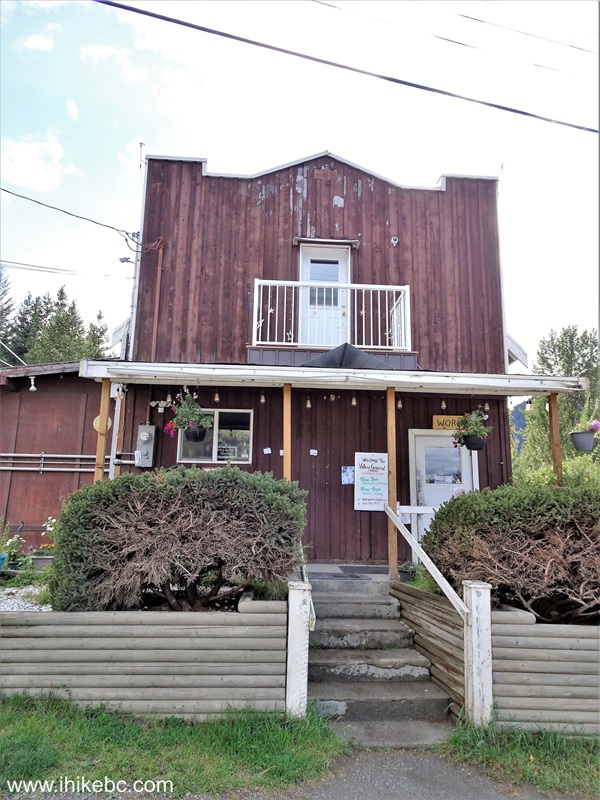
9. And just beyond the gas station there is a corner of Bralorne Road and Fergusson Street. On the left side, where Fergusson Street begins, is Gold Bridge Hotel. To the right is a general store. Just a bit further on Fergusson Street is an Ambulance Station / Library. If you keep going down that way, you would eventually get to the start of Greyrock Forest Service Road along Carpenter Lake (with BC Highway 40 on the other side of the lake).

10-13. We are still at the intersection of Bralorne Road and Fergusson Street, and are looking left down Fergusson Street. Gold Bridge Hotel is in the foreground.

Gold Bridge BC

September of 2024 Photo - the cafe building to the left has been
repainted, two mannequins placed on the rood

Gold Bridge Hotel in 2021 - before two mannequins were placed on the
roof

Gold Bridge Hotel Cafe in May of 2021, before it was repainted some time
before September of 2024
14-17. Here is the general store (September of 2024 photos).


18. Just a bit further down Fergusson Street is this tire shop (September of 2024 photo).

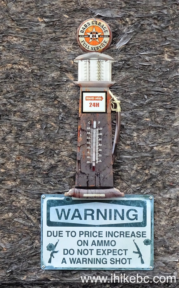
19. And a bit of local humour nearby (September of 2024 photos).
20-21. A very pleasant-looking Gold Bridge community school.


Gold Bridge Community School
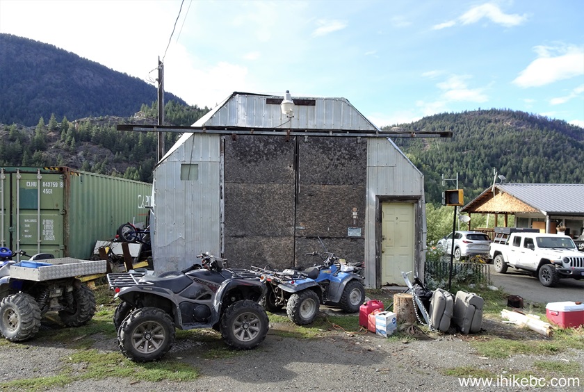
22-23. The fire hall is in Bralorne, and Gold Bridge has several fire shacks, as well as an ambulance station, pictured below.

Gold Bridge Fire Shack and Ambulance Station
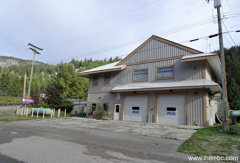
Gold Bridge ambulance station - September of 2024 photo
24. A library with 24/7 Wi-Fi access is on the other side of the ambulance station. Instructions on the front door show how to access Wi-Fi. There is no cellular service in this area.

Library in Gold Bridge, British Columbia - September of 2024 photo
25. The same Bralorne Road you are on when entering Gold Bridge takes you to Bralorne 11 km later.

Pioneer Road Between Gold Bridge and Bralorne BC
26. At 7.0 km from Gold Bridge, a large pullout on the right side has an information sign, as well as a panoramic mountain range view.

Viewpoint Parking Area Between Bralorne and Gold Bridge British Columbia
27. The information sign.

28-29. The mountain on the left side.


30-31. The mountain on the right side.


32. If you walk or drive just a hundred meters further, there is another (unofficial) pullout with a great canyon view.

Pioneer Road between Gold Bridge and Bralorne British Columbia Canada
33. Very nice.

Mountains View from Pioneer Road between Bralorne and Gold Bridge BC
Canada
Here is our video of the views from this spot.
More ihikebc videos are on our YouTube Channel.
34. Getting closer to Bralorne. Quite a smooth road.

Pioneer Road near Bralorne BC Canada
35. And here we are.

Bralorne BC
36. Welcome to Bralorne. Population: 60.

Welcome to Bralorne Sign
37. Just to the left is Bralorne Pub and On The Fly Country Market. A gas pump (operational?) is on the very left.

Bralorne Pub and On The Fly Country Market
38. Bralorne pub sign. Very creative!

Bralorne Pub Sign
39. Bralorne pub information board.

Bralorne Pub Information Board
40. On a building across the street (Bralorne Road) there is a map of Bralorne and the surrounding area.

Bralorne Map
41. Bralorne Road. Bralorne appears to be about three times bigger than Gold Bridge.

Bralorne British Columbia Canada
42. Historical Bralorne Inn on Bralorne Road.

Historical Bralorne Inn
43. Looking left down Dirks Place.

Dirks Place Bralorne BC Canada
44. Historical Bralorne church.

Historical Bralorne Church
45. Bralorne hall.

Bralorne Hall
46. Inside a small shack in the side of Bralorne hall, there is a community message board, as well as a working Telus payphone (appears to accept credit cards only, via an operator). There is no cell phone signal in Gold Bridge or Bralorne.

47. Gold Bridge has an ambulance station, and Bralorne has a fire hall.

Bralorne Fire Hall British Columbia
Gold Bridge and Bralorne are a living BC history, and are very interesting towns to visit. Just be aware of very limited services of any kind in the area.


|
 |
![]()
![]()
![]()
ihikebc.com Trip 210 - Towns of Gold Bridge and Bralorne BC Visit (near Lillooet BC)