
Trip 323 - September 18, 2024 (Wednesday)
Sunshine Mountain Trail Hike
Near Bralorne, BC
Page 4 of 4
Liked: Bralorne Powder Club clubhouse by the trailhead, valley and mountain views, alpine views, shade in the forest, no bugs.
Vancouver, Coast & Mountains Backroad Mapbook (2019 edition) Coordinates : Page 51 (Gold Bridge) B6.
Follow @ihikebc TweetSunshine Mountain Trail is located near Bralorne, BC, which itself can be found 12 km from the end of 103 km-long BC Highway 40, which connects Lillooet with Gold Bridge. This trail has four distinctive parts: an unremarkable hike through a forest, then a neat sub-alpine area, then a dangerous trek across steep and loose-surfaced stretch of the alpine area, followed by a very pleasant nearly flat alpine area close to the peak of Sunshine Mountain.
Unless you are a well-equipped experienced hiker, please limit the hike to the sub-alpine, as the alpine area is a disaster waiting to happen, unless you know what you are doing and have hiking poles and boots. We have all of the above and still managed to fall twice, broke a hiking pole, injured an elbow, and suffered a minor abrasion. The fine views made up for the hurt, but it is a very remote trail, and help will take a long time to arrive should you ever need it.
* All trail distances are based on a GPS odometer and are approximate.
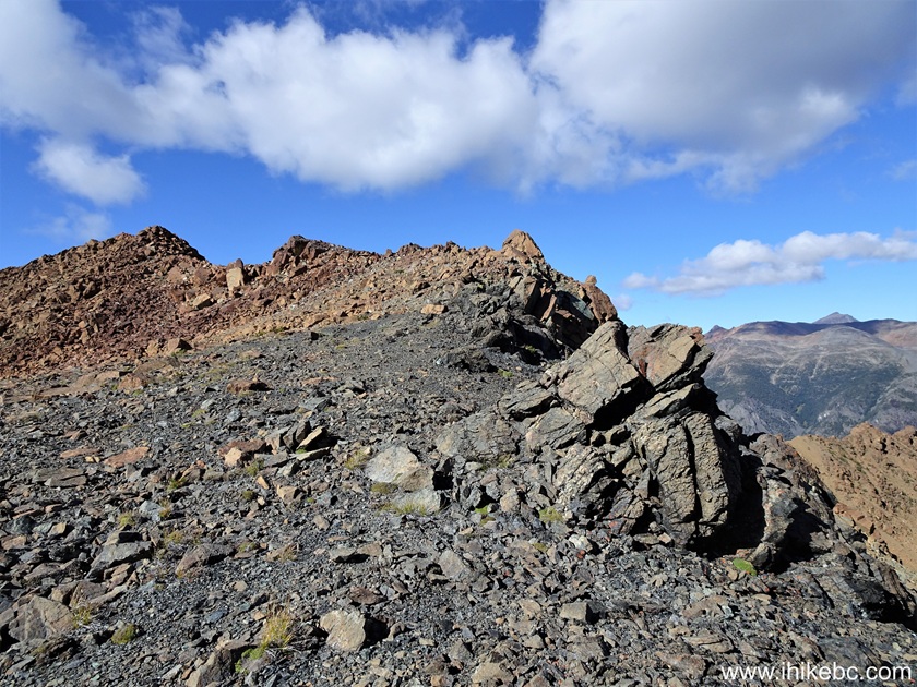
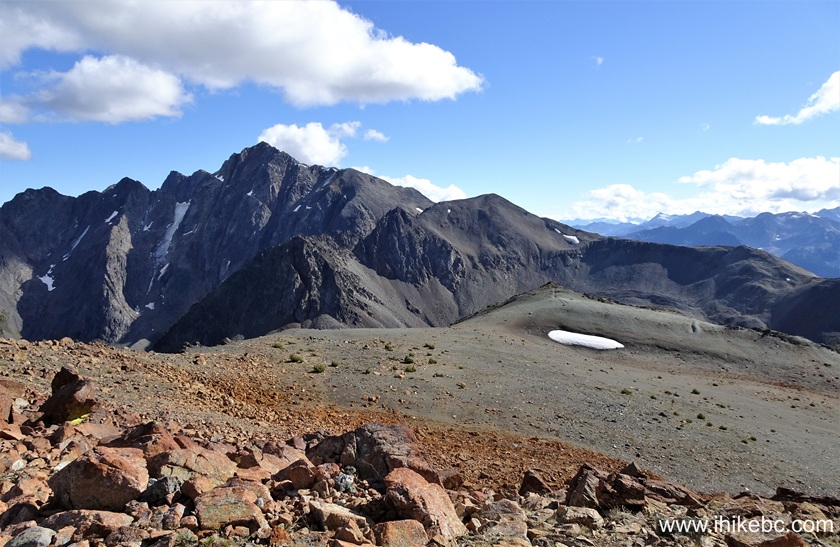
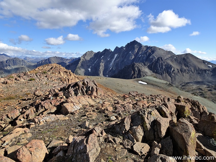
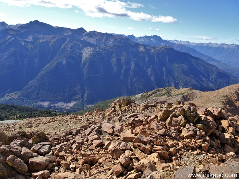
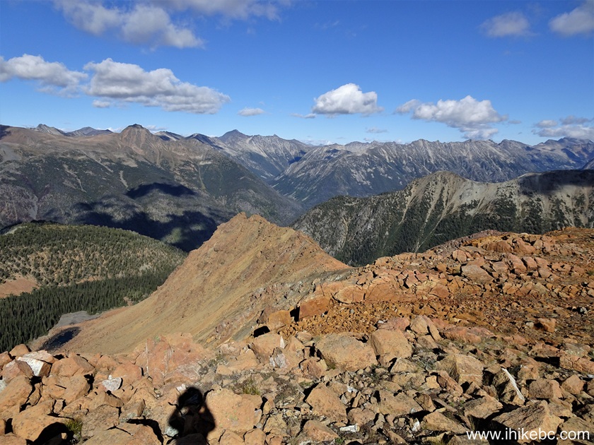
89. We then headed to the peak of Sunshine Mountain, across the alpine from the "bump". At 5.95 km of the hike, with the peak area partially visible on the left side.
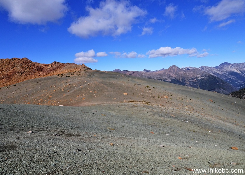
Sunshine Mountain
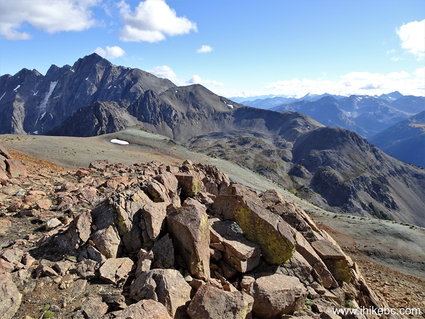
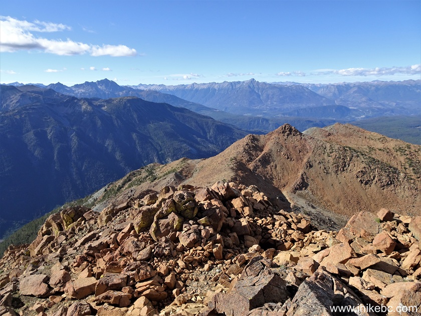
90-92. Now at 6.10 km, we are looking straight ahead, then to the right, then back (towards the bump).
British Columbia Hiking - Sunshine Mountain near Bralorne BC
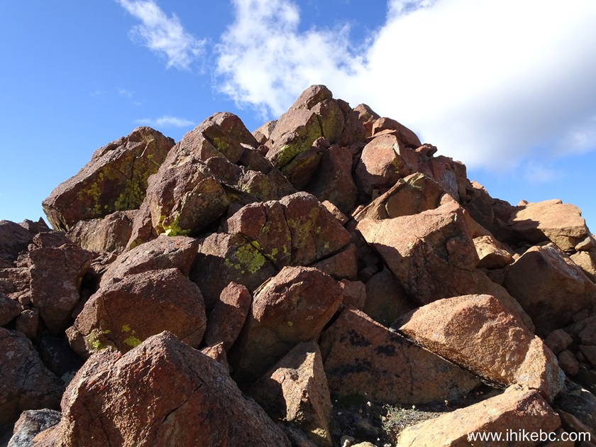
93-94. Found one of a kind (in this area, anyway) stone on the ground nearby. We left it there, so you might find it too!
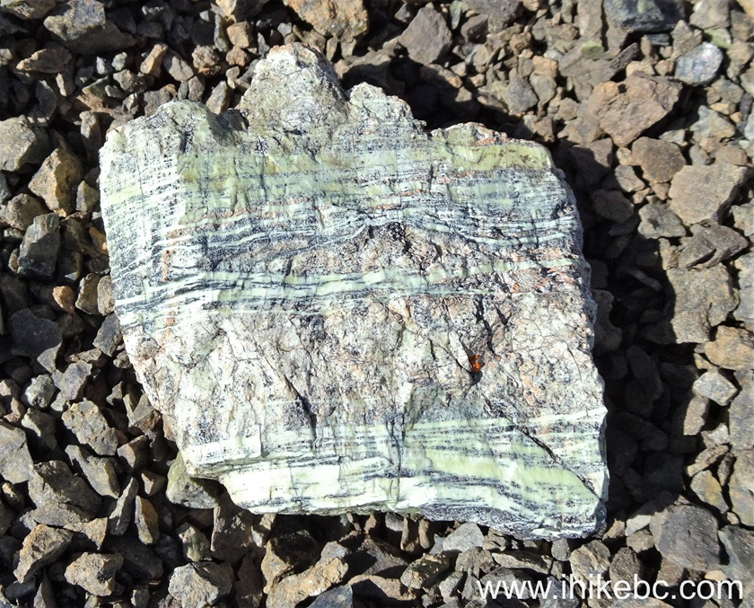
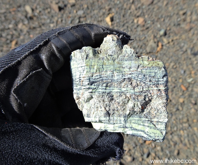
94. At 6.15 km of Sunshine Mountain hike.
Hiking Sunshine Mountain in British Columbia near Bralorne
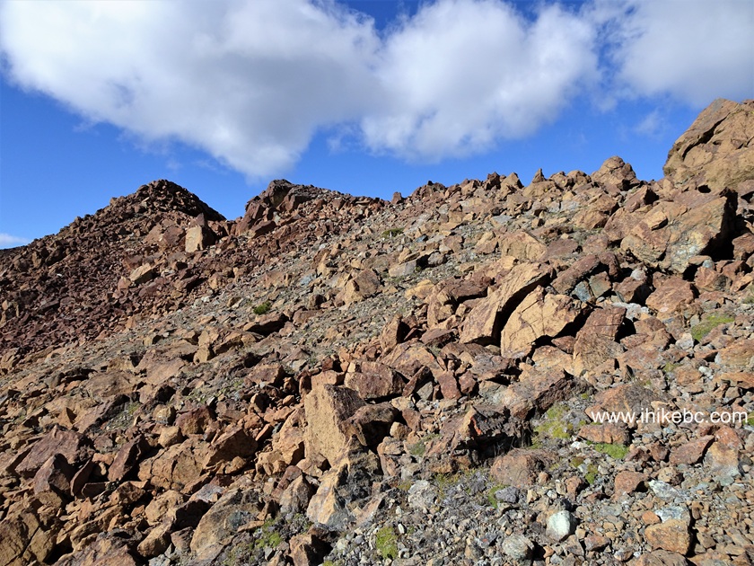
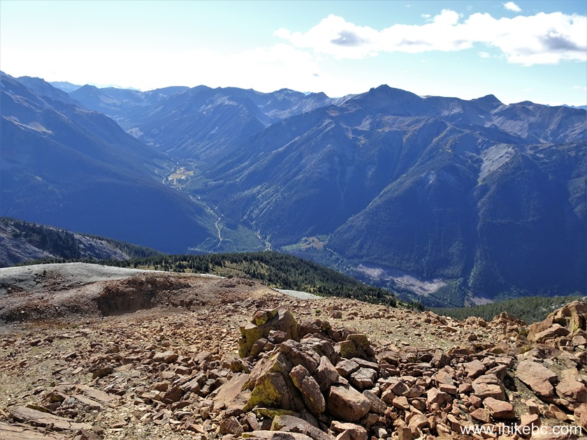
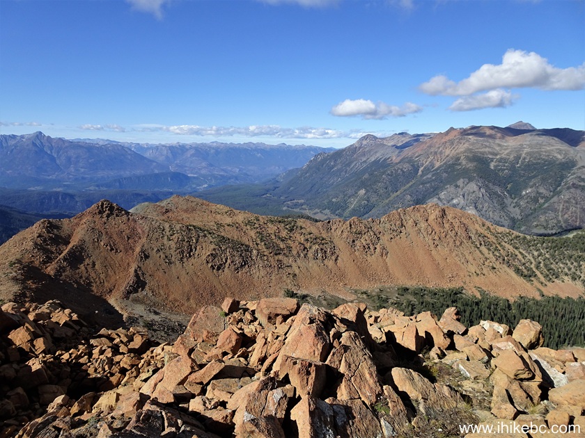
95. Looking right at 6.17 km. Would have been good to hike down there too.

Canadian Hiking - Sunshine Mountain near Bralorne, BC
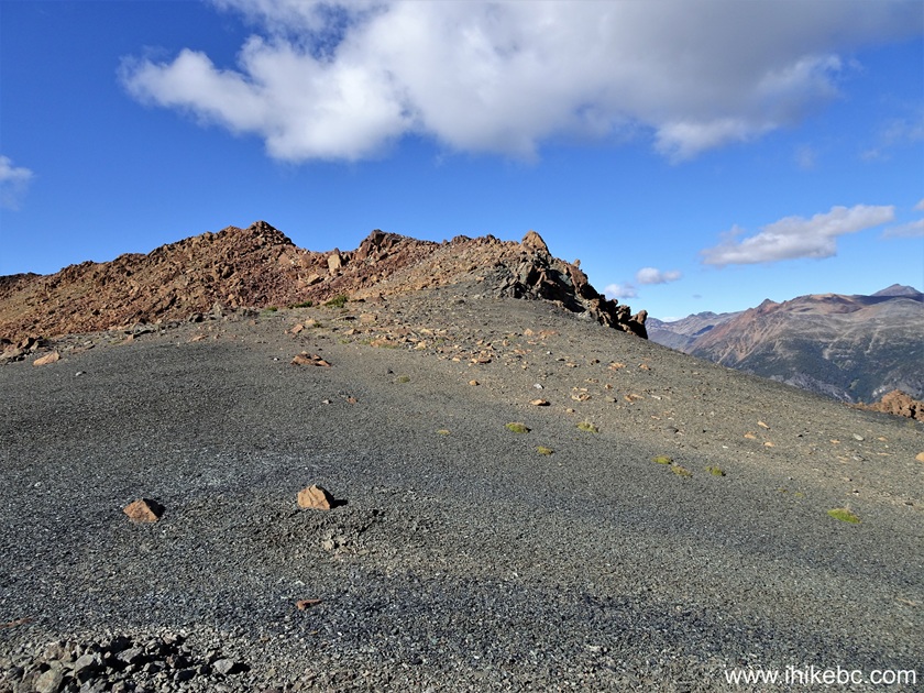
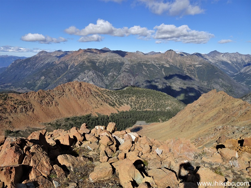
96. Now climbing the peak area at 6.20 km.
Sunshine Mountain British Columbia
97. 90 meters later.
Hiking in Bralorne Area - Sunshine Mountain
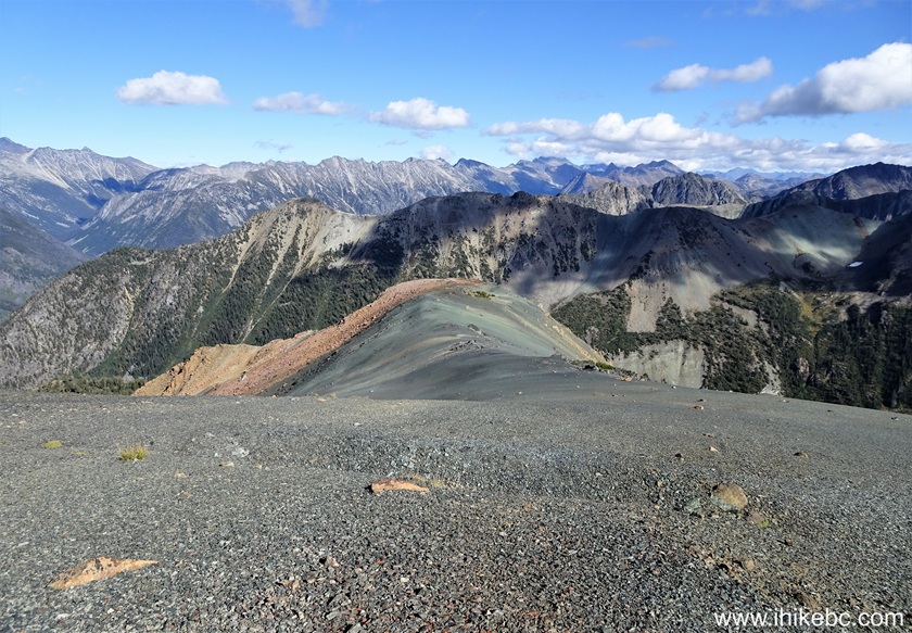
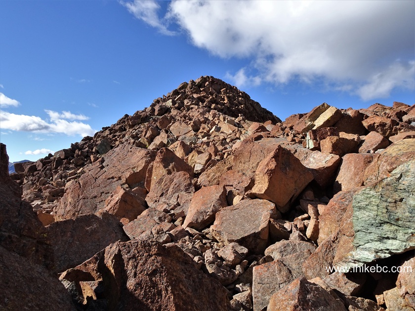
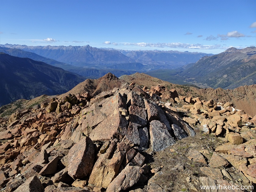
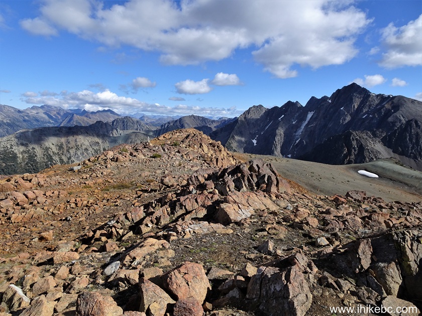
98. A neat stone pile to climb at 6.34 km.
Hike in British Columbia
99. Looking left (towards the bump) from the same spot.
Sunshine Mountain BC
100. At 6.37 km, we are getting close to the peak of Sunshine Mountain near Bralorne, British Columbia, Canada.
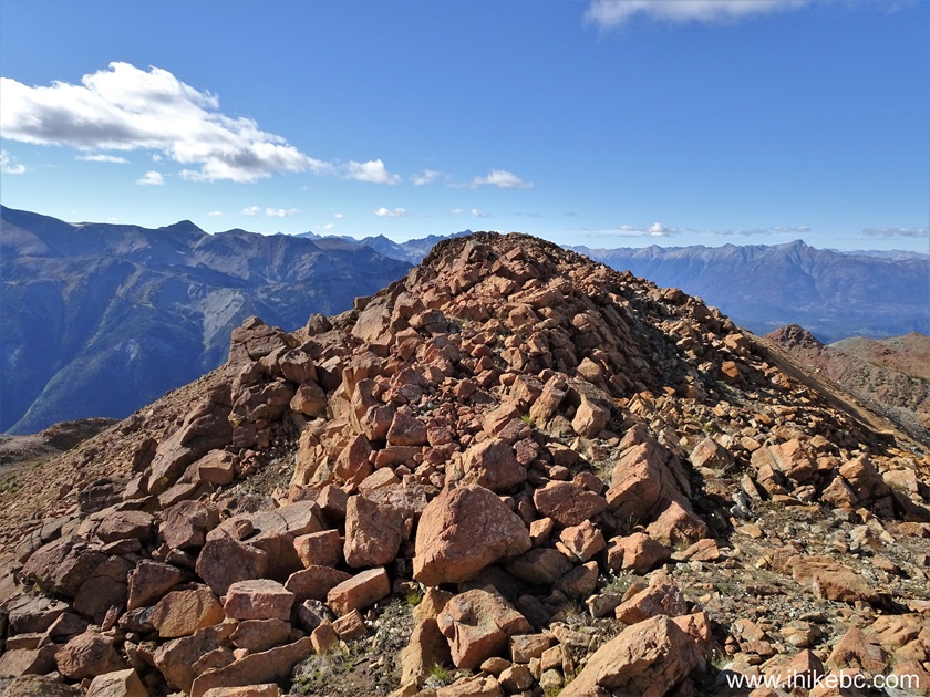
The Peak of Sunshine Mountain near Bralorne BC
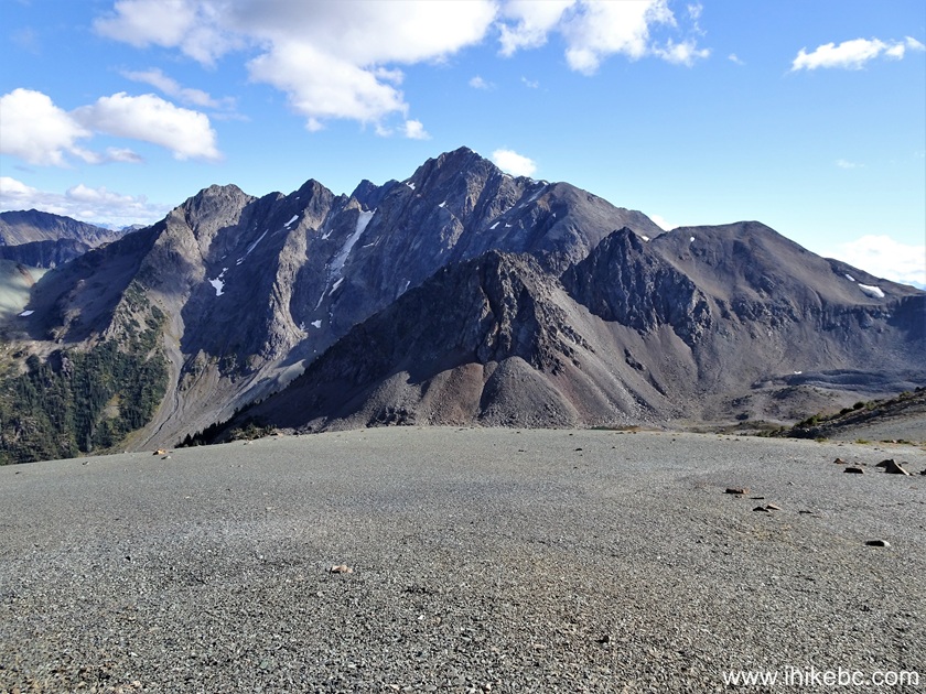
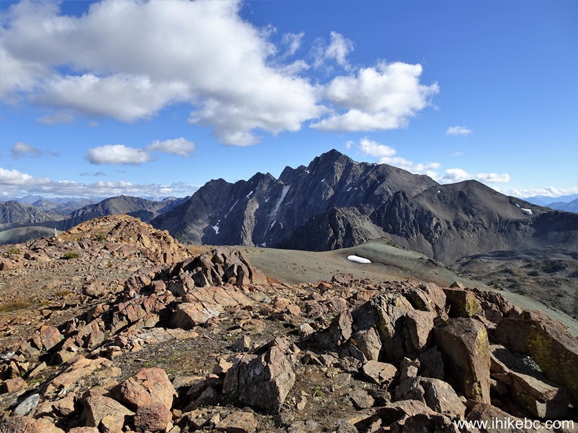
101. And here is Sunshine Mountain peak, at 6.60 km of the hike. Coordinates: N 50⁰43.433' W 122⁰46.347'. Elevation: 2,320 meters. Since we went past the peak to check out "the bump" and then came back, it is possible to save about a kilometer of hiking (each way) by going straight to the peak. But then you would miss some of the best views of the hike which come from the "bump" viewpoint.
Sunshine Mountain Hike British Columbia Canada
102-111. 360 degree views from the peak of Sunshine Mountain. Left to right.
Hiking Sunshine Mountain in British Columbia
Here is our video of the views from this location.
More ihikebc videos are on our YouTube Channel.
Sunshine Mountain Trail is quite challenging in the alpine, but leads to very fine views. Highly recommended.


|
 |
Other Trips:


![]()
![]()
![]()
ihikebc.com Trip 323 - Sunshine Mountain Trail Hike (near Bralorne, BC) Page 4 of 4