
Trip 323 - September 18, 2024 (Wednesday)
Sunshine Mountain Trail Hike
Near Bralorne, BC
Page 3 of 4
Liked: Bralorne Powder Club clubhouse by the trailhead, valley and mountain views, alpine views, shade in the forest, no bugs.
Vancouver, Coast & Mountains Backroad Mapbook (2019 edition) Coordinates : Page 51 (Gold Bridge) B6.
Follow @ihikebc TweetSunshine Mountain Trail is located near Bralorne, BC, which itself can be found 12 km from the end of 103 km-long BC Highway 40, which connects Lillooet with Gold Bridge. This trail has four distinctive parts: an unremarkable hike through a forest, then a neat sub-alpine area, then a dangerous trek across steep and loose-surfaced stretch of the alpine area, followed by a very pleasant nearly flat alpine area close to the peak of Sunshine Mountain.
Unless you are a well-equipped experienced hiker, please limit the hike to the sub-alpine, as the alpine area is a disaster waiting to happen, unless you know what you are doing and have hiking poles and boots. We have all of the above and still managed to fall twice, broke a hiking pole, injured an elbow, and suffered a minor abrasion. The fine views made up for the hurt, but it is a very remote trail, and help will take a long time to arrive should you ever need it.
* All trail distances are based on a GPS odometer and are approximate.
64. Now at the 4.76 km mark of Sunshine Mountain Trail near Bralorne, British Columbia, Canada.
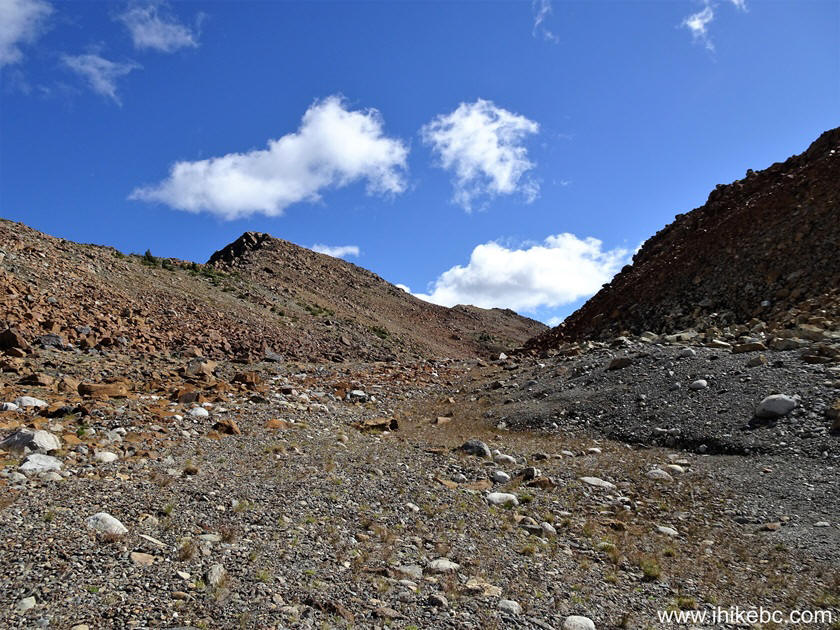
Sunshine Mountain Trail near Bralorne BC Canada
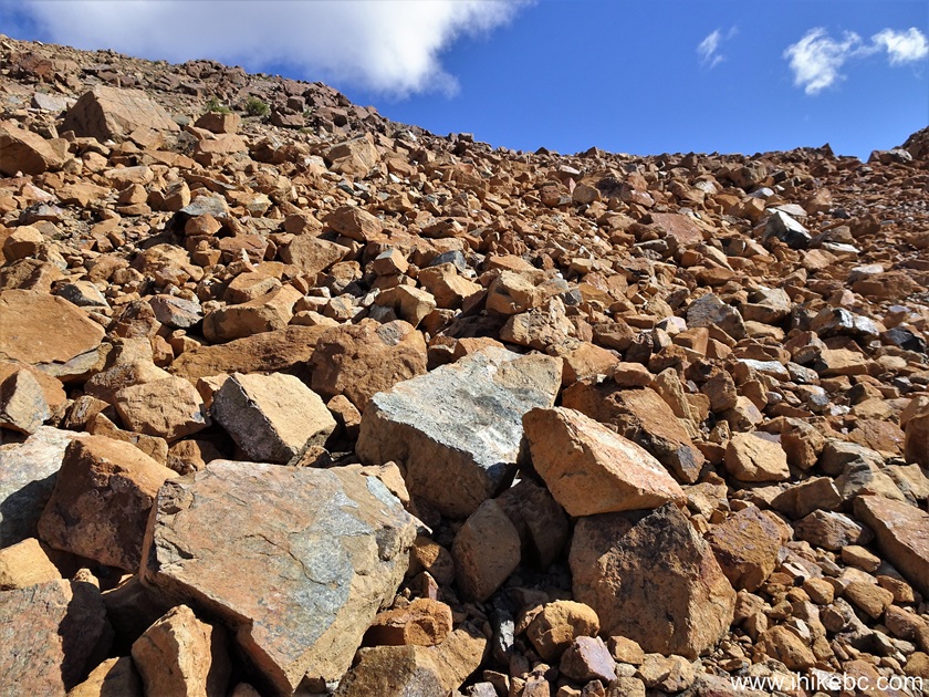
65. Somewhat steep, and still loose stones all around. At 5.06 km.

Sunshine Mountain Hike British Columbia Canada
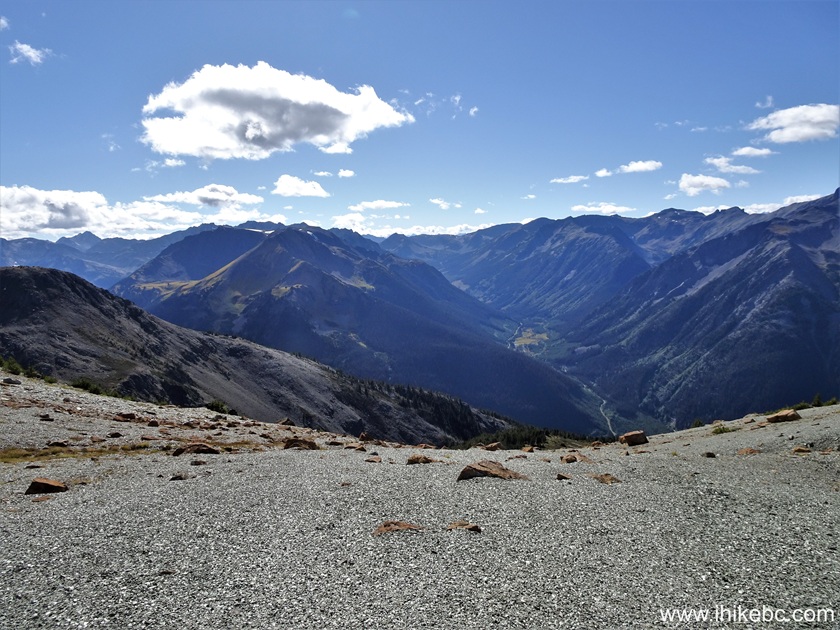
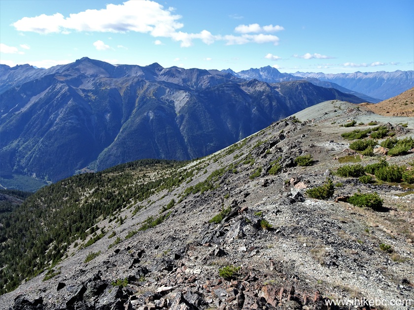
66. Looking back from the same spot.

Hike in British Columbia
67. 70 meters later.
Hike in Canada
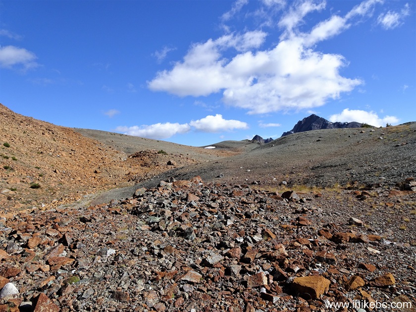
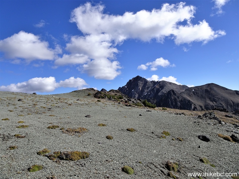
68. At 5.18 km of the trail, we are close to a "saddle", which marks the end of the climbing.

Sunshine Mountain Hiking near Bralorne BC Canada
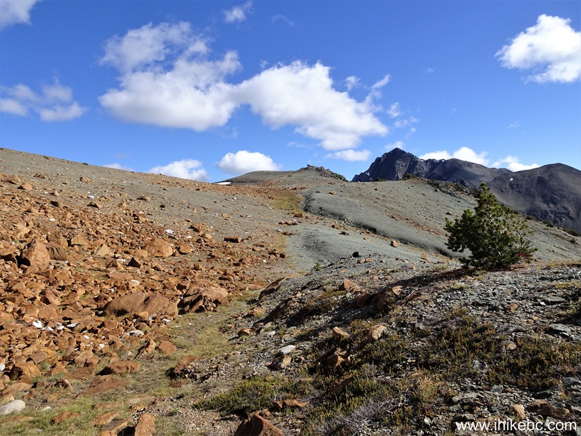
69. At 5.23 km, we have reached the saddle. Coordinates: N 50⁰43.406' W 122⁰46.496'. Elevation: 2,225 meters. The peak is to the left, but there is a fairly large and quite a neat alpine area to be explored straight ahead.

Hiking Sunshine Mountain in British Columbia Canada
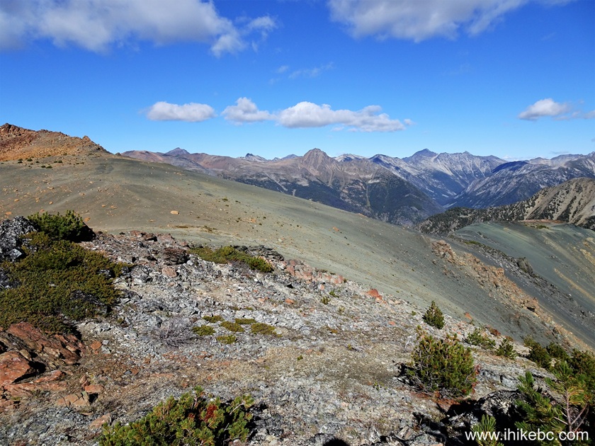
70. At 5.34 km, we are hiking in the (more or less) flat alpine area, with fine views all around.
Hiking in Bralorne BC Area - Sunshine Mountain
71. A neat small tree at the 5.47 km mark of Sunshine Mountain hike.
Sunshine Mountain British Columbia
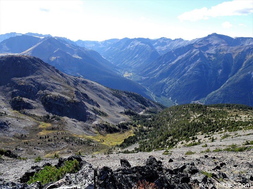
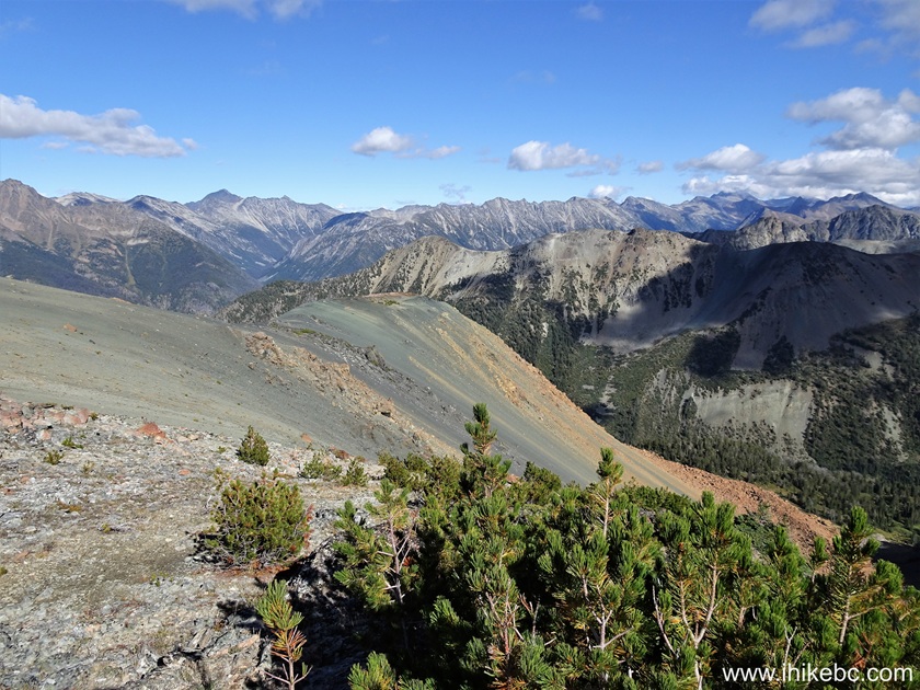
72. The same valley on the right side that we saw earlier in the hike (photo #50). At 5.53 km here.
View from Sunshine Mountain near Bralorne BC Canada
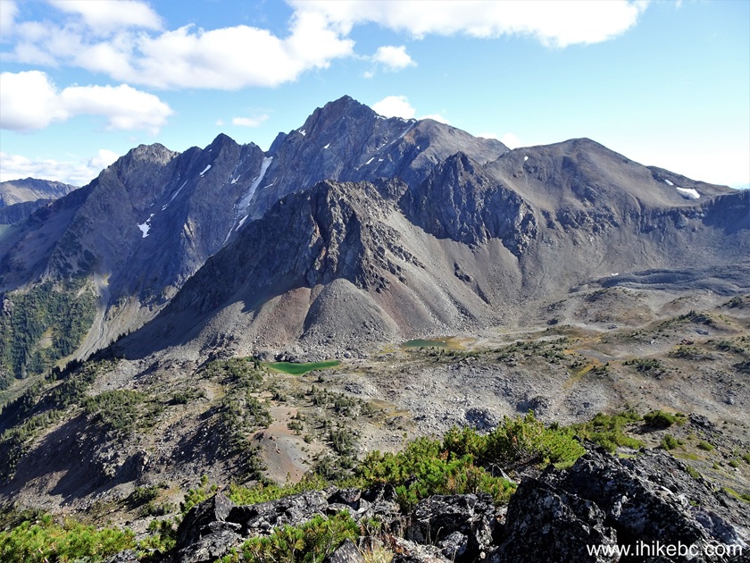
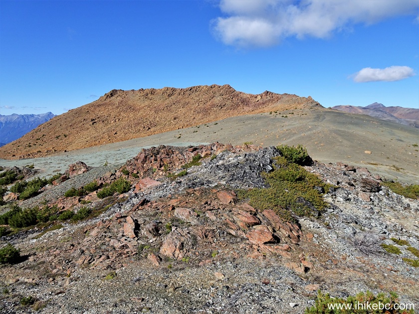
73. Very fine colours at 5.59 km. We are heading towards a prominent bump in the upper middle-right of the photo.

Sunshine Mountain - near Goldbridge - British Columbia
74. At 5.66 km of Sunshine Mountain Trail.

Sunshine Mountain BC
75. At 5.72 km, we are almost at the bump.
Hiking in British Columbia - Sunshine Mountain
76. And here it is, 200 meters later. Coordinates: N 50⁰43.187' W 122⁰46.147'. Elevation: 2,270 meters.

British Columbia Mountains
77-88. Here are 360 degree views from the bump, left to right, followed by three panoramas. Photo #82 shows Sunshine Peak in its entirety.


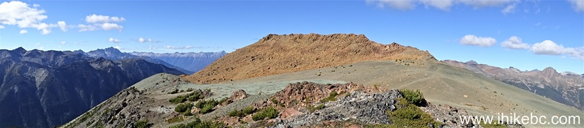


Panoramic view from Sunshine Mountain near Bralorne BC Canada
Here is our video of the views from this location.
More ihikebc videos are on our YouTube Channel.
Our Sunshine Mountain Trail Hike trip report Concludes on Page 4.


|
 |
Other Trips:


![]()
![]()
![]()
ihikebc.com Trip 323 - Sunshine Mountain Trail Hike (near Bralorne, BC) Page 3 of 4